Hill Agroforestry
(Bangladesh)
Anas o mizalya Fal bagan (chakma) ; Mishra Faler Bagan (Bangla)
Description
Mixed fruits gardening on hill slope with forest trees on hill top and bamboo at the lower part of the hill.
On upper part of the slope natural forest tree species were allowed to grow and lower part with bamboo. On the middle part, pineapple was cultivated along the contour as short term cash earning crop and long term fruit trees were planted for long term return within the space (alley) between two rows of pineapple. Generally farmers are acquainted to cultivate pineapple along the slope as cash earning crops and they occasionally incorporate fruit trees in the system. The technology " Hill agroforestry" describe a change in farming system where pineapple and fruit trees are grown along the contour.
Purpose of the Technology: Parmenent farming with short and long-term income generation for better livelihood as well as soil consevation.
Establishment / maintenance activities and inputs: Slash and burn (Jhum) at initial stage followed by pineapple and fruit trees along the contour to establsh a parmenent farming. Three times weedding, accumulaion of weeded material as mulch and using chemical fertilizer (urea, TSP, MP) on Pineapple on rows and individual fruit trees.
Natural / human environment: Steep slope, acidic soil, secondary vegetation, chakma community, poor, subsistance livellihood, adoption of new technology.
Location
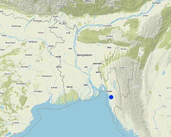
Location: Chittagong Hill Tracts, Bangladesh
No. of Technology sites analysed:
Geo-reference of selected sites
Spread of the Technology: evenly spread over an area (0.4 km²)
In a permanently protected area?:
Date of implementation: less than 10 years ago (recently)
Type of introduction
-
through land users' innovation
-
as part of a traditional system (> 50 years)
-
during experiments/ research
-
through projects/ external interventions
Classification of the Technology
Main purpose
-
improve production
-
reduce, prevent, restore land degradation
-
conserve ecosystem
-
protect a watershed/ downstream areas – in combination with other Technologies
-
preserve/ improve biodiversity
-
reduce risk of disasters
-
adapt to climate change/ extremes and its impacts
-
mitigate climate change and its impacts
-
create beneficial economic impact
-
create beneficial social impact
Land use
Land use mixed within the same land unit: Ja - Agroforestry
-
Cropland
- Perennial (non-woody) cropping: pineapple
- Tree and shrub cropping: fruits, other
Number of growing seasons per year: 3
-
Forest/ woodlands
- Tree plantation, afforestation
Tree types: Bamboo bamboo
Products and services: Timber, Fruits and nuts
-
Waterways, waterbodies, wetlands - Ponds, dams
Main products/ services: Fishes in aquaculture
Water supply
-
rainfed
-
mixed rainfed-irrigated
-
full irrigation
Purpose related to land degradation
-
prevent land degradation
-
reduce land degradation
-
restore/ rehabilitate severely degraded land
-
adapt to land degradation
-
not applicable
Degradation addressed
-
soil erosion by water - Wt: loss of topsoil/ surface erosion
Technical drawing
Technical specifications
Establishment and maintenance: activities, inputs and costs
Calculation of inputs and costs
- Costs are calculated:
- Currency used for cost calculation: Taka
- Exchange rate (to USD): 1 USD = 60.0 Taka
- Average wage cost of hired labour per day: 1.50
Most important factors affecting the costs
n.a.
Establishment activities
-
slash and burn (Timing/ frequency: Jan to Feb)
-
Jhum (Timing/ frequency: May)
-
Fruit trees plantation (Timing/ frequency: May to July)
-
Pine apple Plantation (Timing/ frequency: Aug to Sep)
Maintenance activities
-
Weeding (Timing/ frequency: May /three times)
-
Fertilizer Aplication (Timing/ frequency: May to June /two times)
-
Mulching with weeded material (Timing/ frequency: Feb/March /once in a year)
Natural environment
Average annual rainfall
-
< 250 mm
-
251-500 mm
-
501-750 mm
-
751-1,000 mm
-
1,001-1,500 mm
-
1,501-2,000 mm
-
2,001-3,000 mm
-
3,001-4,000 mm
-
> 4,000 mm
Agro-climatic zone
-
humid
-
sub-humid
-
semi-arid
-
arid
Specifications on climate
n.a.
Slope
-
flat (0-2%)
-
gentle (3-5%)
-
moderate (6-10%)
-
rolling (11-15%)
-
hilly (16-30%)
-
steep (31-60%)
-
very steep (>60%)
Landforms
-
plateau/plains
-
ridges
-
mountain slopes
-
hill slopes
-
footslopes
-
valley floors
Altitude
-
0-100 m a.s.l.
-
101-500 m a.s.l.
-
501-1,000 m a.s.l.
-
1,001-1,500 m a.s.l.
-
1,501-2,000 m a.s.l.
-
2,001-2,500 m a.s.l.
-
2,501-3,000 m a.s.l.
-
3,001-4,000 m a.s.l.
-
> 4,000 m a.s.l.
Technology is applied in
-
convex situations
-
concave situations
-
not relevant
Soil depth
-
very shallow (0-20 cm)
-
shallow (21-50 cm)
-
moderately deep (51-80 cm)
-
deep (81-120 cm)
-
very deep (> 120 cm)
Soil texture (topsoil)
-
coarse/ light (sandy)
-
medium (loamy, silty)
-
fine/ heavy (clay)
Soil texture (> 20 cm below surface)
-
coarse/ light (sandy)
-
medium (loamy, silty)
-
fine/ heavy (clay)
Topsoil organic matter content
-
high (>3%)
-
medium (1-3%)
-
low (<1%)
Groundwater table
-
on surface
-
< 5 m
-
5-50 m
-
> 50 m
Availability of surface water
-
excess
-
good
-
medium
-
poor/ none
Water quality (untreated)
-
good drinking water
-
poor drinking water (treatment required)
-
for agricultural use only (irrigation)
-
unusable
Is salinity a problem?
Occurrence of flooding
Characteristics of land users applying the Technology
Market orientation
-
subsistence (self-supply)
-
mixed (subsistence/ commercial)
-
commercial/ market
Off-farm income
-
less than 10% of all income
-
10-50% of all income
-
> 50% of all income
Relative level of wealth
-
very poor
-
poor
-
average
-
rich
-
very rich
Level of mechanization
-
manual work
-
animal traction
-
mechanized/ motorized
Sedentary or nomadic
-
Sedentary
-
Semi-nomadic
-
Nomadic
Individuals or groups
-
individual/ household
-
groups/ community
-
cooperative
-
employee (company, government)
Age
-
children
-
youth
-
middle-aged
-
elderly
Area used per household
-
< 0.5 ha
-
0.5-1 ha
-
1-2 ha
-
2-5 ha
-
5-15 ha
-
15-50 ha
-
50-100 ha
-
100-500 ha
-
500-1,000 ha
-
1,000-10,000 ha
-
> 10,000 ha
Scale
-
small-scale
-
medium-scale
-
large-scale
Land ownership
-
state
-
company
-
communal/ village
-
group
-
individual, not titled
-
individual, titled
Land use rights
-
open access (unorganized)
-
communal (organized)
-
leased
-
individual
Water use rights
-
open access (unorganized)
-
communal (organized)
-
leased
-
individual
Access to services and infrastructure
Cost-benefit analysis
Benefits compared with establishment costs
Long-term returns
very negative
very positive
Benefits compared with maintenance costs
Long-term returns
very negative
very positive
Adoption and adaptation
Percentage of land users in the area who have adopted the Technology
-
single cases/ experimental
-
1-10%
-
11-50%
-
> 50%
Of all those who have adopted the Technology, how many have done so without receiving material incentives?
-
0-10%
-
11-50%
-
51-90%
-
91-100%
Number of households and/ or area covered
13 households covering 35 percent of stated area.
Has the Technology been modified recently to adapt to changing conditions?
To which changing conditions?
-
climatic change/ extremes
-
changing markets
-
labour availability (e.g. due to migration)
Conclusions and lessons learnt
Strengths: land user's view
Strengths: compiler’s or other key resource person’s view
Weaknesses/ disadvantages/ risks: land user's viewhow to overcome
Weaknesses/ disadvantages/ risks: compiler’s or other key resource person’s viewhow to overcome
References
Reviewer
-
David Streiff
-
Alexandra Gavilano
Date of documentation: Nov. 3, 2010
Last update: Maart 6, 2019
Resource persons
-
Jalal Uddin Md. Shoaib - SLM specialist
Full description in the WOCAT database
Documentation was faciliated by
Institution
- Soil Resource Development Institute (SRDI) (Soil Resource Development Institute (SRDI)) - Bangladesh
Project


