Parkland Agroforestry System
(Burkina Faso)
Description
Parklands are the traditional agroforestry systems of semi-arid West Africa or Sahel where naturally growing, valuable trees are protected and nurtured on cropping and grazing lands
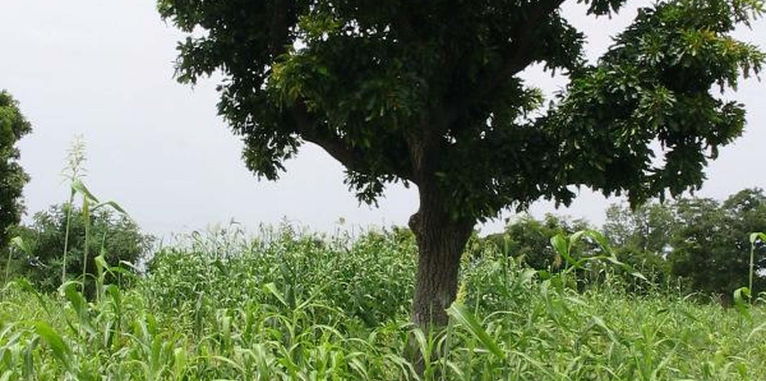
For the rural people in the Sahel, parkland trees are multipurpose: they are a grocery shop, a pharmacy and a silo at the same time. People rely on many locally cherished species to provide food and nutritional security for both human and livestock populations and to protect and enrich soils. Important tree species are baobab (Adansonia digitata), tamarind (Tamarindus indica), Faidherbia albida, shea nut or karité (Vitellaria paradoxa, see photo 1 below) and néré (Parkia biglobosa). Crop production can be increased below and around the trees (especially under Faidherbida albida) due to the favourable micro-climate, accumulation of soil organic matter through litter fall, prunings and root decay in the predominantly sandy and poor soils.
Parkland management practices include: assisted tree regeneration (see Assisted Natural Regeneration, Burkina Faso; and FMNR, Niger); Tree planting (mostly in vicinity of family compounds); Improved fallows (under which economically useful and fertility-improving trees are planted before cropping is discontinued) and fire protection. Farmers commonly apply silvicultural techniques to increase production of parkland trees. These include seedling protection and fencing, watering, and the selection of vigorous shoots. Pruning is done to improve productivity of trees, reduce shade and enhance understorey crop performance and to produce fuelwood and fodder. It stimulates leaf regrowth, causes an additional foliation peak during the rainy season and depresses pod production. Coppicing and pollarding represent a way of limiting competition with intercrops and providing wood and other tree products in species with good vegetative growth.
Location
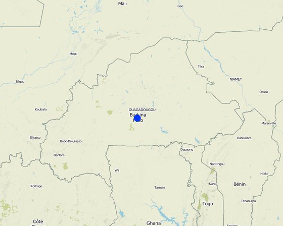
Location: Saponé, Burkina Faso
No. of Technology sites analysed:
Geo-reference of selected sites
Spread of the Technology:
In a permanently protected area?:
Date of implementation: more than 50 years ago (traditional)
Type of introduction
-
through land users' innovation
-
as part of a traditional system (> 50 years)
-
during experiments/ research
-
through projects/ external interventions
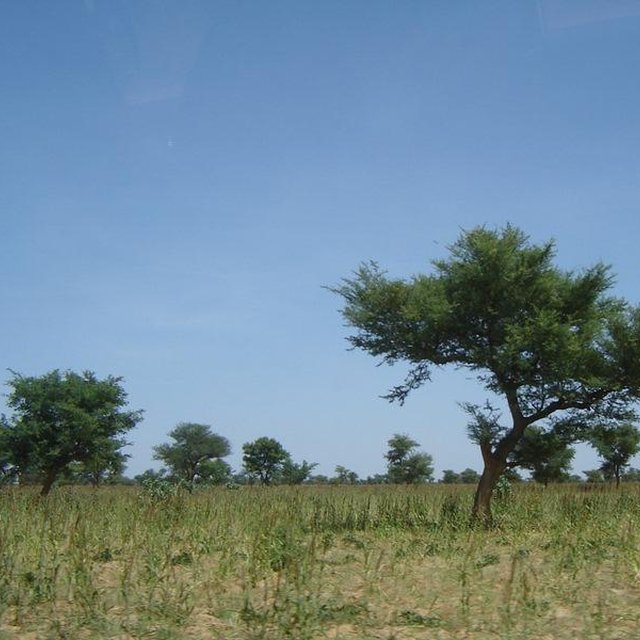
Faidherbia albida dominating a parkland system with pearl millet in Burkina Faso (William Critchley)
Classification of the Technology
Main purpose
-
improve production
-
reduce, prevent, restore land degradation
-
conserve ecosystem
-
protect a watershed/ downstream areas – in combination with other Technologies
-
preserve/ improve biodiversity
-
reduce risk of disasters
-
adapt to climate change/ extremes and its impacts
-
mitigate climate change and its impacts
-
create beneficial economic impact
-
create beneficial social impact
Land use
Land use mixed within the same land unit: Ja - Agroforestry
-
Cropland
- Annual cropping: cereals - millet
- Tree and shrub cropping
Number of growing seasons per year: 1
-
Forest/ woodlands
- Tree plantation, afforestation. Varieties: Mixed varieties
Products and services: Fuelwood, Fruits and nuts, Nature conservation/ protection, Protection against natural hazards, crop production below trees (microclimate)
Water supply
-
rainfed
-
mixed rainfed-irrigated
-
full irrigation
Purpose related to land degradation
-
prevent land degradation
-
reduce land degradation
-
restore/ rehabilitate severely degraded land
-
adapt to land degradation
-
not applicable
Degradation addressed
-
soil erosion by water - Wt: loss of topsoil/ surface erosion
-
soil erosion by wind - Et: loss of topsoil
-
chemical soil deterioration - Cn: fertility decline and reduced organic matter content (not caused by erosion)
-
biological degradation - Bc: reduction of vegetation cover, Bq: quantity/ biomass decline, Bs: quality and species composition/ diversity decline
-
water degradation - Ha: aridification
SLM group
-
agroforestry
-
rotational systems (crop rotation, fallows, shifting cultivation)
-
integrated soil fertility management
SLM measures
-
vegetative measures - V1: Tree and shrub cover
Technical drawing
Technical specifications
Establishment and maintenance: activities, inputs and costs
Calculation of inputs and costs
- Costs are calculated:
- Currency used for cost calculation: n.a.
- Exchange rate (to USD): 1 USD = n.a
- Average wage cost of hired labour per day: n.a
Most important factors affecting the costs
Data on costs is not available. However, costs for management of the land use system are low; only some pruning and trimming of trees is needed which is effectively ‘harvesting’ of fodder and wood.
Establishment activities
-
Retaining saplings from natural regeneration or wildings (Timing/ frequency: before rainy seasons)
-
Planting improved material (early stage) (Timing/ frequency: None)
-
Grafting for shortening juvenile phase and improving fruit quality (initiation stage) (Timing/ frequency: None)
-
Pruning to form erect canopy (Timing/ frequency: None)
-
Protection from animals by dead or live fences (Timing/ frequency: None)
Maintenance activities
-
Weeding around seedlings when necessary (Timing/ frequency: rainy season)
-
Pruning as necessary (pruned branches are dried and used for fuelwood): annually (Timing/ frequency: None)
-
Pollarding (pruning of side branches to improve light for understorey crops (Timing/ frequency: None)
-
Felling some trees to reduce density as they grow bigger (during dry season) (Timing/ frequency: None)
Natural environment
Average annual rainfall
-
< 250 mm
-
251-500 mm
-
501-750 mm
-
751-1,000 mm
-
1,001-1,500 mm
-
1,501-2,000 mm
-
2,001-3,000 mm
-
3,001-4,000 mm
-
> 4,000 mm
Agro-climatic zone
-
humid
-
sub-humid
-
semi-arid
-
arid
Specifications on climate
Unimodal
Thermal climate class: tropics
Slope
-
flat (0-2%)
-
gentle (3-5%)
-
moderate (6-10%)
-
rolling (11-15%)
-
hilly (16-30%)
-
steep (31-60%)
-
very steep (>60%)
Landforms
-
plateau/plains
-
ridges
-
mountain slopes
-
hill slopes
-
footslopes
-
valley floors
Altitude
-
0-100 m a.s.l.
-
101-500 m a.s.l.
-
501-1,000 m a.s.l.
-
1,001-1,500 m a.s.l.
-
1,501-2,000 m a.s.l.
-
2,001-2,500 m a.s.l.
-
2,501-3,000 m a.s.l.
-
3,001-4,000 m a.s.l.
-
> 4,000 m a.s.l.
Technology is applied in
-
convex situations
-
concave situations
-
not relevant
Soil depth
-
very shallow (0-20 cm)
-
shallow (21-50 cm)
-
moderately deep (51-80 cm)
-
deep (81-120 cm)
-
very deep (> 120 cm)
Soil texture (topsoil)
-
coarse/ light (sandy)
-
medium (loamy, silty)
-
fine/ heavy (clay)
Soil texture (> 20 cm below surface)
-
coarse/ light (sandy)
-
medium (loamy, silty)
-
fine/ heavy (clay)
Topsoil organic matter content
-
high (>3%)
-
medium (1-3%)
-
low (<1%)
Groundwater table
-
on surface
-
< 5 m
-
5-50 m
-
> 50 m
Availability of surface water
-
excess
-
good
-
medium
-
poor/ none
Water quality (untreated)
-
good drinking water
-
poor drinking water (treatment required)
-
for agricultural use only (irrigation)
-
unusable
Is salinity a problem?
Occurrence of flooding
Characteristics of land users applying the Technology
Market orientation
-
subsistence (self-supply)
-
mixed (subsistence/ commercial)
-
commercial/ market
Off-farm income
-
less than 10% of all income
-
10-50% of all income
-
> 50% of all income
Relative level of wealth
-
very poor
-
poor
-
average
-
rich
-
very rich
Level of mechanization
-
manual work
-
animal traction
-
mechanized/ motorized
Sedentary or nomadic
-
Sedentary
-
Semi-nomadic
-
Nomadic
Individuals or groups
-
individual/ household
-
groups/ community
-
cooperative
-
employee (company, government)
Age
-
children
-
youth
-
middle-aged
-
elderly
Area used per household
-
< 0.5 ha
-
0.5-1 ha
-
1-2 ha
-
2-5 ha
-
5-15 ha
-
15-50 ha
-
50-100 ha
-
100-500 ha
-
500-1,000 ha
-
1,000-10,000 ha
-
> 10,000 ha
Scale
-
small-scale
-
medium-scale
-
large-scale
Land ownership
-
state
-
company
-
communal/ village
-
group
-
individual, not titled
-
individual, titled
Land use rights
-
open access (unorganized)
-
communal (organized)
-
leased
-
individual
Water use rights
-
open access (unorganized)
-
communal (organized)
-
leased
-
individual
Access to services and infrastructure
Impacts
Socio-economic impacts
Crop production
through mulching and nutrient pumping
fodder production
leaves used as fodder during dry season
Ecological impacts
soil moisture
mulching improves infiltration
nutrient cycling/ recharge
leaf litter and nutrient recycling
wind velocity
affecting crops / homesteads
Off-site impacts
reliable and stable stream flows in dry season (incl. low flows)
downstream flooding (undesired)
Deforestation
Alternative source of fuel and timber
Employment
Tree management and harvesting
Cost-benefit analysis
Benefits compared with establishment costs
Short-term returns
very negative
very positive
Long-term returns
very negative
very positive
Benefits compared with maintenance costs
Short-term returns
very negative
very positive
Long-term returns
very negative
very positive
Adoption and adaptation
Percentage of land users in the area who have adopted the Technology
-
single cases/ experimental
-
1-10%
-
11-50%
-
> 50%
Of all those who have adopted the Technology, how many have done so without receiving material incentives?
-
0-10%
-
11-50%
-
51-90%
-
91-100%
Number of households and/ or area covered
100% of the area covered
Has the Technology been modified recently to adapt to changing conditions?
To which changing conditions?
-
climatic change/ extremes
-
changing markets
-
labour availability (e.g. due to migration)
Conclusions and lessons learnt
Strengths: land user's view
Strengths: compiler’s or other key resource person’s view
-
Generation of several ecological benefits
-
Wood provision for rural as well as urban population
-
Increased food security thanks to fruit production
Weaknesses/ disadvantages/ risks: land user's viewhow to overcome
-
Seedlings and wildings not always readily available
encourage local seed collection and setting up of group tree nurseries
-
Livestock sometimes damage the young seedlings
protection by fencing
-
Dry periods result in low seedling survival rates: planting not possible in dry areas
combine technology with fencing
-
Competition with crops
regular pruning of side branches
-
Long period to fruiting
use vegetative propagation of superior trees
Weaknesses/ disadvantages/ risks: compiler’s or other key resource person’s viewhow to overcome
References
Reviewer
-
Fabian Ottiger
-
Alexandra Gavilano
Date of documentation: Nov. 5, 2010
Last update: Maart 5, 2019
Resource persons
-
Jules Bayala - SLM specialist
Full description in the WOCAT database
Documentation was faciliated by
Institution
- West and Central African Council for Agricultural Research and Development (WECARD/CORAF) - Senegal
Project
- Book project: SLM in Practice - Guidelines and Best Practices for Sub-Saharan Africa (SLM in Practice)
Key references
-
Jonsson K, CK. Ong and JCW. Odongo. 1999. Influence of scattered nere and karite trees on microclimate, soil fertility and millet yield.: Experimental Agriculture 35:39-53.
-
Bayala J., J. Balesdent, C. Marol, F. Zapata, Z. Teklehaimanot, SJ. Quedrago. 2006. Relative contribution of trees and crops to soil carbon content in a parkland system in Burkina Faso using natural 13C abundance.: Nutrient Cycling in Agroecosystems 76:193-201.
Links to relevant information which is available online