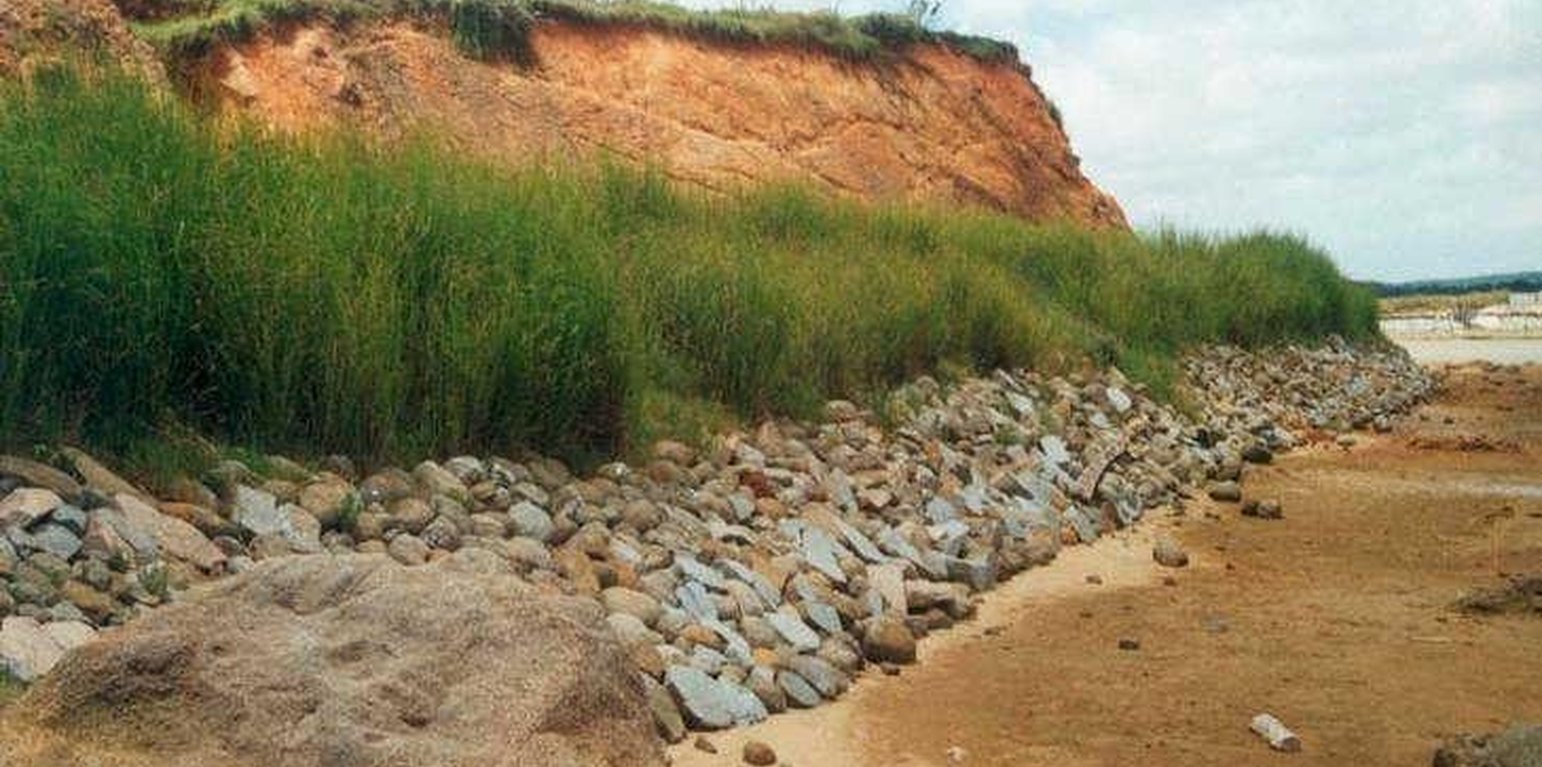
Vetiver Hedge Barrier along Seashore and River bank
(China)
vetiver hedge barrier in huo garden
Description
Uprightness to the main windward, planting Vetiver hedge as barriers to prevent wind erosion.
This technology is to use a good SWC vegetable --- Vetiver to form permanent hedge barrier. The barrier is upright to the main windward or along the river & dike bank. It is pruned 1-2 times after 2 months of planting. It can grow at about 1.5 m high within one year. Vetiver is a perennial plant, and has a strong fibrous roots, which can stretch 3 m beneath soils. It breeds by root & cane, and has strong adaptability. Vetiver is hygrophobe and can endure poor and saline-alkali soil. It is regarded as a saved money & low in labor input but with good benefits. This SWC technology is worth to be applied extensively.
Location
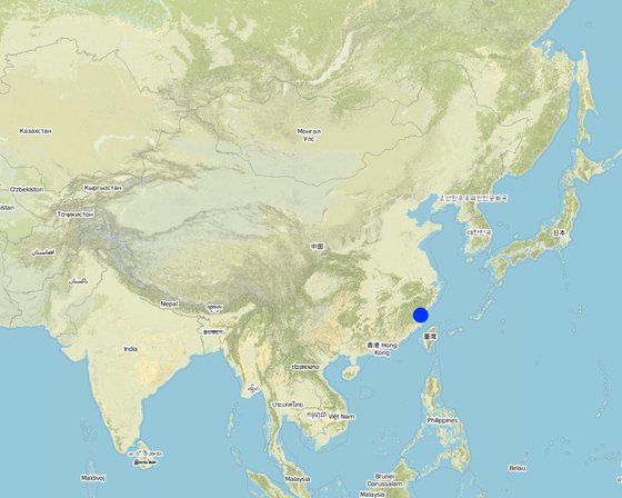
Location: Fujian, China
No. of Technology sites analysed:
Geo-reference of selected sites
Spread of the Technology: evenly spread over an area (0.5 km²)
In a permanently protected area?:
Date of implementation: less than 10 years ago (recently)
Type of introduction
-
through land users' innovation
-
as part of a traditional system (> 50 years)
-
during experiments/ research
-
through projects/ external interventions
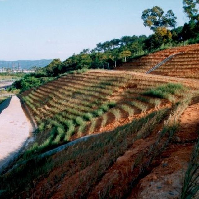
Vetiver hedge barrier on slope of the highway. (Yang Xuezhen (Fuzhou, China))
Classification of the Technology
Main purpose
-
improve production
-
reduce, prevent, restore land degradation
-
conserve ecosystem
-
protect a watershed/ downstream areas – in combination with other Technologies
-
preserve/ improve biodiversity
-
reduce risk of disasters
-
adapt to climate change/ extremes and its impacts
-
mitigate climate change and its impacts
-
create beneficial economic impact
-
create beneficial social impact
Land use
-
Cropland
- Annual cropping: fodder crops - grasses, oilseed crops - groundnuts, root/tuber crops - sweet potatoes, yams, taro/cocoyam, other, rice, vetiver (fodder crop)
Number of growing seasons per year: 1
Water supply
-
rainfed
-
mixed rainfed-irrigated
-
full irrigation
Purpose related to land degradation
-
prevent land degradation
-
reduce land degradation
-
restore/ rehabilitate severely degraded land
-
adapt to land degradation
-
not applicable
Degradation addressed
-
soil erosion by wind - Et: loss of topsoil
-
chemical soil deterioration - Cn: fertility decline and reduced organic matter content (not caused by erosion)
-
water degradation - Ha: aridification
SLM group
-
surface water management (spring, river, lakes, sea)
SLM measures
-
vegetative measures - V1: Tree and shrub cover
Technical drawing
Technical specifications
Establishment and maintenance: activities, inputs and costs
Calculation of inputs and costs
- Costs are calculated:
- Currency used for cost calculation: USD
- Exchange rate (to USD): 1 USD = 8.3
- Average wage cost of hired labour per day: 3.61
Most important factors affecting the costs
seeds and labor.
Establishment activities
-
treating material (Timing/ frequency: mid-March)
-
soil preparation (Timing/ frequency: early March)
-
planting (Timing/ frequency: mid-March)
-
water (Timing/ frequency: planting day)
Maintenance activities
-
pruning (Timing/ frequency: mid-May /)
-
pruning (Timing/ frequency: early June /)
-
applying fertilizer (Timing/ frequency: later May /)
Natural environment
Average annual rainfall
-
< 250 mm
-
251-500 mm
-
501-750 mm
-
751-1,000 mm
-
1,001-1,500 mm
-
1,501-2,000 mm
-
2,001-3,000 mm
-
3,001-4,000 mm
-
> 4,000 mm
Agro-climatic zone
-
humid
-
sub-humid
-
semi-arid
-
arid
Specifications on climate
Average annual rainfall in mm: 1182.0
Slope
-
flat (0-2%)
-
gentle (3-5%)
-
moderate (6-10%)
-
rolling (11-15%)
-
hilly (16-30%)
-
steep (31-60%)
-
very steep (>60%)
Landforms
-
plateau/plains
-
ridges
-
mountain slopes
-
hill slopes
-
footslopes
-
valley floors
Altitude
-
0-100 m a.s.l.
-
101-500 m a.s.l.
-
501-1,000 m a.s.l.
-
1,001-1,500 m a.s.l.
-
1,501-2,000 m a.s.l.
-
2,001-2,500 m a.s.l.
-
2,501-3,000 m a.s.l.
-
3,001-4,000 m a.s.l.
-
> 4,000 m a.s.l.
Technology is applied in
-
convex situations
-
concave situations
-
not relevant
Soil depth
-
very shallow (0-20 cm)
-
shallow (21-50 cm)
-
moderately deep (51-80 cm)
-
deep (81-120 cm)
-
very deep (> 120 cm)
Soil texture (topsoil)
-
coarse/ light (sandy)
-
medium (loamy, silty)
-
fine/ heavy (clay)
Soil texture (> 20 cm below surface)
-
coarse/ light (sandy)
-
medium (loamy, silty)
-
fine/ heavy (clay)
Topsoil organic matter content
-
high (>3%)
-
medium (1-3%)
-
low (<1%)
Groundwater table
-
on surface
-
< 5 m
-
5-50 m
-
> 50 m
Availability of surface water
-
excess
-
good
-
medium
-
poor/ none
Water quality (untreated)
-
good drinking water
-
poor drinking water (treatment required)
-
for agricultural use only (irrigation)
-
unusable
Is salinity a problem?
Occurrence of flooding
Characteristics of land users applying the Technology
Market orientation
-
subsistence (self-supply)
-
mixed (subsistence/ commercial)
-
commercial/ market
Off-farm income
-
less than 10% of all income
-
10-50% of all income
-
> 50% of all income
Relative level of wealth
-
very poor
-
poor
-
average
-
rich
-
very rich
Level of mechanization
-
manual work
-
animal traction
-
mechanized/ motorized
Sedentary or nomadic
-
Sedentary
-
Semi-nomadic
-
Nomadic
Individuals or groups
-
individual/ household
-
groups/ community
-
cooperative
-
employee (company, government)
Age
-
children
-
youth
-
middle-aged
-
elderly
Area used per household
-
< 0.5 ha
-
0.5-1 ha
-
1-2 ha
-
2-5 ha
-
5-15 ha
-
15-50 ha
-
50-100 ha
-
100-500 ha
-
500-1,000 ha
-
1,000-10,000 ha
-
> 10,000 ha
Scale
-
small-scale
-
medium-scale
-
large-scale
Land ownership
-
state
-
company
-
communal/ village
-
group
-
individual, not titled
-
individual, titled
Land use rights
-
open access (unorganized)
-
communal (organized)
-
leased
-
individual
Water use rights
-
open access (unorganized)
-
communal (organized)
-
leased
-
individual
Access to services and infrastructure
Impacts
Ecological impacts
surface runoff
Quantity before SLM: 60
Quantity after SLM: 35
soil loss
Quantity before SLM: 4.5
Quantity after SLM: 2
Cost-benefit analysis
Benefits compared with establishment costs
Short-term returns
very negative
very positive
Long-term returns
very negative
very positive
Benefits compared with maintenance costs
Short-term returns
very negative
very positive
Long-term returns
very negative
very positive
Adoption and adaptation
Percentage of land users in the area who have adopted the Technology
-
single cases/ experimental
-
1-10%
-
11-50%
-
> 50%
Of all those who have adopted the Technology, how many have done so without receiving material incentives?
-
0-10%
-
11-50%
-
51-90%
-
91-100%
Number of households and/ or area covered
100 households and 100% of the area
Has the Technology been modified recently to adapt to changing conditions?
To which changing conditions?
-
climatic change/ extremes
-
changing markets
-
labour availability (e.g. due to migration)
Conclusions and lessons learnt
Strengths: land user's view
Strengths: compiler’s or other key resource person’s view
Weaknesses/ disadvantages/ risks: land user's viewhow to overcome
Weaknesses/ disadvantages/ risks: compiler’s or other key resource person’s viewhow to overcome
References
Reviewer
-
Alexandra Gavilano
-
David Streiff
Date of documentation: Nov. 23, 2010
Last update: Sept. 4, 2019
Full description in the WOCAT database
Documentation was faciliated by