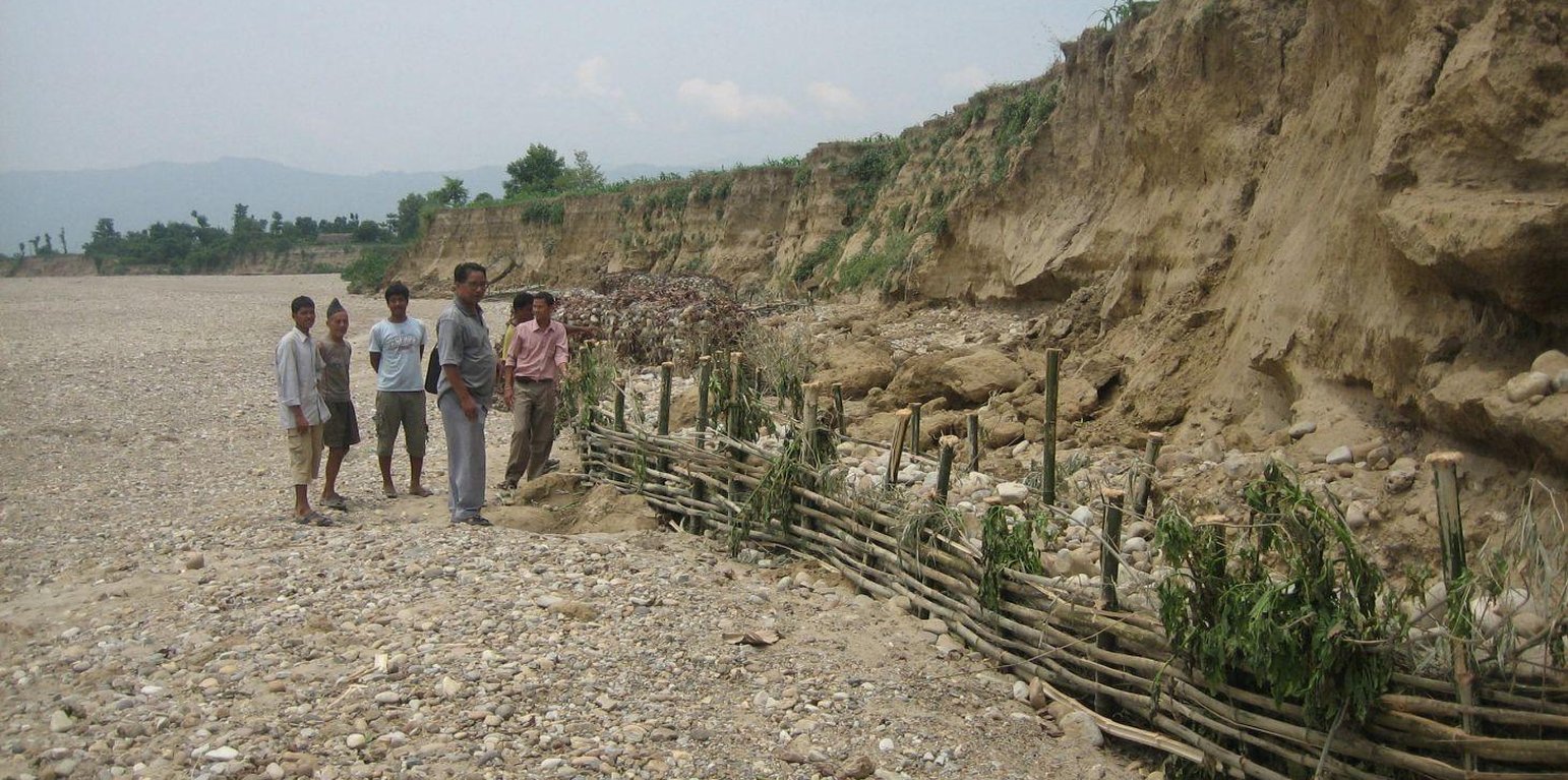
An eroded riverbank in Dang District (Udhaw Ghimire)
Riverbank cutting occurs naturally along the rivers that run along the foothills of the Chure (Siwalik) range in Nepal when the stream collides with the river bank or the bank is eroded by water coming from agricultural land above the affected area. When riverbank cutting occurs, it leaves behind an eroded area shaped like a small cliff. This erosion takes place naturally and is difficult to stop because the site is devoid of natural vegetation. It is important to undertake conservation measures because when the riverbank is eroded it damages agricultural land and decreases soil fertility. When the productivity of the land is decreased it affects the lives and livelihoods of nearby communities most of whom are subsistence farmers.
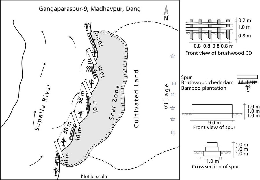
Purpose of the Technology: Communities have developed local measures to help protect the riverbanks and to prevent further erosion and cutting. This technology uses both structural and vegetative measures to help control the erosion and protect both agricultural land and settlement areas from flooding. Check dams are placed at intervals to divert water, additional support is provided by spurs. Bamboo rhizomes are planted between them and Napier grass (Pennisetum purpureum) is planted at the back of the structures so that as the plants grow their roots help to anchor the structure. The washed out areas can be used to generate some income by planting them with greenery and fruit trees. The site needs to be monitored annually and where necessary the structures either need to be repaired or supplemented by building additional structures.
Establishment / maintenance activities and inputs: This technology is a blend of local skills and expertise with some external technical input. The key features of the technology are as follow:
• It uses locally available construction materials, tools, equipment, and vegetation.
• It is easy to replicate.
• It is affordable for local people.
• It is environmentally friendly.
A demonstration plot was established by the District Soil Conservation Office (DSCO) in Dang, but the technology needs to be replicated in other areas with action research and experience
Location: Gobardiha-9, Madhabpur, Dang District,, Nepal
No. of Technology sites analysed:
Spread of the Technology: applied at specific points/ concentrated on a small area
In a permanently protected area?:
Date of implementation:
Type of introduction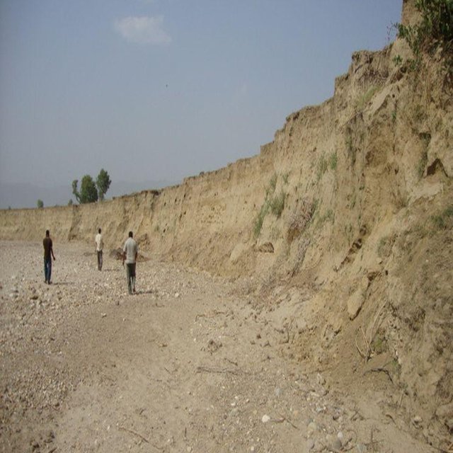


| Specify input | Unit | Quantity | Costs per Unit (USD) | Total costs per input (USD) | % of costs borne by land users |
| Labour | |||||
| Construction of rivervbank protection | ha | 1.0 | 892.0 | 892.0 | 51.0 |
| Equipment | |||||
| Tools | ha | 1.0 | 21.0 | 21.0 | 51.0 |
| Plant material | |||||
| Napier grass, bamboo seedlings | ha | 1.0 | 14.0 | 14.0 | |
| Construction material | |||||
| Stone | ha | 1.0 | 1281.0 | 1281.0 | 51.0 |
| Bamboo poles | ha | 1.0 | 274.0 | 274.0 | 51.0 |
| Wire for gabion box | ha | 1.0 | 1644.0 | 1644.0 | 51.0 |
| Total costs for establishment of the Technology | 4'126.0 | ||||
| Total costs for establishment of the Technology in USD | 4'126.0 | ||||
| Specify input | Unit | Quantity | Costs per Unit (USD) | Total costs per input (USD) | % of costs borne by land users |
| Labour | |||||
| Fortify and reapir check dams | ha | 1.0 | 52.0 | 52.0 | 100.0 |
| Plant material | |||||
| Napier grass, bamboo seedlings | ha | 1.0 | 7.0 | 7.0 | 100.0 |
| Construction material | |||||
| Bamboo poles for replacing | ha | 1.0 | 123.0 | 123.0 | 100.0 |
| Total costs for maintenance of the Technology | 182.0 | ||||
| Total costs for maintenance of the Technology in USD | 182.0 | ||||
Agricultural land is conserved and production is increased


