A MUWS Tower ("Thaado") with two faucets:- the one with pipe connected serves for irrigation and vegetable farming; the next faucet is for supply of drinking water. (Jhuna Kattel)

Gravity-Fed Multiple Use Water System (MUWS) : Odaltaal (Nepal)

Odaltaal Ghaito

Description

Water from source in hill top is collected in a small reservoir (to preserve natural source), then passes onto a Reservoir Tank (RVT) / Ferro-Cement Tank / "Ghaito" for drinking water with a capacity of 4000L. When the RVT gets filled, water overflows, is collected in another concrete irrigation pond (10,000L) for irrigation. From the ferro-cement tank (Ghaito) and concrete irrigation pond, two pipelines are fed and water supplied into individual tap-system or MUWS tap towers for multiple purposes.

The technology is applied in a natural environment, i.e. natural water source. The source of water is a natural source of water that sits atop a small hill which is owned by the government. From the source, water is collected in RVT ( for drinking water) and concrete irrigation pond ( for irrigation). PVC pipes are fed onto the tanks to distribute the water for multiple purposes to 4 MUWS tap towers or tap systems or "Thaado". These MUWS tap towers consist of two faucets each- one for drinking and the other for irrigation and other purposes.The major purposes of this technology are to supply clean water for drinking and other multiple purposes through a cheap, effective and simple system. The natural source of water is locally maintained. Operation and maintenance works are not mandatory, however the locals are responsible for maintaining it should the need arise. The system was financed through a public-private-partnership (PPP) program; out of which some amount was funded by a Non-Governmental Organization (NGO)- Sundar Nepal ( NPR. 2,77,000 ), some amount by the Village Development Committee (VDC)- (NPR. 2,63,000), and the remaining amount was collected by a locals’ group (NPR. 60,000). For establishing the system, labor and construction materials were needed for building the tanks and pipeline systems. For the maintenance, manual labor is necessary. The quality of the water that is supplied to the households is good and the quantity seems sufficient for the 19 households. Sustainable use of water resources through a MUWS system, cheap and effective way to conserve water resources, ensuring availability of clean water even through dry seasons are some of the technology's advantages. Similarly, clean water, more water for irrigation for vegetable farming, simplifying day-to-day life are some of the strengths of the technology. Dislikes could be the limited availability of water during the dry season and that out of 4 systems only 2 are in operation and the other ones are in a non-working condition.

Management system in place for MUWS:
A separate committee is set up for the smooth operation of the system, which consists of 20 members- 10 males and 10 females. The head of the committee is Mrs. Kopila Sunar. The committee conducts a monthly meeting to discuss the problems and need of maintenance. During the initial setup, the connection of pipelines from the tap systems to the reservoir tanks was, however, done with the contribution of the locals. Every month, each family from the 19 households contributes NPR. 100 ( One Hundred Rupees) , which goes to a fund that is set up for the times of need. The labor contribution by the people of the VDC was dependent upon the number and availability of family members in the household. Similarly, the use of the MUWS system and water from it is also dependent upon the availability of family members. Little to no maintenance was done to the system till now from 2075 B.S. ( 1 years) . Equal number of male and female members are in the committee dedicated to the MUWS system.

Location

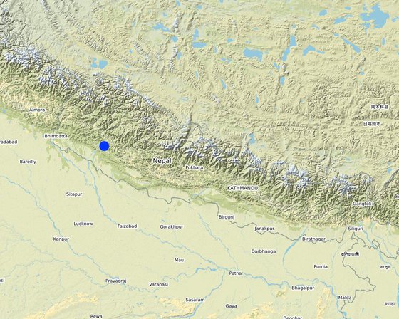
Location: Kunathari VDC-10, Odaltaal, Province-6, Mid-Western Development Region, Nepal

No. of Technology sites analysed: single site

Geo-reference of selected sites
  • 81.5018, 28.72225

Spread of the Technology: applied at specific points/ concentrated on a small area

In a permanently protected area?: Nee

Date of implementation: 2018

Type of introduction
Focus Group Discussion for Data Collection (Jhuna Kattel)
Preserved Natural Source with concrete and iron lid and its natural environment. (Jhuna Kattel)

Classification of the Technology

Main purpose
  • improve production
  • reduce, prevent, restore land degradation
  • conserve ecosystem
  • protect a watershed/ downstream areas – in combination with other Technologies
  • preserve/ improve biodiversity
  • reduce risk of disasters
  • adapt to climate change/ extremes and its impacts
  • mitigate climate change and its impacts
  • create beneficial economic impact
  • create beneficial social impact
  • improve water security and increase efficient use at a household level
Land use

  • Cropland
    • Annual cropping: cereals - barley, cereals - maize, cereals - rice (upland), cereals - wheat (spring), cereals - wheat (winter)
    • Perennial (non-woody) cropping: areca, banana/plantain/abaca, sugar cane
    Number of growing seasons per year: 3
    Is intercropping practiced? Nee
    Is crop rotation practiced? Ja
  • Other - Specify: Drinking Water
    Remarks: Drinking water used directly from the tap systems. Some boil it but most of them use it straight from the tap systems and consume without filtration.
Water supply
  • rainfed
  • mixed rainfed-irrigated
  • full irrigation
  • Natural source (Mool) of water in foliage atop a hill

Purpose related to land degradation
  • prevent land degradation
  • reduce land degradation
  • restore/ rehabilitate severely degraded land
  • adapt to land degradation
  • not applicable
Degradation addressed
  • water degradation - Hs: change in quantity of surface water, Hp: decline of surface water quality
SLM group
  • water harvesting
  • irrigation management (incl. water supply, drainage)
  • ground water management
  • Gravity Fed Multiple Use Water System (MUWS) , New Scheme
SLM measures
  • structural measures - S5: Dams, pans, ponds, S6: Walls, barriers, palisades, fences, S7: Water harvesting/ supply/ irrigation equipment, S11: Others

Technical drawing

Technical specifications
Source: Natural (mool) atop a small hill, secured by wire fences and preserved with concrete and metal lid ( to prevent evaporation).
Water from source collected in Ferro-Cement Tank (RVT) / "Ghaito" in local language, with capacity 4000Ltrs.
Water overflows from RVT into an Irrigation Pond (Open Top, Concrete) with capacity 10,000Ltrs.
PVC Pipes leave the RVT and Pond into 4 MUWS Towers ("Thaado" in local language) to serve 19 households.
One faucet supplies drinking water from RVT and next faucet supplies water for irrigation and other multiple purposes (drip irrigation, tunnel farming, etc.).

Establishment and maintenance: activities, inputs and costs

Calculation of inputs and costs
  • Costs are calculated: per Technology area (size and area unit: 5-6 dhurs; conversion factor to one hectare: 1 ha = 1 ha = 590 dhurs)
  • Currency used for cost calculation: NPR
  • Exchange rate (to USD): 1 USD = 110.0 NPR
  • Average wage cost of hired labour per day: N/A ( voluntary labour from each household)
Most important factors affecting the costs
The construction materials- rods, concrete, cement, bricks and Galvanized Iron (GI) pipes would cost the most
Establishment activities
  1. Enclosement for the groundwater source (Timing/ frequency: Before rainy season)
  2. Construction of Ferro-cement tank for Drinking Water (Timing/ frequency: Before rainy season)
  3. Construction of Concrete pond for Irrigation (Timing/ frequency: Before rainy season)
  4. Securing the perimeter for the tanks (Timing/ frequency: Before rainy season)
  5. Laying down the PVC pipework (Timing/ frequency: Before rainy season)
  6. Construction of 4 individual MUWS tap towers ( Thaado in Nepalese language) (Timing/ frequency: During rainy season)
  7. Final touch-ups, Setting up faucets, Preliminary checking (Timing/ frequency: During rainy season)
Establishment inputs and costs (per 5-6 dhurs)
Specify input Unit Quantity Costs per Unit (NPR) Total costs per input (NPR) % of costs borne by land users
Labour
Voluntary by locals 100.0
Equipment
Irrigation Pond 1.0 275000.0 275000.0 10.0
Ferrocement Tank ( Ghaito) 1.0 225000.0 225000.0 10.0
Securing fences, Perimeter securing for tanks and water source 1.0 50000.0 50000.0 10.0
Setting up MUWS tap towers ( Thaado in local tongue) 4.0 12500.0 50000.0 10.0
PVC Pipes 100.0
Total costs for establishment of the Technology 600'000.0
Total costs for establishment of the Technology in USD 5'454.55
Maintenance activities
  1. Plan on Changing PVC pipework for a Galvanized-Iron (GI) pipe (Timing/ frequency: 1 time after PVC pipes damaged by wear and tear, lime, etc)
  2. Plan on Construction of another Drinking Water Tank (Timing/ frequency: When the one tank is not sufficient for providing enough water)
Maintenance inputs and costs (per 5-6 dhurs)
Specify input Unit Quantity Costs per Unit (NPR) Total costs per input (NPR) % of costs borne by land users
Labour
Voluntary 100.0
Equipment
Drinking water tank construction 1 1.0 75000.0 75000.0 50.0
Laying down GI pipesinstead of PVC Pipes 1 1.0 50000.0 50000.0 25.0
Total costs for maintenance of the Technology 125'000.0
Total costs for maintenance of the Technology in USD 1'136.36

Natural environment

Average annual rainfall
  • < 250 mm
  • 251-500 mm
  • 501-750 mm
  • 751-1,000 mm
  • 1,001-1,500 mm
  • 1,501-2,000 mm
  • 2,001-3,000 mm
  • 3,001-4,000 mm
  • > 4,000 mm
Agro-climatic zone
  • humid
  • sub-humid
  • semi-arid
  • arid
Specifications on climate
Monsoon/ Rainy Season 2-3 months ( June-August)
Name of the meteorological station: Meteorological Forecasting Division, Nepal ( www.mfd.gov.np)
Slope
  • flat (0-2%)
  • gentle (3-5%)
  • moderate (6-10%)
  • rolling (11-15%)
  • hilly (16-30%)
  • steep (31-60%)
  • very steep (>60%)
Landforms
  • plateau/plains
  • ridges
  • mountain slopes
  • hill slopes
  • footslopes
  • valley floors
Altitude
  • 0-100 m a.s.l.
  • 101-500 m a.s.l.
  • 501-1,000 m a.s.l.
  • 1,001-1,500 m a.s.l.
  • 1,501-2,000 m a.s.l.
  • 2,001-2,500 m a.s.l.
  • 2,501-3,000 m a.s.l.
  • 3,001-4,000 m a.s.l.
  • > 4,000 m a.s.l.
Technology is applied in
  • convex situations
  • concave situations
  • not relevant
Soil depth
  • very shallow (0-20 cm)
  • shallow (21-50 cm)
  • moderately deep (51-80 cm)
  • deep (81-120 cm)
  • very deep (> 120 cm)
Soil texture (topsoil)
  • coarse/ light (sandy)
  • medium (loamy, silty)
  • fine/ heavy (clay)
Soil texture (> 20 cm below surface)
  • coarse/ light (sandy)
  • medium (loamy, silty)
  • fine/ heavy (clay)
Topsoil organic matter content
  • high (>3%)
  • medium (1-3%)
  • low (<1%)
Groundwater table
  • on surface
  • < 5 m
  • 5-50 m
  • > 50 m
Availability of surface water
  • excess
  • good
  • medium
  • poor/ none
Water quality (untreated)
  • good drinking water
  • poor drinking water (treatment required)
  • for agricultural use only (irrigation)
  • unusable
Water quality refers to: both ground and surface water
Is salinity a problem?
  • Ja
  • Nee

Occurrence of flooding
  • Ja
  • Nee
Species diversity
  • high
  • medium
  • low
Habitat diversity
  • high
  • medium
  • low

Characteristics of land users applying the Technology

Market orientation
  • subsistence (self-supply)
  • mixed (subsistence/ commercial)
  • commercial/ market
Off-farm income
  • less than 10% of all income
  • 10-50% of all income
  • > 50% of all income
Relative level of wealth
  • very poor
  • poor
  • average
  • rich
  • very rich
Level of mechanization
  • manual work
  • animal traction
  • mechanized/ motorized
Sedentary or nomadic
  • Sedentary
  • Semi-nomadic
  • Nomadic
Individuals or groups
  • individual/ household
  • groups/ community
  • cooperative
  • employee (company, government)
Gender
  • women
  • men
Age
  • children
  • youth
  • middle-aged
  • elderly
Area used per household
  • < 0.5 ha
  • 0.5-1 ha
  • 1-2 ha
  • 2-5 ha
  • 5-15 ha
  • 15-50 ha
  • 50-100 ha
  • 100-500 ha
  • 500-1,000 ha
  • 1,000-10,000 ha
  • > 10,000 ha
Scale
  • small-scale
  • medium-scale
  • large-scale
Land ownership
  • state
  • company
  • communal/ village
  • group
  • individual, not titled
  • individual, titled
  • The source, tanks fall under community forest area- owned by the Government
Land use rights
  • open access (unorganized)
  • communal (organized)
  • leased
  • individual
Water use rights
  • open access (unorganized)
  • communal (organized)
  • leased
  • individual
Access to services and infrastructure
health

poor
x
good
education

poor
x
good
technical assistance

poor
x
good
employment (e.g. off-farm)

poor
x
good
markets

poor
x
good
energy

poor
x
good
roads and transport

poor
x
good
drinking water and sanitation

poor
x
good
financial services

poor
x
good
Comments

The access to health, education and markets along with other facilities is only accessible after a 15 minute journey to the ‘bazaar’ or market area from the village.

Impacts

Socio-economic impacts
Crop production
decreased
x
increased

crop quality
decreased
x
increased

fodder production
decreased
x
increased

fodder quality
decreased
x
increased

animal production
decreased
x
increased

wood production
decreased
x
increased

forest/ woodland quality
decreased
x
increased

non-wood forest production
decreased
x
increased

risk of production failure
increased
x
decreased

product diversity
decreased
x
increased

production area (new land under cultivation/ use)
decreased
x
increased

land management
hindered
x
simplified

energy generation (e.g. hydro, bio)
decreased
x
increased

drinking water availability
decreased
x
increased

drinking water quality
decreased
x
increased

water availability for livestock
decreased
x
increased

water quality for livestock
decreased
x
increased

irrigation water availability
decreased
x
increased

irrigation water quality
decreased
x
increased

demand for irrigation water
increased
x
decreased

expenses on agricultural inputs
increased
x
decreased

farm income
decreased
x
increased

diversity of income sources
decreased
x
increased

economic disparities
increased
x
decreased

workload
increased
x
decreased

Socio-cultural impacts
food security/ self-sufficiency
reduced
x
improved

health situation
worsened
x
improved

land use/ water rights
worsened
x
improved

cultural opportunities (eg spiritual, aesthetic, others)
reduced
x
improved

recreational opportunities
reduced
x
improved

community institutions
weakened
x
strengthened

national institutions
weakened
x
strengthened

SLM/ land degradation knowledge
reduced
x
improved


Knowledge about the technology (MUWS) improved

conflict mitigation
worsened
x
improved

situation of socially and economically disadvantaged groups (gender, age, status, ehtnicity etc.)
worsened
x
improved

Ecological impacts
water quantity
decreased
x
increased

water quality
decreased
x
increased

harvesting/ collection of water (runoff, dew, snow, etc)
reduced
x
improved

surface runoff
increased
x
decreased

excess water drainage
reduced
x
improved

groundwater table/ aquifer
lowered
x
recharge

evaporation
increased
x
decreased


evaporation of water decreased after the construction of enclosures / tanks.

soil moisture
decreased
x
increased

soil cover
reduced
x
improved

soil loss
increased
x
decreased

soil accumulation
decreased
x
increased

soil crusting/ sealing
increased
x
reduced

soil compaction
increased
x
reduced

nutrient cycling/ recharge
decreased
x
increased

salinity
increased
x
decreased

soil organic matter/ below ground C
decreased
x
increased

acidity
increased
x
reduced

vegetation cover
decreased
x
increased

biomass/ above ground C
decreased
x
increased

plant diversity
decreased
x
increased

invasive alien species
increased
x
reduced

animal diversity
decreased
x
increased

beneficial species (predators, earthworms, pollinators)
decreased
x
increased

habitat diversity
decreased
x
increased

pest/ disease control
decreased
x
increased

flood impacts
increased
x
decreased

landslides/ debris flows
increased
x
decreased

drought impacts
increased
x
decreased


As per water users, effects of drought were imminent in the dry seasons, leading to less water available for drinking and irrigation. However, after the MUWS was installed, the effects of drought could be tackled; mainly due to the availability of water for drinking and drip irrigation, even during the dry and arid winter seasons.

Off-site impacts

Cost-benefit analysis

Benefits compared with establishment costs
Short-term returns
very negative
x
very positive

Benefits compared with maintenance costs
Short-term returns
very negative
x
very positive

The system has been in operation since a year only. Thus, long term effects are yet to be visible. Evident from the cost of operation and maintenance with the benefits of the technology, there is a positive impact evident.

Climate change

Gradual climate change
annual temperature increase

not well at all
x
very well
seasonal temperature increase

not well at all
x
very well
Season: summer
annual rainfall decrease

not well at all
x
very well
seasonal rainfall decrease

not well at all
x
very well
Season: wet/ rainy season
Climate-related extremes (disasters)
drought

not well at all
x
very well

Adoption and adaptation

Percentage of land users in the area who have adopted the Technology
  • single cases/ experimental
  • 1-10%
  • 11-50%
  • > 50%
Of all those who have adopted the Technology, how many have done so without receiving material incentives?
  • 0-10%
  • 11-50%
  • 51-90%
  • 91-100%
Has the Technology been modified recently to adapt to changing conditions?
  • Ja
  • Nee
To which changing conditions?
  • climatic change/ extremes
  • changing markets
  • labour availability (e.g. due to migration)

Conclusions and lessons learnt

Strengths: land user's view
  • Substantially less amount of lime present in water than what was previously found.
  • Availability of water even during the dry seasons.
  • Increase in the productivity of perennial vegetables in kitchen garden, construction of tunnels for farming vegetables possible
Strengths: compiler’s or other key resource person’s view
  • Water quality vastly improved, no lime and/or saltiness present in water
  • Need of alternative sources of water during dry seasons not present after construction of MUWS system
  • Overall productivity of land improved through effective irrigation of water
  • Self-sufficiency in the aspect of water and crops, as well as alternative sources of income increased leading to improved quality of the lives of the water users.
Weaknesses/ disadvantages/ risks: land user's viewhow to overcome
  • Water levels not rising in two tap systems of the four Technician could oversee the problem of elevation and give a viable solution so that 4 out of 4 tap systems could be functional again
  • Pipes’ diameter and quality could be improved If the government and/or NGO could add to the savings of the group, good quality of GI pipes could be installed instead of the PVC pipes used
Weaknesses/ disadvantages/ risks: compiler’s or other key resource person’s viewhow to overcome
  • The tank for irrigation is left open at the top Closing the top of the tank
  • The pipes used are not sustainable The use of heavier PVC pipes and/or hybrid GI pipes could result in less chances of system failure due to lime in the water

References

Compiler
  • Jhuna Kattel
Editors
Reviewer
  • Renate Fleiner
Date of documentation: Julie 6, 2019
Last update: Des. 3, 2019
Resource persons
Full description in the WOCAT database
Linked SLM data
Documentation was faciliated by
Institution Project
This work is licensed under Creative Commons Attribution-NonCommercial-ShareaAlike 4.0 International