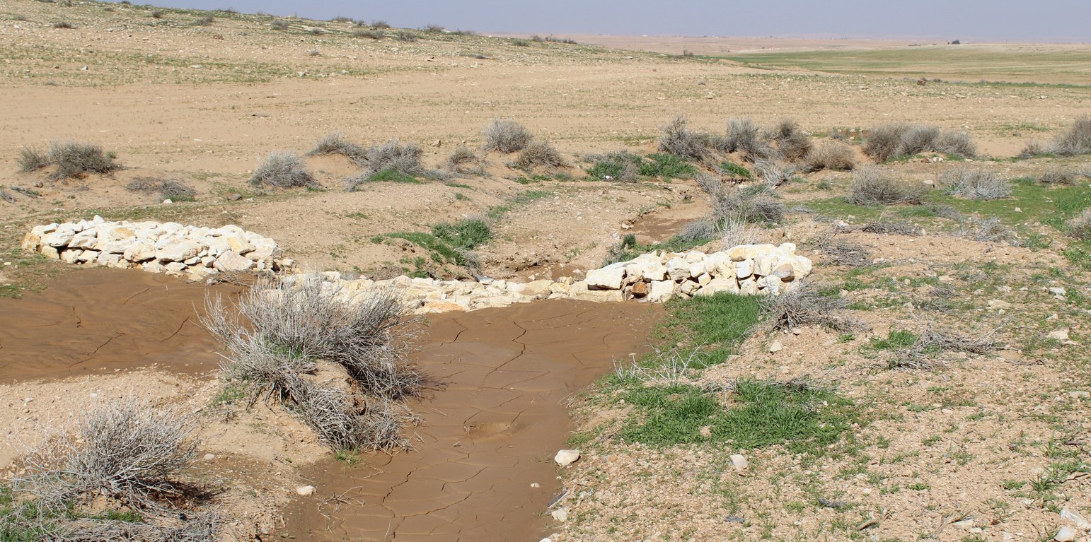


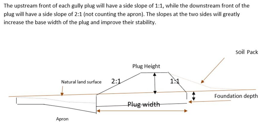
Characteristics: Multiple gully plugs positioned sequentially within a gully system interrupt concentrated surface runoff and reduce its erosive power. The plugs are each made of multiple cobbles/stones mostly ranging between 10 and 30 cm diameter and constructed to ensure a stable structure. The plugs started at the head of the gully (upstream) and ranges from 1.5 - 3.7 m in width with an average of 2.5 m. For heavily eroded and very unstable sections, gabions can be used also. The structures are around 1.0 to 1.5-m high, anchored into the sidewalls, and around 0.20 to 0.35 m deep into the gully bed, built up to around 1/3 to max. 1/2 of the gully depth - ensuring the concentrated flow stays within the channel and does not overflow the side banks. The top of the plug is U-shaped, with the sides built higher than the centre. Upslope, the plugs are packed with soil to trap sediments (stopping it flowing through the structure), and downslope the plugs have an apron to dissipate the energy of overflowing water, into a micro stilling basin. The downslope side of the gully plug is sloped rather than vertical. The large stones add roughness to the slope, creating a rough spillway that dissipates erosive energy. In the direction of gully flow, several gully plugs are placed such that the upper gully apron is set at approximately the height of the following downstream gully crest.
Environment: The technology is used in a watershed close to Al Majeddyeh village, located in the Middle Badia zone, approximately 30 km south-east of Amman. The climate is arid and warm (Palmer, 2013). The average annual rainfall is around 130 mm. The natural environment is labelled as steppe, “BSh” in the köppen classification. The human environment is characterized by agropastoralists. They are semi-nomadic and live in villages around the watershed, for example, Al Majeddyeh village.
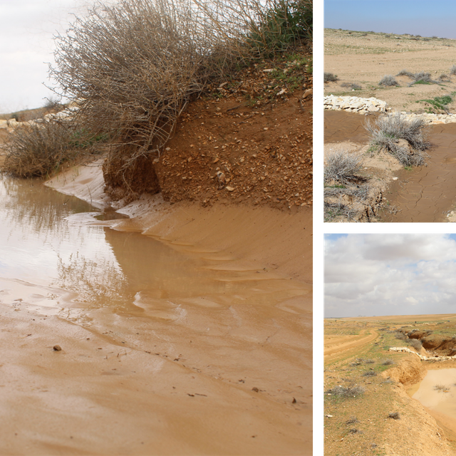
Purpose: The measure interrupts the concentrated flow, reduces velocity, and dissipates energy. Multiple structures along the gully decrease the erosive power of runoff, retaining a fraction of the runoff, inducing sedimentation (upstream of the plug), thus protecting the gully bed from further deep-scouring, and strengthening the gully side banks, especially when this is linked with re-vegetation. Over time, the establishing vegetation (roots and surface cover) stabilizes the soil and protects it from concentrated flow erosion. To be effective, gully plug emplacement requires SLM in upland areas. These measures then jointly mitigate peak runoff generation and accordingly reduce downstream flooding.
Major activities: Upland SLM is essential. In the specific watershed rehabilitation context, upland SLM was achieved through micro water harvesting and re-vegetation through native shrubs (the “VALLERANI” method). Gully morphology assessment is required for gully plug design, and positioning and earthwork excavation is necessary for foundation preparation in the gully bed and wall anchors. Proper layering of various size stones and shaping of gully plugs is necessary as is the addition of a packed soil pack upstream of the stone structure, to semi-seal the surface and to pond water. Then gully walls are revegetated through native seedlings: these benefit from the water ponding upstream prior to sedimentation upstream of the gully and enhanced soil water storage in the sediments once the gully is filled.
Benefits: Stops ongoing land degradation and gully deepening, and achieves a certain degree of rehabilitation; retains a fraction of runoff water and sediments in the watershed – water mainly infiltrates and provides moisture to the gully vegetation; gully vegetation serves various purposes including livestock fodder, reduction of flow velocities in the gully, and retention of further sediment.
Land user's opinion: Land users benefit from the vegetation (e.g. fruit trees can potentially be out-planted), as well as ponded water for livestock; however, the technology is labor-intensive, and therefore costly, and landowners (at the local target site) require incentives to carry out the work.
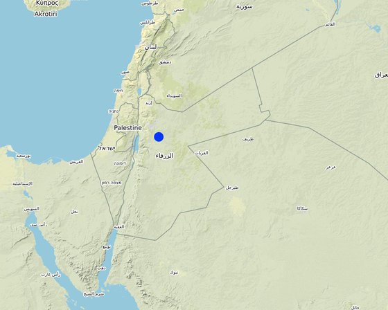
Location: Amman governorate/Al Jizza/Al Majeddyeh village, Jordan
No. of Technology sites analysed: single site
Spread of the Technology: applied at specific points/ concentrated on a small area
In a permanently protected area?: Nee
Date of implementation: 2017
Type of introduction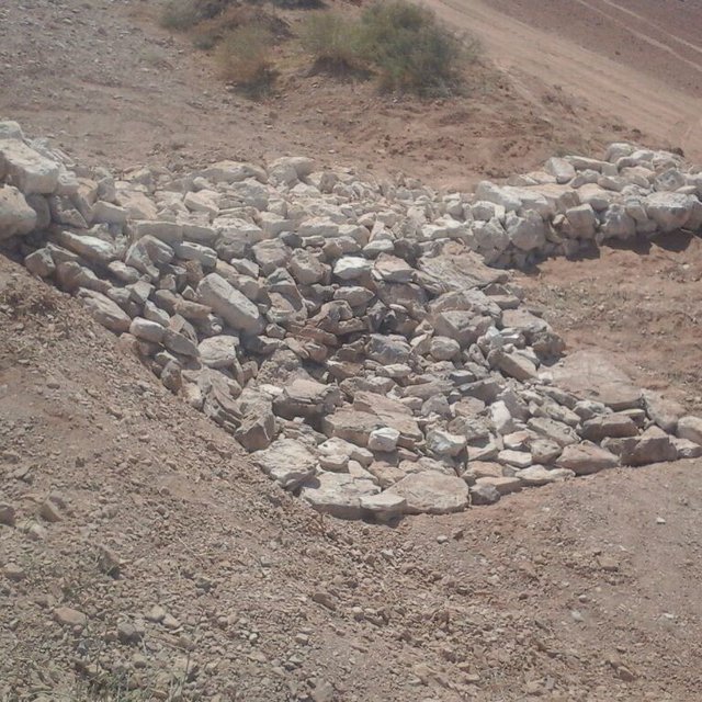


| Specify input | Unit | Quantity | Costs per Unit (USD) | Total costs per input (USD) | % of costs borne by land users |
| Labour | |||||
| Field technician (design and oversight) | Labour Day (LD) per structure | 0.2 | 50.0 | 10.0 | |
| Workers (excavation/earthworks) | LD | 4.0 | 35.0 | 140.0 | |
| Workers (stone layering/construction) | LD | 4.0 | 35.0 | 140.0 | |
| Worker (out-planting of seedlings) | LD | 1.0 | 35.0 | 35.0 | |
| Equipment | |||||
| Shovel, Pickaxe, buckets, ruler | Lump sum | 1.0 | 10.0 | 10.0 | |
| Plant material | |||||
| Seedlings | per item | 10.0 | 0.5 | 5.0 | |
| Construction material | |||||
| Stones | m3 | 4.0 | 10.0 | 40.0 | |
| Other | |||||
| Logistics (seedling transport, local stone transport) | lump sum | 1.0 | 10.0 | 10.0 | |
| Total costs for establishment of the Technology | 390.0 | ||||
| Total costs for establishment of the Technology in USD | 390.0 | ||||
| Specify input | Unit | Quantity | Costs per Unit (USD) | Total costs per input (USD) | % of costs borne by land users |
| Labour | |||||
| Expert (investigation) | LD | 0.1 | 50.0 | 5.0 | |
| LD | 0.5 | 35.0 | 17.5 | ||
| LD | 1.0 | 35.0 | 35.0 | ||
| Construction material | |||||
| stones | m3 | 0.5 | 10.0 | 5.0 | |
| Total costs for maintenance of the Technology | 62.5 | ||||
| Total costs for maintenance of the Technology in USD | 62.5 | ||||
Some herbs (and fruits (trees) in the future)
enhanced biodiversity, shade and shelter
Through training/community participation
Certain degree purification through infiltration in the sediment accumulation zone
Effect on hydrology (distinctness of runoff peak)
Certain deep-infiltration
more open water ponding – but also deep-infiltration and beneficial use for vegetation (transpiration)
Side banks stabilized
sediments trapped
sediment crust increased in the ponding area – but better soil structure at the side banks (revegetation) – overall positive impact.
Through side bank stabilization.
especially when combined with upland measure: reference VALLERANI
Less tributary channel development (connectivity of upland areas); less downstream siltation
less runoff peakiness and siltation