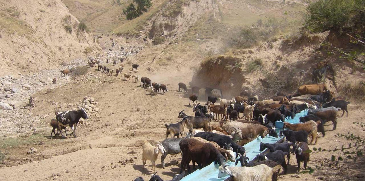
Cattle coming from the pastures drinking from one of the drinking water points on a hot day. (Sady Odinashoev (Muminabad, Tajikistan))
When in 2009 the project started in the two watersheds of Fayzabad and Gesh in Muminabad district, the communities had identified insufficient livestock water points in the pastures, and poor pasture management as top priorities concerning natural resource management in the watersheds. At that time, one of the biggest problems for livestock and herders was the difficult access to water when grazing the daily pastures above the villages. At lunch time, herds had to walk long distances (4-5 kilometers) and actually had to come back to the villages for drinking water. Climbing twice a day to the pasture costs the cattle a lot of energy leading to a yearly loss of up to 40-50 kg, according to a Caritas Switzerland study. One initial measure to improve the condition of the livestock was therefore to establish water points in the pastures. At first, water sources that supply water throughout the year were identified.
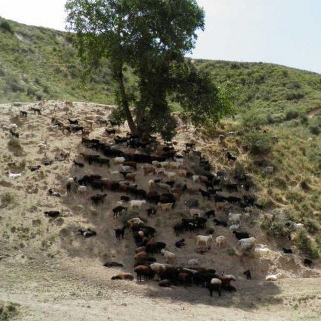
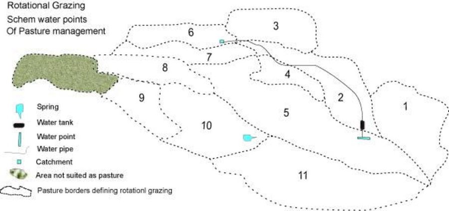
Purpose of the Technology: The water is now collected in a cement catchment, from where it is channelled through pipes to the drinking water points for animals. In some cases water tanks are placed above water points, to collect water and to distribute it to the water points. Additionally, rest places were found for the livestock, where they can have a rest in the shade after drinking water on hot summer days.
In conjunction to the establishment of water points, a rotational grazing scheme was introduced. The pasture land in the watershed was divided into ten parts and in each plot the animals were allowed to graze for five to eight days, assuring longer growing times for grass on specific pastures and thus increasing the quantity of grass and the quality of the pastures.
Establishment / maintenance activities and inputs: Livestock committees, consisting of five people, were organised. They took the lead in developing appropriate grazing schemes and discussing the location of the water points with the villagers. They are in charge of further maintenance of the water points, and the daily organisation of the rotational grazing. One of the five committee members is the shepherd. Every morning he accompanies the herd and checks the water points and the rest places. Once a month he collects one Somoni from each family to cover costs arising from this method of pasture management in the watershed.
Natural / human environment: The technology is implemented on pasture land where animal drinking water is readily available only in spring, and during the rest of the year the distances to water sources are long. Daily pastures in stony terrain with steep slopes and pastures situated higher up are difficult to reach. The livestock grazing on common grazing land are controlled by the head shepherd with the task of coordinating the different helpers and having overall responsibility for herding the livestock.
Location: Muminabad, Tajikistan, Khatlon, Tajikistan
No. of Technology sites analysed:
Spread of the Technology: evenly spread over an area (approx. 100-1,000 km2)
In a permanently protected area?:
Date of implementation: less than 10 years ago (recently)
Type of introduction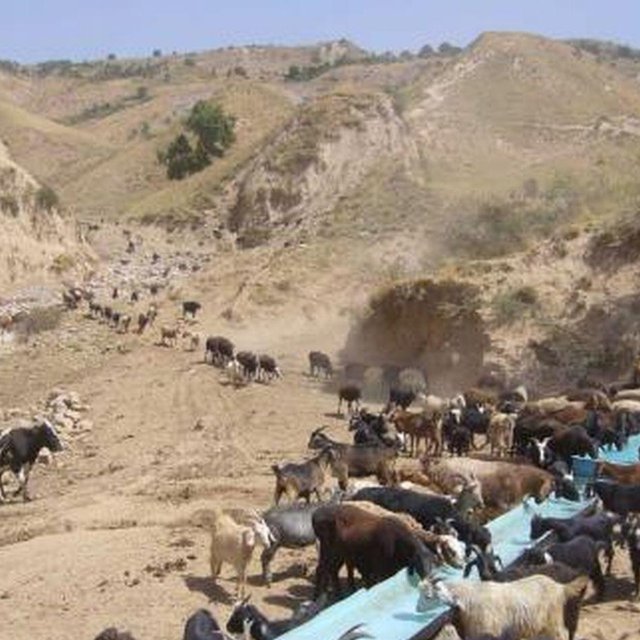


| Specify input | Unit | Quantity | Costs per Unit (USD) | Total costs per input (USD) | % of costs borne by land users |
| Labour | |||||
| Planting trees incl. seeds | Persons/day | 20.0 | 5.5 | 110.0 | 20.0 |
| Waterpoints construction labour | Persons/day | 160.0 | 5.5 | 880.0 | 100.0 |
| Pipeline Construction incl. Watertanks etc | pipeline | 1.0 | 6648.0 | 6648.0 | 30.0 |
| Equipment | |||||
| Catchement device | device | 1.0 | 353.0 | 353.0 | 20.0 |
| Total costs for establishment of the Technology | 7'991.0 | ||||
| Total costs for establishment of the Technology in USD | 7'991.0 | ||||
| Specify input | Unit | Quantity | Costs per Unit (USD) | Total costs per input (USD) | % of costs borne by land users |
| Labour | |||||
| rotational grazing and checking the water catchment and distribution system | ha | 800.0 | 0.7975 | 638.0 | |
| Protecting young trees with dead branches from thorny bushes | Persons/day | 20.0 | 5.5 | 110.0 | |
| Total costs for maintenance of the Technology | 748.0 | ||||
| Total costs for maintenance of the Technology in USD | 748.0 | ||||
in the upper area more grass
perenial plants
milk, meat
No water available previously
No water available previously
less money spent on vets
more milk prduced
less walking for herders
road to the new pastures
No payment previously
livestock commitee have respect in the village
villagers
Previously a lot of conflict in this area, regular meeting have helped reduce these.
Empowerment of women and marginalised groups. Women are involved in the workshops
watershed group in livestock committee in the village
water points
filtering in the spring
more grass
Cattle do not need to walk over soem areas
due to better management
more plants
grass


