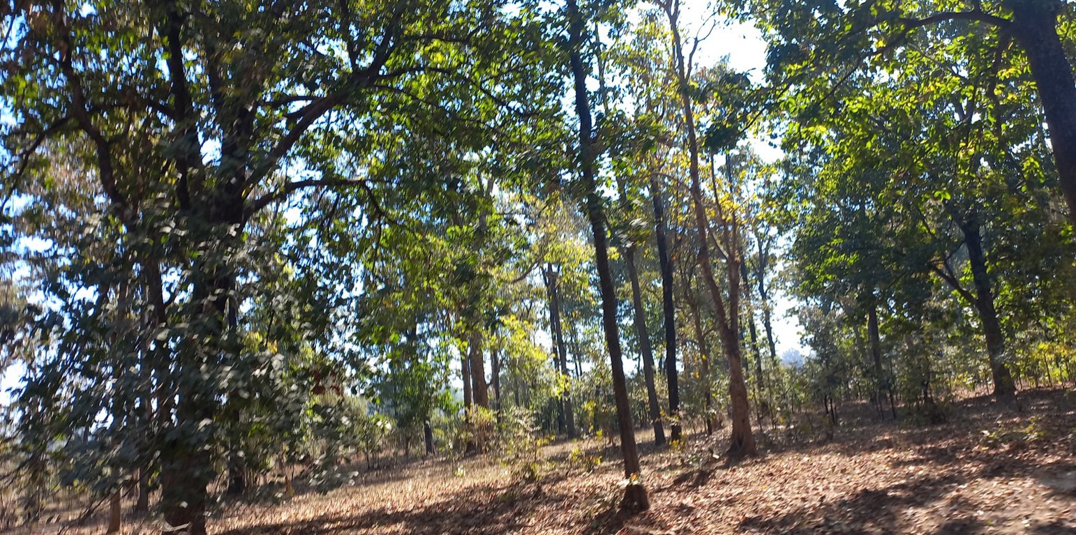
A clean field after the eradication of Lantana camara (Santosh Gupta)

Eradication of Lantana Camara (invasive species) for Soil Rehabilitation on Private Land (India)

Lantana (Ram Phool)

Description

Lantana camara is an invasive species having severe ecological impacts on local biodiversity and economic impact on local communities. Lantana camara has proliferated in central India and occupied many forest lands, commons, and private land. The cut rootstock method provides minimum disturbance to the soil, wherein the plants' roots are cut three inches below the ground. It is followed by lifting the bush and keeping it upside down to prevent it from gaining ground.

Introduced as an ornamental plant to India in the 1800s, Lantana has infested the forests, grazing grounds, and farmlands. It has invaded over 13 million hectares, which is around 4% of the total land area of the country. In the context of Madhya Pradesh, the species has encroached on shared and remote villages’ lands along the fringes of protected areas such as the Kanha Tiger Reserve, impacting wildlife and local communities in multiple ways.

Tribals in the Kanha landscape generally inhabit upper catchments of rivers, usually having large portions of uplands as part of their landholdings. These lands have never attracted investments from land development projects. They used to cultivate millets (particularly Kodo and Kutki) every alternate year. Apart from this crop, the farmers collect tendu leaves (Diospyros Melanoxylon) from these lands every year. Keeping the soil quality in view, they take these crops every alternate year and in some cases, once in three years with a gap of two years. This gap of two years helps Lantana spread on private land.

Traditional practices for controlling lantana camara are chopping the main stem, clipping aerial shoots, burning, and grubbing (total uprooting). These practices however, either led to vigorous regeneration of Lantana or were labor intensive. The cut rootstock method/technology applied under the project provides minimum disturbance to the soil, wherein the plants’ roots are cut three inches below the ground. It is followed by lifting the bush and keeping it upside down to prevent it from gaining ground.

The Foundation for Ecological Security (FES), an NGO located in India, has been working on the eradication of Lantana Camara from the commons land since 2010-11, however from the year 2016-17 onwards, with the support from GIZ, FES also started supporting village institution in eradicating Lantana from private upland. Significant activities are undertaken for the eradication of Lantana and as shown hereunder:

A. Improving community governance mechanism; local communities were engaged by ensuring that the village executive committee took the Gram Sabha (Village Governing Body) into confidence and prepared the by-laws to conserve the lantana-eradicated site. Rules and regulations were framed for the uprooting of the Lantana, its payment process, and usages of the uprooted Lantana for fencing the plot, preparation of biochar, or other usages providing ecological benefits.

B. Adoption of the ‘cut rootstock method’ for the uprooting of Lantana; removing Lantana is tricky because methods such as burning, haphazard uprooting, or cutting result in the recurrence of the species.

C. Appropriate measures were taken to minimize the recurrence of Lantana seeds through regular monitoring and plantation of grass seeds and other plants.

D. Grass seed sowing; with the active support of the village institution, the collection of indigenous grass species was done. Before the advent of the monsoon, the community prepared the grass seed ball and sowed it in the plot. A seed ball helps the seed to protect it from insects, birds, and runoff. In the rainy season, these grass seeds germinate and grow. With the grasses coming, the lantana seeds do not get a suitable environment to germinate and grow.

Eradication of Lantana from the private lands helps the communities access their lands. This has resulted in the cultivation of millets on the same land, which was otherwise left fallow for so many years.

Location

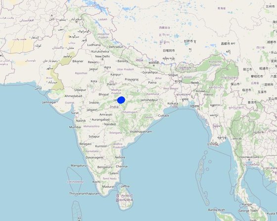
Location: Mandla, Madhya Pradesh, India

No. of Technology sites analysed: 100-1000 sites

Geo-reference of selected sites
  • 80.26523, 22.81034
  • 80.07561, 22.7431
  • 80.07561, 22.7431

Spread of the Technology: applied at specific points/ concentrated on a small area

In a permanently protected area?: Nee

Date of implementation: 2015

Type of introduction
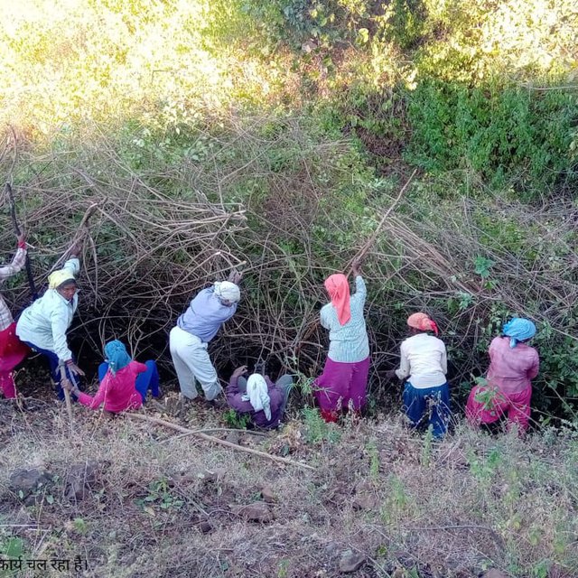
Farmers removing the lantana from their field and common land (Keertan Bhagel)

Classification of the Technology

Main purpose
  • improve production
  • reduce, prevent, restore land degradation
  • conserve ecosystem
  • protect a watershed/ downstream areas – in combination with other Technologies
  • preserve/ improve biodiversity
  • reduce risk of disasters
  • adapt to climate change/ extremes and its impacts
  • mitigate climate change and its impacts
  • create beneficial economic impact
  • create beneficial social impact
Land use
Land use mixed within the same land unit: Ja - Agroforestry

  • Cropland
    • Annual cropping: cereals - millet. Cropping system: Fallow - maize/sorghum/millet
    Number of growing seasons per year: 1
    Is intercropping practiced? Nee
    Is crop rotation practiced? Ja
  • Grazing land
    • Transhumant pastoralism
    • Cut-and-carry/ zero grazing
    Animal type: cattle - dairy
    Is integrated crop-livestock management practiced? Nee
      SpeciesCount
      cattle - dairy500
    • Forest/ woodlands
      • (Semi-)natural forests/ woodlands: boreal coniferous forest natural vegetation. Management: Dead wood/ prunings removal, Non-wood forest use
      Tree types (mixed deciduous/ evergreen): n.a.
      Products and services: Timber, Fuelwood, Fruits and nuts, Other forest products, Grazing/ browsing, Nature conservation/ protection
    Water supply
    • rainfed
    • mixed rainfed-irrigated
    • full irrigation

    Purpose related to land degradation
    • prevent land degradation
    • reduce land degradation
    • restore/ rehabilitate severely degraded land
    • adapt to land degradation
    • not applicable
    Degradation addressed
    • chemical soil deterioration - Ca: acidification
    • biological degradation - Bf: detrimental effects of fires, Bs: quality and species composition/ diversity decline, Bl: loss of soil life
    SLM group
    • agroforestry
    • integrated soil fertility management
    SLM measures
    • vegetative measures - V3: Clearing of vegetation, V4: Replacement or removal of alien/ invasive species
    • management measures - M1: Change of land use type

    Technical drawing

    Technical specifications
    Drawing covering the landscape of private land where Lantana eradication was carried out. The drawing indicates the before and after situation with a change in the land profile. It can be seen that before the eradication land was covered with a thick cover of Lantana while after the eradication, land has plants and grass. The drawing also shows the slopes of the land under treatment.
    Author: Payal

    Establishment and maintenance: activities, inputs and costs

    Calculation of inputs and costs
    • Costs are calculated: per Technology area (size and area unit: 1 hectare)
    • Currency used for cost calculation: INR
    • Exchange rate (to USD): 1 USD = 80.0 INR
    • Average wage cost of hired labour per day: 204
    Most important factors affecting the costs
    The density of lantana in the field is categorized into 3: more than 1500 bushes are considered high density, and between 500-1500 are considered moderately dense, while less than 500 is known as lowly dense.
    Establishment activities
    n.a.
    Maintenance activities
    n.a.
    Maintenance inputs and costs (per 1 hectare)
    Specify input Unit Quantity Costs per Unit (INR) Total costs per input (INR) % of costs borne by land users
    Labour
    Removal of lantana ha 1.0 7229.0 7229.0 16.0
    Total costs for maintenance of the Technology 7'229.0
    Total costs for maintenance of the Technology in USD 90.36

    Natural environment

    Average annual rainfall
    • < 250 mm
    • 251-500 mm
    • 501-750 mm
    • 751-1,000 mm
    • 1,001-1,500 mm
    • 1,501-2,000 mm
    • 2,001-3,000 mm
    • 3,001-4,000 mm
    • > 4,000 mm
    Agro-climatic zone
    • humid
    • sub-humid
    • semi-arid
    • arid
    Specifications on climate
    Average annual rainfall in mm: 1427.0
    Monsoon season is June-September which has the majority of the rainfall
    Name of the meteorological station: Mandla, Madhya Pradesh
    Slope
    • flat (0-2%)
    • gentle (3-5%)
    • moderate (6-10%)
    • rolling (11-15%)
    • hilly (16-30%)
    • steep (31-60%)
    • very steep (>60%)
    Landforms
    • plateau/plains
    • ridges
    • mountain slopes
    • hill slopes
    • footslopes
    • valley floors
    Altitude
    • 0-100 m a.s.l.
    • 101-500 m a.s.l.
    • 501-1,000 m a.s.l.
    • 1,001-1,500 m a.s.l.
    • 1,501-2,000 m a.s.l.
    • 2,001-2,500 m a.s.l.
    • 2,501-3,000 m a.s.l.
    • 3,001-4,000 m a.s.l.
    • > 4,000 m a.s.l.
    Technology is applied in
    • convex situations
    • concave situations
    • not relevant
    Soil depth
    • very shallow (0-20 cm)
    • shallow (21-50 cm)
    • moderately deep (51-80 cm)
    • deep (81-120 cm)
    • very deep (> 120 cm)
    Soil texture (topsoil)
    • coarse/ light (sandy)
    • medium (loamy, silty)
    • fine/ heavy (clay)
    Soil texture (> 20 cm below surface)
    • coarse/ light (sandy)
    • medium (loamy, silty)
    • fine/ heavy (clay)
    Topsoil organic matter content
    • high (>3%)
    • medium (1-3%)
    • low (<1%)
    Groundwater table
    • on surface
    • < 5 m
    • 5-50 m
    • > 50 m
    Availability of surface water
    • excess
    • good
    • medium
    • poor/ none
    Water quality (untreated)
    • good drinking water
    • poor drinking water (treatment required)
    • for agricultural use only (irrigation)
    • unusable
    Water quality refers to: both ground and surface water
    Is salinity a problem?
    • Ja
    • Nee

    Occurrence of flooding
    • Ja
    • Nee
    Species diversity
    • high
    • medium
    • low
    Habitat diversity
    • high
    • medium
    • low

    Characteristics of land users applying the Technology

    Market orientation
    • subsistence (self-supply)
    • mixed (subsistence/ commercial)
    • commercial/ market
    Off-farm income
    • less than 10% of all income
    • 10-50% of all income
    • > 50% of all income
    Relative level of wealth
    • very poor
    • poor
    • average
    • rich
    • very rich
    Level of mechanization
    • manual work
    • animal traction
    • mechanized/ motorized
    Sedentary or nomadic
    • Sedentary
    • Semi-nomadic
    • Nomadic
    Individuals or groups
    • individual/ household
    • groups/ community
    • cooperative
    • employee (company, government)
    Gender
    • women
    • men
    Age
    • children
    • youth
    • middle-aged
    • elderly
    Area used per household
    • < 0.5 ha
    • 0.5-1 ha
    • 1-2 ha
    • 2-5 ha
    • 5-15 ha
    • 15-50 ha
    • 50-100 ha
    • 100-500 ha
    • 500-1,000 ha
    • 1,000-10,000 ha
    • > 10,000 ha
    Scale
    • small-scale
    • medium-scale
    • large-scale
    Land ownership
    • state
    • company
    • communal/ village
    • group
    • individual, not titled
    • individual, titled
    Land use rights
    • open access (unorganized)
    • communal (organized)
    • leased
    • individual
    Water use rights
    • open access (unorganized)
    • communal (organized)
    • leased
    • individual
    Access to services and infrastructure
    health

    poor
    x
    good
    education

    poor
    x
    good
    technical assistance

    poor
    x
    good
    employment (e.g. off-farm)

    poor
    x
    good
    markets

    poor
    x
    good
    energy

    poor
    x
    good
    roads and transport

    poor
    x
    good
    drinking water and sanitation

    poor
    x
    good
    financial services

    poor
    x
    good

    Impacts

    Socio-economic impacts
    Crop production
    decreased
    x
    increased

    Quantity before SLM: 242 kg per ha
    Quantity after SLM: 350 kg per ha
    These are the estimated figures

    fodder production
    decreased
    x
    increased

    forest/ woodland quality
    decreased
    x
    increased

    production area (new land under cultivation/ use)
    decreased
    x
    increased

    drinking water availability
    decreased
    x
    increased

    water availability for livestock
    decreased
    x
    increased

    farm income
    decreased
    x
    increased

    diversity of income sources
    decreased
    x
    increased

    Socio-cultural impacts
    food security/ self-sufficiency
    reduced
    x
    improved

    community institutions
    weakened
    x
    strengthened

    SLM/ land degradation knowledge
    reduced
    x
    improved

    situation of socially and economically disadvantaged groups (gender, age, status, ehtnicity etc.)
    worsened
    x
    improved

    Ecological impacts
    soil moisture
    decreased
    x
    increased

    soil cover
    reduced
    x
    improved

    soil loss
    increased
    x
    decreased

    soil crusting/ sealing
    increased
    x
    reduced

    nutrient cycling/ recharge
    decreased
    x
    increased

    soil organic matter/ below ground C
    decreased
    x
    increased

    vegetation cover
    decreased
    x
    increased

    plant diversity
    decreased
    x
    increased

    invasive alien species
    increased
    x
    reduced

    beneficial species (predators, earthworms, pollinators)
    decreased
    x
    increased

    habitat diversity
    decreased
    x
    increased

    Off-site impacts
    water availability (groundwater, springs)
    decreased
    x
    increased


    Increasing soil moisture in the uplands will help improve water availability in the lowlands

    buffering/ filtering capacity (by soil, vegetation, wetlands)
    reduced
    x
    improved

    Cost-benefit analysis

    Benefits compared with establishment costs
    Short-term returns
    very negative
    x
    very positive

    Long-term returns
    very negative
    x
    very positive

    Benefits compared with maintenance costs
    Short-term returns
    very negative
    x
    very positive

    Long-term returns
    very negative
    x
    very positive

    Short- and long-term benefits are pretty high compared to the cost involved.

    Climate change

    -

    Adoption and adaptation

    Percentage of land users in the area who have adopted the Technology
    • single cases/ experimental
    • 1-10%
    • 11-50%
    • > 50%
    Of all those who have adopted the Technology, how many have done so without receiving material incentives?
    • 0-10%
    • 11-50%
    • 51-90%
    • 91-100%
    Number of households and/ or area covered
    1000 hectares
    Has the Technology been modified recently to adapt to changing conditions?
    • Ja
    • Nee
    To which changing conditions?
    • climatic change/ extremes
    • changing markets
    • labour availability (e.g. due to migration)

    Conclusions and lessons learnt

    Strengths: land user's view
    • 1. Availability of additional land for cultivation of other crops such as Millets on upland
    • 2. Improved land for fodder cultivation
    • 3. Reduced losses due to animal attacks on the standing crops as animals are now not finding the space to hide
    Strengths: compiler’s or other key resource person’s view
    • Reduced human-animal conflict will lead to productivity gains for both forest dwellers and wild animals
    • Available land will be used for millet cultivation, which is rich in nutrition and well-suited to the local ecological conditions. The requirement for water is also very minimal for these crops.
    • This will also improve local biodiversity as farmers will now grow more plant varieties suitable for climatic conditions.
    Weaknesses/ disadvantages/ risks: land user's viewhow to overcome
    Weaknesses/ disadvantages/ risks: compiler’s or other key resource person’s viewhow to overcome
    • Cultivation of crops using chemical pesticides and fertilizers may have a negative impact on both soil and the environment Training and handholding of the farmers around the natural and sustainable farming practices

    References

    Compiler
    • Santosh Gupta
    Editors
    • Noel Templer
    • Stephanie Katsir
    • Kim Arora
    • Tabitha Nekesa
    • Ahmadou Gaye
    • Siagbé Golli
    Reviewer
    • Udo Höggel
    • Joana Eichenberger
    • Sally Bunning
    Date of documentation: Feb. 21, 2023
    Last update: April 11, 2024
    Resource persons
    Full description in the WOCAT database
    Linked SLM data
    Documentation was faciliated by
    Institution Project
    Key references
    • FES internal documents prepared during the year 2021-22: Internal documents
    This work is licensed under Creative Commons Attribution-NonCommercial-ShareaAlike 4.0 International