Stone Faced Soil Bund of South Gonder [Ethiopia]
- Creation:
- Update:
- Compiler: Unknown User
- Editor: –
- Reviewer: Fabian Ottiger
Irken (Amharic)
technologies_1062 - Ethiopia
View sections
Expand all Collapse all1. General information
1.2 Contact details of resource persons and institutions involved in the assessment and documentation of the Technology
Key resource person(s)
SLM specialist:
Ato Moges Anbaw
Ethiopia
SLM specialist:
Ato Chelie Beyene
Ethiopia
1.3 Conditions regarding the use of data documented through WOCAT
When were the data compiled (in the field)?
18/10/2005
The compiler and key resource person(s) accept the conditions regarding the use of data documented through WOCAT:
Ja
2. Description of the SLM Technology
2.1 Short description of the Technology
Definition of the Technology:
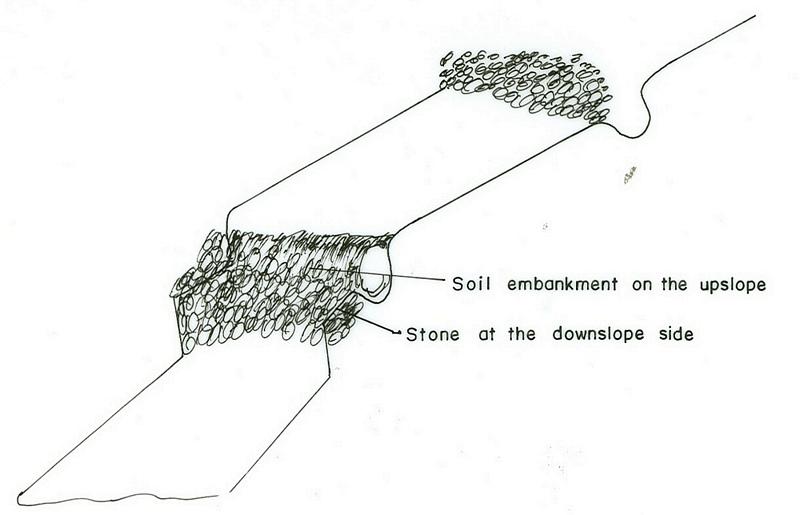
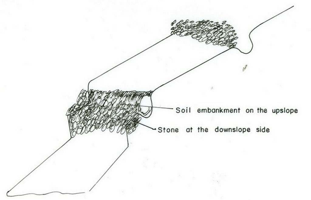
Stone faced soil bund is an embankemt constructed along the contour by the use of stone and soil as a construction material.
2.2 Detailed description of the Technology
Description:
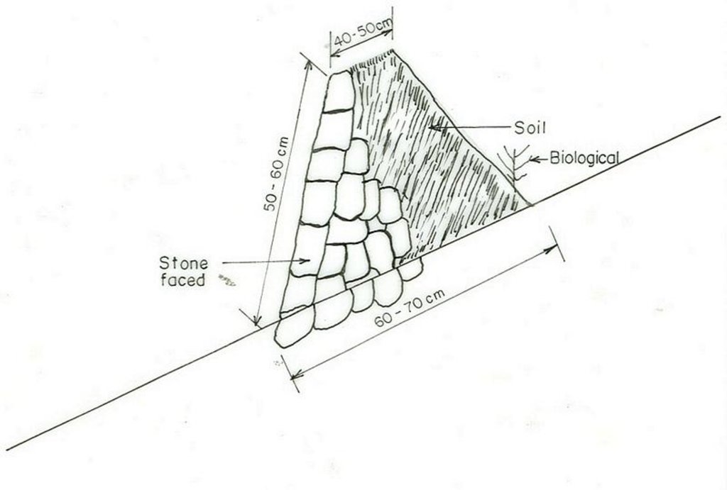
The technology is used in areas where there is no sufficient amount of stone and when the soil depth is shallow. It is established by digging soil and form the embankment. The stone is used at the downslope side for reinforcing the structure. Vegetation is planted on the upper part where there is soil. The purpose is to reduce runoff, decrease slope length, increase infiltration rate and then minimize soil erosion. The structure requires maintenance regularly. Since the stone walls are offten made of small stones, which are not stable. In order to properly stablize the structure livestock should not be allowed to graze on where the structure are placed. Checking for breaks after heavy storms and repair the breaks if any enhances the formation of bench terraces fast.
2.3 Photos of the Technology
2.5 Country/ region/ locations where the Technology has been applied and which are covered by this assessment
Country:
Ethiopia
Region/ State/ Province:
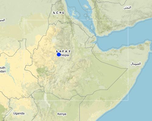
Amhara, South Gonder Zone
Further specification of location:
Mukur, Shelo, Gomit
Map
×2.6 Date of implementation
If precise year is not known, indicate approximate date:
- less than 10 years ago (recently)
2.7 Introduction of the Technology
Specify how the Technology was introduced:
- through projects/ external interventions
Comments (type of project, etc.):
from other regions, which started it first.
3. Classification of the SLM Technology
3.1 Main purpose(s) of the Technology
- reduce, prevent, restore land degradation
3.2 Current land use type(s) where the Technology is applied

Cropland
- Annual cropping
- Perennial (non-woody) cropping

Grazing land
Extensive grazing land:
- Semi-nomadism/ pastoralism
Comments:
Major land use problems (compiler’s opinion): overgrazing, land degradation, population pressure
Major land use problems (land users’ perception): low productivity, erosion
Semi-nomadism / pastoralism: free grazing
Grazingland comments: The size of livestock is decreasing because of shortage of land and poor fodder availablity.
Type of cropping system and major crops comments: legumes, teff, wheat, sorghum
3.3 Further information about land use
Water supply for the land on which the Technology is applied:
- rainfed
Comments:
Water supply: Also mixed rainfed-irrigated
Number of growing seasons per year:
- 1
Specify:
Longest growing period in days: 180 Longest growing period from month to month: Jun - Dec
3.4 SLM group to which the Technology belongs
- cross-slope measure
3.5 Spread of the Technology
Comments:
Total area covered by the SLM Technology is 12.51 m2.
hand tools and seedling transportation support is from GTZ and IFSP
3.6 SLM measures comprising the Technology
3.7 Main types of land degradation addressed by the Technology

soil erosion by water
- Wt: loss of topsoil/ surface erosion
- Wg: gully erosion/ gullying

chemical soil deterioration
- Cn: fertility decline and reduced organic matter content (not caused by erosion)
Comments:
Main type of degradation addressed: Wt: loss of topsoil / surface erosion
Secondary types of degradation addressed: Wg: gully erosion / gullying, Cn: fertility decline and reduced organic matter content
Main causes of degradation: deforestation / removal of natural vegetation (incl. forest fires), overgrazing, other human induced causes (specify) (agricultural causes), labour availability (lack of labour), land subdivision
Secondary causes of degradation: over-exploitation of vegetation for domestic use, other natural causes (avalanches, volcanic eruptions, mud flows, highly susceptible natural resources, extreme topography, etc.) specify, poverty / wealth (lack of captial), education, access to knowledge and support services (lack of knowledge), lack of enforcement of legislat./authority
3.8 Prevention, reduction, or restoration of land degradation
Specify the goal of the Technology with regard to land degradation:
- reduce land degradation
Comments:
Secondary goals: prevention of land degradation, rehabilitation / reclamation of denuded land
4. Technical specifications, implementation activities, inputs, and costs
4.1 Technical drawing of the Technology
4.2 Technical specifications/ explanations of technical drawing
Amhara
Technical knowledge required for field staff / advisors: high
Technical knowledge required for land users: moderate
Main technical functions: control of concentrated runoff: retain / trap
Secondary technical functions: control of dispersed runoff: retain / trap, reduction of slope length
Agronomic measure: Planting on bunds
Material/ species: Grasses, sesbenia, vetiver
Manure / compost / residues
Material/ species: from cow dung & green materials
Contour tillage
Remarks: Traditional farm tools
Aligned: -contour
Vegetative material: T : trees / shrubs, G : grass
Number of plants per (ha): 4500
Vertical interval between rows / strips / blocks (m): 1
Spacing between rows / strips / blocks (m): 0.05
Vertical interval within rows / strips / blocks (m): 0.2
Width within rows / strips / blocks (m): 0.7
Trees/ shrubs species: sesbania treclucern
Grass species: vetiver, bana, grass green gold
Bund/ bank: level
Vertical interval between structures (m): 2
Spacing between structures (m): 20
Depth of ditches/pits/dams (m): 0.3-0.4
Width of ditches/pits/dams (m): 0.6-1
Length of ditches/pits/dams (m): 110
Height of bunds/banks/others (m): 0.5-0.6
Width of bunds/banks/others (m): 0.6-1
Length of bunds/banks/others (m): 110
Slope (which determines the spacing indicated above): 15%
If the original slope has changed as a result of the Technology, the slope today is: 5%
Lateral gradient along the structure: 0%
Vegetation is used for stabilisation of structures.
Other type of management: change of management / intensity level - area closuer on small size
4.3 General information regarding the calculation of inputs and costs
other/ national currency (specify):
Birr
Indicate exchange rate from USD to local currency (if relevant): 1 USD =:
8.6
Indicate average wage cost of hired labour per day:
0.80
4.4 Establishment activities
| Activity | Type of measure | Timing | |
|---|---|---|---|
| 1. | production of planting materials | Vegetative | dry season |
| 2. | transporting planting materials | Vegetative | onset of rain |
| 3. | planting | Vegetative | rainy season |
| 4. | stone collection | Structural | dry |
| 5. | digging foundation | Structural | dry |
| 6. | construction of the bund | Structural | dry |
| 7. | area clouser | Management | the whole year |
4.5 Costs and inputs needed for establishment
| Specify input | Unit | Quantity | Costs per Unit | Total costs per input | % of costs borne by land users | |
|---|---|---|---|---|---|---|
| Labour | Labour | ha | 1.0 | 183.0 | 183.0 | 100.0 |
| Labour | Harvest | ha | 1.0 | 24.0 | 24.0 | 100.0 |
| Equipment | Animal traction | ha | 1.0 | 34.0 | 34.0 | 100.0 |
| Equipment | Tools | ha | 1.0 | 18.0 | 18.0 | |
| Plant material | Seeds | ha | 1.0 | 11.0 | 11.0 | 100.0 |
| Plant material | Seedlings | ha | 1.0 | 3.0 | 3.0 | |
| Total costs for establishment of the Technology | 273.0 | |||||
Comments:
Duration of establishment phase: 12 month(s)
4.6 Maintenance/ recurrent activities
| Activity | Type of measure | Timing/ frequency | |
|---|---|---|---|
| 1. | recycling crop residue | Agronomic | dry season / annual |
| 2. | seed bad preparation | Agronomic | dry season / annual |
| 3. | ploughing | Agronomic | dry season / annual |
| 4. | manure/fertilizer | Agronomic | beginning of rains / annual |
| 5. | weeding | Agronomic | end of rain / annual |
| 6. | harvesting | Agronomic | dry season / annual |
| 7. | replanting | Vegetative | rainy season /as required |
| 8. | pruning/pollarding | Vegetative | after rain /when there is enough biomass |
| 9. | collecting of stone | Structural | dry season/as required |
| 10. | repair the broken part | Structural | dry season/as required |
| 11. | stone facet soil fund | Management | dry season (when needed) / |
4.7 Costs and inputs needed for maintenance/ recurrent activities (per year)
| Specify input | Unit | Quantity | Costs per Unit | Total costs per input | % of costs borne by land users | |
|---|---|---|---|---|---|---|
| Labour | Labour | ha | 1.0 | 25.0 | 25.0 | 100.0 |
| Total costs for maintenance of the Technology | 25.0 | |||||
Comments:
it is for stone faced soil bund construction
4.8 Most important factors affecting the costs
Describe the most determinate factors affecting the costs:
availability of stone, slope, soil depth
5. Natural and human environment
5.1 Climate
Annual rainfall
- < 250 mm
- 251-500 mm
- 501-750 mm
- 751-1,000 mm
- 1,001-1,500 mm
- 1,501-2,000 mm
- 2,001-3,000 mm
- 3,001-4,000 mm
- > 4,000 mm
Specifications/ comments on rainfall:
950-1400
Agro-climatic zone
- sub-humid
- semi-arid
80-85% of the areas is subhumid
15-20% of the area
5.2 Topography
Slopes on average:
- flat (0-2%)
- gentle (3-5%)
- moderate (6-10%)
- rolling (11-15%)
- hilly (16-30%)
- steep (31-60%)
- very steep (>60%)
Landforms:
- plateau/plains
- ridges
- mountain slopes
- hill slopes
- footslopes
- valley floors
Altitudinal zone:
- 0-100 m a.s.l.
- 101-500 m a.s.l.
- 501-1,000 m a.s.l.
- 1,001-1,500 m a.s.l.
- 1,501-2,000 m a.s.l.
- 2,001-2,500 m a.s.l.
- 2,501-3,000 m a.s.l.
- 3,001-4,000 m a.s.l.
- > 4,000 m a.s.l.
Comments and further specifications on topography:
Altitudinal zone: 1501-2000 m a.s.l. (mid altitudes, ranked 1) and 2,001-2,500 m a.s.l. (better rainfall, ranked 2)
Landforms: Footslopes (big and deep gullies exist, ranked 1) and hill slopes (small gullies, ranked 2)
Slopes on average: Rolling (medium soil depth, ranked 1), moderate (deep soil, ranked 2) and hilly (shallow soil, ranked 3)
5.3 Soils
Soil depth on average:
- very shallow (0-20 cm)
- shallow (21-50 cm)
- moderately deep (51-80 cm)
- deep (81-120 cm)
- very deep (> 120 cm)
Soil texture (topsoil):
- coarse/ light (sandy)
- medium (loamy, silty)
Topsoil organic matter:
- medium (1-3%)
- low (<1%)
If available, attach full soil description or specify the available information, e.g. soil type, soil PH/ acidity, Cation Exchange Capacity, nitrogen, salinity etc.
Soil depth on average: Shallow (gentle slopes, ranked 1) and very shallow (highly steep slopes, ranked 2)
Soil texture: Medium (rolling, ranked 1) and coarse/light (helly, ranked 2)
Soil fertility: Medium (ranked 1) and low (ranked 2)
Topsoil organic matter: Medium (ranked 1, flat terrain) and low (on all land, ranked 2)
Soil drainage/infiltration: Medium
5.6 Characteristics of land users applying the Technology
Market orientation of production system:
- subsistence (self-supply)
- mixed (subsistence/ commercial
Off-farm income:
- less than 10% of all income
Relative level of wealth:
- poor
- average
Level of mechanization:
- animal traction
Indicate other relevant characteristics of the land users:
Population density: 100-200 persons/km2
Annual population growth: 2% - 3%
and own 11% of the land.
and own 72% of the land.
and own 27% of the land.
5.7 Average area of land owned or leased by land users applying the Technology
- < 0.5 ha
- 0.5-1 ha
- 1-2 ha
- 2-5 ha
- 5-15 ha
- 15-50 ha
- 50-100 ha
- 100-500 ha
- 500-1,000 ha
- 1,000-10,000 ha
- > 10,000 ha
Comments:
The size is shrinking every year/more and more since grazing land is converted to cultivated lands
5.8 Land ownership, land use rights, and water use rights
Land ownership:
- state
- individual, not titled
Land use rights:
- individual
6. Impacts and concluding statements
6.1 On-site impacts the Technology has shown
Socio-economic impacts
Production
crop production
Comments/ specify:
field crop
fodder production
Comments/ specify:
legumes & grass
fodder quality
Comments/ specify:
legumes & grass
Socio-cultural impacts
conflict mitigation
Ecological impacts
Soil
soil cover
Comments/ specify:
due to SWC measure
soil loss
Comments/ specify:
due to constructed stone faced soil bund
6.2 Off-site impacts the Technology has shown
reliable and stable stream flows in dry season
downstream flooding
6.4 Cost-benefit analysis
How do the benefits compare with the establishment costs (from land users’ perspective)?
Short-term returns:
positive
Long-term returns:
positive
How do the benefits compare with the maintenance/ recurrent costs (from land users' perspective)?
Short-term returns:
positive
Long-term returns:
positive
6.5 Adoption of the Technology
Comments:
75% of land user families have adopted the Technology with external material support
4 land user families have adopted the Technology with external material support
Comments on acceptance with external material support: estimates
75% of land user families have adopted the Technology without any external material support
4 land user families have adopted the Technology without any external material support
Comments on spontaneous adoption: estimates
There is a moderate trend towards spontaneous adoption of the Technology
Comments on adoption trend: moderate
6.7 Strengths/ advantages/ opportunities of the Technology
| Strengths/ advantages/ opportunities in the land user’s view |
|---|
|
decrease soil erosion How can they be sustained / enhanced? continous maintenance and limit livestock movment |
| increase soil depth |
| increase production |
| Strengths/ advantages/ opportunities in the compiler’s or other key resource person’s view |
|---|
|
decrease slope length How can they be sustained / enhanced? continuous maintenance |
| increase infiltration |
6.8 Weaknesses/ disadvantages/ risks of the Technology and ways of overcoming them
| Weaknesses/ disadvantages/ risks in the land user’s view | How can they be overcome? |
|---|---|
| loss of land | increase the productivity per unit area of land |
| pest | use of pesticide |
Links and modules
Expand all Collapse allLinks
No links
Modules
No modules


