Soil faced deep trench bunds [Ethiopia]
- Creation:
- Update:
- Compiler: Eyasu Yazew
- Editor: –
- Reviewer: Fabian Ottiger
Nay Hamed Amik Metrebwi Zala
technologies_1197 - Ethiopia
View sections
Expand all Collapse all1. General information
1.2 Contact details of resource persons and institutions involved in the assessment and documentation of the Technology
SLM specialist:
Sibhatleab Mulugeta
+251 910 170415
Mekelle University
P.O.Box 231, Mekelle, Ethiopia
Ethiopia
SLM specialist:
Weldearegay Kifle
+251 910 170415
Mekelle University
P.O.Box 231, Mekelle, Ethiopia
Ethiopia
Name of the institution(s) which facilitated the documentation/ evaluation of the Technology (if relevant)
Mekelle University (Mekelle University) - Ethiopia1.3 Conditions regarding the use of data documented through WOCAT
When were the data compiled (in the field)?
10/11/2012
The compiler and key resource person(s) accept the conditions regarding the use of data documented through WOCAT:
Ja
2. Description of the SLM Technology
2.1 Short description of the Technology
Definition of the Technology:
Compacted soil bund constructed following a contour using a soil excavated from deep trenches on the up-slope side.
2.2 Detailed description of the Technology
Description:
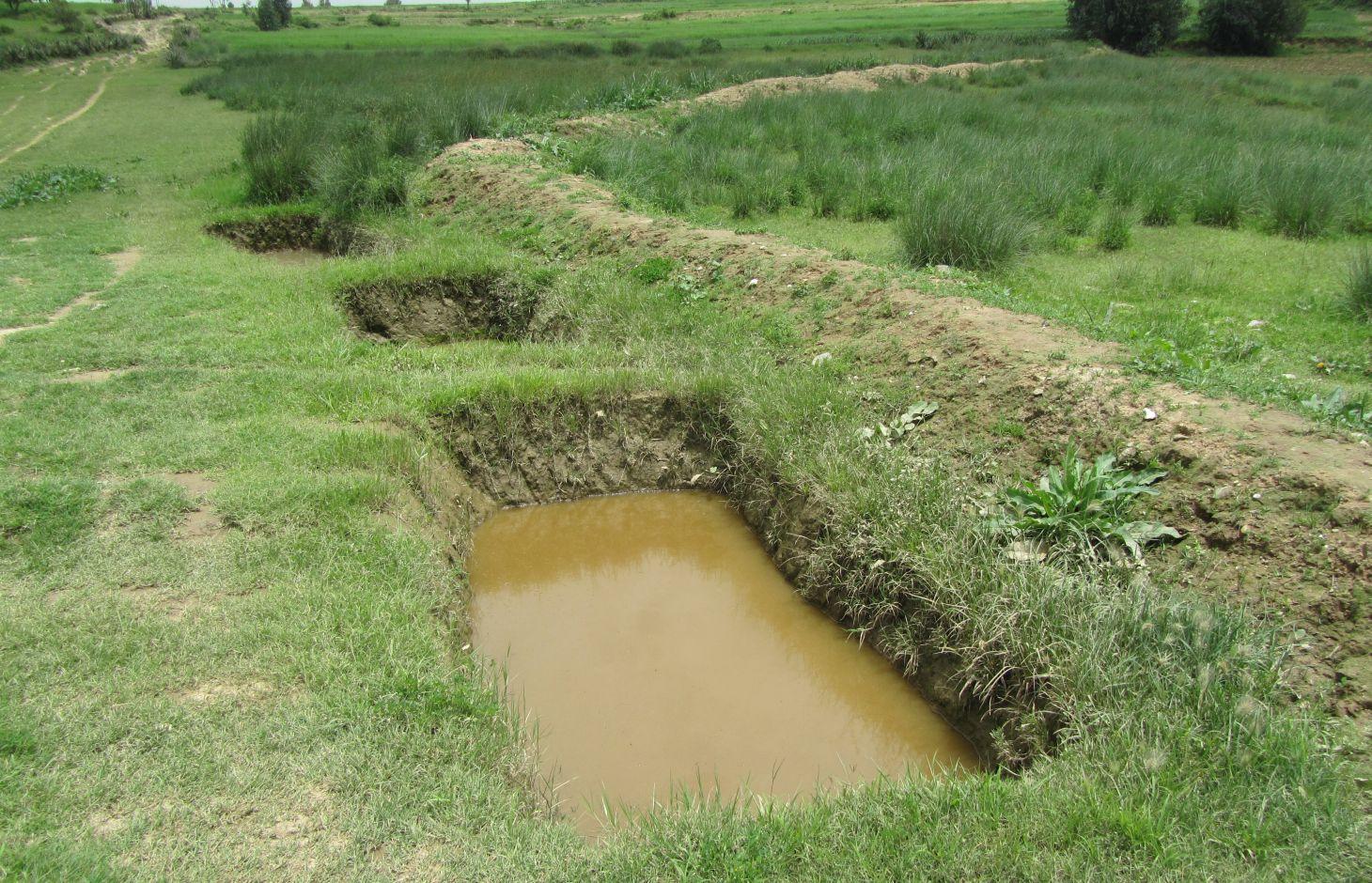
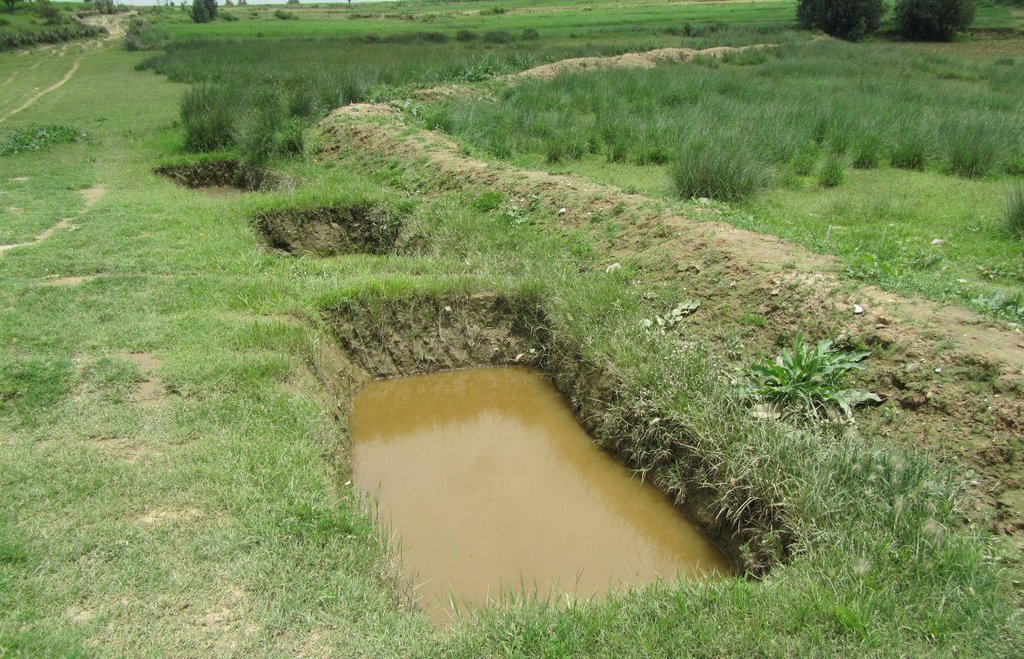
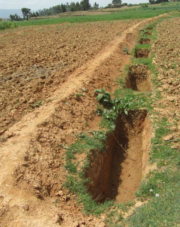
Soil faced deep trench bund is constructed by excavating trenches of 1 m deep, 0.5 - 1 m wide and 2 - 3.5 m long with spacing between trenches of 0.3 - 0.5 m along the contour and using the excavated soil to construct a compacted bund downslope. The smaller dimensions are usually used in cultivated lands while the larger are implemented in grazing lands.
Purpose of the Technology: Soil faced deep trench bund decreases slope length, runoff velocity and soil loss; and increases runoff harvesting, soil moisture and groundwater recharge.
Establishment / maintenance activities and inputs: Construction of soil faced deep trench bund involves alignment of a contour, excavation of trenches, construction and compaction of bund and planting grass, while the maintenance involves dredging of sediment from the trenches and use it for reinforcing the embankment.
Line level, tape meter, digging hoe, shovel and grass are needed for the establishment and maintenance.
Natural / human environment: The technology is implemented in moderate (5 - 8%) and hill (8 - 16%) slopes and in medium and heavy soil types of at least 1 m depth. It reduces runoff amount and velocity thereby decreasing soil loss and desertification/land degradation. It also improves soil moisture availability and groundwater recharge by encouraging lateral and vertical movement of water respectively.
It is mostly constructed using communal labour and there is an encouraging trend of spontaneous adoption. The technology is witnessed to be increasing crop and fodder production thereby improving the livelihood of the land users. It, however, is labour intensive and slightly reduces farm size.
2.3 Photos of the Technology
2.5 Country/ region/ locations where the Technology has been applied and which are covered by this assessment
Country:
Ethiopia
Region/ State/ Province:
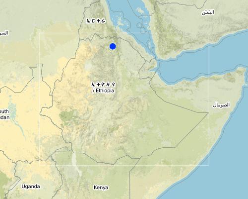
Tigray
Further specification of location:
Kilte Awlaelo
Map
×2.7 Introduction of the Technology
Specify how the Technology was introduced:
- through projects/ external interventions
3. Classification of the SLM Technology
3.1 Main purpose(s) of the Technology
- reduce, prevent, restore land degradation
3.2 Current land use type(s) where the Technology is applied

Cropland
- Annual cropping
Main crops (cash and food crops):
Major food crop: Wheat, barley, teff, maize, sorghum
Major other crops: Oil seeds

Grazing land
Intensive grazing/ fodder production:
- Cut-and-carry/ zero grazing
- Improved pastures
Comments:
Major land use problems (compiler’s opinion): Soil erosion, overgrazing, decline of soil fertility and productivity.
Major land use problems (land users’ perception): Soil erosion, reduced soil depth, fertility and productivity.
3.3 Further information about land use
Water supply for the land on which the Technology is applied:
- rainfed
Number of growing seasons per year:
- 1
Specify:
Longest growing period in days: 150 Longest growing period from month to month: June - November
Livestock density (if relevant):
50-100 LU /km2
3.4 SLM group to which the Technology belongs
- cross-slope measure
- ground water management
3.5 Spread of the Technology
Specify the spread of the Technology:
- evenly spread over an area
If the Technology is evenly spread over an area, indicate approximate area covered:
- 10-100 km2
3.6 SLM measures comprising the Technology

vegetative measures
- V2: Grasses and perennial herbaceous plants

structural measures
- S2: Bunds, banks
Comments:
Main measures: structural measures
Secondary measures: vegetative measures
Type of vegetative measures: aligned: -contour
3.7 Main types of land degradation addressed by the Technology

soil erosion by water
- Wt: loss of topsoil/ surface erosion
- Wg: gully erosion/ gullying

biological degradation
- Bc: reduction of vegetation cover
Comments:
Main type of degradation addressed: Wt: loss of topsoil / surface erosion
Secondary types of degradation addressed: Wg: gully erosion / gullying, Bc: reduction of vegetation cover
Main causes of degradation: soil management, overgrazing, Heavy / extreme rainfall (intensity/amounts), population pressure
Secondary causes of degradation: crop management (annual, perennial, tree/shrub) (Crop residues are removed during harvesting), over-exploitation of vegetation for domestic use, change of seasonal rainfall, droughts, land tenure, poverty / wealth, education, access to knowledge and support services
3.8 Prevention, reduction, or restoration of land degradation
Specify the goal of the Technology with regard to land degradation:
- reduce land degradation
- restore/ rehabilitate severely degraded land
Comments:
Main goals: mitigation / reduction of land degradation
Secondary goals: rehabilitation / reclamation of denuded land
4. Technical specifications, implementation activities, inputs, and costs
4.1 Technical drawing of the Technology
4.2 Technical specifications/ explanations of technical drawing
Soil faced deep trench bunds are structures constructed by excavating trenches following the contour and using the excavated soil to establish compacted bund on the lower side.
Location: Tigray. Kilte Awlaelo
Date: 10/10/2014
Technical knowledge required for field staff / advisors: moderate
Technical knowledge required for land users: low
Main technical functions: control of dispersed runoff: retain / trap, reduction of slope length
Secondary technical functions: increase of infiltration, increase / maintain water stored in soil, increase of groundwater level / recharge of groundwater, sediment retention / trapping, sediment harvesting
Aligned: -contour
Vegetative material: G : grass
Number of plants per (ha): 1600
Vertical interval between rows / strips / blocks (m): 1 - 1.2
Spacing between rows / strips / blocks (m): 10 - 15
Vertical interval within rows / strips / blocks (m): 0.5
Grass species: Elephant grass is mostly planted on the bunds in a single row at spacing of 0.5 m.
Slope (which determines the spacing indicated above): 6.5 and 12%
Gradient along the rows / strips: 0%
Bund/ bank: level
Vertical interval between structures (m): 1 - 1.2
Spacing between structures (m): 10 - 15
Depth of ditches/pits/dams (m): 1
Width of ditches/pits/dams (m): 0.5 - 1
Length of ditches/pits/dams (m): 2 - 3.5
Height of bunds/banks/others (m): 0.75 - 1
Width of bunds/banks/others (m): 0.3 - 1.2
Length of bunds/banks/others (m): 60 - 100
Construction material (earth): Soil excavated from the trenches is used to construct bunds
Slope (which determines the spacing indicated above): 6.5 and 12%
Lateral gradient along the structure: 0%
Vegetation is used for stabilisation of structures.
4.3 General information regarding the calculation of inputs and costs
other/ national currency (specify):
Birr
Indicate exchange rate from USD to local currency (if relevant): 1 USD =:
18.0
Indicate average wage cost of hired labour per day:
2.50
4.4 Establishment activities
| Activity | Type of measure | Timing | |
|---|---|---|---|
| 1. | Purchase of elephant grass | Vegetative | June/July |
| 2. | Grass plantation | Vegetative | July |
| 3. | Contour alignment, marking trench dimensions, trench excavation and construction and compaction of bund | Structural | January - May |
4.5 Costs and inputs needed for establishment
| Specify input | Unit | Quantity | Costs per Unit | Total costs per input | % of costs borne by land users | |
|---|---|---|---|---|---|---|
| Labour | Labour | ha | 1.0 | 2119.0 | 2119.0 | 60.0 |
| Equipment | Tools | ha | 1.0 | 44.0 | 44.0 | |
| Plant material | Seedlings | ha | 1.0 | 36.0 | 36.0 | |
| Total costs for establishment of the Technology | 2199.0 | |||||
Comments:
Duration of establishment phase: 48 month(s)
4.6 Maintenance/ recurrent activities
| Activity | Type of measure | Timing/ frequency | |
|---|---|---|---|
| 1. | Dredging of deposited sediment from trenches and compacting it on the bund | Structural | January - May |
4.7 Costs and inputs needed for maintenance/ recurrent activities (per year)
| Specify input | Unit | Quantity | Costs per Unit | Total costs per input | % of costs borne by land users | |
|---|---|---|---|---|---|---|
| Labour | Labour | ha | 1.0 | 833.0 | 833.0 | 100.0 |
| Total costs for maintenance of the Technology | 833.0 | |||||
Comments:
Machinery/ tools: Digging hoe, shovel (Costs are included in the structural measures), Line level, tape meter, digging hoe, shovel
The cost was calculated for an average bund length and spacing of 80 m and 12.5 m respectively, which would result in a construction of 10 bunds per ha. In addition, an average trench length and spacing between trenches along the contour of 2.75 m and 0.4 m was considered respectively resulting in 25 trenches per bund and 250 trenches per ha.
The excavation of one deep trench and construction of the corresponding bund requires 3 person days during establishment while maintaining it needs 1.5 person days per year. A single row of grass is planted on the bunds at 0.5 m interval and a person is assumed to plant about 100 seedlings per day. The cost calculation rates apply to 2012. Accordingly, the price of single elephant grass is 0.4 Birr and the daily labour wage is 40 Birr for light work such as grass planting and 50 Birr for medium work such as trench excavation.
4.8 Most important factors affecting the costs
Describe the most determinate factors affecting the costs:
Labour, slope, landuse, soil depth.
5. Natural and human environment
5.1 Climate
Annual rainfall
- < 250 mm
- 251-500 mm
- 501-750 mm
- 751-1,000 mm
- 1,001-1,500 mm
- 1,501-2,000 mm
- 2,001-3,000 mm
- 3,001-4,000 mm
- > 4,000 mm
Specifications/ comments on rainfall:
Average rainfall of 450-550 mm, Main rainy season from Mid-June to August
Agro-climatic zone
- semi-arid
Thermal climate class: subtropics
5.2 Topography
Slopes on average:
- flat (0-2%)
- gentle (3-5%)
- moderate (6-10%)
- rolling (11-15%)
- hilly (16-30%)
- steep (31-60%)
- very steep (>60%)
Landforms:
- plateau/plains
- ridges
- mountain slopes
- hill slopes
- footslopes
- valley floors
Altitudinal zone:
- 0-100 m a.s.l.
- 101-500 m a.s.l.
- 501-1,000 m a.s.l.
- 1,001-1,500 m a.s.l.
- 1,501-2,000 m a.s.l.
- 2,001-2,500 m a.s.l.
- 2,501-3,000 m a.s.l.
- 3,001-4,000 m a.s.l.
- > 4,000 m a.s.l.
Comments and further specifications on topography:
Slopes on average: An average slope of 6.5% is taken for moderate slope and 12% for hill slope.
5.3 Soils
Soil depth on average:
- very shallow (0-20 cm)
- shallow (21-50 cm)
- moderately deep (51-80 cm)
- deep (81-120 cm)
- very deep (> 120 cm)
Soil texture (topsoil):
- medium (loamy, silty)
- fine/ heavy (clay)
Topsoil organic matter:
- medium (1-3%)
- low (<1%)
If available, attach full soil description or specify the available information, e.g. soil type, soil PH/ acidity, Cation Exchange Capacity, nitrogen, salinity etc.
Soil depth on average: The deep trench should usually be 1 m deep.
Soil texture: Medium (ranked 1) and fine/heavy (ranked 2, Appropriate in case of grazing lands.)
Soil fertility: Low (ranked 1) and medium (Clay soils in rehabilitated grazing lands, ranked 2.)
Topsoil organic matter: Low (more in cultivate lands, ranked 1) and Medium (more in grazing lands, ranked 2)
Soil drainage/infiltration is medium (ranked 1) and poor (in clay soils, ranked 2)
Soil water storage capacity is medium (ranked 1) and high (ranked 2)
5.4 Water availability and quality
Ground water table:
5-50 m
Availability of surface water:
poor/ none
Water quality (untreated):
for agricultural use only (irrigation)
5.5 Biodiversity
Species diversity:
- low
5.6 Characteristics of land users applying the Technology
Market orientation of production system:
- subsistence (self-supply)
Off-farm income:
- less than 10% of all income
Relative level of wealth:
- poor
- average
Individuals or groups:
- groups/ community
Level of mechanization:
- manual work
- animal traction
Gender:
- women
- men
Indicate other relevant characteristics of the land users:
Land users applying the Technology are mainly common / average land users
Population density: 100-200 persons/km2
Annual population growth: 2% - 3%
10% of the land users are rich and own 10% of the land.
60% of the land users are average wealthy and own 55% of the land (35 birr/person/day).
30% of the land users are poor and own 35% of the land.
5.7 Average area of land owned or leased by land users applying the Technology
- < 0.5 ha
- 0.5-1 ha
- 1-2 ha
- 2-5 ha
- 5-15 ha
- 15-50 ha
- 50-100 ha
- 100-500 ha
- 500-1,000 ha
- 1,000-10,000 ha
- > 10,000 ha
Is this considered small-, medium- or large-scale (referring to local context)?
- small-scale
Comments:
Average land holding is 0.6 ha per household.
5.8 Land ownership, land use rights, and water use rights
Land ownership:
- state
Land use rights:
- communal (organized)
- individual
5.9 Access to services and infrastructure
health:
- poor
- moderate
- good
education:
- poor
- moderate
- good
technical assistance:
- poor
- moderate
- good
employment (e.g. off-farm):
- poor
- moderate
- good
markets:
- poor
- moderate
- good
energy:
- poor
- moderate
- good
roads and transport:
- poor
- moderate
- good
drinking water and sanitation:
- poor
- moderate
- good
financial services:
- poor
- moderate
- good
Mobile communication:
- poor
- moderate
- good
6. Impacts and concluding statements
6.1 On-site impacts the Technology has shown
Socio-economic impacts
Production
crop production
fodder production
fodder quality
animal production
production area
Income and costs
farm income
workload
Socio-cultural impacts
food security/ self-sufficiency
health situation
Comments/ specify:
Increased investment in health as a result of increased income.
community institutions
SLM/ land degradation knowledge
situation of socially and economically disadvantaged groups
Improved livelihoods and human well-being
Ecological impacts
Water cycle/ runoff
harvesting/ collection of water
surface runoff
groundwater table/ aquifer
Soil
soil moisture
soil cover
soil loss
6.2 Off-site impacts the Technology has shown
water availability
downstream flooding
downstream siltation
damage on neighbours' fields
6.4 Cost-benefit analysis
How do the benefits compare with the establishment costs (from land users’ perspective)?
Short-term returns:
positive
Long-term returns:
positive
How do the benefits compare with the maintenance/ recurrent costs (from land users' perspective)?
Short-term returns:
positive
Long-term returns:
very positive
6.5 Adoption of the Technology
If available, quantify (no. of households and/ or area covered):
8735
Of all those who have adopted the Technology, how many have did so spontaneously, i.e. without receiving any material incentives/ payments?
- 50-90%
Comments:
27% of land user families have adopted the Technology with external material support
2541 land user families have adopted the Technology with external material support
73% of land user families have adopted the Technology without any external material support
6194 land user families have adopted the Technology without any external material support
There is a moderate trend towards spontaneous adoption of the Technology
6.7 Strengths/ advantages/ opportunities of the Technology
| Strengths/ advantages/ opportunities in the land user’s view |
|---|
|
Reduce soil erosion and increase soil fertility How can they be sustained / enhanced? Continuous maintenance and excavation of sediment |
|
Increase soil moisture and yield How can they be sustained / enhanced? Planting grass, sunflower and other fodder plants on the bund to increase conservation as well as economic benefits |
|
Reduce surface runoff, increase water storage in trenches and recharging downstream springs How can they be sustained / enhanced? Continuous maintenance and excavation of sediment |
| Strengths/ advantages/ opportunities in the compiler’s or other key resource person’s view |
|---|
|
Decreased slope length, reduced runoff amount and velocity and soil erosion How can they be sustained / enhanced? Continuous maintenance of the structures and controlled grazing of the grass |
|
Increase in rainwater harvesting, soil moisture and groundwater recharge How can they be sustained / enhanced? Continuous maintenance of the structures |
|
Increase in crop and fodder production How can they be sustained / enhanced? Planting improved and high yielding crop and fodder varieties |
6.8 Weaknesses/ disadvantages/ risks of the Technology and ways of overcoming them
| Weaknesses/ disadvantages/ risks in the land user’s view | How can they be overcome? |
|---|---|
| Reduced farm land | Increase the productivity of the bunds. |
| Increased labour requirement | Mass mobilization and/or increased incentives to households. |
| Weaknesses/ disadvantages/ risks in the compiler’s or other key resource person’s view | How can they be overcome? |
|---|---|
| Labour intensive | Mass mobilization and improving the design. |
| Reduced farm land | Increasing the spacing and reduce dimension of bunds without compromising their effectiveness. |
7. References and links
7.2 References to available publications
Title, author, year, ISBN:
Staff members of the Kilte Awlaelo Wereda Office of Agriculture and Rural Development
Title, author, year, ISBN:
Carucci, V. (2000). Guidelines on Water Harvesting and Soil Conservation for Moisture Deficit Areas in Ethiopia:the productive use of water and soil. First draft manual for trainers, Addis Ababa, Ethiopia.
Title, author, year, ISBN:
Lakew, D., Carucci, V., Asrat, W. and Yitayew, A. (2005). Community Based Participatory Watershed Development: A guideline. Part I, first edition, Ministry of Agriculture and Rural Development, Addis Ababa, Ethiopia.
Links and modules
Expand all Collapse allLinks
No links
Modules
No modules


