Технология очистки родника и водопойный пункт [Kyrgyzstan]
- Creation:
- Update:
- Compiler: Abdybek Asanaliev
- Editor: –
- Reviewer: Deborah Niggli
Булакты тазалоо
technologies_1538 - Kyrgyzstan
View sections
Expand all Collapse all1. General information
1.2 Contact details of resource persons and institutions involved in the assessment and documentation of the Technology
Name of the institution(s) which facilitated the documentation/ evaluation of the Technology (if relevant)
Kyrgyz Agrarian University (Kyrgyz Agrarian University) - Kyrgyzstan1.3 Conditions regarding the use of data documented through WOCAT
When were the data compiled (in the field)?
26/12/2011
The compiler and key resource person(s) accept the conditions regarding the use of data documented through WOCAT:
Ja
1.4 Declaration on sustainability of the described Technology
Is the Technology described here problematic with regard to land degradation, so that it cannot be declared a sustainable land management technology?
Nee
2. Description of the SLM Technology
2.1 Short description of the Technology
Definition of the Technology:
Технология очистка родника и строительство водопойного пункта для животных.
2.2 Detailed description of the Technology
Description:
В селе Саз имеется около 4 тысяч га пастбищ. Они подразделяются на присельные, интенсивные и отгонные. Присельные пастбища составляют около 30% от всей площади пастбищ. Их используют весеннее, осеннее и зимнее время. Летом животных пасут на интенсивных и отгонных пастбищах.
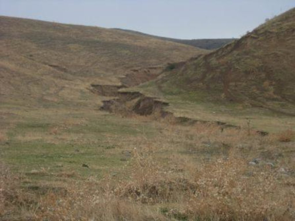
Одним из недостатков присельных пастбищных земель является нехватка воды для водопоя животных. Примерно к полудню пастухи пригоняют животных к речке Сокулук для водопоя. Таким образом в день животные совершают 4 перехода. Это приводит к образованию на пастбищах многочисленных тропинок, способствующие эрозию почв. Пастбищная эрозия ярко выражена на подходах к речке и селу.
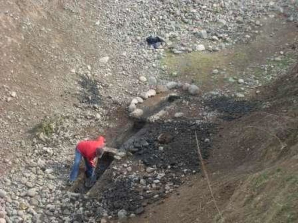
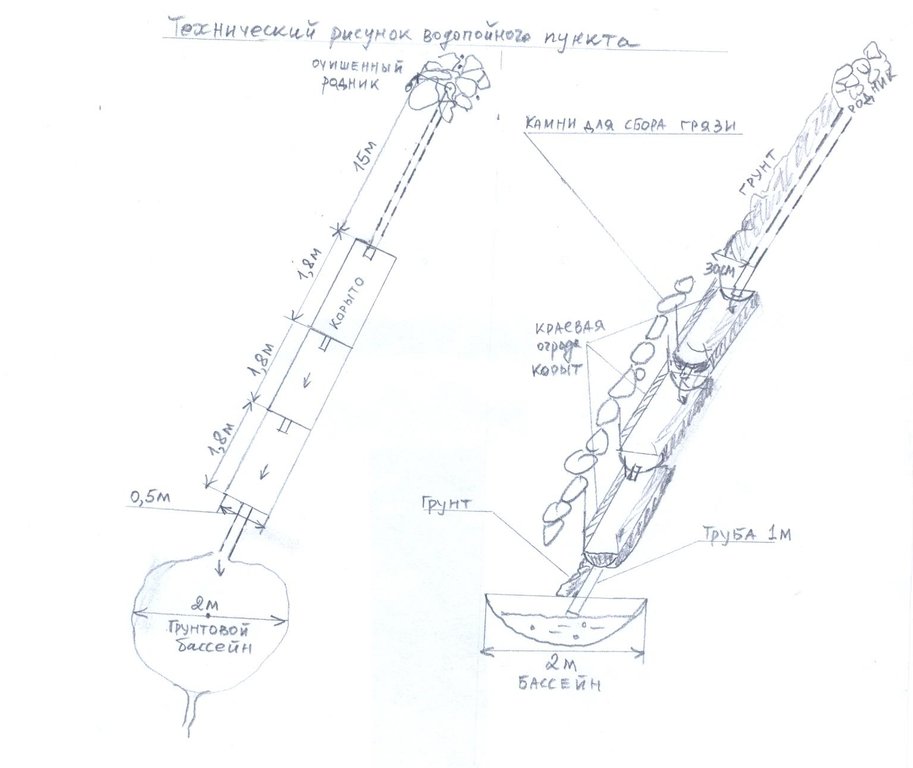
В то же время в одном из ущелий имеется родник. Но выход воды на поверхность затруднен в связи с засорением камнями и илом. Слабая струя не может удовлетворить потребность животных в воде и все животные устремляются к реке для водопоя. Житель села Айткулов Дуйшен при поддержке ОФ «САМР-Алатоо» и местной администрации «САЗ» очистил родник и построил водопойный пункт для животных. Сначала определено точное место выклинивания воды и очищено от грязевой массы. Ниже 15 метров от этого места построены 3 сообщающиеся корыта для водопоя. Длина каждого корыта 1,8 метра, ширина 0,50 метра и глубина 0,50 метра. Каждая последующее корыто размещено ниже предыдущего, и вода поступает в виде каскада. Ниже уровнем от корыт создан грунтовый бассейн с окружность 2 метра. Края корыт приподняты от земли на 0, 20 метра от земли для предотвращения засорения воды камнями и землей. В конце строительства корыта соединены трубой с местом выхода воды. Место выхода воды обложено крупными камнями, труба уложена в небольшую траншею с глубиной 0, 30 метра. На этом пункте могут одновременно пить воду 15-17 животных в зависимости их величины. В результате осуществления технологии животные совершаю 2 перехода: утром и вечером. На эрозионных тропах появляются не поедаемые растения.
Обеспечение животных на пастбище водой и предотвращения пастбищной эрозии.
Применение технологии стало возможным после обучающего семинара - «Устойчивое использование природных ресурсов через почво и водосберегающие технологии», организованный Общественным Фондом (ОФ) «САMP-Алатоо». В ходе семинара, сами участники из этого села, используя коллекций почво и водосберегающих технологий (ПВСТ) от «САMP-Алатоо» разработали свои проекты ПВСТ. Одну из этих групп участников возглавил Айткулов Дуйшен и разработали проект очистки родника и строительства водопоя животных. Каждая группа вносила свой вклад на внедрение технологии и в то же время (ОФ) «САMP-Алатоо» финансировал часть затрат.
Родник расположен на высоте 1600 метров над уровнем моря в ущелье Сары Коо. Естественная растительность эфемерно-разнотравно-злаковая, по северным склонам произрастает кустарниковая растительность представленная Спиреей (Таволга), Барбарисом, Боярышником и Шиповником. На склонах ярко выражены эрозионные тропы, лишенные растительности. На дне ущелий развивается овражная эрозия. Люди используют присельние, интенсивные и отгонные пастбищах на основе «Пастбищного законодательства Кыргызской Республики». Пастбищный комитет еще не организован. В селе не практикуют использование пастбищеоборота, нет плана использования пастбищ. Но есть решение местной администрации о датах выгона животных на интенсивные и отгонные пастбища для защиты посевов от потравы животными. Предусмотрена административная ответственность для жителей при повреждении посевов сельскохозяйственных культур, животными.
На пастбищах обитают дикие животные (заяц, лиса, волк, шакалы и др.). Зимнее время волки чаще нападают на домашний скот на пастбищах. На присельных пастбищах распространена пастбищная эрозия, начавшееся еще советское время. На пастбищах увеличивается количествПочвы светло-каштановые, формирующиеся на глнисто-супесчанных и хрящеватых галечниках. Структура почвы способствует получению хороших урожаев сельскохозяйственных культур. Сельскохозяйственные поля орошаемые, недостаток поливной воды не испытывается. За оросительную воду жители платят согласно установленных государством расценок. Огородные участки и обрабатываемые поля частные.
В горах имеются сенокосные участки, где жители в летнее время заготавливают сено для скота в зимний период. Сенокосные участки в основном расположены на северных склонах и представлены злаково-разнотравной растительностью.
Жители села обеспечены питьевой водой на 100%. Имеются фельдшерско-акушерский пункт, средняя школа, клуб и мечеть. Не грамотных жителей нет.
2.3 Photos of the Technology
2.5 Country/ region/ locations where the Technology has been applied and which are covered by this assessment
Country:
Kyrgyzstan
Region/ State/ Province:
Кыргызская Республика
Further specification of location:
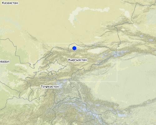
Сокулукский район
Map
×2.6 Date of implementation
If precise year is not known, indicate approximate date:
- more than 50 years ago (traditional)
2.7 Introduction of the Technology
Specify how the Technology was introduced:
- through projects/ external interventions
Comments (type of project, etc.):
Технологию внедрили в 2006 г
3. Classification of the SLM Technology
3.1 Main purpose(s) of the Technology
- improve production
3.2 Current land use type(s) where the Technology is applied

Grazing land
Extensive grazing land:
- Semi-nomadism/ pastoralism

Mixed (crops/ grazing/ trees), incl. agroforestry
- Agro-pastoralism
Comments:
Деградация пастбищных земель в результате перевыпаса
увеличение поголовья животных , снижение урожайности пастбищ в результате вытаптывания животными.
Летом отгоняют на высокогорное пастбище
Осенью после уборки урожая, поля используются как пастбище.
3.3 Further information about land use
Water supply for the land on which the Technology is applied:
- full irrigation
Number of growing seasons per year:
- 1
Specify:
Умеренная зона, ясно выраженным четырьмя сезонами
Livestock density (if relevant):
1-10 УГ/км2
3.4 SLM group to which the Technology belongs
- irrigation management (incl. water supply, drainage)
- surface water management (spring, river, lakes, sea)
3.5 Spread of the Technology
Comments:
1 км2 m2.
Данная технология обслуживает пастбищный участок с площадью 100 га
3.6 SLM measures comprising the Technology

structural measures
- S11: Others
3.7 Main types of land degradation addressed by the Technology

soil erosion by water
- Wg: gully erosion/ gullying
- Wc: coastal erosion
Comments:
чрезмерный выпас (Увеличение поголовья животных, отсутствие плана выпаса), засуха (При засухе в родниках уменьшается вода)
управление землеи (Отсутствие ухода за родниками)
3.8 Prevention, reduction, or restoration of land degradation
Specify the goal of the Technology with regard to land degradation:
- reduce land degradation
4. Technical specifications, implementation activities, inputs, and costs
4.1 Technical drawing of the Technology
4.2 Technical specifications/ explanations of technical drawing
в рисунке слева указано общий план родника и водопойных корыт. Справа указан поперечный разрез участка.
Location: село Саз. Чуйская область
Date: 26/12/2011
высокий (Нужно знать свойства грунта и воды.)
средний (Необходимы базовые знания о строительстве.)
сбор воды / повышение водоснабжения
Для рытья траншеи под корыта
Использованы для обкладывания начало родника.
Для укрепления водопойных корыт.
4.3 General information regarding the calculation of inputs and costs
other/ national currency (specify):
кыргызский сом
Indicate exchange rate from USD to local currency (if relevant): 1 USD =:
40.0
Indicate average wage cost of hired labour per day:
10.00
4.4 Establishment activities
| Activity | Type of measure | Timing | |
|---|---|---|---|
| 1. | очистка родника | Structural | Весной |
| 2. | строительство водопойного пункта | Structural | Весной |
4.5 Costs and inputs needed for establishment
| Specify input | Unit | Quantity | Costs per Unit | Total costs per input | % of costs borne by land users | |
|---|---|---|---|---|---|---|
| Labour | None | 1.0 | 112.0 | 112.0 | 100.0 | |
| Construction material | None | 1.0 | 200.0 | 200.0 | 30.0 | |
| Total costs for establishment of the Technology | 312.0 | |||||
4.6 Maintenance/ recurrent activities
| Activity | Type of measure | Timing/ frequency | |
|---|---|---|---|
| 1. | очистка корыт от земли и камней | Structural | 2 раза: весной и осенью |
4.7 Costs and inputs needed for maintenance/ recurrent activities (per year)
| Specify input | Unit | Quantity | Costs per Unit | Total costs per input | % of costs borne by land users | |
|---|---|---|---|---|---|---|
| Labour | None | 1.0 | 12.0 | 12.0 | 100.0 | |
| Total costs for maintenance of the Technology | 12.0 | |||||
4.8 Most important factors affecting the costs
Describe the most determinate factors affecting the costs:
На затраты влияет глубина копки ямы под корыта, механический состав почвы, стоимость труда и стоимость цемента.
5. Natural and human environment
5.1 Climate
Annual rainfall
- < 250 mm
- 251-500 mm
- 501-750 mm
- 751-1,000 mm
- 1,001-1,500 mm
- 1,501-2,000 mm
- 2,001-3,000 mm
- 3,001-4,000 mm
- > 4,000 mm
Agro-climatic zone
- semi-arid
Умеренная зона, ясно выраженным четырьмя сезонами
5.2 Topography
Slopes on average:
- flat (0-2%)
- gentle (3-5%)
- moderate (6-10%)
- rolling (11-15%)
- hilly (16-30%)
- steep (31-60%)
- very steep (>60%)
Landforms:
- plateau/plains
- ridges
- mountain slopes
- hill slopes
- footslopes
- valley floors
Altitudinal zone:
- 0-100 m a.s.l.
- 101-500 m a.s.l.
- 501-1,000 m a.s.l.
- 1,001-1,500 m a.s.l.
- 1,501-2,000 m a.s.l.
- 2,001-2,500 m a.s.l.
- 2,501-3,000 m a.s.l.
- 3,001-4,000 m a.s.l.
- > 4,000 m a.s.l.
5.3 Soils
Soil depth on average:
- very shallow (0-20 cm)
- shallow (21-50 cm)
- moderately deep (51-80 cm)
- deep (81-120 cm)
- very deep (> 120 cm)
Soil texture (topsoil):
- medium (loamy, silty)
Topsoil organic matter:
- medium (1-3%)
5.4 Water availability and quality
Ground water table:
> 50 m
Availability of surface water:
medium
Water quality (untreated):
good drinking water
5.5 Biodiversity
Species diversity:
- medium
5.6 Characteristics of land users applying the Technology
Off-farm income:
- less than 10% of all income
Individuals or groups:
- groups/ community
Gender:
- women
- men
Indicate other relevant characteristics of the land users:
Те, которые не применяют УУЗР, занимаются растениеводством или занимаются частным извозом
5.7 Average area of land owned or leased by land users applying the Technology
- < 0.5 ha
- 0.5-1 ha
- 1-2 ha
- 2-5 ha
- 5-15 ha
- 15-50 ha
- 50-100 ha
- 100-500 ha
- 500-1,000 ha
- 1,000-10,000 ha
- > 10,000 ha
Is this considered small-, medium- or large-scale (referring to local context)?
- medium-scale
5.8 Land ownership, land use rights, and water use rights
Land ownership:
- individual, titled
Land use rights:
- individual
5.9 Access to services and infrastructure
health:
- poor
- moderate
- good
education:
- poor
- moderate
- good
technical assistance:
- poor
- moderate
- good
employment (e.g. off-farm):
- poor
- moderate
- good
markets:
- poor
- moderate
- good
energy:
- poor
- moderate
- good
roads and transport:
- poor
- moderate
- good
drinking water and sanitation:
- poor
- moderate
- good
financial services:
- poor
- moderate
- good
6. Impacts and concluding statements
6.1 On-site impacts the Technology has shown
Socio-economic impacts
Production
crop production
animal production
Income and costs
expenses on agricultural inputs
Quantity before SLM:
0
Quantity after SLM:
1%
economic disparities
Quantity before SLM:
0
Quantity after SLM:
2
Socio-cultural impacts
recreational opportunities
Quantity before SLM:
2ч/водопой
Quantity after SLM:
0
community institutions
SLM/ land degradation knowledge
conflict mitigation
Ecological impacts
Water cycle/ runoff
harvesting/ collection of water
Quantity before SLM:
0
Quantity after SLM:
1
Soil
soil compaction
6.2 Off-site impacts the Technology has shown
water availability
Quantity before SLM:
0
Quantity after SLM:
1
reliable and stable stream flows in dry season
Quantity before SLM:
0,5 %
Quantity after SLM:
90 %
6.3 Exposure and sensitivity of the Technology to gradual climate change and climate-related extremes/ disasters (as perceived by land users)
Gradual climate change
Gradual climate change
| Season | Type of climatic change/ extreme | How does the Technology cope with it? | |
|---|---|---|---|
| annual temperature | increase | not well |
Climate-related extremes (disasters)
Meteorological disasters
| How does the Technology cope with it? | |
|---|---|
| local rainstorm | not well |
Other climate-related consequences
Other climate-related consequences
| How does the Technology cope with it? | |
|---|---|
| reduced growing period | not known |
6.4 Cost-benefit analysis
How do the benefits compare with the establishment costs (from land users’ perspective)?
Short-term returns:
positive
Long-term returns:
positive
6.5 Adoption of the Technology
Comments:
200 семей пасут животных на правом берегу реки, где построили водопойный пункт. Но половина животных могут пастись вокруг родника т.е. животные 100 семей. Это составляет 50 га.
в селе Тош-Булак также построили один водопойный пункт.
6.7 Strengths/ advantages/ opportunities of the Technology
| Strengths/ advantages/ opportunities in the land user’s view |
|---|
| Упитанность животных повышается за счет лучшего водоснабжения на пастбищах |
| Strengths/ advantages/ opportunities in the compiler’s or other key resource person’s view |
|---|
| смягчение эрозии пастбищ через сокращения вытаптывания животными пастбищ. |
| повышение продуктивности животных через сокращения отгона на водопой и увеличения времени пастьбы. |
6.8 Weaknesses/ disadvantages/ risks of the Technology and ways of overcoming them
| Weaknesses/ disadvantages/ risks in the land user’s view | How can they be overcome? |
|---|---|
| засорение водопойного пункта | Очистка корыт весной и осенью |
| Weaknesses/ disadvantages/ risks in the compiler’s or other key resource person’s view | How can they be overcome? |
|---|---|
| ослабление ухода за родником | Усиление контроля местной власти за состоянием родника и водопойного пункта. |
7. References and links
7.1 Methods/ sources of information
- field visits, field surveys
- interviews with land users
7.2 References to available publications
Title, author, year, ISBN:
Отчеты «ОФ САМР-Алатоо» по мониторингу и оценке внедренных ПВСТ в селе Саз.
Available from where? Costs?
Офис «ОФ САМР-Алатоо»
Links and modules
Expand all Collapse allLinks
No links
Modules
No modules


