Sediment Traps [Philippines]
- Creation:
- Update:
- Compiler: Philippine Overview of Conservation Approaches and Technologies
- Editor: –
- Reviewer: Fabian Ottiger
Catch basin, silt traps, cascading canals, trenches, ditches
technologies_1712 - Philippines
View sections
Expand all Collapse all1. General information
1.2 Contact details of resource persons and institutions involved in the assessment and documentation of the Technology
Key resource person(s)
SLM specialist:
Manubag Jerry
+63 88 813 4943
Mt. Kitanglad Agri- Development Corporation
Propia corner Luminton Street, Sumpong, Malaybalay City, Bukidnon, Philippines
Philippines
Name of the institution(s) which facilitated the documentation/ evaluation of the Technology (if relevant)
Mt. Kitanglad and Agri Development Corporation (MKADC) - Philippines1.3 Conditions regarding the use of data documented through WOCAT
When were the data compiled (in the field)?
15/07/2015
The compiler and key resource person(s) accept the conditions regarding the use of data documented through WOCAT:
Ja
1.5 Reference to Questionnaire(s) on SLM Approaches
Integrated Soil and Water Conservation Approach in Improving … [Philippines]
Integration of soil and water conservation technologies primarily aim to protect the area from loss of biodiversity and land degradation.
- Compiler: Philippine Overview of Conservation Approaches and Technologies
2. Description of the SLM Technology
2.1 Short description of the Technology
Definition of the Technology:
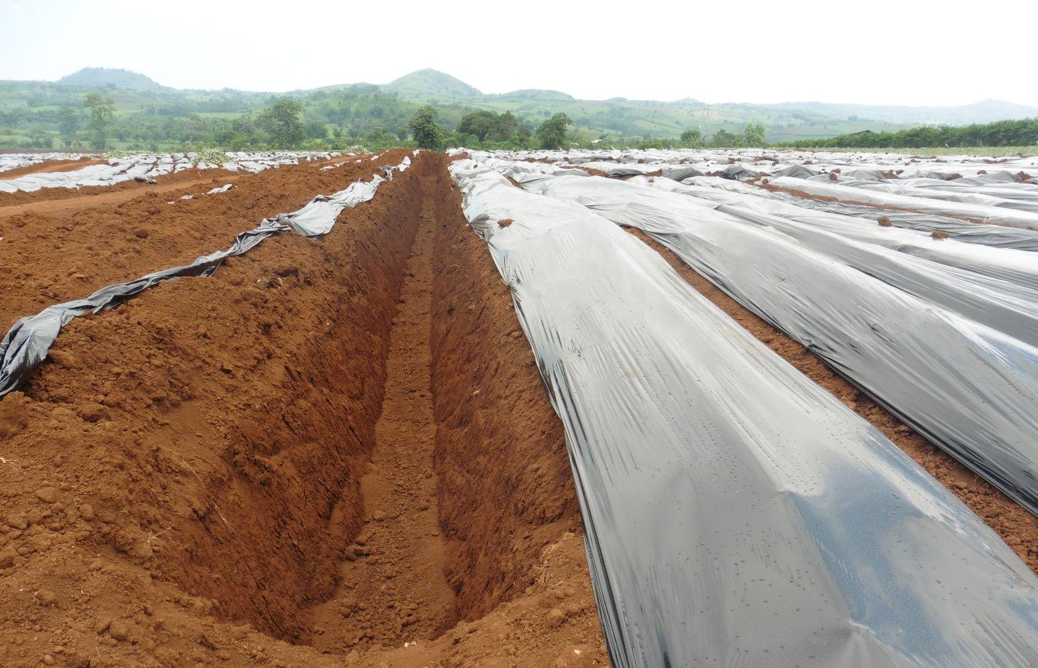
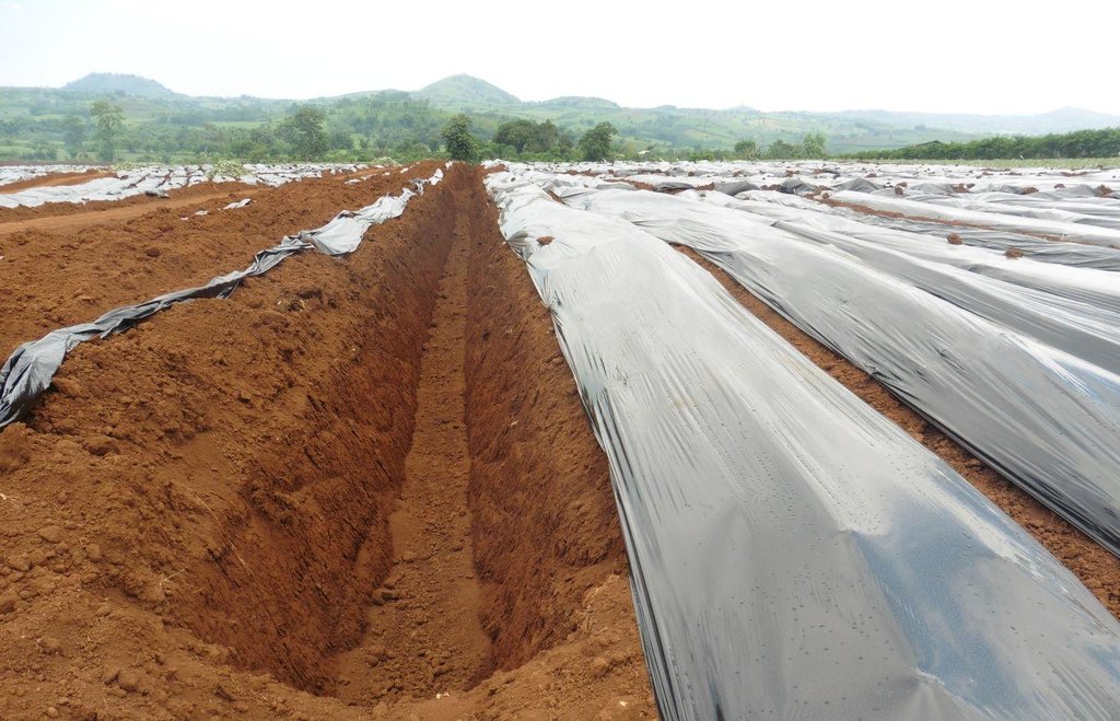
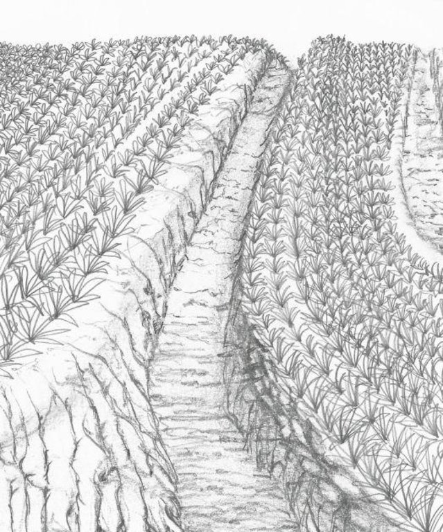
Sediment traps are structures built in the area which includes cascading catchment canal, silt traps and catch basin along perimeter, between pineapple fields and along diversion ditches to collect runoff during rains, preventing and minimizing the eroded soils cascading into natural bodies of water.
2.2 Detailed description of the Technology
Description:
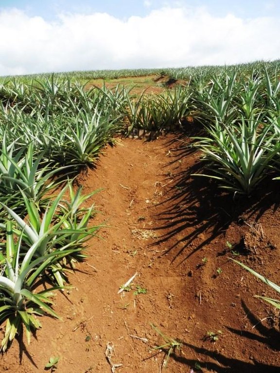
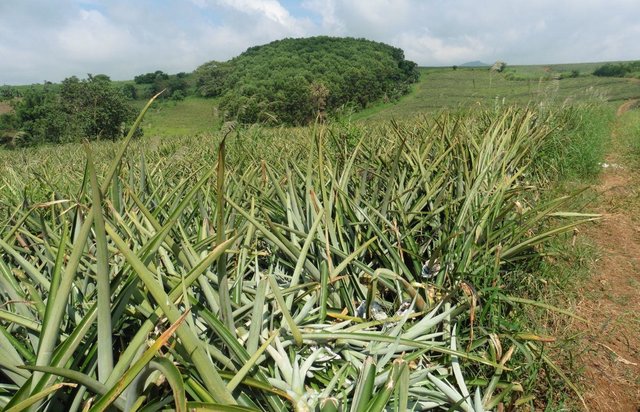
Strategic construction of water catchment in and around existing pineapple fields to collect runoff during rains, aim to minimize eroded soil cascading into natural bodies of water. Sediment trap structures are earth canals designed to reduce soil erosion. The cascading catchment canal length depends on the slope, a length of five meters or longer is excavated when the slope of the area is less than 2%. The higher the slope percentage, the shorter the length of the canal. Silt traps are built along diversion ditches by stacking bamboo pegs or planting pineapple. Catch basin are bigger canals than the cascading canals which trap sediments that are not trapped in the silt traps and cascading canals. Weeds in this structures are not uprooted to further trap eroded soils or silts.
Purpose of the Technology: The technology aims to: (1) control of dispersed runoff; (2) serves as water harvesting facility; and (3) serves as sediment retention / trapping.
Establishment / maintenance activities and inputs: In the establishment of sediment trap structures, the following activities are undertaken in the area: (1) Depending on the slope, sediment trap structure locations are identified; (2) Excavation of catch basin and cascading canals using back hoe; (3) Establishment of raised beds which are used for pineapple production; and (4) Construction of trenches with silt traps using bamboo pegs and pineapple plants. Cascading canals, trenches and diversion ditches are re-established every cropping season.
Natural / human environment: The area is under humid agro-climate condition with a topography ranging from 1-10% slope. It receives an average annual rainfall of approximately 3072 mm/year. The elevation ranges from 370-890 meter above sea level.
Mt. Kitanglad and Agri Development Corporation (MKADC) operates the area where the technology are being practiced. Farmers living within the area are the laborers of the company.
2.3 Photos of the Technology
2.5 Country/ region/ locations where the Technology has been applied and which are covered by this assessment
Country:
Philippines
Region/ State/ Province:
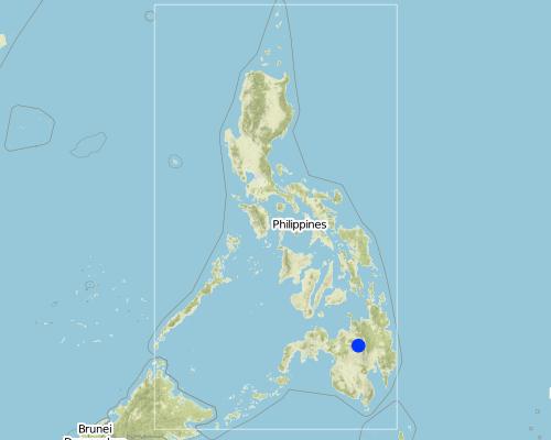
Valencia City
Further specification of location:
Bukidnon
Map
×2.6 Date of implementation
If precise year is not known, indicate approximate date:
- less than 10 years ago (recently)
2.7 Introduction of the Technology
Specify how the Technology was introduced:
- during experiments/ research
Comments (type of project, etc.):
Establishment of sediment traps is a trial and error method,established canals are not permanent, design of canals are change the next cropping season when they observe that the current design is not effective.
3. Classification of the SLM Technology
3.2 Current land use type(s) where the Technology is applied

Cropland
- Perennial (non-woody) cropping
Main crops (cash and food crops):
Major cash crop: pineapple
Comments:
Major land use problems (compiler’s opinion): Soil erosion/ or siltation
Future (final) land use (after implementation of SLM Technology): Other: Ow: Waterways, drainage lines, ponds, dams
If land use has changed due to the implementation of the Technology, indicate land use before implementation of the Technology:
Cropland: Cp: Perennial (non-woody) cropping
3.4 SLM group to which the Technology belongs
- water harvesting
- irrigation management (incl. water supply, drainage)
3.5 Spread of the Technology
Specify the spread of the Technology:
- evenly spread over an area
If the Technology is evenly spread over an area, indicate approximate area covered:
- 1-10 km2
Comments:
Total area covered by the SLM Technology is 2.6066 m2.
Around 20% of the area is devoted for sediment traps. The gross area of the company is 1,303.28 has which includes all other structures/ or conservation technology.
3.6 SLM measures comprising the Technology

structural measures
- S11: Others
Comments:
Main measures: structural measures
Specification of other structural measures: Cascading canals, silt traps, catch basin
3.7 Main types of land degradation addressed by the Technology

soil erosion by water
- Wt: loss of topsoil/ surface erosion
- Wo: offsite degradation effects
Comments:
Main type of degradation addressed: Wt: loss of topsoil / surface erosion
Secondary types of degradation addressed: Wo: offsite degradation effects
Main causes of degradation: Heavy / extreme rainfall (intensity/amounts)
Secondary causes of degradation: droughts
3.8 Prevention, reduction, or restoration of land degradation
Specify the goal of the Technology with regard to land degradation:
- prevent land degradation
- reduce land degradation
4. Technical specifications, implementation activities, inputs, and costs
4.1 Technical drawing of the Technology
4.2 Technical specifications/ explanations of technical drawing
Sediment traps are established to collect silts.
Location: Barangay Lurogan. Valencia City, Bukidnon
Technical knowledge required for field staff / advisors: high
Technical knowledge required for land users: high
Main technical functions: control of dispersed runoff: retain / trap, control of dispersed runoff: impede / retard, control of concentrated runoff: retain / trap, control of concentrated runoff: impede / retard, control of concentrated runoff: drain / divert, sediment retention / trapping, sediment harvesting
Secondary technical functions: reduction of slope angle, reduction of slope length, water harvesting / increase water supply
Structural measure: Cascading canal
Depth of ditches/pits/dams (m): 1m
Width of ditches/pits/dams (m): 1m
Length of ditches/pits/dams (m): 5m
Structural measure: Catch basin
Depth of ditches/pits/dams (m): 1.5 m
Width of ditches/pits/dams (m): 1m
Length of ditches/pits/dams (m): 1m
Structural measure: Silt traps
Depth of ditches/pits/dams (m): 0.3m
Width of ditches/pits/dams (m): 0.75m
Length of ditches/pits/dams (m): 0.5m
4.3 General information regarding the calculation of inputs and costs
other/ national currency (specify):
Philippine Peso
Indicate exchange rate from USD to local currency (if relevant): 1 USD =:
46.0
4.4 Establishment activities
| Activity | Type of measure | Timing | |
|---|---|---|---|
| 1. | Excavation of canal using back hoe | Structural | Before land preparation |
| 2. | Construction of bed | Structural | Once, before planting |
| 3. | Construction of trenches | Structural |
4.5 Costs and inputs needed for establishment
| Specify input | Unit | Quantity | Costs per Unit | Total costs per input | % of costs borne by land users | |
|---|---|---|---|---|---|---|
| Labour | Labour | ha | 1.0 | 100.0 | ||
| Equipment | Machine use | ha | 1.0 | 100.0 |
Comments:
Duration of establishment phase: 1 month(s)
4.6 Maintenance/ recurrent activities
| Activity | Type of measure | Timing/ frequency | |
|---|---|---|---|
| 1. | Desilting | Structural | Once in three months, but depends on the needs |
4.7 Costs and inputs needed for maintenance/ recurrent activities (per year)
| Specify input | Unit | Quantity | Costs per Unit | Total costs per input | % of costs borne by land users | |
|---|---|---|---|---|---|---|
| Labour | Labour | ha | 1.0 | 100.0 |
5. Natural and human environment
5.1 Climate
Annual rainfall
- < 250 mm
- 251-500 mm
- 501-750 mm
- 751-1,000 mm
- 1,001-1,500 mm
- 1,501-2,000 mm
- 2,001-3,000 mm
- 3,001-4,000 mm
- > 4,000 mm
Agro-climatic zone
- humid
Thermal climate class: tropics
5.2 Topography
Slopes on average:
- flat (0-2%)
- gentle (3-5%)
- moderate (6-10%)
- rolling (11-15%)
- hilly (16-30%)
- steep (31-60%)
- very steep (>60%)
Landforms:
- plateau/plains
- ridges
- mountain slopes
- hill slopes
- footslopes
- valley floors
Altitudinal zone:
- 0-100 m a.s.l.
- 101-500 m a.s.l.
- 501-1,000 m a.s.l.
- 1,001-1,500 m a.s.l.
- 1,501-2,000 m a.s.l.
- 2,001-2,500 m a.s.l.
- 2,501-3,000 m a.s.l.
- 3,001-4,000 m a.s.l.
- > 4,000 m a.s.l.
5.3 Soils
Soil depth on average:
- very shallow (0-20 cm)
- shallow (21-50 cm)
- moderately deep (51-80 cm)
- deep (81-120 cm)
- very deep (> 120 cm)
Soil texture (topsoil):
- medium (loamy, silty)
- fine/ heavy (clay)
Soil texture (> 20 cm below surface):
- medium (loamy, silty)
- fine/ heavy (clay)
Topsoil organic matter:
- medium (1-3%)
If available, attach full soil description or specify the available information, e.g. soil type, soil PH/ acidity, Cation Exchange Capacity, nitrogen, salinity etc.
Soil depth: moderately deep to deep (26 inches, 66.04cm of root penetration)
Soil fertility is medium ( With the incorporation of pineapple trash in the soil, there is now a build-up of OM content in the soil and based on soil analysis, essential elements in the soil are on adequate level for pineapple. )
Topsoil organic matter is medium (Soil organic matter ranges from 1.73% to 5.52% with highest in Perla Chan area and lowest OM in Gamboa area. Long term plan to reach 5% OM content in soil as effect of incorporating pineapple trash.)
Soil drainage/infiltration is medium (External and internal drainage of Ad luyon clay is good )
Soil water storage is high (ue to high clay content of the soil, it enables to store more water. )
5.4 Water availability and quality
Ground water table:
5-50 m
Availability of surface water:
medium
Water quality (untreated):
good drinking water
5.6 Characteristics of land users applying the Technology
Market orientation of production system:
- mixed (subsistence/ commercial
Relative level of wealth:
- average
Individuals or groups:
- employee (company, government)
Level of mechanization:
- manual work
- mechanized/ motorized
Gender:
- women
- men
Indicate other relevant characteristics of the land users:
Land users applying the Technology are mainly common / average land users
Population density: < 10 persons/km2
Annual population growth: < 0.5%
Off-farm income specification: The technology is more on trapping sediments, and is irrelevant with respect to additional income for the farmers
Level of mechanization: mechanised (Construction of sediment traps ad catch basin require machines i. e. back hoe)
5.7 Average area of land owned or leased by land users applying the Technology
- < 0.5 ha
- 0.5-1 ha
- 1-2 ha
- 2-5 ha
- 5-15 ha
- 15-50 ha
- 50-100 ha
- 100-500 ha
- 500-1,000 ha
- 1,000-10,000 ha
- > 10,000 ha
Is this considered small-, medium- or large-scale (referring to local context)?
- large-scale
Comments:
An average of 1.5 hectare per household
5.8 Land ownership, land use rights, and water use rights
Land ownership:
- individual, not titled
- individual, titled
Land use rights:
- leased
Comments:
Usually leased from individual land users 10 to 15 years upon the return of the area the company assured they will return back to the soil to its original form.
5.9 Access to services and infrastructure
health:
- poor
- moderate
- good
education:
- poor
- moderate
- good
technical assistance:
- poor
- moderate
- good
employment (e.g. off-farm):
- poor
- moderate
- good
markets:
- poor
- moderate
- good
energy:
- poor
- moderate
- good
roads and transport:
- poor
- moderate
- good
drinking water and sanitation:
- poor
- moderate
- good
financial services:
- poor
- moderate
- good
6. Impacts and concluding statements
6.1 On-site impacts the Technology has shown
Socio-economic impacts
Production
crop production
production area
land management
Water availability and quality
irrigation water availability
Comments/ specify:
little (5-20%)
Socio-cultural impacts
conflict mitigation
Ecological impacts
Water cycle/ runoff
harvesting/ collection of water
surface runoff
groundwater table/ aquifer
Soil
soil loss
Other ecological impacts
Has the Technology contributed to improve livelihoods and human well-being (eg education, health)?
Comments/ specify:
yes, little
6.2 Off-site impacts the Technology has shown
downstream flooding
downstream siltation
groundwater/ river pollution
damage on neighbours' fields
6.3 Exposure and sensitivity of the Technology to gradual climate change and climate-related extremes/ disasters (as perceived by land users)
Climate-related extremes (disasters)
Meteorological disasters
| How does the Technology cope with it? | |
|---|---|
| local rainstorm | not well |
| local windstorm | not known |
Climatological disasters
| How does the Technology cope with it? | |
|---|---|
| drought | well |
Hydrological disasters
| How does the Technology cope with it? | |
|---|---|
| general (river) flood | not well |
Other climate-related consequences
Other climate-related consequences
| How does the Technology cope with it? | |
|---|---|
| reduced growing period | not known |
6.4 Cost-benefit analysis
How do the benefits compare with the establishment costs (from land users’ perspective)?
Short-term returns:
positive
Long-term returns:
positive
How do the benefits compare with the maintenance/ recurrent costs (from land users' perspective)?
Short-term returns:
positive
Long-term returns:
positive
6.5 Adoption of the Technology
Of all those who have adopted the Technology, how many have did so spontaneously, i.e. without receiving any material incentives/ payments?
- 90-100%
Comments:
100% of land user families have adopted the Technology without any external material support
Comments on spontaneous adoption: Mt. Kitanglad and Agri Development Corporation (MKADC) operates the area where the technology are being practiced. The technology has been introduced through experiments and adoption from neighboring farms.
There is no trend towards spontaneous adoption of the Technology
Comments on adoption trend: Other land users in the area do not adopt the technology due to the opportunity cost that will be incurred. This opportunity cost pertains to the reduction of their production area since part of it will be allotted/converted in the establishment of sediment structures.
6.7 Strengths/ advantages/ opportunities of the Technology
| Strengths/ advantages/ opportunities in the land user’s view |
|---|
| Land user's view agree with experts opinion. |
| Strengths/ advantages/ opportunities in the compiler’s or other key resource person’s view |
|---|
|
Sediment traps are effective in minimizing soil erosion and preserving the top soil. |
| Negative off-site effects are lessened i.e siltation of natural water bodies |
6.8 Weaknesses/ disadvantages/ risks of the Technology and ways of overcoming them
| Weaknesses/ disadvantages/ risks in the land user’s view | How can they be overcome? |
|---|---|
| Land user's view agree with experts opinion. |
| Weaknesses/ disadvantages/ risks in the compiler’s or other key resource person’s view | How can they be overcome? |
|---|---|
| Established sediment traps are not permanent, designs are changed per cropping season, this activity disturb soil biological and physical properties which might cause soil fertility decline and on-site erosion. Further, altering or modifying canal designs per cropping would entail more cost just for the establishment of sediment traps. | Design location of other sediment traps that could be used for more than one cropping to minimize cost. A research must be done to address this issue. |
Links and modules
Expand all Collapse allLinks

Integrated Soil and Water Conservation Approach in Improving … [Philippines]
Integration of soil and water conservation technologies primarily aim to protect the area from loss of biodiversity and land degradation.
- Compiler: Philippine Overview of Conservation Approaches and Technologies
Modules
No modules


