Progressive bench terrace [China]
- Creation:
- Update:
- Compiler: Fei WANG
- Editor: –
- Reviewers: Deborah Niggli, Alexandra Gavilano
树盘,逐年扩盘
technologies_1522 - China
View sections
Expand all Collapse all1. General information
1.2 Contact details of resource persons and institutions involved in the assessment and documentation of the Technology
SLM specialist:
Chen Yunming
Institute of Soil and Water Conservation, CAS and MWR
China
SLM specialist:
Liu Guobin
Institute of Soil and Water Conservation, CAS and MWR
China
SLM specialist:
Cao Qingyu
China
Name of project which facilitated the documentation/ evaluation of the Technology (if relevant)
DESIRE (EU-DES!RE)Name of the institution(s) which facilitated the documentation/ evaluation of the Technology (if relevant)
Northwest A&F University (NWAFU) - China1.3 Conditions regarding the use of data documented through WOCAT
The compiler and key resource person(s) accept the conditions regarding the use of data documented through WOCAT:
Ja
2. Description of the SLM Technology
2.1 Short description of the Technology
Definition of the Technology:
Bench terraces are progressively expanded to form a fully developed terrace system in order to reduce runoff and soil erosion on medium- to high- angled loess slopes.
2.2 Detailed description of the Technology
Description:
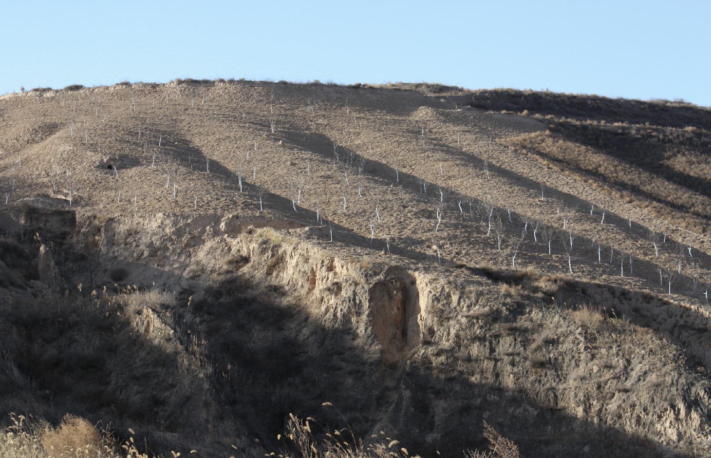
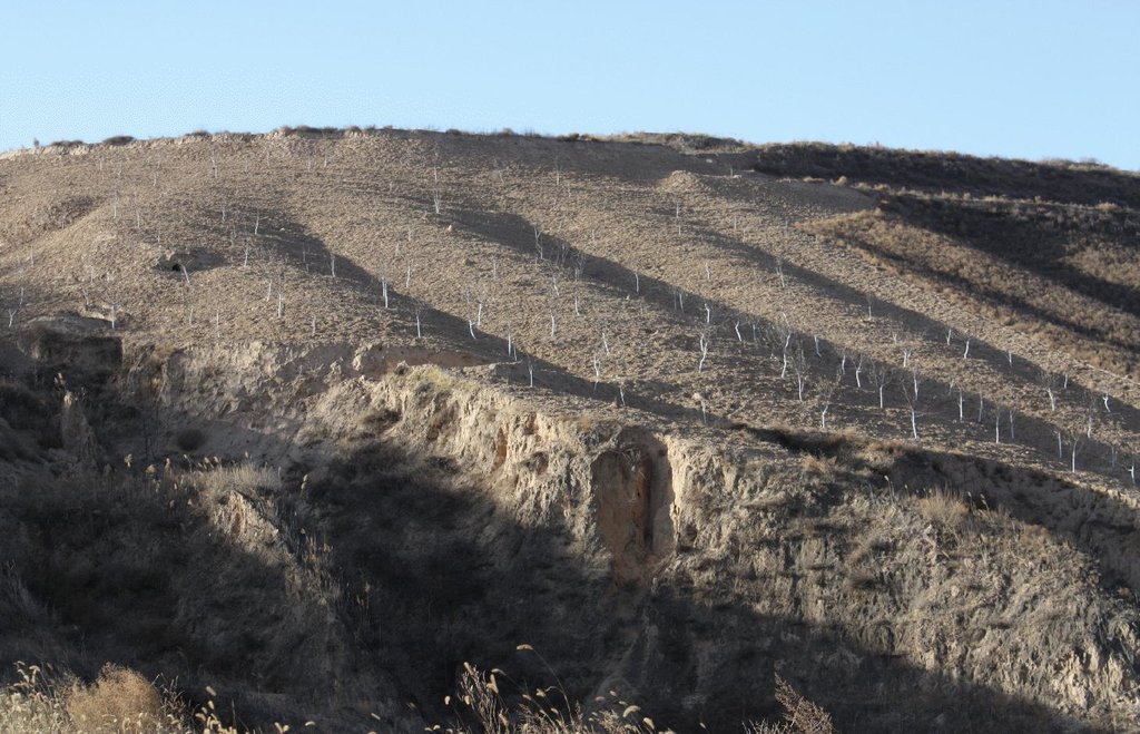
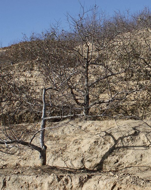
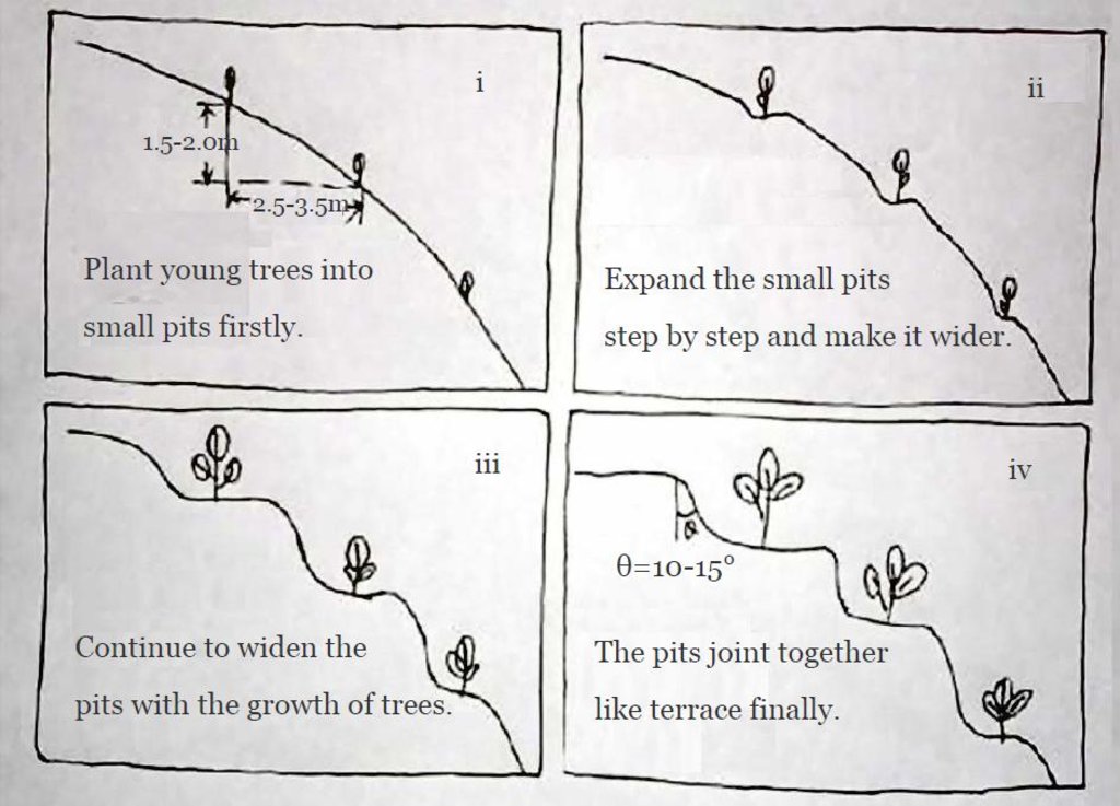
n Miaowan Village, the technology is mainly applied to apple tree plantations. Tree seedlings are planted in rows every 4 m along the contour with a spacing of 2.5-3.5 m between rows. Trees are planted in pits 40 cm diameter and 3040 cm deep. Manure and/or fertilizer are applied and the seedlings are watered.
Around each tree, soil from the upper parts of the slope is removed and deposited below in order to extend the flat terrain. Over 5-10 years, the terraces become enlarged around each tree and form a terrace with the neighbouring trees along the contour, such that the slopes are transformed into level bench terraces. The fruit trees are located in the middle of the terrace. All the work is done manually using shovels.
Purpose of the Technology: The main purpose of this technology is to reduce runoff and soil erosion on the slope and to improve soil quality and soil moisture retention. It is a sustainable land use technology for small farmers because farmers can use their spare time to improve the land’s condition during the growth of the trees.
A major aim is to conserve water and reduce runoff. Soil erosion in this village is very severe and the soil erosion rate before amounted to 60-100 tonnes per hectare per year and was reduced practically to zero as a result of building the terraces. Slope gradients are very steep (around 20-35 degrees). The main income of local farmers is from orchards.
Establishment / maintenance activities and inputs: The establishment phase thus takes 5-10 years. Afterwards maintenance inputs are restricted to repairing the terrace walls.
2.3 Photos of the Technology
2.5 Country/ region/ locations where the Technology has been applied and which are covered by this assessment
Country:
China
Region/ State/ Province:
Shaanxi
Further specification of location:
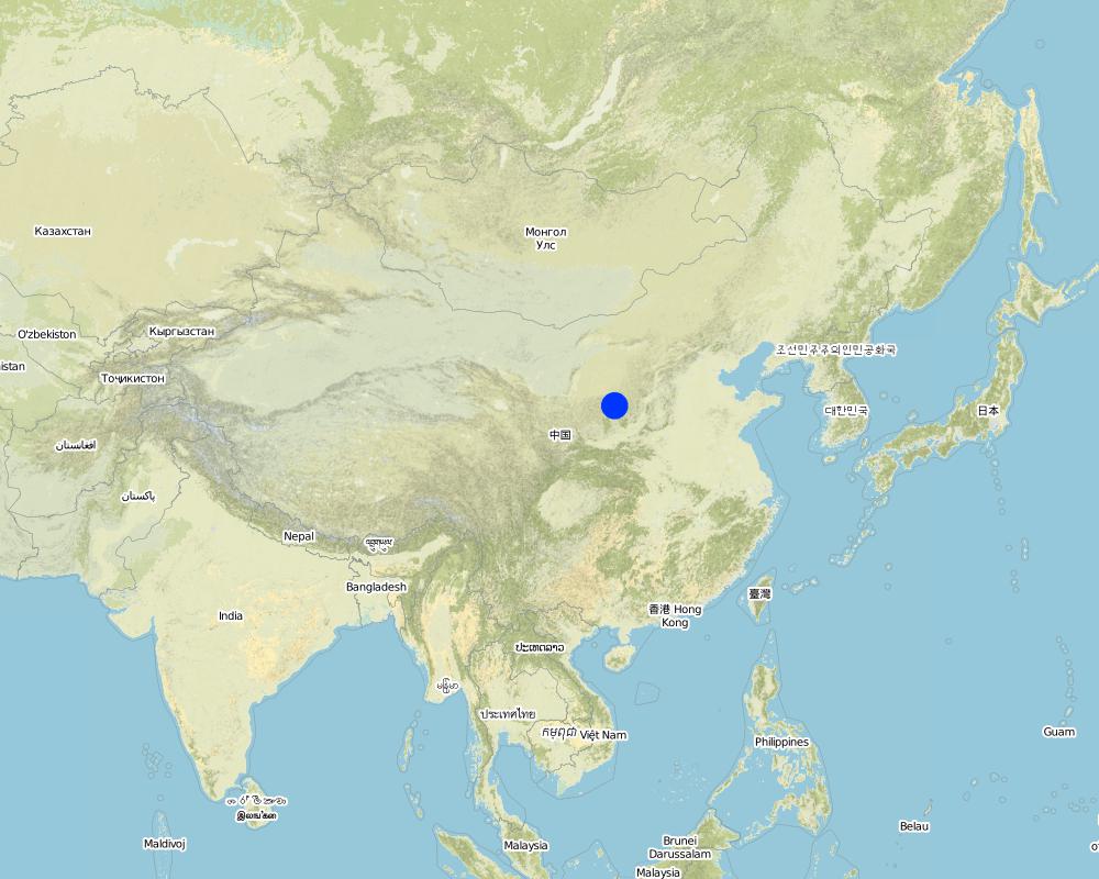
Miaowan Village, Xuejiagou Watershed
Specify the spread of the Technology:
- evenly spread over an area
If the Technology is evenly spread over an area, specify area covered (in km2):
2.55
Comments:
Boundary points of the Technology area: The technology is around the village.
Total area covered by the SLM Technology is 2.55 km2.
The whole area of this watershed is about 7.5 Km^2. There are a lot of orchard, mostly apple, in this watershed. It is one of typical watershed with specially soil erosion problem despite the high plant coverage.
Map
×2.6 Date of implementation
If precise year is not known, indicate approximate date:
- 10-50 years ago
2.7 Introduction of the Technology
Specify how the Technology was introduced:
- through land users' innovation
Comments (type of project, etc.):
It is a kind of traditional method.
3. Classification of the SLM Technology
3.1 Main purpose(s) of the Technology
- reduce, prevent, restore land degradation
3.2 Current land use type(s) where the Technology is applied
Land use mixed within the same land unit:
Ja
Specify mixed land use (crops/ grazing/ trees):
- Agroforestry

Cropland
- Annual cropping
- Tree and shrub cropping
Annual cropping - Specify crops:
- root/tuber crops - potatoes
Tree and shrub cropping - Specify crops:
- pome fruits (apples, pears, quinces, etc.)
Specify:
Longest growing period in days: 300Longest growing period from month to month: Mar - NovSecond longest growing period in days: 200Second longest growing period from month to month: Apr - Oct
Comments:
Major land use problems (compiler’s opinion): On moderate- to high-angled slopes, water loss and soil erosion are very high. Outside the protected canopy of the trees rainsplash impact during heavy storms is very severe. The local farmers clear all the wild grasses and shrubs, such as Korshinsk Peashrub, Artemisia scoparia, Leymus secalinus, Stipa bungeana, Lespedeza davurica etc. to reduce competition with the fruit trees. Consequently, the soil is bare and unprotected
3.4 Water supply
Water supply for the land on which the Technology is applied:
- rainfed
3.5 SLM group to which the Technology belongs
- cross-slope measure
3.6 SLM measures comprising the Technology

structural measures
- S11: Others
Comments:
Main measures: structural measures
3.7 Main types of land degradation addressed by the Technology

soil erosion by water
- Wt: loss of topsoil/ surface erosion

water degradation
- Ha: aridification
Comments:
Main type of degradation addressed: Wt: loss of topsoil / surface erosion
Secondary types of degradation addressed: Ha: aridification
Main causes of degradation: Heavy / extreme rainfall (intensity/amounts) (Storm are strong in summer.), other natural causes (avalanches, volcanic eruptions, mud flows, highly susceptible natural resources, extreme topography, etc.) specify (orchards on steep slopes without conservation measures), poverty / wealth (to increase the yield and income of orchard.)
Secondary causes of degradation: deforestation / removal of natural vegetation (incl. forest fires) (There is no natural grass cover here.), droughts (Lack of water for the cash trees)
3.8 Prevention, reduction, or restoration of land degradation
Specify the goal of the Technology with regard to land degradation:
- prevent land degradation
- reduce land degradation
Comments:
Main goals: prevention of land degradation
Secondary goals: mitigation / reduction of land degradation
4. Technical specifications, implementation activities, inputs, and costs
4.1 Technical drawing of the Technology
Technical specifications (related to technical drawing):
i: first year: planting of fruit trees along the contour in small pits
ii: after 3-4 years: a small terrace is built up around each tree (as the tree grows it needs more water, which is collected from the platform around the trees..
iii: after 5-8 years: terraces develop
iv: final stage: fully developed level bench terraces
Owing to the soil properties of loess, there is no need to separate surface and subsoil as there is little difference between them. Therefore, soil can be moved directly from upper to lower parts of the terrace without changing soil fertility.
Location: Miaowan Village, Xuejiagou Watershed. Ansai County, Shaanxi Province, China
Date: 2008-12-20
Technical knowledge required for land users: moderate (It is easy to understand and implement.)
Main technical functions: control of concentrated runoff: retain / trap, reduced soil loss
Secondary technical functions: reduction of slope angle, increase of infiltration
Reshaping surface
Vertical interval between structures (m): 1
Spacing between structures (m): 2.5
Depth of ditches/pits/dams (m): 1..5
Width of ditches/pits/dams (m): 2.5
Length of ditches/pits/dams (m): 100-150
Construction material (earth): Using the earth of the same land.
Slope (which determines the spacing indicated above): 45%
If the original slope has changed as a result of the Technology, the slope today is: 2%
Lateral gradient along the structure: 2%
Author:
Wang Fei, Yangling, Shaanxi Province, China
4.2 General information regarding the calculation of inputs and costs
Specify currency used for cost calculations:
- USD
Indicate average wage cost of hired labour per day:
14.2
4.3 Establishment activities
| Activity | Timing (season) | |
|---|---|---|
| 1. | Plant the young trees with small pits. | Before practice |
| 2. | The soils from the upper parts of the slope is shovelled away and deposited on the lower side of the trees | |
| 3. | Expand the pits into a large platform year by year. | |
| 4. | 3.4 years after planning the trees a level platform of 2 to 3 square meters around the trees is build. | |
| 5. | The platforms increase and the space between trees is change into terrace. |
4.4 Costs and inputs needed for establishment
| Specify input | Unit | Quantity | Costs per Unit | Total costs per input | % of costs borne by land users | |
|---|---|---|---|---|---|---|
| Labour | Planting trees | Person/day | 120.0 | 7.3 | 876.0 | 100.0 |
| Labour | Building pits | Person/day | 750.0 | 7.3 | 5475.0 | 100.0 |
| Total costs for establishment of the Technology | 6351.0 | |||||
| Total costs for establishment of the Technology in USD | 6351.0 | |||||
Comments:
Duration of establishment phase: 60 month(s)
4.5 Maintenance/ recurrent activities
| Activity | Timing/ frequency | |
|---|---|---|
| 1. | Repair the bank of year-after-year terraced land | Annual after it formed |
4.6 Costs and inputs needed for maintenance/ recurrent activities (per year)
| Specify input | Unit | Quantity | Costs per Unit | Total costs per input | % of costs borne by land users | |
|---|---|---|---|---|---|---|
| Labour | Reparing of terraced land | Person/day | 15.0 | 14.6 | 219.0 | 100.0 |
| Total costs for maintenance of the Technology | 219.0 | |||||
| Total costs for maintenance of the Technology in USD | 219.0 | |||||
Comments:
Machinery/ tools: spade and hoe
The costs are calculated assuming a local wage rate of 14.2 US$/day.
4.7 Most important factors affecting the costs
Describe the most determinate factors affecting the costs:
Slope is the most important factor. The steeper it is, the higher the cost. Labour was not considered as a cost before, but now it is expensive so that some local farmers do not use this technology.
5. Natural and human environment
5.1 Climate
Annual rainfall
- < 250 mm
- 251-500 mm
- 501-750 mm
- 751-1,000 mm
- 1,001-1,500 mm
- 1,501-2,000 mm
- 2,001-3,000 mm
- 3,001-4,000 mm
- > 4,000 mm
Specifications/ comments on rainfall:
The mean annual rainfall in the basin is 515.2 mm in the duration from 1952 to 2000. The rainfall from May to Oct accounts for 446.8 mm, up to 86.7%; and that from Jun to Sep accounts for 367.6 mm
Agro-climatic zone
- semi-arid
Thermal climate class: temperate. The accumulating time that temperature above 0 ℃ about 3800 hours, and that above 10 ℃ is more than 3200 hours
It is based on the classification sysytem only based on the rainfall
5.2 Topography
Slopes on average:
- flat (0-2%)
- gentle (3-5%)
- moderate (6-10%)
- rolling (11-15%)
- hilly (16-30%)
- steep (31-60%)
- very steep (>60%)
Landforms:
- plateau/plains
- ridges
- mountain slopes
- hill slopes
- footslopes
- valley floors
Altitudinal zone:
- 0-100 m a.s.l.
- 101-500 m a.s.l.
- 501-1,000 m a.s.l.
- 1,001-1,500 m a.s.l.
- 1,501-2,000 m a.s.l.
- 2,001-2,500 m a.s.l.
- 2,501-3,000 m a.s.l.
- 3,001-4,000 m a.s.l.
- > 4,000 m a.s.l.
Indicate if the Technology is specifically applied in:
- not relevant
Comments and further specifications on topography:
Altitudinal zone 501-1,000 m a.s.l.: Most area is in this altitudinal zonation
Landforms: Based on 1:100 thousand scale landform map
Slopes on average: Based on 1:100 thousand scale landform map
5.3 Soils
Soil depth on average:
- very shallow (0-20 cm)
- shallow (21-50 cm)
- moderately deep (51-80 cm)
- deep (81-120 cm)
- very deep (> 120 cm)
Soil texture (topsoil):
- medium (loamy, silty)
Topsoil organic matter:
- low (<1%)
If available, attach full soil description or specify the available information, e.g. soil type, soil PH/ acidity, Cation Exchange Capacity, nitrogen, salinity etc.
Soil depth on average: The depth of Loess varies from nearly 30 m to more than 100 m in Yanhe River Basin. The depth of soil is less than this but it could be nearly 10 meters in common
Soil texture (topsoil): Here are more than 50% soil particle are fine sand with size between 0.05 and 0.1 mm
Soil fertility very low: Lack of N, P and SOM
Topsoil organic matter: <0.5%
Soil drainage / infiltration good: The inflitration of Loess is very fast, but it is prone to sealing when flashing.
Soil water storage capacity low: It is easy to evaporation and drainage
5.4 Water availability and quality
Ground water table:
5-50 m
Availability of surface water:
medium
Water quality (untreated):
good drinking water
Comments and further specifications on water quality and quantity:
Availability of surface also poor/ none: Nearly all the branches of Yanhe are seasonal river
Availability of surface water medium: It is very stable in this region
Water quality (untreated): Good quality for there are few pollution sources
5.5 Biodiversity
Species diversity:
- medium
Comments and further specifications on biodiversity:
It is very stable in this region
5.6 Characteristics of land users applying the Technology
Market orientation of production system:
- commercial/ market
Off-farm income:
- 10-50% of all income
Relative level of wealth:
- rich
Individuals or groups:
- individual/ household
Level of mechanization:
- manual work
Gender:
- women
- men
Indicate other relevant characteristics of the land users:
Land users applying the Technology are mainly common / average land users
Difference in the involvement of women and men: No clear difference.
Population density: 50-100 persons/km2
Annual population growth: < 0.5%
30% of the land users are rich and own 30% of the land (Higher yield and income.).
Off-farm income specification: Only a few land users have implemented this measure because there are other market based activities that bring higher returns. Sometimes farmers have enough money to buy more fertilizer for the orchard.
Level of mechanization: nearly all the work is done by hand.
Market orientation of production system: It is on apple production base and this generates good income of local farmers
5.7 Average area of land used by land users applying the Technology
- < 0.5 ha
- 0.5-1 ha
- 1-2 ha
- 2-5 ha
- 5-15 ha
- 15-50 ha
- 50-100 ha
- 100-500 ha
- 500-1,000 ha
- 1,000-10,000 ha
- > 10,000 ha
Is this considered small-, medium- or large-scale (referring to local context)?
- small-scale
Comments:
0.054 ha per capita
5.8 Land ownership, land use rights, and water use rights
Land ownership:
- state
- communal/ village
Land use rights:
- individual
Water use rights:
- open access (unorganized)
5.9 Access to services and infrastructure
health:
- poor
- moderate
- good
education:
- poor
- moderate
- good
employment (e.g. off-farm):
- poor
- moderate
- good
roads and transport:
- poor
- moderate
- good
drinking water and sanitation:
- poor
- moderate
- good
financial services:
- poor
- moderate
- good
6. Impacts and concluding statements
6.1 On-site impacts the Technology has shown
Socio-economic impacts
Production
crop production
Quantity before SLM:
45000kg
Quantity after SLM:
52500kg
Comments/ specify:
Yield increasing by 16.7%
Income and costs
farm income
Quantity before SLM:
9883
Quantity after SLM:
11530
Comments/ specify:
Income increases by 1647 USD per ha.
workload
Quantity before SLM:
1500
Quantity after SLM:
1650
Comments/ specify:
10% person days increases annually in the first 5 years
Socio-cultural impacts
situation of socially and economically disadvantaged groups
Quantity before SLM:
2700
Quantity after SLM:
3200
Comments/ specify:
Not excluding of the labour input of the local farmers themselves.
Livelihoods and human well-being
Ecological impacts
Water cycle/ runoff
surface runoff
Quantity before SLM:
60 mm/yr
Quantity after SLM:
<10 mm/yr
Comments/ specify:
no runoff in common
Soil
soil loss
Quantity before SLM:
60 t/yr/ha
Quantity after SLM:
10 t/yr/ha
Comments/ specify:
Soil erosion is well controlled
6.2 Off-site impacts the Technology has shown
reliable and stable stream flows in dry season
Quantity before SLM:
60mm/yr
Quantity after SLM:
<10mm/yr
downstream flooding
Quantity before SLM:
60 mm/yr
Quantity after SLM:
<10 mm/yr
6.3 Exposure and sensitivity of the Technology to gradual climate change and climate-related extremes/ disasters (as perceived by land users)
Gradual climate change
Gradual climate change
| Season | increase or decrease | How does the Technology cope with it? | |
|---|---|---|---|
| annual temperature | increase | well |
Climate-related extremes (disasters)
Meteorological disasters
| How does the Technology cope with it? | |
|---|---|
| local rainstorm | well |
| local windstorm | not well |
Climatological disasters
| How does the Technology cope with it? | |
|---|---|
| drought | well |
Hydrological disasters
| How does the Technology cope with it? | |
|---|---|
| general (river) flood | not known |
Other climate-related consequences
Other climate-related consequences
| How does the Technology cope with it? | |
|---|---|
| reduced growing period | not known |
Comments:
The technology increases infiltration, reduces soil erosion by water and improves soil moisture retention to reduce the negative impact of extreme drought. However, it does not protect the soil well from wind erosion. Soil cover could be increased to protect against strong winds and reduce
6.4 Cost-benefit analysis
How do the benefits compare with the establishment costs (from land users’ perspective)?
Short-term returns:
slightly positive
Long-term returns:
positive
How do the benefits compare with the maintenance/ recurrent costs (from land users' perspective)?
Short-term returns:
positive
Long-term returns:
positive
Comments:
It is very cheap to maintain this measure. More trees could be planted on degraded land in future.
6.5 Adoption of the Technology
- 11-50%
If available, quantify (no. of households and/ or area covered):
65 households (15percent of the stated area)
Of all those who have adopted the Technology, how many did so spontaneously, i.e. without receiving any material incentives/ payments?
- 91-100%
Comments:
Comments on acceptance with external material support: There are no outside input to do sunch thing.
100% of land user families have adopted the Technology without any external material support
65 land user families have adopted the Technology without any external material support
Comments on spontaneous adoption: In this area, there are many other practices, such as reforestation, enclosure (to prevent grazing) and terrace construction.
There is a moderate trend towards spontaneous adoption of the Technology
Comments on adoption trend: Even the local farmers know the benefits of progressive bench terraces, but with the increased labour costs, fewer people apply this technology.
6.7 Strengths/ advantages/ opportunities of the Technology
| Strengths/ advantages/ opportunities in the land user’s view |
|---|
|
Higher yield and income. How can they be sustained / enhanced? If they have time, they wish to adopt this technology. |
| Strengths/ advantages/ opportunities in the compiler’s or other key resource person’s view |
|---|
|
Establishing the technology over a long time. Local farmers have enough time to do it How can they be sustained / enhanced? Show to land users that they have time and can spread to work over many years and fit the labour into the time they have available. |
|
It can reduce water loss and soil erosion and prevent the degradation of land How can they be sustained / enhanced? Give subsidy to the local farmers to reduce the sediment delivery into the downstream river. |
|
It can increase soil moisture. How can they be sustained / enhanced? Makes people understand the importance of conserving water with such a technology. |
|
Higher yield and income. How can they be sustained / enhanced? Share ideas through meeting in the field. Present this measure to more people and show them how to apply it and promote the technology to more farmers. |
6.8 Weaknesses/ disadvantages/ risks of the Technology and ways of overcoming them
| Weaknesses/ disadvantages/ risks in the land user’s view | How can they be overcome? |
|---|---|
| It takes a lot of time to establish it. | It is difficult to use it, because the people could balance the establishment costs and work at the labour market. If they can get some subsidy from government, they may adapt this measure. |
| Weaknesses/ disadvantages/ risks in the compiler’s or other key resource person’s view | How can they be overcome? |
|---|---|
| It takes considerable time to establish and labour is more and more expensive so that farmers are looking for paid work | Subsidy for farmers using this measure. |
7. References and links
7.1 Methods/ sources of information
7.2 References to available publications
Title, author, year, ISBN:
Soil and water conservation records of Shaanxi Province. 2000. Shaanxi People's Press, Xi'an City, China
Available from where? Costs?
Library of ISWC, CAS
Links and modules
Expand all Collapse allLinks
No links
Modules
No modules


