Building Walls's stones to protect lands and building outlet to drain excess water [Yemen]
- Creation:
- Update:
- Compiler: ahmed algalal
- Editor: –
- Reviewers: David Streiff, Alexandra Gavilano
الجدران الحجرية والمفيضات
technologies_1578 - Yemen
- Full summary as PDF
- Full summary as PDF for print
- Full summary in the browser
- Full summary (unformatted)
- Building Walls's stones to protect lands and building outlet to drain excess water: Junie 24, 2017 (inactive)
- Building Walls's stones to protect lands and building outlet to drain excess water: Aug. 11, 2019 (inactive)
- Building Walls's stones to protect lands and building outlet to drain excess water: April 4, 2024 (public)
View sections
Expand all Collapse all1. General information
1.2 Contact details of resource persons and institutions involved in the assessment and documentation of the Technology
SLM specialist:
Sallam Ahmed
Agricultural Research and Extension Authority
Yemen
SLM specialist:
Alhadrami Yahya
General Directorate for irrigation
Yemen
Name of the institution(s) which facilitated the documentation/ evaluation of the Technology (if relevant)
General Directorate of Irrigation - YemenName of the institution(s) which facilitated the documentation/ evaluation of the Technology (if relevant)
Agricultural Research and Extension Authority (AREA) - Yemen1.3 Conditions regarding the use of data documented through WOCAT
The compiler and key resource person(s) accept the conditions regarding the use of data documented through WOCAT:
Ja
1.5 Reference to Questionnaire(s) on SLM Approaches (documented using WOCAT)
Rehabilitation of terraces and diversion construction with gates … [Yemen]
The rehabilitation of walls and outlets of the terraces and diversion construction with accessories from channels and gates are carried out by the local community in a regular way
- Compiler: ahmed algalal
2. Description of the SLM Technology
2.1 Short description of the Technology
Definition of the Technology:
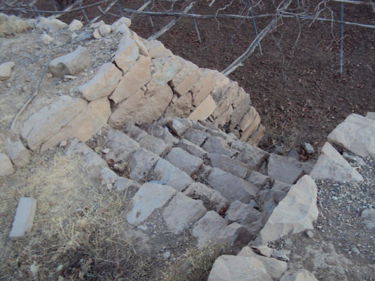
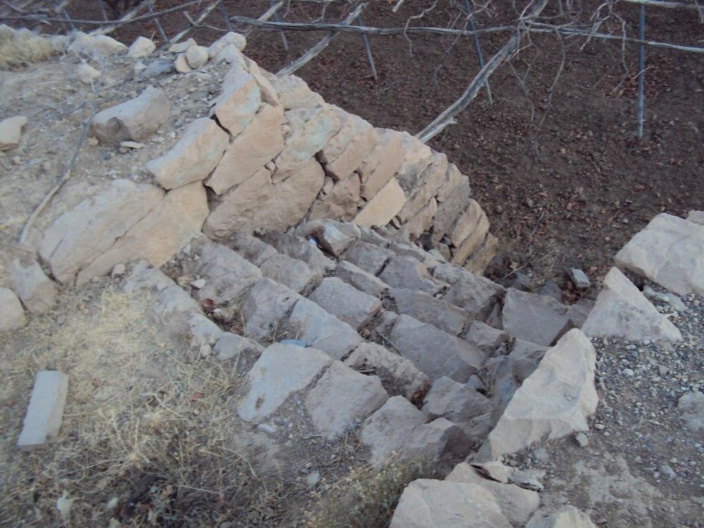
use the stones to build walls around agricultural terraces to protect them from erosion and make outlets (Spillway) to discharge excess water and prevent the destruction of the stands
2.2 Detailed description of the Technology
Description:
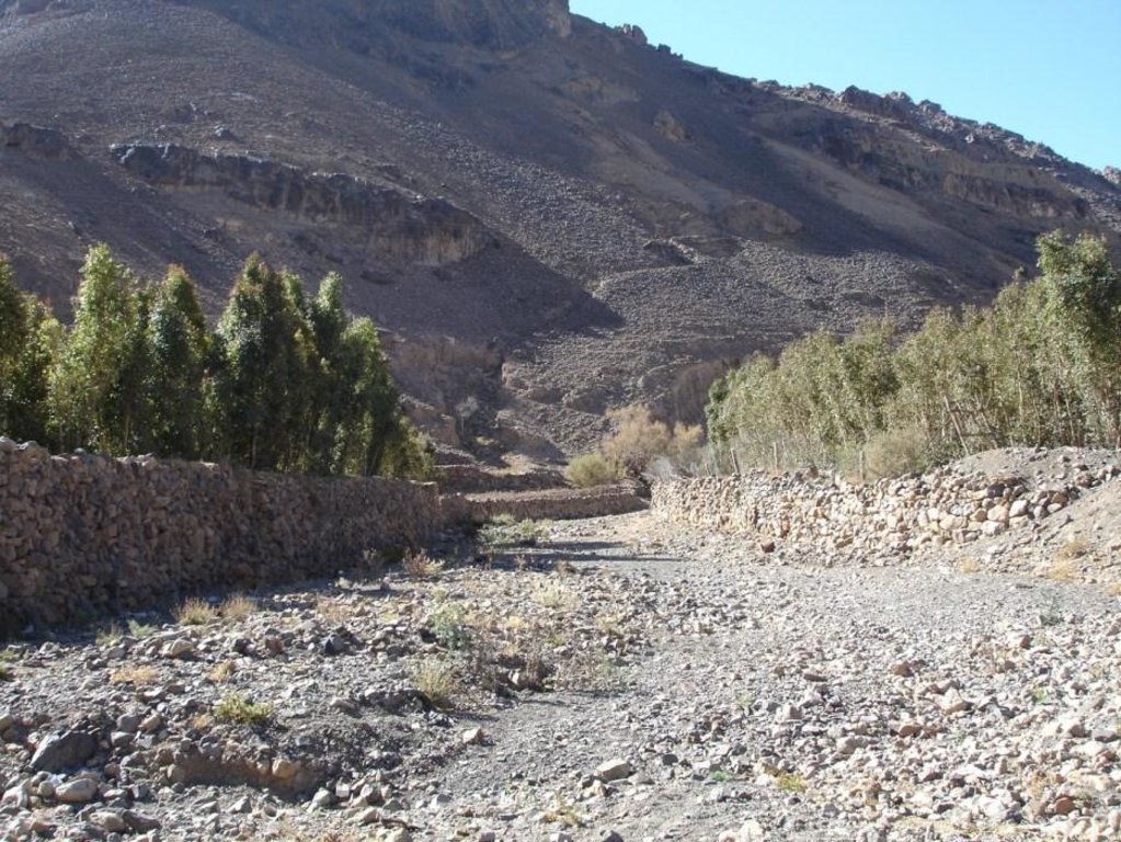
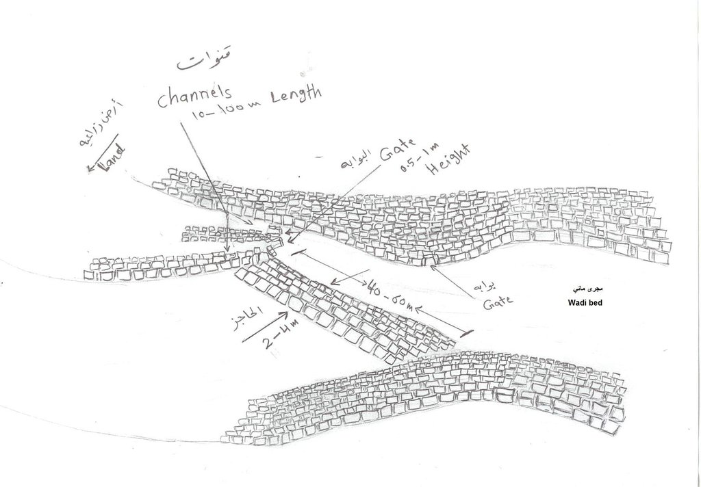
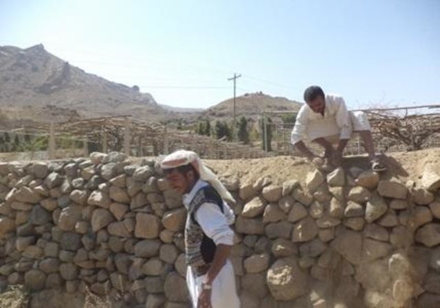
Is a structural one of the types of measures and that is where build walls around the land of stones available in the area to protect agricultural terraces from erosion as a result of the speed of the water flow.
This process starts of building walls to collect stones available and building walls around the agricultural terraces, which is beside the waterway and then land agricultural away from the stream where are building walls around land terraces threatened drift ranges wall height 2-3 meters and a width of 30 cm and is accompanied by building outlets with the construction of the walls. Different view slot spillway and the number depending on the amount of water entering the agricultural land terraces which is used irrigation number of agricultural terraces about 4 - 5 terraces (pieces) where irrigation start from the top-down system of first come through outlets which works to protect the land from erosion and destruction by water pressure due process flood irrigation .
walls and outlets Were built by hands where the process of building need a long time, the walls are built gradually according to the height of the surface of the soil where you are collecting sediment , which requires him to do to raise the walls and well outlets .
The implementation of this technique in filled valleys on the slope moderate 5% of the irrigation system mixed and used to irrigate crop of grapes , mainly for the purpose of self-sufficiency and to go to the market to trade, is the technology of long-term investments that need to be high costs in the process of starch and because of the natural conditions of flow velocity and the output from a pool of water in the mountain slopes , the process of maintenance necessary to sustain and maintain the technology .
2.3 Photos of the Technology
2.5 Country/ region/ locations where the Technology has been applied and which are covered by this assessment
Country:
Yemen
Region/ State/ Province:
Sana
Further specification of location:
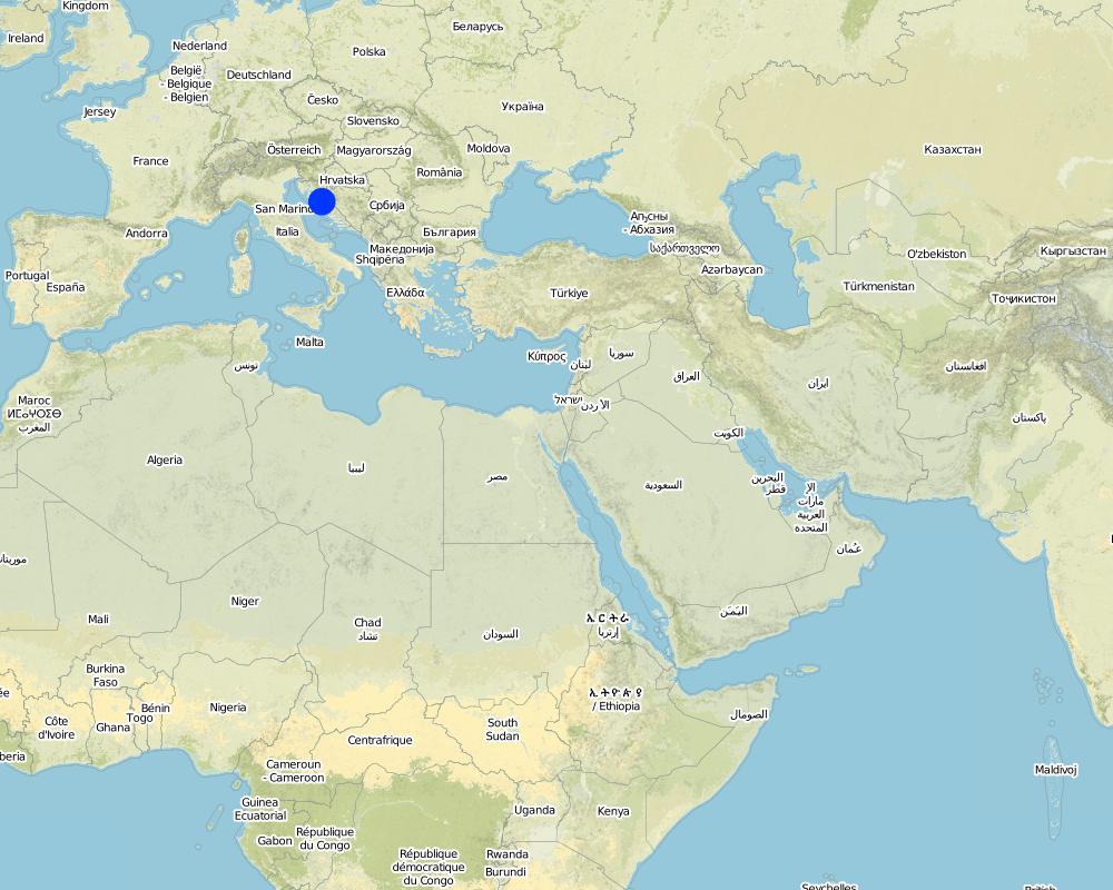
Bani Hushaish district
Specify the spread of the Technology:
- evenly spread over an area
If precise area is not known, indicate approximate area covered:
- 10-100 km2
Comments:
Total area covered by the SLM Technology is 20.6 km2.
Alrawanah Bani Hushaish, which is located on the eastern side of the capital Sanaa, and is about 16 km away
Map
×2.6 Date of implementation
If precise year is not known, indicate approximate date:
- more than 50 years ago (traditional)
2.7 Introduction of the Technology
Specify how the Technology was introduced:
- as part of a traditional system (> 50 years)
Comments (type of project, etc.):
It is a very old technology but was rehabilitated in 1956 by the community
3. Classification of the SLM Technology
3.1 Main purpose(s) of the Technology
- reduce, prevent, restore land degradation
3.2 Current land use type(s) where the Technology is applied

Cropland
- Tree and shrub cropping
Tree and shrub cropping - Specify crops:
- grapes
- Qat
Number of growing seasons per year:
- 1
Specify:
Longest growing period in days: 90
Comments:
Major land use problems (compiler’s opinion): Erosion of riparian valley resulting from the floods in addition to gully erosion on agricultural land
Major land use problems (land users’ perception): Erosion of agricultural terraces
3.4 Water supply
Water supply for the land on which the Technology is applied:
- rainfed
Comments:
Water supply: Also mixed rainfed - irrigated and post-flooding
3.5 SLM group to which the Technology belongs
- cross-slope measure
- irrigation management (incl. water supply, drainage)
3.6 SLM measures comprising the Technology

structural measures
- S1: Terraces
3.7 Main types of land degradation addressed by the Technology

soil erosion by water
- Wg: gully erosion/ gullying
- Wr: riverbank erosion

physical soil deterioration
- Ps: subsidence of organic soils, settling of soil
Comments:
Secondary types of degradation addressed: Ps: subsidence of organic soils, settling of soil
Main causes of degradation: floods (As a result of flow velocity and rainwater collected from many places)
Secondary causes of degradation: over-exploitation of vegetation for domestic use (For domestic use due to lack of alternatives such as gas), poverty / wealth (poverty), education, access to knowledge and support services
3.8 Prevention, reduction, or restoration of land degradation
Specify the goal of the Technology with regard to land degradation:
- reduce land degradation
- restore/ rehabilitate severely degraded land
Comments:
Secondary goals: mitigation / reduction of land degradation
4. Technical specifications, implementation activities, inputs, and costs
4.1 Technical drawing of the Technology
Technical specifications (related to technical drawing):
Stone walls with outlets
Location: Bani Hushaish district. Sana'a
Date: 15-3-2013
Technical knowledge required for field staff / advisors: high (The construction process requires skills and experiences)
Technical knowledge required for land users: low (Has enough experience)
Main technical functions: control of concentrated runoff: retain / trap, water spreading, Reduce runoff
Secondary technical functions: increase of groundwater level / recharge of groundwater, water harvesting / increase water supply, sediment retention / trapping, sediment harvesting
Spillway
Vertical interval between structures (m): S
Height of bunds/banks/others (m): 2 - 3
Width of bunds/banks/others (m): 1– 1.5
Structural measure: Stone walls
Vertical interval between structures (m): S
Height of bunds/banks/others (m): 2 - 3
Width of bunds/banks/others (m): 0.3
Length of bunds/banks/others (m): 60-100
Construction material (stone): Available stones in the region
Slope (which determines the spacing indicated above): 5%
For water harvesting: the ratio between the area where the harvested water is applied and the total area from which water is collected is: 1:1
4.2 General information regarding the calculation of inputs and costs
Specify currency used for cost calculations:
- USD
Indicate average wage cost of hired labour per day:
7.00
4.3 Establishment activities
| Activity | Timing (season) | |
|---|---|---|
| 1. | Collecting stones | Before the rainy season |
| 2. | Building outlets walls | Before the rainy season |
| 3. | Packing the soil behind walls and outlets | Before the rainy season |
| 4. | Settlement of the Earth's surface and filling the grooves | Before the rainy season |
4.4 Costs and inputs needed for establishment
| Specify input | Unit | Quantity | Costs per Unit | Total costs per input | % of costs borne by land users | |
|---|---|---|---|---|---|---|
| Labour | Collecting stones | persons/day/ha | 150.0 | 7.0 | 1050.0 | 100.0 |
| Labour | Building outlets walls | persons/day/ha | 500.0 | 7.0 | 3500.0 | 100.0 |
| Labour | Packing the soil behind walls and outlets | persons/day/ha | 10.0 | 7.0 | 70.0 | 100.0 |
| Labour | Settlement of the Earth's surface and filling the grooves | persons/day/ha | 10.0 | 7.0 | 70.0 | 100.0 |
| Equipment | Collecting stones (animal traction) | ha | 1.0 | 69.76 | 69.76 | 100.0 |
| Equipment | Tools | ha | 1.0 | 14.0 | 14.0 | 100.0 |
| Equipment | Settlement of the Earth's surface and filling the grooves (animal traction) | ha | 1.0 | 23.25 | 23.25 | 100.0 |
| Total costs for establishment of the Technology | 4797.01 | |||||
| Total costs for establishment of the Technology in USD | 4797.01 | |||||
Comments:
Duration of establishment phase: 12 month(s)
4.5 Maintenance/ recurrent activities
| Activity | Timing/ frequency | |
|---|---|---|
| 1. | Repair walls and outlets | annually after the rainy season |
4.6 Costs and inputs needed for maintenance/ recurrent activities (per year)
| Specify input | Unit | Quantity | Costs per Unit | Total costs per input | % of costs borne by land users | |
|---|---|---|---|---|---|---|
| Labour | Repair walls and outlets | persons/day/ha | 20.0 | 7.0 | 140.0 | 100.0 |
| Total costs for maintenance of the Technology | 140.0 | |||||
| Total costs for maintenance of the Technology in USD | 140.0 | |||||
Comments:
Machinery/ tools: A Leveler , shovel and a big hammer
The calculated costs are based on the current situation and a length of the wall of 500 meters and a height of 2 meters and a width of 0.3 meters.
It should be noted that the walls do not work in all agricultural terraces, but they are working in areas threatened by drift but for outlets it is built in each of agricultural land terraces. Construction costs were calculated for walls with outlets including the number of working days per person. In fact most of the activities are at the same time and with the participation of a large number of people.
4.7 Most important factors affecting the costs
Describe the most determinate factors affecting the costs:
The most determinate factors affecting the costs are the collection and the transport of stones, and the difficulty of the road
5. Natural and human environment
5.1 Climate
Annual rainfall
- < 250 mm
- 251-500 mm
- 501-750 mm
- 751-1,000 mm
- 1,001-1,500 mm
- 1,501-2,000 mm
- 2,001-3,000 mm
- 3,001-4,000 mm
- > 4,000 mm
Agro-climatic zone
- semi-arid
Thermal climate class: temperate
5.2 Topography
Slopes on average:
- flat (0-2%)
- gentle (3-5%)
- moderate (6-10%)
- rolling (11-15%)
- hilly (16-30%)
- steep (31-60%)
- very steep (>60%)
Landforms:
- plateau/plains
- ridges
- mountain slopes
- hill slopes
- footslopes
- valley floors
Altitudinal zone:
- 0-100 m a.s.l.
- 101-500 m a.s.l.
- 501-1,000 m a.s.l.
- 1,001-1,500 m a.s.l.
- 1,501-2,000 m a.s.l.
- 2,001-2,500 m a.s.l.
- 2,501-3,000 m a.s.l.
- 3,001-4,000 m a.s.l.
- > 4,000 m a.s.l.
Comments and further specifications on topography:
Altitudinal zone: 2400 m a.s.l.
5.3 Soils
Soil depth on average:
- very shallow (0-20 cm)
- shallow (21-50 cm)
- moderately deep (51-80 cm)
- deep (81-120 cm)
- very deep (> 120 cm)
Soil texture (topsoil):
- medium (loamy, silty)
- fine/ heavy (clay)
Topsoil organic matter:
- medium (1-3%)
If available, attach full soil description or specify the available information, e.g. soil type, soil PH/ acidity, Cation Exchange Capacity, nitrogen, salinity etc.
Soil depth on average: 150 cm
Soil texture: Flood deposits
Topsoil organic matter: After falling grape leaves and weeds developing
Soil fertility is low - medium (output of the flood deposits)
Soil drainage / infiltration is medium - good
Soil water storage capacity is medium - high
5.4 Water availability and quality
Ground water table:
> 50 m
Availability of surface water:
poor/ none
Water quality (untreated):
poor drinking water (treatment required)
Comments and further specifications on water quality and quantity:
Ground water table: 400 m
5.5 Biodiversity
Species diversity:
- low
5.6 Characteristics of land users applying the Technology
Market orientation of production system:
- mixed (subsistence/ commercial)
Off-farm income:
- 10-50% of all income
Relative level of wealth:
- poor
- average
Individuals or groups:
- groups/ community
Level of mechanization:
- manual work
- animal traction
Gender:
- men
Indicate other relevant characteristics of the land users:
Land users applying the Technology are mainly common / average land users
Difference in the involvement of women and men: Women could not do the hard work, therefore, men do work on the farm and women do the house works.
Population density: > 500 persons/km2
Annual population growth: 3% - 4%
70% of the land users are average wealthy and own 90% of the land.
30% of the land users are poor and own 10% of the land.
100% of the land users are poor and own 100% of the land.
Level of mechanization: Also mechanized, but less common
5.7 Average area of land used by land users applying the Technology
- < 0.5 ha
- 0.5-1 ha
- 1-2 ha
- 2-5 ha
- 5-15 ha
- 15-50 ha
- 50-100 ha
- 100-500 ha
- 500-1,000 ha
- 1,000-10,000 ha
- > 10,000 ha
Is this considered small-, medium- or large-scale (referring to local context)?
- medium-scale
Comments:
0.45 – 0.9 fragmentation of tenure is the cause of the small ownership per household
5.8 Land ownership, land use rights, and water use rights
Land ownership:
- individual, titled
Land use rights:
- leased
- individual
- Waqf
Water use rights:
- communal (organized)
- Waqf
Comments:
There are three types of land ownership owned, Waqf, and a share at 70%, 20%, 10% respectively.
5.9 Access to services and infrastructure
health:
- poor
- moderate
- good
education:
- poor
- moderate
- good
technical assistance:
- poor
- moderate
- good
employment (e.g. off-farm):
- poor
- moderate
- good
markets:
- poor
- moderate
- good
energy:
- poor
- moderate
- good
roads and transport:
- poor
- moderate
- good
drinking water and sanitation:
- poor
- moderate
- good
financial services:
- poor
- moderate
- good
6. Impacts and concluding statements
6.1 On-site impacts the Technology has shown
Socio-economic impacts
Production
crop production
risk of production failure
production area
land management
Water availability and quality
demand for irrigation water
Income and costs
farm income
diversity of income sources
workload
Socio-cultural impacts
food security/ self-sufficiency
SLM/ land degradation knowledge
livelihood and human well-being
Comments/ specify:
As a result of reduced labor and increased production, standard of living is improved and children can go to school.
Ecological impacts
Water cycle/ runoff
surface runoff
excess water drainage
groundwater table/ aquifer
Soil
soil moisture
soil loss
Biodiversity: vegetation, animals
habitat diversity
Climate and disaster risk reduction
flood impacts
6.2 Off-site impacts the Technology has shown
downstream siltation
6.3 Exposure and sensitivity of the Technology to gradual climate change and climate-related extremes/ disasters (as perceived by land users)
Gradual climate change
Gradual climate change
| Season | increase or decrease | How does the Technology cope with it? | |
|---|---|---|---|
| annual temperature | increase | well |
Climate-related extremes (disasters)
Meteorological disasters
| How does the Technology cope with it? | |
|---|---|
| local rainstorm | well |
Hydrological disasters
| How does the Technology cope with it? | |
|---|---|
| general (river) flood | not well |
6.4 Cost-benefit analysis
How do the benefits compare with the establishment costs (from land users’ perspective)?
Short-term returns:
neutral/ balanced
Long-term returns:
positive
How do the benefits compare with the maintenance/ recurrent costs (from land users' perspective)?
Short-term returns:
positive
Long-term returns:
very positive
6.5 Adoption of the Technology
If available, quantify (no. of households and/ or area covered):
537 households covering 100 percent of the stated area
Comments:
537 land user families have adopted the Technology without any external material support
There is a moderate trend towards spontaneous adoption of the Technology
Comments on adoption trend: The technology is implemented at the level of the entire region, but due to a lack of capital the adoption is hindered.
6.7 Strengths/ advantages/ opportunities of the Technology
| Strengths/ advantages/ opportunities in the compiler’s or other key resource person’s view |
|---|
|
Protection of the land from erosion How can they be sustained / enhanced? Continue the process of maintenance to maintain walls and outlets |
|
Increase in soil moisture How can they be sustained / enhanced? Maintenance of the outlets to ensure that they are working |
6.8 Weaknesses/ disadvantages/ risks of the Technology and ways of overcoming them
| Weaknesses/ disadvantages/ risks in the compiler’s or other key resource person’s view | How can they be overcome? |
|---|---|
| The inability of the walls to withstand severe flooding due to the use of only stones in construction | The use of stone and cement materials in the construction of walls |
7. References and links
7.1 Methods/ sources of information
7.2 References to available publications
Title, author, year, ISBN:
Report of traditional knowledge and customs (sallam, et al, 2008)- General Census of Population, Housing and Establishment (Census, 2004). - 45.Guide of agricultural climate in Yemen (Al Khorasani, 2005).
Available from where? Costs?
Agricultural Research and ExtensionAuthority, AREACentral Bureau of StatisticsAgricultural Research and ExtensionAuthority, AREA
Links and modules
Expand all Collapse allLinks

Rehabilitation of terraces and diversion construction with gates … [Yemen]
The rehabilitation of walls and outlets of the terraces and diversion construction with accessories from channels and gates are carried out by the local community in a regular way
- Compiler: ahmed algalal
Modules
No modules


