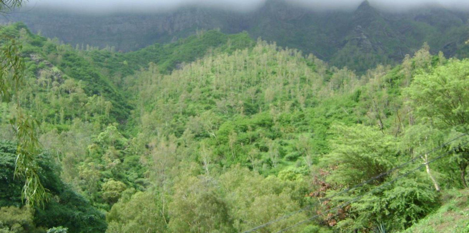
Forest area in the mountains with several species: Eucalyptus spp., Dichrostachys cinerea and Lantana camara on steep slopes. (Jacques Tavares)
Mountain forest areas are considered protective due to their role in regulating water (infiltration of storm water, regulation of surface runoff, and ground water recharge) within the watershed. The main species used are Prosopis juliflora, Parkinsonia aculeata, Jatropha curcas, Atriplex spp, Acacia holosericea, Acacia victoriae, Lantana camara and others, in arid areas and Eucalyptus camaldulensis, Grevillea robusta, Pinus and Cupressus ssp. in highland and humid areas.
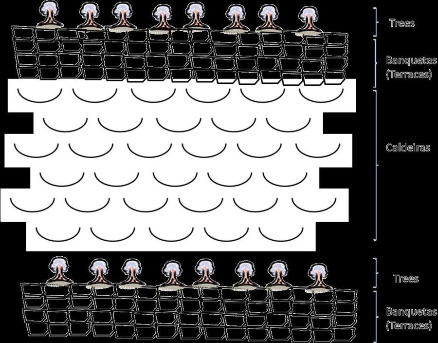
Purpose of the Technology: The climatic conditions are characterized by high spatial and temporal variability of the rainfall. The rains are concentrated in two or three months (August and September or October); the highlands and the N-NE parts are wetter compared to the low lands or coastal areas, which are very dry. The average annual rainfall is about 225 mm over the whole island; it has declined since the 1960s, with negative effects on farming conditions, and water supply. However, in areas located more than 500 m above sea level and exposed to trade winds, rainfall can exceed 700 mm. About 20% of the precipitation is lost through runoff, 13% infiltrates the soil and recharges aquifers and 67% evaporates. The evaporation loss is a limiting factor for any agriculture or forestry. Therefore, it is necessary to adapt the afforestation implementation to the specific local conditions (slope, stone cover, climate, etc). To overcome and minimize the problem of water scarcity, several measures are applied: (a) caldeira or half-moon structures achieved with earth or stone; (b) contour furrows or level bench terraces with stone walls arranged along the contour; (c). small dams to protect gullies. The aim is to maximize retention of water and control surface runoff. This not only allows better infiltration of water for the tree plantations, but also protects against soil erosion and facilitates groundwater recharge.
Establishment / maintenance activities and inputs: The success of the reforestation may be indicated not only by the area covered but also by the number of introduced plants. In 1975, there were about 3,000 ha of afforested land. By 2011, there are over 90,000 ha of afforested land with almost 50 million trees. Afforestation has focused mainly on the island of Santiago and Santo Antão, (13% of the total area reforested). Nowadays, more than 20% of the country is afforested. The forest has had a great importance in the context of combating desertification, rehabilitation of vegetation cover, in meeting energy needs and forage production and in developing agrosilvopastoral systems, as well as having undoubtedly contributed to a significant modification of the landscape in Cape Verde. The afforestation activities also contributed to increase biodiversity of some species of birds, including “Galinha di mato” (Numida meleagris), “Codorniz” (Coturnix coturnix), “Passarinha” (Halcyon leucocephala) and others.
Natural / human environment: The forest species are mainly used for land protection and for production of fuel wood and coal. Because of the poor growing conditions, the forest species are not well suited to the construction industry or wood processing.
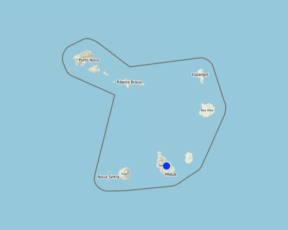
الموقع: Ribeira Seca, Santiago Island, Cape Verde, الرأس الأخضر
عدد مواقع تنفيذ التقنيةالتي تم تحليلها:
انتشار التقنية: منتشرة بالتساوي على مساحة (71.5 km²)
في منطقة محمية بشكل دائم؟:
تاريخ التنفيذ: منذ 10-50 سنة
نوع التقديم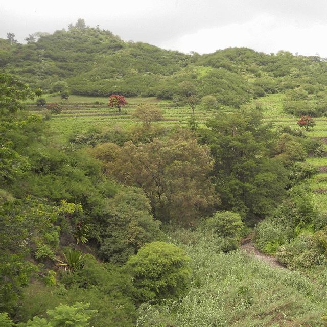


| تحديد المدخلات | الوحدة | الكمية | التكاليف لكل وحدة (غير متاح) | إجمالي التكاليف لكل مدخل (غير متاح) | % من التكاليف التي يتحملها مستخدمو الأراضي |
| العمالة | |||||
| Labour | ha | 1,0 | 28218,0 | 28218,0 | |
| معدات | |||||
| Tools | ha | 1,0 | 410,0 | 410,0 | 10,0 |
| المواد النباتية | |||||
| Seeds | ha | 1,0 | 942,0 | 942,0 | |
| إجمالي تكاليف إنشاء التقنية | 29'570.0 | ||||
| إجمالي تكاليف إنشاء التقنية بالدولار الأمريكي | 29'570.0 | ||||
| تحديد المدخلات | الوحدة | الكمية | التكاليف لكل وحدة (غير متاح) | إجمالي التكاليف لكل مدخل (غير متاح) | % من التكاليف التي يتحملها مستخدمو الأراضي |
| العمالة | |||||
| Forest cleaning | ha | 1,0 | 142,0 | 142,0 | 52,0 |
| إجمالي تكاليف صيانة التقنية | 142.0 | ||||
| إجمالي تكاليف صيانة التقنية بالدولار الأمريكي | 142.0 | ||||
Firewood to the community
It reduces the options of land use
Any sex has the same opportunity on the assets of the forest
It improves air quality, promotes the production of endemic species and its use as medicine


