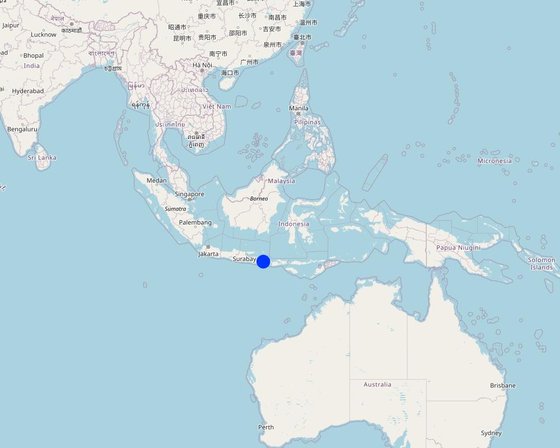
Location 1 of the Pilot Locations for Land Restoration in Northeast Bali (Fabian Wiropranoto)
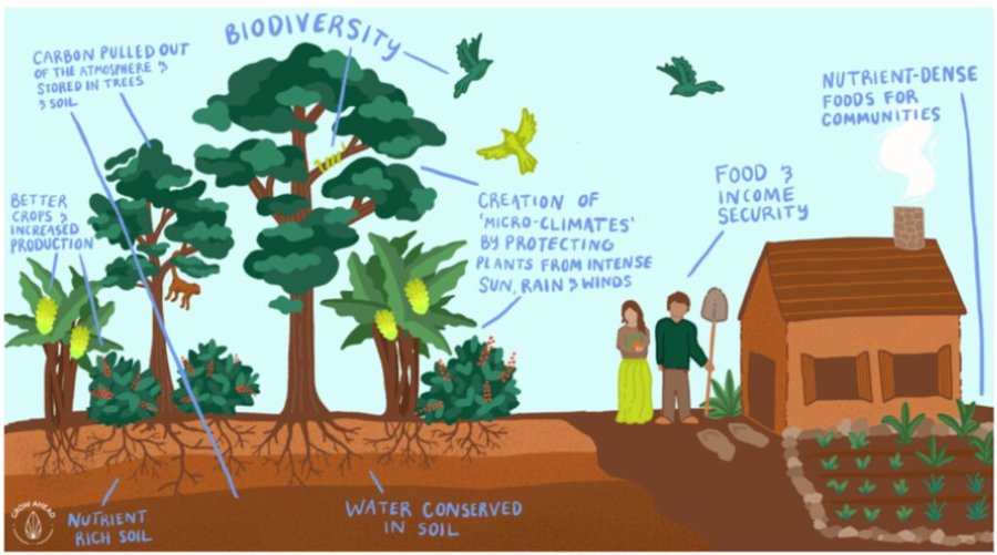
A partnership of local communities and governments is, in collaboration with international and national development organizations, donors and investors, rehabilitating approximately 20,000 hectares of degraded forest and agricultural land using assisted natural regeneration, enrichment planting and agroforestry. The resultant secondary forests and agroforests will have high values for ecotourism, sequester substantial amounts of carbon, produce a range of in-demand commodities (e.g., coffee, spices), and generate bioenergy. They will also offer improved ecosystem services to Bali as a whole, which will be very valuable for the tourism industry, representing an opportunity for investment and payment for ecosystem services (PES).
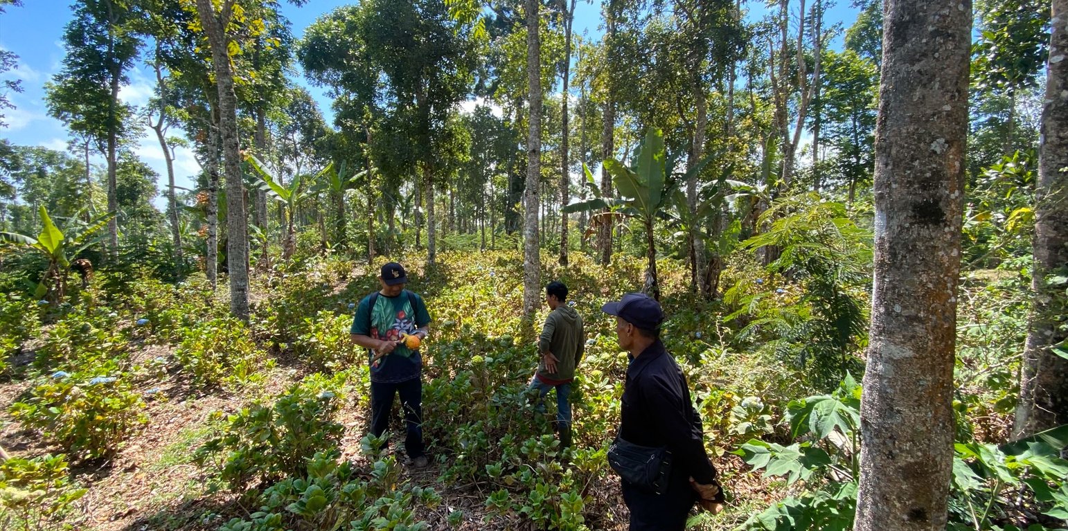
In the first 20 hectares, around 1,600 trees were planted per hectare, consisting of Coffee Arabica Katimor and Local Avocado trees. In between, shrubs such as local cassava and root species already existed. The spacing followed recommendations from ICCRI (Indonesian Coffee and Cacao Research Institute) whereby 2-3 meters distance are placed in between coffee trees, with much further distances for the shade trees. For fertilization, local goat manure is primarily used and filled in the planting holes the size of 30cm x 30cm x 30cm.
Northeast Bali, Indonesia — which includes the Batur UNESCO Global Geopark — features approximately 135,000 ha of degraded land in the Government’s Forest Estate (‘Kawasan Hutan’), which is managed by the provincial government’s Forestry and Environment Agency (Dinas Kehutanan Dan Lingkungan Hidup Provinsi Bali/DKLH).
The vegetation, soils and water resources are designated as ‘potentially’ to ‘very severely’ degraded on 463,500 hectares. This is steadily increasing owing to unsustainable forestry and farming practices. Local communities within and surrounding the Kawasan Hutan — among the poorest in Bali — are affected by droughts, flash floods, landslides and poor water quality.
The Geopark in Northeast Bali was established in 2012 on the active volcanic landscape of Mt Batur, which features not only unique and dramatic geological formations, protected forests and endemic flora and fauna but also 15 villages. Approximately 90% of the Geopark is classified as severely degraded owing to a lack of post-eruption rehabilitation and unsustainable farming practices. The Geopark received almost one million visitors in 2019.
The ten-year project will be implemented by a consortium consisting of Sustainability and Resilience Co. (a local NGO), Indonesian government (through DKLH), local university (Udayana), international research-in-development organization (CIFOR-ICRAF), specialist national research organizations, intergovernmental organization, larger private sector and investment partners, each bringing a specific set of skills and expertise.
The work will be carried out through four major components.
1. Establishment of a coordinated enabling environment through a multistakeholder forum of local governments, national and provincial government agencies, communities, larger private sector and project consortium members.
2. Co-designing and co-implementing models of integrated ecosystem and livelihoods restoration that suit local socio-economic and environmental conditions with staged expansion over the ten years.
3. Training communities, local small businesses and Government staff in co-design, establishment and management of restored, productive ecosystems and value chains.
4. Strengthening and further introducing partnerships between the community, public and private sectors in all aspects of the landscape, including co-developing and co-implementing an enabling investment environment for continuing financial flows.
الموقع: Wanagiri, Northeast Bali, Bali, أندونيسيا
عدد مواقع تنفيذ التقنيةالتي تم تحليلها: 100 - 1000 موقع
انتشار التقنية: منتشرة بالتساوي على مساحة (approx. 0.1-1 كم2)
في منطقة محمية بشكل دائم؟: نعم
تاريخ التنفيذ: 2024; منذ أقل من 10 سنوات (مؤخرًا)
نوع التقديم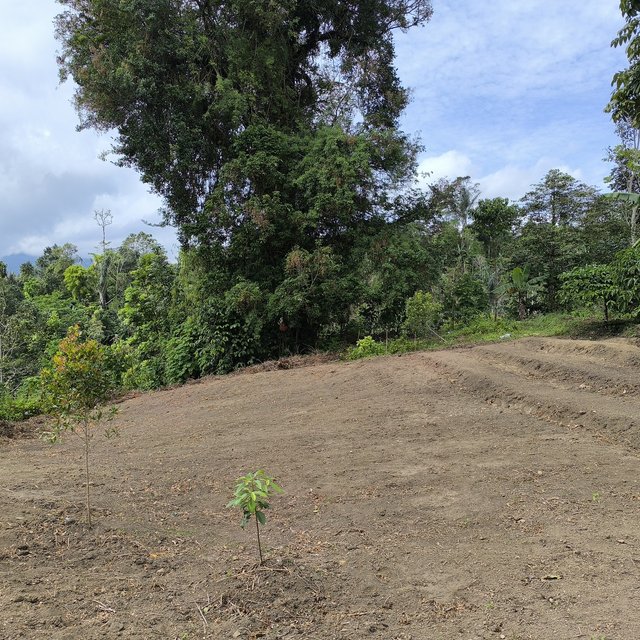


| تحديد المدخلات | الوحدة | الكمية | التكاليف لكل وحدة (دولار أمريكي USD) | إجمالي التكاليف لكل مدخل (دولار أمريكي USD) | % من التكاليف التي يتحملها مستخدمو الأراضي |
| العمالة | |||||
| Workers and Researchers | 1000 | 20,0 | 1000,0 | 20000,0 | |
| المواد النباتية | |||||
| Seedlings | 500 | 40,0 | 500,0 | 20000,0 | |
| الأسمدة والمبيدات الحيوية | |||||
| Organic fertilizer | 60 | 100,0 | 60,0 | 6000,0 | |
| مواد البناء | |||||
| Nursery | 1000 | 14,0 | 1000,0 | 14000,0 | |
| إجمالي تكاليف إنشاء التقنية | 60'000.0 | ||||
| إجمالي تكاليف إنشاء التقنية بالدولار الأمريكي | 100.0 | ||||
| تحديد المدخلات | الوحدة | الكمية | التكاليف لكل وحدة (دولار أمريكي USD) | إجمالي التكاليف لكل مدخل (دولار أمريكي USD) | % من التكاليف التي يتحملها مستخدمو الأراضي |
| العمالة | |||||
| Transportation, accommodation in the 1st year | Package | 1,0 | 250,0 | 250,0 | |
| Transportation, accommodation in the 2nd year | Package | 1,0 | 250,0 | 250,0 | |
| Transportation, accommodation in the 2nd year | Package | 1,0 | 250,0 | 250,0 | |
| الأسمدة والمبيدات الحيوية | |||||
| Goat manure in the 1st year | kg | 400,0 | 0,2 | 80,0 | |
| Chicken manure in the 1st year | kg | 400,0 | 0,1 | 40,0 | |
| Goat manure in the 2nd year | kg | 400,0 | 0,2 | 80,0 | |
| Chicken manure in the 2nd year | kg | 400,0 | 0,1 | 40,0 | |
| Goat manure in the 3rd year | kg | 400,0 | 0,2 | 80,0 | |
| Chicken manure in the 3rd year | kg | 400,0 | 0,1 | 40,0 | |
| إجمالي تكاليف صيانة التقنية | 1'110.0 | ||||
| إجمالي تكاليف صيانة التقنية بالدولار الأمريكي | 1.85 | ||||
52.64% primary education 35.51% lower secondary and upper secondary 11.85% undergraduate and graduate school Technical assistance Employment Markets Energy Road and transport Drinking water and sanitation
الكمية قبل الإدارة المستدامة للأراضي: 0 ha
الكمية بعد الإدارة المستدامة للأراضي: 20 ha
This is calculated per 20 ha of the pilot area.
الكمية قبل الإدارة المستدامة للأراضي: 1 income source
الكمية بعد الإدارة المستدامة للأراضي: 2 income sources
Per 20 ha
الكمية قبل الإدارة المستدامة للأراضي: 0 activity
الكمية بعد الإدارة المستدامة للأراضي: 3 activities
Traditional rituals in 20 ha of the pilot area
الكمية قبل الإدارة المستدامة للأراضي: 30%
الكمية بعد الإدارة المستدامة للأراضي: 75%
الكمية قبل الإدارة المستدامة للأراضي: 5 types
الكمية بعد الإدارة المستدامة للأراضي: 10 types
الكمية قبل الإدارة المستدامة للأراضي: 0 organisation
الكمية بعد الإدارة المستدامة للأراضي: 10 organisations
Per 20 ha


