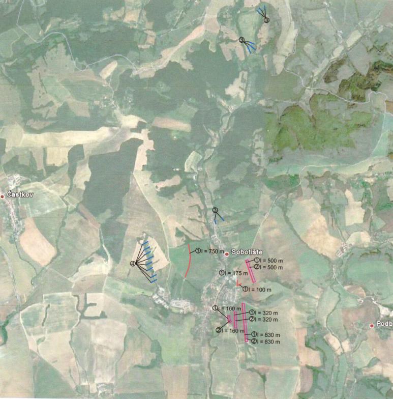
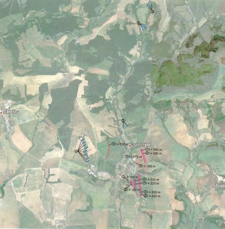
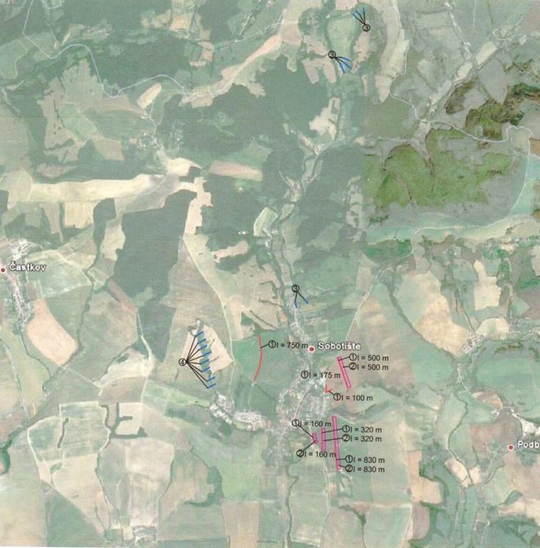
The programme of landscape revitalization and integrated river basin management in the Slovak republic for the year 2011 - retention measures in the Sobotište village. [سلوفاكيا]
- تاريخ الإنشاء:
- تحديث:
- جامع المعلومات: Zuzana Studvova
- المحرر: –
- المُراجع: David Streiff
Program revitalizácie krajiny a integrovaného manažmentu povodí v Slovenskej republike pre rok 2011 - vodozádržné opatrenia v obci Sobotište. (Slovak language)
approaches_2680 - سلوفاكيا
- The programme of landscape revitalization and integrated river basin management in the Slovak republic for the year 2011 - retention measures in the Sobotište village.: 2 أغسطس، 2017 (inactive)
- The programme of landscape revitalization and integrated river basin management in the Slovak republic for the year 2011 - retention measures in the Sobotište village.: 2 أغسطس، 2017 (public)
عرض الأقسام
توسيع الكل طي الكل1. معلومات عامة
1.2 تفاصيل الاتصال بالأشخاص الرئيسيين لمصدر المعلومات والمؤسسات المعنية بتقييم وتوثيق النهج
اسم المشروع الذي سهّل توثيق/تقييم النهج (إذا كان ذلك على صلة)
Sustainable Hill Cultivation Programme1.3 الشروط المتعلقة باستخدام البيانات الموثقة من خلال WOCAT
متى تم تجميع البيانات (ميدانيا)؟:
01/01/2015
يوافق جامع المعلومات والشخص (لاشخاص) الرئيسي لمصدر المعلومات على الشروط المتعلقة باستخدام البيانات الموثقة من خلال WOCAT:
نعم
1.4 المراجع الخاصة باستبيان(استبيانات) تقنيات الإدارة المستدامة للأراضي
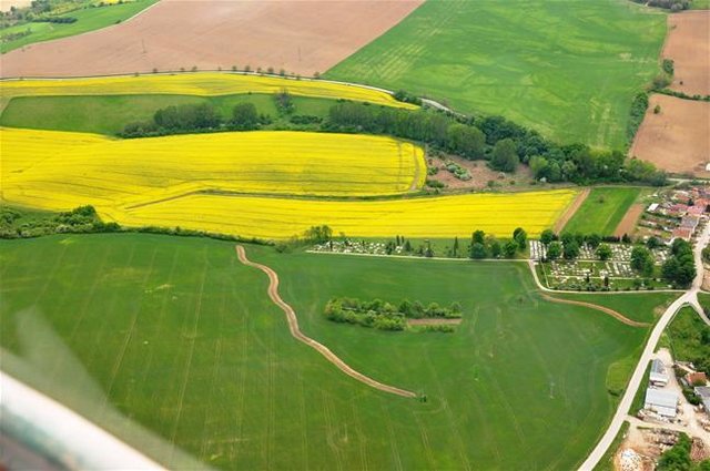
Level ditches in cropland [سلوفاكيا]
Conservation measures for eroded cropland. The technology contains level ditches of various lengths, which are digged along a contour.
- جامع المعلومات: Zuzana Studvova
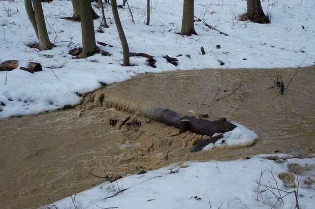
Wooden check dams [سلوفاكيا]
Small wooden check dams built in erosion rills, grooves or gorges to reduce flood risk.
- جامع المعلومات: Zuzana Studvova
2. وصف نهج الإدارة المستدامة للأراضي
2.1 وصف موجز للنهج
This approach is devoted to the implementation of 'The Landscape Revitalisation Programme and integrated river basins management of the Slovak Republic' in the Sobotište village.
2.2 وصف تفصيلي للنهج
وصف تفصيلي للنهج:
Aims / objectives: The objective of the first implementation project for 2011 was to create, activate and systematically implement a minimum of 6 million m³ of water retention elements in mountain and foothill areas of forest-agricultural landscape in Slovakia. A particular aim was to create and build landscape water retention systems, terrain elements, facilities and technical solutions in forest, agricultural and urban areas in selected village locations, with the abovementioned cyclical rainwater retention capacity, which will then be operated and
maintained. Another project objective was to force and socially support the creation of employment at community and regional level. The creation of water retention elements and the implementation of revitalisation measures required the creation of a minimum of 2,500 jobs of a seasonal and temporary nature in 2011, including extending existing specialist capacities. This whould also extend the work skills and knowledge necessary for revitalisation of the landscape.
833 municipalities showed interest to participate in this project/approach, while 200 municipalities met the criteria. The project created about 3,500 seasonal jobs in 2011, particularly in regions with high unemployment.
Methods: Criteria and their significance for including villages into the first implementation project are
as follows:
1. 45% - historic or regularly repeated occurrence of flash flooding,
2. 35 % - village is situated in a location with a high potential risk of flooding, in accordance
with modelled potential for the occurrence of flooding. A map of regional and local
potential for flooding in the area of Slovakia1
is at Appendix No. 1,
3. 10% - location of a village in the upper part of river basins, so the implemented measures
will positively decrease the risk of flooding for highest possible number of villages in the
given river basins,
4. 10% - the ratio of documented unemployment is taking into account so citizens of villages
with a high ratio of documented unemployment could contribute towards revitalisation
works.
The submitted methodology of the whole flood potential of Slovakia was prepared on the basis of the work of J. Minár and Co. (2005). The mentioned work focuses upon the
presentation of methodology and results for evaluating the flood creation potential within the whole of Slovakia. It also includes a general description of the modelling of hydrological
processes. The method presented in this work is a good alternative for fast, effective and relatively financially undemanding but still sufficiently reliable analysis of flood risks of
larger areas. The actual calculation of total potential for flooding took place in the technological environment of Geographic Information Systems (GIS) in the following steps
with the stated data:
- calculation of the morphometric potential (incline, horizontal articulation of the
topography, slope length, speed of surface run-off),
- partial synthetic geological potential (infiltration and drainage properties of the soil,
retention properties of the land cover, breaking effect of land cover, size of river basin,
shape of river basin),
- overall potential of the land for the creation of flood situations (climatic and
hydrological characteristics and data).
Stages of implementation: Management of the first implementation project was carried out by the Executive Manager of the Programme of Landscape Revitalization and Integrated River Basin Management in SR in cooperation with the Government Representative for Local Government and for Integrated River Basin and Landscape Management and other interested departments of the Government Office SR.
2.3 صور عن النهج
2.5 البلد/المنطقة/المواقع التي تم تطبيق النهج فيها
البلد:
سلوفاكيا
المنطقة/الولاية/المحافظة:
Slovakia
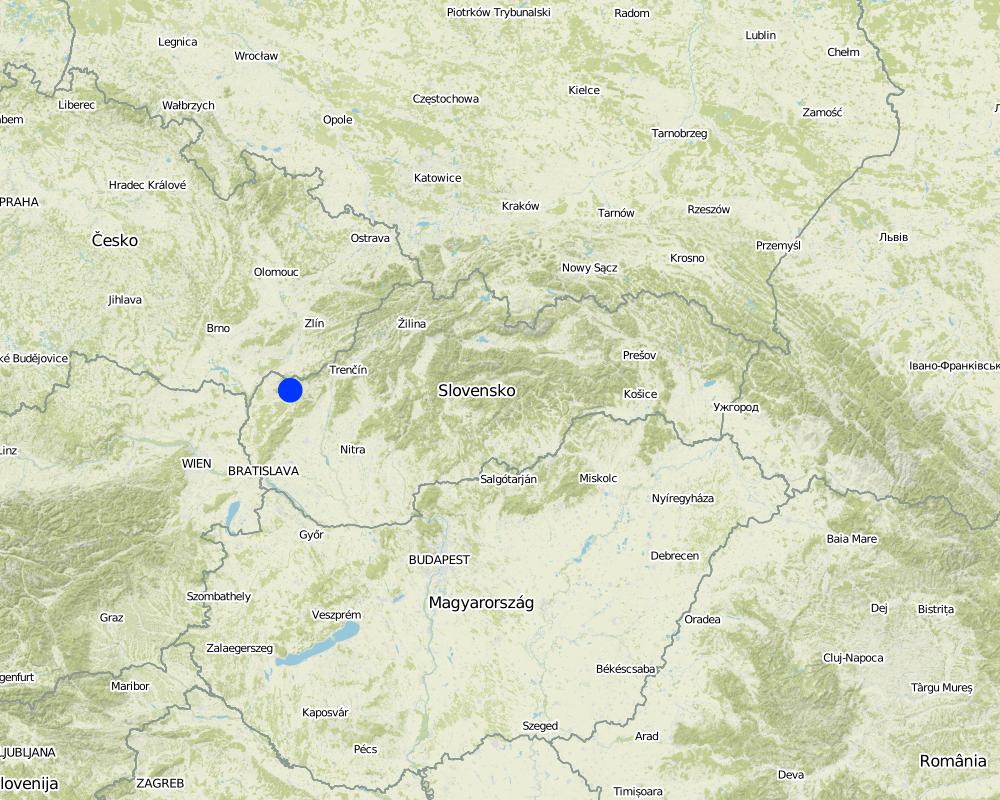
مزيد من التفاصيل حول الموقع:
Senica / Sobotište
Map
×2.6 تواريخ بدء وإنهاء تنفيذ النهج
أشر إلى سنة البدء:
2011
سنة الإنهاء (إذا لم يعد النهج مطبقًا):
2012
2.7 نوع النهج
- قائم على مشروع/برنامج
2.8 الغايات/الأهداف الرئيسية للنهج
The Approach focused mainly on SLM with other activities
The Sobotište of village was greatly affected in 2011 by floods from storm rainfall. Problems with floods, however, occur regularly, especially at the Teplica and the Sobotišský stream. Some problems have been recorded in farmland and meadows, in places of concentrated runoff during the storm rainfalls, long lasting rainfalls, and snow melting. Floods endanger villages and make severe damage. The goal of the approach is to eliminate damage to healt and properties.
Water retention measures are proposed in the territory of Sobotište, localities of Kubiny, Staré Hory, Javorec, Kaničkov Jarok and Padelky. It is expected that the proposed water retention measures will support the accumulation and infiltration of water into the soil and retard runoff from farmland, meadows, and pastures. With the proper function of measures the surface runoff in farmland will decrease and slow down, and community will not endanger as much as previously.
The SLM Approach addressed the following problems: In general, the main problems within the implementation of projects are mostly legislative regulations that hamper the SLM and the implementation of technologies. The big problem is protection zone of particular rivers connected to administrative and legislative laws and regulations. Some difficulties detected were the execution of permissions for the implementations of methods and technologies that would help to achieve the sustainable land management.
Second problem is land consolidation. The process of the land consolidation is too long to be achieved and accomplished in time. Especially if the public call of the application submission for subsidies needs the consolidation of land to be already solved.
Third, the measures cannot be more expensive than the protected object.
Four, there is lack of money for the purchasing the land in municipalities.
Five, there is very poor law enforcement and recovery of law and claims.
2.9 الظروف التي تمكن أو تعيق تنفيذ التقنية/التقنيات المطبقة بموجب النهج
توفر/الوصول إلى الموارد والخدمات المالية
- معيق
Treatment through the SLM Approach:
الإطار القانوني (حيازة الأراضي، وحقوق استخدام الأراضي والمياه)
- معيق
ownership of the land
Treatment through the SLM Approach:
3. المشاركة وأدوار الأطراف المعنية
3.1 أصحاب المصلحة المعنيون بالنهج وأدوارهم
- مستخدمو الأراضي المحليون/المجتمعات المحلية
The approach involved socially and economically disadvantaged ethnicities
- متخصصون في الإدارة المستدامة للأراضي / مستشارون زراعيون
- الحكومة الوطنية (المخططون، صانعو القرار)
3.2 انخراط مستخدمي الأراضي المحليين/المجتمعات المحلية في المراحل المختلفة للنهج
| انخراط مستخدمي الأراضي المحليين/المجتمعات المحلية | حدد من شارك وصف الأنشطة | |
|---|---|---|
| المبادرة/التحفيز | التعبئة الذاتية | Government |
| التخطيط | التعبئة الذاتية | Government, SLM specialist |
| التنفيذ | التعبئة الذاتية | Municipalities, land users |
| الرصد/التقييم | التعبئة الذاتية | Municipalities, land users |
| Research | سلبي |
3.4 اتخاذ القرار بشأن اختيار تقنية/تقنيات الإدارة المستدامة للأراضي
حدد من الذي قرر اختيار التقنية/التقنيات التي سيتم تنفيذها:
- مستخدمو الأراضي بشكل أساسي، بدعم من متخصصي الإدارة المستدامة للأراضي
اشرح:
Decisions on the method of implementing the SLM Technology were made by mainly by land users supported by SLM specialists
4. الدعم الفني وبناء القدرات وإدارة المعرفة
4.1 بناء القدرات/التدريب
هل تم تقديم التدريب لمستخدمي الأراضي / الأطراف المعنيين الآخرين؟:
كلا
4.2 خدمة استشارية
هل يملك مستخدمو الأراضي وصولا إلى خدمة استشارية؟:
كلا
4.3 تعزيز المؤسسات (التطوير التنظيمي)
هل تم إنشاء أو تعزيز مؤسسات من خلال هذا النهج؟:
- لا
4.4 الرصد والتقييم
هل يشكل الرصد والتقييم جزءا من النهج؟:
كلا
4.5 البحوث
هل كانت البحوث جزءًا من النهج؟:
نعم
حدد المواضيع:
- تكنولوجيا
أعط تفاصيل إضافية وأشر إلى من قام بالبحوث:
Research was carried out on-farm
5. التمويل والدعم المادي الخارجي
5.1 الميزانية السنوية لمكون الإدارة المستدامة للأراضي في النهج المذكور
إذا لم تكن الميزانية السنوية الدقيقة معروفة، قم بالإشارة إلى نطاقها:
- 100,000-10,000
التعليقات (على سبيل المثال المصادر الرئيسية للتمويل/الجهات المانحة الرئيسية):
Approach costs were met by the following donors: government: 100.0%
5.2 الدعم المالي/المادي المقدم لمستخدمي الأراضي
هل حصل مستخدمو الأراضي على دعم مالي/ مادي لتنفيذ التقنية/ التقنيات؟:
نعم
إذا كانت الإجابة بنعم، حدد نوع (أنواع) الدعم والشروط والمزودين:
Government funds and subsidies
5.3 إعانات لمدخلات محددة (بما في ذلك العمالة)
- معدات
| حدد المدخلات التي تم دعمها | إلى أي مدى | حدد الإعانات |
|---|---|---|
| الآلات | ممول بالكامل | |
| أدوات | ممول بالكامل | |
- زراعة
| حدد المدخلات التي تم دعمها | إلى أي مدى | حدد الإعانات |
|---|---|---|
| بذور | ممول بالكامل | |
| أسمدة | ممول بالكامل | |
- بناء
| حدد المدخلات التي تم دعمها | إلى أي مدى | حدد الإعانات |
|---|---|---|
| حجر | ممول بالكامل | |
| خشب | ممول بالكامل | |
5.4 الائتمان
هل تم توفير ائتمان في إطار نهج أنشطة الإدارة المستدامة للأراضي؟:
كلا
7. المراجع والروابط
7.1 طرق جمع/مصادر المعلومات
- زيارات ميدانية، مسوحات ميدانية
- مقابلات مع مستخدمي الأراضي
الروابط والوحدات المواضيعية
توسيع الكل طي الكلالروابط

Level ditches in cropland [سلوفاكيا]
Conservation measures for eroded cropland. The technology contains level ditches of various lengths, which are digged along a contour.
- جامع المعلومات: Zuzana Studvova

Wooden check dams [سلوفاكيا]
Small wooden check dams built in erosion rills, grooves or gorges to reduce flood risk.
- جامع المعلومات: Zuzana Studvova
الوحدات المواضيعية
لا يوجد وحدات مواضيعية


