Pasture inclination used for developing grazing plan [طاجيكستان]
- تاريخ الإنشاء:
- تحديث:
- جامع المعلومات: Askarsho Zevarshoev
- المحرر: –
- المراجعون: Maximilian Knoll, Yacime Khadraoui
Накшаи чарондани чорво дар чарогох аз руи мавкеи чойгиршави (офтобруя ва сояру)
approaches_3474 - طاجيكستان
عرض الأقسام
توسيع الكل طي الكل1. معلومات عامة
1.2 تفاصيل الاتصال بالأشخاص الرئيسيين لمصدر المعلومات والمؤسسات المعنية بتقييم وتوثيق النهج
متخصص في الإدارة المستدامة للأراضي:
اسم المشروع الذي سهّل توثيق/تقييم النهج (إذا كان ذلك على صلة)
Environmental Land Management and Rural Livelihood Projectاسم المؤسسة (المؤسسات) التي سهلت توثيق/تقييم النهج (إذا كان ذلك على صلة)
Aga Khan Foundation (Aga Khan Foundation) - سويسرا1.3 الشروط المتعلقة باستخدام البيانات الموثقة من خلال WOCAT
متى تم تجميع البيانات (ميدانيا)؟:
20/07/2016
يوافق جامع المعلومات والشخص (لاشخاص) الرئيسي لمصدر المعلومات على الشروط المتعلقة باستخدام البيانات الموثقة من خلال WOCAT:
نعم
1.4 المراجع الخاصة باستبيان(استبيانات) تقنيات الإدارة المستدامة للأراضي

Технология управлениия пастбищами в условиях Западного Памира [طاجيكستان]
Управление пастбищных угодий путем внедрения новой техники пастбищеоборота с учетом емкости пастбища
- جامع المعلومات: Aslam Qadamov
2. وصف نهج الإدارة المستدامة للأراضي
2.1 وصف موجز للنهج
In this approach the inclination of pasture land and its effect on the spread of sun and shadow is used to identify different periods for grazing. This simple approach will raise awareness and provides biological aspects in pasture management. In this approach the vegetation cover of the pasture is linked to the position of the sun. This is specific to mountain areas, where in one location vegetation periods can differ in two spots although they are in the same location.
2.2 وصف تفصيلي للنهج
وصف تفصيلي للنهج:
Considering pasture's geographical location and its inclination to the sun is identified as an important element of devoloping rotational grazing plans. Because of the mountainous geography of the area, within certain pasture areas one part can be sun inclined and the other is shadowed. This is effecting the vegetation growing process, since on the sun inclined part the vegetation is growing faster compared to the other where sun is reaching later. Communities in the past did not take this into consideration and grazed in both areas at the same time. This leads to degradation in the areas where vegetation did not grow properly. On the other side if the areas inclined to the sun are not grazed in time they dry up.
The main objective of this approach is to apply an ecosystem based adaptation approach in pasture use, with vegetative periods for different areas and locations. By applying this approach communities will be enabled to organize grazing plans correctly and to prevent pasture degradation.
The implementation period will start from the planing phase up to the implementation of the pasture plan. Mainly livestock owners and the PUU management is involved in the implementation of this approach. Pasture users will be mobilized according to the grazing plan, in which part of the pasture when to graze with taking into consideration the position to the sun. Beside land users, the local government is also involved to ensure sustainable use of this approach as one of the techniques in prevention of pasture degradation.
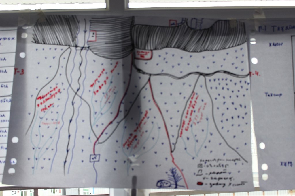
Based on the existing traditional community knowledge and experiences the communities identify the geographical location. Based on this knowledge while developing the grazing plan for the year in a meeting in a participatory manner they do community resource mapping, where the location of resources is provided. After preparing the community resource maps, especially with focus on pasture resources they mark the plots according to assigned attributes. Based on these attributes, where the important features is pasture exposition, a timeframe for grazing for each plot is set up.
Livestock owners are very much in favor to implement this approach as a simple method to prevent degradation and raising awareness on importance of periodic and systematic use of pasture lands. It was not well perceived well by some individual livestock owners, who abused the absence of grazing plans and benefited from early use of grazing without considering the degradation of the pastures.
2.3 صور عن النهج
ملاحظات عامة بخصوص الصور:
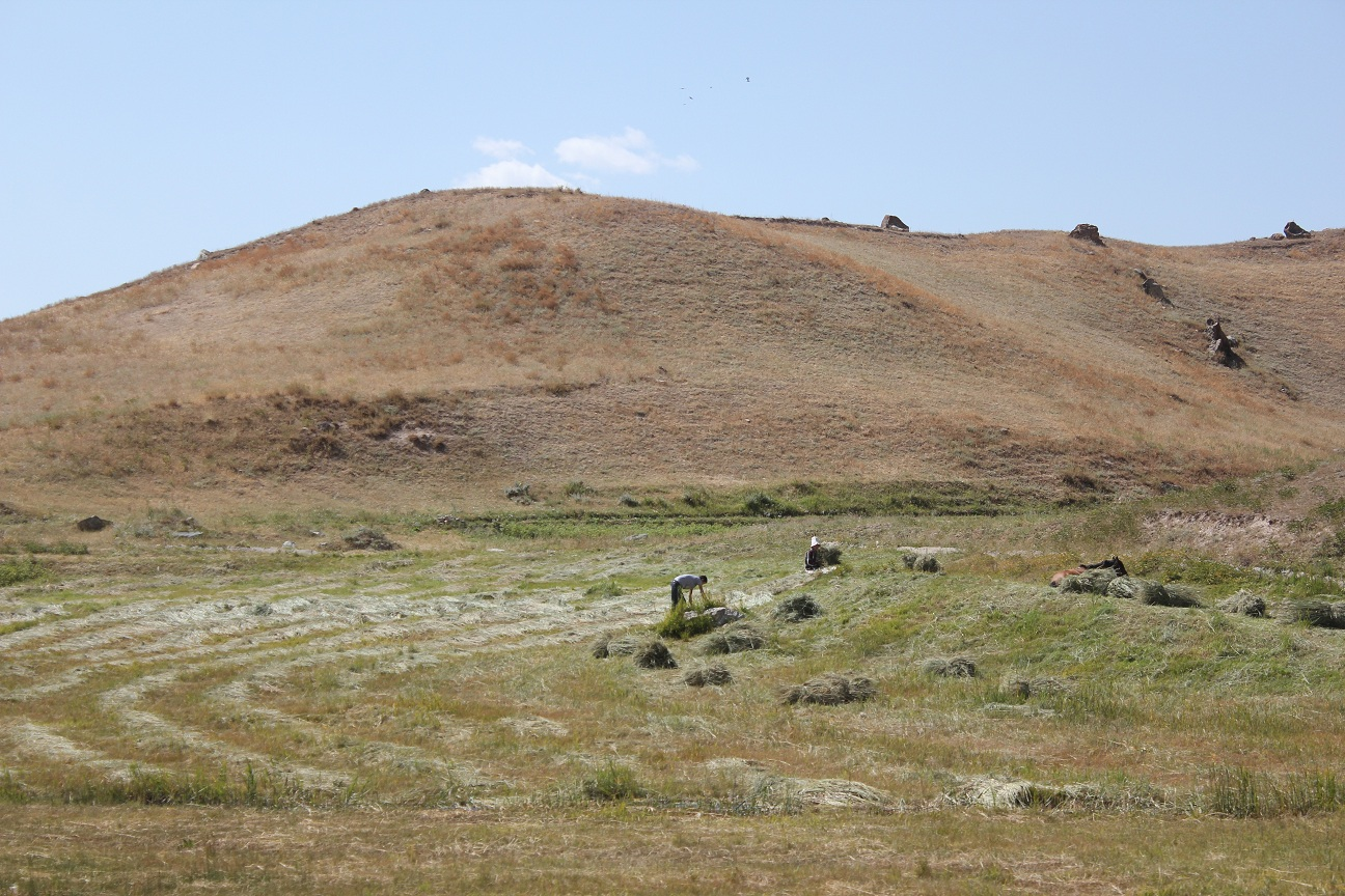
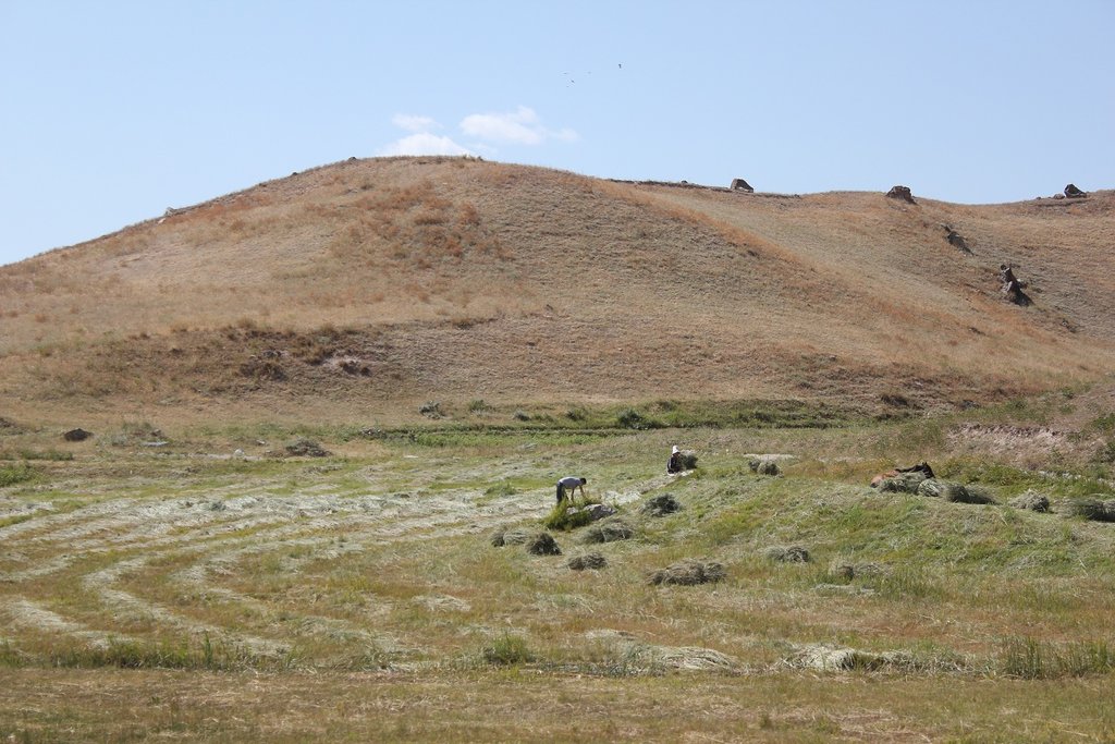
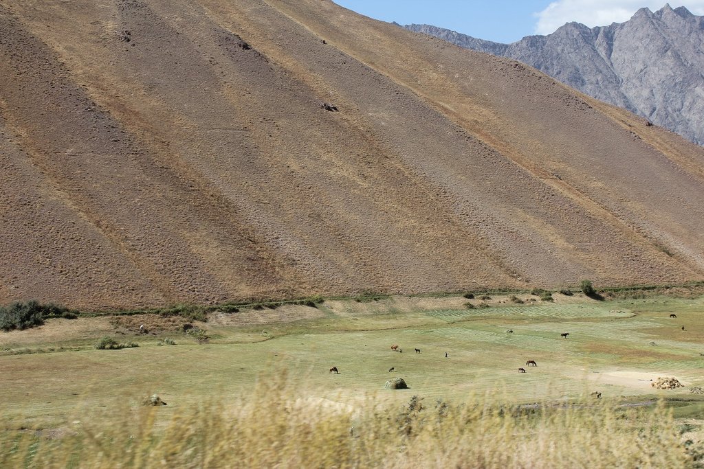
Community resource mapping with using land use system approach and distribution of the pasture lands into different plots according to different attributes.
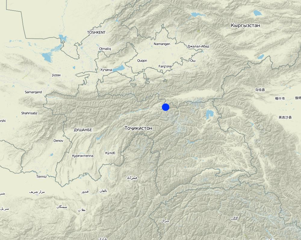
2.5 البلد/المنطقة/المواقع التي تم تطبيق النهج فيها
البلد:
طاجيكستان
المنطقة/الولاية/المحافظة:
Central Asia/Tajikistan/Rasht Valley
Map
×2.6 تواريخ بدء وإنهاء تنفيذ النهج
في حالة عدم معرفة السنة بالتحديد، يرجى الإشارة إلى التاريخ التقريبي لبدء النهج:
منذ 10-50 سنة
التعليقات:
Traditionally community used this approach based on the knowledge on pasture management coming to them from their ancestors.
2.7 نوع النهج
- تقليدي/أصلي
2.8 الغايات/الأهداف الرئيسية للنهج
The main aim of this approach is to set up clear timeframes for grazing in different plots of the pasture. When the pasture plot is sun inclined this will define the grazing time earlier, because the vegetation grows faster and bigger. On the other hand the pasture plot which is in the shadowed part is grazed later after winter, because the grass should reach a certain height before grazing.
2.9 الظروف التي تمكن أو تعيق تنفيذ التقنية/التقنيات المطبقة بموجب النهج
المعايير والقيم الاجتماعية /الثقافية/ الدينية
- تمكين/تمكيني
Since the beginning traditional institute based on traditional knowledge used to apply this approach.
توفر/الوصول إلى الموارد والخدمات المالية
- تمكين/تمكيني
No financial resource is required to apply this approach. It is purely based on the management techniques and depend on the organizational capacity of the communities.
الإطار المؤسساتي
- تمكين/تمكيني
Traditionally community based organizations exist, which were responsible for management of community resource, including pasture lands. Nowadays, based on this knowledge community in their newly established Pasture User Unions apply this approach.
الإطار القانوني (حيازة الأراضي، وحقوق استخدام الأراضي والمياه)
- تمكين/تمكيني
No legal framework is required for this approach.
المعرفة حول الإدارة المستدامة للأراضي، والوصول إلى الدعم الفني
- تمكين/تمكيني
Community members usually inherit this kind of traditional practices from their ancestors.
3. المشاركة وأدوار الأطراف المعنية
3.1 أصحاب المصلحة المعنيون بالنهج وأدوارهم
- مستخدمو الأراضي المحليون/المجتمعات المحلية
livestock owners
People traditionally use this approach as a limiting factor to plan for grazing and this approach is also incorporated into the community pasture plan.
- المنظمات المجتمعية
village organizations
In those communities, where official legal structure is not established, community based organization still use this approach as traditional practices inherited from previous generation.
3.2 انخراط مستخدمي الأراضي المحليين/المجتمعات المحلية في المراحل المختلفة للنهج
| انخراط مستخدمي الأراضي المحليين/المجتمعات المحلية | حدد من شارك وصف الأنشطة | |
|---|---|---|
| المبادرة/التحفيز | التعبئة الذاتية | Land users and their community structure is traditionally aware of this approach and consider it in their planning process. |
| التخطيط | التعبئة الذاتية | Once a community initiates its pasture plan they take this approach into consideration. |
| التنفيذ | التعبئة الذاتية | The plan is developed in a participatory way with involvement of all stakeholders and agreed on. The grazing location within different timeframe is implemented by the responsible person according to the plan. |
| الرصد/التقييم | التعبئة الذاتية | Community leaders or PUUs management assign responsible people to follow up on the approved grazing plan and follow up on the progress by reporting to them. |
3.4 اتخاذ القرار بشأن اختيار تقنية/تقنيات الإدارة المستدامة للأراضي
حدد من الذي قرر اختيار التقنية/التقنيات التي سيتم تنفيذها:
- مستخدمو الأراضي وحدهم (المبادرة الذاتية)
اشرح:
This is a specific grographycally bound approach, where land users themselves take initiative.
حدد على أي أساس تم اتخاذ القرارات:
- خبرة وآراء شخصية(غير موثقة)
4. الدعم الفني وبناء القدرات وإدارة المعرفة
4.1 بناء القدرات/التدريب
هل تم تقديم التدريب لمستخدمي الأراضي / الأطراف المعنيين الآخرين؟:
كلا
4.2 خدمة استشارية
هل يملك مستخدمو الأراضي وصولا إلى خدمة استشارية؟:
كلا
4.3 تعزيز المؤسسات (التطوير التنظيمي)
هل تم إنشاء أو تعزيز مؤسسات من خلال هذا النهج؟:
- لا
4.4 الرصد والتقييم
هل يشكل الرصد والتقييم جزءا من النهج؟:
كلا
التعليقات:
Communities themselves follow up according to their plan.
4.5 البحوث
هل كانت البحوث جزءًا من النهج؟:
كلا
5. التمويل والدعم المادي الخارجي
5.1 الميزانية السنوية لمكون الإدارة المستدامة للأراضي في النهج المذكور
التعليقات (على سبيل المثال المصادر الرئيسية للتمويل/الجهات المانحة الرئيسية):
no special budget is required to implement this approach
5.2 الدعم المالي/المادي المقدم لمستخدمي الأراضي
هل حصل مستخدمو الأراضي على دعم مالي/ مادي لتنفيذ التقنية/ التقنيات؟:
كلا
5.3 إعانات لمدخلات محددة (بما في ذلك العمالة)
- غير موجود
إذا كان العمل من قبل مستخدمي الأراضي مدخلاً جوهريًا، فهل كان:
- تطوعي
5.4 الائتمان
هل تم توفير ائتمان في إطار نهج أنشطة الإدارة المستدامة للأراضي؟:
كلا
5.5 حوافز أو وسائل أخرى
هل تم استخدام حوافز أو أدوات أخرى لتشجيع تنفيذ تقنيات الإدارة المستدامة للأراضي؟:
نعم
إذا كانت الإجابة بنعم، حدد:
Some people usually try to graze in those plots which are exposed to sun and the vegetation is growing earlier. Especially farmers who are limited in fodder crops start grazing earlier. They are provided with some incentives to balance fodder and livestock number and are not permitted for earlier grazing.
6. تحليل الأثر والتصريحات الختامية
6.1 آثار النهج
هل ساهم النهج في تمكين مستخدمي الأراضي المحليين وتحسين مشاركة الأطراف المعنية؟:
- لا
- نعم، قليلا
- نعم، باعتدال
- نعم، إلى حد كبير
Because the design of a grazing plan takes place in a participatory meeting, it brings together all stakeholders to agree on the decision. In addition all stakeholders are involved in preparing community resource map and plan accordingly.
هل ساعد النهج مستخدمي الأراضي على تنفيذ وصيانة تقنيات الإدارة المستدامة للأراضي؟:
- لا
- نعم، قليلا
- نعم، باعتدال
- نعم، إلى حد كبير
The approach is considered as one of the important steps to prevent pasture degradation. Once this approach is applied correctly it leads to implementation of other SLM technologies for improving pasture conditions.
هل أدى النهج إلى تحسن في مسائل حيازة الأراضي / حقوق المستخدمين التي أعاقت تنفيذ تقنيات الإدارة المستدامة للأراضي؟:
- لا
- نعم، قليلا
- نعم، باعتدال
- نعم، إلى حد كبير
When the whole pasture area is used sustainably, it improves land users rights.
هل أدى النهج إلى استخدام طاقة/ مصادر طاقة أكثر استدامة؟:
- لا
- نعم، قليلا
- نعم، باعتدال
- نعم، إلى حد كبير
If the approach is applied, it will minimize the risk of pasture degradation, where people also collect wood for energy.
هل أدى النهج إلى تحسين قدرة مستخدمي الأراضي على التكيف مع التغيرات المناخية/الظواهر المناخية المتطرفة والتخفيف من الكوارث المرتبطة بالمناخ؟:
- لا
- نعم، قليلا
- نعم، باعتدال
- نعم، إلى حد كبير
Because of the effect of climate change in the mountain areas unplanned grazing leads to degradation immediately.
6.2 المحفز الرئيسي لقيام مستخدمي الأراضي بتنفيذ الإدارة المستدامة للأراضي
- الحد من تدهور الأراضي
When the approach is followed, it prevents early grazing in the areas which are not exposed to sun and lets the vegetation grow properly.
- الحد من مخاطر الكوارث
The approach will lead to prevention of pasture degradation which is the main cause of land slides during rainfall.
- القواعد واللوائح (الغرامات) / الإنفاذ
The approach is considered a part of the grazing plan development and requires enforcement of certain rules in order to achieve the goal.
6.3 استدامة أنشطة النهج
هل يمكن لمستخدمي الأراضي المحافظة على استدامة ما تم تنفيذه من خلال النهج (بدون دعم خارجي)؟:
- نعم
إذا كانت الإجابة بنعم، صف كيف:
The approach does not require technical knowledge in implementing SLM technology. It therefore is simple and mobilized communities can sustain it for a long time once practiced successfully.
6.4 نقاط قوة/مزايا النهج
| نقاط القوة/ المزايا/ الفرص من وجهة نظر مستخدمي الأراضي |
|---|
| cost effective, simple to apply and produces good effects |
| simple techniques, easy understandable, based on traditional knowledge |
| can be applied in big areas |
| نقاط القوة/ المزايا/ الفرص من وجهة نظر جامع المعلومات أو غيره من الاشخاص الرئيسيين لمصدر المعلومات |
|---|
| traditionally practiced and adapted to local conditions |
| cost effective and easy to document and provides evidence based results in a short period of time |
| could be replicated in all other mountain areas |
6.5 نقاط الضعف/ العيوب في المنهج وطرق التغلب عليها
| نقاط الضعف/ المساوىء/ المخاطر من وجهة نظر مستخدم الأراضي | كيف يمكن التغلب عليها؟ |
|---|---|
| not considered within other factors, like meteorological | Research could be applied to study it on scientific evidence. |
| نقاط الضعف/ المساوىء/ المخاطر من وجهة نظر جامع المعلومات أو غيره من الاشخاص الرئيسيين لمصدر المعلومات | كيف يمكن التغلب عليها؟ |
|---|---|
| If overall pasture management is not planned properly and managed chaotically, the uncontrolled use of this approach can easily contribute to pasture degradation. | It should be well documented as it is a simple and effective approach in degradation prevention. |
7. المراجع والروابط
7.1 طرق جمع/مصادر المعلومات
- زيارات ميدانية، مسوحات ميدانية
6
- مقابلات مع مستخدمي الأراضي
4
7.2 المراجع للمنشورات المتاحة
العنوان، المؤلف، السنة، النظام القياسي الدولي لترقيم الكتب ISBN:
Pasture and Livestock Management Plan of PUU Soyru, 2015
متاح من أين؟كم التكلفة؟:
from community, free of cost
الروابط والوحدات المواضيعية
توسيع الكل طي الكلالروابط

Технология управлениия пастбищами в условиях Западного Памира [طاجيكستان]
Управление пастбищных угодий путем внедрения новой техники пастбищеоборота с учетом емкости пастбища
- جامع المعلومات: Aslam Qadamov
الوحدات المواضيعية
لا يوجد وحدات مواضيعية


