Fertilizing and re-seeding degraded rangelands [أيسلندا]
- تاريخ الإنشاء:
- تحديث:
- جامع المعلومات: Thorunn Petursdottir
- المحرر: –
- المُراجع: Fabian Ottiger
Hekluskogar area
technologies_1261 - أيسلندا
عرض الأقسام
توسيع الكل طي الكل1. معلومات عامة
1.2 تفاصيل الاتصال بالأشخاص الرئيسيين لمصدر المعلومات والمؤسسات المشاركة في تقييم وتوثيق التقنية
اسم المشروع الذي سهّل توثيق/تقييم التقنية (إذا كان ذلك على صلة)
Preventing and Remediating degradation of soils in Europe through Land Care (EU-RECARE )اسم المؤسسة (المؤسسات) التي سهلت توثيق/تقييم التقنية (إذا كان ذلك على صلة)
Soil Conservation Service of Iceland (Soil Conservation Service of Iceland) - أيسلندا1.3 الشروط المتعلقة باستخدام البيانات الموثقة من خلال WOCAT
متى تم تجميع البيانات (ميدانيا)؟:
08/05/2015
يوافق جامع المعلومات والشخص (لاشخاص) الرئيسي لمصدر المعلومات على الشروط المتعلقة باستخدام البيانات الموثقة من خلال WOCAT:
نعم
2. وصف تقنيةالإدارة المستدامي للأراضي
2.1 وصف مختصر للتقنية
تعريف التقنية:
Rangeland restoration - Spreading small portions of inorganic fertilizer and seeds on degraded rangelands
2.2 وصف تفصيلي للتقنية
الوصف:
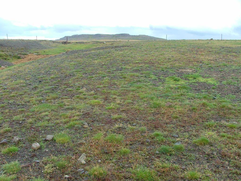
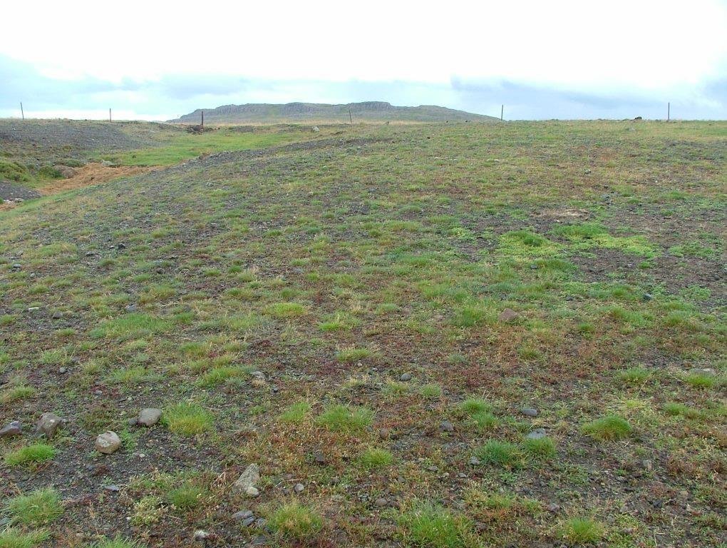
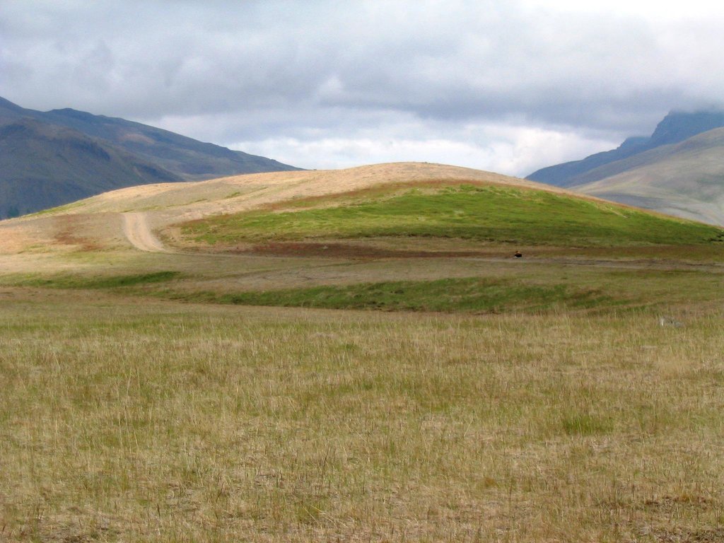
The concerning rangelands are severely degraded and parts of them have even lost their topsoil layer entirely. Nevertheless, in many cases some remnant vegetation patches are still in place and can serve as seed banks during the restoration process. In order to stabilize the surface (i.e. to reduce the effects of freeze-thaw processes), provide nutrients to the system, increase water availability and facilitate the distribution of native species within the degraded areas, tractors are used to fertilize and reseed the areas with grass species that later in the process will retreat as soon as the dispersal of native species increases. All implementations are based on the methods and tools used in ecological restoration, aiming at re-activating environmental and ecological processes and increasing the resilience of the ecosystems undergoing restoration. Minimum portions of fertilizer and seed are distributed over pre-selected areas, preferably close to the remaining vegetation "islands" in order to facilitate seed production and dispersal and provide safe sites for seed germination.
Purpose of the Technology: The purpose with the technology is to halt further land degradation and facilitate natural succession within the area undergoing restoration. In the long-term, it should substantially reduce wind and water erosion. It should also lead to increased biodiversity, enhanced water availability and accelerated carbon sequestration (in soil and vegetation). The overall restoration task is to increase the resilience of the ecosystems against natural hazards; such as volcanic activities.
Establishment / maintenance activities and inputs: In the first year, the areas are treated with a mixture of chemical fertilizer that fits the local soil condition and grass seed that are proofed to survive under harsh condition. A mixture of approx 200 kg/ha of fertilizer and around 10 kg/ha of grass seed (usually a mixture of Poa and Festuca species) is spread over the treated area. The year after the area is treated again, this time with fertilizer only (approx 100-150 kg/ha). Then the area is usually treated biannually for 4 to 6 years, based on the vegetational succession rate.
Natural / human environment: In the long-term, the technology is expected to substantially increase biomass production, re-build soil qualities, accelerate carbon sequestration and secure water availability within the rangeland and the adjacent ecosystems. The areas still grazed are expected to be more suitable for livestock grazing and the protected areas are expected to be of more recreational and aesthetic value. Increased vegetation cover will reduce and even halt the sand drift that still creates challenges for inhabitants in adjacent villages, on farmsteads and within the summerhouse clusters, scattered around the area. As the degraded rangeland is in the vicinity of an active volcano (Mt Hekla) the technology is also expected to increase ecosystem resilience against natural hazards like ash and pumice drift and reduce potential offsite damages caused by these materials.
2.3 صور التقنية
2.5 البلد/المنطقة/المواقع التي تم تنفيذ التقنية فيها والتي يغطيها هذا التقييم
البلد:
أيسلندا
المنطقة/الولاية/المحافظة:
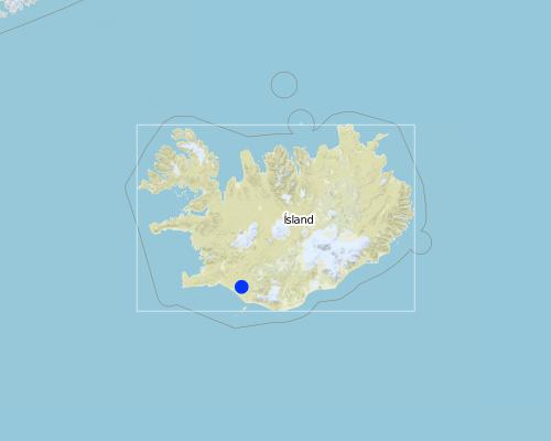
Rangarthing Ytra
مزيد من التفاصيل حول الموقع:
Rangarvellir
Map
×2.6 تاريخ التنفيذ
في حالة عدم معرفة السنة بالتحديد، يرجى الإشارة إلى التاريخ التقريبي:
- منذ أكثر من 50 عامًا (تقليدي)
2.7 إدخال التقنية
حدد كيف تم إدخال التقنية:
- كجزء من النظام التقليدي (> 50 عامًا)
- من خلال المشاريع/ التدخلات الخارجية
- by the Soil Conservation Service (governmental institute)
3. تصنيف تقنية الإدارة المستدامي للأراضي
3.2 نوع (أنواع) استخدام الأراضي الحالية حيث يتم تطبيق التقنية

أراضي الرعي
أراضي الرعي الواسع النطاق:
- رعي شبه مرتحل
الأنواع والمنتجات الحيوانية الرئيسية:
Main species: Sheep

الغابات/ الأراضي الحرجية
منتجات وخدمات:
- الرعي/ رعي أطراف الأشجار الفتية (الجلح)
- حفظ/حماية الطبيعة
- الترفيه / السياحة
- الحماية من المخاطر الطبيعية
التعليقات:
Major land use problems (compiler’s opinion): Vast parts of the area are heavily degraded due to unsustainable land use through the centuries in combination to harsh climate and frequent volcanic eruptions. The major land use problem are related to the fact that the concerned ecosystems collapsed long time ago and despite all restoration efforts implemented within the area for over 100 years, the systems are still highly dysfunctional. Their carrying capacity is limited and even light livestock grazing can keep further vegetational succession down. Passive restoration might take place where the livestock grazing has been excluded but in most cases some technologies are needed to "kickstart" the ecosystem and brake their negative resilience against changes.
Major land use problems (land users’ perception): They are fully aware that the ecosystems are in a poor condition and restoration is needed in order to push improvements forward. They acknowledge that grazing of collapsed ecosystems can maintain the dysfunctional of the systems and hinder ecological improvements. Nevertheless, in many cases they believe the harsh climate and volcanic activities are the main contributors to land degradation - that livestock grazing and the grazing carrying capacity of the rangeland are not fundamental issues in this context.
Types of other land: Wastelands / deserts / glaciers / swamps
Types of other land: Recreation
إذا تغير استخدام الأراضي بسبب التقنية، قم بالإشارة إلى استخدام الأرض قبل تنفيذ التقنية:
Grazing land: Ge: Extensive grazing land
3.3 مزيد من المعلومات حول استخدام الأراضي
عدد مواسم الزراعة في السنة:
- 1
3.4 مجموعةالإدارة المستدامة للأراضي التي تنتمي إليها هذه التقنية
- تحسين الغطاء الأرضي/النباتي
3.5 انتشار التقنية
التعليقات:
Total area covered by the SLM Technology is 900 m2.
3.6 التدابير التقنية في مجال إلادارة المستدامة للأراضي

التدابير النباتية
- V2: الأعشاب والنباتات العشبية المعمرة

التدابير البنيوية
- S11: غير ذلك

التدابير الإدارية
- M2: تغيير في مستوى الإدارة/الكثافة
التعليقات:
Main measures: vegetative measures, management measures
Specification of other structural measures: fertilizing and seeding rather flat but gravel surface
Type of agronomic measures: retaining more vegetation cover, mineral (inorganic) fertilizers
Type of vegetative measures: scattered / dispersed
3.7 الأنواع الرئيسية من تدهور الأراضي التي تناولتها التقنية

تآكل التربة بالمياه
- الوزن(Wt): فقدان التربة السطحية/تآكل السطح
- (Wo:) تأثيرات التدهور من مواقع أخرى

تآكل التربة الناتج عن الرياح
- (Et): فقدان التربة السطحية

التدهور البيولوجي
- (Bc): تناقص الغطاء النباتي

تدهور المياه
- (Hg): التغير في مستوى المياه الجوفية/الطبقة المائية الجوفية
التعليقات:
Main type of degradation addressed: Wt: loss of topsoil / surface erosion, Et: loss of topsoil, Bc: reduction of vegetation cover
Secondary types of degradation addressed: Wo: offsite degradation effects, Hg: change in groundwater / aquifer level
Main causes of degradation: deforestation / removal of natural vegetation (incl. forest fires) (in earlier centuries), over-exploitation of vegetation for domestic use (in earlier centuries), overgrazing (in earlier centuries), change in temperature, wind storms / dust storms, other natural causes (avalanches, volcanic eruptions, mud flows, highly susceptible natural resources, extreme topography, etc.) specify, poverty / wealth (in earlier centuries)
Secondary causes of degradation: soil management (in earlier centuries (from settlement in 874 onward)), floods, droughts, land tenure, governance / institutional (vague policies (especially in the last 50 years or so))
3.8 منع أو حد أو عكس تدهور الأراضي
التعليقات:
Main goals: prevention of land degradation, mitigation / reduction of land degradation, rehabilitation / reclamation of denuded land
4. المواصفات الفنية، وأنشطة التنفيذ، والمدخلات، والتكاليف
4.1 الرسم الفني للتقنية
4.2 المواصفات الفنية/شروحات الرسم الفني
Technical knowledge required for field staff / advisors: moderate
Technical knowledge required for land users: moderate
Main technical functions: control of raindrop splash, control of dispersed runoff: retain / trap, control of dispersed runoff: impede / retard, control of concentrated runoff: retain / trap, control of concentrated runoff: impede / retard, control of concentrated runoff: drain / divert, improvement of ground cover, increase of surface roughness, improvement of surface structure (crusting, sealing), improvement of topsoil structure (compaction), stabilisation of soil (eg by tree roots against land slides), increase in organic matter, increase in nutrient availability (supply, recycling,…), increase of infiltration, increase / maintain water stored in soil, increase of groundwater level / recharge of groundwater, improvement of water quality, buffering / filtering water, sediment retention / trapping, sediment harvesting, increase of biomass (quantity), promotion of vegetation species and varieties (quality, eg palatable fodder)
Secondary technical functions: reduction of slope angle, reduction of slope length, improvement of subsoil structure (hardpan), water harvesting / increase water supply, reduction in wind speed, spatial arrangement and diversification of land use
Retaining more vegetation cover
Material/ species: grass seed (mixture of seed)
Quantity/ density: 10 kg/ha
Mineral (inorganic) fertilizers
Quantity/ density: 200 kg/ha
Scattered / dispersed
Vegetative material: G : grass
Trees/ shrubs species: Birch and some native willow species are expected to follow up as natural regeneration (secondary succession)
Change of land use type: Part of the areas was fenced off and is now protected from grazing
Change of land use practices / intensity level: During the last decades, the summer grazing period has been shortened substantially
4.3 معلومات عامة بخصوص حساب المدخلات والتكاليف
عملة أخرى/ عملة وطنية (حدد):
ISK
أشر إلى سعر الصرف من الدولار الأمريكي إلى العملة المحلية (إذا كان ذا صلة): 1 دولار أمريكي =:
113,0
4.4 أنشطة التأسيس
| النشاط | نوع التدبير | التوقيت | |
|---|---|---|---|
| 1. | Fertilizing and re-seeding | إدارية | May/June |
4.5 التكاليف والمدخلات اللازمة للتأسيس
| تحديد المدخلات | الوحدة | الكمية | التكاليف لكل وحدة | إجمالي التكاليف لكل مدخل | % من التكاليف التي يتحملها مستخدمو الأراضي | |
|---|---|---|---|---|---|---|
| العمالة | Fertilizing and re-seeding | ha | 1,0 | 66,0 | 66,0 | |
| معدات | Machine use | ha | 1,0 | 44,0 | 44,0 | 100,0 |
| المواد النباتية | Seeds (20kg) | ha | 1,0 | 137,0 | 137,0 | |
| الأسمدة والمبيدات الحيوية | Fertilizer (200kg) | ha | 1,0 | 118,0 | 118,0 | |
| إجمالي تكاليف إنشاء التقنية | 365,0 | |||||
4.7 التكاليف والمدخلات اللازمة للصيانة/للأنشطة المتكررة (سنويًا)
| تحديد المدخلات | الوحدة | الكمية | التكاليف لكل وحدة | إجمالي التكاليف لكل مدخل | % من التكاليف التي يتحملها مستخدمو الأراضي | |
|---|---|---|---|---|---|---|
| العمالة | Labour | ha | 1,0 | 66,0 | 66,0 | |
| معدات | Machine use | ha | 1,0 | 44,0 | 44,0 | 100,0 |
| الأسمدة والمبيدات الحيوية | fertilizer | ha | 1,0 | 118,0 | 118,0 | |
| إجمالي تكاليف صيانة التقنية | 228,0 | |||||
التعليقات:
The cost was estimated based on official estimation numbers from the SCSI
5. البيئة الطبيعية والبشرية
5.1 المناخ
هطول الأمطار السنوي
- < 250 مم
- 251- 500 ملم
- 501 - 750ملم
- 1,000-751 ملم
- 1,500-1,100 ملم
- 2,000-1,500 ملم
- 3,000-2,001 ملم
- 4,000-3,100 ملم
- > 4000 ملم
المنطقة المناخية الزراعية
- شبه رطبة
- شبه قاحلة
Thermal climate class: boreal
Thermal climate class: polar/arctic
5.2 طوبوغرافيا
متوسط الانحدارات:
- مسطح (0-2%)
- بسيط (3-5%)
- معتدل (6-10%)
- متدحرج (11-15%)
- تلال (16-30%)
- شديدة الانحدار(31-60%)
- فائقة الانحدار (>60%)
التضاريس:
- هضاب/سهول
- أثلام مرتفعة
- المنحدرات الجبلية
- منحدرات التلال
- منحدرات في السفوح
- قاع الوادي
المنطقة الارتفاعية:
- 100-0 متر فوق سطح البحر
- 500-101 متر فوق سطح البحر
- 1,000-501 متر فوق سطح البحر
- 1,500-1,001 متر فوق سطح البحر
- 2,000-1,501 متر فوق سطح البحر
- 2,500-2,100 متر فوق سطح البحر
- 3,000-2,501 متر فوق سطح البحر
- 4,000-3,001 متر فوق سطح البحر
- > 4000 متر فوق سطح البحر
5.3 التربة
متوسط عمق التربة:
- ضحل جدًا (0-20 سم)
- ضحلة (21-50 سم)
- متوسطة العمق (51-80 سم)
- عميقة (81-120 سم)
- عميقة جدًا (> 120 سم)
قوام التربة (التربة السطحية):
- خشن / خفيف (رملي)
المواد العضوية في التربة السطحية:
- منخفضة (<1%)
إذا كان متاحًا، قم بإرفاق وصف كامل للتربة أو تحديد المعلومات المتوفرة، على سبيل المثال نوع التربة، الرقم الهيدروجيني/ درجة حموضة التربة، قدرة التبادل الكاتيوني، النيتروجين، الملوحة وما إلى ذلك.
Soil fertility is very low- low
Soil water storage capacity is very low-low
5.4 توافر المياه ونوعيتها
توافر المياه السطحية:
ضعيف/ غير متوافر
نوعية المياه (غير المعالجة):
مياه شرب جيدة
5.5 التنوع البيولوجي
تنوع الأنواع:
- منخفض
5.6 خصائص مستخدمي الأراضي الذين يطبقون التقنية
التوجه السوقي لنظام الإنتاج:
- الكفاف (الإمداد الذاتي)
أفراداً أو مجموعات:
- فرد/أسرة معيشية
الجنس:
- نساء
- رجال
اذكر الخصائص الأخرى ذات الصلة لمستخدمي الأراضي:
Land users applying the Technology are mainly common / average land users
Population density: < 10 persons/km2
5.7 متوسط مساحة الأرض المملوكة أو المستأجرة من قبل مستخدمي الأراضي الذين يطبقون التقنية
- < 0.5 هكتارا
- 0.5 - 1 هكتار
- 1 -2 هكتار
- 2 - 5 هكتار
- 5 - 15 هكتار
- 15 - 50 هكتار
- 50 - 100هكتار
- 500-100 هكتار
- 1,000-500 هكتار
- 10,000-1,000 هكتار
- > 10,000 هكتار
هل يعتبر هذا نطاقًا صغيرًا أو متوسطًا أو واسعا (في إشارة إلى السياق المحلي)؟:
- على نطاق متوسط
5.8 ملكية الأراضي، وحقوق استخدام الأراضي، وحقوق استخدام المياه
- governmental institutes
5.9 الوصول إلى الخدمات والبنية التحتية
الصحة:
- ضعيف
- معتدل
- جيد
التعليم:
- ضعيف
- معتدل
- جيد
المساعدة التقنية:
- ضعيف
- معتدل
- جيد
العمل (على سبيل المثال خارج المزرعة):
- ضعيف
- معتدل
- جيد
الأسواق:
- ضعيف
- معتدل
- جيد
الطاقة:
- ضعيف
- معتدل
- جيد
الطرق والنقل:
- ضعيف
- معتدل
- جيد
مياه الشرب وخدمات الصرف الصحي:
- ضعيف
- معتدل
- جيد
الخدمات المالية:
- ضعيف
- معتدل
- جيد
6. الآثار والتصريحات الختامية
6.1 الآثار التي أظهرتها التقنية في الموقع
الآثار الاجتماعية والاقتصادية
الإنتاج
إنتاج حيواني
توافر المياه ونوعيتها
توافر المياه للماشية
نوعية المياه للماشية
الآثار الاجتماعية والثقافية
الأمن الغذائي / الاكتفاء الذاتي
الفرص الثقافية
الفرص الترفيهية
المؤسسات المجتمعية
المؤسسات الوطنية
المعرفة بالإدارة المستدامة للأراضي/تدهور الأراضي
التخفيف من حدة الصراع
وضع الفئات المحرومة اجتماعيا واقتصاديا
الآثار الايكولوجية
دورة المياه / الجريان السطحي
كمية المياه
جودة المياه
الجريان السطحي
تصريف المياه الزائدة
مستوى المياه الجوفية/ الطبقة المائية الجوفية
التبخر
التربة
رطوبة التربة
غطاء التربة
فقدان التربة
تكون قشرة التربة السطحية/انسداد مسام التربة
دورة المغذيات/إعادة الشحن
المادة العضوية في التربة/تحت الطبقة c
التنوع البيولوجي: الغطاء النباتي، الحيوانات
الكتلة الحيوية/ طبقة الكربون فوق التربة
التنوع النباتي
التنوع الحيواني
تنوع الموائل
الحد من مخاطر المناخ والكوارث
انبعاث الكربون والغازات المسببة للاحتباس الحراري
سرعة الرياح
6.2 الآثار التي أظهرتها التقنية خارج الموقع
توافر المياه
الفيضان في اتجاه مجرى النهر
تراكم الطمي باتجاه مصب النهر
القدرة على التخفيف / الترشيح
الرواسب المنقولة بواسطة الرياح
الأضرار التي لحقت بحقول الجيران
الضرر على البنية التحتية العامة/ الخاصة
6.3 تعرض التقنية وحساسيتها لتغير المناخ التدريجي والظواهر المتطرفة/الكوارث المرتبطة بالمناخ (كما يراها مستخدمو الأراضي)
تغير مناخ تدريجي
تغير مناخ تدريجي
| الموسم | نوع التغير المناخي/ المتطرف | كيف تتعامل التقنية مع ذلك؟ | |
|---|---|---|---|
| درجة الحرارة السنوية | زيادة | غير معروف |
الظواهر المتطرفة / الكوارث المرتبطة بالمناخ
الكوارث الجوية
| كيف تتعامل التقنية مع ذلك؟ | |
|---|---|
| عاصفة ممطرة محلية | جيدا |
| عاصفة هوائية محلية | جيدا |
الكوارث المناخية
| كيف تتعامل التقنية مع ذلك؟ | |
|---|---|
| جفاف | ليس جيدا |
الكوارث الهيدرولوجية
| كيف تتعامل التقنية مع ذلك؟ | |
|---|---|
| فيضان عام (نهر) | جيدا |
العواقب الأخرى المتعلقة بالمناخ
العواقب الأخرى المتعلقة بالمناخ
| كيف تتعامل التقنية مع ذلك؟ | |
|---|---|
| انخفاض فترة النمو | غير معروف |
| Cold spells combined with wind storms | ليس جيدا |
6.4 تحليل التكلفة والعائد
كيف يمكن مقارنة العوائد نسبة لتكاليف الإنشاء (من وجهة نظر مستخدمي الأراضي)؟
عوائد قصيرة الأجل:
إيجابي قليلا
عوائد طويلة الأجل:
إيجابي
كيف تتم مقارنة العوائدمع كلفة الصيانة/التكاليف المتكررة (من وجهة نظر مستخدمي الأراضي)؟
عوائد قصيرة الأجل:
إيجابي قليلا
عوائد طويلة الأجل:
إيجابي
6.5 اعتماد التقنية
التعليقات:
There is a moderate trend towards spontaneous adoption of the Technology
6.7 نقاط القوة / المزايا / الفرص التي توفرها التقنية
| نقاط القوة/ المزايا/ الفرص من وجهة نظر جامع المعلومات أو غيره من الاشخاص الرئيسيين لمصدر المعلومات |
|---|
| It bases on the ecosystem approach - working with nature and re-establishing dysfunctional environmental and ecological processes with strong stakeholder involvement |
الروابط والوحدات المواضيعية
توسيع الكل طي الكلالروابط
لا يوجد روابط
الوحدات المواضيعية
لا يوجد وحدات مواضيعية


