Sunken streambed structure [الهند]
- تاريخ الإنشاء:
- تحديث:
- جامع المعلومات: David Gandhi
- المحرر: –
- المُراجع: Fabian Ottiger
DOH
technologies_1471 - الهند
عرض الأقسام
توسيع الكل طي الكل1. معلومات عامة
1.2 تفاصيل الاتصال بالأشخاص الرئيسيين لمصدر المعلومات والمؤسسات المشاركة في تقييم وتوثيق التقنية
متخصص في الإدارة المستدامة للأراضي:
Agrawal VK
danidain@mantrafreenet.com / pmdanida@sancharnet.in
Comprehensive Watershed Development Project
22 Pratap Nagar, RATLAM – 457 001, MP, India
الهند
متخصص في الإدارة المستدامة للأراضي:
اسم المشروع الذي سهّل توثيق/تقييم التقنية (إذا كان ذلك على صلة)
Book project: Water Harvesting – Guidelines to Good Practice (Water Harvesting)اسم المشروع الذي سهّل توثيق/تقييم التقنية (إذا كان ذلك على صلة)
Book project: where the land is greener - Case Studies and Analysis of Soil and Water Conservation Initiatives Worldwide (where the land is greener)1.3 الشروط المتعلقة باستخدام البيانات الموثقة من خلال WOCAT
متى تم تجميع البيانات (ميدانيا)؟:
28/09/2002
يوافق جامع المعلومات والشخص (لاشخاص) الرئيسي لمصدر المعلومات على الشروط المتعلقة باستخدام البيانات الموثقة من خلال WOCAT:
نعم
1.5 الإشارة إلى الاستبيان (الاستبيانات) حول مناهج الإدارة المستدامة للأراضي
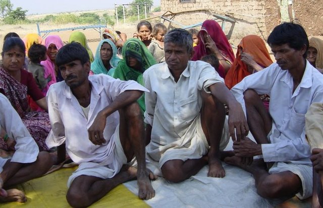
Comprehensive watershed development [الهند]
Participatory approach that includes a package of measures leading to empowerment of communities to implement and sustain watershed development.
- جامع المعلومات: David Gandhi
2. وصف تقنيةالإدارة المستدامي للأراضي
2.1 وصف مختصر للتقنية
تعريف التقنية:
Excavations in streambeds to provide temporary storage of runoff, increasing water yields from shallow wells for supplementary irrigation.
2.2 وصف تفصيلي للتقنية
الوصف:
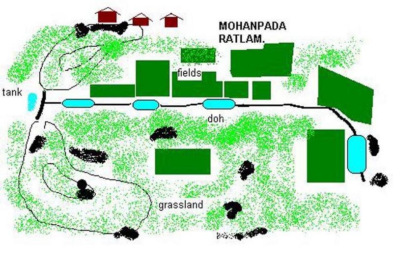
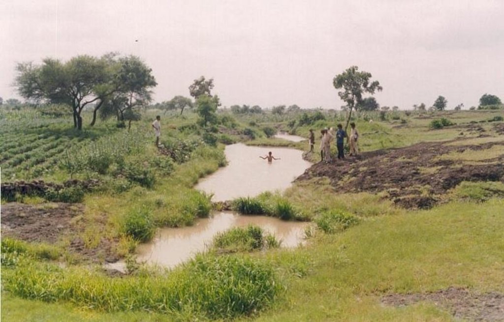
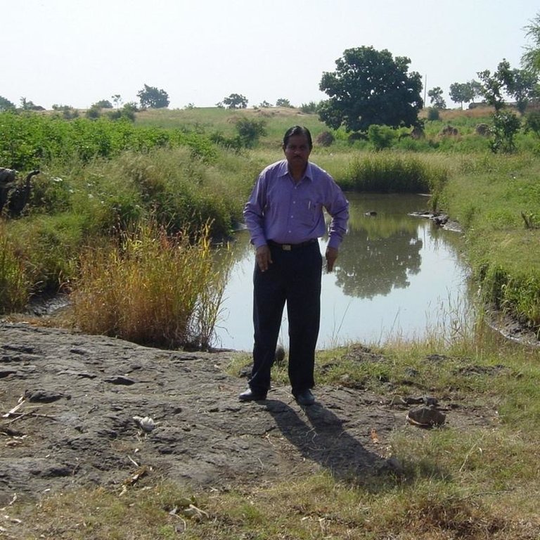
Dohs are rectangular excavations in seasonal streambeds, which are intended to capture and hold runoff to enhance groundwater recharge, thus increasing water for irrigation from nearby shallow wells. They also collect and impound subsurface flow. Dohs are built in semi-arid areas where rainfall is low and seasonal. The dimension of a typical doh is 1.0-1.5 m deep with variable length (up to 40 m) and width (up to 10 m) depending on streambed section, with an average capacity of 400 m3.
Purpose of the Technology: The excavated material is deposited along the stream banks as a barrier against siltation from surrounding areas. The slopes of the excavation are gentle (an upstream slope of 1:6 or 17% and a downstream slope of 1:8 or 12%) so that water flows into it, and excess water out again, carrying silt rather than depositing it. The sides however are steep, to increase capacity - and would benefit from stone pitching to stabilise them. A silt trap comprising a line of loose boulders is constructed upstream across the streambed. Dohs are generally built in sequence. They may be as close as a few metres apart. Bends in the stream are avoided as these are susceptible to bank erosion.
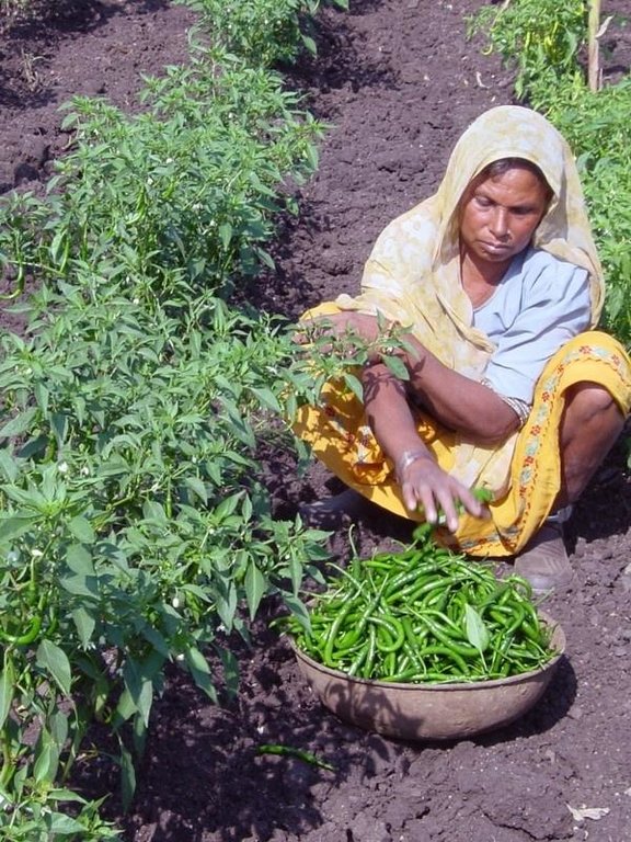
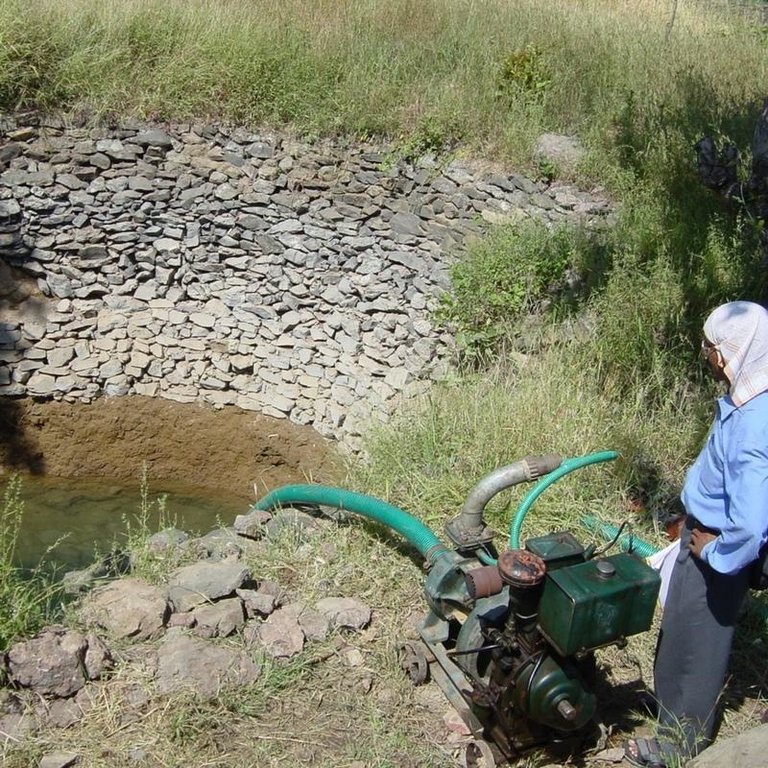
Establishment / maintenance activities and inputs: The technology is used in conjunction with shallow wells (odees), which enable farmers to harvest the increased groundwater for supplementary irrigation of annual crops- including vegetables such as chilli peppers. Water is pumped out of the wells. In the case study village, Mohanpada, each doh basically supplies an underground source of extra water to one well. Communities together with project staff carry out site selection, and then detailed design/estimates/layout is done with project technical assistance. As a supportive measure the catchment area is treated with gully plugs (small stone checks in gullies). A water harvesting tank (small reservoir or dam) may be excavated above the series of dohs where this is justified by a sufficiently large catchment area/suitable site. The capacity of the tank at Mohanpada is around 600 m3 and thus also has a positive impact on groundwater recharge.
Natural / human environment: Maintenance is agreed through meetings of user groups: manual desilting is planned and repairs of gully plugs also. In summary, dohs are low cost water recharge alternatives for poorer communities, and in this case study, the extra area brought under production has meant that all families that require it, now have access to some water for irrigation.
2.3 صور التقنية
2.5 البلد/المنطقة/المواقع التي تم تنفيذ التقنية فيها والتي يغطيها هذا التقييم
البلد:
الهند
المنطقة/الولاية/المحافظة:
Madhya Pradesh
مزيد من التفاصيل حول الموقع:
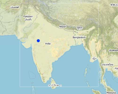
Ratlam, Mohanpada
Map
×2.6 تاريخ التنفيذ
في حالة عدم معرفة السنة بالتحديد، يرجى الإشارة إلى التاريخ التقريبي:
- منذ أكثر من 50 عامًا (تقليدي)
2.7 إدخال التقنية
حدد كيف تم إدخال التقنية:
- من خلال المشاريع/ التدخلات الخارجية
التعليقات (نوع المشروع، الخ):
The technology which is a modification of the traditional 'DOH' observed in river beds was implemented on an experimental basis in village Ambaohondan Tehsil 0 Mau, Dist. Indore under NWDPRA by Mr. V.K.Agrawal & Mr.V.V.Karmarkar.
3. تصنيف تقنية الإدارة المستدامي للأراضي
3.1 الغرض الرئيسي ( الأغراض الرئيسية) للتقنية
- تحسين الإنتاج
3.2 نوع (أنواع) استخدام الأراضي الحالية حيث يتم تطبيق التقنية

الأراضي الزراعية
- زراعة سنوية
المحاصيل الرئيسية (المحاصيل النقدية والغذائية):
Major cash crop: Wheat, cotton,vegetables etc (irrigated)

أراضي الرعي
التعليقات:
Major land use problems (compiler’s opinion): There are regular poor yields of agricultural crops on the degraded, rainfed fields. A further constraint is the limited amount of water in wells, restricting both the extent of irrigation, and the number of people with access to irrigation. There is an underlying problem of poverty, which in turn leads to seasonal out-migration to find work.
Major land use problems (land users’ perception): Agricultural lands: sloping fields, soil loss, poor yields. Common lands:competition from surrounding villages for grazing resulting in low yields. Private pastures (bir): small patches which are not sufficient to meet the fodder needs. Settlement area: 28 huts already erected. Additional space not available.
Other grazingland: extensive grazing: on patches of waste lands within fields
Type of cropping system and major crops comments: During monsoon (kharif) season the main crop is cotton + maize. In addition minor pulses are taken. If water is available for irrigation, this is followed by wheat+gram in winter. Major area is fallow in winter except for the cotton crop which is of longer duration. No cultivation was observed in summer.
3.3 مزيد من المعلومات حول استخدام الأراضي
إمدادات المياه للأرض التي يتم تنفيذ التقنية عليها:
- بعلية
التعليقات:
Water supply: Also mixed rainfed - irrigated
عدد مواسم الزراعة في السنة:
- 2
حدد:
Longest growing period in days: 120 Longest growing period from month to month: Jul - Oct
3.4 مجموعةالإدارة المستدامة للأراضي التي تنتمي إليها هذه التقنية
- حصاد المياه
- إدارة الري (بما في ذلك إمدادات المياه والصرف الصحي)
- إدارة المياه السطحية (الينابيع، الأنهار، البحيرات، البحار)
3.5 انتشار التقنية
التعليقات:
Total area covered by the SLM Technology is 0.1 m2.
The project area for phase 1 comprises 18 villages (3314 Households) mainly tribal. A significant portion of the area is barren and used for open grazing. The sunken wter harvesting technology was initially demonstrated in few villages as an alternative to the high cost heading type approach to water harvesting bieng implemented on a large scale by main line programmes.
3.6 التدابير التقنية في مجال إلادارة المستدامة للأراضي
3.7 الأنواع الرئيسية من تدهور الأراضي التي تناولتها التقنية

تآكل التربة بالمياه
- (Wg):الانجراف الخلجاني/ الخلجان

تدهور المياه
- (Ha): التجفيف
التعليقات:
Main type of degradation addressed: Wg: gully erosion / gullying, Ha: aridification
Main causes of degradation: other human induced causes (specify) (Social causes = Lack of awareness and mobilisation amongst the communities.), Top down approach (Macro planning rather than micro (village level) planning.)
3.8 منع أو حد أو عكس تدهور الأراضي
تحديد هدف التقنية فيما يتعلق بتدهور الأراضي:
- الحد من تدهور الأراضي
4. المواصفات الفنية، وأنشطة التنفيذ، والمدخلات، والتكاليف
4.1 الرسم الفني للتقنية
4.2 المواصفات الفنية/شروحات الرسم الفني
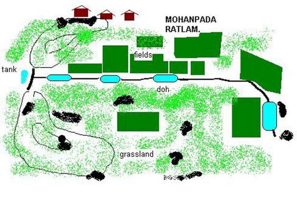
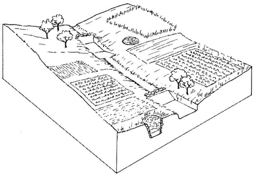
Overview of sunken streambed structures (doh) with associated wells and irrigated plots. Note that several dohs are applied in series along the waterway.
Technical knowledge required for field staff / advisors: moderate
Technical knowledge required for land users: low
Main technical functions: increase of infiltration, water harvesting / increase water supply
Secondary technical functions: control of concentrated runoff: retain / trap
Structural measure: doh (sunken streambed structure)
Structural measure: dam, gully plugs (supp.)
Construction material (stone): used for silt trap on the upstream side
Construction material (other): weathered section is excavated manually, while hard rock beds may be excavated by machine, dynamite.
4.3 معلومات عامة بخصوص حساب المدخلات والتكاليف
عملة أخرى/ عملة وطنية (حدد):
Rupees
أشر إلى سعر الصرف من الدولار الأمريكي إلى العملة المحلية (إذا كان ذا صلة): 1 دولار أمريكي =:
48,85
اذكر متوسط تكلفة أجر العمالة المستأجرة في اليوم الواحد:
1.00
4.4 أنشطة التأسيس
| النشاط | نوع التدبير | التوقيت | |
|---|---|---|---|
| 1. | Site selection with community by eye | بنيوية أو هيكلية | Dry season |
| 2. | Identification of beneficiaries and user groups | بنيوية أو هيكلية | Dry season |
| 3. | Design & estimation by project staff | بنيوية أو هيكلية | Dry season |
| 4. | Agreement of village committee. | بنيوية أو هيكلية | Dry season |
| 5. | Treatment of catchment with gully plug | بنيوية أو هيكلية | Dry season |
| 6. | Excavation of Dohs (200–400 m3) as last action with silt traps upstreamof each made from loose stone. | بنيوية أو هيكلية | Dry season |
| 7. | Wells (odees) may be deepened and pumps bought | بنيوية أو هيكلية | Dry season |
4.5 التكاليف والمدخلات اللازمة للتأسيس
| تحديد المدخلات | الوحدة | الكمية | التكاليف لكل وحدة | إجمالي التكاليف لكل مدخل | % من التكاليف التي يتحملها مستخدمو الأراضي | |
|---|---|---|---|---|---|---|
| العمالة | Labour | ha | 1,0 | 225,0 | 225,0 | 25,0 |
| معدات | Tools | ha | 1,0 | 15,0 | 15,0 | 100,0 |
| إجمالي تكاليف إنشاء التقنية | 240,0 | |||||
التعليقات:
Duration of establishment phase: 12 month(s)
4.6 الصيانة/الأنشطة المتكررة
| النشاط | نوع التدبير | التوقيت/الوتيرة | |
|---|---|---|---|
| 1. | Maintenance of catchment treatments (desilting of gully plugs etc) | بنيوية أو هيكلية | Dry Season/if required |
| 2. | Meeting of User Group | بنيوية أو هيكلية | Monsoon/After heavy Showars |
| 3. | Repairs to Silt-trap | بنيوية أو هيكلية | During monsoon/After heavy shower |
| 4. | Desilting of DOH | بنيوية أو هيكلية | Dry Season/annual |
4.7 التكاليف والمدخلات اللازمة للصيانة/للأنشطة المتكررة (سنويًا)
| تحديد المدخلات | الوحدة | الكمية | التكاليف لكل وحدة | إجمالي التكاليف لكل مدخل | % من التكاليف التي يتحملها مستخدمو الأراضي | |
|---|---|---|---|---|---|---|
| العمالة | Labour | ha | 1,0 | 5,0 | 5,0 | 100,0 |
| إجمالي تكاليف صيانة التقنية | 5,0 | |||||
التعليقات:
The construction of one doh costs between US$ 200-400, depending on the size of the doh (approximately one cubic metre can be excavated per person day at a cost of one US dollar). On a per hectare basis the costs are very variable, since they are related to the extra area brought under irrigation. In this case study there are four dohs within a total village area of 50 ha. Ten of the 50 ha have been brought into irrigated production (extra to the 5 ha already irrigated) due to the four dohs and the ‘tank’ and the costs outlined above are spread over those 10 ha. In this case half of the costs are directly attributable to dohs (average capacity 400 m3 each), and half to catchment treatment where the water-harvesting tank (a reservoir of approximately 600 m3) is the main cost. Where there is underlying rock, mechanical drills and blasting by dynamite may be required, which increases the costs. That was not the case in this village. The cost of deepening/widening the five wells (odees) has not been included here: that is carried out by the villagers themselves. While the project normally pays around 85% of labour costs, here at Mohanpada village the project only needs to pay 75%, due to a high level of commitment by the villagers.
The total of 4 doh structure were constructed along a stream length of 451 m having gradient of 1.2%. Total storage capacity is 1646qm. It is observed that during past year (2002) the structures were completely filled & subsequently emptied (percolated) 5 times.
4.8 أهم العوامل المؤثرة على التكاليف
قدم وصفا لأهم العوامل التي تؤثر على التكاليف:
Presence of hard stata (bed rock) increases cost of excavation
5. البيئة الطبيعية والبشرية
5.1 المناخ
هطول الأمطار السنوي
- < 250 مم
- 251- 500 ملم
- 501 - 750ملم
- 1,000-751 ملم
- 1,500-1,100 ملم
- 2,000-1,500 ملم
- 3,000-2,001 ملم
- 4,000-3,100 ملم
- > 4000 ملم
حدد متوسط هطول الأمطار السنوي (إذا كان معروفًا)، بالملليمتر:
800,00
المواصفات/التعليقات على هطول الأمطار:
However since past 4 years rainfall has been below average
المنطقة المناخية الزراعية
- شبه قاحلة
Located on the tropic of cancer, characterised by hot dry summers (max 46 deg C) and cold dry winters. Monsoon (July-Sept) is characterised by high intensity showers followed by prolonged dry spells.
5.2 طوبوغرافيا
متوسط الانحدارات:
- مسطح (0-2%)
- بسيط (3-5%)
- معتدل (6-10%)
- متدحرج (11-15%)
- تلال (16-30%)
- شديدة الانحدار(31-60%)
- فائقة الانحدار (>60%)
التضاريس:
- هضاب/سهول
- أثلام مرتفعة
- المنحدرات الجبلية
- منحدرات التلال
- منحدرات في السفوح
- قاع الوادي
المنطقة الارتفاعية:
- 100-0 متر فوق سطح البحر
- 500-101 متر فوق سطح البحر
- 1,000-501 متر فوق سطح البحر
- 1,500-1,001 متر فوق سطح البحر
- 2,000-1,501 متر فوق سطح البحر
- 2,500-2,100 متر فوق سطح البحر
- 3,000-2,501 متر فوق سطح البحر
- 4,000-3,001 متر فوق سطح البحر
- > 4000 متر فوق سطح البحر
التعليقات والمواصفات الإضافية بشأن التضاريس:
Slopes on average: Also gentle (ranked 2) and moderate (ranked 3)
5.3 التربة
متوسط عمق التربة:
- ضحل جدًا (0-20 سم)
- ضحلة (21-50 سم)
- متوسطة العمق (51-80 سم)
- عميقة (81-120 سم)
- عميقة جدًا (> 120 سم)
قوام التربة (التربة السطحية):
- خشن / خفيف (رملي)
- متوسط ( طميي، سلتي)
المواد العضوية في التربة السطحية:
- عالية (>3%)
- متوسطة (1-3%)
إذا كان متاحًا، قم بإرفاق وصف كامل للتربة أو تحديد المعلومات المتوفرة، على سبيل المثال نوع التربة، الرقم الهيدروجيني/ درجة حموضة التربة، قدرة التبادل الكاتيوني، النيتروجين، الملوحة وما إلى ذلك.
Soil depth on average: Very shallow (ranked 1, eroded wastelands, fields on slopes) and shallow (ranked 2, fields in valley portion)
Soil texture: Medium (ranked 1, present in valley sections) and coarse/light (ranked 2, present along slopes)
Soil fertility: Low (ranked 1, fields along slopes,waste lands) and medium (ranked 2, fields in valley section)
Topsoil organic matter: High (ranked 1, fields along slopes, waste lands) and medium (ranked 2, fields in valley sections)
Soil drainage/infiltration: Medium
Soil water storage capacity: Low
5.6 خصائص مستخدمي الأراضي الذين يطبقون التقنية
التوجه السوقي لنظام الإنتاج:
- مختلط (كفاف/ تجاري)
الدخل من خارج المزرعة:
- 10-50% من جميع الإيرادات
المستوى النسبي للثروة:
- ضعيف جدا
- ضعيف
مستوى المكننة:
- عمل يدوي
- الجر الحيواني
اذكر الخصائص الأخرى ذات الصلة لمستخدمي الأراضي:
Population density: > 500 persons/km2
Annual population growth: > 4%
1% of the land users are average wealthy (One family has bore-well).
19% of the land users are poor (Few farmers have access to shallow wells.).
80% of the land users are poor (Majority are small/marginal farmers without access to irrigation).
Off-farm income specification: some migratory work in nearby towns and in large scale mechanised farms during peak periods (note: now there is less migration as a result of increased irrigation)
5.7 متوسط مساحة الأرض المملوكة أو المستأجرة من قبل مستخدمي الأراضي الذين يطبقون التقنية
- < 0.5 هكتارا
- 0.5 - 1 هكتار
- 1 -2 هكتار
- 2 - 5 هكتار
- 5 - 15 هكتار
- 15 - 50 هكتار
- 50 - 100هكتار
- 500-100 هكتار
- 1,000-500 هكتار
- 10,000-1,000 هكتار
- > 10,000 هكتار
5.8 ملكية الأراضي، وحقوق استخدام الأراضي، وحقوق استخدام المياه
ملكية الارض:
- مجتمعي/قروي
- فردية، يوجد سند ملكية
حقوق استخدام الأراضي:
- وصول مفتوح (غير منظم)
- فردي
6. الآثار والتصريحات الختامية
6.1 الآثار التي أظهرتها التقنية في الموقع
الآثار الاجتماعية والاقتصادية
الإنتاج
إنتاج المحاصيل
الدخل والتكاليف
دخل المزرعة
فروقات اقتصادية
التعليقات/ حدد:
Increased economic inequity in some villages, between those with wells and those without
الآثار الاجتماعية والثقافية
المؤسسات المجتمعية
المعرفة بالإدارة المستدامة للأراضي/تدهور الأراضي
التخفيف من حدة الصراع
التعليقات/ حدد:
Increased economic inequity in some villages, between those with wells and those without
الآثار الايكولوجية
دورة المياه / الجريان السطحي
مستوى المياه الجوفية/ الطبقة المائية الجوفية
التربة
رطوبة التربة
غطاء التربة
التعليقات/ حدد:
Where cultivated
فقدان التربة
التعليقات/ حدد:
In catchment
6.2 الآثار التي أظهرتها التقنية خارج الموقع
تدفقات مائية موثوقة ومستقرة في موسم الجفاف
الفيضان في اتجاه مجرى النهر
تراكم الطمي باتجاه مصب النهر
تلوث المياه الجوفية/الأنهار
Amount of water to downstream users
6.4 تحليل التكلفة والعائد
كيف يمكن مقارنة العوائد نسبة لتكاليف الإنشاء (من وجهة نظر مستخدمي الأراضي)؟
عوائد قصيرة الأجل:
إيجابي
عوائد طويلة الأجل:
ايجابي جدا
كيف تتم مقارنة العوائدمع كلفة الصيانة/التكاليف المتكررة (من وجهة نظر مستخدمي الأراضي)؟
عوائد قصيرة الأجل:
إيجابي
عوائد طويلة الأجل:
ايجابي جدا
6.5 اعتماد التقنية
التعليقات:
100% of land user families have adopted the Technology with external material support
1600 land user families have adopted the Technology with external material support
Comments on acceptance with external material support: estimates
There is a little trend towards spontaneous adoption of the Technology
Comments on adoption trend: Farmers in Mohanpada have constructed one doh with only 10 % subsidy on the total cost.
Spontaneous adoption is growing in neighbouring villages.
6.7 نقاط القوة / المزايا / الفرص التي توفرها التقنية
| نقاط القوة/ المزايا/ الفرص من وجهة نظر جامع المعلومات أو غيره من الاشخاص الرئيسيين لمصدر المعلومات |
|---|
|
Dohs are a low cost alternative method of increasing groundwater in a semi-arid area where production of high value legumes depends on irrigation – and dohs represent the best way in this situation of expanding the extent of irrigated land, and bringing irrigation to more families. |
|
Small, multiple recharge points for replenishing groundwater for irrigation from wells How can they be sustained / enhanced? Breaking hard pan in stream bed mechanically by drills or blasting to deepen dohs and thereby make them more effective. |
| No risk of breaches of bunds as the structures are sunken below ground. |
6.8 نقاط ضعف / مساوىء / مخاطر التقنية وسبل التغلب عليها
| نقاط الضعف/ المساوىء/ المخاطر من وجهة نظر جامع المعلومات أو غيره من الاشخاص الرئيسيين لمصدر المعلومات | كيف يمكن التغلب عليها؟ |
|---|---|
| Group maintenance is required | Form user groups. |
| Villagers are more used to (and may prefer) larger and deeper ‘tanks’ | Establish more dohs to create more impact. |
| Dohs are limited in capacity and thus dry up quickly, as do the wells | Establish more dohs to create more impact. |
الروابط والوحدات المواضيعية
توسيع الكل طي الكلالروابط

Comprehensive watershed development [الهند]
Participatory approach that includes a package of measures leading to empowerment of communities to implement and sustain watershed development.
- جامع المعلومات: David Gandhi
الوحدات المواضيعية
لا يوجد وحدات مواضيعية


