Forest catchment treatment [الهند]
- تاريخ الإنشاء:
- تحديث:
- جامع المعلومات: Chetan Kumar
- المحرر: –
- المُراجع: Fabian Ottiger
technologies_1476 - الهند
عرض الأقسام
توسيع الكل طي الكل1. معلومات عامة
1.2 تفاصيل الاتصال بالأشخاص الرئيسيين لمصدر المعلومات والمؤسسات المشاركة في تقييم وتوثيق التقنية
متخصص في الإدارة المستدامة للأراضي:
Vashisth US
01732-30006
usvashisth@teri.res.in
House No.1014 Sector 17 Jagadhari, Yamunanagar
الهند
اسم المشروع الذي سهّل توثيق/تقييم التقنية (إذا كان ذلك على صلة)
Book project: where the land is greener - Case Studies and Analysis of Soil and Water Conservation Initiatives Worldwide (where the land is greener)اسم المؤسسة (المؤسسات) التي سهلت توثيق/تقييم التقنية (إذا كان ذلك على صلة)
CIFOR Center for International Forestry Research (CIFOR) - الهند1.3 الشروط المتعلقة باستخدام البيانات الموثقة من خلال WOCAT
متى تم تجميع البيانات (ميدانيا)؟:
01/09/2002
يوافق جامع المعلومات والشخص (لاشخاص) الرئيسي لمصدر المعلومات على الشروط المتعلقة باستخدام البيانات الموثقة من خلال WOCAT:
نعم
1.5 الإشارة إلى الاستبيان (الاستبيانات) حول مناهج الإدارة المستدامة للأراضي

Joint forest management [الهند]
Government and NGO supported community protection of forested catchments, through village-based Hill Resource Management Societies.
- جامع المعلومات: Sumana Datta
Joint forest management [الهند]
Joint forest management is a community based program developed in collaboration with the forest department for the protection and management of local forests while providing incentives to the local communities with political and institutional support from the state.
- جامع المعلومات: Sumana Datta
2. وصف تقنيةالإدارة المستدامي للأراضي
2.1 وصف مختصر للتقنية
تعريف التقنية:
Catchment treatment of degraded forest land including social fencing, infiltration trenches and enrichment planting with trees and grasses for production and dam protection.
2.2 وصف تفصيلي للتقنية
الوصف:
Forest catchment treatment aims to achieve production and environmental benefits through a combination of structural, vegetative and management measures in badly degraded catchments above villages. These efforts are concentrated in the highly erodible Shiwalik Hills at the foot of the Himalayan range where soil erosion has ravaged the landscape, and the original forest has almost disappeared.
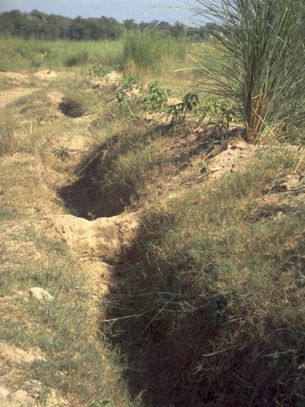
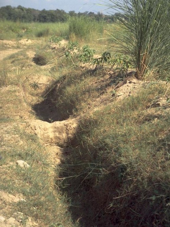
The purpose of forest catchment treatment is first to rehabilitate the forest through protection of the area by ‘social fencing’ (villagers agreeing amongst themselves to exclude livestock without using physical barriers), then construction of soil conservation measures (staggered contour trenches, check dams, graded stabilisation channels etc; see establishment activities), and ‘enrichment planting’ of trees and grasses within the existing forest stand to improve composition and cover. These species usually include trees such as Acacia catechu and Dalbergia sissoo, and fodder grasses - as well as bhabbar grass (Eulaliopsis binata), which is used for rope making. The combined measures are aimed at reestablishing the forest canopy, understorey and floor, thereby restoring the forest ecosystem together with its functions and services. Biodiversity is simultaneously enhanced.
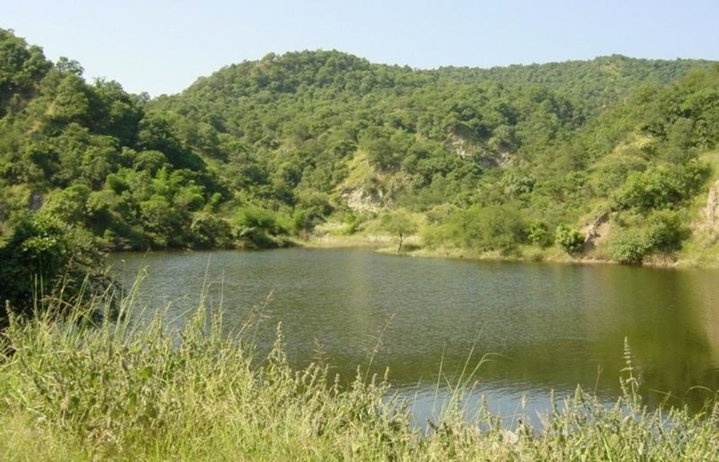
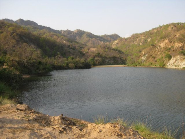
The second main objective is to provide supplementary irrigation water to the village below through construction of one, or more, earth dams. The village community - organised into a Hill Resource Management Society - is the source of highly subsidised labour for forest catchment treatment. After catchment protection around the proposed dam site(s), the dam(s) and pipeline(s) are constructed. The dams are generally between 20,000 and 200,000 m3 in capacity, and the pipelines usually one kilometre or less in length.
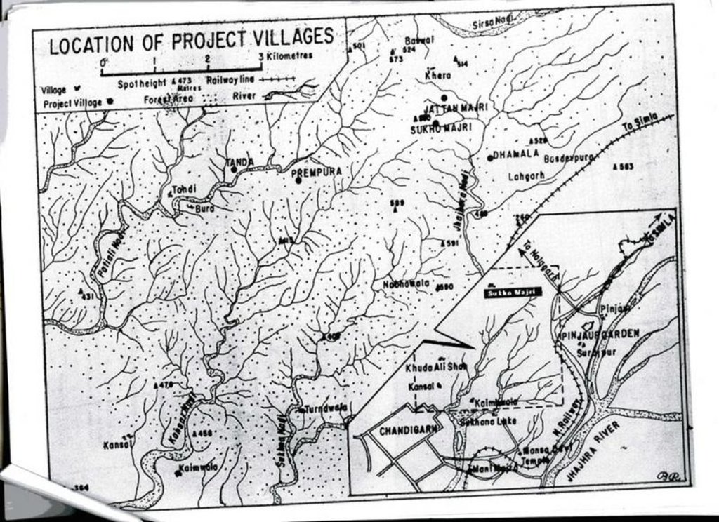
Apart from irrigation, the villagers benefit from communal use of non-timber forest resources. Forest catchment treatment (associated with the approach termed ‘joint forest management’ - JFM) has been developed from a pilot initiative in Sukhomajri village in 1976, and has spread very widely throughout India. This description focuses on Ambala and Yamunanagar Districts in Haryana State.
The Shiwalik hills where the SWC technology was applied is one of the eight most degraded, rainfed agro-ecosystems of India. It is highly erodible, with presence of low water retentive soils and severe soil erosion, haing water scarcity despite average 1000 mm annual rainfall.
2.3 صور التقنية
2.5 البلد/المنطقة/المواقع التي تم تنفيذ التقنية فيها والتي يغطيها هذا التقييم
البلد:
الهند
المنطقة/الولاية/المحافظة:
Haryana
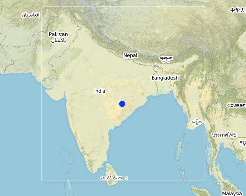
مزيد من التفاصيل حول الموقع:
Ambala and Yamunanagar
Map
×3. تصنيف تقنية الإدارة المستدامي للأراضي
3.1 الغرض الرئيسي ( الأغراض الرئيسية) للتقنية
- تحسين الإنتاج
- الحد من تدهور الأراضي ومنعه وعكسه
3.2 نوع (أنواع) استخدام الأراضي الحالية حيث يتم تطبيق التقنية

أراضي الرعي

الغابات/ الأراضي الحرجية
- Rehabilitated natural forest
التعليقات:
Major land use problems (compiler’s opinion): The Shiwalik Hills are extremely prone to both surface erosion and landslides, and general degradation of vegetation due to over-exploitation. Some areas have become completely denuded because of overgrazing and woodcutting. Furthermore there is no, or inadequate, water for irrigation of crops.
Grazingland comments: Due to free grazing, much of the forest land was becoming barren and fodder yield declined over a period of time. The average fodder yield was about two quintals/ha of forest land and fodder consumption was 26.69kg/animal/day.
Problems / comments regarding forest use: Tree species like Khaci (Acacia catechu), Dalbergio sissoo in pits and slips of bhabbar grass (Eulaliopsis binata) on mounds of trenches and hill slopes were planted. Bhabbar grass was sold out by forest department to contractors.
Type of grazing system comments: Due to free grazing, much of the forest land was becoming barren and fodder yield declined over a period of time. The average fodder yield was about two quintals/ha of forest land and fodder consumption was 26.69kg/animal/day.
3.3 مزيد من المعلومات حول استخدام الأراضي
حدد:
Longest growing period in days: 120 Longest growing period from month to month: Jul - Oct
3.4 مجموعةالإدارة المستدامة للأراضي التي تنتمي إليها هذه التقنية
- إغلاق المنطقة (إيقاف الاستخدام، دعم الاصلاح)
- تحسين الغطاء الأرضي/النباتي
- التدابير المتقاطعة للمنحدرات
3.5 انتشار التقنية
التعليقات:
Total area covered by the SLM Technology is 198 m2.
3.6 التدابير التقنية في مجال إلادارة المستدامة للأراضي
3.7 الأنواع الرئيسية من تدهور الأراضي التي تناولتها التقنية

تآكل التربة بالمياه
- الوزن(Wt): فقدان التربة السطحية/تآكل السطح
- (Wg):الانجراف الخلجاني/ الخلجان
- (Wm): مجموعة كبيرة من الحركات الأرضية/انزلاقات أرضية

تدهور المياه
- (Ha): التجفيف
التعليقات:
Main type of degradation addressed: Wt: loss of topsoil / surface erosion
Secondary types of degradation addressed: Wg: gully erosion / gullying, Wm: mass movements / landslides, Ha: aridification
Main causes of degradation: deforestation / removal of natural vegetation (incl. forest fires), education, access to knowledge and support services (Absence of institutional arrangements to disseminate the knowledge from lab to land and involve the users in implementation)
Secondary causes of degradation: overgrazing (Subsistence economy, dependance on forests for fuelwood and fodder, livestock were low quality, free grazing type. And these were no regulatory mechanisms to share usufruct from forests with people.), poverty / wealth (Lack of capital at the grassroot to take the initiative by the farmers themselves)
3.8 منع أو حد أو عكس تدهور الأراضي
تحديد هدف التقنية فيما يتعلق بتدهور الأراضي:
- الحد من تدهور الأراضي
4. المواصفات الفنية، وأنشطة التنفيذ، والمدخلات، والتكاليف
4.1 الرسم الفني للتقنية
4.2 المواصفات الفنية/شروحات الرسم الفني
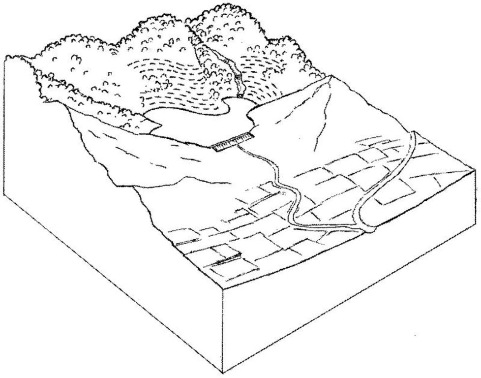
Forest catchment treatment: an overview showing protected forest, dam and irrigated cropland below.
Technical knowledge required for field staff / advisors: moderate
Technical knowledge required for land users: moderate
Main technical functions: increase of infiltration, water harvesting / increase water supply
Secondary technical functions: control of dispersed runoff: retain / trap, improvement of ground cover, control of concentrated runoff
Vegetative measure: enrichment planting with
Vegetative material: T : trees / shrubs, G : grass
Vegetative measure: Vegetative material: T : trees / shrubs, G : grass
Vegetative measure: Vegetative material: T : trees / shrubs, G : grass
Vegetative measure: Vegetative material: T : trees / shrubs, G : grass
Trees/ shrubs species: Acacia catechu, Dalbergia sissoo etc
Grass species: bhabbar grass: Eulaliopsis binata
Structural measure: dam
Structural measure: trenches
Structural measure: ditches
Structural measure: check dams
Other type of management: social fencing
4.4 أنشطة التأسيس
| النشاط | نوع التدبير | التوقيت | |
|---|---|---|---|
| 1. | Enrichment planting of tree seedlings (Acacia catechu, Dalbergiasissoo etc), grasses (bhabbar grass: Eulaliopsis binata) on bundsof earth and hill slopes, and Ipomea cornea in channels. | نباتية | beginning of the monsoon rains. |
| 2. | Construction of a series of staggered contour trenches on slopes. | بنيوية أو هيكلية | pre-monsoon |
| 3. | Construction of stone/earth/wood check dams in gullies. | بنيوية أو هيكلية | pre-monsoon |
| 4. | Construction of graded stabilisation channels which capture runoffand discharge it safely. | بنيوية أو هيكلية | pre-monsoon |
| 5. | Construction of earth dam wall for water harvesting and concretepipelines for irrigation. | بنيوية أو هيكلية | pre-monsoon |
| 6. | Introduction of social fencing system through Hill ResourceManagement Societies. | إدارية | pre-monsoon |
4.5 التكاليف والمدخلات اللازمة للتأسيس
| تحديد المدخلات | الوحدة | الكمية | التكاليف لكل وحدة | إجمالي التكاليف لكل مدخل | % من التكاليف التي يتحملها مستخدمو الأراضي | |
|---|---|---|---|---|---|---|
| العمالة | Labour | ha | 1,0 | 250,0 | 250,0 | 5,0 |
| معدات | Machine use | ha | 1,0 | 75,0 | 75,0 | |
| المواد النباتية | Seedlings | ha | 1,0 | 50,0 | 50,0 | |
| مواد البناء | Construction material for dam wall | ha | 1,0 | 25,0 | 25,0 | |
| إجمالي تكاليف إنشاء التقنية | 400,0 | |||||
التعليقات:
Duration of establishment phase: 36 month(s)
4.6 الصيانة/الأنشطة المتكررة
| النشاط | نوع التدبير | التوقيت/الوتيرة | |
|---|---|---|---|
| 1. | watch and ward | نباتية | /on-going |
| 2. | Desilting of water harvesting structures. | بنيوية أو هيكلية | pre-monsoon,/once every year |
| 3. | Repair of channels. | بنيوية أو هيكلية | pre-monsoon,/once every year |
| 4. | Maintenance of structures. | بنيوية أو هيكلية | pre-monsoon,/ |
| 5. | regular meetings/facilitations | إدارية | |
| 6. | control grazing fines, peer-group pressure | إدارية |
4.7 التكاليف والمدخلات اللازمة للصيانة/للأنشطة المتكررة (سنويًا)
| تحديد المدخلات | الوحدة | الكمية | التكاليف لكل وحدة | إجمالي التكاليف لكل مدخل | % من التكاليف التي يتحملها مستخدمو الأراضي | |
|---|---|---|---|---|---|---|
| العمالة | Labour | ha | 1,0 | 50,0 | 50,0 | 95,0 |
| إجمالي تكاليف صيانة التقنية | 50,0 | |||||
التعليقات:
This information is indicative and is based on calculations derived from Thaska village (Yamunanagar District)
where there are 3 dams - collecting the runoff from the total forest catchment of 75 ha. The cost range of treatments per
hectare of rehabilitated forest is generally US$ 200–700 (where the main cost is that of the dam construction) and typically the area of supplementary irrigation (command area) is twice as large as the forest catchment treated (in this case the irrigated area is 150 ha).
Cost per unit: the treatment of a 25 ha unit of catchment including construction of a dam costs around US$ 10,000.
5. البيئة الطبيعية والبشرية
5.1 المناخ
هطول الأمطار السنوي
- < 250 مم
- 251- 500 ملم
- 501 - 750ملم
- 1,000-751 ملم
- 1,500-1,100 ملم
- 2,000-1,500 ملم
- 3,000-2,001 ملم
- 4,000-3,100 ملم
- > 4000 ملم
المنطقة المناخية الزراعية
- شبه رطبة
- شبه قاحلة
Semi arid: Shiwalik region falls under semi-arid agro-climatic zone.
5.2 طوبوغرافيا
متوسط الانحدارات:
- مسطح (0-2%)
- بسيط (3-5%)
- معتدل (6-10%)
- متدحرج (11-15%)
- تلال (16-30%)
- شديدة الانحدار(31-60%)
- فائقة الانحدار (>60%)
التضاريس:
- هضاب/سهول
- أثلام مرتفعة
- المنحدرات الجبلية
- منحدرات التلال
- منحدرات في السفوح
- قاع الوادي
المنطقة الارتفاعية:
- 100-0 متر فوق سطح البحر
- 500-101 متر فوق سطح البحر
- 1,000-501 متر فوق سطح البحر
- 1,500-1,001 متر فوق سطح البحر
- 2,000-1,501 متر فوق سطح البحر
- 2,500-2,100 متر فوق سطح البحر
- 3,000-2,501 متر فوق سطح البحر
- 4,000-3,001 متر فوق سطح البحر
- > 4000 متر فوق سطح البحر
التعليقات والمواصفات الإضافية بشأن التضاريس:
Landforms: Hill slopes (ranked 1, Higher hills are located in the northern and eastern part of the tract, while low hills in the southern and western parts of the tract. These hills are characterized by relatively high intensity of er), ridges (ranked 2) and footslopes (ranked 3)
Slopes on average: Moderate (ranked 1, the slopes vary considerably from moderate to precipitous), hilly (ranked 2) and steep (ranked 3)
5.3 التربة
متوسط عمق التربة:
- ضحل جدًا (0-20 سم)
- ضحلة (21-50 سم)
- متوسطة العمق (51-80 سم)
- عميقة (81-120 سم)
- عميقة جدًا (> 120 سم)
قوام التربة (التربة السطحية):
- خشن / خفيف (رملي)
المواد العضوية في التربة السطحية:
- متوسطة (1-3%)
- منخفضة (<1%)
إذا كان متاحًا، قم بإرفاق وصف كامل للتربة أو تحديد المعلومات المتوفرة، على سبيل المثال نوع التربة، الرقم الهيدروجيني/ درجة حموضة التربة، قدرة التبادل الكاتيوني، النيتروجين، الملوحة وما إلى ذلك.
Soil depth on average: Also shallow (ranked 2) and deep (ranked 3)
Soil texture: Coarse (ranked 1, in most of the areas soils are sandy. However sandy loam, loamy sand and sill loam soils are also met with), medium (ranked 2) and fine/heavy (ranked 3)
Soil fertility: Medium (soils are deficient in humus contents. However soils are fairly fertile and suitable for raising forest crops in the entire area)
Soil drainage/infiltration: Poor (water holding capacity of soils is good)
5.6 خصائص مستخدمي الأراضي الذين يطبقون التقنية
التوجه السوقي لنظام الإنتاج:
- الكفاف (الإمداد الذاتي)
- مختلط (كفاف/ تجاري)
الدخل من خارج المزرعة:
- 10-50% من جميع الإيرادات
اذكر الخصائص الأخرى ذات الصلة لمستخدمي الأراضي:
Off-farm income specification: significant off-farm activity/income includes rope making from bhabbar grass. Sale of fodder grass from the forest provides
additional income.
Market orientation forest land: Mixed (forest dept. used to give annual contracts for bhabbar grasses)
5.7 متوسط مساحة الأرض المملوكة أو المستأجرة من قبل مستخدمي الأراضي الذين يطبقون التقنية
- < 0.5 هكتارا
- 0.5 - 1 هكتار
- 1 -2 هكتار
- 2 - 5 هكتار
- 5 - 15 هكتار
- 15 - 50 هكتار
- 50 - 100هكتار
- 500-100 هكتار
- 1,000-500 هكتار
- 10,000-1,000 هكتار
- > 10,000 هكتار
التعليقات:
2-5 ha: Grazing land mainly comprises of forest area where villagers have rights, private as well as community lands.
5.8 ملكية الأراضي، وحقوق استخدام الأراضي، وحقوق استخدام المياه
ملكية الارض:
- دولة
حقوق استخدام الأراضي:
- مجتمعي (منظم)
6. الآثار والتصريحات الختامية
6.1 الآثار التي أظهرتها التقنية في الموقع
الآثار الاجتماعية والاقتصادية
الإنتاج
إنتاج الأعلاف
جودة العلف
إنتاج الخشب
تنوع المنتج
التعليقات/ حدد:
Increased non-timber forest products
الدخل والتكاليف
دخل المزرعة
فروقات اقتصادية
التعليقات/ حدد:
Those with irrigation vs those without
الآثار الاجتماعية والثقافية
المؤسسات المجتمعية
المعرفة بالإدارة المستدامة للأراضي/تدهور الأراضي
التخفيف من حدة الصراع
التعليقات/ حدد:
Those with irrigation vs those without
الآثار الايكولوجية
التربة
رطوبة التربة
غطاء التربة
فقدان التربة
التنوع البيولوجي: الغطاء النباتي، الحيوانات
الغطاء النباتي
التعليقات/ حدد:
Trees and grass
التنوع النباتي
التنوع الحيواني
تنوع الموائل
6.2 الآثار التي أظهرتها التقنية خارج الموقع
تدفقات مائية موثوقة ومستقرة في موسم الجفاف
الفيضان في اتجاه مجرى النهر
تراكم الطمي باتجاه مصب النهر
Crop yield
التعليقات/ حدد:
From new irrigation water
6.4 تحليل التكلفة والعائد
كيف يمكن مقارنة العوائد نسبة لتكاليف الإنشاء (من وجهة نظر مستخدمي الأراضي)؟
عوائد قصيرة الأجل:
ايجابي جدا
عوائد طويلة الأجل:
ايجابي جدا
كيف تتم مقارنة العوائدمع كلفة الصيانة/التكاليف المتكررة (من وجهة نظر مستخدمي الأراضي)؟
عوائد قصيرة الأجل:
ايجابي جدا
عوائد طويلة الأجل:
ايجابي جدا
6.5 اعتماد التقنية
من بين جميع الذين تبنوا التقنية، كم عدد الذين فعلوا ذلك بشكل تلقائي، أي دون تلقي أي حوافز مادية/مدفوعات؟:
- 90-50%
التعليقات:
40% of land user families have adopted the Technology with external material support
Comments on acceptance with external material support: estimates
60% of land user families have adopted the Technology without any external material support
There is a strong trend towards spontaneous adoption of the Technology
Comments on adoption trend: The spread of such forest treatment within Haryana (and outside) is happening steadily.
Farmers have levelled theor fields to await water for irrigation from dams. The villagers have also contributed by money/labour in lying pipelines for water distribution.
6.7 نقاط القوة / المزايا / الفرص التي توفرها التقنية
| نقاط القوة/ المزايا/ الفرص من وجهة نظر مستخدمي الأراضي |
|---|
|
Increased availabilzy of fodder and fuel. How can they be sustained / enhanced? Improvement in livestock mix and breed owned by villlagers. |
|
Increased crop yields, milk production and horticultural products How can they be sustained / enhanced? Suitable crop mix to derive maximum benefits from water from dams |
| نقاط القوة/ المزايا/ الفرص من وجهة نظر جامع المعلومات أو غيره من الاشخاص الرئيسيين لمصدر المعلومات |
|---|
|
Increased surface and groundwater help to fill the dam rather than running off and causing flooding and erosion lower down (but not always: see first off-site disadvantage) How can they be sustained / enhanced? Ensure continuous protection/ regular maintenance. |
|
Increased fodder and fuel from the renewed forest resources How can they be sustained / enhanced? Ditto. |
|
Reduction of runoff and erosion in the previously degraded catchment How can they be sustained / enhanced? Ditto. |
|
Improved forest conditions – both canopy and understorey delivering general ecosystem benefits How can they be sustained / enhanced? Ditto. |
|
Increased crop yield from irrigation made possible through irrigation from the dam Increased household income Increased community institution strength How can they be sustained / enhanced? Ditto. |
6.8 نقاط ضعف / مساوىء / مخاطر التقنية وسبل التغلب عليها
| نقاط الضعف/ المساوىء/ المخاطر من وجهة نظر مستخدم الأراضي | كيف يمكن التغلب عليها؟ |
|---|---|
| Initial investment to change the cattle mix. | Arrangement of credit facility. |
| نقاط الضعف/ المساوىء/ المخاطر من وجهة نظر جامع المعلومات أو غيره من الاشخاص الرئيسيين لمصدر المعلومات | كيف يمكن التغلب عليها؟ |
|---|---|
| In some cases reduction in runoff (because of increased vegetation) causes less water for irrigation | Manipulate vegetative cover as required (selective cutting). |
| Conflicts in water distribution | Conflict resolution may need to be carried out through Hill Resource Management Societies. |
| High labour input. | |
| Regular maintenance and desilting of earthen dams. |
7. المراجع والروابط
7.2 المراجع للمنشورات المتاحة
العنوان، المؤلف، السنة، النظام القياسي الدولي لترقيم الكتب ISBN:
Singh TP and Varalakshmi V: The Decade and Beyond: Evolving community-state partnership. TERI, New Delhi. 1998.
العنوان، المؤلف، السنة، النظام القياسي الدولي لترقيم الكتب ISBN:
Poffenberger M and McGean B (eds): Village Voices, Forest Choices. Joint Forest Management in India. Oxford University Press, Delhi. 1996.
الروابط والوحدات المواضيعية
توسيع الكل طي الكلالروابط

Joint forest management [الهند]
Government and NGO supported community protection of forested catchments, through village-based Hill Resource Management Societies.
- جامع المعلومات: Sumana Datta

Joint forest management [الهند]
Joint forest management is a community based program developed in collaboration with the forest department for the protection and management of local forests while providing incentives to the local communities with political and institutional support from the state.
- جامع المعلومات: Sumana Datta
الوحدات المواضيعية
لا يوجد وحدات مواضيعية


