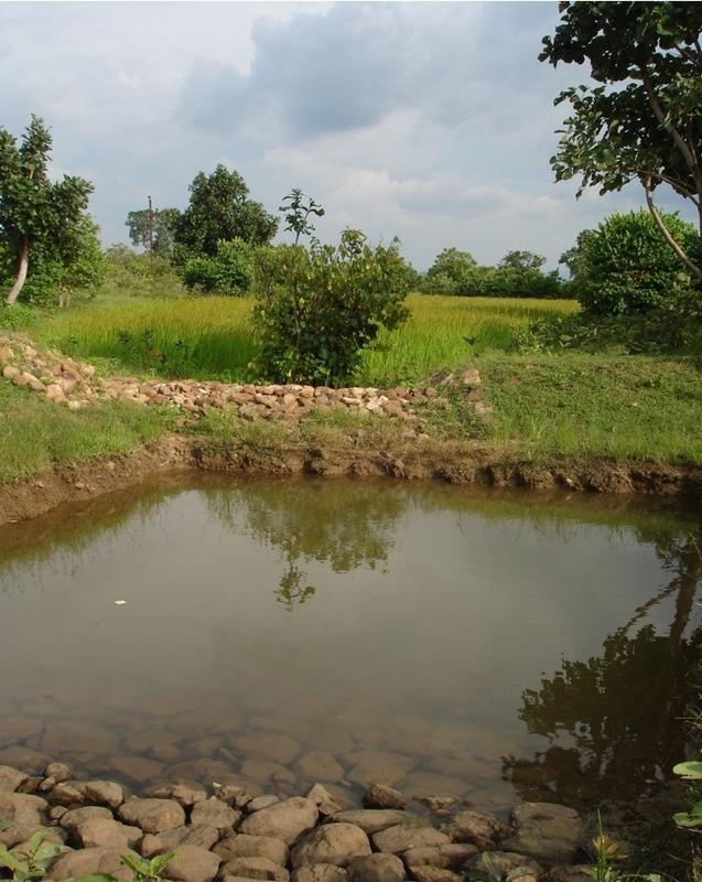
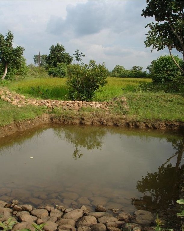
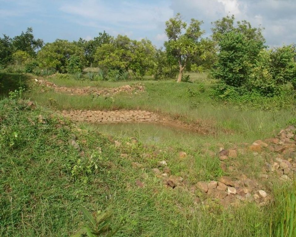
Sunken gully pits [الهند]
- تاريخ الإنشاء:
- تحديث:
- جامع المعلومات: SATYANARAYANA SAHU
- المحرر: –
- المُراجع: Fabian Ottiger
khancha, Dhuda
technologies_1479 - الهند
عرض الأقسام
توسيع الكل طي الكل1. معلومات عامة
1.2 تفاصيل الاتصال بالأشخاص الرئيسيين لمصدر المعلومات والمؤسسات المشاركة في تقييم وتوثيق التقنية
متخصص في الإدارة المستدامة للأراضي:
متخصص في الإدارة المستدامة للأراضي:
Nayak Pradeep Kumar
Nuapada, Orissa, India
الهند
1.3 الشروط المتعلقة باستخدام البيانات الموثقة من خلال WOCAT
متى تم تجميع البيانات (ميدانيا)؟:
10/10/2006
يوافق جامع المعلومات والشخص (لاشخاص) الرئيسي لمصدر المعلومات على الشروط المتعلقة باستخدام البيانات الموثقة من خلال WOCAT:
نعم
1.5 الإشارة إلى الاستبيان (الاستبيانات) حول مناهج الإدارة المستدامة للأراضي
Participatory Watershed Development Approach [الهند]
Livelihood asset base development through participatory watershed developemnt keeping people at the center stage of development and promoting village level institutions.
- جامع المعلومات: Narendra Kumar Panigrahi
2. وصف تقنيةالإدارة المستدامي للأراضي
2.1 وصف مختصر للتقنية
تعريف التقنية:
Runoff management pit in the gully with provision of waterway for excess runoff water.
2.2 وصف تفصيلي للتقنية
الوصف:
Adopted in 4-8% sloped gully at an interval varying from 20 M to 30 M . Pits are dug on the upsteam of the bund with graded slope or the upsteam of the pits. Also having provision of safe water disposal. Purpose: 1. Reduction in flow velocity 2. Withheld and impound the flow water 3. Ground water recharge 4. Increase in soil moisture regime 5. For supplemental irrigation by the middle and lower reach structure. Establishment/maintenance: Turfing, Placing in position of displaced boulder. Excavation of deposited earth from the pit. Environment: User friendly, Low maintenance, Promotes vegetation,Eco-friendly
2.3 صور التقنية
2.5 البلد/المنطقة/المواقع التي تم تنفيذ التقنية فيها والتي يغطيها هذا التقييم
البلد:
الهند
المنطقة/الولاية/المحافظة:
ORISSA
مزيد من التفاصيل حول الموقع:
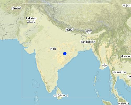
ORISSA/NUAPADA/MAHANADI/CHAKAPADA
Map
×2.6 تاريخ التنفيذ
في حالة عدم معرفة السنة بالتحديد، يرجى الإشارة إلى التاريخ التقريبي:
- منذ أكثر من 50 عامًا (تقليدي)
2.7 إدخال التقنية
حدد كيف تم إدخال التقنية:
- من خلال المشاريع/ التدخلات الخارجية
التعليقات (نوع المشروع، الخ):
ANDHRA PRADESH By Hanumant Rao based upon Four- Water concept.
3. تصنيف تقنية الإدارة المستدامي للأراضي
3.1 الغرض الرئيسي ( الأغراض الرئيسية) للتقنية
- الحد من تدهور الأراضي ومنعه وعكسه
- التكيف مع تغير المناخ/الظواهر المتطرفة وآثارها
3.2 نوع (أنواع) استخدام الأراضي الحالية حيث يتم تطبيق التقنية

مختلطة (محاصيل/ رعي/ أشجار)، بما في ذلك الحراجة الزراعية
- الرعي الحرجي
المنتجات / الخدمات الرئيسية:
Shrubs, trees and fodder cultivation. Also: fuelwood, fruits and nuts, grazing / browsing, other forest products / uses (honey, medical, etc.), nature conservation / protection, recreation / tourism
التعليقات:
Major land use problems (compiler’s opinion): Formation and development of gully in course of time.
Major land use problems (land users’ perception): Problem of sand casting in crop land and graduallly coverted into unproductive lands.
Semi-nomadism / pastoralism: Animals reside in the Watershed area
Grazingland comments: Trend increasing towards livestock production. Trend to have stall feeding. Trend to produce better and improved quality fodder.
Plantation forestry: Yes
Other type of forest: Natural forest
Problems / comments regarding forest use: Management and protection of existing forest and species are increasing by providing watch and ward by the Watershed members through Vana Surakhya Samiti(Forest Protection Committee)
3.3 مزيد من المعلومات حول استخدام الأراضي
إمدادات المياه للأرض التي يتم تنفيذ التقنية عليها:
- بعلية
عدد مواسم الزراعة في السنة:
- 2
حدد:
Longest growing period in days: 150 Longest growing period from month to month: Jun - Oct Second longest growing period in days: 75 Second longest growing period from month to month: Nov - Jan
3.4 مجموعةالإدارة المستدامة للأراضي التي تنتمي إليها هذه التقنية
- حصاد المياه
- إدارة الري (بما في ذلك إمدادات المياه والصرف الصحي)
- إدارة المياه الجوفية
3.5 انتشار التقنية
حدد انتشار التقنية:
- منتشرة بالتساوي على مساحة
إذا كانت التقنية منتشرة بالتساوي على منطقة ما، فحدد المنطقة التقريبية المغطاة:
- 0.1-1 كم2
التعليقات:
Total area covered by the SLM Technology is 0.4 m2.
Technology adopted following T.Hanumanth Rao's four- Water concept.
3.6 التدابير التقنية في مجال إلادارة المستدامة للأراضي
3.7 الأنواع الرئيسية من تدهور الأراضي التي تناولتها التقنية

تآكل التربة بالمياه
- الوزن(Wt): فقدان التربة السطحية/تآكل السطح
- (Wg):الانجراف الخلجاني/ الخلجان
- (Wo:) تأثيرات التدهور من مواقع أخرى
التعليقات:
Main type of degradation addressed: Wg: gully erosion / gullying
Secondary types of degradation addressed: Wt: loss of topsoil / surface erosion, Wo: offsite degradation effects
3.8 منع أو حد أو عكس تدهور الأراضي
تحديد هدف التقنية فيما يتعلق بتدهور الأراضي:
- منع تدهور الأراضي
- الحد من تدهور الأراضي
التعليقات:
Main goals: prevention of land degradation
Secondary goals: mitigation / reduction of land degradation
4. المواصفات الفنية، وأنشطة التنفيذ، والمدخلات، والتكاليف
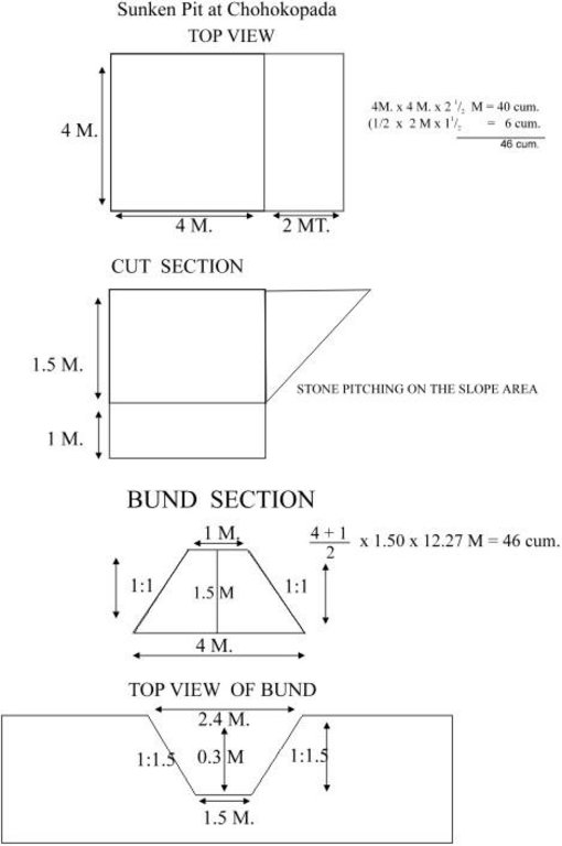
4.1 الرسم الفني للتقنية
4.2 المواصفات الفنية/شروحات الرسم الفني
Sunken pit technical drawing
Technical knowledge required for field staff / advisors: moderate
Technical knowledge required for land users: low
Main technical functions: control of dispersed runoff: retain / trap, control of concentrated runoff: impede / retard, increase of infiltration, increase / maintain water stored in soil
Secondary technical functions: control of concentrated runoff: retain / trap, control of concentrated runoff: drain / divert, reduction of slope angle, reduction of slope length, sediment retention / trapping, sediment harvesting, increase in soil fertility
Vegetative measure: Turf on bund
Vegetative material: G : grass
Vegetative measure: Vegetative material: G : grass
Vegetative measure: Vegetative material: G : grass
Vegetative measure: Vegetative material: G : grass
Grass species: Local grass
Slope (which determines the spacing indicated above): 3.00%
If the original slope has changed as a result of the Technology, the slope today is (see figure below): 2.00%
Gradient along the rows / strips: 0.00%
Structural measure: Sunken gully pit
Vertical interval between structures (m): 1
Spacing between structures (m): 20
Depth of ditches/pits/dams (m): 1
Width of ditches/pits/dams (m): 2
Length of ditches/pits/dams (m): 3
Height of bunds/banks/others (m): 1
Width of bunds/banks/others (m): 2.5
Length of bunds/banks/others (m): 3
Construction material (earth): Excavated earth over 4.5 cum is utilised for construction of down stream bund
Construction material (stone): 1.08 cum of stone is used in upstream pit slope
Slope (which determines the spacing indicated above): 3%
If the original slope has changed as a result of the Technology, the slope today is: 2%
Lateral gradient along the structure: 0%
Vegetation is used for stabilisation of structures.
4.3 معلومات عامة بخصوص حساب المدخلات والتكاليف
عملة أخرى/ عملة وطنية (حدد):
Rupees
أشر إلى سعر الصرف من الدولار الأمريكي إلى العملة المحلية (إذا كان ذا صلة): 1 دولار أمريكي =:
50,0
اذكر متوسط تكلفة أجر العمالة المستأجرة في اليوم الواحد:
1.00
4.4 أنشطة التأسيس
| النشاط | نوع التدبير | التوقيت | |
|---|---|---|---|
| 1. | Local grass collection | نباتية | Onset of monsoon(Jun-july) |
| 2. | Putting the turf on the bund | نباتية | Onset of monsoon(Jun-july) |
| 3. | Establishment of grass | نباتية | During monsoon |
| 4. | Survey and layout | بنيوية أو هيكلية | before onset of rain. |
| 5. | digging of pit & construction of earthen bund | بنيوية أو هيكلية | pre-monsoon |
| 6. | stone pitching on upstream slope of pit | بنيوية أو هيكلية | pre-monsoon |
| 7. | grass turffing | بنيوية أو هيكلية | monsoon |
4.5 التكاليف والمدخلات اللازمة للتأسيس
| تحديد المدخلات | الوحدة | الكمية | التكاليف لكل وحدة | إجمالي التكاليف لكل مدخل | % من التكاليف التي يتحملها مستخدمو الأراضي | |
|---|---|---|---|---|---|---|
| العمالة | Labour | ha | 1,0 | 37,0 | 37,0 | |
| مواد البناء | Stone | ha | 1,0 | 3,0 | 3,0 | |
| إجمالي تكاليف إنشاء التقنية | 40,0 | |||||
التعليقات:
Duration of establishment phase: 12 month(s)
4.6 الصيانة/الأنشطة المتكررة
| النشاط | نوع التدبير | التوقيت/الوتيرة | |
|---|---|---|---|
| 1. | Replanting of grass in the dried out patches | نباتية | During rainy season(July-Sept) /When required. |
| 2. | stabilisatioin of bund with grass | بنيوية أو هيكلية | during rain/annual |
| 3. | de-silting of pit | بنيوية أو هيكلية | Before onset of monsoon/annual |
| 4. | Maintaing upstream & down stream bund slope | بنيوية أو هيكلية | Before onset of rain/annual |
| 5. | Re-arrangement of displaced stones | بنيوية أو هيكلية | before onset of rain/annual |
4.7 التكاليف والمدخلات اللازمة للصيانة/للأنشطة المتكررة (سنويًا)
التعليقات:
Length of structure , deapth of gully , stone availability
4.8 أهم العوامل المؤثرة على التكاليف
قدم وصفا لأهم العوامل التي تؤثر على التكاليف:
Labour availability, stone transportation.
5. البيئة الطبيعية والبشرية
5.1 المناخ
هطول الأمطار السنوي
- < 250 مم
- 251- 500 ملم
- 501 - 750ملم
- 1,000-751 ملم
- 1,500-1,100 ملم
- 2,000-1,500 ملم
- 3,000-2,001 ملم
- 4,000-3,100 ملم
- > 4000 ملم
حدد متوسط هطول الأمطار السنوي (إذا كان معروفًا)، بالملليمتر:
1250,00
المنطقة المناخية الزراعية
- شبه قاحلة
5.2 طوبوغرافيا
متوسط الانحدارات:
- مسطح (0-2%)
- بسيط (3-5%)
- معتدل (6-10%)
- متدحرج (11-15%)
- تلال (16-30%)
- شديدة الانحدار(31-60%)
- فائقة الانحدار (>60%)
التضاريس:
- هضاب/سهول
- أثلام مرتفعة
- المنحدرات الجبلية
- منحدرات التلال
- منحدرات في السفوح
- قاع الوادي
المنطقة الارتفاعية:
- 100-0 متر فوق سطح البحر
- 500-101 متر فوق سطح البحر
- 1,000-501 متر فوق سطح البحر
- 1,500-1,001 متر فوق سطح البحر
- 2,000-1,501 متر فوق سطح البحر
- 2,500-2,100 متر فوق سطح البحر
- 3,000-2,501 متر فوق سطح البحر
- 4,000-3,001 متر فوق سطح البحر
- > 4000 متر فوق سطح البحر
5.3 التربة
متوسط عمق التربة:
- ضحل جدًا (0-20 سم)
- ضحلة (21-50 سم)
- متوسطة العمق (51-80 سم)
- عميقة (81-120 سم)
- عميقة جدًا (> 120 سم)
قوام التربة (التربة السطحية):
- متوسط ( طميي، سلتي)
المواد العضوية في التربة السطحية:
- متوسطة (1-3%)
إذا كان متاحًا، قم بإرفاق وصف كامل للتربة أو تحديد المعلومات المتوفرة، على سبيل المثال نوع التربة، الرقم الهيدروجيني/ درجة حموضة التربة، قدرة التبادل الكاتيوني، النيتروجين، الملوحة وما إلى ذلك.
Soil fertility: Medium
Soil drainage/infiltration: Medium
Soil water storage capacity: Medium (ranked 1) and high (ranked 2)
5.6 خصائص مستخدمي الأراضي الذين يطبقون التقنية
الدخل من خارج المزرعة:
- أقل من % 10من كامل الدخل
المستوى النسبي للثروة:
- ضعيف
- متوسط
اذكر الخصائص الأخرى ذات الصلة لمستخدمي الأراضي:
Population density: 100-200 persons/km2
Annual population growth: 1% - 2%
5% of the land users are very rich and own 40% of the land.
5% of the land users are rich and own 20% of the land.
30% of the land users are average wealthy and own 30% of the land.
40% of the land users are poor and own 10% of the land.
20% of the land users are poor.
Off-farm income specification: Income from offl farm activities like stone cutting, stone transporation, dry stone pitching
Market orientation of grazing land: Mixed (ranked 1, shrubs, trees and fodder cultivation) and subsistence (self-supply, ranked 2, to supplement the fodder requirements of watershed)
Market orientation of forest land: Commercial/market (ranked 1, sale of oil producing seeds), mixed (ranked 2, supply of excess fodder to nearby area/watershed) and self subsistence (ranked 3, trend increasing towards livestock production. Trend to have stall feeding. Trend to produce better and improved quality fodder.)
5.7 متوسط مساحة الأرض المملوكة أو المستأجرة من قبل مستخدمي الأراضي الذين يطبقون التقنية
- < 0.5 هكتارا
- 0.5 - 1 هكتار
- 1 -2 هكتار
- 2 - 5 هكتار
- 5 - 15 هكتار
- 15 - 50 هكتار
- 50 - 100هكتار
- 500-100 هكتار
- 1,000-500 هكتار
- 10,000-1,000 هكتار
- > 10,000 هكتار
5.8 ملكية الأراضي، وحقوق استخدام الأراضي، وحقوق استخدام المياه
ملكية الارض:
- دولة
6. الآثار والتصريحات الختامية
6.1 الآثار التي أظهرتها التقنية في الموقع
الآثار الاجتماعية والاقتصادية
الإنتاج
إنتاج المحاصيل
التعليقات/ حدد:
Low fertile and degraded soil
إنتاج الأعلاف
التعليقات/ حدد:
Cowpea, Stylo
جودة العلف
التعليقات/ حدد:
Cowpea, Stylo
إنتاج الخشب
منطقة الإنتاج
التعليقات/ حدد:
Private land
الدخل والتكاليف
دخل المزرعة
التعليقات/ حدد:
Rs. 400/- per ha
عبء العمل
التعليقات/ حدد:
Crop area increased.
Awareness and willingness for maintenance required needs to develop
آثار اجتماعية واقتصادية أخرى
On farm employment
التعليقات/ حدد:
Farm production
Off farm employment
التعليقات/ حدد:
Stone cutting and T.C. of stone and dry packing
Input constraints
الآثار الاجتماعية والثقافية
المؤسسات المجتمعية
التعليقات/ حدد:
User group formation
المعرفة بالإدارة المستدامة للأراضي/تدهور الأراضي
التخفيف من حدة الصراع
التعليقات/ حدد:
Communitymobilization is required to restore the conflicts.
الآثار الايكولوجية
دورة المياه / الجريان السطحي
الجريان السطحي
الكمية قبل الإدارة المستدامة للأراضي:
60
الكمية بعد الإدارة المستدامة للأراضي:
25
تصريف المياه الزائدة
التربة
رطوبة التربة
التعليقات/ حدد:
Retention of water in pit. But might lead to waterlogging
غطاء التربة
التعليقات/ حدد:
Plantation of fodder crops
فقدان التربة
الكمية قبل الإدارة المستدامة للأراضي:
20
الكمية بعد الإدارة المستدامة للأراضي:
18
الآثار الايكولوجية الأخرى
Soil fertility
التعليقات/ حدد:
Top soil loss checked
Biodiversity
التعليقات/ حدد:
Ecological changes/Eco. Dev./benefits to environment not assesed in short period of time.
6.2 الآثار التي أظهرتها التقنية خارج الموقع
الفيضان في اتجاه مجرى النهر
التعليقات/ حدد:
Recharge to ground water
تلوث المياه الجوفية/الأنهار
الرواسب المنقولة بواسطة الرياح
6.4 تحليل التكلفة والعائد
كيف يمكن مقارنة العوائد نسبة لتكاليف الإنشاء (من وجهة نظر مستخدمي الأراضي)؟
عوائد قصيرة الأجل:
إيجابي
عوائد طويلة الأجل:
إيجابي
كيف تتم مقارنة العوائدمع كلفة الصيانة/التكاليف المتكررة (من وجهة نظر مستخدمي الأراضي)؟
عوائد قصيرة الأجل:
إيجابي
عوائد طويلة الأجل:
إيجابي قليلا
6.5 اعتماد التقنية
إذا كان متاحًا، قم بتحديد الكمية (عدد الأسر المعيشية و/أو المساحةالمغطاة):
13
من بين جميع الذين تبنوا التقنية، كم عدد الذين فعلوا ذلك بشكل تلقائي، أي دون تلقي أي حوافز مادية/مدفوعات؟:
- 10-0%
التعليقات:
25% of land user families have adopted the Technology with external material support
10 land user families have adopted the Technology with external material support
Comments on acceptance with external material support: estimates
2% of land user families have adopted the Technology without any external material support
3 land user families have adopted the Technology without any external material support
Comments on spontaneous adoption: estimates
There is a strong trend towards spontaneous adoption of the Technology
Comments on adoption trend: Because this technology shows successful result in moisture retention, check soil erosioin and prevents sand casting.
6.7 نقاط القوة / المزايا / الفرص التي توفرها التقنية
| نقاط القوة/ المزايا/ الفرص من وجهة نظر مستخدمي الأراضي |
|---|
| Low cost & affordable. |
| Maintainable based upon traditional practices with some additional techniques. |
| Farmers friendly. |
| نقاط القوة/ المزايا/ الفرص من وجهة نظر جامع المعلومات أو غيره من الاشخاص الرئيسيين لمصدر المعلومات |
|---|
|
Best upon traditional practices, reducing runoff and soil loss How can they be sustained / enhanced? proper planning Water disposal at higher elevation Regular maintenance Adoption of proper cropping pattern depending on water availability Water disposal at higher alevation Regular maintenance Adoption of proper cropping pattern depending upon water availability. Water disposal at higher elevation Regular maintenance Adoption of proper cropping pattern depending upon water availability. water disposal at higher elevatioin regular maintenance Adoptioin of proper cropping pattern depending upon water availability. |
| low cost |
| Farmers can maintain and very less area is lost |
| Efficient soil & moisture conservation. |
| Protection of top soil, Increase Productivity and production of land |
6.8 نقاط ضعف / مساوىء / مخاطر التقنية وسبل التغلب عليها
| نقاط الضعف/ المساوىء/ المخاطر من وجهة نظر جامع المعلومات أو غيره من الاشخاص الرئيسيين لمصدر المعلومات | كيف يمكن التغلب عليها؟ |
|---|---|
| Expected conflicts from adjecent farmers | Community mobilisation |
| Contribution mobilisation to have their ownership | Participatory planning |
| To be liable for its future care & maintenance | Awareness among the community |
الروابط والوحدات المواضيعية
توسيع الكل طي الكلالروابط

Participatory Watershed Development Approach [الهند]
Livelihood asset base development through participatory watershed developemnt keeping people at the center stage of development and promoting village level institutions.
- جامع المعلومات: Narendra Kumar Panigrahi
الوحدات المواضيعية
لا يوجد وحدات مواضيعية


