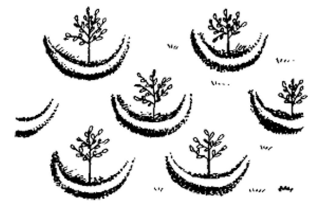
Large semi circular stone bunds [أثيوبيا]
- تاريخ الإنشاء:
- تحديث:
- جامع المعلومات: Eyasu Yazew
- المحرر: –
- المُراجع: Fabian Ottiger
Abiy nay emni firki werhi
technologies_1546 - أثيوبيا
عرض الأقسام
توسيع الكل طي الكل1. معلومات عامة
1.2 تفاصيل الاتصال بالأشخاص الرئيسيين لمصدر المعلومات والمؤسسات المشاركة في تقييم وتوثيق التقنية
متخصص في الإدارة المستدامة للأراضي:
Hailemariam Mengisteab
+251 910 170415
Mekelle University
P.O.Box 231, Mekelle, Ethiopia
أثيوبيا
متخصص في الإدارة المستدامة للأراضي:
Weldearegay Kifle
+251 910 170415
Mekelle University
P.O.Box 231, Mekelle, Ethiopia
أثيوبيا
اسم المؤسسة (المؤسسات) التي سهلت توثيق/تقييم التقنية (إذا كان ذلك على صلة)
Mekelle University (Mekelle University) - أثيوبيا1.3 الشروط المتعلقة باستخدام البيانات الموثقة من خلال WOCAT
متى تم تجميع البيانات (ميدانيا)؟:
11/11/2012
يوافق جامع المعلومات والشخص (لاشخاص) الرئيسي لمصدر المعلومات على الشروط المتعلقة باستخدام البيانات الموثقة من خلال WOCAT:
نعم
2. وصف تقنيةالإدارة المستدامي للأراضي
2.1 وصف مختصر للتقنية
تعريف التقنية:
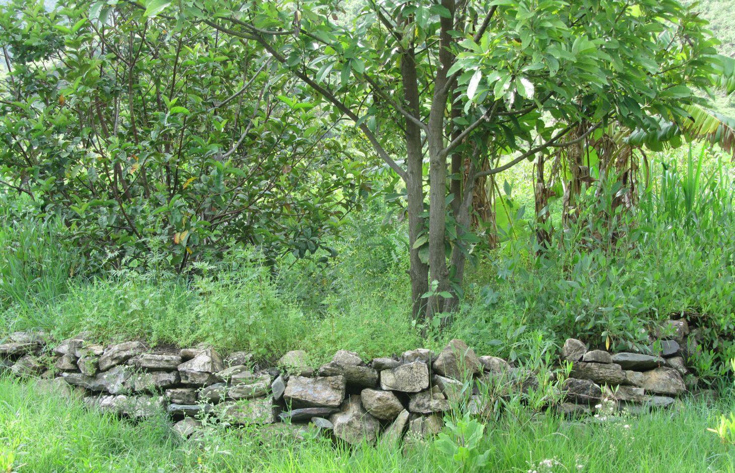
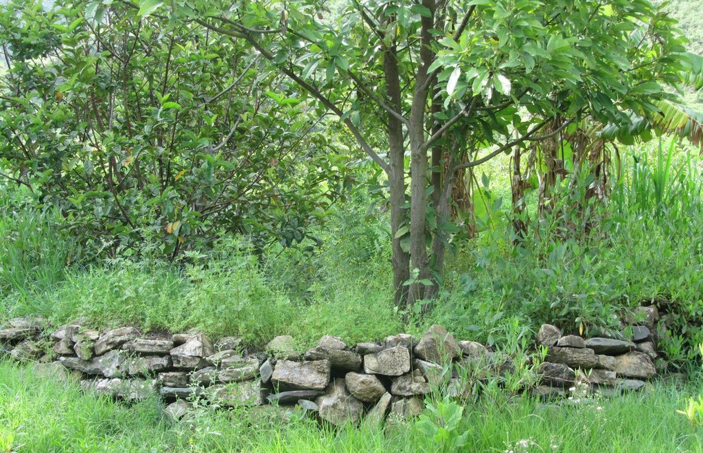
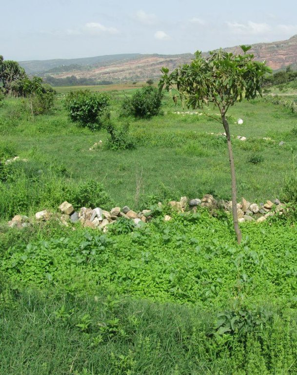
These consist of stone embankments built in the shape of a semi circle with the tips of the bund on the contour and are arranged in staggered orientation in rows so that overflow from one row will run into the next downslope.
2.2 وصف تفصيلي للتقنية
الوصف:
Large semi circular stone bunds are constructed by excavating a foundation of 0.1 - 0.2 m following the semi circle and building of the embankment using stones with a decreasing height at the tips to evacuate excess runoff. 1 - 3 pits are excavated within the semi circle for for planting trees.
Large semi circular stone bunds (Large half moons) are constructed with a diameter of 6 m and corresponding perimeter/length of 9.42 m. The spacing between the tips of adjacent bunds within a row and between the base bund and tip of adjacent rows is 3 m. The height of the embankment varies from 0.5 - 0.75 m at the base bund to 0.4 - 0.5 m at the tip while the corresponding width varies from 0.4 - 0.5 m to 0.2 - 0.3 m. The planting pit has a diameter and depth of 0.3 m.
Purpose of the Technology: Large semi circular stone bunds assist in decreasing slope length, runoff velocity and soil loss; and improving runoff harvesting, soil moisture and groundwater recharge.
Establishment / maintenance activities and inputs: The establishment of large semi circular stone bunds involves collection of stones, alignment of a contour and the semi circle, excavation of foundation, construction of the embankment and digging of planting pits and runoff harvesting ditch. The maintenance includes re-enforcing the embankment and dredging sediment from runoff harvesting ditch during the dry season.
Natural / human environment: Large semi circular stone bunds are implemented in foot (5 - 8%) and hill (8 - 16%) slopes and in medium and light soil types of shallow to moderate depth (0.2 - 0.8 m). It reduces runoff amount and velocity thereby decreasing soil loss and desertification/land degradation. It also improves soil moisture availability and groundwater recharge.
It is mostly constructed using communal labour and there is a moderate trend of spontaneous adoption. The technology is witnessed to be increasing fruit and fodder production thereby improving the livelihood of the land users. It, however, demands high labour especially during establishment.
2.3 صور التقنية
2.5 البلد/المنطقة/المواقع التي تم تنفيذ التقنية فيها والتي يغطيها هذا التقييم
البلد:
أثيوبيا
المنطقة/الولاية/المحافظة:
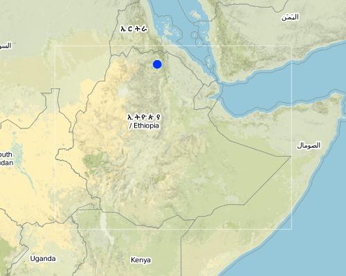
Tigray
مزيد من التفاصيل حول الموقع:
Kilte Awlaelo
Map
×2.6 تاريخ التنفيذ
في حالة عدم معرفة السنة بالتحديد، يرجى الإشارة إلى التاريخ التقريبي:
- منذ أقل من 10 سنوات (مؤخرًا)
2.7 إدخال التقنية
حدد كيف تم إدخال التقنية:
- من خلال المشاريع/ التدخلات الخارجية
3. تصنيف تقنية الإدارة المستدامي للأراضي
3.1 الغرض الرئيسي ( الأغراض الرئيسية) للتقنية
- الحد من تدهور الأراضي ومنعه وعكسه
3.2 نوع (أنواع) استخدام الأراضي الحالية حيث يتم تطبيق التقنية

الأراضي الزراعية
- زراعة الأشجار والشجيرات
المحاصيل الرئيسية (المحاصيل النقدية والغذائية):
Major cash crop: Fruit trees such as mango, guava, lemon.

الغابات/ الأراضي الحرجية
التعليقات:
Major land use problems (compiler’s opinion): Deforestation, soil erosion, overgrazing, decline of soil fertility and productivity.
Major land use problems (land users’ perception): Decrease soil moisture, drought, soil erosion, decrease fodder production and shortage of fuel wood.
Plantation forestry: Deforestation
Forest products and services: timber, fuelwood, fruits and nuts, grazing / browsing, nature conservation / protection
3.3 مزيد من المعلومات حول استخدام الأراضي
إمدادات المياه للأرض التي يتم تنفيذ التقنية عليها:
- بعلية
عدد مواسم الزراعة في السنة:
- 1
حدد:
Longest growing period in days: 150 Longest growing period from month to month: June - November
3.4 مجموعةالإدارة المستدامة للأراضي التي تنتمي إليها هذه التقنية
- التدابير المتقاطعة للمنحدرات
- إدارة المياه الجوفية
3.5 انتشار التقنية
حدد انتشار التقنية:
- منتشرة بالتساوي على مساحة
إذا كانت التقنية منتشرة بالتساوي على منطقة ما، فحدد المنطقة التقريبية المغطاة:
- 100-10 كم2
3.6 التدابير التقنية في مجال إلادارة المستدامة للأراضي

التدابير البنيوية
- الحواجز والضفاف
التعليقات:
Main measures: structural measures
3.7 الأنواع الرئيسية من تدهور الأراضي التي تناولتها التقنية

تآكل التربة بالمياه
- الوزن(Wt): فقدان التربة السطحية/تآكل السطح
- (Wg):الانجراف الخلجاني/ الخلجان
- (Wo:) تأثيرات التدهور من مواقع أخرى

التدهور البيولوجي
- (Bc): تناقص الغطاء النباتي
- (Bs): انخفاض جودة وتركيبة الأنواع/التنوع
التعليقات:
Main type of degradation addressed: Wt: loss of topsoil / surface erosion
Secondary types of degradation addressed: Wg: gully erosion / gullying, Wo: offsite degradation effects, Bc: reduction of vegetation cover, Bs: quality and species composition /diversity decline
Main causes of degradation: deforestation / removal of natural vegetation (incl. forest fires), Heavy / extreme rainfall (intensity/amounts), other natural causes (avalanches, volcanic eruptions, mud flows, highly susceptible natural resources, extreme topography, etc.) specify (Steep topography), population pressure
Secondary causes of degradation: over-exploitation of vegetation for domestic use, overgrazing, droughts, land tenure, poverty / wealth, education, access to knowledge and support services
3.8 منع أو حد أو عكس تدهور الأراضي
تحديد هدف التقنية فيما يتعلق بتدهور الأراضي:
- الحد من تدهور الأراضي
- اصلاح/إعادة تأهيل الأراضي المتدهورة بشدة
التعليقات:
Secondary goals: rehabilitation / reclamation of denuded land
4. المواصفات الفنية، وأنشطة التنفيذ، والمدخلات، والتكاليف
4.1 الرسم الفني للتقنية
4.2 المواصفات الفنية/شروحات الرسم الفني
Large semi circular stone bunds are stone embankments built in the shape of a semi circle with the tips of the bund on the contour and are arranged in staggered orientation in rows so that overflow from one row will run into the next downslope.
Location: Tigray. Kilte Awlaelo
Date: 10/10/2014
Technical knowledge required for field staff / advisors: moderate
Technical knowledge required for land users: low
Main technical functions: control of dispersed runoff: retain / trap, reduction of slope length
Secondary technical functions: increase of infiltration, increase / maintain water stored in soil, increase of groundwater level / recharge of groundwater, sediment retention / trapping, sediment harvesting, increase of biomass (quantity)
Bund/ bank: semi-circular/V shaped trapezoidal
Vertical interval between structures (m): 0.2 - 0.3
Spacing between structures (m): 3
Depth of ditches/pits/dams (m): 1
Width of ditches/pits/dams (m): 1
Length of ditches/pits/dams (m): 1
Height of bunds/banks/others (m): 0.5 - 0.75
Width of bunds/banks/others (m): 0.4 - 0.5
Length of bunds/banks/others (m): 9.42
Construction material (stone): The embankment of the semi circular bunds is constructed by the stones.
Slope (which determines the spacing indicated above): 6.5 and 12%
Lateral gradient along the structure: 0%
4.3 معلومات عامة بخصوص حساب المدخلات والتكاليف
عملة أخرى/ عملة وطنية (حدد):
Birr
أشر إلى سعر الصرف من الدولار الأمريكي إلى العملة المحلية (إذا كان ذا صلة): 1 دولار أمريكي =:
18,0
اذكر متوسط تكلفة أجر العمالة المستأجرة في اليوم الواحد:
2.50
4.4 أنشطة التأسيس
| النشاط | نوع التدبير | التوقيت | |
|---|---|---|---|
| 1. | Collection of stones, contour and semi circle alignment, excavation of foundation, construction of bunds and excavation of planting pits and water storage ditch. | بنيوية أو هيكلية | January - May |
4.5 التكاليف والمدخلات اللازمة للتأسيس
| تحديد المدخلات | الوحدة | الكمية | التكاليف لكل وحدة | إجمالي التكاليف لكل مدخل | % من التكاليف التي يتحملها مستخدمو الأراضي | |
|---|---|---|---|---|---|---|
| العمالة | Labour | ha | 1,0 | 3667,0 | 3667,0 | 60,0 |
| معدات | Tools | ha | 1,0 | 75,0 | 75,0 | |
| إجمالي تكاليف إنشاء التقنية | 3742,0 | |||||
التعليقات:
Duration of establishment phase: 24 month(s)
4.6 الصيانة/الأنشطة المتكررة
| النشاط | نوع التدبير | التوقيت/الوتيرة | |
|---|---|---|---|
| 1. | Replacement of displaced stones and dredging of planting pits and storage ditch | بنيوية أو هيكلية | January - May |
4.7 التكاليف والمدخلات اللازمة للصيانة/للأنشطة المتكررة (سنويًا)
| تحديد المدخلات | الوحدة | الكمية | التكاليف لكل وحدة | إجمالي التكاليف لكل مدخل | % من التكاليف التي يتحملها مستخدمو الأراضي | |
|---|---|---|---|---|---|---|
| العمالة | Labour | ha | 1,0 | 117,0 | 117,0 | 100,0 |
| إجمالي تكاليف صيانة التقنية | 117,0 | |||||
التعليقات:
Machinery/ tools: Line level, tape meter, digging hoe, shovel, hammer
The cost was calculated for a semi circular bund of 6 m diameter, spacing between the tips of adjacent bunds within a row of 3 m and spacing between a base bund of one row and the tip of the next row of 3 m. This arrangement results in a construction of 2.5 bunds over 94.5 square meter area and a total of 264 bunds per ha.
The construction of one large semi circular stone bund and excavation of the planting pits and runoff harvesting ditch requires 5 person days during establishment while maintaining it needs 0.2 person days.The cost calculation rates apply to 2012. Accordingly, the daily labour wage is 40 Birr for light work such as sediment dredging and 50 Birr for medium work such as stone collection.
4.8 أهم العوامل المؤثرة على التكاليف
قدم وصفا لأهم العوامل التي تؤثر على التكاليف:
Labour, slope, stone availability and size.
5. البيئة الطبيعية والبشرية
5.1 المناخ
هطول الأمطار السنوي
- < 250 مم
- 251- 500 ملم
- 501 - 750ملم
- 1,000-751 ملم
- 1,500-1,100 ملم
- 2,000-1,500 ملم
- 3,000-2,001 ملم
- 4,000-3,100 ملم
- > 4000 ملم
المواصفات/التعليقات على هطول الأمطار:
Average rainfall of 450-550 mm, Main rainy season from Mid-June to August
المنطقة المناخية الزراعية
- شبه قاحلة
Thermal climate class: subtropics
5.2 طوبوغرافيا
متوسط الانحدارات:
- مسطح (0-2%)
- بسيط (3-5%)
- معتدل (6-10%)
- متدحرج (11-15%)
- تلال (16-30%)
- شديدة الانحدار(31-60%)
- فائقة الانحدار (>60%)
التضاريس:
- هضاب/سهول
- أثلام مرتفعة
- المنحدرات الجبلية
- منحدرات التلال
- منحدرات في السفوح
- قاع الوادي
المنطقة الارتفاعية:
- 100-0 متر فوق سطح البحر
- 500-101 متر فوق سطح البحر
- 1,000-501 متر فوق سطح البحر
- 1,500-1,001 متر فوق سطح البحر
- 2,000-1,501 متر فوق سطح البحر
- 2,500-2,100 متر فوق سطح البحر
- 3,000-2,501 متر فوق سطح البحر
- 4,000-3,001 متر فوق سطح البحر
- > 4000 متر فوق سطح البحر
التعليقات والمواصفات الإضافية بشأن التضاريس:
Slopes on average: An average slope of 6.5% is taken for moderate/foot slope and 12% for hill slope.
5.3 التربة
متوسط عمق التربة:
- ضحل جدًا (0-20 سم)
- ضحلة (21-50 سم)
- متوسطة العمق (51-80 سم)
- عميقة (81-120 سم)
- عميقة جدًا (> 120 سم)
قوام التربة (التربة السطحية):
- خشن / خفيف (رملي)
- متوسط ( طميي، سلتي)
المواد العضوية في التربة السطحية:
- منخفضة (<1%)
إذا كان متاحًا، قم بإرفاق وصف كامل للتربة أو تحديد المعلومات المتوفرة، على سبيل المثال نوع التربة، الرقم الهيدروجيني/ درجة حموضة التربة، قدرة التبادل الكاتيوني، النيتروجين، الملوحة وما إلى ذلك.
Soil depth on average: Shallow (ranked 1) and moderately deep (Fruit tree plantation on deeper soils, ranked 2)
Soil fertility is low (medium soils, ranked 1) and very low (Light soils, ranked 2)
Soil drainage/infiltration is poor (ranked 1) and medium (ranked 2, Drainage is restricted by the soil depth)
Soil water storage capacity is medium (Medium soils, ranked 1) and low (light soils, ranked 2)
5.4 توافر المياه ونوعيتها
منسوب المياه الجوفية:
50-5 م
توافر المياه السطحية:
ضعيف/ غير متوافر
نوعية المياه (غير المعالجة):
للاستخدام الزراعي فقط (الري)
5.5 التنوع البيولوجي
تنوع الأنواع:
- منخفض
5.6 خصائص مستخدمي الأراضي الذين يطبقون التقنية
التوجه السوقي لنظام الإنتاج:
- الكفاف (الإمداد الذاتي)
الدخل من خارج المزرعة:
- أقل من % 10من كامل الدخل
المستوى النسبي للثروة:
- ضعيف
- متوسط
أفراداً أو مجموعات:
- المجموعات/ المجتمع المحلي
مستوى المكننة:
- عمل يدوي
الجنس:
- نساء
- رجال
اذكر الخصائص الأخرى ذات الصلة لمستخدمي الأراضي:
Land users applying the Technology are mainly common / average land users
Population density: 100-200 persons/km2
Annual population growth: 2% - 3%
10% of the land users are rich and own 10% of the land.
60% of the land users are average wealthy and own 55% of the land (35 Birr/day/person).
30% of the land users are poor and own 35% of the land.
5.7 متوسط مساحة الأرض المملوكة أو المستأجرة من قبل مستخدمي الأراضي الذين يطبقون التقنية
- < 0.5 هكتارا
- 0.5 - 1 هكتار
- 1 -2 هكتار
- 2 - 5 هكتار
- 5 - 15 هكتار
- 15 - 50 هكتار
- 50 - 100هكتار
- 500-100 هكتار
- 1,000-500 هكتار
- 10,000-1,000 هكتار
- > 10,000 هكتار
هل يعتبر هذا نطاقًا صغيرًا أو متوسطًا أو واسعا (في إشارة إلى السياق المحلي)؟:
- على نطاق صغير
التعليقات:
Cropland: Average land holding is 0.6 ha per household.
Forest land: Average land holding is 0.7 ha per household.
5.8 ملكية الأراضي، وحقوق استخدام الأراضي، وحقوق استخدام المياه
ملكية الارض:
- دولة
حقوق استخدام الأراضي:
- مجتمعي (منظم)
- فردي
5.9 الوصول إلى الخدمات والبنية التحتية
الصحة:
- ضعيف
- معتدل
- جيد
التعليم:
- ضعيف
- معتدل
- جيد
المساعدة التقنية:
- ضعيف
- معتدل
- جيد
العمل (على سبيل المثال خارج المزرعة):
- ضعيف
- معتدل
- جيد
الأسواق:
- ضعيف
- معتدل
- جيد
الطاقة:
- ضعيف
- معتدل
- جيد
الطرق والنقل:
- ضعيف
- معتدل
- جيد
مياه الشرب وخدمات الصرف الصحي:
- ضعيف
- معتدل
- جيد
الخدمات المالية:
- ضعيف
- معتدل
- جيد
Mobile communication:
- ضعيف
- معتدل
- جيد
6. الآثار والتصريحات الختامية
6.1 الآثار التي أظهرتها التقنية في الموقع
الآثار الاجتماعية والاقتصادية
الإنتاج
إنتاج المحاصيل
إنتاج الأعلاف
إنتاج حيواني
منطقة الإنتاج
الدخل والتكاليف
دخل المزرعة
تنوع مصادر الدخل
عبء العمل
الآثار الاجتماعية والثقافية
الأمن الغذائي / الاكتفاء الذاتي
الوضع الصحي
التعليقات/ حدد:
Increased investment in health care as a result of increased income.
المؤسسات المجتمعية
المعرفة بالإدارة المستدامة للأراضي/تدهور الأراضي
وضع الفئات المحرومة اجتماعيا واقتصاديا
Improved livelihoods and human well-being
الآثار الايكولوجية
دورة المياه / الجريان السطحي
حصاد / جمع المياه
الجريان السطحي
مستوى المياه الجوفية/ الطبقة المائية الجوفية
التربة
رطوبة التربة
غطاء التربة
فقدان التربة
التنوع البيولوجي: الغطاء النباتي، الحيوانات
التنوع النباتي
6.2 الآثار التي أظهرتها التقنية خارج الموقع
توافر المياه
تدفقات مائية موثوقة ومستقرة في موسم الجفاف
الفيضان في اتجاه مجرى النهر
تراكم الطمي باتجاه مصب النهر
6.4 تحليل التكلفة والعائد
كيف يمكن مقارنة العوائد نسبة لتكاليف الإنشاء (من وجهة نظر مستخدمي الأراضي)؟
عوائد قصيرة الأجل:
إيجابي
عوائد طويلة الأجل:
ايجابي جدا
كيف تتم مقارنة العوائدمع كلفة الصيانة/التكاليف المتكررة (من وجهة نظر مستخدمي الأراضي)؟
عوائد قصيرة الأجل:
ايجابي جدا
عوائد طويلة الأجل:
ايجابي جدا
6.5 اعتماد التقنية
إذا كان متاحًا، قم بتحديد الكمية (عدد الأسر المعيشية و/أو المساحةالمغطاة):
2820
من بين جميع الذين تبنوا التقنية، كم عدد الذين فعلوا ذلك بشكل تلقائي، أي دون تلقي أي حوافز مادية/مدفوعات؟:
- 50-10%
التعليقات:
70% of land user families have adopted the Technology with external material support
1880 land user families have adopted the Technology with external material support
30% of land user families have adopted the Technology without any external material support
940 land user families have adopted the Technology without any external material support
There is a moderate trend towards spontaneous adoption of the Technology
6.7 نقاط القوة / المزايا / الفرص التي توفرها التقنية
| نقاط القوة/ المزايا/ الفرص من وجهة نظر مستخدمي الأراضي |
|---|
|
Increased vegetation coverage and fruit and fodder production How can they be sustained / enhanced? Continuous maintenance of the structure. |
|
Reduced soil erosion and increased soil moisture How can they be sustained / enhanced? Continuous maintenance of the structure. |
|
Increased spring discharges downstream How can they be sustained / enhanced? Continuous maintenance of the structure. |
| نقاط القوة/ المزايا/ الفرص من وجهة نظر جامع المعلومات أو غيره من الاشخاص الرئيسيين لمصدر المعلومات |
|---|
|
Decreased slope length, reduced runoff amount and velocity and soil erosion How can they be sustained / enhanced? Maintenance of bunds and runoff harvesting ditch. |
|
Increase in rainwater harvesting, soil moisture and groundwater recharge How can they be sustained / enhanced? Maintenance of bunds and runoff harvesting ditch. |
|
Increase in fruit and fodder production How can they be sustained / enhanced? Proper agronomic management |
|
Reduced maintenance requirement compared to bunds made of soils How can they be sustained / enhanced? No action needed, as is inherent to technology |
6.8 نقاط ضعف / مساوىء / مخاطر التقنية وسبل التغلب عليها
| نقاط الضعف/ المساوىء/ المخاطر من وجهة نظر مستخدم الأراضي | كيف يمكن التغلب عليها؟ |
|---|---|
| Damage to structures constructed at foot slopes if the hillside is not well conserved | Conserve the upper catchment first. |
| Increase labour requirement |
Mass mobilization and/or increased incentives to households. Reducing the size of the structure. |
| نقاط الضعف/ المساوىء/ المخاطر من وجهة نظر جامع المعلومات أو غيره من الاشخاص الرئيسيين لمصدر المعلومات | كيف يمكن التغلب عليها؟ |
|---|---|
| Poor design approach (the same diameter and spacing for different slope ranges) | Improve the design approach. |
| Increased labour demand | Mass mobilization and improving the design. |
| Reduced farm land | Increasing the spacing and reducing the dimension of bunds without compromising their effectiveness. |
7. المراجع والروابط
7.2 المراجع للمنشورات المتاحة
العنوان، المؤلف، السنة، النظام القياسي الدولي لترقيم الكتب ISBN:
Staff members of the Kilte Awlaelo Wereda Office of Agriculture and Rural Development
العنوان، المؤلف، السنة، النظام القياسي الدولي لترقيم الكتب ISBN:
Carucci, V. (2000). Guidelines on Water Harvesting and Soil Conservation for Moisture Deficit Areas in Ethiopia:the productive use of water and soil. First draft manual for trainers, Addis Ababa, Ethiopia.
العنوان، المؤلف، السنة، النظام القياسي الدولي لترقيم الكتب ISBN:
Lakew, D., Carucci, V., Asrat, W. and Yitayew, A. (2005). Community Based Participatory Watershed Development: A guideline. Part I, first edition, Ministry of Agriculture and Rural Development, Addis Ababa, Ethiopia.
الروابط والوحدات المواضيعية
توسيع الكل طي الكلالروابط
لا يوجد روابط
الوحدات المواضيعية
لا يوجد وحدات مواضيعية


