Pasture management of a communal grazing land [طاجيكستان]
- تاريخ الإنشاء:
- تحديث:
- جامع المعلومات: Malgorzata Conder
- المحرر: –
- المُراجع: David Streiff
technologies_1555 - طاجيكستان
عرض الأقسام
توسيع الكل طي الكل1. معلومات عامة
1.2 تفاصيل الاتصال بالأشخاص الرئيسيين لمصدر المعلومات والمؤسسات المشاركة في تقييم وتوثيق التقنية
متخصص في الإدارة المستدامة للأراضي:
اسم المؤسسة (المؤسسات) التي سهلت توثيق/تقييم التقنية (إذا كان ذلك على صلة)
CDE Centre for Development and Environment (CDE Centre for Development and Environment) - سويسرااسم المؤسسة (المؤسسات) التي سهلت توثيق/تقييم التقنية (إذا كان ذلك على صلة)
CARITAS (Switzerland) - سويسرا1.3 الشروط المتعلقة باستخدام البيانات الموثقة من خلال WOCAT
متى تم تجميع البيانات (ميدانيا)؟:
25/09/2012
يوافق جامع المعلومات والشخص (لاشخاص) الرئيسي لمصدر المعلومات على الشروط المتعلقة باستخدام البيانات الموثقة من خلال WOCAT:
نعم
2. وصف تقنيةالإدارة المستدامي للأراضي
2.1 وصف مختصر للتقنية
تعريف التقنية:
Pasture management of a communal land through daily rotation
2.2 وصف تفصيلي للتقنية
الوصف:
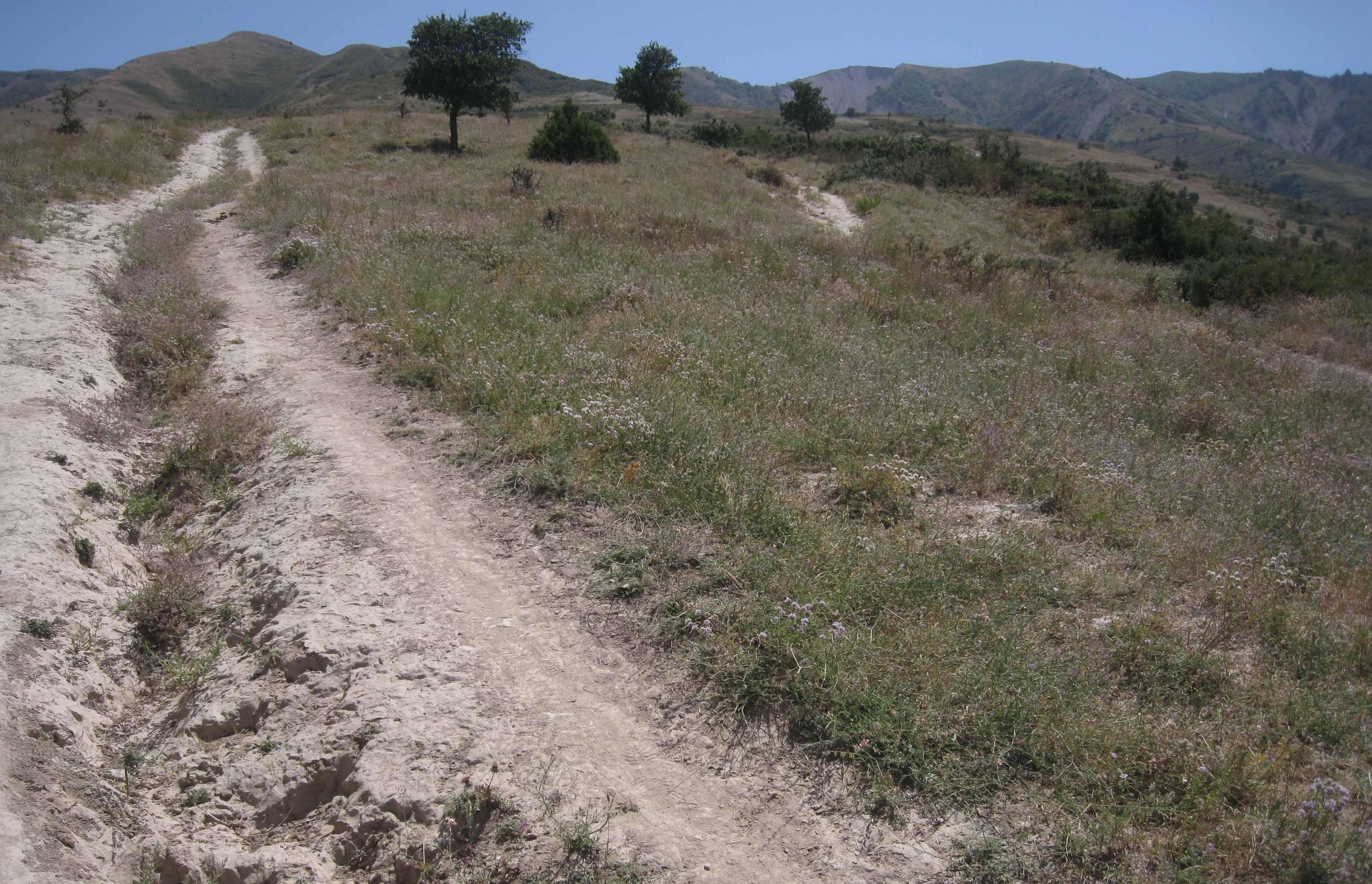
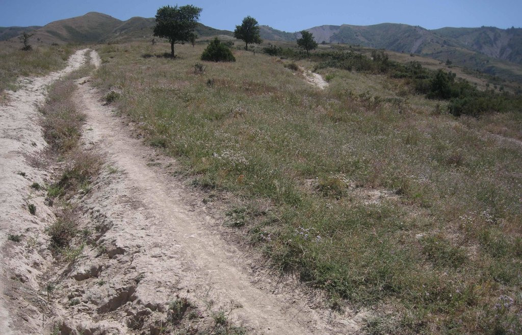
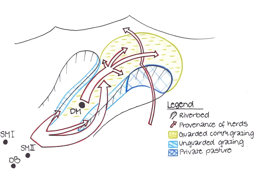
The total area of the pasture accounts for 300 – 500 ha. The pasture is property of the Doshmand village but it includes also some private properties, mainly potato and wheat crops. After the harvest, livestock is also grazing on these crops. Eighteen households are currently using the pasture with a total of 150 cows and 500 small animals. Additionally, three groups of herds from other villages graze irregularly on this pasture mainly on the lateral parts as it is less guarded by the villagers. The interviewee estimates that over 1000 cows, goats and sheep are coming from other villages. Other herds cross this pasture when migrating to or coming back from the summer pasture in spring and autumn, respectively. Nevertheless Doshmand residents claim that this intrusive grazing is accepted as “every animal has to be fed”. This shows the need of a pasture management not only on village but also on watershed level.
During Soviet time the inhabitants of Doshmand were forced to migrate to the valley. In 2003, the resettlement of the ancient location started with two families. Simultaneously, the pasture management was established and joined by each family who resettled. The controlled area is divided in 4 subparts. The herd switches daily within them. Every household looks after the herd for a day, which results in a rotational cycle of 18 days. There are no fixed and regular meetings for pasture management within the village pasture. However, two subsequent herders communicate to know where the herd has been grazing and where to graze the next time.
Purpose of the Technology: Purpose of the rotational grazing is to graze on one subpart, while the three other areas are resting. This reduces the impact of grazed and trampled areas per subpart and allows the growth and recovery of the vegetation in the other parts.
The task of herding is shared among the families. The rotational grazing is organized orally and freely, why it’s not sure if that approach is strictly binding. Discussions about pasture management rise only in case of need.
Establishment / maintenance activities and inputs: Doshmand village got the pasture in a good condition at the time of establishment. Vegetation cover was high. The only investment consisted in building a water point for the livestock. A further investment was to buy a water pipe and dig out a channel for the pipe to conduct the water from the water point to the village. Money was collected by the families and many villagers were involved in digging the channel.
No further input was and is required except coordination between the herders.
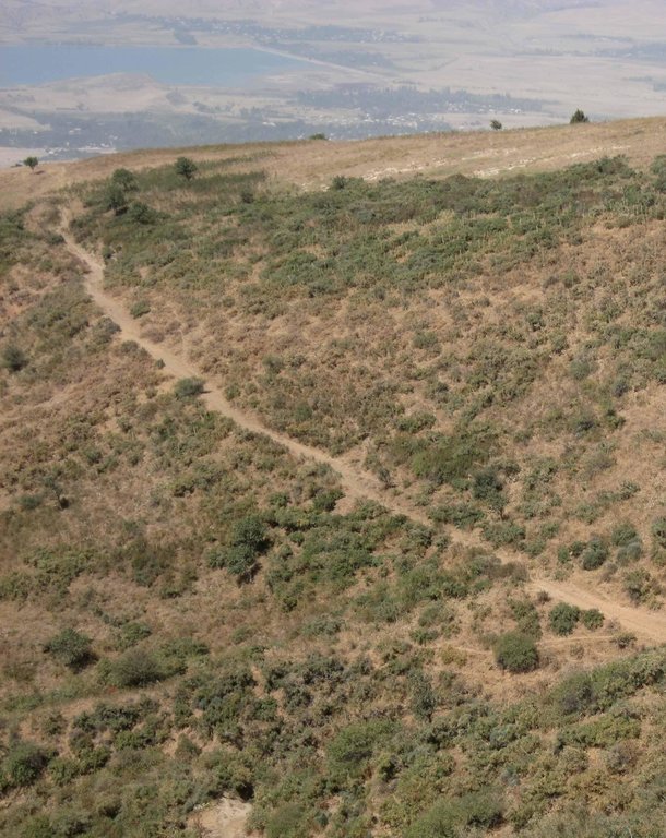
Natural / human environment: The pasture of Doshmand village is located in the middle and upper zone of the watershed. Thanks to the distance to other settlements, the pasture is less affected by overgrazing than other communal pastures in the watershed. Nevertheless, the pasture is heterogeneously grazed, with some areas which are difficult to access even for livestock and hence abundant vegetation. Other areas, especially those situated next to the village show a more bare vegetation cover.
2.3 صور التقنية
2.5 البلد/المنطقة/المواقع التي تم تنفيذ التقنية فيها والتي يغطيها هذا التقييم
البلد:
طاجيكستان
المنطقة/الولاية/المحافظة:
Khatlon, Tajikistan
مزيد من التفاصيل حول الموقع:
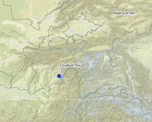
Muminabad
Map
×2.6 تاريخ التنفيذ
في حالة عدم معرفة السنة بالتحديد، يرجى الإشارة إلى التاريخ التقريبي:
- منذ 10-50 سنة
2.7 إدخال التقنية
حدد كيف تم إدخال التقنية:
- من خلال ابتكار مستخدمي الأراضي
3. تصنيف تقنية الإدارة المستدامي للأراضي
3.1 الغرض الرئيسي ( الأغراض الرئيسية) للتقنية
- الحد من تدهور الأراضي ومنعه وعكسه
- الحفاظ على النظام البيئي
3.2 نوع (أنواع) استخدام الأراضي الحالية حيث يتم تطبيق التقنية

أراضي الرعي
أراضي الرعي الواسع النطاق:
- رعي شبه مرتحل
- rotational grazing
التعليقات:
Major land use problems (compiler’s opinion): Erosion
Overgrazing
Major land use problems (land users’ perception): increase of unpalatable vegetation
Semi-nomadism / pastoralism: Yes
Grazingland comments: Mainly summer pasture, normally no grazing from November/ December to February/ March
Type of grazing system comments: Mainly summer pasture, normally no grazing from November/ December to February/ March
3.3 مزيد من المعلومات حول استخدام الأراضي
إمدادات المياه للأرض التي يتم تنفيذ التقنية عليها:
- بعلية
عدد مواسم الزراعة في السنة:
- 1
حدد:
Longest growing period in days: 160Longest growing period from month to month: April-Sept
كثافة الثروة الحيوانية (إذا كانت ذات صلة):
> 100 LU /km2
3.4 مجموعةالإدارة المستدامة للأراضي التي تنتمي إليها هذه التقنية
- الرعي وإدارة المراعي
3.5 انتشار التقنية
حدد انتشار التقنية:
- منتشرة بالتساوي على مساحة
إذا كانت التقنية منتشرة بالتساوي على منطقة ما، فحدد المنطقة التقريبية المغطاة:
- 10-1 كم2
التعليقات:
Total area covered by the SLM Technology is 4 m2.
The Vakil (village representant) was not sure about the area, between 300 to 500 ha.
3.6 التدابير التقنية في مجال إلادارة المستدامة للأراضي

التدابير الإدارية
- M2: تغيير في مستوى الإدارة/الكثافة
التعليقات:
Main measures: management measures
3.7 الأنواع الرئيسية من تدهور الأراضي التي تناولتها التقنية

تآكل التربة بالمياه
- (Wo:) تأثيرات التدهور من مواقع أخرى

التدهور الكيميائي للتربة
- (Cn): تراجع الخصوبة وانخفاض محتوى المادة العضوية (غير ناتج عن الانجراف)

التدهور المادي أو الفيزيائي للتربة
- (Pc) : تراص التربة

التدهور البيولوجي
- (Bc): تناقص الغطاء النباتي
- (Bs): انخفاض جودة وتركيبة الأنواع/التنوع
التعليقات:
Main type of degradation addressed: Wo: offsite degradation effects, Pc: compaction, Bc: reduction of vegetation cover
Secondary types of degradation addressed: Cn: fertility decline and reduced organic matter content, Bs: quality and species composition /diversity decline
Main causes of degradation: overgrazing, land tenure (communal grazing land also used by other communes)
Secondary causes of degradation: deforestation / removal of natural vegetation (incl. forest fires), disturbance of water cycle (infiltration / runoff)
3.8 منع أو حد أو عكس تدهور الأراضي
تحديد هدف التقنية فيما يتعلق بتدهور الأراضي:
- الحد من تدهور الأراضي
- اصلاح/إعادة تأهيل الأراضي المتدهورة بشدة
التعليقات:
Main goals: rehabilitation / reclamation of denuded land
Secondary goals: mitigation / reduction of land degradation
4. المواصفات الفنية، وأنشطة التنفيذ، والمدخلات، والتكاليف
4.1 الرسم الفني للتقنية
4.2 المواصفات الفنية/شروحات الرسم الفني
Livestock from Doshmand village (DM) is grazing in the four subparts of the communal pasture. Livestock from other villages, located in the valley Sarmadoni I (SMI) and II (SMII) and Dehibaland (DB), can invade the guarded and unguarded communal pasture of Doschmand. In spring and autumn also other livestock crosses Doshmand's pasture when migrating to or leaving the summer pasture.
Location: Chukurak watershed. Muminabad, Khatlon
Technical knowledge required for land users: low
Main technical functions: improvement of ground cover, increase of infiltration
Secondary technical functions: improvement of topsoil structure (compaction), stabilisation of soil (eg by tree roots against land slides), increase in organic matter
Change of land use practices / intensity level: Rotational grazing at village level
4.3 معلومات عامة بخصوص حساب المدخلات والتكاليف
حدد العملة المستخدمة لحساب التكاليف:
- دولار أمريكي
اذكر متوسط تكلفة أجر العمالة المستأجرة في اليوم الواحد:
12.40
4.4 أنشطة التأسيس
| النشاط | نوع التدبير | التوقيت | |
|---|---|---|---|
| 1. | Coordination with villagers and herders | إدارية | Reestablishment of village |
4.5 التكاليف والمدخلات اللازمة للتأسيس
| تحديد المدخلات | الوحدة | الكمية | التكاليف لكل وحدة | إجمالي التكاليف لكل مدخل | % من التكاليف التي يتحملها مستخدمو الأراضي | |
|---|---|---|---|---|---|---|
| العمالة | Coordination with villagers and herders | - | 1,0 |
4.6 الصيانة/الأنشطة المتكررة
| النشاط | نوع التدبير | التوقيت/الوتيرة | |
|---|---|---|---|
| 1. | Consultation with village herders | إدارية | If needed |
4.7 التكاليف والمدخلات اللازمة للصيانة/للأنشطة المتكررة (سنويًا)
| تحديد المدخلات | الوحدة | الكمية | التكاليف لكل وحدة | إجمالي التكاليف لكل مدخل | % من التكاليف التي يتحملها مستخدمو الأراضي | |
|---|---|---|---|---|---|---|
| العمالة | Consultation with village herders | - | 1,0 |
4.8 أهم العوامل المؤثرة على التكاليف
قدم وصفا لأهم العوامل التي تؤثر على التكاليف:
There are no costly factors, the most important input is a good planning, coordination and consistent execution of the rotational grazing system.
The installation of a waterpoint would be needed but it is a very costly installation.
5. البيئة الطبيعية والبشرية
5.1 المناخ
هطول الأمطار السنوي
- < 250 مم
- 251- 500 ملم
- 501 - 750ملم
- 1,000-751 ملم
- 1,500-1,100 ملم
- 2,000-1,500 ملم
- 3,000-2,001 ملم
- 4,000-3,100 ملم
- > 4000 ملم
المواصفات/التعليقات على هطول الأمطار:
Annual rainfall (1,001-1,500 mm): Totally 800mm: 700mm in winter-spring, July-Sept dry season (At 1200mm asl, weather station Muminabad)
Annual rainfall (1,501-2,000 mm): Precipitation increases 60mm per 100m of altitude in average. Here up to 1600mm.
المنطقة المناخية الزراعية
- شبه رطبة
Thermal climate class: temperate
LPG from April until September
5.2 طوبوغرافيا
متوسط الانحدارات:
- مسطح (0-2%)
- بسيط (3-5%)
- معتدل (6-10%)
- متدحرج (11-15%)
- تلال (16-30%)
- شديدة الانحدار(31-60%)
- فائقة الانحدار (>60%)
التضاريس:
- هضاب/سهول
- أثلام مرتفعة
- المنحدرات الجبلية
- منحدرات التلال
- منحدرات في السفوح
- قاع الوادي
المنطقة الارتفاعية:
- 100-0 متر فوق سطح البحر
- 500-101 متر فوق سطح البحر
- 1,000-501 متر فوق سطح البحر
- 1,500-1,001 متر فوق سطح البحر
- 2,000-1,501 متر فوق سطح البحر
- 2,500-2,100 متر فوق سطح البحر
- 3,000-2,501 متر فوق سطح البحر
- 4,000-3,001 متر فوق سطح البحر
- > 4000 متر فوق سطح البحر
التعليقات والمواصفات الإضافية بشأن التضاريس:
Slopes on average (steep): Some flanks up to approx. 40%
5.3 التربة
متوسط عمق التربة:
- ضحل جدًا (0-20 سم)
- ضحلة (21-50 سم)
- متوسطة العمق (51-80 سم)
- عميقة (81-120 سم)
- عميقة جدًا (> 120 سم)
قوام التربة (التربة السطحية):
- متوسط ( طميي، سلتي)
- ناعم/ثقيل (طيني)
المواد العضوية في التربة السطحية:
- عالية (>3%)
- متوسطة (1-3%)
إذا كان متاحًا، قم بإرفاق وصف كامل للتربة أو تحديد المعلومات المتوفرة، على سبيل المثال نوع التربة، الرقم الهيدروجيني/ درجة حموضة التربة، قدرة التبادل الكاتيوني، النيتروجين، الملوحة وما إلى ذلك.
Topsoil organic matter (high): On some flanks with high vegetation cover, which are difficult to access by livestock
Soil fertility is low
Soil drainage / infiltration is medium
Soil water storage capacity is low near the villages and high on mountain slopes (off-village)
5.4 توافر المياه ونوعيتها
منسوب المياه الجوفية:
50-5 م
توافر المياه السطحية:
متوسط
نوعية المياه (غير المعالجة):
مياه الشرب سيئة (تتطلب معالجة)
تعليقات ومواصفات أخرى بشأن نوعية المياه وكميتها:
Water quality (untreated) is also for agricultural use only (irrigation)
5.5 التنوع البيولوجي
تنوع الأنواع:
- مرتفع
5.6 خصائص مستخدمي الأراضي الذين يطبقون التقنية
التوجه السوقي لنظام الإنتاج:
- الكفاف (الإمداد الذاتي)
الدخل من خارج المزرعة:
- أقل من % 10من كامل الدخل
المستوى النسبي للثروة:
- متوسط
أفراداً أو مجموعات:
- المجموعات/ المجتمع المحلي
الجنس:
- نساء
- رجال
اذكر الخصائص الأخرى ذات الصلة لمستخدمي الأراضي:
Land users applying the Technology are mainly common / average land users
Population density: 100-200 persons/km2
Annual population growth: 1% - 2%
5.7 متوسط مساحة الأرض المملوكة أو المستأجرة من قبل مستخدمي الأراضي الذين يطبقون التقنية
- < 0.5 هكتارا
- 0.5 - 1 هكتار
- 1 -2 هكتار
- 2 - 5 هكتار
- 5 - 15 هكتار
- 15 - 50 هكتار
- 50 - 100هكتار
- 500-100 هكتار
- 1,000-500 هكتار
- 10,000-1,000 هكتار
- > 10,000 هكتار
هل يعتبر هذا نطاقًا صغيرًا أو متوسطًا أو واسعا (في إشارة إلى السياق المحلي)؟:
- على نطاق صغير
التعليقات:
Around 3 ha, if 7.7 pers/household of totally 2350 ha pasture
5.8 ملكية الأراضي، وحقوق استخدام الأراضي، وحقوق استخدام المياه
ملكية الارض:
- دولة
حقوق استخدام الأراضي:
- مؤجر
حقوق استخدام المياه:
- مجتمعي (منظم)
التعليقات:
Land ownership is based on the land user certificate conferred by the government
5.9 الوصول إلى الخدمات والبنية التحتية
الصحة:
- ضعيف
- معتدل
- جيد
التعليم:
- ضعيف
- معتدل
- جيد
المساعدة التقنية:
- ضعيف
- معتدل
- جيد
العمل (على سبيل المثال خارج المزرعة):
- ضعيف
- معتدل
- جيد
الأسواق:
- ضعيف
- معتدل
- جيد
الطاقة:
- ضعيف
- معتدل
- جيد
الطرق والنقل:
- ضعيف
- معتدل
- جيد
مياه الشرب وخدمات الصرف الصحي:
- ضعيف
- معتدل
- جيد
الخدمات المالية:
- ضعيف
- معتدل
- جيد
6. الآثار والتصريحات الختامية
6.1 الآثار التي أظهرتها التقنية في الموقع
الآثار الاجتماعية والاقتصادية
الإنتاج
إنتاج الأعلاف
إنتاج حيواني
التعليقات/ حدد:
Not the whole pastureland can be grazed at once
توافر المياه ونوعيتها
توافر المياه للماشية
نوعية المياه للماشية
الآثار الاجتماعية والثقافية
الأمن الغذائي / الاكتفاء الذاتي
المؤسسات المجتمعية
Livelihoods and human well-being
التعليقات/ حدد:
Strenghtening of the community sense and awareness through increased coordination for rotational grazing between villagers. Higher fodder availability leads to healthier livestock.
الآثار الايكولوجية
دورة المياه / الجريان السطحي
الجريان السطحي
التبخر
التربة
رطوبة التربة
تكون قشرة التربة السطحية/انسداد مسام التربة
تراص التربة
التنوع البيولوجي: الغطاء النباتي، الحيوانات
الكتلة الحيوية/ طبقة الكربون فوق التربة
الحد من مخاطر المناخ والكوارث
خطر الحريق
الآثار الايكولوجية الأخرى
Hazards towards adverse events
6.2 الآثار التي أظهرتها التقنية خارج الموقع
تراكم الطمي باتجاه مصب النهر
القدرة على التخفيف / الترشيح
الضرر على البنية التحتية العامة/ الخاصة
6.3 تعرض التقنية وحساسيتها لتغير المناخ التدريجي والظواهر المتطرفة/الكوارث المرتبطة بالمناخ (كما يراها مستخدمو الأراضي)
تغير مناخ تدريجي
تغير مناخ تدريجي
| الموسم | نوع التغير المناخي/ المتطرف | كيف تتعامل التقنية مع ذلك؟ | |
|---|---|---|---|
| درجة الحرارة السنوية | زيادة | جيدا |
الظواهر المتطرفة / الكوارث المرتبطة بالمناخ
الكوارث الجوية
| كيف تتعامل التقنية مع ذلك؟ | |
|---|---|
| عاصفة ممطرة محلية | ليس جيدا |
| عاصفة هوائية محلية | جيدا |
الكوارث المناخية
| كيف تتعامل التقنية مع ذلك؟ | |
|---|---|
| جفاف | ليس جيدا |
الكوارث الهيدرولوجية
| كيف تتعامل التقنية مع ذلك؟ | |
|---|---|
| فيضان عام (نهر) | ليس جيدا |
العواقب الأخرى المتعلقة بالمناخ
العواقب الأخرى المتعلقة بالمناخ
| كيف تتعامل التقنية مع ذلك؟ | |
|---|---|
| انخفاض فترة النمو | غير معروف |
التعليقات:
Conduct the rotational grazing even more strictly
6.4 تحليل التكلفة والعائد
كيف يمكن مقارنة العوائد نسبة لتكاليف الإنشاء (من وجهة نظر مستخدمي الأراضي)؟
عوائد قصيرة الأجل:
محايد/متوازن
عوائد طويلة الأجل:
إيجابي قليلا
كيف تتم مقارنة العوائدمع كلفة الصيانة/التكاليف المتكررة (من وجهة نظر مستخدمي الأراضي)؟
عوائد قصيرة الأجل:
محايد/متوازن
عوائد طويلة الأجل:
إيجابي
6.5 اعتماد التقنية
إذا كان متاحًا، قم بتحديد الكمية (عدد الأسر المعيشية و/أو المساحةالمغطاة):
NA
التعليقات:
There is a little trend towards spontaneous adoption of the Technology
Comments on adoption trend: Effort is made to introduce more rotational grazing on cummunity level in the region with institutional support.
6.7 نقاط القوة / المزايا / الفرص التي توفرها التقنية
| نقاط القوة/ المزايا/ الفرص من وجهة نظر مستخدمي الأراضي |
|---|
| No big input, coordination between farmers exists anyway |
| نقاط القوة/ المزايا/ الفرص من وجهة نظر جامع المعلومات أو غيره من الاشخاص الرئيسيين لمصدر المعلومات |
|---|
|
In a rotational grazing system at village level every family is responsible for the sustainability of the pasture How can they be sustained / enhanced? Give more responsability and co-determination to individuals |
|
High establishment potential as rotational grazing do not demand any costs, except coordination and organization on village level How can they be sustained / enhanced? Disseminate the idea of rotational grazing also on watershed level |
|
Ecologic benefits as high vegetation cover, less erosion etc. can be achieved without monetary investment How can they be sustained / enhanced? Spread knowledge of long-term effects by rotational grazing |
|
Being a pasture of a big area extent in the uphills, the good quality of the pasture plays an important role for all the settlements and cultivations downstream How can they be sustained / enhanced? Raise the awareness about the upstream-downstream interrelation in the watersheds |
6.8 نقاط ضعف / مساوىء / مخاطر التقنية وسبل التغلب عليها
| نقاط الضعف/ المساوىء/ المخاطر من وجهة نظر جامع المعلومات أو غيره من الاشخاص الرئيسيين لمصدر المعلومات | كيف يمكن التغلب عليها؟ |
|---|---|
| In reality, rotational grazing is not executed strictly enough | Stricter separation of the subparts needed |
| Herds from other villages graze in the same pasture | Strenghten coordination of grazing between and within villages |
| Some flanks show high vegetation because they are not accessible for livestock and not because of the rotational grazing |
الروابط والوحدات المواضيعية
توسيع الكل طي الكلالروابط
لا يوجد روابط
الوحدات المواضيعية
لا يوجد وحدات مواضيعية


