Trees in the riparian area as a protective and aesthetic advantage at Naro Moru River [كينيا]
- تاريخ الإنشاء:
- تحديث:
- جامع المعلومات: Manuel Fischer
- المحرر: –
- المُراجع: David Streiff
technologies_1580 - كينيا
عرض الأقسام
توسيع الكل طي الكل1. معلومات عامة
1.2 تفاصيل الاتصال بالأشخاص الرئيسيين لمصدر المعلومات والمؤسسات المشاركة في تقييم وتوثيق التقنية
مستخدم الأرض:
Wanjiru Cecilia
كينيا
اسم المؤسسة (المؤسسات) التي سهلت توثيق/تقييم التقنية (إذا كان ذلك على صلة)
CDE Centre for Development and Environment (CDE Centre for Development and Environment) - سويسرا1.3 الشروط المتعلقة باستخدام البيانات الموثقة من خلال WOCAT
متى تم تجميع البيانات (ميدانيا)؟:
14/11/2012
يوافق جامع المعلومات والشخص (لاشخاص) الرئيسي لمصدر المعلومات على الشروط المتعلقة باستخدام البيانات الموثقة من خلال WOCAT:
نعم
2. وصف تقنيةالإدارة المستدامي للأراضي
2.1 وصف مختصر للتقنية
تعريف التقنية:
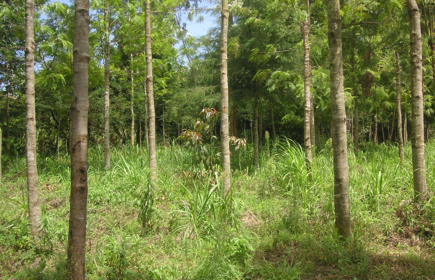
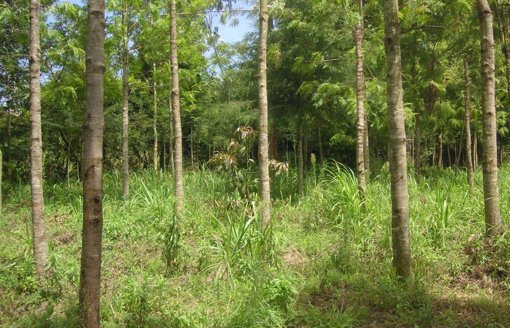
Trees are planted along the riparian zone to stabilize the riverbank and to prevent degradation. The wood can be used to establish a building or to generate income on the market.
2.2 وصف تفصيلي للتقنية
الوصف:
At the foot slopes of Mt. Kenya a farmer has developed a technology to protect the own land plot from riverbank erosion. The technology consists of three main measures: A wall along the riverbed, trees that are aligned on the wall as well as beside it and Napier grass wildly scattered between the trees. The wall was built on a highly exposed spot of the riverbank. Trees along and beside the wall ensure its stability. The combination of the two measures results in an effective protection of the riverbank in terms of erosion. Side effects of the technology are higher runoff during the dry season, better water quality due to less erosion and an improved riparian habitat for animals and plants.
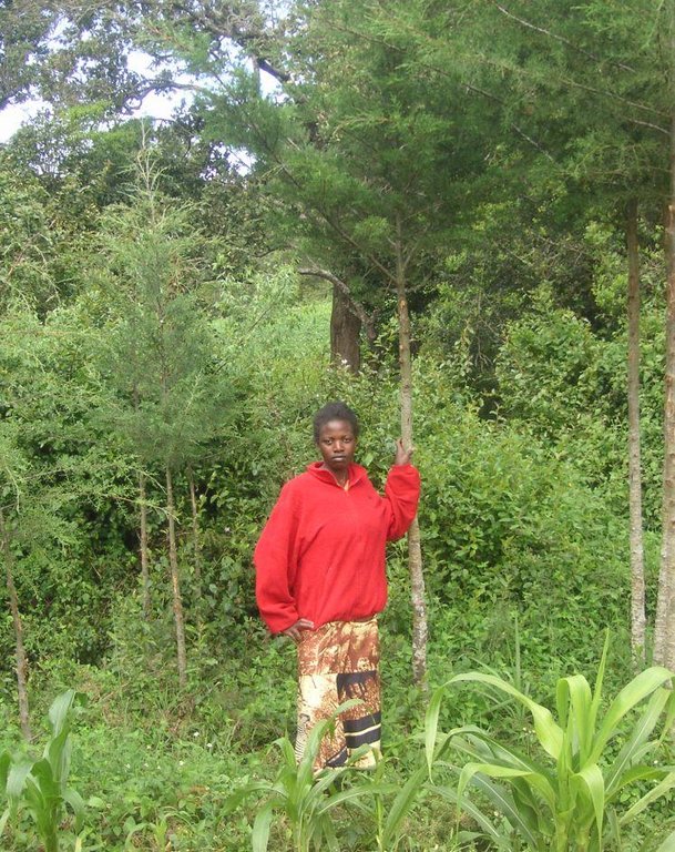
Purpose of the Technology: For a small scale farmer, planting of trees can have advantages in an economic, an ecologic and an aesthetic point of view. The trees stabilize the soil, allow the riparian vegetation to establish, and prevent major damages through flooding. Furthermore, there are several advantages of an intact riparian zone, such as enhanced biodiversity, increased water quality as well as retention of agrochemicals. The trees also work as a kind of bank account, since the prices for wood are quite high. Trees can be cut and sold from time to time to generate an income that can be used for further investments like local entrepreneurship or building houses for family members. Last but not least, the farmer emphasized the beautiful appearance of the trees including the relatively cool micro- climate the trees are able to provide during the hot months of the dry period.
Establishment / maintenance activities and inputs: The trees were planted during the rainy season. Braches are pruned regularly and provide mulch material as well as fire wood. When trees are reaching maturity they will selectively be cut and replanted. The Napier grass is cut regularly for fodder to be feed to animals. At this particular time, there is a regular hay yield (weed). Seedlings for trees and the grasses are produced on site. Occasional pruning ensures fuel wood supply.
Natural / human environment: The plot is situated at the western side of Mt. Kenya in its foot zone, a moderate hilly region. Actually, the foot zone is a transition area between the humid mountain forest above elevations of 2500 m.a.s.l and the semi-arid savannah zone below 2000 m a.s.l. Although the region is located in the rain shadow of Mt. Kenya, there is just enough precipitation (740mm) to sustain rain fed agriculture and the farmers even benefit from a water project. During the last decades, the region has experienced a still continuing population growth which increases population pressure in the area. The good accessibility and the moderate tourism allow even off-farm income-generation.
2.3 صور التقنية
2.5 البلد/المنطقة/المواقع التي تم تنفيذ التقنية فيها والتي يغطيها هذا التقييم
البلد:
كينيا
المنطقة/الولاية/المحافظة:
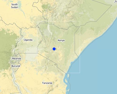
Kenya/Central Province
مزيد من التفاصيل حول الموقع:
Naro Moru
Map
×2.6 تاريخ التنفيذ
في حالة عدم معرفة السنة بالتحديد، يرجى الإشارة إلى التاريخ التقريبي:
- منذ أقل من 10 سنوات (مؤخرًا)
2.7 إدخال التقنية
حدد كيف تم إدخال التقنية:
- من خلال ابتكار مستخدمي الأراضي
التعليقات (نوع المشروع، الخ):
The land user has enough space to afforest along the riparian. The main goals are to stabilise the riparian soil and to produce wood for use in the future.
3. تصنيف تقنية الإدارة المستدامي للأراضي
3.1 الغرض الرئيسي ( الأغراض الرئيسية) للتقنية
- الحد من تدهور الأراضي ومنعه وعكسه
3.2 نوع (أنواع) استخدام الأراضي الحالية حيث يتم تطبيق التقنية

الأراضي الزراعية
- زراعة سنوية

الغابات/ الأراضي الحرجية
منتجات وخدمات:
- الخشب
- حطب الوقود
- حفظ/حماية الطبيعة
- الترفيه / السياحة
التعليقات:
Major land use problems (compiler’s opinion): Surface water pollution and riverbank degradation as well as a diminished habitat of riparian flora and fauna.
Major land use problems (land users’ perception): An unstable riparian zone being eroded by the river and unattractive aesthetics.
Problems / comments regarding forest use: The purpose of the forest is mainly in a protective way. Later on, as soon as the trees are large enough, selective felling for construction is planned.
Forest products and services: timber, fuelwood, nature conservation / protection, recreation / tourism
Future (final) land use (after implementation of SLM Technology): Forests / woodlands: Fp: Plantations, afforestations
إذا تغير استخدام الأراضي بسبب التقنية، قم بالإشارة إلى استخدام الأرض قبل تنفيذ التقنية:
Cropland: Ca: Annual cropping
3.3 مزيد من المعلومات حول استخدام الأراضي
عدد مواسم الزراعة في السنة:
- 2
حدد:
Longest growing period in days: 90 Longest growing period from month to month: april to may Second longest growing period in days: 90 Second longest growing period from month to month: october to november
3.4 مجموعةالإدارة المستدامة للأراضي التي تنتمي إليها هذه التقنية
- إدارة الغابات الطبيعية وشبه الطبيعية
- تحسين الغطاء الأرضي/النباتي
3.5 انتشار التقنية
حدد انتشار التقنية:
- منتشرة بالتساوي على مساحة
إذا كانت التقنية منتشرة بالتساوي على منطقة ما، فحدد المنطقة التقريبية المغطاة:
- < 0.1 كم2 (10 هكتار)
3.6 التدابير التقنية في مجال إلادارة المستدامة للأراضي

التدابير النباتية
- V1: غطاء من الأشجار والشجيرات

التدابير البنيوية
- S6: الجدران والحواجز وسياجات القش، والسياجات
التعليقات:
Main measures: vegetative measures
Secondary measures: structural measures
Type of vegetative measures: aligned: -linear, scattered / dispersed
3.7 الأنواع الرئيسية من تدهور الأراضي التي تناولتها التقنية

تآكل التربة بالمياه
- الوزن(Wt): فقدان التربة السطحية/تآكل السطح
- (Wr):انجراف ضفة النهر

التدهور البيولوجي
- (Bc): تناقص الغطاء النباتي
- (Bs): انخفاض جودة وتركيبة الأنواع/التنوع

تدهور المياه
- (Hp): تدهور نوعية المياه السطحية
- (Hw): تناقص القدرة التخفيفية للمناطق الرطبة
التعليقات:
Main type of degradation addressed: Wr: riverbank erosion, Bs: quality and species composition /diversity decline, Hp: decline of surface water quality
Secondary types of degradation addressed: Wt: loss of topsoil / surface erosion, Bc: reduction of vegetation cover, Hw: reduction of the buffering capacity of wetland areas
Main causes of degradation: deforestation / removal of natural vegetation (incl. forest fires), over-exploitation of vegetation for domestic use, population pressure, education, access to knowledge and support services
Secondary causes of degradation: floods
3.8 منع أو حد أو عكس تدهور الأراضي
تحديد هدف التقنية فيما يتعلق بتدهور الأراضي:
- منع تدهور الأراضي
- الحد من تدهور الأراضي
التعليقات:
Secondary goals: mitigation / reduction of land degradation
4. المواصفات الفنية، وأنشطة التنفيذ، والمدخلات، والتكاليف
4.1 الرسم الفني للتقنية
4.2 المواصفات الفنية/شروحات الرسم الفني
Indigenous trees, a wall and Napier grass are installed between the agricultural land and the river. The wall prevents erosion at a very endangered spot. The trees and the grass provide fodder and wood.
Location: Naro Moru. Nyeri / Central Province
Technical knowledge required for field staff / advisors: moderate
Technical knowledge required for land users: low
Main technical functions: increase of infiltration, improvement of water quality, buffering / filtering water, sediment retention / trapping, sediment harvesting, stabilization of riverbank by trees and grasses
Secondary technical functions: stabilisation of soil (eg by tree roots against land slides)
Aligned: -linear
Vegetative material: T : trees / shrubs
Number of plants per (ha): 200
Vertical interval between rows / strips / blocks (m): 0
Spacing between rows / strips / blocks (m): 1
Vertical interval within rows / strips / blocks (m): 1.5
Width within rows / strips / blocks (m): 2
Scattered / dispersed
Vegetative material: G : grass
Number of plants per (ha): 800
Trees/ shrubs species: Cypress, Grevillea, indigenous trees
Fruit trees / shrubs species: Napier grass
Wall/ barrier
Height of bunds/banks/others (m): 0.5m
Width of bunds/banks/others (m): 2m
Length of bunds/banks/others (m): 10m
4.3 معلومات عامة بخصوص حساب المدخلات والتكاليف
حدد كيفية احتساب التكاليف والمدخلات:
- لكل وحدة تقنية
حدد العملة المستخدمة لحساب التكاليف:
- دولار أمريكي
اذكر متوسط تكلفة أجر العمالة المستأجرة في اليوم الواحد:
2.70
4.4 أنشطة التأسيس
| النشاط | نوع التدبير | التوقيت | |
|---|---|---|---|
| 1. | Setting up a tree nursery | نباتية | |
| 2. | Planting seedlings | نباتية | during rainy season |
| 3. | Establishment of wall | بنيوية أو هيكلية |
4.5 التكاليف والمدخلات اللازمة للتأسيس
| تحديد المدخلات | الوحدة | الكمية | التكاليف لكل وحدة | إجمالي التكاليف لكل مدخل | % من التكاليف التي يتحملها مستخدمو الأراضي | |
|---|---|---|---|---|---|---|
| العمالة | Setting up a tree nursery | Persons/day | 5,0 | 3,3333 | 16,67 | 100,0 |
| العمالة | Planting seedlings | Persons/day | 25,0 | 3,3333 | 83,33 | 100,0 |
| العمالة | Establishment of wall | Persons/day | 5,0 | 3,3333 | 16,67 | 100,0 |
| إجمالي تكاليف إنشاء التقنية | 116,67 | |||||
4.6 الصيانة/الأنشطة المتكررة
| النشاط | نوع التدبير | التوقيت/الوتيرة | |
|---|---|---|---|
| 1. | Replanting trees that dried up | نباتية | |
| 2. | Cutting the Napier grass and pruning trees | نباتية | during the rainy seasons = 4 months a year. 3 times a month |
4.7 التكاليف والمدخلات اللازمة للصيانة/للأنشطة المتكررة (سنويًا)
| تحديد المدخلات | الوحدة | الكمية | التكاليف لكل وحدة | إجمالي التكاليف لكل مدخل | % من التكاليف التي يتحملها مستخدمو الأراضي | |
|---|---|---|---|---|---|---|
| العمالة | Replanting trees | Persons/day | 3,0 | 3,3333 | 10,0 | 100,0 |
| العمالة | Cutting the Napier grass and pruning trees | Persons/day | 12,0 | 3,33333 | 40,0 | 100,0 |
| إجمالي تكاليف صيانة التقنية | 50,0 | |||||
التعليقات:
Establishment has been carried out over a time period of 5 years. Considering this time frame, the establishment costs are smaller than the maintenance costs.
The costs per hectare were calculated for a riparian area with the length of 100 m and a width of 10 m, since hectares are difficult to apply in a riparian context. The determining factor for the costs is labour. In this case, the labour costs are quite high because the seedlings were produced in the own nursery. This explains the high labour costs. Some of the seedlings had to be replanted, because they dried up. The required equipment like a spade is available on nearly every farm or can be borrowed from neighbours and is thus not added to the costs.
5. البيئة الطبيعية والبشرية
5.1 المناخ
هطول الأمطار السنوي
- < 250 مم
- 251- 500 ملم
- 501 - 750ملم
- 1,000-751 ملم
- 1,500-1,100 ملم
- 2,000-1,500 ملم
- 3,000-2,001 ملم
- 4,000-3,100 ملم
- > 4000 ملم
الإشارة إلى اسم محطة الأرصاد الجوية المرجعية المعنية:
NS-Daten Eliza
المنطقة المناخية الزراعية
- شبه رطبة
Thermal climate class: subtropics. source: http://en.climate-data.org/location/103473/
5.2 طوبوغرافيا
متوسط الانحدارات:
- مسطح (0-2%)
- بسيط (3-5%)
- معتدل (6-10%)
- متدحرج (11-15%)
- تلال (16-30%)
- شديدة الانحدار(31-60%)
- فائقة الانحدار (>60%)
التضاريس:
- هضاب/سهول
- أثلام مرتفعة
- المنحدرات الجبلية
- منحدرات التلال
- منحدرات في السفوح
- قاع الوادي
المنطقة الارتفاعية:
- 100-0 متر فوق سطح البحر
- 500-101 متر فوق سطح البحر
- 1,000-501 متر فوق سطح البحر
- 1,500-1,001 متر فوق سطح البحر
- 2,000-1,501 متر فوق سطح البحر
- 2,500-2,100 متر فوق سطح البحر
- 3,000-2,501 متر فوق سطح البحر
- 4,000-3,001 متر فوق سطح البحر
- > 4000 متر فوق سطح البحر
التعليقات والمواصفات الإضافية بشأن التضاريس:
Altitudinal zone: 2020
Slopes on average: Land plot has a slope between 5% and 9%
5.3 التربة
متوسط عمق التربة:
- ضحل جدًا (0-20 سم)
- ضحلة (21-50 سم)
- متوسطة العمق (51-80 سم)
- عميقة (81-120 سم)
- عميقة جدًا (> 120 سم)
المواد العضوية في التربة السطحية:
- متوسطة (1-3%)
إذا كان متاحًا، قم بإرفاق وصف كامل للتربة أو تحديد المعلومات المتوفرة، على سبيل المثال نوع التربة، الرقم الهيدروجيني/ درجة حموضة التربة، قدرة التبادل الكاتيوني، النيتروجين، الملوحة وما إلى ذلك.
Soil texture: mixture, because it is not red
Soil fertility is high
Soil drainage / infiltration is good
Soil water storage capacity very low - low
5.4 توافر المياه ونوعيتها
منسوب المياه الجوفية:
< 5 م
توافر المياه السطحية:
جيد
نوعية المياه (غير المعالجة):
مياه شرب جيدة
تعليقات ومواصفات أخرى بشأن نوعية المياه وكميتها:
Ground water table: <5 mjust along the river, deeper ground water level 50-100m
Water quality (untreated): From a water project
5.5 التنوع البيولوجي
تنوع الأنواع:
- مرتفع
التعليقات والمواصفات الإضافية بشأن التنوع البيولوجي:
Species diversity: Also medium
5.6 خصائص مستخدمي الأراضي الذين يطبقون التقنية
التوجه السوقي لنظام الإنتاج:
- الكفاف (الإمداد الذاتي)
- مختلط (كفاف/ تجاري)
الدخل من خارج المزرعة:
- أقل من % 10من كامل الدخل
المستوى النسبي للثروة:
- متوسط
أفراداً أو مجموعات:
- فرد/أسرة معيشية
مستوى المكننة:
- عمل يدوي
الجنس:
- نساء
- رجال
اذكر الخصائص الأخرى ذات الصلة لمستخدمي الأراضي:
Land users applying the Technology are mainly common / average land users
Difference in the involvement of women and men: A clan uses the land commonly. Besides the base family (mother, father, son), the grandmother and an uncle use parts of the land. All of them apply the protective technologies in the riparian.
Population density: 200-500 persons/km2
5.7 متوسط مساحة الأرض المملوكة أو المستأجرة من قبل مستخدمي الأراضي الذين يطبقون التقنية
- < 0.5 هكتارا
- 0.5 - 1 هكتار
- 1 -2 هكتار
- 2 - 5 هكتار
- 5 - 15 هكتار
- 15 - 50 هكتار
- 50 - 100هكتار
- 500-100 هكتار
- 1,000-500 هكتار
- 10,000-1,000 هكتار
- > 10,000 هكتار
هل يعتبر هذا نطاقًا صغيرًا أو متوسطًا أو واسعا (في إشارة إلى السياق المحلي)؟:
- على نطاق صغير
التعليقات:
Average area of land owned or leased by land users applying the Technology: < 0.5 ha for Riparian forest.
5.8 ملكية الأراضي، وحقوق استخدام الأراضي، وحقوق استخدام المياه
ملكية الارض:
- فردية، لا يوجد سند ملكية
حقوق استخدام الأراضي:
- فردي
حقوق استخدام المياه:
- مجتمعي (منظم)
التعليقات:
Mostly small scale farmers are using the land.
5.9 الوصول إلى الخدمات والبنية التحتية
الصحة:
- ضعيف
- معتدل
- جيد
التعليم:
- ضعيف
- معتدل
- جيد
المساعدة التقنية:
- ضعيف
- معتدل
- جيد
العمل (على سبيل المثال خارج المزرعة):
- ضعيف
- معتدل
- جيد
الأسواق:
- ضعيف
- معتدل
- جيد
الطرق والنقل:
- ضعيف
- معتدل
- جيد
مياه الشرب وخدمات الصرف الصحي:
- ضعيف
- معتدل
- جيد
الخدمات المالية:
- ضعيف
- معتدل
- جيد
6. الآثار والتصريحات الختامية
6.1 الآثار التي أظهرتها التقنية في الموقع
الآثار الاجتماعية والاقتصادية
الإنتاج
إنتاج المحاصيل
إنتاج الأعلاف
التعليقات/ حدد:
Napier grass yield has increased
إنتاج الخشب
التعليقات/ حدد:
Before, there was only little wood production
الآثار الاجتماعية والثقافية
المعرفة بالإدارة المستدامة للأراضي/تدهور الأراضي
Aesthetics
الآثار الايكولوجية
دورة المياه / الجريان السطحي
الجريان السطحي
تصريف المياه الزائدة
التربة
غطاء التربة
فقدان التربة
التنوع البيولوجي: الغطاء النباتي، الحيوانات
الأنواع المفيدة
الحد من مخاطر المناخ والكوارث
آثار الفيضانات
الآثار الايكولوجية الأخرى
Riverbank erosion
6.2 الآثار التي أظهرتها التقنية خارج الموقع
تدفقات مائية موثوقة ومستقرة في موسم الجفاف
تراكم الطمي باتجاه مصب النهر
تلوث المياه الجوفية/الأنهار
الضرر على البنية التحتية العامة/ الخاصة
6.3 تعرض التقنية وحساسيتها لتغير المناخ التدريجي والظواهر المتطرفة/الكوارث المرتبطة بالمناخ (كما يراها مستخدمو الأراضي)
تغير مناخ تدريجي
تغير مناخ تدريجي
| الموسم | نوع التغير المناخي/ المتطرف | كيف تتعامل التقنية مع ذلك؟ | |
|---|---|---|---|
| درجة الحرارة السنوية | زيادة | جيدا |
الظواهر المتطرفة / الكوارث المرتبطة بالمناخ
الكوارث الجوية
| كيف تتعامل التقنية مع ذلك؟ | |
|---|---|
| عاصفة ممطرة محلية | جيدا |
| عاصفة هوائية محلية | جيدا |
الكوارث المناخية
| كيف تتعامل التقنية مع ذلك؟ | |
|---|---|
| جفاف | جيدا |
الكوارث الهيدرولوجية
| كيف تتعامل التقنية مع ذلك؟ | |
|---|---|
| فيضان عام (نهر) | جيدا |
العواقب الأخرى المتعلقة بالمناخ
العواقب الأخرى المتعلقة بالمناخ
| كيف تتعامل التقنية مع ذلك؟ | |
|---|---|
| انخفاض فترة النمو | جيدا |
6.4 تحليل التكلفة والعائد
كيف يمكن مقارنة العوائد نسبة لتكاليف الإنشاء (من وجهة نظر مستخدمي الأراضي)؟
عوائد قصيرة الأجل:
سلبي للغاية
عوائد طويلة الأجل:
ايجابي جدا
كيف تتم مقارنة العوائدمع كلفة الصيانة/التكاليف المتكررة (من وجهة نظر مستخدمي الأراضي)؟
عوائد قصيرة الأجل:
سلبي
عوائد طويلة الأجل:
ايجابي جدا
6.5 اعتماد التقنية
- حالات فردية/تجريبية
إذا كان متاحًا، قم بتحديد الكمية (عدد الأسر المعيشية و/أو المساحةالمغطاة):
1 household
من بين جميع الذين تبنوا التقنية، كم عدد الذين فعلوا ذلك بشكل تلقائي، أي دون تلقي أي حوافز مادية/مدفوعات؟:
- 100-90%
التعليقات:
Comments on acceptance with external material support: The WRUA has been distributing seedlings among the riparian farmers. Quantification is not possible.
100% of land user families have adopted the Technology without any external material support
6.7 نقاط القوة / المزايا / الفرص التي توفرها التقنية
| نقاط القوة/ المزايا/ الفرص من وجهة نظر مستخدمي الأراضي |
|---|
|
There is a recreational aspect of the riparian zone. Especially during hot days the farmer is enjoying the slightly colder temperatures because of the canopy and the cooling stream. The aesthetic aspects of the riparian are also enhanced. How can they be sustained / enhanced? If the canopy of the riparian is maintained, it can serve still as recreation area and convince with beautiful looks. |
|
Long term benefits in terms of wood and timber provided by the trees. How can they be sustained / enhanced? If trees are not chopped too early, they will have a good price on the market. |
|
The maintenance of the riparian is not tiring and still gives a good harvest. How can they be sustained / enhanced? Benefits can be sustained by continuing the management practices. |
|
Diversification: Formerly, there was maize at the river, but it died due to cold temperatures. Forests do not die due to frost. How can they be sustained / enhanced? Every plant has its special needs that should be kept in mind. |
| نقاط القوة/ المزايا/ الفرص من وجهة نظر جامع المعلومات أو غيره من الاشخاص الرئيسيين لمصدر المعلومات |
|---|
|
Wood production through selective felling is sustainable. How can they be sustained / enhanced? No widespread felling of trees, only selective intervention. |
|
Fodder production enables the keeping of cattle. How can they be sustained / enhanced? Before dry periods, some fodder should be stored to ensure fodder supplies. |
6.8 نقاط ضعف / مساوىء / مخاطر التقنية وسبل التغلب عليها
| نقاط الضعف/ المساوىء/ المخاطر من وجهة نظر مستخدم الأراضي | كيف يمكن التغلب عليها؟ |
|---|---|
| There is less crop yield, because an area of the plot was formerly used for maize production and now it is part of the riparian. | The productive and protective benefits of the riparian overcome decreased size of the agricultural plot. |
الروابط والوحدات المواضيعية
توسيع الكل طي الكلالروابط
لا يوجد روابط
الوحدات المواضيعية
لا يوجد وحدات مواضيعية


