Pasture management through rotational grazing [طاجيكستان]
- تاريخ الإنشاء:
- تحديث:
- جامع المعلومات: Malgorzata Conder
- المحرر: –
- المُراجع: Deborah Niggli
technologies_1585 - طاجيكستان
عرض الأقسام
توسيع الكل طي الكل1. معلومات عامة
1.2 تفاصيل الاتصال بالأشخاص الرئيسيين لمصدر المعلومات والمؤسسات المشاركة في تقييم وتوثيق التقنية
متخصص في الإدارة المستدامة للأراضي:
1.3 الشروط المتعلقة باستخدام البيانات الموثقة من خلال WOCAT
متى تم تجميع البيانات (ميدانيا)؟:
03/09/2012
يوافق جامع المعلومات والشخص (لاشخاص) الرئيسي لمصدر المعلومات على الشروط المتعلقة باستخدام البيانات الموثقة من خلال WOCAT:
نعم
1.4 إعلان بشأن استدامة التقنية الموصوفة
هل التقنية الموصوفة هنا تمثل مشكلة فيما يتعلق بتدهور الأراضي، بحيث لا يمكن إعلانها تقنية مستدامة لإدارة الأراضي؟:
كلا
2. وصف تقنيةالإدارة المستدامي للأراضي
2.1 وصف مختصر للتقنية
تعريف التقنية:
Rotational grazing on private grazing land used as daily pastures
2.2 وصف تفصيلي للتقنية
الوصف:
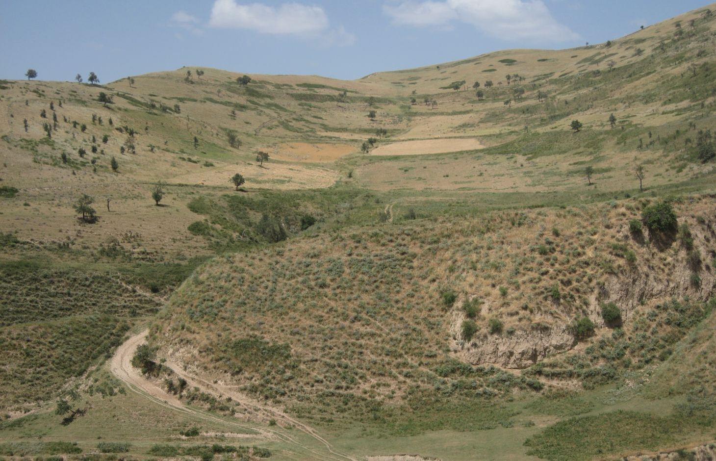
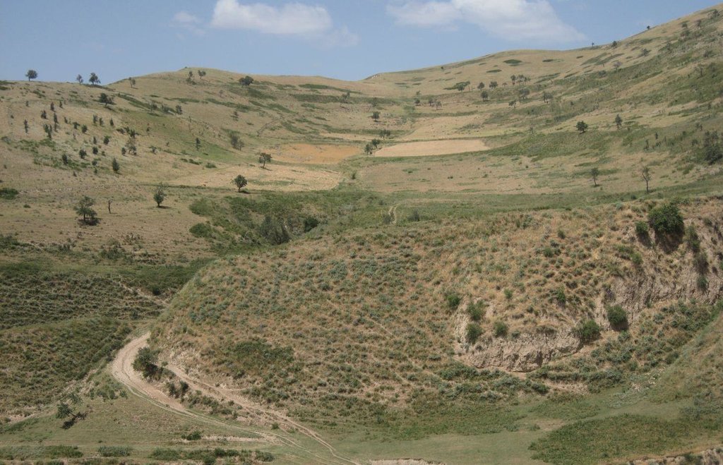
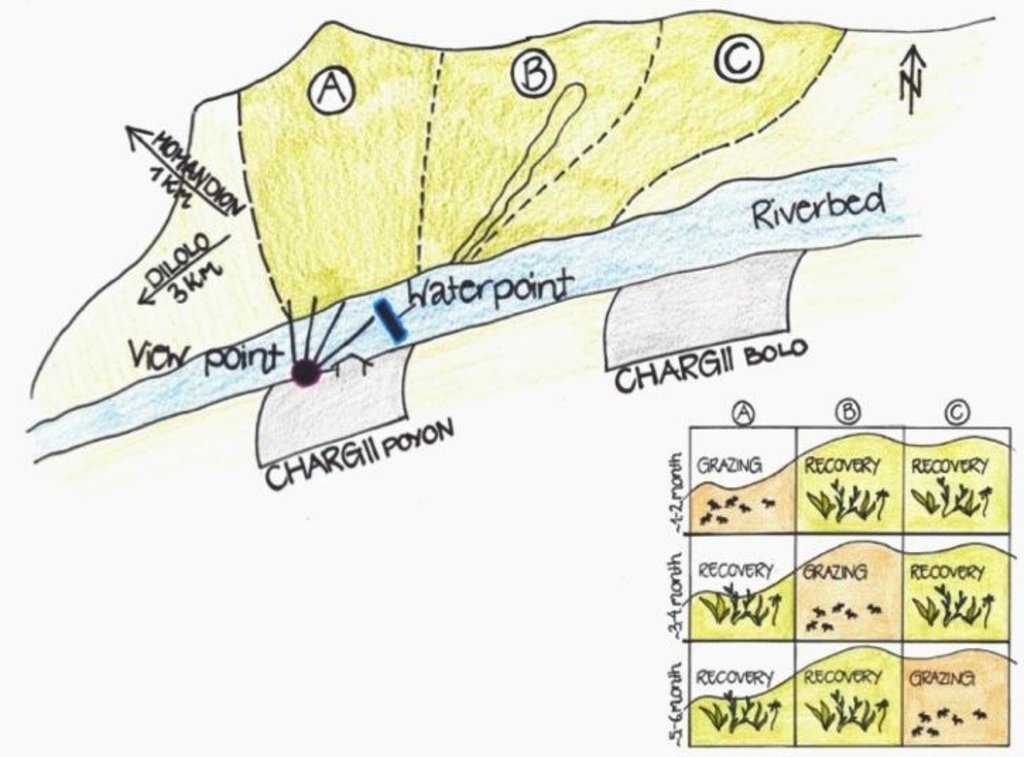
A riverbed divides the pasture where rotational grazing is practiced with the village Chargii poyon, where the certified land user and owner of the pasture lives. From a view point nearby his house, he has a good view on and hence a good control over the pasture area. This allows him to keep intrusive livestock outside, having a limited number of grazing livestock in the pasture. The area encompasses 119 ha, from which 5 ha are rented out as crop land.
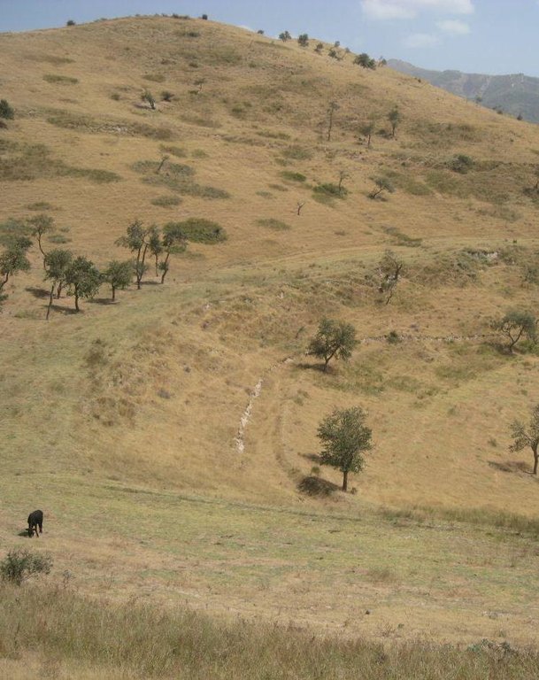
Land tenure conflicts about this pasture existed over many years, because there wasn’t declared any owner. The certified land user of Chargii poyon claims to possess the pasture since 1999. It is unclear how he got the land transferred. Being aware of the ongoing degradation of this land, the certified land user divided the area into 3 parts and introduced controlled grazing in 2007. While one part is being grazed the other two lie fallow. After one to two months of grazing in one area, the herds move to the next area. The rotation phases depend on the availability of grass. In June 2012, at the moment of documentation, there were 145 cows and some 30 goats and sheep. The number of animals is varying seasonally, with a higher amount of animals in summer than in winter. Compared to other pastures in summer, more grass in available on the pasture with rotational grazing. In winter grass availability is comparable between the pastures. This may explain why a higher number of livestock is recorded on the pasture with rotational grazing in summer.
The pasture is controlled by the farmer and further 4 people to avoid livestock intrusion.
In a seminar organized by Caritas Switzerland, the farmer learned about increasing long-term productivity of pastures by vegetation recovery. The idea of pasture rotation convinced him in order to raise productivity on long-term. The main reasons for changing the pasture management were the advanced stage of deforestation, increasing overgrazing, and the additional source to get the land taxes paid. The management of the pasture by rotational grazing on three areas allows the non-grazed areas to rest and recover. Less grazed and trampled areas result in an increase of the vegetation cover and thus to higher fodder quality, as well as increased soil stability and therefore a reduced risk of disasters, such as floods.
The farmer expected that the implementation of land conservation measures would stop the on-going pasture degradation and would assure long-term and sustainable use of the land. Despite the rotating system, the grazing land is still overgrazed and shows signs indicating moderate erosion, but it is less degraded than other pastures in the watershed. The area being the most far away from the settlement is in best conditions. The closer to the riverbed the more degraded and eroded the pasture is.
Additional measures are necessary to reduce soil erosion and gully formation in the area
Livestock owners have to pay a fee to the farmer for grazing cows, but not for grazing sheep and goats. The amount of the fee depends on the provenance of the herder. Fees vary greatly between the villages. Because of solidarity, Chargii villagers pay much less than herders from villages located further away. Momandion villagers pay 3 times, Dilolo villagers even 9 times more than Chargi villagers. But the certified land user claims to be flexible in the amount of fees for poor herders. He has to pay taxes to the government for the property and salary to the surveillants. If more money is available, also generated by the fees, the certified land user claims to invest a part of the money into the pasture. He would like to build another water point and to plant trees in the upper area. Livestock could graze in more remote areas which would reduce the pressure on the pastures in the lower area and decrease the soil compaction.
The pasture is located in the middle zone of the Obishur watershed and on the foothill above the riverbed plain. This pasture, located between the villages of Chargi poyon, Chargi bolo and Momandion and not far from Dilolo village, is a reachable place for many livestock of private households. In the riverbed, the only water point is installed where livestock is watered at midday. Due to tree cutting in the past, only a few shady places exist. Vegetation cover varies depending on the exposition of the slopes and the accessibility of the pasture. North-facing slopes have a more abundant vegetation cover. Some flanks are difficult to reach because of dense thorn bushes. A big gully, hardly accessible by livestock, is about to be covered again by naturally re-growing bushes and trees. Nevertheless, signs of erosion and rill building can be observed. Due to the closeness to the villages and to the pressure on natural resources it is crucial to sustain a controlled pasture management.
2.3 صور التقنية
2.5 البلد/المنطقة/المواقع التي تم تنفيذ التقنية فيها والتي يغطيها هذا التقييم
البلد:
طاجيكستان
المنطقة/الولاية/المحافظة:
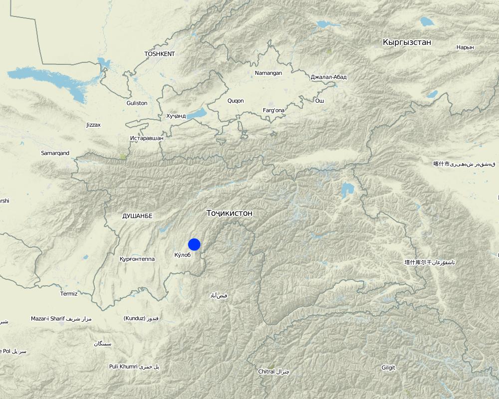
Khatlon, Tajikistan
مزيد من التفاصيل حول الموقع:
Muminabad
Map
×2.6 تاريخ التنفيذ
في حالة عدم معرفة السنة بالتحديد، يرجى الإشارة إلى التاريخ التقريبي:
- منذ أقل من 10 سنوات (مؤخرًا)
2.7 إدخال التقنية
حدد كيف تم إدخال التقنية:
- من خلال المشاريع/ التدخلات الخارجية
التعليقات (نوع المشروع، الخ):
Idea of how to improve ground cover was initiated by a workshop from Caritas, but the rotational grazing was introduced by the farmer himself in 2007
3. تصنيف تقنية الإدارة المستدامي للأراضي
3.1 الغرض الرئيسي ( الأغراض الرئيسية) للتقنية
- تحسين الإنتاج
- الحد من تدهور الأراضي ومنعه وعكسه
3.2 نوع (أنواع) استخدام الأراضي الحالية حيث يتم تطبيق التقنية

أراضي الرعي
أراضي الرعي الواسع النطاق:
- رعي شبه مرتحل
- rotational grazing
التعليقات:
Major land use problems (compiler’s opinion): Overgrazed pasture with frequent big gullies, rills and trampled areas. Almost complete deforestation of the grazing land.
Major land use problems (land users’ perception): Lack of water availability and water points for grazing livestock. Gradual degradation and erosion of the pasture which has to be stopped.
Grazingland comments: Rotation within 119 ha of grazing land
3.3 مزيد من المعلومات حول استخدام الأراضي
إمدادات المياه للأرض التي يتم تنفيذ التقنية عليها:
- بعلية
عدد مواسم الزراعة في السنة:
- 1
حدد:
Longest growing period in days: 180, Longest growing period from month to month: April-Sept/Oct
كثافة الثروة الحيوانية (إذا كانت ذات صلة):
> 100 LU /km2
3.4 مجموعةالإدارة المستدامة للأراضي التي تنتمي إليها هذه التقنية
- أنظمة التناوب (تعاقب المحاصيل، البور، الزراعة المتنقلة)
- الرعي وإدارة المراعي
3.5 انتشار التقنية
حدد انتشار التقنية:
- منتشرة بالتساوي على مساحة
إذا كانت التقنية منتشرة بالتساوي على منطقة ما، فحدد المنطقة التقريبية المغطاة:
- 10-1 كم2
التعليقات:
Total area covered by the SLM Technology is 1.14 m2.
Total area is 119 ha, but 5 ha out of it are rented for cropping
3.6 التدابير التقنية في مجال إلادارة المستدامة للأراضي

التدابير الإدارية
- M2: تغيير في مستوى الإدارة/الكثافة
3.7 الأنواع الرئيسية من تدهور الأراضي التي تناولتها التقنية

تآكل التربة بالمياه
- الوزن(Wt): فقدان التربة السطحية/تآكل السطح
- (Wg):الانجراف الخلجاني/ الخلجان

التدهور الكيميائي للتربة
- (Cn): تراجع الخصوبة وانخفاض محتوى المادة العضوية (غير ناتج عن الانجراف)

التدهور المادي أو الفيزيائي للتربة
- (Pc) : تراص التربة

التدهور البيولوجي
- (Bc): تناقص الغطاء النباتي
التعليقات:
Main causes of degradation: overgrazing, governance / institutional (No/ Insufficient management planning and control), livestock pressure (Due to subsistence of the population)
Secondary causes of degradation: deforestation / removal of natural vegetation (incl. forest fires), disturbance of water cycle (infiltration / runoff) (impact of overgrazing and deforestation), education, access to knowledge and support services
3.8 منع أو حد أو عكس تدهور الأراضي
تحديد هدف التقنية فيما يتعلق بتدهور الأراضي:
- الحد من تدهور الأراضي
- اصلاح/إعادة تأهيل الأراضي المتدهورة بشدة
4. المواصفات الفنية، وأنشطة التنفيذ، والمدخلات، والتكاليف
4.1 الرسم الفني للتقنية
4.2 المواصفات الفنية/شروحات الرسم الفني
The hilly pasture of 114 ha in total is divided more or less vertically in 3 areas. In each area, the pasture between the ridge and the riverbed is covered. After having grazed one area for approximately one to two months, the herd moves to the next part. This means that two areas rest and grasses recover, while one is being grazed.
Location: Chargii poyon. Muminobod, Kathlon, Tajikistan
Technical knowledge required for field staff / advisors: low (When benefits of pasture management are known and understood, high technical knowledge isn't required)
Technical knowledge required for land users: low (When benefits of pasture management are known and understood, high technical knowledge isn't required)
Main technical functions: control of concentrated runoff: impede / retard, control of concentrated runoff: drain / divert, improvement of ground cover, increase of infiltration
Secondary technical functions: increase of surface roughness, improvement of surface structure (crusting, sealing), improvement of topsoil structure (compaction), stabilisation of soil (eg by tree roots against land slides), increase in organic matter, increase / maintain water stored in soil, sediment retention / trapping, sediment harvesting
Change of land use practices / intensity level: In 2007 controlled and rotational grazing was introduced where no pasture management existed before
4.3 معلومات عامة بخصوص حساب المدخلات والتكاليف
عملة أخرى/ عملة وطنية (حدد):
Somoni
أشر إلى سعر الصرف من الدولار الأمريكي إلى العملة المحلية (إذا كان ذا صلة): 1 دولار أمريكي =:
4,83
اذكر متوسط تكلفة أجر العمالة المستأجرة في اليوم الواحد:
12.40
4.4 أنشطة التأسيس
| النشاط | نوع التدبير | التوقيت | |
|---|---|---|---|
| 1. | Introduction/information of pasture management among the herders | إدارية | once in 2007 |
4.5 التكاليف والمدخلات اللازمة للتأسيس
التعليقات:
Duration of establishment phase: 1 month(s)
4.6 الصيانة/الأنشطة المتكررة
| النشاط | نوع التدبير | التوقيت/الوتيرة | |
|---|---|---|---|
| 1. | Salary for 5 people to guard pasture and herders: Monthly salary 70 Som/pers, pers d unknown | إدارية | every day, from spring until autumn |
| 2. | Annual Rent | إدارية | once a year |
4.7 التكاليف والمدخلات اللازمة للصيانة/للأنشطة المتكررة (سنويًا)
| تحديد المدخلات | الوحدة | الكمية | التكاليف لكل وحدة | إجمالي التكاليف لكل مدخل | % من التكاليف التي يتحملها مستخدمو الأراضي | |
|---|---|---|---|---|---|---|
| العمالة | labour | ha | 1,0 | 590,3 | 590,3 | 100,0 |
| إجمالي تكاليف صيانة التقنية | 590,3 | |||||
التعليقات:
Costs which concern the information transfer to the herders is not calculated, as it is done informally. Only guardening by the employed people is monetarised.
4.8 أهم العوامل المؤثرة على التكاليف
قدم وصفا لأهم العوامل التي تؤثر على التكاليف:
The farmer already owns the land user certificate for the property and only has to pay annual taxes and the people who control the pasture. He covers these costs with the rent he gets for the grazing livestock.
5. البيئة الطبيعية والبشرية
5.1 المناخ
هطول الأمطار السنوي
- < 250 مم
- 251- 500 ملم
- 501 - 750ملم
- 1,000-751 ملم
- 1,500-1,100 ملم
- 2,000-1,500 ملم
- 3,000-2,001 ملم
- 4,000-3,100 ملم
- > 4000 ملم
المواصفات/التعليقات على هطول الأمطار:
Totally 800mm: 700mm in winter-spring, July-Sept dry season (At 1200mm asl, wheater station Muminabad). Precipitation increases 60mm per 100m of altitude in average.
المنطقة المناخية الزراعية
- شبه رطبة
Thermal climate class: temperate
5.2 طوبوغرافيا
متوسط الانحدارات:
- مسطح (0-2%)
- بسيط (3-5%)
- معتدل (6-10%)
- متدحرج (11-15%)
- تلال (16-30%)
- شديدة الانحدار(31-60%)
- فائقة الانحدار (>60%)
التضاريس:
- هضاب/سهول
- أثلام مرتفعة
- المنحدرات الجبلية
- منحدرات التلال
- منحدرات في السفوح
- قاع الوادي
المنطقة الارتفاعية:
- 100-0 متر فوق سطح البحر
- 500-101 متر فوق سطح البحر
- 1,000-501 متر فوق سطح البحر
- 1,500-1,001 متر فوق سطح البحر
- 2,000-1,501 متر فوق سطح البحر
- 2,500-2,100 متر فوق سطح البحر
- 3,000-2,501 متر فوق سطح البحر
- 4,000-3,001 متر فوق سطح البحر
- > 4000 متر فوق سطح البحر
5.3 التربة
متوسط عمق التربة:
- ضحل جدًا (0-20 سم)
- ضحلة (21-50 سم)
- متوسطة العمق (51-80 سم)
- عميقة (81-120 سم)
- عميقة جدًا (> 120 سم)
قوام التربة (التربة السطحية):
- متوسط ( طميي، سلتي)
- ناعم/ثقيل (طيني)
المواد العضوية في التربة السطحية:
- منخفضة (<1%)
5.4 توافر المياه ونوعيتها
منسوب المياه الجوفية:
50-5 م
توافر المياه السطحية:
ضعيف/ غير متوافر
نوعية المياه (غير المعالجة):
مياه الشرب سيئة (تتطلب معالجة)
5.5 التنوع البيولوجي
تنوع الأنواع:
- منخفض
5.6 خصائص مستخدمي الأراضي الذين يطبقون التقنية
التوجه السوقي لنظام الإنتاج:
- الكفاف (الإمداد الذاتي)
الدخل من خارج المزرعة:
- أقل من % 10من كامل الدخل
المستوى النسبي للثروة:
- ثري
أفراداً أو مجموعات:
- فرد/أسرة معيشية
الجنس:
- رجال
اذكر الخصائص الأخرى ذات الصلة لمستخدمي الأراضي:
Land users applying the Technology are mainly Leaders / privileged
Difference in the involvement of women and men: Men are taking decisions and administrating the property whereas women are working on the field. Privileged land user because he owns a big area.
Population density: 100-200 persons/km2
Annual population growth: 1% - 2% (Farmer owns a big property of 119 ha).
Off-farm income specification: Additionally bee-keeping
5.7 متوسط مساحة الأرض المملوكة أو المستأجرة من قبل مستخدمي الأراضي الذين يطبقون التقنية
- < 0.5 هكتارا
- 0.5 - 1 هكتار
- 1 -2 هكتار
- 2 - 5 هكتار
- 5 - 15 هكتار
- 15 - 50 هكتار
- 50 - 100هكتار
- 500-100 هكتار
- 1,000-500 هكتار
- 10,000-1,000 هكتار
- > 10,000 هكتار
هل يعتبر هذا نطاقًا صغيرًا أو متوسطًا أو واسعا (في إشارة إلى السياق المحلي)؟:
- على نطاق متوسط
5.8 ملكية الأراضي، وحقوق استخدام الأراضي، وحقوق استخدام المياه
ملكية الارض:
- دولة
حقوق استخدام الأراضي:
- مؤجر
حقوق استخدام المياه:
- مجتمعي (منظم)
التعليقات:
Land ownership is based on the land user certificate conferred by the government.
5.9 الوصول إلى الخدمات والبنية التحتية
الصحة:
- ضعيف
- معتدل
- جيد
التعليم:
- ضعيف
- معتدل
- جيد
المساعدة التقنية:
- ضعيف
- معتدل
- جيد
العمل (على سبيل المثال خارج المزرعة):
- ضعيف
- معتدل
- جيد
الأسواق:
- ضعيف
- معتدل
- جيد
الطاقة:
- ضعيف
- معتدل
- جيد
الطرق والنقل:
- ضعيف
- معتدل
- جيد
مياه الشرب وخدمات الصرف الصحي:
- ضعيف
- معتدل
- جيد
الخدمات المالية:
- ضعيف
- معتدل
- جيد
6. الآثار والتصريحات الختامية
6.1 الآثار التي أظهرتها التقنية في الموقع
الآثار الاجتماعية والاقتصادية
الإنتاج
منطقة الإنتاج
إدارة الأراضي
الدخل والتكاليف
دخل المزرعة
فروقات اقتصادية
الآثار الاجتماعية والثقافية
الأمن الغذائي / الاكتفاء الذاتي
الوضع الصحي
المؤسسات المجتمعية
التخفيف من حدة الصراع
contribution to human well-being
التعليقات/ حدد:
The farmer possessing the user certificate of the land states that even poor families are allowed to graze their livestock for a low rent and thus this pasture management seems to lead to more equity among the farmers of different economic classes. The better the livestock is fed, the higher the value of livestock and the wealthier the households are. But this statement could not be verified and should be taken with precaution.
الآثار الايكولوجية
دورة المياه / الجريان السطحي
كمية المياه
الجريان السطحي
التبخر
التربة
رطوبة التربة
غطاء التربة
فقدان التربة
تكون قشرة التربة السطحية/انسداد مسام التربة
تراص التربة
المادة العضوية في التربة/تحت الطبقة c
التنوع البيولوجي: الغطاء النباتي، الحيوانات
الكتلة الحيوية/ طبقة الكربون فوق التربة
التنوع النباتي
تنوع الموائل
6.2 الآثار التي أظهرتها التقنية خارج الموقع
الفيضان في اتجاه مجرى النهر
6.3 تعرض التقنية وحساسيتها لتغير المناخ التدريجي والظواهر المتطرفة/الكوارث المرتبطة بالمناخ (كما يراها مستخدمو الأراضي)
تغير مناخ تدريجي
تغير مناخ تدريجي
| الموسم | نوع التغير المناخي/ المتطرف | كيف تتعامل التقنية مع ذلك؟ | |
|---|---|---|---|
| درجة الحرارة السنوية | زيادة | جيدا |
الظواهر المتطرفة / الكوارث المرتبطة بالمناخ
الكوارث الجوية
| كيف تتعامل التقنية مع ذلك؟ | |
|---|---|
| عاصفة ممطرة محلية | جيدا |
| عاصفة هوائية محلية | جيدا |
الكوارث المناخية
| كيف تتعامل التقنية مع ذلك؟ | |
|---|---|
| جفاف | جيدا |
الكوارث الهيدرولوجية
| كيف تتعامل التقنية مع ذلك؟ | |
|---|---|
| فيضان عام (نهر) | جيدا |
العواقب الأخرى المتعلقة بالمناخ
العواقب الأخرى المتعلقة بالمناخ
| كيف تتعامل التقنية مع ذلك؟ | |
|---|---|
| انخفاض فترة النمو | غير معروف |
التعليقات:
Thanks to a better vegetation cover, the infiltration of rainwater is facilitated which results in an increase in soil moisture and thus to a higher resilience to droughts or higher temperatures.
6.4 تحليل التكلفة والعائد
كيف يمكن مقارنة العوائد نسبة لتكاليف الإنشاء (من وجهة نظر مستخدمي الأراضي)؟
عوائد قصيرة الأجل:
إيجابي
عوائد طويلة الأجل:
ايجابي جدا
كيف تتم مقارنة العوائدمع كلفة الصيانة/التكاليف المتكررة (من وجهة نظر مستخدمي الأراضي)؟
عوائد قصيرة الأجل:
إيجابي
عوائد طويلة الأجل:
ايجابي جدا
التعليقات:
Establishment and maintenance cost are low. Input consists mainly of the establishment of a pasture management which is based on dissemination of knowledge and information
6.5 اعتماد التقنية
التعليقات:
1 land user families have adopted the Technology without any external material support
At the time of documentation it wasn't known if there exist other land users with a similar technology. There are more farmers grazing on that rotational pasture than in the very beginning.
Precondition is a big grazing land property, but only a small amount of farmers do own such a property.
6.7 نقاط القوة / المزايا / الفرص التي توفرها التقنية
| نقاط القوة/ المزايا/ الفرص من وجهة نظر مستخدمي الأراضي |
|---|
| Equity amongst the farmers through flexible renting prices |
| نقاط القوة/ المزايا/ الفرص من وجهة نظر جامع المعلومات أو غيره من الاشخاص الرئيسيين لمصدر المعلومات |
|---|
| No high establishment and maintenance cost |
| No high physical inputs required |
| Economic (better fodder quality) and ecological benefits (grass recovery, erosion reduction) can be seen as a direct result of pasture rotation |
| It is a good platform to share and spread knowledge of good practices, as over time many farmers come regularly to graze |
6.8 نقاط ضعف / مساوىء / مخاطر التقنية وسبل التغلب عليها
| نقاط الضعف/ المساوىء/ المخاطر من وجهة نظر مستخدم الأراضي | كيف يمكن التغلب عليها؟ |
|---|---|
| Other cost intensive investments required like building another waterpipe and planting trees |
| نقاط الضعف/ المساوىء/ المخاطر من وجهة نظر جامع المعلومات أو غيره من الاشخاص الرئيسيين لمصدر المعلومات | كيف يمكن التغلب عليها؟ |
|---|---|
| Precondition for such a setup is that one farmer owns the user certificates for a big grazing land, which is unusual. It is not clear how he got the user rights. | Ideally communal grazing land would be divided among several households sharing access to pastures |
| The pasture shows still a lot of signs of erosion and degraded areas. | Less livestock or division into more parts to allow the vegetation cover to rest for a longer time span. Enhance a homogeneous grazing of upper and more distant parts of the pasture. Control if pasture management is adhered consequently. Additional conservation measures such as resowing of specific areas, or fencing of badly degraded areas such as gullies. |
| This system works when there are communal pastures in the surrounding area. On the here documented pasture, less livestock is kept than on communal pastures. This lower density of livestock is not realistic at watersheds level, because it might raise the pressure on land in the other pastures. | Rotating within the grazing land just combats the fact that there is too much livestock compared to the available area |
| It is not clear whether the main motivation of this private pasture is to stop degradation or to collect the renting fees | Elaborate an investment plan showing how the collected fees will be reinvested into grazing land infrastructure and how much is taken for reimbursing the efforts of the certified land user. |
| It is not known whether the different fee levels according to the herders provenance does not create discontentment | Transparent price structure |
7. المراجع والروابط
7.1 طرق جمع/مصادر المعلومات
- زيارات ميدانية، مسوحات ميدانية
- مقابلات مع مستخدمي الأراضي
الروابط والوحدات المواضيعية
توسيع الكل طي الكلالروابط
لا يوجد روابط
الوحدات المواضيعية
لا يوجد وحدات مواضيعية


