Vegetated graded soil bund [أثيوبيا]
- تاريخ الإنشاء:
- تحديث:
- جامع المعلومات: Gizaw Desta Gessesse
- المحرر: –
- المُراجع: Deborah Niggli
Yeafer Erken (Amharic)
technologies_1601 - أثيوبيا
عرض الأقسام
توسيع الكل طي الكل1. معلومات عامة
1.2 تفاصيل الاتصال بالأشخاص الرئيسيين لمصدر المعلومات والمؤسسات المشاركة في تقييم وتوثيق التقنية
اسم المشروع الذي سهّل توثيق/تقييم التقنية (إذا كان ذلك على صلة)
Water and Land Resource Centre Project (WLRC)1.3 الشروط المتعلقة باستخدام البيانات الموثقة من خلال WOCAT
متى تم تجميع البيانات (ميدانيا)؟:
12/05/2014
يوافق جامع المعلومات والشخص (لاشخاص) الرئيسي لمصدر المعلومات على الشروط المتعلقة باستخدام البيانات الموثقة من خلال WOCAT:
نعم
1.4 إعلان بشأن استدامة التقنية الموصوفة
هل التقنية الموصوفة هنا تمثل مشكلة فيما يتعلق بتدهور الأراضي، بحيث لا يمكن إعلانها تقنية مستدامة لإدارة الأراضي؟:
كلا
1.5 الإشارة إلى الاستبيان (الاستبيانات) حول مناهج الإدارة المستدامة للأراضي
Community Organizations and Mobilization for Soil and Water … [أثيوبيا]
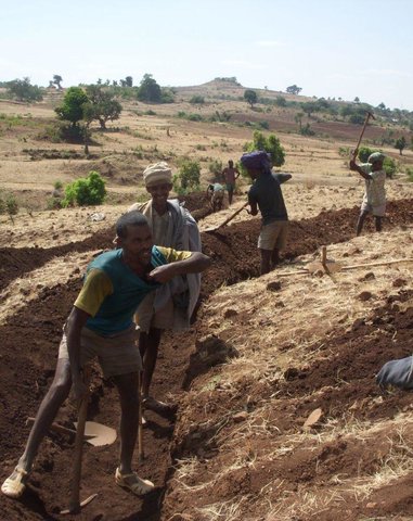
Community mobilization for soil and water conservation work in a watershed planning unit is an approach for collective action by organizing all active labor forces living in the kebele/peasant association into development group of 20-30 members and further divide into 1:5 work force to implement construction of soil and water …
- جامع المعلومات: Gizaw Desta Gessesse
'Cut and Carry' Grazing system or 'Zero Grazing' … [أثيوبيا]
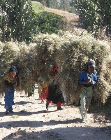
Cut and carry grazing system (alternatively called zero grazing) is an approach where the community is consulted to identify and agree on areas to be closed and protected from free grazing; establish user groups are established to share the fodder biomass harvested from communal closed areas equitably; they utilize tree/shrub …
- جامع المعلومات: Gizaw Desta Gessesse
2. وصف تقنيةالإدارة المستدامي للأراضي
2.1 وصف مختصر للتقنية
تعريف التقنية:
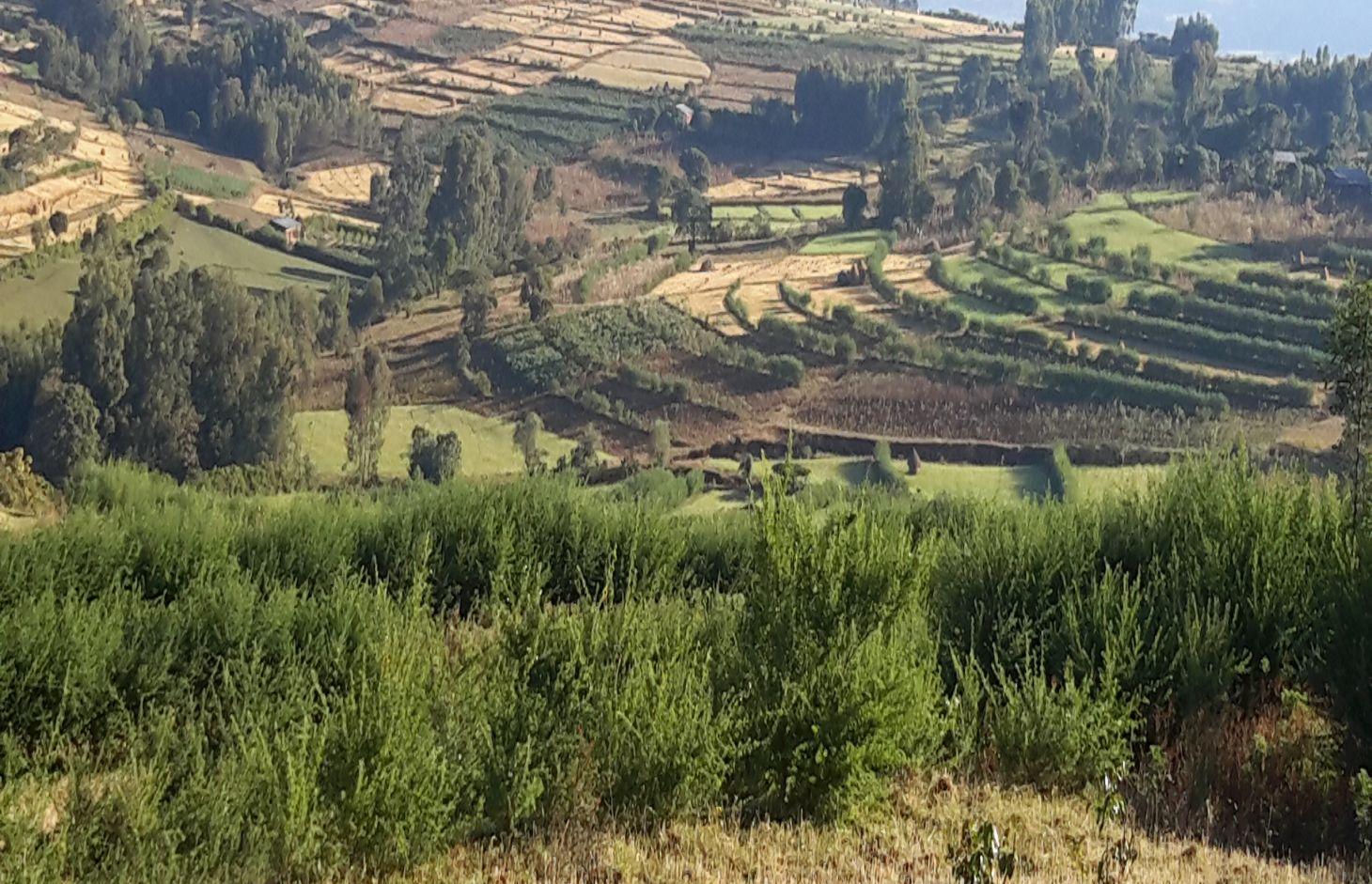
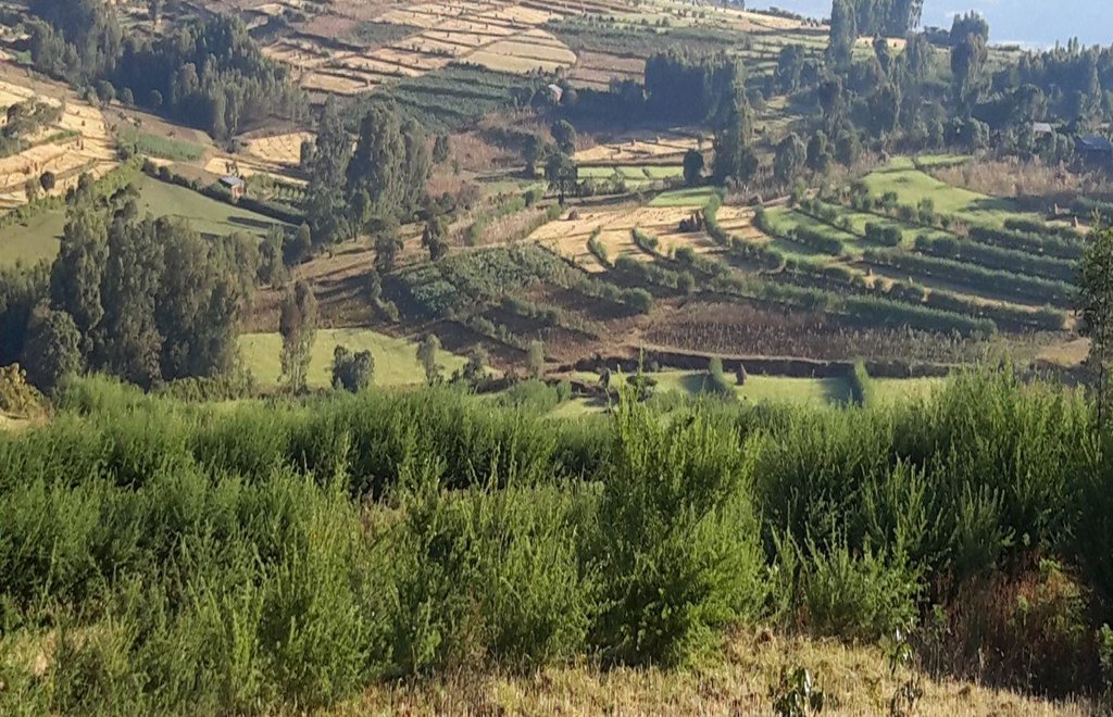
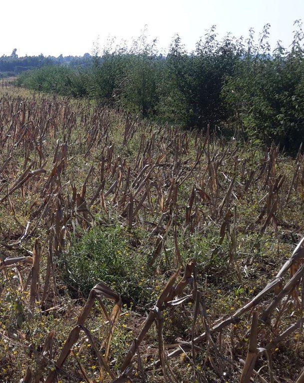
Vegetated graded soil bund is a soil conservation practice meant for cultivated lands and constructed by excavating graded channel on upper side and develop embankment on lower side which is planted with grass or shrub species in order to control soil erosion and drain excess runoff implemented through community mobilization.
2.2 وصف تفصيلي للتقنية
الوصف:
Vegetated graded soil bund is a practice or soil conservation technology for cultivated lands and constructed by excavating graded channel and form embankment. It is practiced in areas where there is excess runoff to be disposed and where there is no stones available for construction. The design specifications (ditch gradient, width and height) and layout (spacing/vertical interval) vary on the amount of excess runoff and slope of the land. Soil bund construction begins from top of the catchment. Cut off drains are constructed on top of the catchment and where needed to drain excess runoff to well stabilized natural or man-made waterways. this helps to reduce runoff impact on gullies. The bund ditch/channel should be sufficient enough to drain excess runoff safely without causing channel erosion and creating downstream damages. At same time the embankment should be stable to withstand overflows and damage due to free grazing. One technique to stabilize bunds is to plant the embankment with grass and shrub species of multiple economic value in order to compensate production area lost by bund construction. Often, the species are preferably used for livestock feed. Thus, free grazing has to be controlled. To protect damage of channels and embankments by extreme runoff and floods, frequent supervision and maintenance is required.
The purposes are:
1) Reduce nutrient loss and soil erosion by shortening the slope length,
2) Safely drain excess runoff from upstream of gully into protected waterways,
4) Produce biomass of fodder and cash values.
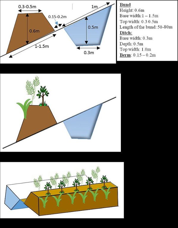
Vegetated graded bunds are established by doing surveying using hand level to determine the layout of the technology along the slope. During the surveying, the position of bunds (spacing) and cutoff drains and connection to waterways are determined. Bunds are laid following 0.05% gradient and up to 80 m maximum length. The specifications of the structure are: height of bund is a minimum of 60 cm after compaction; depending on the soil, base width range between 1.0 and 1.5m; top width is between 30 and 50 cm. The construction is made across different parcels owned by different land users. If there is no natural waterways and where it is appropriate, paved waterways are constructed at every 80 m or less bund length to dispose drainage water. At the beginning of the rainy season, the embankments are covered with grass and/or shrubs either by direct sowing of seeds or planting the seedlings raised in the nurseries. Monitoring of damages due to flooding and animals, maintenance of the structure as well as replanting of dead seedlings on bunds is required to sustain the soil conservation technology.
The technology is appropriately applied in high rainfall and sub-humid areas of the sub-tropics, particularly where the soil is moderately deep and poorly drained. It is constructed on cultivated lands having slopes in the range of 3-15%. The practice can be constructed by land users. It also requires collective decision and actions to drain excess runoff through waterways. The living condition depends on subsistence crop-livestock mixed farming. On average households have 5-6 family size. Crop production is meant for home consumption with small surplus for local market. The services related to water supply, energy supply, and infrastructure are low. Besides it is an asset, animals often used to cope shocks during drought periods.
2.3 صور التقنية
2.5 البلد/المنطقة/المواقع التي تم تنفيذ التقنية فيها والتي يغطيها هذا التقييم
البلد:
أثيوبيا
المنطقة/الولاية/المحافظة:
Amhara National Regional State (ANRS)
مزيد من التفاصيل حول الموقع:
Mecha, Bahirdar Zuria and Yilmana Densa
2.6 تاريخ التنفيذ
في حالة عدم معرفة السنة بالتحديد، يرجى الإشارة إلى التاريخ التقريبي:
- منذ أقل من 10 سنوات (مؤخرًا)
2.7 إدخال التقنية
حدد كيف تم إدخال التقنية:
- من خلال المشاريع/ التدخلات الخارجية
التعليقات (نوع المشروع، الخ):
The soil bunds are introduced before 30-40 years, however the integration of structural and combination of vegetative measures are applied in three years period in the WLRC learning watersheds.
3. تصنيف تقنية الإدارة المستدامي للأراضي
3.1 الغرض الرئيسي ( الأغراض الرئيسية) للتقنية
- الحد من تدهور الأراضي ومنعه وعكسه
3.2 نوع (أنواع) استخدام الأراضي الحالية حيث يتم تطبيق التقنية

الأراضي الزراعية
- زراعة سنوية
التعليقات:
Major land use problems (compiler’s opinion): Land degradation due to sheet erosion, rills and gullies, soil nutrient depletion, overgrazing, shortage of fuel wood, excessive removal of crop residuals, loss of vegetation and deforestation
Major land use problems (land users’ perception): Soil erosion, soil nutrient depletion, shortage of pasture
3.3 مزيد من المعلومات حول استخدام الأراضي
إمدادات المياه للأرض التي يتم تنفيذ التقنية عليها:
- ري كامل
عدد مواسم الزراعة في السنة:
- 1
حدد:
Longest growing period in days: 210, Longest growing period from month to month: June-December; Second longest growing period in days: 180, Second longest growing period from month to month: June-November
3.4 مجموعةالإدارة المستدامة للأراضي التي تنتمي إليها هذه التقنية
- التدابير المتقاطعة للمنحدرات
3.5 انتشار التقنية
التعليقات:
Total area covered by the SLM Technology is 20 m2.
The technology is applied on specific conditions within the watersheds or area of adoption
3.6 التدابير التقنية في مجال إلادارة المستدامة للأراضي

التدابير النباتية
- V1: غطاء من الأشجار والشجيرات
- V2: الأعشاب والنباتات العشبية المعمرة

التدابير البنيوية
- الحواجز والضفاف
- S3: الخنادق المتدرجة ،والقنوات، والممرات المائية
التعليقات:
Type of vegetative measures: aligned: -graded strips
3.7 الأنواع الرئيسية من تدهور الأراضي التي تناولتها التقنية

تآكل التربة بالمياه
- الوزن(Wt): فقدان التربة السطحية/تآكل السطح
- (Wo:) تأثيرات التدهور من مواقع أخرى

تدهور المياه
- (Hs): التغيير في كمية المياه السطحية
التعليقات:
Main causes of degradation: soil management (High tillage frequency on annual basis and steep slope cultivation), crop management (annual, perennial, tree/shrub) (The cropping system is cereal based that induce erosion), overgrazing (Livestock graze on crop residues after harvesting of crops), Heavy / extreme rainfall (intensity/amounts) (Extreme rainfall cause for high erosion), other natural causes (avalanches, volcanic eruptions, mud flows, highly susceptible natural resources, extreme topography, etc.) specify (Steep slopes or rugged topography), population pressure (Result in expansion of crop lands to steeper slopes)
Secondary causes of degradation: deforestation / removal of natural vegetation (incl. forest fires) (Deforestation of scattered trees in the farm and forests upstream of crop lands), land tenure (Insecure tenure play role not to invest on long term), poverty / wealth (Poor can not afford to invest on soil conservation on his parcel), education, access to knowledge and support services, governance / institutional
3.8 منع أو حد أو عكس تدهور الأراضي
تحديد هدف التقنية فيما يتعلق بتدهور الأراضي:
- الحد من تدهور الأراضي
4. المواصفات الفنية، وأنشطة التنفيذ، والمدخلات، والتكاليف
4.1 الرسم الفني للتقنية
4.2 المواصفات الفنية/شروحات الرسم الفني
Vegetated graded soil bund showing the excavated ditch or channel and the embankment planted with grass and shrubs
Location: Amhara Region. Mecha, Yilmana Densa, Bahir Dar Zuria and Dessie Z
Technical knowledge required for field staff / advisors: high (Layout and design specification of soil bunds and cutoff drains vary on soil types, slopes, and rainfall conditions. Experts thus should acquire knowledge on specific hydrologic conditions)
Technical knowledge required for land users: moderate (Land users need skill to layout and construct bunds, monitor structures before the occurrence of excessive damage, and do regular maintenance)
Main technical functions: control of dispersed runoff: impede / retard, reduction of slope length, sediment retention / trapping, sediment harvesting, increase of biomass (quantity)
Secondary technical functions: control of dispersed runoff: retain / trap, reduction of slope angle, increase / maintain water stored in soil, increase of groundwater level / recharge of groundwater
Aligned: -graded strips
Vegetative material: T : trees / shrubs, C : perennial crops, G : grass
Number of plants per (ha): T=5333, C=160, G=1600
Vertical interval between rows / strips / blocks (m): 1-1.5
Spacing between rows / strips / blocks (m): 10-20
Vertical interval within rows / strips / blocks (m): T=0.3, C=5, G=0.5
Width within rows / strips / blocks (m): 0.3
Trees/ shrubs species: Cordia Africana, Polycantha, Sesbania Susban, Pigeon pea, Treelucer
Perennial crops species: Rhamnus
Grass species: Napier grass
Slope (which determines the spacing indicated above): 3-15%
Gradient along the rows / strips: 0.05%
Diversion ditch/ drainage
Depth of ditches/pits/dams (m): 0.3-0.7
Width of ditches/pits/dams (m): 1.2-2.8
Length of ditches/pits/dams (m): 100-250
Waterway
Depth of ditches/pits/dams (m): 0.3
Width of ditches/pits/dams (m): 1.5-2.0
Bund/ bank: graded
Vertical interval between structures (m): 1-1.5
Spacing between structures (m): 10-20
Depth of ditches/pits/dams (m): 0.5
Width of ditches/pits/dams (m): 0.3
Height of bunds/banks/others (m): 0.6
Width of bunds/banks/others (m): 1-1.5
Length of bunds/banks/others (m): 50-80
Construction material (earth): in-situ excavated soil
Slope (which determines the spacing indicated above): 3-15%
Lateral gradient along the structure: 0.05%
Vegetation is used for stabilisation of structures.
4.3 معلومات عامة بخصوص حساب المدخلات والتكاليف
عملة أخرى/ عملة وطنية (حدد):
ETH BIRR
أشر إلى سعر الصرف من الدولار الأمريكي إلى العملة المحلية (إذا كان ذا صلة): 1 دولار أمريكي =:
20,0
اذكر متوسط تكلفة أجر العمالة المستأجرة في اليوم الواحد:
2.50
4.4 أنشطة التأسيس
| النشاط | نوع التدبير | التوقيت | |
|---|---|---|---|
| 1. | Preparing planting materials | نباتية | January-May |
| 2. | Preparation of planting materials | نباتية | January-May |
| 3. | Transportation of grass splits/cuttings | نباتية | Start of rainy season/July |
| 4. | Transporting tree seedlings | نباتية | Start of rain season/July |
| 5. | Planting grass splits/cuttings | نباتية | Start of rainy season/July |
| 6. | Sowing seeds on bunds | نباتية | Start of rainy season/July |
| 7. | Planting tree seedlings on bunds | نباتية | Starting of rainy season/July |
| 8. | Surveying (layout of structures) | بنيوية أو هيكلية | After crop harvest and before first tillage operation |
| 9. | Construction of cutoff drains | بنيوية أو هيكلية | January-April |
| 10. | Construction of bunds (ditch and embankment) | بنيوية أو هيكلية | January-April |
| 11. | Construction of waterways | بنيوية أو هيكلية | January - April |
4.5 التكاليف والمدخلات اللازمة للتأسيس
| تحديد المدخلات | الوحدة | الكمية | التكاليف لكل وحدة | إجمالي التكاليف لكل مدخل | % من التكاليف التي يتحملها مستخدمو الأراضي | |
|---|---|---|---|---|---|---|
| العمالة | labour | ha | 1,0 | 1107,0 | 1107,0 | 79,0 |
| معدات | animal traction | ha | 1,0 | 4,0 | 4,0 | 100,0 |
| معدات | tools | ha | 1,0 | 300,6 | 300,6 | 50,0 |
| المواد النباتية | seedlings | ha | 1,0 | 32,0 | 32,0 | 100,0 |
| المواد النباتية | seeds | ha | 1,0 | 9,0 | 9,0 | 100,0 |
| المواد النباتية | compost manure | ha | 1,0 | 2,0 | 2,0 | 100,0 |
| مواد البناء | stone | ha | 1,0 | 1300,0 | 1300,0 | 100,0 |
| مواد البناء | wood | ha | 1,0 | 110,0 | 110,0 | 100,0 |
| مواد البناء | earth | ha | 1,0 | 25,2 | 25,2 | 100,0 |
| إجمالي تكاليف إنشاء التقنية | 2889,8 | |||||
التعليقات:
Duration of establishment phase: 15 month(s)
4.6 الصيانة/الأنشطة المتكررة
| النشاط | نوع التدبير | التوقيت/الوتيرة | |
|---|---|---|---|
| 1. | Preparation of planting materials | نباتية | January - May |
| 2. | Transportation of seedlings | نباتية | July |
| 3. | Re-plantation of seedlings and grass splits | نباتية | July |
| 4. | Maintenance of bunds, cutoff drain and waterways | بنيوية أو هيكلية | January-April |
4.7 التكاليف والمدخلات اللازمة للصيانة/للأنشطة المتكررة (سنويًا)
| تحديد المدخلات | الوحدة | الكمية | التكاليف لكل وحدة | إجمالي التكاليف لكل مدخل | % من التكاليف التي يتحملها مستخدمو الأراضي | |
|---|---|---|---|---|---|---|
| العمالة | labour | ha | 1,0 | 279,0 | 279,0 | 100,0 |
| المواد النباتية | seedlings | ha | 1,0 | 20,0 | 20,0 | 100,0 |
| إجمالي تكاليف صيانة التقنية | 299,0 | |||||
التعليقات:
Machinery/ tools: Cart, plastic tubes, spade, pickaxe, hand level, graduated ranging pole, spade, pickaxe, crowbar, hammer
The costs are calculated based on the labour, seedling/seed, grass splits required per hectare
4.8 أهم العوامل المؤثرة على التكاليف
قدم وصفا لأهم العوامل التي تؤثر على التكاليف:
The cost variation in implementing vegetated soil bund is dependent upon availability of stones, workability of the soil, cost of seeds or seedlings for plantation, and distance for transporting seedlings.
5. البيئة الطبيعية والبشرية
5.1 المناخ
هطول الأمطار السنوي
- < 250 مم
- 251- 500 ملم
- 501 - 750ملم
- 1,000-751 ملم
- 1,500-1,100 ملم
- 2,000-1,500 ملم
- 3,000-2,001 ملم
- 4,000-3,100 ملم
- > 4000 ملم
المواصفات/التعليقات على هطول الأمطار:
Monsoon, 5-6 months rain and 6-7 dry months
المنطقة المناخية الزراعية
- شبه رطبة
Thermal climate class: subtropics. he lowest temperature is above 5oc but below 18oc etween November to January
5.2 طوبوغرافيا
متوسط الانحدارات:
- مسطح (0-2%)
- بسيط (3-5%)
- معتدل (6-10%)
- متدحرج (11-15%)
- تلال (16-30%)
- شديدة الانحدار(31-60%)
- فائقة الانحدار (>60%)
التضاريس:
- هضاب/سهول
- أثلام مرتفعة
- المنحدرات الجبلية
- منحدرات التلال
- منحدرات في السفوح
- قاع الوادي
المنطقة الارتفاعية:
- 100-0 متر فوق سطح البحر
- 500-101 متر فوق سطح البحر
- 1,000-501 متر فوق سطح البحر
- 1,500-1,001 متر فوق سطح البحر
- 2,000-1,501 متر فوق سطح البحر
- 2,500-2,100 متر فوق سطح البحر
- 3,000-2,501 متر فوق سطح البحر
- 4,000-3,001 متر فوق سطح البحر
- > 4000 متر فوق سطح البحر
5.3 التربة
متوسط عمق التربة:
- ضحل جدًا (0-20 سم)
- ضحلة (21-50 سم)
- متوسطة العمق (51-80 سم)
- عميقة (81-120 سم)
- عميقة جدًا (> 120 سم)
قوام التربة (التربة السطحية):
- متوسط ( طميي، سلتي)
- ناعم/ثقيل (طيني)
المواد العضوية في التربة السطحية:
- متوسطة (1-3%)
- منخفضة (<1%)
5.4 توافر المياه ونوعيتها
منسوب المياه الجوفية:
50-5 م
توافر المياه السطحية:
متوسط
نوعية المياه (غير المعالجة):
مياه الشرب سيئة (تتطلب معالجة)
5.5 التنوع البيولوجي
تنوع الأنواع:
- منخفض
5.6 خصائص مستخدمي الأراضي الذين يطبقون التقنية
التوجه السوقي لنظام الإنتاج:
- الكفاف (الإمداد الذاتي)
- مختلط (كفاف/ تجاري)
الدخل من خارج المزرعة:
- أقل من % 10من كامل الدخل
المستوى النسبي للثروة:
- ضعيف
- متوسط
أفراداً أو مجموعات:
- فرد/أسرة معيشية
مستوى المكننة:
- عمل يدوي
- الجر الحيواني
الجنس:
- نساء
- رجال
اذكر الخصائص الأخرى ذات الصلة لمستخدمي الأراضي:
Land users applying the Technology are mainly common / average land users
Difference in the involvement of women and men: Women are involved in the construction of bunds with role of collecting stones, stabilize/compact the embankments and sometimes help men in excavating the earth
Population density: 200-500 persons/km2
Annual population growth: 2% - 3%
80% of the land users are average wealthy.
20% of the land users are poor.
Off-farm income specification: Land users often do not have access to off-farm income unless those who are young and own small size of land go for seasonal labor to towns during the slack period
5.7 متوسط مساحة الأرض المملوكة أو المستأجرة من قبل مستخدمي الأراضي الذين يطبقون التقنية
- < 0.5 هكتارا
- 0.5 - 1 هكتار
- 1 -2 هكتار
- 2 - 5 هكتار
- 5 - 15 هكتار
- 15 - 50 هكتار
- 50 - 100هكتار
- 500-100 هكتار
- 1,000-500 هكتار
- 10,000-1,000 هكتار
- > 10,000 هكتار
هل يعتبر هذا نطاقًا صغيرًا أو متوسطًا أو واسعا (في إشارة إلى السياق المحلي)؟:
- على نطاق صغير
5.8 ملكية الأراضي، وحقوق استخدام الأراضي، وحقوق استخدام المياه
ملكية الارض:
- دولة
حقوق استخدام الأراضي:
- فردي
حقوق استخدام المياه:
- وصول مفتوح (غير منظم)
- مجتمعي (منظم)
5.9 الوصول إلى الخدمات والبنية التحتية
الصحة:
- ضعيف
- معتدل
- جيد
التعليم:
- ضعيف
- معتدل
- جيد
المساعدة التقنية:
- ضعيف
- معتدل
- جيد
العمل (على سبيل المثال خارج المزرعة):
- ضعيف
- معتدل
- جيد
الأسواق:
- ضعيف
- معتدل
- جيد
الطاقة:
- ضعيف
- معتدل
- جيد
الطرق والنقل:
- ضعيف
- معتدل
- جيد
مياه الشرب وخدمات الصرف الصحي:
- ضعيف
- معتدل
- جيد
الخدمات المالية:
- ضعيف
- معتدل
- جيد
6. الآثار والتصريحات الختامية
6.1 الآثار التي أظهرتها التقنية في الموقع
الآثار الاجتماعية والاقتصادية
الإنتاج
إنتاج المحاصيل
التعليقات/ حدد:
Crop yield increase on sedimentation area of bunds
إنتاج الأعلاف
التعليقات/ حدد:
Introduction of fodder crops on bunds
جودة العلف
التعليقات/ حدد:
Introduction of high value forage crops
منطقة الإنتاج
التعليقات/ حدد:
The area used for ditch construction can be taken as a loss of land
إدارة الأراضي
التعليقات/ حدد:
In slope classes where spacing is narrow farm operation will be hindered
الدخل والتكاليف
دخل المزرعة
التعليقات/ حدد:
Increase in income due to yield increase and fodder production
الآثار الاجتماعية والثقافية
المؤسسات المجتمعية
التعليقات/ حدد:
Watershed users committee established to regulate the development
المعرفة بالإدارة المستدامة للأراضي/تدهور الأراضي
التعليقات/ حدد:
Field staffs and land users aware of erosion and soil conservation
التخفيف من حدة الصراع
contribution to human well-being
التعليقات/ حدد:
The technology aim to reduce the soil loss and improving the soil moisture to produce crops. On the other hand, the fodder production on bunds increase livestock productivity. Through improving crop and livestock productivity the livelihood of the watershed people is improved in long terms.
الآثار الايكولوجية
دورة المياه / الجريان السطحي
كمية المياه
التعليقات/ حدد:
Overall effect of bunds show increase in surface water downstreams
الجريان السطحي
التعليقات/ حدد:
reduction of concentrated runoff
التربة
رطوبة التربة
التعليقات/ حدد:
Increase the rate of infiltration
فقدان التربة
التعليقات/ حدد:
Soil loss is reduced by breaking the slope length
6.2 الآثار التي أظهرتها التقنية خارج الموقع
تدفقات مائية موثوقة ومستقرة في موسم الجفاف
التعليقات/ حدد:
In good drainage soils it increases infiltrated water and interflows
الفيضان في اتجاه مجرى النهر
التعليقات/ حدد:
Since it helps to reduce concentration of runoff it contributes to reduce flooding
تراكم الطمي باتجاه مصب النهر
التعليقات/ حدد:
The main function of bunds is to reduce soil loss
الأضرار التي لحقت بحقول الجيران
التعليقات/ حدد:
All fields are treated with integrated bund, cutoff drain and waterways
6.3 تعرض التقنية وحساسيتها لتغير المناخ التدريجي والظواهر المتطرفة/الكوارث المرتبطة بالمناخ (كما يراها مستخدمو الأراضي)
الظواهر المتطرفة / الكوارث المرتبطة بالمناخ
الكوارث الجوية
| كيف تتعامل التقنية مع ذلك؟ | |
|---|---|
| عاصفة ممطرة محلية | جيدا |
الكوارث الهيدرولوجية
| كيف تتعامل التقنية مع ذلك؟ | |
|---|---|
| فيضان عام (نهر) | ليس جيدا |
التعليقات:
The technology has sufficient drainage ditch to tolerate excess runoff occurred during heavy rainfall events. However, it is sensitive to floods unless flood management measures such as strong cutoff drains and waterways are implemented
6.4 تحليل التكلفة والعائد
كيف يمكن مقارنة العوائد نسبة لتكاليف الإنشاء (من وجهة نظر مستخدمي الأراضي)؟
عوائد قصيرة الأجل:
إيجابي قليلا
عوائد طويلة الأجل:
إيجابي
كيف تتم مقارنة العوائدمع كلفة الصيانة/التكاليف المتكررة (من وجهة نظر مستخدمي الأراضي)؟
عوائد قصيرة الأجل:
إيجابي
عوائد طويلة الأجل:
ايجابي جدا
التعليقات:
The short term economic benefits of the technology includes increase in fodder production and slightly crop productivity due to improved soil moisture. Whereas the long term benefit can be obtained as a result of increased yield on areas where sediment accumulation occurs as well as production of fodder on soil bunds for livestock feed
6.5 اعتماد التقنية
التعليقات:
The technology is implemented using community mobilization approach which involves all land users. All land users, who cultivate land in areas where bunds are suitable, implemented the technology. All parcels are covered with the technology/bunds except homesteads and degraded hillsides and gullies which are treated with different SLM technologies
Since the approach encourages collective action (through community organizations) to integrate different SLM technologies in the watershed level, there is no attempt by individual land users. However, there are motivations and implementation of land users on adjacent watersheds to implement the technology.
There is a moderate trend towards spontaneous adoption of the Technology
The trend is at increasing rate although land users need material support such as multipurpose seedlings to stabilize bunds. There is shortage of supply of fodder seeds. Community nurseries are inadequate and not well supported to raise seedlings to meet community demands.
6.7 نقاط القوة / المزايا / الفرص التي توفرها التقنية
| نقاط القوة/ المزايا/ الفرص من وجهة نظر مستخدمي الأراضي |
|---|
| Increase in fodder production for livestock feed |
| Reduce conflict among adjacent land users (i.e., upstream and downstream land users) that arise due to concentrated runoff |
| Reduce soil erosion |
| نقاط القوة/ المزايا/ الفرص من وجهة نظر جامع المعلومات أو غيره من الاشخاص الرئيسيين لمصدر المعلومات |
|---|
| The technology reduces soil loss and associated nutrient loss significantly in the first 3 to 4 years and further reduce siltation of reservoirs and land degradation |
| Increase the soil moisture in the landscape/watershed |
| Improves the greenness, soil carbon and micro-climate |
| Increase level of awareness of land users to produce fodder and diversify production and income |
| Reduce the concentration of runoff and safely drain without causing damage |
6.8 نقاط ضعف / مساوىء / مخاطر التقنية وسبل التغلب عليها
| نقاط الضعف/ المساوىء/ المخاطر من وجهة نظر مستخدم الأراضي | كيف يمكن التغلب عليها؟ |
|---|---|
| Hinder farm operations like turning oxen become difficult while ploughing | It can be sustained through proper layout and allow space for human and animal paths |
| Plantation on bunds harbor birds | This can be avoided by harvesting the mature branches of the shrubs for livestock feed on seasonal basis. |
| Appearance of new weeds species along the drainage ditches | Regular weed monitoring and manual control |
| Hinders livestock to graze on crop residues | Try to use cut and carry grazing system (both crop residues and fodders) and develop forage development strategies in every possible niches |
| نقاط الضعف/ المساوىء/ المخاطر من وجهة نظر جامع المعلومات أو غيره من الاشخاص الرئيسيين لمصدر المعلومات | كيف يمكن التغلب عليها؟ |
|---|---|
| High labor requirement to establish and maintain the technology | Increase the awareness level of land users and strength collective actions and local organizational setups |
| Small land loss for construction | Introduce production options (like fodder production) on bunds to compensate the lost land |
| It requires some years to accumulate sediment on bund area and form bench | It can be improved by modifying the design of drainage ditchs |
7. المراجع والروابط
7.1 طرق جمع/مصادر المعلومات
- زيارات ميدانية، مسوحات ميدانية
- مقابلات مع مستخدمي الأراضي
7.2 المراجع للمنشورات المتاحة
العنوان، المؤلف، السنة، النظام القياسي الدولي لترقيم الكتب ISBN:
Vegetated Graded Soil Bund: A Technique to Reduce Runoff Impact and Increase Soil Moisture Storage and Fodder Biomass, WLRC Brief No. 4
متاح من أين؟كم التكلفة؟:
WWW.wlrc-eth.org
الروابط والوحدات المواضيعية
توسيع الكل طي الكلالروابط

Community Organizations and Mobilization for Soil and Water … [أثيوبيا]
Community mobilization for soil and water conservation work in a watershed planning unit is an approach for collective action by organizing all active labor forces living in the kebele/peasant association into development group of 20-30 members and further divide into 1:5 work force to implement construction of soil and water …
- جامع المعلومات: Gizaw Desta Gessesse

'Cut and Carry' Grazing system or 'Zero Grazing' … [أثيوبيا]
Cut and carry grazing system (alternatively called zero grazing) is an approach where the community is consulted to identify and agree on areas to be closed and protected from free grazing; establish user groups are established to share the fodder biomass harvested from communal closed areas equitably; they utilize tree/shrub …
- جامع المعلومات: Gizaw Desta Gessesse
الوحدات المواضيعية
لا يوجد وحدات مواضيعية


