Earth embankment dams [مالي]
- تاريخ الإنشاء:
- تحديث:
- جامع المعلومات: Nina Lauterburg
- المحرر: –
- المُراجع: Deborah Niggli
Barrages avec digues en terre (French)
technologies_1631 - مالي
عرض الأقسام
توسيع الكل طي الكل1. معلومات عامة
1.2 تفاصيل الاتصال بالأشخاص الرئيسيين لمصدر المعلومات والمؤسسات المشاركة في تقييم وتوثيق التقنية
متخصص في الإدارة المستدامة للأراضي:
Dembele Célestin
celestin.dembele@helvetas.org
Helvetas Swiss Intercooperation
مالي
متخصص في الإدارة المستدامة للأراضي:
Doumbia Moussa
mtdoumbia@yahoo.fr
ADEPE MALI
مالي
اسم المشروع الذي سهّل توثيق/تقييم التقنية (إذا كان ذلك على صلة)
Manual of Good Practices in Small Scale Irrigation in the Sahel (GIZ )اسم المؤسسة (المؤسسات) التي سهلت توثيق/تقييم التقنية (إذا كان ذلك على صلة)
Deutsche Gesellschaft für Internationale Zusammenarbeit (GIZ) GmbH (GIZ) - ألمانيا1.3 الشروط المتعلقة باستخدام البيانات الموثقة من خلال WOCAT
متى تم تجميع البيانات (ميدانيا)؟:
01/07/2012
يوافق جامع المعلومات والشخص (لاشخاص) الرئيسي لمصدر المعلومات على الشروط المتعلقة باستخدام البيانات الموثقة من خلال WOCAT:
نعم
1.4 إعلان بشأن استدامة التقنية الموصوفة
هل التقنية الموصوفة هنا تمثل مشكلة فيما يتعلق بتدهور الأراضي، بحيث لا يمكن إعلانها تقنية مستدامة لإدارة الأراضي؟:
كلا
2. وصف تقنيةالإدارة المستدامي للأراضي
2.1 وصف مختصر للتقنية
تعريف التقنية:
Embankment dams are built to retain rainwater without totally blocking the flow of water, enabling the irrigation of a part of the plain.
2.2 وصف تفصيلي للتقنية
الوصف:
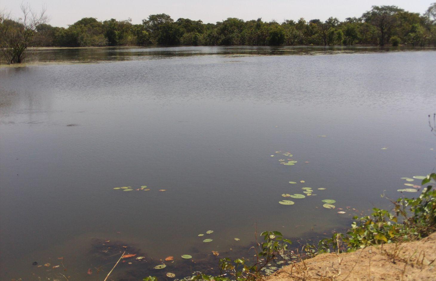
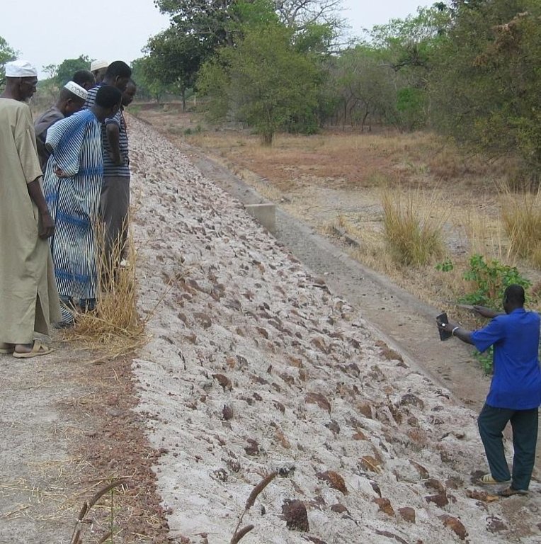
The installation of earth embankment dams in lowland areas comprises the following elements: 1) a compacted earth embankment, 100 to 450 metres in length; 2) a side spillway built with rubble or cyclopean concrete, 40 to 75 metres in length and connected to the embankment with lock walls; 3) a spillway stilling basin of loose stones; 4) dam height of up to five metres and a crest width of up to four metres; 5) a pond upstream of the embankment dug up to three to four metres deep for storing water throughout the dry season and, thereby, ensuring supplies for watering animals, market gardening and fish farming.
Embankment dams retain water in the basin for several months after the end of the rainy season, which can be used for watering livestock and crops off season; and they help raise the water table, which makes well water more easily accessible (at a depth of one to five metres). These dams are used for both controlled and free submersion.
The side of the embankment is about one metre higher than that of the side spillway. When the water level reaches the height of the side spillway, water flows down through the structure and continues along the riverbed on its normal route downstream. In-season rice growing is carried out both upstream and downstream of the dam. Upstream growers farming areas peripheral to the reservoir are advised to use varieties of floating rice or those that can withstand prolonged flooding. The seedlings for this kind of rice must be sown before the reservoir fills with water.
At the end of the growing season, the water is retained in the reservoir for watering animals and for fishing. Market gardening activities are carried out along the entire length of the river, with water being extracted from dug wells (sumps two to six metres deep).
In Mali, there are around 15 schemes in place in the circles of Sikasso, Kadiolo, Bougouni and Yanfolila, covering more than 1,000 hectares and benefiting 1,500 rural families. In these areas, more than 60% of rice growers are women. More than 100,000 head of cattle are watered each year from the reservoirs. The very large quantity of stored water considerably increases the potential to use land for vegetable and tree growing.
Local people formulate the requirement and negotiate with the commune on the investment programme; they identify the rules of access and set up the farming cooperatives and management bodies. The commune plans investments and assumes overall control of the construction work, delegates management to users, and validates the farming rules and oversees their correct application. Consultancies carry out the socio-economic, environmental and technical studies (scheme design, plans, models), draw up the invitation to tender document and support the tender selection process, and monitor and inspect works. Technical services oversee the application of technical and environmental standards and participate in ensuring sound financial practices (collection, financial control, public service concessions). Contractors carry out the construction work. The project team provides training (planning, social engineering, studies involving farmers, etc.), advisory support (organisation of users, formulation and validation of rules, area development plan, plan to develop and exploit value chains, selection of suitable crop varieties, management delegation procedures, procedures for securing land titles, etc.) and co-financing.
The users are divided up into management and maintenance teams and their respective responsibilities are clearly defined prior to the interim and final acceptance of works.
This type of scheme is effective in areas with good rainfall levels and in lowland areas where the water table is not very low. It is important to select lowland areas with the potential to store a substantial volume of water (topographic basins). This type of scheme works best in southern areas of Mali with 1,100 to 1,200 millimetres of precipitation per year.
2.3 صور التقنية
2.5 البلد/المنطقة/المواقع التي تم تنفيذ التقنية فيها والتي يغطيها هذا التقييم
البلد:
مالي
المنطقة/الولاية/المحافظة:
Mali
مزيد من التفاصيل حول الموقع:
Kadiolo, Sikasso, Bougouni, Yanfolila
2.6 تاريخ التنفيذ
في حالة عدم معرفة السنة بالتحديد، يرجى الإشارة إلى التاريخ التقريبي:
- منذ 10-50 سنة
2.7 إدخال التقنية
حدد كيف تم إدخال التقنية:
- من خلال المشاريع/ التدخلات الخارجية
التعليقات (نوع المشروع، الخ):
Since 2003, by HELVETAS Swiss Intercooperation
3. تصنيف تقنية الإدارة المستدامي للأراضي
3.1 الغرض الرئيسي ( الأغراض الرئيسية) للتقنية
- تحسين الإنتاج
- الحد من تدهور الأراضي ومنعه وعكسه
3.2 نوع (أنواع) استخدام الأراضي الحالية حيث يتم تطبيق التقنية

الأراضي الزراعية
- زراعة سنوية

مختلطة (محاصيل/ رعي/ أشجار)، بما في ذلك الحراجة الزراعية
- الرعي الزراعي
التعليقات:
Major land use problems (compiler’s opinion): aridification, loss of water
3.3 مزيد من المعلومات حول استخدام الأراضي
إمدادات المياه للأرض التي يتم تنفيذ التقنية عليها:
- مختلط بعلي-مروي
عدد مواسم الزراعة في السنة:
- 1
حدد:
Longest growing period in days: 120, Longest growing period from month to month: August-November
كثافة الثروة الحيوانية (إذا كانت ذات صلة):
1-10 LU /km2
3.4 مجموعةالإدارة المستدامة للأراضي التي تنتمي إليها هذه التقنية
- إدارة الري (بما في ذلك إمدادات المياه والصرف الصحي)
- تحويل المياه والصرف
- إدارة المياه السطحية (الينابيع، الأنهار، البحيرات، البحار)
3.5 انتشار التقنية
التعليقات:
Total area covered by the SLM Technology is 10 m2.
In the Sikasso region; in 15 or so communes within the circles of Kadiolo, Sikasso, Bougouni and Yanfolila. Around 1,000 hectares.
3.6 التدابير التقنية في مجال إلادارة المستدامة للأراضي

التدابير البنيوية
- S5: السدود، الأحواض الصغيرة، البرك
3.7 الأنواع الرئيسية من تدهور الأراضي التي تناولتها التقنية

التدهور البيولوجي
- (Bc): تناقص الغطاء النباتي

تدهور المياه
- (Ha): التجفيف
- (Hs): التغيير في كمية المياه السطحية
- (Hg): التغير في مستوى المياه الجوفية/الطبقة المائية الجوفية
التعليقات:
Main causes of degradation: over abstraction / excessive withdrawal of water (for irrigation, industry, etc.), droughts
3.8 منع أو حد أو عكس تدهور الأراضي
تحديد هدف التقنية فيما يتعلق بتدهور الأراضي:
- الحد من تدهور الأراضي
4. المواصفات الفنية، وأنشطة التنفيذ، والمدخلات، والتكاليف
4.2 المواصفات الفنية/شروحات الرسم الفني
Technical knowledge required for field staff / advisors: high
Technical knowledge required for land users: low
Main technical functions: increase of groundwater level / recharge of groundwater, water harvesting / increase water supply
Secondary technical functions: increase of infiltration
Spillway
Length of ditches/pits/dams (m): 40-75
Dam/ pan/ pond
Depth of ditches/pits/dams (m): 3-4
Wall/ barrier
Depth of ditches/pits/dams (m): 5
Width of ditches/pits/dams (m): 4
Length of ditches/pits/dams (m): 100-450
Structural measure: spillway stilling basin of loose stones
4.3 معلومات عامة بخصوص حساب المدخلات والتكاليف
عملة أخرى/ عملة وطنية (حدد):
CFA Franc
أشر إلى سعر الصرف من الدولار الأمريكي إلى العملة المحلية (إذا كان ذا صلة): 1 دولار أمريكي =:
512,0
4.4 أنشطة التأسيس
| النشاط | نوع التدبير | التوقيت | |
|---|---|---|---|
| 1. | Local people formulate the requirement and negotiate with the commune on the investment programme; they identify the rules of access and set up the farming cooperatives and management bodies | بنيوية أو هيكلية | |
| 2. | Contractors carry out the construction work | بنيوية أو هيكلية |
4.6 الصيانة/الأنشطة المتكررة
| النشاط | نوع التدبير | التوقيت/الوتيرة | |
|---|---|---|---|
| 1. | maintenance of the dam | بنيوية أو هيكلية |
4.8 أهم العوامل المؤثرة على التكاليف
قدم وصفا لأهم العوامل التي تؤثر على التكاليف:
The cost of a scheme stands at around 40 million CFA francs (77838 Dollars) for between 10 to 80 hectares (0.5 to 4 million CFA francs per hectare (972-7780 Dollars)).
5. البيئة الطبيعية والبشرية
5.1 المناخ
هطول الأمطار السنوي
- < 250 مم
- 251- 500 ملم
- 501 - 750ملم
- 1,000-751 ملم
- 1,500-1,100 ملم
- 2,000-1,500 ملم
- 3,000-2,001 ملم
- 4,000-3,100 ملم
- > 4000 ملم
المنطقة المناخية الزراعية
- شبه قاحلة
Thermal climate class: tropics
5.2 طوبوغرافيا
متوسط الانحدارات:
- مسطح (0-2%)
- بسيط (3-5%)
- معتدل (6-10%)
- متدحرج (11-15%)
- تلال (16-30%)
- شديدة الانحدار(31-60%)
- فائقة الانحدار (>60%)
التضاريس:
- هضاب/سهول
- أثلام مرتفعة
- المنحدرات الجبلية
- منحدرات التلال
- منحدرات في السفوح
- قاع الوادي
المنطقة الارتفاعية:
- 100-0 متر فوق سطح البحر
- 500-101 متر فوق سطح البحر
- 1,000-501 متر فوق سطح البحر
- 1,500-1,001 متر فوق سطح البحر
- 2,000-1,501 متر فوق سطح البحر
- 2,500-2,100 متر فوق سطح البحر
- 3,000-2,501 متر فوق سطح البحر
- 4,000-3,001 متر فوق سطح البحر
- > 4000 متر فوق سطح البحر
5.3 التربة
متوسط عمق التربة:
- ضحل جدًا (0-20 سم)
- ضحلة (21-50 سم)
- متوسطة العمق (51-80 سم)
- عميقة (81-120 سم)
- عميقة جدًا (> 120 سم)
قوام التربة (التربة السطحية):
- متوسط ( طميي، سلتي)
- ناعم/ثقيل (طيني)
المواد العضوية في التربة السطحية:
- متوسطة (1-3%)
- منخفضة (<1%)
5.4 توافر المياه ونوعيتها
منسوب المياه الجوفية:
50-5 م
توافر المياه السطحية:
متوسط
نوعية المياه (غير المعالجة):
للاستخدام الزراعي فقط (الري)
5.5 التنوع البيولوجي
تنوع الأنواع:
- متوسط
5.6 خصائص مستخدمي الأراضي الذين يطبقون التقنية
التوجه السوقي لنظام الإنتاج:
- مختلط (كفاف/ تجاري)
الدخل من خارج المزرعة:
- 10-50% من جميع الإيرادات
المستوى النسبي للثروة:
- ضعيف
- متوسط
مستوى المكننة:
- عمل يدوي
الجنس:
- رجال
اذكر الخصائص الأخرى ذات الصلة لمستخدمي الأراضي:
Population density: < 10 persons/km2
Annual population growth: 2% - 3%
10% of the land users are rich.
50% of the land users are average wealthy.
30% of the land users are poor.
10% of the land users are very poor.
5.7 متوسط مساحة الأرض المملوكة أو المستأجرة من قبل مستخدمي الأراضي الذين يطبقون التقنية
- < 0.5 هكتارا
- 0.5 - 1 هكتار
- 1 -2 هكتار
- 2 - 5 هكتار
- 5 - 15 هكتار
- 15 - 50 هكتار
- 50 - 100هكتار
- 500-100 هكتار
- 1,000-500 هكتار
- 10,000-1,000 هكتار
- > 10,000 هكتار
هل يعتبر هذا نطاقًا صغيرًا أو متوسطًا أو واسعا (في إشارة إلى السياق المحلي)؟:
- على نطاق صغير
5.8 ملكية الأراضي، وحقوق استخدام الأراضي، وحقوق استخدام المياه
التعليقات:
The irrigated land is allocated by the chief
5.9 الوصول إلى الخدمات والبنية التحتية
الصحة:
- ضعيف
- معتدل
- جيد
التعليم:
- ضعيف
- معتدل
- جيد
المساعدة التقنية:
- ضعيف
- معتدل
- جيد
العمل (على سبيل المثال خارج المزرعة):
- ضعيف
- معتدل
- جيد
الأسواق:
- ضعيف
- معتدل
- جيد
الطاقة:
- ضعيف
- معتدل
- جيد
الطرق والنقل:
- ضعيف
- معتدل
- جيد
مياه الشرب وخدمات الصرف الصحي:
- ضعيف
- معتدل
- جيد
الخدمات المالية:
- ضعيف
- معتدل
- جيد
6. الآثار والتصريحات الختامية
6.1 الآثار التي أظهرتها التقنية في الموقع
الآثار الاجتماعية والاقتصادية
الإنتاج
إنتاج المحاصيل
إنتاج حيواني
خطر فشل الإنتاج
منطقة الإنتاج
الدخل والتكاليف
دخل المزرعة
الآثار الاجتماعية والثقافية
الأمن الغذائي / الاكتفاء الذاتي
التخفيف من حدة الصراع
contribution to human well-being
التعليقات/ حدد:
In Mali, there are around 15 schemes in place in the circles of Sikasso, Kadiolo, Bougouni and Yanfolila, covering more than 1,000 hectares and benefiting 1,500 rural families. In these areas, more than 60% of rice growers are women. More than 100,000 head of cattle are watered each year from the reservoirs. The very large quantity of stored water considerably increases the potential to use land for vegetable and tree growing.
الآثار الايكولوجية
دورة المياه / الجريان السطحي
حصاد / جمع المياه
مستوى المياه الجوفية/ الطبقة المائية الجوفية
6.2 الآثار التي أظهرتها التقنية خارج الموقع
تدفقات مائية موثوقة ومستقرة في موسم الجفاف
الفيضان في اتجاه مجرى النهر
الرواسب المنقولة بواسطة الرياح
6.3 تعرض التقنية وحساسيتها لتغير المناخ التدريجي والظواهر المتطرفة/الكوارث المرتبطة بالمناخ (كما يراها مستخدمو الأراضي)
تغير مناخ تدريجي
تغير مناخ تدريجي
| الموسم | نوع التغير المناخي/ المتطرف | كيف تتعامل التقنية مع ذلك؟ | |
|---|---|---|---|
| درجة الحرارة السنوية | زيادة | جيدا |
الظواهر المتطرفة / الكوارث المرتبطة بالمناخ
الكوارث الجوية
| كيف تتعامل التقنية مع ذلك؟ | |
|---|---|
| عاصفة ممطرة محلية | جيدا |
| عاصفة هوائية محلية | جيدا |
الكوارث المناخية
| كيف تتعامل التقنية مع ذلك؟ | |
|---|---|
| جفاف | جيدا |
الكوارث الهيدرولوجية
| كيف تتعامل التقنية مع ذلك؟ | |
|---|---|
| فيضان عام (نهر) | جيدا |
العواقب الأخرى المتعلقة بالمناخ
العواقب الأخرى المتعلقة بالمناخ
| كيف تتعامل التقنية مع ذلك؟ | |
|---|---|
| انخفاض فترة النمو | جيدا |
6.4 تحليل التكلفة والعائد
كيف يمكن مقارنة العوائد نسبة لتكاليف الإنشاء (من وجهة نظر مستخدمي الأراضي)؟
عوائد قصيرة الأجل:
إيجابي
عوائد طويلة الأجل:
ايجابي جدا
كيف تتم مقارنة العوائدمع كلفة الصيانة/التكاليف المتكررة (من وجهة نظر مستخدمي الأراضي)؟
عوائد قصيرة الأجل:
ايجابي جدا
عوائد طويلة الأجل:
ايجابي جدا
6.5 اعتماد التقنية
التعليقات:
There is a moderate trend towards spontaneous adoption of the Technology
In Mali, there are around 15 schemes in place in the circles of Sikasso, Kadiolo, Bougouni and Yanfolila, covering more than 1,000 hectares and benefiting 1,500 rural families. The technique has now been mastered by a number of local companies. No dam has failed in the last eight years.
The technology has also been successfully adopted in northern Côte d’Ivoire.
6.7 نقاط القوة / المزايا / الفرص التي توفرها التقنية
| نقاط القوة/ المزايا/ الفرص من وجهة نظر مستخدمي الأراضي |
|---|
| At the community level, larger revenues are being generated. |
| The works are not overly complex from a technical point of view and can be delivered at a reasonable cost. |
| نقاط القوة/ المزايا/ الفرص من وجهة نظر جامع المعلومات أو غيره من الاشخاص الرئيسيين لمصدر المعلومات |
|---|
| The scheme has enabled irrigable areas to be rehabilitated and extended. agricultural intensification is possible year round, providing several harvests. Farming yields have doubled, or even tripled, due to the availability of water supplies and the technical support that continued up until the end of works. High-added-value vegetable crops have been produced. |
| The water table has risen and rises to the surface at times. The wells located in the lowland basin no longer dry up. |
| Watering livestock is not difficult and the pastures in the catchment basin are larger because of the dam. Grazing animals stay in the area longer and produce manure. Moreover, fees are collected for the watering of livestock. |
| Fish have returned, along with crocodiles; both having previously disappeared from these village areas. There has been a five-fold increase in the volume of fishing activities, catches and trade. |
| Greater levels of biodiversity and vegetation have been observed in the vicinity of schemes. |
6.8 نقاط ضعف / مساوىء / مخاطر التقنية وسبل التغلب عليها
| نقاط الضعف/ المساوىء/ المخاطر من وجهة نظر جامع المعلومات أو غيره من الاشخاص الرئيسيين لمصدر المعلومات | كيف يمكن التغلب عليها؟ |
|---|---|
| Installation requires the use of bulldozers and compactors, equipment that is not always available from local companies. | It is essential for regulatory and arbitration mechanisms to provide support in these areas throughout the process. |
| The initial request for a scheme is sometimes drawn up by a specific group of users who may not take into account the full range of functions offered by the scheme: indigenous livestock rearing, transhumant livestock rearing, rice growing, tree growing, market gardening, fishing, brickmaking, etc. |
7. المراجع والروابط
7.1 طرق جمع/مصادر المعلومات
- زيارات ميدانية، مسوحات ميدانية
- مقابلات مع مستخدمي الأراضي
7.2 المراجع للمنشورات المتاحة
العنوان، المؤلف، السنة، النظام القياسي الدولي لترقيم الكتب ISBN:
Manual of Good Practices in Small Scale Irrigation in the Sahel. Experiences from Mali. Published by GIZ in 2014.
متاح من أين؟كم التكلفة؟:
http://star-www.giz.de/starweb/giz/pub/servlet.starweb
العنوان، المؤلف، السنة، النظام القياسي الدولي لترقيم الكتب ISBN:
Intercooperation, Sahel Delegation (2008): Les aménagements de bas-fonds dans le bassin cotonnier de Sikasso. Expérience du programme Jékasy. [Developing lowland areas in the Sikasso cotton-growing basin. The Jékasy programme’s experience.] Intercooperation, Sahel Delegation: Capitalisation des experiences du programme Jékasy en gestion des ressources naturelles et aménagements des bas-fonds. [Capitalising on the experiences of the Jékasy programme in managing natural resources and lowland schemes.] Rapport Collecte de données sur la valorisation des ouvrages réalisés dans le Pôle de Bougouni sur le financement APEL [Data collection report on developing the value of APEL-funded schemes carried out in the Bougouni Hub] – Bougouni, April 2013
الروابط والوحدات المواضيعية
توسيع الكل طي الكلالروابط
لا يوجد روابط
الوحدات المواضيعية
لا يوجد وحدات مواضيعية


