Gradual development of bench terraces from contour ditches [طاجيكستان]
- تاريخ الإنشاء:
- تحديث:
- جامع المعلومات: Manuchehr Rakhmatdzhonov
- المحرر: –
- المراجعون: Laura Ebneter, Alexandra Gavilano, Fabian Ottiger
Ташакули тадричии терассахо тавассути чуйборхои контури
technologies_1043 - طاجيكستان
- Gradual development of bench terraces from contour ditches: 20 أغسطس، 2019 (inactive)
- Gradual development of bench terraces from contour ditches: 2 نوفمبر، 2021 (public)
- Gradual development of bench terraces from contour ditches: 22 يوليو، 2017 (inactive)
- Gradual development of bench terraces from contour ditches: 2 يونيو، 2017 (inactive)
- Gradual development of bench terraces from contour ditches: 31 مايو، 2017 (inactive)
- Gradual development of bench terraces from contour ditches: 27 ديسمبر، 2016 (inactive)
عرض الأقسام
توسيع الكل طي الكل1. معلومات عامة
1.2 تفاصيل الاتصال بالأشخاص الرئيسيين لمصدر المعلومات والمؤسسات المشاركة في تقييم وتوثيق التقنية
hafizova tahmina
Deutsche Welthungerhilfe, Tajikistan
طاجيكستان
اسم المؤسسة (المؤسسات) التي سهلت توثيق/تقييم التقنية (إذا كان ذلك على صلة)
Deutsche Welthungerhilfe e. V. (Welthungerhilfe) - طاجيكستان1.3 الشروط المتعلقة باستخدام البيانات الموثقة من خلال WOCAT
متى تم تجميع البيانات (ميدانيا)؟:
02/05/2011
يوافق جامع المعلومات والشخص (لاشخاص) الرئيسي لمصدر المعلومات على الشروط المتعلقة باستخدام البيانات الموثقة من خلال WOCAT:
نعم
2. وصف تقنيةالإدارة المستدامي للأراضي
2.1 وصف مختصر للتقنية
تعريف التقنية:
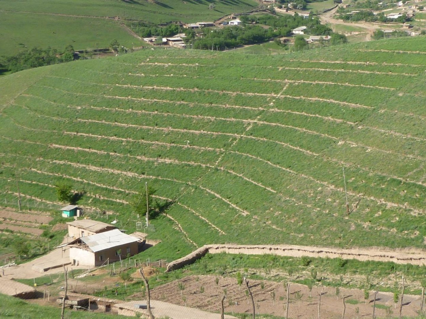
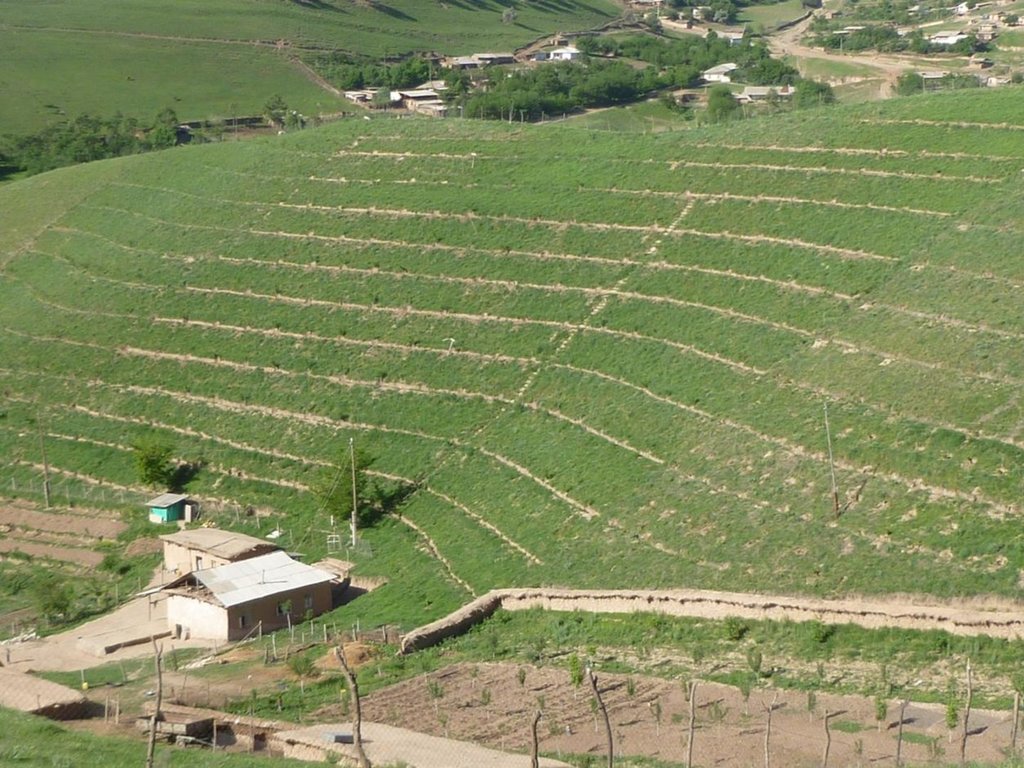
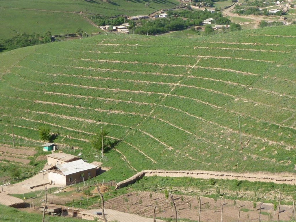
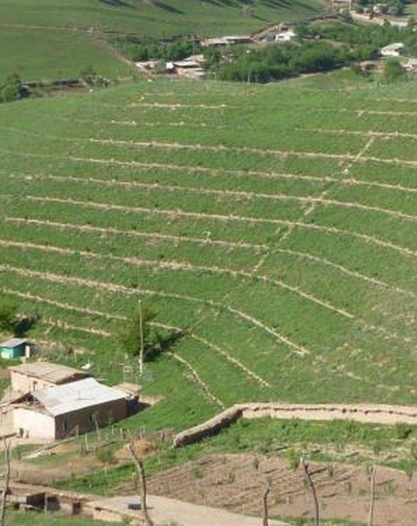
Use of the SLM technology facilitates the development of bench terraces from contour channels by gradually removing soil material up the slope for an estimated 5 years until the terraces on the slope reach a desired width of 1.2 m.
2.2 وصف تفصيلي للتقنية
الوصف:
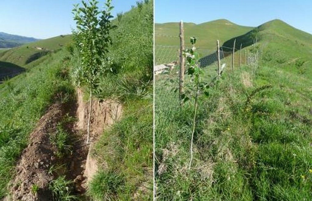
The SLM technology is thought to stop water run-off resulting in the prevention of damage to the top soil on steep slopes. This enables better distribution and infiltration of water into the soil. A complementing live fence, along with a metal net along the perimeter aim to stop livestock grazing. Contour ditches are planted in intervals with fruit trees, and the live fence is made of a combination of fire wood, trees and bushes. This combination makes possible the establishment of an agro forestry system on a slope in an area with limited irrigation using making use of the natural rainfall.
Details: 1. Ditches are dug out along the contour lines drawn by an "A" frame on the slope. 2. Seedlings are planted in 5 metre intervals, positioned right in the middle of the ditch. 3. The back wall behind each tree (upslope) has a half moon cutting to enable an even water/moisture supply. 4. The ditches are barriered with "septas" between two trees to trap water in the individual sections. 5. Horizontally across the ditches, the tree species vary, but vertically are homogeneous. 6. The strips between ditches are left free to enable natural grass to grow. 7. The residual soil material is mounted in front of the ditches in piles the width of a shovel. 8. The complementing perimeter live fence and metal net (1.5m height) is supported by wooden poles made of Acacia trees. (Assumed life span of poles is 25 years). 9. Improvised drip irrigation with 5 litre plastic bottles is used together with mulch coverage beneath the trees. 10. Species composition: apple, cherry, apricot, grape, walnut, pomegranate. In the garden; species of Acacia, Ailantus, dogroses and willow act as a live fence.
Purpose of the Technology: The aim of this system is to significantly reduce the water run-off that removes the top soil, and to subsequently prevent water erosion, and the formation/development of gullies. This can be achieved through the following methods; conserving the available resources and using them more efficiently, prevention overgrazing and improving the natural soil cover, as well as changing the type of land management towards a more sustainable and profitable one.
Establishment / maintenance activities and inputs: The plot was established on one side of a micro watershed. In mid February the contour lines were identified using an “A” frame. Digging of contour ditches then took until late February. The material was accumulated down the slope in deposits the width of a shovel to build a riser. At the beginning of March all the fruit tree seedlings were planted in the middle of the ditches. Perimeter fencing was constructed and live fence plants were planted up until late March. In May, the grass around the trees was cut and used for mulching beneath the trees. During June and July in the first year the plants needed watering 3 times a week which was done using a drip irrigation system with 5 litre plastic bottles. To help prevent the water heating and evaporating, the bottles were left under the mulch cover. Mulching and irrigation are repeated every dry and hot season. Every spring, the soil material is removed alongside the inner wall of the ditch just taking an amount that equals the width of a shovel, and accumulated down the slope to extend the riser. Materials required include: (1) Ditches: hand tools, stakes, rope, “A” frame, (2) Live fence: seedlings of Acacia, Ailantus, willow and dog rose, (3) Fencing: metal net, wooden poles, metal wire, (4) Cow dung, lime suspension, straw, mulch, plastic bottles.
Natural / human environment: The watershed can be characterised as follows: Hydrology - surface water is available only at times of rain and snow melt, this can be used for irrigation only. No sources of potable water exist. Soils are of loess type, as generally characteristic to the whole area. Flora - natural grasses prevail in the micro watershed, 9 species could be identified. Natural bushes and trees were completely removed due to high demand for fuelwood. Cultivation of rare tree varieties and household gardening was practiced in advance of the project. Fauna - Wild animals are often still seen such as turtles, lizards and snakes. Farm animals - mixed breeds of cattle, sheep and goats are very important. The households in this micro watershed area own almost 350 animals. The majority of these are kept for the summer season in adjacent pastures. The micro watershed was first inhabited in early 2000. Five households were established with a total of around 40 inhabitants. Family heads tend to be in their early 40s. Families have 7 to 9 members, including 5 to 7 children. All are of Tajik ethnicity, and Muslim, open to secular values. Of these 5 households, only 4 households have adopted the SLM technology. The fifth household only decided to join the project after witnessing their neighbour’s positive experiences. Both spouses tended to be involved in the activities. Both men and women took part in the training sessions and orientation meeting. However, it is likely that most decisions were made by the men, after the women had shared their ideas. Work load: providing the external inputs, construction and the heavy manual labour were done by the men. Maintenance work: watering, mulching and grass cutting was shared between men and women. Digging and fencing were performed in "hashars" - community labour groups. As women spend more time at home working within their households, they tend to perform more maintenance work on the plot compared to men. Other activities away from the farms are important to the family budget providing a means of extra income. This often includes men’s long term migration to Russia to find work.
2.3 صور التقنية
2.5 البلد/المنطقة/المواقع التي تم تنفيذ التقنية فيها والتي يغطيها هذا التقييم
البلد:
طاجيكستان
المنطقة/الولاية/المحافظة:
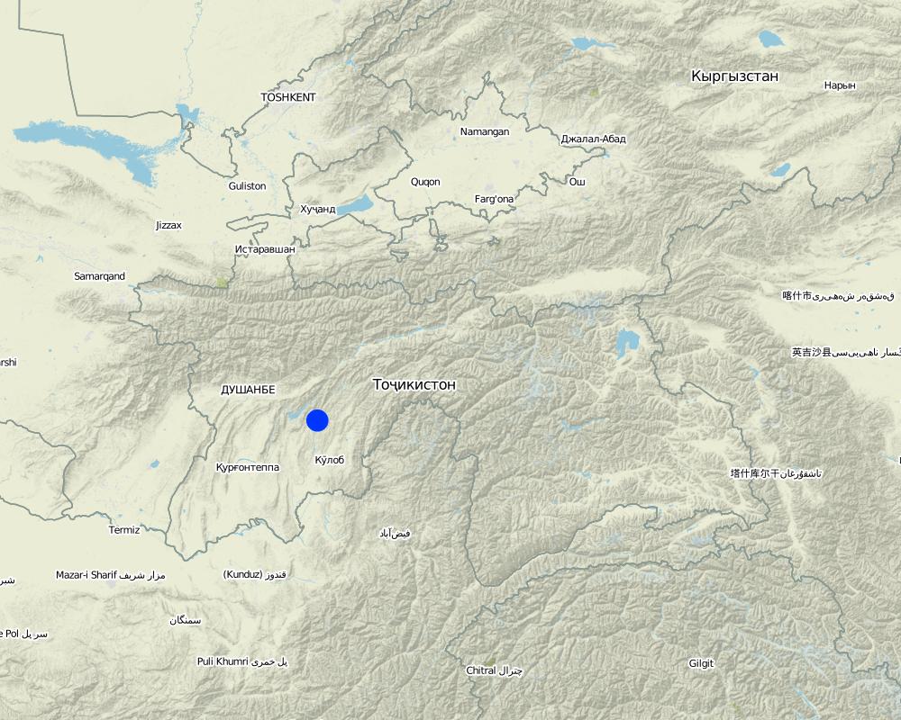
Tajikistan, Khatlon
مزيد من التفاصيل حول الموقع:
Baljuvon, Khirob
التعليقات:
Boundary points of the Technology area: North - 38.284233°N 69.639420°E
South - 38.278485°N 69.639555°E
East - 38.281854°N 69.641276°E
South - 38.281250°N 69.638009°E
Map
×2.6 تاريخ التنفيذ
في حالة عدم معرفة السنة بالتحديد، يرجى الإشارة إلى التاريخ التقريبي:
- منذ أقل من 10 سنوات (مؤخرًا)
2.7 إدخال التقنية
حدد كيف تم إدخال التقنية:
- من خلال المشاريع/ التدخلات الخارجية
3. تصنيف تقنية الإدارة المستدامي للأراضي
3.2 نوع (أنواع) استخدام الأراضي الحالية حيث يتم تطبيق التقنية

الأراضي الزراعية
- زراعة سنوية
- زراعة معمرة (غير خشبية)

أراضي الرعي
أراضي الرعي الواسع النطاق:
- الرعي المرتحل
- رعي شبه مرتحل
الرعي المكثف/ إنتاج الأعلاف:
- قطع وحمل / صفر مرعى
التعليقات:
Major land use problems (compiler’s opinion): Implementation of land tenure rights at a local level was also a major barrier.
Major land use problems (land users’ perception): There is a soil and water conservation project in place to manage water runoff, soil erosion and gully formation. Low land productivity only allows for wheat production with long fallow periods. Improper pasture management has led to overall overgrazing.
Nomadism: animals taken to summer pastures
Semi-nomadism / pastoralism: animal graze around villages
Ranching: no practice
Cut-and-carry/ zero grazing: almost extinct
Improved pasture: no practice at all
Clear felling of (semi-)natural forests: No selection in times of electricity cuts in winter season.
Forest products and services: timber, fuelwood, fruits and nuts, grazing / browsing, other forest products / uses (honey, medical, etc.), nature conservation / protection
Future (final) land use (after implementation of SLM Technology): Mixed: Mf: Agroforestry
Constraints of infrastructure network (roads, railways, pipe lines, power lines): no irrigation network, heavy transports costs
إذا تغير استخدام الأراضي بسبب التقنية، قم بالإشارة إلى استخدام الأرض قبل تنفيذ التقنية:
Grazing land: Ge: Extensive grazing land
3.3 مزيد من المعلومات حول استخدام الأراضي
التعليقات:
Water supply: rainfed, mixed rainfed - irrigated, rainfed
Water supply: post-flooding
post-flooding
عدد مواسم الزراعة في السنة:
- 1
حدد:
Longest growing period in days: 180Longest growing period from month to month: March - August
كثافة الثروة الحيوانية (إذا كانت ذات صلة):
50-100 LU /km2
3.5 انتشار التقنية
التعليقات:
Total area covered by the SLM Technology is 0.112 m2.
The application of the SLM technology is planned for the whole micro watershed which has a total area of 0.112 km2. Currently it has been impemented in 0.07km2 of this watershed.
3.6 التدابير التقنية في مجال إلادارة المستدامة للأراضي

التدابير الزراعية
- A1: الغطاء النباتي/التربة

التدابير النباتية
- V1: غطاء من الأشجار والشجيرات

التدابير البنيوية
- S1: المصاطب المتدرجة

التدابير الإدارية
- M1: التغيير في نوع استخدام الأراضي
التعليقات:
Main measures: agronomic measures, vegetative measures, structural measures, management measures
Type of agronomic measures: mixed cropping / intercropping, contour planting / strip cropping, mulching, legume inter-planting, manure / compost / residues, zero tillage / no-till, pits
Type of vegetative measures: aligned: -contour, aligned: -graded strips *<sup>3</sup>, aligned: -along boundary
3.7 الأنواع الرئيسية من تدهور الأراضي التي تناولتها التقنية

تآكل التربة بالمياه
- الوزن(Wt): فقدان التربة السطحية/تآكل السطح
- (Wg):الانجراف الخلجاني/ الخلجان

التدهور البيولوجي
- (Bc): تناقص الغطاء النباتي
التعليقات:
Main causes of degradation: soil management (Tillage on steep slope >35%.), deforestation / removal of natural vegetation (incl. forest fires) (Natural tree and shrubs removed completely.), over-exploitation of vegetation for domestic use, overgrazing (Stocking rates do exceed the standards in multiple times), disturbance of water cycle (infiltration / runoff) (Run-off is induced by maximum removal of vegetation cover.), land tenure (Unclear land right situation induces irresponsible attitudes.), inputs and infrastructure: (roads, markets, distribution of water points, other, …) (Very limited infrastructure development, vital infrastructure points are a long distance away.)
Secondary causes of degradation: Heavy / extreme rainfall (intensity/amounts) (Induces gully formation and mass movement.), droughts (If vegetation is dry then less soil cover is provided.), other natural causes (avalanches, volcanic eruptions, mud flows, highly susceptible natural resources, extreme topography, etc.) specify (The gradient is over 30%.), population pressure (Large family sizes, and high growth rates causes increased need for food and living space in the area.), poverty / wealth (Very limited financial power to develop the land.), labour availability (Though cheap labour is available, it takes much effort to organise communities to work together for SLM activities.), education, access to knowledge and support services (Basic schooling of children, no state provided extension or training after school age.), war and conflicts (The after-effects of recent civil war still have some influence.), governance / institutional (Communist attitudes still persist, very slow institutional development.)
3.8 منع أو حد أو عكس تدهور الأراضي
التعليقات:
Main goals: prevention of land degradation
Secondary goals: mitigation / reduction of land degradation, rehabilitation / reclamation of denuded land
4. المواصفات الفنية، وأنشطة التنفيذ، والمدخلات، والتكاليف
4.1 الرسم الفني للتقنية
4.2 المواصفات الفنية/شروحات الرسم الفني
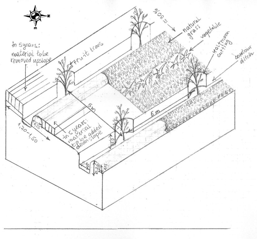
The drawing shows the contour ditches on a slope with a 25 - 30 % steepness. The gradient is 3-5%.
Vertically, the contour ditches are spaced at 5 m intervals. The upper left part of the drawing shows how the material on the slope will be removed in portions during the five years to create a levelled terrace. The ditches are planted with fruit trees, and strips of natural grass cover the space between the ditches. In the middle line of the strips in the bottom part of the plot the farmer has grown vegetables.
Location: Khirob village. Baljuvon/ Khatlon/ Tajikistan
Date: 06.05.2011
Technical knowledge required for field staff / advisors: high (Specific knowledge needed in the issues of integrated watershed management and technology.)
Technical knowledge required for land users: moderate (Training needed in terms of technology, planning and implementation of activities.)
Main technical functions: control of dispersed runoff: retain / trap, reduction of slope angle, increase of infiltration, promotion of vegetation species and varieties (quality, eg palatable fodder)
Secondary technical functions: control of dispersed runoff: impede / retard, improvement of ground cover, increase of surface roughness, improvement of topsoil structure (compaction), stabilisation of soil (eg by tree roots against land slides), increase / maintain water stored in soil, water harvesting / increase water supply, water spreading, increase of biomass (quantity), spatial arrangement and diversification of land use
Mixed cropping / intercropping
Material/ species: Growing a few tomatoes and paprica on the bottom strips.
Quantity/ density: 4plants m2
Remarks: Down slope alongside the ditches.
Contour planting / strip cropping
Material/ species: Wild vegetation is left to grow.
Quantity/ density: very dense
Remarks: Over 9 species counted on the plot all palatable, cut for hay and mulch.
Mulching
Material/ species: Mulching from natural grass, over 9 species.
Remarks: Ditches and trees covered beneath.
Legume inter-planting
Quantity/ density: 2 raisers.
Remarks: As a test to cover raiser surface.
Manure / compost / residues
Material/ species: Cattle dung suspended in water.
Quantity/ density: Once.
Remarks: Applied while planting the trees.
Zero tillage / no-till
Material/ species: No tillage for intercropping completed.
Pits
Material/ species: Pits were dug to plant seedlings.
Aligned: -contour
Vegetative material: T : trees / shrubs
Number of plants per (ha): 400
Vertical interval between rows / strips / blocks (m): 5
Spacing between rows / strips / blocks (m): 5
Vertical interval within rows / strips / blocks (m): 5
Width within rows / strips / blocks (m): 5
Aligned: -graded strips
Vegetative material: G : grass
Number of plants per (ha): na
Vertical interval between rows / strips / blocks (m): 1
Spacing between rows / strips / blocks (m): 3
Aligned: -along boundary
Vegetative material: T : trees / shrubs
Number of plants per (ha): 400
Spacing between rows / strips / blocks (m): 1
Trees/ shrubs species: Ailantus, Acacia, dog rose, willow, poplar
Fruit trees / shrubs species: Apple, grape, pear, apricot, cherry, pomegranate, mulberry, walnut
Perennial crops species: little alfalfa and espercet
Grass species: 9 naturally growing species
Slope (which determines the spacing indicated above): 30.00%
Gradient along the rows / strips: 25.00%
Retention/infiltration ditch/pit, sediment/sand trap
Vertical interval between structures (m): 5
Spacing between structures (m): 5
Depth of ditches/pits/dams (m): 0.3
Width of ditches/pits/dams (m): 0.25
Height of bunds/banks/others (m): 0.15
Width of bunds/banks/others (m): 0.25
Terrace: bench level
Vertical interval between structures (m): 3.50-3.80
Height of bunds/banks/others (m): 0.25
Width of bunds/banks/others (m): 1.20-1.50
Construction material (earth): the earth is removed upslope and added downslope to the front bank (raiser)
Slope (which determines the spacing indicated above): 25-30%
Lateral gradient along the structure: 3-5%
Vegetation is used for stabilisation of structures.
Change of land use type: Communal pasture land was turned into an agroforestry system
Change of land use practices / intensity level: Self subsistance, market orientated agroforestry system
Layout change according to natural and human environment: Along the contour lines of the slope
Major change in timing of activities: Major seasonal activities in three seasons: spring agronomic and vegetative measures, summer and autumn yield harvesting, clearing the branches
4.3 معلومات عامة بخصوص حساب المدخلات والتكاليف
عملة أخرى/ عملة وطنية (حدد):
Somoni
أشر إلى سعر الصرف من الدولار الأمريكي إلى العملة المحلية (إذا كان ذا صلة): 1 دولار أمريكي =:
4,5
اذكر متوسط تكلفة أجر العمالة المستأجرة في اليوم الواحد:
5.00
4.4 أنشطة التأسيس
| النشاط | نوع التدبير | التوقيت | |
|---|---|---|---|
| 1. | Planting seedlings in contour ditches | نباتية | February-March |
| 2. | Planting seedlings and bushes along the perimeter | نباتية | March |
| 3. | Cost of seedlings: frutiouse and firewood trees | نباتية | February -March |
| 4. | Gradual terracing by Broadening the ditch onslope and extending the raiser downslope | بنيوية أو هيكلية | every spring during 5 years |
| 5. | Membership fees | إدارية | |
| 6. | Attending the training | إدارية | |
| 7. | Management of staff | إدارية | |
| 8. | Taxes | إدارية | |
| 9. | Membership fees | إدارية | |
| 10. | None |
4.5 التكاليف والمدخلات اللازمة للتأسيس
| تحديد المدخلات | الوحدة | الكمية | التكاليف لكل وحدة | إجمالي التكاليف لكل مدخل | % من التكاليف التي يتحملها مستخدمو الأراضي | |
|---|---|---|---|---|---|---|
| العمالة | Labour | 1,0 | 355,0 | 355,0 | 100,0 | |
| العمالة | Mulching | 1,0 | 4,5 | 4,5 | 100,0 | |
| العمالة | Planting seedlings in contour ditches | person days | 20,0 | 4,4 | 88,0 | 100,0 |
| العمالة | Planting seedlings and bushes along the perimeter | person days | 10,0 | 4,4 | 44,0 | 100,0 |
| معدات | Set of shovels, hoes, picks | Set | 1,0 | 66,0 | 66,0 | 50,0 |
| المواد النباتية | mulching | 1,0 | 4,5 | 4,5 | 100,0 | |
| المواد النباتية | seedlings | 1,0 | 333,0 | 333,0 | 50,0 | |
| المواد النباتية | Seedlings: frutiouse and firewood trees | ha | 500,0 | 0,666 | 333,0 | 50,0 |
| مواد البناء | Wood frame | Piece | 1,0 | 3,0 | 3,0 | 100,0 |
| غير ذلك | Labour: Gradual terracing by Broadening the ditch onslope and extending the raiser downslope | person days | 150,0 | 0,68 | 102,0 | 100,0 |
| إجمالي تكاليف إنشاء التقنية | 1333,0 | |||||
التعليقات:
Number of parties sharing for Mulching, tools, labour and a wood frame: 5
Lifespan for tools and wood frame: 5 years
Life span of mulching: 3 years
4.6 الصيانة/الأنشطة المتكررة
| النشاط | نوع التدبير | التوقيت/الوتيرة | |
|---|---|---|---|
| 1. | Drip irrigation with plastic bottles | زراعية | first 3 years |
| 2. | Mulching | زراعية | once a year |
| 3. | Shaping the trees, cutting branches | نباتية | Autumn |
| 4. | Shaping the trees, cutting branches | نباتية | Autumn |
| 5. | Grafting | نباتية | March |
| 6. | Manuring | نباتية | March |
| 7. | None | None |
4.7 التكاليف والمدخلات اللازمة للصيانة/للأنشطة المتكررة (سنويًا)
| تحديد المدخلات | الوحدة | الكمية | التكاليف لكل وحدة | إجمالي التكاليف لكل مدخل | % من التكاليف التي يتحملها مستخدمو الأراضي | |
|---|---|---|---|---|---|---|
| العمالة | Drip irrigation with plastic bottles | person days | 15,0 | 4,44 | 66,6 | 100,0 |
| العمالة | Mulching | person days | 5,0 | 4,44 | 22,2 | 100,0 |
| العمالة | Shaping the trees, cutting branches | person days | 5,0 | 4,44 | 22,2 | 100,0 |
| العمالة | Grafting | person days | 5,0 | 4,44 | 22,2 | 100,0 |
| المواد النباتية | mulching | 1,0 | 22,0 | 22,0 | 100,0 | |
| غير ذلك | Labour: Manuring | person days | 3,0 | 4,4 | 13,2 | 100,0 |
| إجمالي تكاليف صيانة التقنية | 168,4 | |||||
التعليقات:
Labour costs apply to the cultivation of the whole 7ha plot.
4.8 أهم العوامل المؤثرة على التكاليف
قدم وصفا لأهم العوامل التي تؤثر على التكاليف:
The most affecting factors were the high cost inputs for construction material which usually has to be imported into the area: Fuel, metal nets for fencing, cement, etc.
5. البيئة الطبيعية والبشرية
5.1 المناخ
هطول الأمطار السنوي
- < 250 مم
- 251- 500 ملم
- 501 - 750ملم
- 1,000-751 ملم
- 1,500-1,100 ملم
- 2,000-1,500 ملم
- 3,000-2,001 ملم
- 4,000-3,100 ملم
- > 4000 ملم
المواصفات/التعليقات على هطول الأمطار:
Summer, >120 dry days
250-500 mm
Late summer, late autumn, rain prevails until the late autumn
500-750 mm
Late autumn mid spring, rain, snow.
750-1000 mm
avarage annual, usually up to 800mm
1000-1500 mm
not often, 1000mm heppen in single years
المنطقة المناخية الزراعية
- شبه قاحلة
Thermal climate class: temperate. winters with possible extreme cold, warm summers, with hot spells in July August
5.2 طوبوغرافيا
متوسط الانحدارات:
- مسطح (0-2%)
- بسيط (3-5%)
- معتدل (6-10%)
- متدحرج (11-15%)
- تلال (16-30%)
- شديدة الانحدار(31-60%)
- فائقة الانحدار (>60%)
التضاريس:
- هضاب/سهول
- أثلام مرتفعة
- المنحدرات الجبلية
- منحدرات التلال
- منحدرات في السفوح
- قاع الوادي
المنطقة الارتفاعية:
- 100-0 متر فوق سطح البحر
- 500-101 متر فوق سطح البحر
- 1,000-501 متر فوق سطح البحر
- 1,500-1,001 متر فوق سطح البحر
- 2,000-1,501 متر فوق سطح البحر
- 2,500-2,100 متر فوق سطح البحر
- 3,000-2,501 متر فوق سطح البحر
- 4,000-3,001 متر فوق سطح البحر
- > 4000 متر فوق سطح البحر
وضح ما إذا كانت التقنية مطبقة على وجه التحديد في:
- غير ذات صلة
التعليقات والمواصفات الإضافية بشأن التضاريس:
hilly area, located on the foot of Vakhsh mountain range; micro watersheds feeding the bigger watershed of the Kyzylsu river
5.3 التربة
متوسط عمق التربة:
- ضحل جدًا (0-20 سم)
- ضحلة (21-50 سم)
- متوسطة العمق (51-80 سم)
- عميقة (81-120 سم)
- عميقة جدًا (> 120 سم)
قوام التربة (التربة السطحية):
- متوسط ( طميي، سلتي)
المواد العضوية في التربة السطحية:
- متوسطة (1-3%)
- منخفضة (<1%)
5.4 توافر المياه ونوعيتها
منسوب المياه الجوفية:
50-5 م
توافر المياه السطحية:
متوسط
نوعية المياه (غير المعالجة):
للاستخدام الزراعي فقط (الري)
5.5 التنوع البيولوجي
تنوع الأنواع:
- متوسط
5.6 خصائص مستخدمي الأراضي الذين يطبقون التقنية
الدخل من خارج المزرعة:
- 10-50% من جميع الإيرادات
المستوى النسبي للثروة:
- ضعيف جدا
- ضعيف
أفراداً أو مجموعات:
- فرد/أسرة معيشية
الجنس:
- رجال
اذكر الخصائص الأخرى ذات الصلة لمستخدمي الأراضي:
Land users applying the Technology are mainly common / average land users
Difference in the involvement of women and men: Very few women are trusted to run a farm or make decisions about land use. Usually women have taken leading roles only if the men leave the family for long term migration, or have died. Only 8 women in the whole district are farm owners out of the total of 350 existing farms.
Women's involvement and level of freedom given to them are influenced by existing patriarchal values, and in many areas women often remain unaware of their rights.
Population density: 10-50 persons/km2
Annual population growth: 1% - 2%
3% of the land users are very rich and own 20% of the land.
5% of the land users are rich and own 10% of the land.
10% of the land users are average wealthy and own 40% of the land.
60% of the land users are poor and own 20% of the land.
22% of the land users are poor and own 10% of the land.
Off-farm income specification: Complemented by salary from state job, NGO activity, transport service and construction work in capital town and other regions, labour migration to Russia.
Market orientation of production system: subsistence (self-supply), subsistence (self-supply), subsistence (self-supply), mixed (subsistence/ commercial, mixed (subsistence/ commercial, commercial/ market
5.7 متوسط مساحة الأرض المملوكة أو المستأجرة من قبل مستخدمي الأراضي الذين يطبقون التقنية
- < 0.5 هكتارا
- 0.5 - 1 هكتار
- 1 -2 هكتار
- 2 - 5 هكتار
- 5 - 15 هكتار
- 15 - 50 هكتار
- 50 - 100هكتار
- 500-100 هكتار
- 1,000-500 هكتار
- 10,000-1,000 هكتار
- > 10,000 هكتار
هل يعتبر هذا نطاقًا صغيرًا أو متوسطًا أو واسعا (في إشارة إلى السياق المحلي)؟:
- على نطاق صغير
التعليقات:
Average area of land owned or leased by land users applying the Technology: < 0.5 ha, 0.5-1 ha, 1-2 ha, 2-5 ha, 5-15 ha, 5-15 ha, 15-50 ha
5.8 ملكية الأراضي، وحقوق استخدام الأراضي، وحقوق استخدام المياه
ملكية الارض:
- دولة
5.9 الوصول إلى الخدمات والبنية التحتية
الصحة:
- ضعيف
- معتدل
- جيد
التعليم:
- ضعيف
- معتدل
- جيد
المساعدة التقنية:
- ضعيف
- معتدل
- جيد
العمل (على سبيل المثال خارج المزرعة):
- ضعيف
- معتدل
- جيد
الأسواق:
- ضعيف
- معتدل
- جيد
الطاقة:
- ضعيف
- معتدل
- جيد
الطرق والنقل:
- ضعيف
- معتدل
- جيد
مياه الشرب وخدمات الصرف الصحي:
- ضعيف
- معتدل
- جيد
الخدمات المالية:
- ضعيف
- معتدل
- جيد
6. الآثار والتصريحات الختامية
6.1 الآثار التي أظهرتها التقنية في الموقع
الآثار الاجتماعية والاقتصادية
الإنتاج
إنتاج الأعلاف
الكمية قبل الإدارة المستدامة للأراضي:
very little fodder could be collected
الكمية بعد الإدارة المستدامة للأراضي:
cut and carry fodder production
جودة العلف
إنتاج حيواني
إنتاج الخشب
الكمية قبل الإدارة المستدامة للأراضي:
not possible
الكمية بعد الإدارة المستدامة للأراضي:
may cover 40 -50 percent of HH need only in 5 year
خطر فشل الإنتاج
الكمية قبل الإدارة المستدامة للأراضي:
no
الكمية بعد الإدارة المستدامة للأراضي:
yes
تنوع المنتج
الكمية بعد الإدارة المستدامة للأراضي:
yes
منطقة الإنتاج
الكمية قبل الإدارة المستدامة للأراضي:
no
الكمية بعد الإدارة المستدامة للأراضي:
yes
إدارة الأراضي
الكمية بعد الإدارة المستدامة للأراضي:
yes
توليد الطاقة
الدخل والتكاليف
دخل المزرعة
الكمية قبل الإدارة المستدامة للأراضي:
no
الكمية بعد الإدارة المستدامة للأراضي:
yes
تنوع مصادر الدخل
الكمية قبل الإدارة المستدامة للأراضي:
no
الكمية بعد الإدارة المستدامة للأراضي:
yes
عبء العمل
الآثار الاجتماعية والثقافية
الأمن الغذائي / الاكتفاء الذاتي
الوضع الصحي
الفرص الترفيهية
المؤسسات المجتمعية
المؤسسات الوطنية
المعرفة بالإدارة المستدامة للأراضي/تدهور الأراضي
الآثار الايكولوجية
دورة المياه / الجريان السطحي
الجريان السطحي
التبخر
التربة
رطوبة التربة
غطاء التربة
فقدان التربة
تراص التربة
التنوع البيولوجي: الغطاء النباتي، الحيوانات
الكتلة الحيوية/ طبقة الكربون فوق التربة
التنوع النباتي
مكافحة الآفات/الأمراض
الحد من مخاطر المناخ والكوارث
انبعاث الكربون والغازات المسببة للاحتباس الحراري
خطر الحريق
سرعة الرياح
6.2 الآثار التي أظهرتها التقنية خارج الموقع
الفيضان في اتجاه مجرى النهر
القدرة على التخفيف / الترشيح
الرواسب المنقولة بواسطة الرياح
الأضرار التي لحقت بحقول الجيران
6.3 تعرض التقنية وحساسيتها لتغير المناخ التدريجي والظواهر المتطرفة/الكوارث المرتبطة بالمناخ (كما يراها مستخدمو الأراضي)
تغير مناخ تدريجي
تغير مناخ تدريجي
| الموسم | نوع التغير المناخي/ المتطرف | كيف تتعامل التقنية مع ذلك؟ | |
|---|---|---|---|
| درجة الحرارة السنوية | زيادة | ليس جيدا |
الظواهر المتطرفة / الكوارث المرتبطة بالمناخ
الكوارث الجوية
| كيف تتعامل التقنية مع ذلك؟ | |
|---|---|
| عاصفة ممطرة محلية | ليس جيدا |
| عاصفة هوائية محلية | جيدا |
الكوارث المناخية
| كيف تتعامل التقنية مع ذلك؟ | |
|---|---|
| جفاف | ليس جيدا |
الكوارث الهيدرولوجية
| كيف تتعامل التقنية مع ذلك؟ | |
|---|---|
| فيضان عام (نهر) | جيدا |
العواقب الأخرى المتعلقة بالمناخ
العواقب الأخرى المتعلقة بالمناخ
| كيف تتعامل التقنية مع ذلك؟ | |
|---|---|
| انخفاض فترة النمو | جيدا |
6.4 تحليل التكلفة والعائد
كيف يمكن مقارنة العوائد نسبة لتكاليف الإنشاء (من وجهة نظر مستخدمي الأراضي)؟
عوائد قصيرة الأجل:
سلبي قليلا
عوائد طويلة الأجل:
إيجابي
كيف تتم مقارنة العوائدمع كلفة الصيانة/التكاليف المتكررة (من وجهة نظر مستخدمي الأراضي)؟
عوائد قصيرة الأجل:
سلبي قليلا
عوائد طويلة الأجل:
إيجابي
6.5 اعتماد التقنية
التعليقات:
100% of land user families have adopted the Technology with external material support
4 land user families have adopted the Technology with external material support
Comments on acceptance with external material support: Project subsidised only 50% of material inputs.
Comments on adoption trend: Metal for the net was costly- farmers had to convince the project to subsidise prior to adoption, otherwise would reject adopting (area has high risk of crop damage- high livestock density, grazing not controlled).
Year following implementation: 3 farmers in neighbourhood have adopted on own funds; much more are willing to adopt, but need external support
6.7 نقاط القوة / المزايا / الفرص التي توفرها التقنية
| نقاط القوة/ المزايا/ الفرص من وجهة نظر مستخدمي الأراضي |
|---|
| It helped to acquire more land user rights. |
| Land users feel they have an increased status in local society. |
|
It has good potential for replication in other areas. How can they be sustained / enhanced? It would be better if the more expensive parts of the input were subsidised. |
| Good long term perspectives for improvement of livelihoods. |
| It allows a positive long term change in household provision regarding food, employment and energy sources, allowing more spare time for cultural events and education. |
| نقاط القوة/ المزايا/ الفرص من وجهة نظر جامع المعلومات أو غيره من الاشخاص الرئيسيين لمصدر المعلومات |
|---|
| It made possible the change to more sustainable land management techniques. |
| The technology is well suited to the sloping landscape and is easy to adopt. |
| The technology allows the use of locally available materials, and has low maintenance costs. |
|
It fits well to the local needs for land reclamation and conservation, and sits within the legislative frameworks. How can they be sustained / enhanced? There has been a recent state decree to encourage promotion of orchard development. |
|
It has a positive effect on the areas downstream. How can they be sustained / enhanced? Prior to implementation of the technology, areas downstream were often were damaged by floods. |
6.8 نقاط ضعف / مساوىء / مخاطر التقنية وسبل التغلب عليها
| نقاط الضعف/ المساوىء/ المخاطر من وجهة نظر مستخدم الأراضي | كيف يمكن التغلب عليها؟ |
|---|---|
| It needed some immediate on-site adjustments when structuring the half moon cuttings in the contour ditches. | The farmer's opinion should be considered during the adoption of the technology, and to assist with any changes made. |
| It caused some disagreements between the farmers and the consultant over what part of the material input should be subsidised. | The consultant should try to ensure they understand the social and economic factors affecting the locals. |
| نقاط الضعف/ المساوىء/ المخاطر من وجهة نظر جامع المعلومات أو غيره من الاشخاص الرئيسيين لمصدر المعلومات | كيف يمكن التغلب عليها؟ |
|---|---|
| Needs more until the final structure is finished | This depends on the length and intensity of any precipitation/drought/dry spells etc. |
| It is a new technology in this area so will need some time to be proven effective. | |
| External knowledge is needed for the establishment and maintainance of the technology. | |
| Extra workers are needed for the complementary drip irrigation - child labour is often used for this. |
7. المراجع والروابط
7.2 المراجع للمنشورات المتاحة
العنوان، المؤلف، السنة، النظام القياسي الدولي لترقيم الكتب ISBN:
Scetch map of Khirob Microwatershed
متاح من أين؟كم التكلفة؟:
DWHH Baljuvon Office
العنوان، المؤلف، السنة، النظام القياسي الدولي لترقيم الكتب ISBN:
Interim Narrative Report 01.05.2009-30.04.2010 Project TAJ 1068
متاح من أين؟كم التكلفة؟:
DWHH Baljuvon Office
العنوان، المؤلف، السنة، النظام القياسي الدولي لترقيم الكتب ISBN:
Grant Application Form to EU Commision: "Individual incomes & Improving Living Standards in Khatlon and Sughd Regions", Tajikistan
متاح من أين؟كم التكلفة؟:
DWHH Regional Office, Dushanbe mail to:
الروابط والوحدات المواضيعية
توسيع الكل طي الكلالروابط
لا يوجد روابط
الوحدات المواضيعية
لا يوجد وحدات مواضيعية


