Sub-Sarface Dams (SSD) [كينيا]
- تاريخ الإنشاء:
- تحديث:
- جامع المعلومات: Guyo Roba
- المحرر: –
- المُراجع: Rima Mekdaschi Studer
technologies_3340 - كينيا
- Sub-Sarface Dams (SSD): 22 يونيو، 2018 (inactive)
- Sub-Sarface Dams (SSD): 7 مايو، 2018 (inactive)
- Sub-Sarface Dams (SSD): 17 يوليو، 2018 (inactive)
- Sub-Sarface Dams (SSD): 15 أغسطس، 2018 (inactive)
- Sub-Surface Dams (SSD): 5 ديسمبر، 2018 (inactive)
- Sub-Sarface Dams (SSD): 3 سبتمبر، 2018 (inactive)
- Sub-Surface Dams (SSD): 2 نوفمبر، 2021 (public)
عرض الأقسام
توسيع الكل طي الكل1. معلومات عامة
1.3 الشروط المتعلقة باستخدام البيانات الموثقة من خلال WOCAT
متى تم تجميع البيانات (ميدانيا)؟:
11/01/2018
يوافق جامع المعلومات والشخص (لاشخاص) الرئيسي لمصدر المعلومات على الشروط المتعلقة باستخدام البيانات الموثقة من خلال WOCAT:
نعم
1.4 إعلان بشأن استدامة التقنية الموصوفة
هل التقنية الموصوفة هنا تمثل مشكلة فيما يتعلق بتدهور الأراضي، بحيث لا يمكن إعلانها تقنية مستدامة لإدارة الأراضي؟:
كلا
2. وصف تقنيةالإدارة المستدامي للأراضي
2.1 وصف مختصر للتقنية
تعريف التقنية:
These are constructions stretching across the sand filled dry riverbed, down towards the impermeable floor of the riverbed. They are totally submerged into the ground. For example by fully covering after construction by sand. This are done along dry rivers with huge sand deposits, which has high yield potential and where water can be easily extracted. The aim is to raise groundwater tables and increase the storage capacity for water withdrawals.
2.2 وصف تفصيلي للتقنية
الوصف:
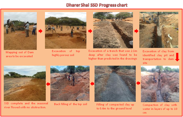
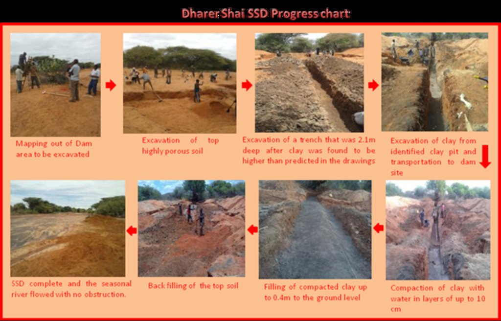
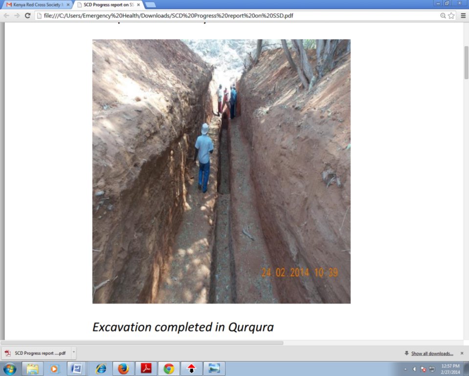
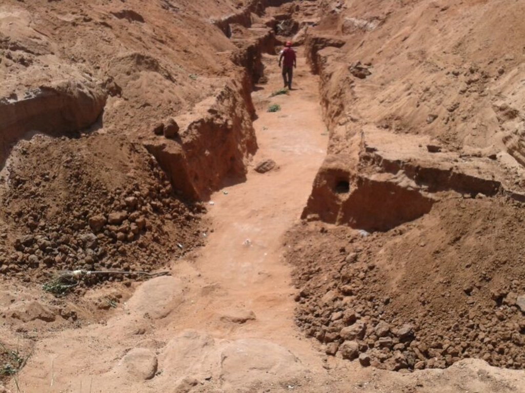
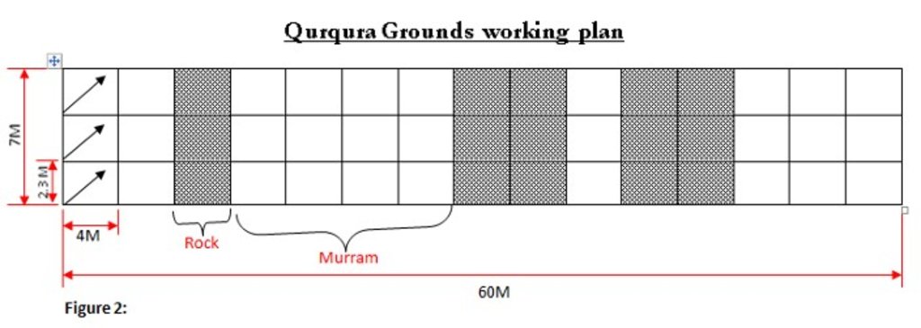
The technology is applied in northern rangeland of Isiolo County which is managed under communal management systems. The technology involves soil excavation which are typically subdivided into a number of square chambers measuring 4X2.3X2.2= 20.2M3 (not to scale). Then, excavation and transportation of clay soil from the clay pit and final compaction of clay soil after approximately a week, and lying out of the concrete and refilling of the sand. Finally, a liner is placed. The technology functions as underground water storage infrastructure. The development of Sub-Surface Dams (SSDs) was done through Cash for Work program where local labours comprising of 40-50 persons are engaged in excavation, compactions and developing the liners. Typical activities include, excavation of top porous soil, excavation of sample pits within the excavated area, checking filtration rates of soil, compaction of soil on which dam liners are laid, smoothing the sharp liners along which the dam liners are laid, making grooves to anchor the dam liner, laying the dam liner, anchoring the dam liner with a mixture of cement, water proof and sand with water (motor) and finally drying of the motor and filling back of sand. The technology aim to improve water access for livestock in ways that support wider management and utilization of the rangeland and as such strength the resilience of pastoralists to droughts. Inputs such as farm tools like jembe, panga, spades and human labour are required to develop SSD. The technology improves water supply/availability, thereby extending the period of livestock grazing in areas where typically water is depleted before the pasture. This effectively gives pastoral groups, an extra grazing time (typically 2 extra months) that is not too long to lead to land degradation through over-grazing but long enough to enable pastoralist utilize the remaining pasture in wet season grazing areas. In so doing, the technology enable balanced use of vast communal lands without livestock retreating to dry season grazing areas. The extended grazing period is instrumental in building resilience of pastoral communities in the face of climate variability. The technology was instrumental in fostering both balanced utilization of land and strengthening sustainable use of the vast rangeland by moderating the mobility between wet season and dry season grazing areas. The water stored through the technology stays longer, in this case study, the water lasted for 5 months after the end of the rainy season. Normally, the water is depleted within 2 months after the rainy period. The technology is also cheap and easy to understand and construct (especially in areas with clay as the underlying impermeable material) with a possibility of the communities to be taught how to identify suitable site and the entire process of construction. However, in areas without clay soil, the excavation of clay and transportation can be labour intensive and expensive.
2.3 صور التقنية
2.5 البلد/المنطقة/المواقع التي تم تنفيذ التقنية فيها والتي يغطيها هذا التقييم
البلد:
كينيا
المنطقة/الولاية/المحافظة:
Northern Kenya
مزيد من التفاصيل حول الموقع:
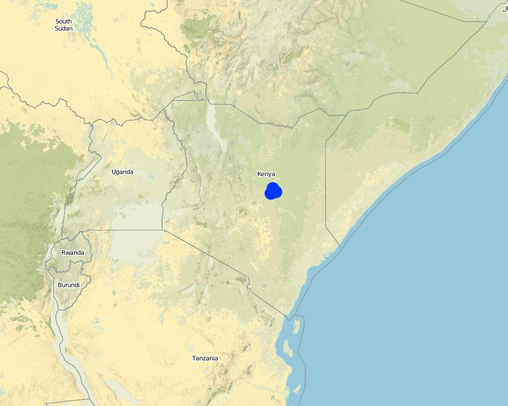
Garba Tula, Isiolo County
Map
×2.7 إدخال التقنية
حدد كيف تم إدخال التقنية:
- من خلال المشاريع/ التدخلات الخارجية
3. تصنيف تقنية الإدارة المستدامي للأراضي
3.1 الغرض الرئيسي ( الأغراض الرئيسية) للتقنية
- تحسين الإنتاج
- الحد من تدهور الأراضي ومنعه وعكسه
- التخفيف من تغير المناخ وآثاره
- خلق أثر اقتصادي مفيد
- خلق أثر اجتماعي مفيد
3.2 نوع (أنواع) استخدام الأراضي الحالية حيث يتم تطبيق التقنية

أراضي الرعي
أراضي الرعي الواسع النطاق:
- رعي شبه مرتحل
التعليقات:
Communal grazing area that is shared by 2 and more pastoral groups
3.3 مزيد من المعلومات حول استخدام الأراضي
إمدادات المياه للأرض التي يتم تنفيذ التقنية عليها:
- بعلية
كثافة الثروة الحيوانية (إذا كانت ذات صلة):
Fluctuates, depending on seasons and pasture availability
3.4 مجموعةالإدارة المستدامة للأراضي التي تنتمي إليها هذه التقنية
- الرعي وإدارة المراعي
3.5 انتشار التقنية
حدد انتشار التقنية:
- يتم تطبيقها في نقاط محددة/ تتركز على مساحة صغيرة
التعليقات:
Sub-Surface Dams are only suitable in areas along the river, with suitable density of sand deposits
3.6 التدابير التقنية في مجال إلادارة المستدامة للأراضي

التدابير البنيوية
- S5: السدود، الأحواض الصغيرة، البرك
3.7 الأنواع الرئيسية من تدهور الأراضي التي تناولتها التقنية

آخر
التعليقات:
Mismatch of pasture and water resources - there are areas where pastures are plenty but surface rain water is depleted earlier than pasture.
3.8 منع أو حد أو عكس تدهور الأراضي
تحديد هدف التقنية فيما يتعلق بتدهور الأراضي:
- منع تدهور الأراضي
- الحد من تدهور الأراضي
التعليقات:
The SSD technology increase water availability is period immediately after the rain, hence ensuring better pasture utilization and more sustainable use of land
4. المواصفات الفنية، وأنشطة التنفيذ، والمدخلات، والتكاليف
4.1 الرسم الفني للتقنية
4.2 المواصفات الفنية/شروحات الرسم الفني
The SSD has initial excavation works. The construction of the SSD was constructed by 50 laborers. The design attached represent an Aerial view of the area of excavation that is subdivided into 45 square chambers of 4X2.3X2.2= 20.2M3 (not to scale). Each of the chambers were excavated by 5 laborers. The estimated time for excavation as per the plan was estimated to be five days. Excavation and transportation of the clay from the clay pit was estimated to take an approximate of five days while the compacting of the clay will follow one week later, and laying out of the concrete and refilling of the sand for another week. The liner will then be finally placed. in summary, the excavation of sand takes 5days, and the excavation of clay soil takes another 5days while concrete placing, compacting of clay as well as putting of liner and refilling of sand takes 10 days.
4.3 معلومات عامة بخصوص حساب المدخلات والتكاليف
اذكر متوسط تكلفة أجر العمالة المستأجرة في اليوم الواحد:
3.5 USD per day
4.4 أنشطة التأسيس
| النشاط | نوع التدبير | التوقيت | |
|---|---|---|---|
| 1. | Removing sand over dyke and Man-days for excavating and transporting soil to dam site | تدابير أخرى | 21 days for 45 casual labourers |
| 2. | Building and compaction soil in dam wall | بنيوية أو هيكلية | 3 days for 45 casual labourers |
| 3. | Supplying water for compaction | تدابير أخرى | 0.5 day for 45 casual labourers |
| 4. | Back-filling sand on dam | تدابير أخرى | 1 day for 45 casual labourers |
| 5. | Supplying water for compacting soil in dam wall | تدابير أخرى | 2 days for 45 casual labourers |
| 6. | Compacting soil and placing liners | تدابير أخرى | 12 days for 45 casual labourers |
التعليقات:
The construction of SSD was done through “Cash for work” which is participatory process that involves community mobilization, identification of beneficiaries and formation of “Cash for work” committees, registrations and verification of beneficiaries and implementation/supervision of the work.
4.5 التكاليف والمدخلات اللازمة للتأسيس
| تحديد المدخلات | الوحدة | الكمية | التكاليف لكل وحدة | إجمالي التكاليف لكل مدخل | % من التكاليف التي يتحملها مستخدمو الأراضي | |
|---|---|---|---|---|---|---|
| العمالة | tools - jembe, spade etc. | pieces | 80,0 | 5,33 | 426,4 | |
| العمالة | Removing sand over dyke and Man-days for excavating and transporting soil to dam site | per day | 945,0 | 4,0 | 3780,0 | |
| العمالة | Building and compaction soil in dam wall | per day | 135,0 | 4,0 | 540,0 | |
| معدات | Supplying water for compaction | per day | 22,5 | 4,0 | 90,0 | |
| معدات | Back-filling sand on dam | per day | 45,0 | 4,0 | 180,0 | |
| معدات | Supplying water for compacting soil in dam wall | per day | 90,0 | 4,0 | 360,0 | |
| معدات | Compacting soil and placing liners | per day | 540,0 | 4,0 | 2160,0 | |
| إجمالي تكاليف إنشاء التقنية | 7536,4 | |||||
4.6 الصيانة/الأنشطة المتكررة
| النشاط | نوع التدبير | التوقيت/الوتيرة | |
|---|---|---|---|
| 1. | Training of communities to manage and maintain the structures | بنيوية أو هيكلية | yearly |
4.7 التكاليف والمدخلات اللازمة للصيانة/للأنشطة المتكررة (سنويًا)
| تحديد المدخلات | الوحدة | الكمية | التكاليف لكل وحدة | إجمالي التكاليف لكل مدخل | % من التكاليف التي يتحملها مستخدمو الأراضي | |
|---|---|---|---|---|---|---|
| العمالة | Labour for site protection and maintenance of hygiene | per site | 10,0 | 100,0 | 1000,0 | |
| إجمالي تكاليف صيانة التقنية | 1000,0 | |||||
التعليقات:
Water User Associations on the sites are trained on the management of the structures on behalf of the community e.g. on the protection of structure and hygiene maintenance.
4.8 أهم العوامل المؤثرة على التكاليف
قدم وصفا لأهم العوامل التي تؤثر على التكاليف:
Distance of the sub-surface dam from villages, extent of destruction by floods and human activities
5. البيئة الطبيعية والبشرية
5.1 المناخ
هطول الأمطار السنوي
- < 250 مم
- 251- 500 ملم
- 501 - 750ملم
- 1,000-751 ملم
- 1,500-1,100 ملم
- 2,000-1,500 ملم
- 3,000-2,001 ملم
- 4,000-3,100 ملم
- > 4000 ملم
المواصفات/التعليقات على هطول الأمطار:
because of the climate change, the rainfall is becoming more erratic
الإشارة إلى اسم محطة الأرصاد الجوية المرجعية المعنية:
Isiolo
المنطقة المناخية الزراعية
- شبه قاحلة
5.2 طوبوغرافيا
متوسط الانحدارات:
- مسطح (0-2%)
- بسيط (3-5%)
- معتدل (6-10%)
- متدحرج (11-15%)
- تلال (16-30%)
- شديدة الانحدار(31-60%)
- فائقة الانحدار (>60%)
التضاريس:
- هضاب/سهول
- أثلام مرتفعة
- المنحدرات الجبلية
- منحدرات التلال
- منحدرات في السفوح
- قاع الوادي
المنطقة الارتفاعية:
- 100-0 متر فوق سطح البحر
- 500-101 متر فوق سطح البحر
- 1,000-501 متر فوق سطح البحر
- 1,500-1,001 متر فوق سطح البحر
- 2,000-1,501 متر فوق سطح البحر
- 2,500-2,100 متر فوق سطح البحر
- 3,000-2,501 متر فوق سطح البحر
- 4,000-3,001 متر فوق سطح البحر
- > 4000 متر فوق سطح البحر
وضح ما إذا كانت التقنية مطبقة على وجه التحديد في:
- غير ذات صلة
5.3 التربة
متوسط عمق التربة:
- ضحل جدًا (0-20 سم)
- ضحلة (21-50 سم)
- متوسطة العمق (51-80 سم)
- عميقة (81-120 سم)
- عميقة جدًا (> 120 سم)
قوام التربة (التربة السطحية):
- خشن / خفيف (رملي)
قوام التربة (> 20 سم تحت السطح):
- خشن / خفيف (رملي)
المواد العضوية في التربة السطحية:
- متوسطة (1-3%)
5.4 توافر المياه ونوعيتها
منسوب المياه الجوفية:
50-5 م
توافر المياه السطحية:
ضعيف/ غير متوافر
نوعية المياه (غير المعالجة):
مياه شرب جيدة
هل تعتبر ملوحة الماء مشكلة؟:
كلا
هل تحدث فيضانات في المنطقة؟:
كلا
5.5 التنوع البيولوجي
تنوع الأنواع:
- مرتفع
تنوع الموائل:
- مرتفع
5.6 خصائص مستخدمي الأراضي الذين يطبقون التقنية
مستقر أو مرتحل:
- شبه مرتحل
التوجه السوقي لنظام الإنتاج:
- مختلط (كفاف/ تجاري)
الدخل من خارج المزرعة:
- أقل من % 10من كامل الدخل
المستوى النسبي للثروة:
- متوسط
أفراداً أو مجموعات:
- المجموعات/ المجتمع المحلي
مستوى المكننة:
- عمل يدوي
الجنس:
- رجال
عمر مستخدمي الأرضي:
- متوسط العمر
5.7 متوسط مساحة الأرض المملوكة أو المستأجرة من قبل مستخدمي الأراضي الذين يطبقون التقنية
- < 0.5 هكتارا
- 0.5 - 1 هكتار
- 1 -2 هكتار
- 2 - 5 هكتار
- 5 - 15 هكتار
- 15 - 50 هكتار
- 50 - 100هكتار
- 500-100 هكتار
- 1,000-500 هكتار
- 10,000-1,000 هكتار
- > 10,000 هكتار
هل يعتبر هذا نطاقًا صغيرًا أو متوسطًا أو واسعا (في إشارة إلى السياق المحلي)؟:
- على نطاق واسع
5.8 ملكية الأراضي، وحقوق استخدام الأراضي، وحقوق استخدام المياه
ملكية الارض:
- مجتمعي/قروي
حقوق استخدام الأراضي:
- مجتمعي (منظم)
حقوق استخدام المياه:
- مجتمعي (منظم)
5.9 الوصول إلى الخدمات والبنية التحتية
الصحة:
- ضعيف
- معتدل
- جيد
التعليم:
- ضعيف
- معتدل
- جيد
المساعدة التقنية:
- ضعيف
- معتدل
- جيد
العمل (على سبيل المثال خارج المزرعة):
- ضعيف
- معتدل
- جيد
الأسواق:
- ضعيف
- معتدل
- جيد
الطاقة:
- ضعيف
- معتدل
- جيد
الطرق والنقل:
- ضعيف
- معتدل
- جيد
مياه الشرب وخدمات الصرف الصحي:
- ضعيف
- معتدل
- جيد
الخدمات المالية:
- ضعيف
- معتدل
- جيد
6. الآثار والتصريحات الختامية
6.1 الآثار التي أظهرتها التقنية في الموقع
الآثار الاجتماعية والاقتصادية
الإنتاج
إنتاج حيواني
إدارة الأراضي
توافر المياه ونوعيتها
توافر المياه للماشية
الآثار الايكولوجية
الحد من مخاطر المناخ والكوارث
آثار الجفاف
6.2 الآثار التي أظهرتها التقنية خارج الموقع
توافر المياه
6.3 تعرض التقنية وحساسيتها لتغير المناخ التدريجي والظواهر المتطرفة/الكوارث المرتبطة بالمناخ (كما يراها مستخدمو الأراضي)
الظواهر المتطرفة / الكوارث المرتبطة بالمناخ
الكوارث المناخية
| كيف تتعامل التقنية مع ذلك؟ | |
|---|---|
| جفاف | جيدا |
6.4 تحليل التكلفة والعائد
كيف يمكن مقارنة العوائد نسبة لتكاليف الإنشاء (من وجهة نظر مستخدمي الأراضي)؟
عوائد طويلة الأجل:
إيجابي
كيف تتم مقارنة العوائدمع كلفة الصيانة/التكاليف المتكررة (من وجهة نظر مستخدمي الأراضي)؟
عوائد طويلة الأجل:
ايجابي جدا
التعليقات:
The technology has limited running and maintenance costs once its done fairly well.
6.5 اعتماد التقنية
- 1-10%
من بين جميع الذين تبنوا التقنية، كم عدد الذين فعلوا ذلك بشكل تلقائي، أي دون تلقي أي حوافز مادية/مدفوعات؟:
- 10-0%
6.6 التكيف
هل تم تعديل التقنية مؤخرًا لتتكيف مع الظروف المتغيرة؟:
كلا
6.7 نقاط القوة / المزايا / الفرص التي توفرها التقنية
| نقاط القوة/ المزايا/ الفرص من وجهة نظر مستخدمي الأراضي |
|---|
| The technology created opportunity to graze in wet season grazing areas for extra 2 months period after rainy seasons. The technology has provided additional water that extended, albeit slightly, the grazing period of the land-users. In so doing, the land users utilized the pasture without retreating to traditional dry season grazing areas. |
| The extra grazing months has reduced overall livestock mortality during droughts and also improved resilience of pastoral community. |
| The distance traveled and effort required to access water was reduced. Community members reported reduced distances covered and time spent in search of water for livestock. In some instances the distance reduced from 12-15 Km to 3 Km. Community members also mentioned reduction in conflict incidences over water resources in some areas due to adequate supply of water as a result of construction of water infrastructure. |
| نقاط القوة/ المزايا/ الفرص من وجهة نظر جامع المعلومات أو غيره من الاشخاص الرئيسيين لمصدر المعلومات |
|---|
| The technology has created an opportunity to optimally use the grazing area and overall reduced land degradation. The technology Improves access to water for livestock in ways which promote more sustainable management of rangeland resources and as such strengthening the resilience of local communities. |
| The validation process prior to construction of the SSD is draws critical lessons of identifying and agreeing on where to construct the SSD in a way that fit within broader sustainable rangeland management in a manner that ensured sustainable and efficient utilization of pasture and browse resources in targeted areas. The increase in water supply allowed livestock to graze additional 2-3 months in target areas before shifting to dry grazing areas where previously they migrated before exhausting the pasture and browse resources due to water scarcity. |
6.8 نقاط ضعف / مساوىء / مخاطر التقنية وسبل التغلب عليها
| نقاط الضعف/ المساوىء/ المخاطر من وجهة نظر مستخدم الأراضي | كيف يمكن التغلب عليها؟ |
|---|---|
| When the construction season for SSD is not well planned, there is likelihood/risks of the dams being washed away by flash floods. | Better planning and timing of the development of SDD, just slightly before the onset of rainfall. |
7. المراجع والروابط
7.1 طرق جمع/مصادر المعلومات
- التجميع من التقارير والوثائق الأخرى الموجودة
7.3 روابط للمعلومات ذات الصلة المتوفرة على الإنترنت
العنوان/الوصف:
Promoting resilience by influencing water infrastructure development in community managed rangelands of Kenya
عنوان الرابط URL:
https://portals.iucn.org/library/sites/library/files/documents/2014-088.pdf
العنوان/الوصف:
Balancing water infrastructure in community-managed rangelands in the arid and semi-arid lands of Kenya
عنوان الرابط URL:
https://portals.iucn.org/library/sites/library/files/documents/2014-089.pdf
الروابط والوحدات المواضيعية
توسيع الكل طي الكلالروابط
لا يوجد روابط
الوحدات المواضيعية
لا يوجد وحدات مواضيعية


