Afforestation [الرأس الأخضر]
- تاريخ الإنشاء:
- تحديث:
- جامع المعلومات: Jacques Tavares
- المحرر: –
- المُراجع: Deborah Niggli
Arborização / floresta (Portuguese)
technologies_1523 - الرأس الأخضر
عرض الأقسام
توسيع الكل طي الكل1. معلومات عامة
1.2 تفاصيل الاتصال بالأشخاص الرئيسيين لمصدر المعلومات والمؤسسات المشاركة في تقييم وتوثيق التقنية
متخصص في الإدارة المستدامة للأراضي:
Varela Larissa
INIDA
الرأس الأخضر
متخصص في الإدارة المستدامة للأراضي:
Amarós Regla
INIDA
الرأس الأخضر
متخصص في الإدارة المستدامة للأراضي:
Bentub Jailson
INIDA
الرأس الأخضر
اسم المشروع الذي سهّل توثيق/تقييم التقنية (إذا كان ذلك على صلة)
DESIRE (EU-DES!RE)اسم المؤسسة (المؤسسات) التي سهلت توثيق/تقييم التقنية (إذا كان ذلك على صلة)
INIDA (INIDA) - الرأس الأخضر1.3 الشروط المتعلقة باستخدام البيانات الموثقة من خلال WOCAT
متى تم تجميع البيانات (ميدانيا)؟:
03/04/2009
يوافق جامع المعلومات والشخص (لاشخاص) الرئيسي لمصدر المعلومات على الشروط المتعلقة باستخدام البيانات الموثقة من خلال WOCAT:
نعم
1.5 الإشارة إلى الاستبيان (الاستبيانات) حول مناهج الإدارة المستدامة للأراضي

Protection des versants [الرأس الأخضر]
Cette approche consiste à mettre à profit les eaux d'écoulement superficiel
- جامع المعلومات: Jacques Tavares
2. وصف تقنيةالإدارة المستدامي للأراضي
2.1 وصف مختصر للتقنية
تعريف التقنية:
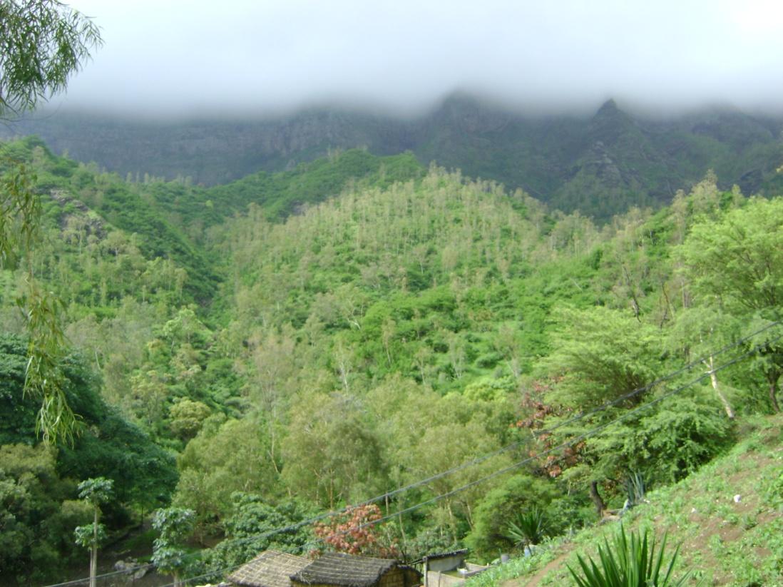
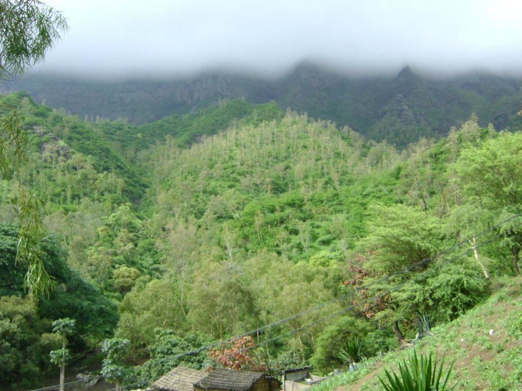
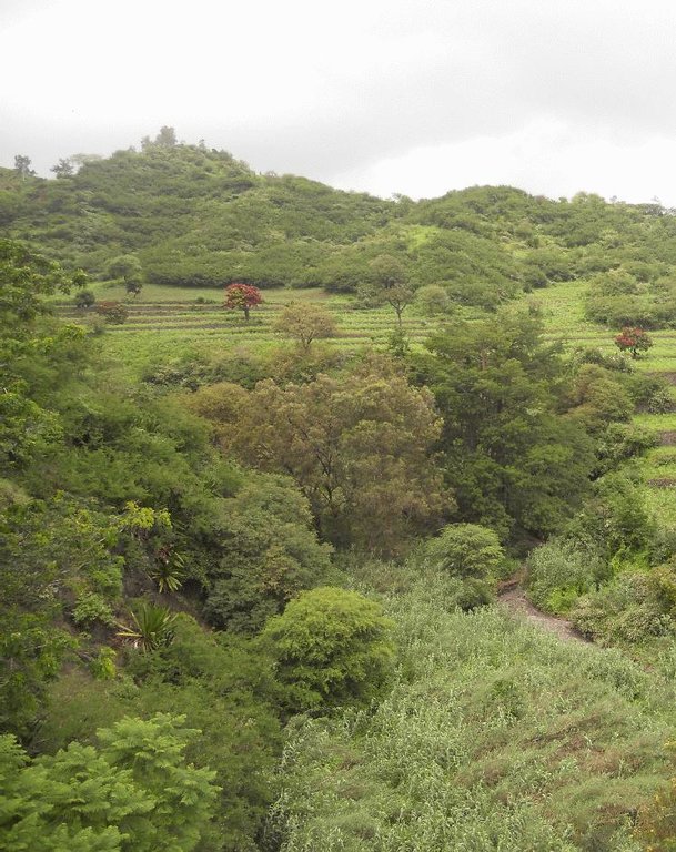
Afforestation is one of the key technologies to address the fragility of ecosystems: it provides better protection against erosion and makes better use of rainfall in order to maintain the sustainability of agricultural systems.
2.2 وصف تفصيلي للتقنية
الوصف:
Mountain forest areas are considered protective due to their role in regulating water (infiltration of storm water, regulation of surface runoff, and ground water recharge) within the watershed. The main species used are Prosopis juliflora, Parkinsonia aculeata, Jatropha curcas, Atriplex spp, Acacia holosericea, Acacia victoriae, Lantana camara and others, in arid areas and Eucalyptus camaldulensis, Grevillea robusta, Pinus and Cupressus ssp. in highland and humid areas.
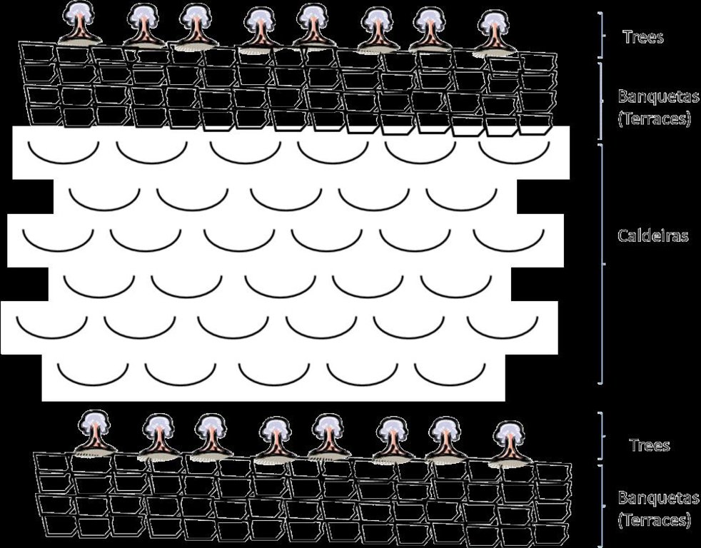
Purpose of the Technology: The climatic conditions are characterized by high spatial and temporal variability of the rainfall. The rains are concentrated in two or three months (August and September or October); the highlands and the N-NE parts are wetter compared to the low lands or coastal areas, which are very dry. The average annual rainfall is about 225 mm over the whole island; it has declined since the 1960s, with negative effects on farming conditions, and water supply. However, in areas located more than 500 m above sea level and exposed to trade winds, rainfall can exceed 700 mm. About 20% of the precipitation is lost through runoff, 13% infiltrates the soil and recharges aquifers and 67% evaporates. The evaporation loss is a limiting factor for any agriculture or forestry. Therefore, it is necessary to adapt the afforestation implementation to the specific local conditions (slope, stone cover, climate, etc). To overcome and minimize the problem of water scarcity, several measures are applied: (a) caldeira or half-moon structures achieved with earth or stone; (b) contour furrows or level bench terraces with stone walls arranged along the contour; (c). small dams to protect gullies. The aim is to maximize retention of water and control surface runoff. This not only allows better infiltration of water for the tree plantations, but also protects against soil erosion and facilitates groundwater recharge.
Establishment / maintenance activities and inputs: The success of the reforestation may be indicated not only by the area covered but also by the number of introduced plants. In 1975, there were about 3,000 ha of afforested land. By 2011, there are over 90,000 ha of afforested land with almost 50 million trees. Afforestation has focused mainly on the island of Santiago and Santo Antão, (13% of the total area reforested). Nowadays, more than 20% of the country is afforested. The forest has had a great importance in the context of combating desertification, rehabilitation of vegetation cover, in meeting energy needs and forage production and in developing agrosilvopastoral systems, as well as having undoubtedly contributed to a significant modification of the landscape in Cape Verde. The afforestation activities also contributed to increase biodiversity of some species of birds, including “Galinha di mato” (Numida meleagris), “Codorniz” (Coturnix coturnix), “Passarinha” (Halcyon leucocephala) and others.
Natural / human environment: The forest species are mainly used for land protection and for production of fuel wood and coal. Because of the poor growing conditions, the forest species are not well suited to the construction industry or wood processing.
2.3 صور التقنية
2.5 البلد/المنطقة/المواقع التي تم تنفيذ التقنية فيها والتي يغطيها هذا التقييم
البلد:
الرأس الأخضر
المنطقة/الولاية/المحافظة:
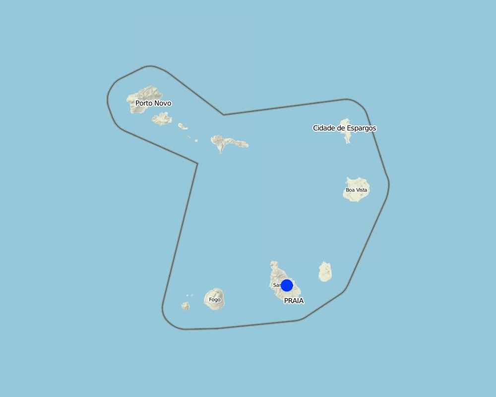
Santiago Island, Cape Verde
مزيد من التفاصيل حول الموقع:
Ribeira Seca
Map
×2.6 تاريخ التنفيذ
في حالة عدم معرفة السنة بالتحديد، يرجى الإشارة إلى التاريخ التقريبي:
- منذ 10-50 سنة
2.7 إدخال التقنية
حدد كيف تم إدخال التقنية:
- من خلال المشاريع/ التدخلات الخارجية
التعليقات (نوع المشروع، الخ):
Before 1975, the forestry production was directed to the market of wood, after 1975 began to stock in order to protect the environment
3. تصنيف تقنية الإدارة المستدامي للأراضي
3.1 الغرض الرئيسي ( الأغراض الرئيسية) للتقنية
- الحد من تدهور الأراضي ومنعه وعكسه
- الحفاظ على النظام البيئي
3.2 نوع (أنواع) استخدام الأراضي الحالية حيث يتم تطبيق التقنية

أراضي الرعي
الرعي المكثف/ إنتاج الأعلاف:
- قطع وحمل / صفر مرعى
الأنواع والمنتجات الحيوانية الرئيسية:
goats and cows

الغابات/ الأراضي الحرجية
زراعة الأشجار، التشجير:
- أصناف مختلطة
منتجات وخدمات:
- حفظ/حماية الطبيعة
التعليقات:
Major land use problems (compiler’s opinion): The loss of soil by runoff, influenced by its low coverage, reducing their fertility and their thickness
Major land use problems (land users’ perception): Soil erosion by runoff, low productive soils, low organic matter, low soil cover, fertility and depth particularly in the agro-systems with rainfed agriculture.
Cut-and-carry/ zero grazing: goats/ cows
Grazingland comments: production is characterized as extensive, although made in a closed expaço
Plantation forestry: Few trees are cut, since the main objective of which is the forest canopy. The dead are removed, make's some clean and plant new trees every year.
Problems / comments regarding forest use: Before 1975, date of independence of Cape Verde, began to stock the areas discovered. The forest is more dense at high altitudes but also introduced
Forest products and services: nature conservation / protection
Future (final) land use (after implementation of SLM Technology): Mixed: Ms: Silvo-pastoralism
Type of grazing system comments: production is characterized as extensive, although made in a closed expaço
إذا تغير استخدام الأراضي بسبب التقنية، قم بالإشارة إلى استخدام الأرض قبل تنفيذ التقنية:
Mixed: Mo: Other
3.3 مزيد من المعلومات حول استخدام الأراضي
إمدادات المياه للأرض التي يتم تنفيذ التقنية عليها:
- بعلية
عدد مواسم الزراعة في السنة:
- 1
حدد:
Longest growing period in days: 90; Longest growing period from month to month: August untill October
كثافة الثروة الحيوانية (إذا كانت ذات صلة):
25-50 LU /km2
3.4 مجموعةالإدارة المستدامة للأراضي التي تنتمي إليها هذه التقنية
- إدارة الغابات الطبيعية وشبه الطبيعية
- إدارة الري (بما في ذلك إمدادات المياه والصرف الصحي)
3.5 انتشار التقنية
التعليقات:
Total area covered by the SLM Technology is 71.5 km2.
The forest with the greatest density of trees occupies an area of 2.51 km2 and is located in the area of higher altitude. The density decreases with decrease in altitude
3.6 التدابير التقنية في مجال إلادارة المستدامة للأراضي

التدابير النباتية
- V1: غطاء من الأشجار والشجيرات

التدابير البنيوية
- الحواجز والضفاف
التعليقات:
Secondary measures: structural measures
3.7 الأنواع الرئيسية من تدهور الأراضي التي تناولتها التقنية

تآكل التربة بالمياه
- الوزن(Wt): فقدان التربة السطحية/تآكل السطح
- (Wg):الانجراف الخلجاني/ الخلجان

التدهور البيولوجي
- (Bc): تناقص الغطاء النباتي
- (Bh): فقدان الموائل

تدهور المياه
- (Hg): التغير في مستوى المياه الجوفية/الطبقة المائية الجوفية
التعليقات:
Secondary types of degradation addressed: Hg: change in groundwater / aquifer level
Main causes of degradation: soil management (It is cultivated maize and peanuts on land slopes very pronounced and boot up the plants by the root in end of the cycle), crop management (annual, perennial, tree/shrub) (The cleaning of the crop residues of corn is done pulling them by the root, negatively affecting soil stability), poverty / wealth (Leads sensitized peoples to advocate action against the landscape for survival of the family), education, access to knowledge and support services (Knowledge and technical training increase the options for means of survival of the community that acts on the forest, the degree of attending school is low and the illiteracy rate is 17%)
Secondary causes of degradation: overgrazing (Creation of the wild animals compact the soil, destroying the structures for the conservation of soil and water exists, and creates conflict), disturbance of water cycle (infiltration / runoff), Heavy / extreme rainfall (intensity/amounts) (Sometimes occur heavy rains intensity that associated with poor vegetation cover, increase soil erosion), governance / institutional (Lack of applicability of the laws that manage the land)
3.8 منع أو حد أو عكس تدهور الأراضي
تحديد هدف التقنية فيما يتعلق بتدهور الأراضي:
- اصلاح/إعادة تأهيل الأراضي المتدهورة بشدة
4. المواصفات الفنية، وأنشطة التنفيذ، والمدخلات، والتكاليف
4.1 الرسم الفني للتقنية
4.2 المواصفات الفنية/شروحات الرسم الفني
Treatment of slope before afforestation
Technical knowledge required for field staff / advisors: moderate (It's needed sufficient knowledge to choice species according to their suitability to the natural and human environment)
Technical knowledge required for land users: low
Main technical functions: control of raindrop splash, improvement of ground cover, stabilisation of soil (eg by tree roots against land slides), increase of infiltration, increase of groundwater level / recharge of groundwater
Secondary technical functions: increase in organic matter, increase / maintain water stored in soil, reduction in wind speed
Retention/infiltration ditch/pit, sediment/sand trap
Vertical interval between structures (m): 2
Spacing between structures (m): 5
Depth of ditches/pits/dams (m): 0.2
Width of ditches/pits/dams (m): 0.8
Length of ditches/pits/dams (m): 100
Height of bunds/banks/others (m): 0.4
Width of bunds/banks/others (m): 0.4
Length of bunds/banks/others (m): 100
Construction material (earth): land from the local construction of the ditch is used in the construction of banks, that can be rein
Slope (which determines the spacing indicated above): 30 - 60%
Lateral gradient along the structure: 0%
For water harvesting: the ratio between the area where the harvested water is applied and the total area from which water is collected is: 1:3
Vegetation is used for stabilisation of structures.
4.4 أنشطة التأسيس
| النشاط | نوع التدبير | التوقيت | |
|---|---|---|---|
| 1. | Quantification of the area to be afforested | نباتية | |
| 2. | Production of plants in nursery ( 500 - 1300 plants) | نباتية | |
| 3. | Treatment of area (slope) with building terraces (15 m / person / day) | نباتية | |
| 4. | Treatment of area (slope) with: Making half-moons “Caldeiras” (3 / person / day) | نباتية | |
| 5. | 4. Excavating the pits (10 / person / day): 60x60x60 cm | نباتية | |
| 6. | Planting (50 /person / day): 5 to 5 metres | نباتية | |
| 7. | Initial maintenance (8 /persons / day) | نباتية | |
| 8. | Cleaning and marking on curves level | بنيوية أو هيكلية | In April |
| 9. | Construction of the retention / infiltration ditch and opening of the surface of culture | بنيوية أو هيكلية | April to June |
4.5 التكاليف والمدخلات اللازمة للتأسيس
| تحديد المدخلات | الوحدة | الكمية | التكاليف لكل وحدة | إجمالي التكاليف لكل مدخل | % من التكاليف التي يتحملها مستخدمو الأراضي | |
|---|---|---|---|---|---|---|
| العمالة | Labour | ha | 1,0 | 28218,0 | 28218,0 | |
| معدات | Tools | ha | 1,0 | 410,0 | 410,0 | 10,0 |
| المواد النباتية | Seeds | ha | 1,0 | 942,0 | 942,0 | |
| إجمالي تكاليف إنشاء التقنية | 29570,0 | |||||
التعليقات:
Duration of establishment phase: 1 month(s)
4.6 الصيانة/الأنشطة المتكررة
| النشاط | نوع التدبير | التوقيت/الوتيرة | |
|---|---|---|---|
| 1. | forest cleaning | نباتية | |
| 2. | forest cleaning | بنيوية أو هيكلية | In the dry session |
4.7 التكاليف والمدخلات اللازمة للصيانة/للأنشطة المتكررة (سنويًا)
| تحديد المدخلات | الوحدة | الكمية | التكاليف لكل وحدة | إجمالي التكاليف لكل مدخل | % من التكاليف التي يتحملها مستخدمو الأراضي | |
|---|---|---|---|---|---|---|
| العمالة | Forest cleaning | ha | 1,0 | 142,0 | 142,0 | 52,0 |
| إجمالي تكاليف صيانة التقنية | 142,0 | |||||
التعليقات:
Machinery/ tools: Hoe, machete
Costs are estimated according to the time required for afforestation and the entity contracted for the implementation of the activities.
4.8 أهم العوامل المؤثرة على التكاليف
قدم وصفا لأهم العوامل التي تؤثر على التكاليف:
The labour affects the costs more than other factors. Paid labour is a way to achieve additional income for many people in this area. The employer (Directorate General of Agriculture, Sylviculture and Livestock of the Ministry of Rural Development) provides 90% of the cost of the equipment. The lifetime of the equipment is 10-15 years.
5. البيئة الطبيعية والبشرية
5.1 المناخ
هطول الأمطار السنوي
- < 250 مم
- 251- 500 ملم
- 501 - 750ملم
- 1,000-751 ملم
- 1,500-1,100 ملم
- 2,000-1,500 ملم
- 3,000-2,001 ملم
- 4,000-3,100 ملم
- > 4000 ملم
حدد متوسط هطول الأمطار السنوي (إذا كان معروفًا)، بالملليمتر:
800,00
المنطقة المناخية الزراعية
- رطبة
- شبه رطبة
- شبه قاحلة
- قاحلة
Thermal climate class: tropics. average temperature equal to 26 º C
The exposure and altitude are factors diterminantes for agroclimatic estratização. the higher areas and targeted to the SE are more humid.
5.2 طوبوغرافيا
متوسط الانحدارات:
- مسطح (0-2%)
- بسيط (3-5%)
- معتدل (6-10%)
- متدحرج (11-15%)
- تلال (16-30%)
- شديدة الانحدار(31-60%)
- فائقة الانحدار (>60%)
التضاريس:
- هضاب/سهول
- أثلام مرتفعة
- المنحدرات الجبلية
- منحدرات التلال
- منحدرات في السفوح
- قاع الوادي
المنطقة الارتفاعية:
- 100-0 متر فوق سطح البحر
- 500-101 متر فوق سطح البحر
- 1,000-501 متر فوق سطح البحر
- 1,500-1,001 متر فوق سطح البحر
- 2,000-1,501 متر فوق سطح البحر
- 2,500-2,100 متر فوق سطح البحر
- 3,000-2,501 متر فوق سطح البحر
- 4,000-3,001 متر فوق سطح البحر
- > 4000 متر فوق سطح البحر
وضح ما إذا كانت التقنية مطبقة على وجه التحديد في:
- غير ذات صلة
التعليقات والمواصفات الإضافية بشأن التضاريس:
Altitudinal zone: 100-500 m a.s.l. belongs to the stratum semi-arid sub-humid. Is part of the stratum the highest percentage of the area of the basin. 1000-1500 m a.s.l. includes mainly the cliffs and ridges.
Landforms: Also ridges and footslopes. The hazards of a convex situations does not allow its application in mountain slopes.
5.3 التربة
متوسط عمق التربة:
- ضحل جدًا (0-20 سم)
- ضحلة (21-50 سم)
- متوسطة العمق (51-80 سم)
- عميقة (81-120 سم)
- عميقة جدًا (> 120 سم)
قوام التربة (التربة السطحية):
- خشن / خفيف (رملي)
- متوسط ( طميي، سلتي)
المواد العضوية في التربة السطحية:
- متوسطة (1-3%)
- منخفضة (<1%)
إذا كان متاحًا، قم بإرفاق وصف كامل للتربة أو تحديد المعلومات المتوفرة، على سبيل المثال نوع التربة، الرقم الهيدروجيني/ درجة حموضة التربة، قدرة التبادل الكاتيوني، النيتروجين، الملوحة وما إلى ذلك.
Soil depth on average: Very shallow is associated with the sloping hillsides used for rainfull agriculture and shaloow is found mainly in the valley bottoms of the downstream.
Soil texture (topsoil): The soil overlay mainly basaltic rocks, piroclastic, conglomerates and aluvial deposits
Soil fertility is medium - low
Soil drainage / infiltration is good - medium
Soil water storage capacity is medium - low
5.4 توافر المياه ونوعيتها
منسوب المياه الجوفية:
50-5 م
توافر المياه السطحية:
ضعيف/ غير متوافر
نوعية المياه (غير المعالجة):
مياه الشرب سيئة (تتطلب معالجة)
تعليقات ومواصفات أخرى بشأن نوعية المياه وكميتها:
Ground water table: In rain months, it is more superficial than in the dry months
Availability of surface water: There is some just when it rains.
Water quality (untreated): Salinization of water due to over exploitation of wells and boreholes
5.5 التنوع البيولوجي
تنوع الأنواع:
- متوسط
5.6 خصائص مستخدمي الأراضي الذين يطبقون التقنية
الدخل من خارج المزرعة:
- أقل من % 10من كامل الدخل
المستوى النسبي للثروة:
- ضعيف
أفراداً أو مجموعات:
- موظف (شركة، حكومة)
اذكر الخصائص الأخرى ذات الصلة لمستخدمي الأراضي:
Population density: 100-200 persons/km2
Annual population growth: > 4%
and own 1% of the land (the tecnology is applyed by the state, and the state of that country is poor).
Off-farm income specification: forest production (mainly grass and wood) generate an annual income of approximately $2,500
Market orientation of production system: Mixed:Forest products are quite limited: lumber, firewood, charcoal and fodder from the pods. Firewood is the most important product but marketing is quite limited in time and space and subsistence are families who enter the forest for collection of grass and firewood. It is necessary for their survival. The state sells these products in order to finance other development projects.
5.7 متوسط مساحة الأرض المملوكة أو المستأجرة من قبل مستخدمي الأراضي الذين يطبقون التقنية
- < 0.5 هكتارا
- 0.5 - 1 هكتار
- 1 -2 هكتار
- 2 - 5 هكتار
- 5 - 15 هكتار
- 15 - 50 هكتار
- 50 - 100هكتار
- 500-100 هكتار
- 1,000-500 هكتار
- 10,000-1,000 هكتار
- > 10,000 هكتار
هل يعتبر هذا نطاقًا صغيرًا أو متوسطًا أو واسعا (في إشارة إلى السياق المحلي)؟:
- على نطاق واسع
التعليقات:
Also 50-100 ha, 100-500 ha and 100-500 ha,
The forest covers all the household
The grass production is made between the trees across the forest area if it's possible
5.8 ملكية الأراضي، وحقوق استخدام الأراضي، وحقوق استخدام المياه
ملكية الارض:
- دولة
- فردية، يوجد سند ملكية
- Diocese
حقوق استخدام الأراضي:
- مجتمعي (منظم)
- فردي
حقوق استخدام المياه:
- مجتمعي (منظم)
5.9 الوصول إلى الخدمات والبنية التحتية
التعليم:
- ضعيف
- معتدل
- جيد
المساعدة التقنية:
- ضعيف
- معتدل
- جيد
العمل (على سبيل المثال خارج المزرعة):
- ضعيف
- معتدل
- جيد
الأسواق:
- ضعيف
- معتدل
- جيد
الطاقة:
- ضعيف
- معتدل
- جيد
الطرق والنقل:
- ضعيف
- معتدل
- جيد
مياه الشرب وخدمات الصرف الصحي:
- ضعيف
- معتدل
- جيد
الخدمات المالية:
- ضعيف
- معتدل
- جيد
6. الآثار والتصريحات الختامية
6.1 الآثار التي أظهرتها التقنية في الموقع
الآثار الاجتماعية والاقتصادية
الإنتاج
إنتاج الأعلاف
جودة العلف
توليد الطاقة
التعليقات/ حدد:
Firewood to the community
توافر المياه ونوعيتها
توافر مياه الشرب
الدخل والتكاليف
النفقات على المدخلات الزراعية
فروقات اقتصادية
الآثار الاجتماعية والثقافية
الأمن الغذائي / الاكتفاء الذاتي
التعليقات/ حدد:
It reduces the options of land use
الفرص الثقافية
التخفيف من حدة الصراع
وضع الفئات المحرومة اجتماعيا واقتصاديا
التعليقات/ حدد:
Any sex has the same opportunity on the assets of the forest
livelihood and human well-being
التعليقات/ حدد:
It improves air quality, promotes the production of endemic species and its use as medicine
الآثار الايكولوجية
دورة المياه / الجريان السطحي
مستوى المياه الجوفية/ الطبقة المائية الجوفية
التبخر
التربة
رطوبة التربة
غطاء التربة
فقدان التربة
المادة العضوية في التربة/تحت الطبقة c
الحد من مخاطر المناخ والكوارث
انبعاث الكربون والغازات المسببة للاحتباس الحراري
سرعة الرياح
الآثار الايكولوجية الأخرى
Invasive species
competition
6.2 الآثار التي أظهرتها التقنية خارج الموقع
توافر المياه
تدفقات مائية موثوقة ومستقرة في موسم الجفاف
الفيضان في اتجاه مجرى النهر
تراكم الطمي باتجاه مصب النهر
القدرة على التخفيف / الترشيح
الرواسب المنقولة بواسطة الرياح
الأضرار التي لحقت بحقول الجيران
6.3 تعرض التقنية وحساسيتها لتغير المناخ التدريجي والظواهر المتطرفة/الكوارث المرتبطة بالمناخ (كما يراها مستخدمو الأراضي)
تغير مناخ تدريجي
تغير مناخ تدريجي
| الموسم | نوع التغير المناخي/ المتطرف | كيف تتعامل التقنية مع ذلك؟ | |
|---|---|---|---|
| درجة الحرارة السنوية | زيادة | جيدا |
الظواهر المتطرفة / الكوارث المرتبطة بالمناخ
الكوارث الجوية
| كيف تتعامل التقنية مع ذلك؟ | |
|---|---|
| عاصفة ممطرة محلية | غير معروف |
| عاصفة هوائية محلية | ليس جيدا |
الكوارث المناخية
| كيف تتعامل التقنية مع ذلك؟ | |
|---|---|
| جفاف | ليس جيدا |
الكوارث الهيدرولوجية
| كيف تتعامل التقنية مع ذلك؟ | |
|---|---|
| فيضان عام (نهر) | غير معروف |
العواقب الأخرى المتعلقة بالمناخ
العواقب الأخرى المتعلقة بالمناخ
| كيف تتعامل التقنية مع ذلك؟ | |
|---|---|
| انخفاض فترة النمو | جيدا |
التعليقات:
Tree species more tolerant of the climatic factors can be used, whilst retaining all the benefits that the existing species provide
6.4 تحليل التكلفة والعائد
كيف يمكن مقارنة العوائد نسبة لتكاليف الإنشاء (من وجهة نظر مستخدمي الأراضي)؟
عوائد قصيرة الأجل:
سلبي
عوائد طويلة الأجل:
إيجابي
كيف تتم مقارنة العوائدمع كلفة الصيانة/التكاليف المتكررة (من وجهة نظر مستخدمي الأراضي)؟
عوائد قصيرة الأجل:
محايد/متوازن
عوائد طويلة الأجل:
ايجابي جدا
التعليقات:
The high costs are associated with its implementation; afterwards they are significantly reduced and the technology builds up the benefits.
6.5 اعتماد التقنية
إذا كان متاحًا، قم بتحديد الكمية (عدد الأسر المعيشية و/أو المساحةالمغطاة):
None. It's a project of the government
التعليقات:
Comments on acceptance with external material support: Only the state has implemented this technology, because it changes the use of land and, without any subsidies, other land users are not encouraged to agree to it.
There is a moderate trend towards spontaneous adoption of the Technology
Comments on adoption trend: there is a continuing campaign of afforestation of state land. There are voluntary associations working in this technology for a better environment
6.7 نقاط القوة / المزايا / الفرص التي توفرها التقنية
| نقاط القوة/ المزايا/ الفرص من وجهة نظر مستخدمي الأراضي |
|---|
|
Production of firewood and grass How can they be sustained / enhanced? make more forest operations such as pruning or cutting of new seedlings |
|
Protection of soil How can they be sustained / enhanced? strengthen maintenance operations |
| نقاط القوة/ المزايا/ الفرص من وجهة نظر جامع المعلومات أو غيره من الاشخاص الرئيسيين لمصدر المعلومات |
|---|
|
Increases the quality of the landscape and reduces the loss of soil by runoff How can they be sustained / enhanced? increasing the tree cover in areas with low coverage |
|
Encourages the production of livestock, and fuel wood How can they be sustained / enhanced? integrate the community in managing the forest, and manage it in a sustainable way. |
6.8 نقاط ضعف / مساوىء / مخاطر التقنية وسبل التغلب عليها
| نقاط الضعف/ المساوىء/ المخاطر من وجهة نظر مستخدم الأراضي | كيف يمكن التغلب عليها؟ |
|---|---|
| impossibility of farming in the forest lands | off-farm income creation to compensate |
| Lack of involvement of farmers in the management of forest areas | capacity building of land users in forest management strategies, elaboration of contracts between State and land users for the management of forest perimeters |
| نقاط الضعف/ المساوىء/ المخاطر من وجهة نظر جامع المعلومات أو غيره من الاشخاص الرئيسيين لمصدر المعلومات | كيف يمكن التغلب عليها؟ |
|---|---|
| Reduces the percentage of land for agricultural production | increase productivity in cultivated land and reduce the need for the use of forest land, and implement new production technologies such as greenhouses |
7. المراجع والروابط
7.2 المراجع للمنشورات المتاحة
العنوان، المؤلف، السنة، النظام القياسي الدولي لترقيم الكتب ISBN:
Desertification at the Santiago Island, DESIRE, 2008
العنوان، المؤلف، السنة، النظام القياسي الدولي لترقيم الكتب ISBN:
Relatório de avaliação inicial do impacto das realizações de conservação de solos e água em 1993 do projecto WDP, WDP project, 1995
العنوان، المؤلف، السنة، النظام القياسي الدولي لترقيم الكتب ISBN:
www.ine.cv: Survey of family income and expenditure, INE, 2002
العنوان، المؤلف، السنة، النظام القياسي الدولي لترقيم الكتب ISBN:
OCDE, CILSS, 1982. Análise do Sector Florestal e Propostas para Cabo Verde. Sahel D (82) 179
متاح من أين؟كم التكلفة؟:
Club do Sahel, pp 203.
العنوان، المؤلف، السنة، النظام القياسي الدولي لترقيم الكتب ISBN:
MAAA/DGASP, 1996. Rapport de pays pour la Conférence Technique Internationale de la FAO sur les Ressources Phytogénétiques, Leipzig, 1996, pp 38.
متاح من أين؟كم التكلفة؟:
Leipzig, 1996, pp 38.
الروابط والوحدات المواضيعية
توسيع الكل طي الكلالروابط

Protection des versants [الرأس الأخضر]
Cette approche consiste à mettre à profit les eaux d'écoulement superficiel
- جامع المعلومات: Jacques Tavares
الوحدات المواضيعية
لا يوجد وحدات مواضيعية


