Ngitili Dry-Season Fodder Reserves [تنزانيا، جمهورية تنزانيا المتحدة]
- تاريخ الإنشاء:
- تحديث:
- جامع المعلومات: Unknown User
- المحرر: –
- المراجعون: David Streiff, Deborah Niggli
Ngitili
technologies_1351 - تنزانيا، جمهورية تنزانيا المتحدة
عرض الأقسام
توسيع الكل طي الكل1. معلومات عامة
1.2 تفاصيل الاتصال بالأشخاص الرئيسيين لمصدر المعلومات والمؤسسات المشاركة في تقييم وتوثيق التقنية
الشخص (الأشخاص) الرئيسي لمصدر المعلومات
متخصص في الإدارة المستدامة للأراضي:
Barrow Edmund
اسم المشروع الذي سهّل توثيق/تقييم التقنية (إذا كان ذلك على صلة)
Book project: SLM in Practice - Guidelines and Best Practices for Sub-Saharan Africa (SLM in Practice)1.3 الشروط المتعلقة باستخدام البيانات الموثقة من خلال WOCAT
يوافق جامع المعلومات والشخص (لاشخاص) الرئيسي لمصدر المعلومات على الشروط المتعلقة باستخدام البيانات الموثقة من خلال WOCAT:
نعم
2. وصف تقنيةالإدارة المستدامي للأراضي
2.1 وصف مختصر للتقنية
تعريف التقنية:
Ngitili are traditional enclosures for in-situ conservation and rehabilitation of vegetation, practiced by the Wasukuma agropastoralists in Shinyanga, Tanzania.
2.2 وصف تفصيلي للتقنية
الوصف:
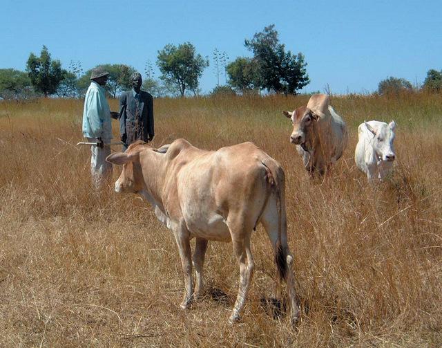
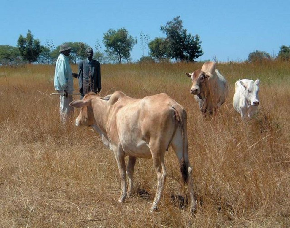
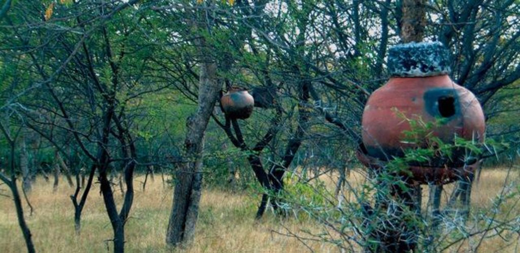
Shinyanga is a semiarid area characterized by shortage of fodder associated with problems of deforestation, fuelwood scarcity, food insecurity, declining soil fertility, severe soil erosion and unsecure land use rights. Ngitili is a dry-season fodder reserve, an indigenous practice which has been revived by a government programme from 1986-2001. For initial regeneration of the vegetation and rehabilitation of denuded land absolute exclusion of up to 5 years is needed. Then, areas of standing vegetation are enclosed seasonally from the onset of the rainy season till the peak / end of dry season, before they are opened up for grazing. Two distinct vegetation strata are identifiable, an upper stratum dominated by trees and shrubs (Acacia tortilis, A. nilotica, A. polyacantha and A. seyal) and a lower stratum of grasses, herbs and forbs. Structure and composition of the ngitili areas are closely influenced by location, age, management practices and intensity of use. The reserves are established on degraded land and around homesteads. Individual plots usually reach 2-5 ha in size, while communal ngitili cover 10-200 ha. Mostly, the boundaries are not rigidly marked, and physical barriers are not established. Local guards and community by-laws are used to protect and enforce the system. Ngitili alleviates dry season fodder shortages and prevents land degradation, through reducing soil erosion and deforestation. The reserves provide a wide range of woodland goods - such as timber, fodder, fuelwood, medicinal herbs, wild fruits and honey. They help to enhance livelihoods, provide a vital safety net during dry seasons and droughts and generate additional income of up to US$ 500-1,000 per year and household. Ngitili greatly reduced women’s labour, cutting the time spent on fuelwood collection by over 80%, and have a highly positive impact on biodiversity
2.3 صور التقنية
2.5 البلد/المنطقة/المواقع التي تم تنفيذ التقنية فيها والتي يغطيها هذا التقييم
البلد:
تنزانيا، جمهورية تنزانيا المتحدة
المنطقة/الولاية/المحافظة:
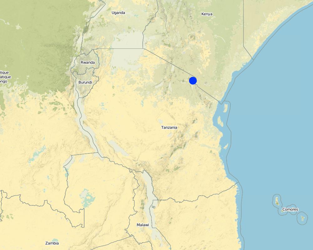
Shinyanga region
Map
×2.6 تاريخ التنفيذ
في حالة عدم معرفة السنة بالتحديد، يرجى الإشارة إلى التاريخ التقريبي:
- منذ أكثر من 50 عامًا (تقليدي)
2.7 إدخال التقنية
حدد كيف تم إدخال التقنية:
- كجزء من النظام التقليدي (> 50 عامًا)
التعليقات (نوع المشروع، الخ):
an indigenous practice which has been revived by a government programme from 1986-2001
3. تصنيف تقنية الإدارة المستدامي للأراضي
3.1 الغرض الرئيسي ( الأغراض الرئيسية) للتقنية
- الحد من تدهور الأراضي ومنعه وعكسه
3.2 نوع (أنواع) استخدام الأراضي الحالية حيث يتم تطبيق التقنية

أراضي الرعي
أراضي الرعي الواسع النطاق:
- رعي شبه مرتحل
التعليقات:
Major land use problems (compiler’s opinion): shortage of fodder associated with problems of deforestation, fuelwood scarcity, food insecurity, declining soil fertility, severe soil erosion and unsecure land use rights
Semi-nomadism / pastoralism: Yes
Future (final) land use (after implementation of SLM Technology): Mixed: Ms: Silvo-pastoralism
إذا تغير استخدام الأراضي بسبب التقنية، قم بالإشارة إلى استخدام الأرض قبل تنفيذ التقنية:
Grazing land: Ge: Extensive grazing land
3.3 مزيد من المعلومات حول استخدام الأراضي
إمدادات المياه للأرض التي يتم تنفيذ التقنية عليها:
- بعلية
عدد مواسم الزراعة في السنة:
- 1
3.4 مجموعةالإدارة المستدامة للأراضي التي تنتمي إليها هذه التقنية
- إغلاق المنطقة (إيقاف الاستخدام، دعم الاصلاح)
- الرعي وإدارة المراعي
3.5 انتشار التقنية
حدد انتشار التقنية:
- يتم تطبيقها في نقاط محددة/ تتركز على مساحة صغيرة
التعليقات:
3000-5000 km2
3.6 التدابير التقنية في مجال إلادارة المستدامة للأراضي

التدابير النباتية
- V1: غطاء من الأشجار والشجيرات

التدابير الإدارية
- M4: تغيير كبير في توقيت الأنشطة
التعليقات:
Type of vegetative measures: scattered / dispersed
3.7 الأنواع الرئيسية من تدهور الأراضي التي تناولتها التقنية

تآكل التربة بالمياه
- الوزن(Wt): فقدان التربة السطحية/تآكل السطح

تآكل التربة الناتج عن الرياح
- (Et): فقدان التربة السطحية

التدهور الكيميائي للتربة
- (Cn): تراجع الخصوبة وانخفاض محتوى المادة العضوية (غير ناتج عن الانجراف)

التدهور البيولوجي
- (Bc): تناقص الغطاء النباتي
- (Bq): انخفاض الكمية/الكتلة الحيوية
- (Bs): انخفاض جودة وتركيبة الأنواع/التنوع
التعليقات:
Main type of degradation addressed: Wt: loss of topsoil / surface erosion, Et: loss of topsoil, Cn: fertility decline and reduced organic matter content, Bc: reduction of vegetation cover, Bq: quantity / biomass decline, Bs: quality and species composition /diversity decline
3.8 منع أو حد أو عكس تدهور الأراضي
تحديد هدف التقنية فيما يتعلق بتدهور الأراضي:
- اصلاح/إعادة تأهيل الأراضي المتدهورة بشدة
4. المواصفات الفنية، وأنشطة التنفيذ، والمدخلات، والتكاليف
4.2 المواصفات الفنية/شروحات الرسم الفني
Technical knowledge required for field staff / advisors: low
Technical knowledge required for land users: low
Main technical functions: control of raindrop splash, improvement of ground cover, stabilisation of soil (eg by tree roots against land slides), increase in organic matter, increase in nutrient availability (supply, recycling,…), increase of biomass (quantity), promotion of vegetation species and varieties (quality, eg palatable fodder)
Secondary technical functions: increase of infiltration
Scattered / dispersed
Vegetative material: T : trees / shrubs
Trees/ shrubs species: Acacia tortilis, A. nilotica, A. polyacantha and A. seyal
Major change in timing of activities: For initial regeneration of the vegetation and rehabilitation of denuded land absolute exclusion of up to 5 years is needed. Then, areas of standing vegetation are enclosed seasonally from the onset o
4.4 أنشطة التأسيس
| النشاط | نوع التدبير | التوقيت | |
|---|---|---|---|
| 1. | Demarcation and closure of sites usually on degraded land around homesteads | نباتية | |
| 2. | Total enclosure during up to 5 years for initial regeneration of vegetation (if land is degraded) | نباتية | |
| 3. | Temporary demarcation of paddocks for specific periods for rotational grazing within ngitili (controlled by experienced elders; based on utilization level and fodder availability) | نباتية | |
| 4. | Controlled pruning and thinning (for firewood and poles) | نباتية |
4.6 الصيانة/الأنشطة المتكررة
| النشاط | نوع التدبير | التوقيت/الوتيرة | |
|---|---|---|---|
| 1. | Closure of ngitili area at onset of rainy season. No management during rainy season | نباتية | |
| 2. | Open area for grazing in July or August, after the crop residues and fallow vegetation have been depleted | نباتية | |
| 3. | Temporary demarcation of paddocks for specific periods for rotational grazing within ngitili (controlled by experienced elders; based on utilization level and fodder availability) | نباتية | |
| 4. | Controlled pruning and thinning (for firewood and poles) | نباتية |
5. البيئة الطبيعية والبشرية
5.1 المناخ
هطول الأمطار السنوي
- < 250 مم
- 251- 500 ملم
- 501 - 750ملم
- 1,000-751 ملم
- 1,500-1,100 ملم
- 2,000-1,500 ملم
- 3,000-2,001 ملم
- 4,000-3,100 ملم
- > 4000 ملم
المنطقة المناخية الزراعية
- شبه قاحلة
Thermal climate class: tropics
Unimodal rainfall pattern
5.2 طوبوغرافيا
متوسط الانحدارات:
- مسطح (0-2%)
- بسيط (3-5%)
- معتدل (6-10%)
- متدحرج (11-15%)
- تلال (16-30%)
- شديدة الانحدار(31-60%)
- فائقة الانحدار (>60%)
التضاريس:
- هضاب/سهول
- أثلام مرتفعة
- المنحدرات الجبلية
- منحدرات التلال
- منحدرات في السفوح
- قاع الوادي
المنطقة الارتفاعية:
- 100-0 متر فوق سطح البحر
- 500-101 متر فوق سطح البحر
- 1,000-501 متر فوق سطح البحر
- 1,500-1,001 متر فوق سطح البحر
- 2,000-1,501 متر فوق سطح البحر
- 2,500-2,100 متر فوق سطح البحر
- 3,000-2,501 متر فوق سطح البحر
- 4,000-3,001 متر فوق سطح البحر
- > 4000 متر فوق سطح البحر
5.3 التربة
إذا كان متاحًا، قم بإرفاق وصف كامل للتربة أو تحديد المعلومات المتوفرة، على سبيل المثال نوع التربة، الرقم الهيدروجيني/ درجة حموضة التربة، قدرة التبادل الكاتيوني، النيتروجين، الملوحة وما إلى ذلك.
Soil texture (topsoil): Vertic soils are very extensive covering 47% of all soil types in the region
Soil drainage / infiltration is medium - poor
5.6 خصائص مستخدمي الأراضي الذين يطبقون التقنية
مستوى المكننة:
- عمل يدوي
5.8 ملكية الأراضي، وحقوق استخدام الأراضي، وحقوق استخدام المياه
حقوق استخدام الأراضي:
- مجتمعي (منظم)
- فردي
التعليقات:
individual (cropland), individual/communal 50%/50% (grazing land)
Land ownership: communal / village, individual, not titled, individual, titled
6. الآثار والتصريحات الختامية
6.1 الآثار التي أظهرتها التقنية في الموقع
الآثار الاجتماعية والاقتصادية
الإنتاج
إنتاج الأعلاف
التعليقات/ حدد:
dry season
إنتاج حيواني
إنتاج الخشب
التعليقات/ حدد:
timber, fuelwood
إنتاج الغابات غير الخشبية
التعليقات/ حدد:
fruit, honey, medicines, edible insects
الدخل والتكاليف
دخل المزرعة
التعليقات/ حدد:
from selling timber/fuelwood; to purchase agricultural inputs, manpower
عبء العمل
التعليقات/ حدد:
collection of fuelwood / fodder by women
الآثار الاجتماعية والثقافية
الأمن الغذائي / الاكتفاء الذاتي
الوضع الصحي
diet diversification
housing
التعليقات/ حدد:
thatched grass for roofs
education
التعليقات/ حدد:
school fees payment due to income from ngitili
Income from communal ngitili used for village development
التعليقات/ حدد:
schools, health centres
الآثار الايكولوجية
دورة المياه / الجريان السطحي
كمية المياه
التعليقات/ حدد:
increased water availability
التربة
غطاء التربة
فقدان التربة
دورة المغذيات/إعادة الشحن
التنوع البيولوجي: الغطاء النباتي، الحيوانات
التنوع الحيواني
التعليقات/ حدد:
152 plant species; 145 bird species; also mammals returning
6.3 تعرض التقنية وحساسيتها لتغير المناخ التدريجي والظواهر المتطرفة/الكوارث المرتبطة بالمناخ (كما يراها مستخدمو الأراضي)
التعليقات:
Increased tolerance to climatic extremes (e.g. prolonged dry spells and droughts)
6.4 تحليل التكلفة والعائد
كيف يمكن مقارنة العوائد نسبة لتكاليف الإنشاء (من وجهة نظر مستخدمي الأراضي)؟
عوائد قصيرة الأجل:
إيجابي قليلا
عوائد طويلة الأجل:
ايجابي جدا
كيف تتم مقارنة العوائدمع كلفة الصيانة/التكاليف المتكررة (من وجهة نظر مستخدمي الأراضي)؟
عوائد قصيرة الأجل:
إيجابي قليلا
عوائد طويلة الأجل:
ايجابي جدا
6.5 اعتماد التقنية
- أكثر من 50%
التعليقات:
Comments on adoption trend: 300’000-500’000 ha of woodland restored 1986-2001 (most of Ngitilis are individual, but area-wise half-half), over 800 villages; 60-70% of all households have Ngitilis
6.7 نقاط القوة / المزايا / الفرص التي توفرها التقنية
| نقاط القوة/ المزايا/ الفرص من وجهة نظر جامع المعلومات أو غيره من الاشخاص الرئيسيين لمصدر المعلومات |
|---|
| Generates many production and ecological benefits at the same time |
6.8 نقاط ضعف / مساوىء / مخاطر التقنية وسبل التغلب عليها
| نقاط الضعف/ المساوىء/ المخاطر من وجهة نظر مستخدم الأراضي | كيف يمكن التغلب عليها؟ |
|---|---|
| Damage to livestock and crops caused by growing wildlife populations | outweighed by the benefits gained from ngitili (in most areas) |
| Increased local inequity: benefit gap between richer and poorer house¬holds (who have no ngitilis); growing sales of ngitilis | local institutions have to enable people to hold on to land and maintain ngitilis; allow poorer households to benefit from communal ngitilis |
| Scarcity of land, growing pressure (rising human and livestock populations); conflicts over grazing rights | encourage villages to establish by-laws for protecting ngitilis |
| Insecurity of tenure impedes establishment of ngitilis (individual and communal) | increase local people’s and groups ownership and control over their resources; clearly acknowledge in national law the secure tenure of both private and communal ngitili |
| Productivity could still be improved | introduction of improved fodder grasses. Planting of fast growing fodder trees and/or shrubs |
7. المراجع والروابط
7.2 المراجع للمنشورات المتاحة
العنوان، المؤلف، السنة، النظام القياسي الدولي لترقيم الكتب ISBN:
Kamwenda G.J. 2002. Ngitili agrosilvopastoral systems in the United Republic of Tanzania. Unasylva 211, Vol. 53, 2002.
العنوان، المؤلف، السنة، النظام القياسي الدولي لترقيم الكتب ISBN:
World Resource Institute. 2010. Regenerating Woodlands: Tanzania's HASHI Project. http://www.wri.org/publication/content/8108
العنوان، المؤلف، السنة، النظام القياسي الدولي لترقيم الكتب ISBN:
Equator initiative. 2010. Nomination Form Equator Initiative. http://www.equatorinitiative.org/knowledgebase/files/2002-0128_Nom_HASHI_Tanzania.pdf
العنوان، المؤلف، السنة، النظام القياسي الدولي لترقيم الكتب ISBN:
Blay D., E. Bonkoungou, S.A.O. Chamshama and B.Chikamai. 2004. Rehabilitation of Degraded Lands in Sub-Saharan Africa: Lessons Learned from Selected Case Studies. Forestry research network for Sub-Saharan Africa (fornessa)
العنوان، المؤلف، السنة، النظام القياسي الدولي لترقيم الكتب ISBN:
WRI (2005): World Resources 2005: The Wealth of the Poor—Managing Ecosystems to Fight Poverty. World Resources Institute (WRI) in collaboration with United Nations Development Programme, United Nations Environment Programme, and World Bank
الروابط والوحدات المواضيعية
توسيع الكل طي الكلالروابط
لا يوجد روابط
الوحدات المواضيعية
لا يوجد وحدات مواضيعية


