Indigenous water collecting pond and livestock watering trough [تنزانيا، جمهورية تنزانيا المتحدة]
- تاريخ الإنشاء:
- تحديث:
- جامع المعلومات: ALLAN BUBELWA
- المحرر: –
- المراجعون: Alexandra Gavilano, Fabian Ottiger, Donia Mühlematter
elyeshero ne elyato (Haya tribe)
technologies_1157 - تنزانيا، جمهورية تنزانيا المتحدة
- Indigenous water collecting pond and livestock watering trough: 29 ديسمبر، 2016 (inactive)
- Indigenous water collecting pond and livestock watering trough: 5 يونيو، 2017 (inactive)
- Indigenous water collecting pond and livestock watering trough: 28 يونيو، 2018 (inactive)
- Indigenous water collecting pond and livestock watering trough: 6 أغسطس، 2019 (public)
عرض الأقسام
توسيع الكل طي الكل1. معلومات عامة
1.2 تفاصيل الاتصال بالأشخاص الرئيسيين لمصدر المعلومات والمؤسسات المشاركة في تقييم وتوثيق التقنية
الشخص (الأشخاص) الرئيسي لمصدر المعلومات
government:
Kagaruki Annagrace
Misseny District Council
متخصص في الإدارة المستدامة للأراضي:
government:
اسم المؤسسة (المؤسسات) التي سهلت توثيق/تقييم التقنية (إذا كان ذلك على صلة)
Missenyi District Council (Missenyi District Council) - تنزانيا، جمهورية تنزانيا المتحدةاسم المؤسسة (المؤسسات) التي سهلت توثيق/تقييم التقنية (إذا كان ذلك على صلة)
Food and Agriculture Organization of the United Nations (FAO) - إيطاليا1.3 الشروط المتعلقة باستخدام البيانات الموثقة من خلال WOCAT
متى تم تجميع البيانات (ميدانيا)؟:
28/08/2012
يوافق جامع المعلومات والشخص (لاشخاص) الرئيسي لمصدر المعلومات على الشروط المتعلقة باستخدام البيانات الموثقة من خلال WOCAT:
نعم
2. وصف تقنيةالإدارة المستدامي للأراضي
2.1 وصف مختصر للتقنية
تعريف التقنية:
Construction of indigenous water pond and a livestock watering trough along an underground water source.
2.2 وصف تفصيلي للتقنية
الوصف:
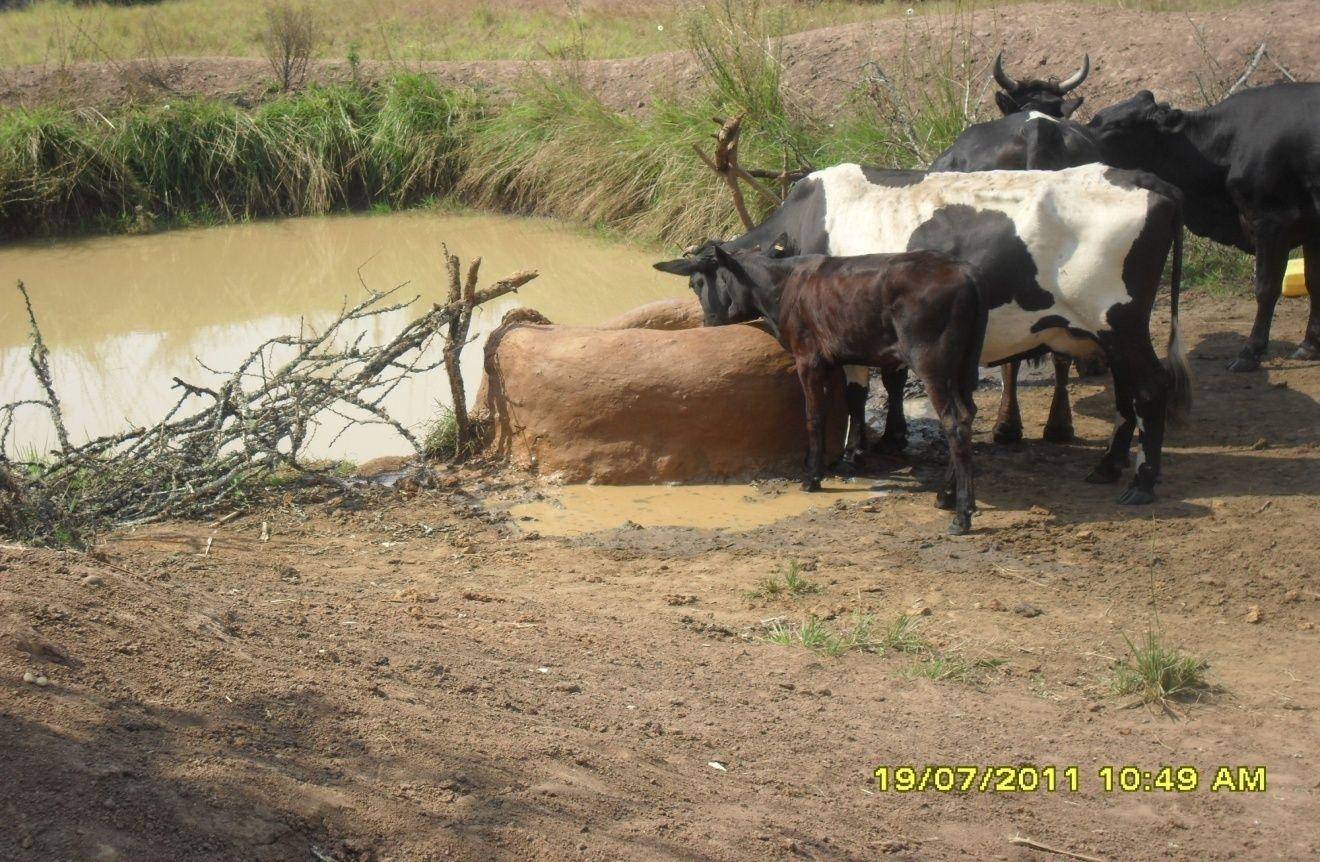
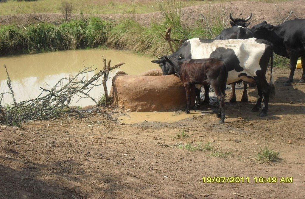
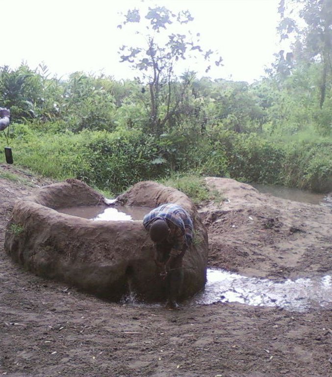
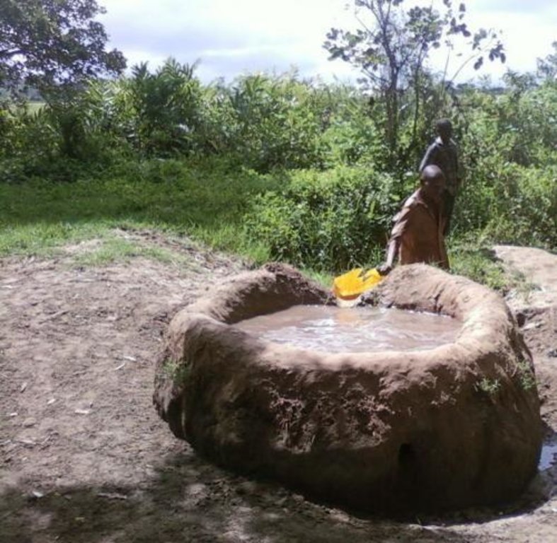
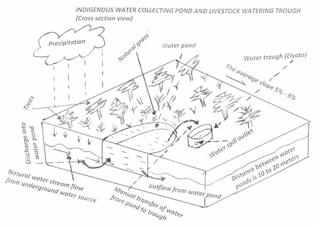
This technology is used during the dry seasons and where ground water level is high and there is natural water stream flowing from underground water source. Water pond is excavated along the naturally flowing water stream and is recharged by natural ground water. The size of the pond will vary depending on the area available, groundwater table, slope and soil characteristic. Groundwater collection ponds described in this technology on average are 4m long, 3m wide and 1m deep of 12m3 (12 000 liter) capacity and the slope is moderate 5% to 8% and soil characteristics is clay loam with deep soil. Water troughs (Elyato by local name) are constructed adjacent to the water pond to allow livestock to access clean drinking water. The number of troughs per pond is usually 1 to 2. Materials used in construction of water trough include clay, red termite mound soil, grass and wooden poles. The number of ponds needed usually depends on the expected number of animals and are arranged at irregular intervals ranging from 10 to 20 meters apart. The average size of a water trough is 0.14 m3 and can cater for 5 cattle at a time. The Pond is stabilized by naturally growing grass on its banks. Common pond stabilizer species are Leodicatiar digitalia and Hyperrhenia rufa. Management of the natural water source is through preventive village/customary by-laws which prohibit tree and grass cutting around the water source. The dominant indicator tree species normally found are Erythrina abysinica, Ficus thorgii and Phoenix recrinata. The animal watering troughs are usually used in the dry period. Before watering the troughs are coated (smeared) with red termite mound soil (normally hand carried by herders) to provide a good taste which is attractive to animals. Water is transferred from the pond to the water trough manually using cans or buckets. Animals drink directly from the troughs. This water from the trough is rich in iron (Fe) from red termite mound soil. The troughs are constructed with outlets used to spill out water immediately after drinking in order to prevent their damage through excessive water saturation.
Purpose of the Technology: This technology is preferred by livestock keepers as it provides for animals to drink clean and mineralized water and for health improvement. User fee payed to land owners also enable them to expand and diversify there income sources.
Establishment / maintenance activities and inputs: Establishment: Land clearing, excavation and shaping of water pond and construction of animal watering trough.
Maintenance: repair of water pond and water trough (de-siltation, grass slashing and gap refilling).
Inputs: labour, implements (machete, spade, hand hoe, sickle), clay, red termite mound soil, wooden poles, buckets, grass and tying rope. Average establishment cost for one pond and its water trough is 41.27 American dollars. Average annual maintenance and recurrent costs (filling and emptying of water trough) for one pond and its water trough stands at 458.76 dollars and labour is a core cost determinant factor.
Natural / human environment: Natural environment: Extensive grazing land. The technology is largely structural (excavation and shaping of water ponds and construction of water troughs) supported by the use of by-laws which prohibit destruction of the protective natural and indicative trees and grasses around. The technology is common in sub-humid climatic zone.
Social economic environment: Level of mechanization is handy tools with subsistence production systems on individual fields.
2.3 صور التقنية
2.5 البلد/المنطقة/المواقع التي تم تنفيذ التقنية فيها والتي يغطيها هذا التقييم
البلد:
تنزانيا، جمهورية تنزانيا المتحدة
المنطقة/الولاية/المحافظة:
Tanzania
مزيد من التفاصيل حول الموقع:
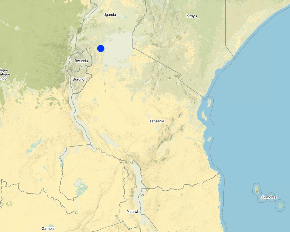
Missenyi District (Minziro)
التعليقات:
Boundary points of the Technology area: -1.11472, 31.655 ; -1,09972, 31.70194
Map
×2.6 تاريخ التنفيذ
في حالة عدم معرفة السنة بالتحديد، يرجى الإشارة إلى التاريخ التقريبي:
- منذ أكثر من 50 عامًا (تقليدي)
2.7 إدخال التقنية
حدد كيف تم إدخال التقنية:
- كجزء من النظام التقليدي (> 50 عامًا)
التعليقات (نوع المشروع، الخ):
the technology has been in use for about 80 years ago
3. تصنيف تقنية الإدارة المستدامي للأراضي
3.2 نوع (أنواع) استخدام الأراضي الحالية حيث يتم تطبيق التقنية

أراضي الرعي
أراضي الرعي الواسع النطاق:
- رعي شبه مرتحل
الأنواع والمنتجات الحيوانية الرئيسية:
Semi-nomadism / pastoralism: cattle, goats and sheeps

مختلطة (محاصيل/ رعي/ أشجار)، بما في ذلك الحراجة الزراعية
- الرعي الزراعي
التعليقات:
Major land use problems (compiler’s opinion): Eutrophication, siltation, water shortage, deforestation and wildfire outbreaks
Major land use problems (land users’ perception): Drying of the underground water source.
Constraints of mines and extractive industries
Constraints of settlement / urban
Constraints of infrastructure network (roads, railways, pipe lines, power lines)
Constraints of wastelands / deserts / glaciers / swamps
Constraints of recreation
3.3 مزيد من المعلومات حول استخدام الأراضي
إمدادات المياه للأرض التي يتم تنفيذ التقنية عليها:
- بعلية
عدد مواسم الزراعة في السنة:
- 2
حدد:
Longest growing period in days: 120Longest growing period from month to month: September to DecemberSecond longest growing period in days: 90Second longest growing period from month to month: March to May
كثافة الثروة الحيوانية (إذا كانت ذات صلة):
10-25 LU /km2
3.5 انتشار التقنية
حدد انتشار التقنية:
- منتشرة بالتساوي على مساحة
إذا كانت التقنية منتشرة بالتساوي على منطقة ما، فحدد المنطقة التقريبية المغطاة:
- < 0.1 كم2 (10 هكتار)
التعليقات:
The area is owned by individual farmer. The area is found adjacent to extensive grazing land. Water table is high and there is a permanent underground natural water flows.
3.6 التدابير التقنية في مجال إلادارة المستدامة للأراضي

التدابير النباتية
- V1: غطاء من الأشجار والشجيرات
- V2: الأعشاب والنباتات العشبية المعمرة

التدابير البنيوية
- S11: غير ذلك

التدابير الإدارية
- M7: أخرى
التعليقات:
Specification of other structural measures: water collection pond and animal watering trough
Specification of other management measures: protect water source enclosure by naturally regenerating vegetation
3.7 الأنواع الرئيسية من تدهور الأراضي التي تناولتها التقنية

التدهور المادي أو الفيزيائي للتربة
- (Pc) : تراص التربة

التدهور البيولوجي
- (Bc): تناقص الغطاء النباتي

تدهور المياه
- (Hp): تدهور نوعية المياه السطحية
التعليقات:
Main causes of degradation: deforestation / removal of natural vegetation (incl. forest fires) (cutting of natural tree and removal of grass along the natural water flow way), overgrazing (Compaction by trampling animals, rainfall runoff, siltation of water collection point and disapearence of vegatative cover.), discharges (point contamination of water) (spoilage and contamination of surface water by human and livestock feaces.), population pressure (Overstocking due to increase in the number of livestock), poverty / wealth (low capacity to invest in enviromental friendly energy sources), inputs and infrastructure: (roads, markets, distribution of water points, other, …) (Unavailable improved and reliable water ponds and animal watering troughs), education, access to knowledge and support services (limited knowledge on sustainable use of natural water sources), governance / institutional (limited enforcement of existing environmental regulatory systems.)
Secondary causes of degradation: soil management (excavation and layout that contradict the natural environment), crop management (annual, perennial, tree/shrub), over-exploitation of vegetation for domestic use (fire wood collection from the natural water source), industrial activities and mining, urbanisation and infrastructure development, release of airborne pollutants (urban/industry…), disturbance of water cycle (infiltration / runoff), over abstraction / excessive withdrawal of water (for irrigation, industry, etc.), other human induced causes (specify), change in temperature, change of seasonal rainfall, Heavy / extreme rainfall (intensity/amounts), wind storms / dust storms, floods, droughts, other natural causes (avalanches, volcanic eruptions, mud flows, highly susceptible natural resources, extreme topography, etc.) specify, land tenure, labour availability, war and conflicts
3.8 منع أو حد أو عكس تدهور الأراضي
تحديد هدف التقنية فيما يتعلق بتدهور الأراضي:
- منع تدهور الأراضي
- اصلاح/إعادة تأهيل الأراضي المتدهورة بشدة
4. المواصفات الفنية، وأنشطة التنفيذ، والمدخلات، والتكاليف
4.1 الرسم الفني للتقنية
4.2 المواصفات الفنية/شروحات الرسم الفني
Water pond and water trough cross section view.
The water pond has an average internal capacity of size of 12m3 (4m length, 3m width and 1m depth).
Water troughs are constructed on the side of the water ponds. The water trough outside height is 0.2 - 0.4m above ground, inner depth is 0.5m, and diameter varies from 0.6 to 1m. It is made of cylindrical walls whose average width is 0.1m.
The average slope of the water catchment is 5% to 8%.
Location: Minziro village, Minziro ward, Missenyi division. Missenyi Dist, Kagera Reg, United Rep of Tanzania
Technical knowledge required for land users: moderate (At least primary school leaver with the basic indigenous technical knowledge.)
Main technical functions: control of dispersed runoff: retain / trap, control of concentrated runoff: retain / trap, water harvesting / increase water supply, improvement of water quality, buffering / filtering water
Secondary technical functions: improvement of ground cover, improvement of surface structure (crusting, sealing), stabilisation of soil (eg by tree roots against land slides), increase / maintain water stored in soil, increase of groundwater level / recharge of groundwater, water spreading, sediment retention / trapping, sediment harvesting, increase of biomass (quantity), control of fires, spatial arrangement and diversification of land use
Dam/ pan/ pond
Vertical interval between structures (m): 0
Spacing between structures (m): 10 to 20
Depth of ditches/pits/dams (m): 1
Width of ditches/pits/dams (m): 3
Length of ditches/pits/dams (m): 4
Height of bunds/banks/others (m): 0.3
Width of bunds/banks/others (m): 0.3
Length of bunds/banks/others (m): 4
Structural measure: water trough
Depth of ditches/pits/dams (m): 0.5
Width of ditches/pits/dams (m): 0.6 to 1
Length of ditches/pits/dams (m): 0.6 to 1
Height of bunds/banks/others (m): 0.2
Width of bunds/banks/others (m): 0.1
Length of bunds/banks/others (m): 0.6
Construction material (earth): mostry used clay soil and red termite mound soil.
Construction material (wood): for water pond and trough stabilization
Slope (which determines the spacing indicated above): 8%
If the original slope has changed as a result of the Technology, the slope today is: 8%
Lateral gradient along the structure: 5%
Specification of dams/ pans/ ponds: Capacity 10.6m3
Catchment area: 4 acresm2
For water harvesting: the ratio between the area where the harvested water is applied and the total area from which water is collected is: 1:4
Vegetation is used for stabilisation of structures.
4.3 معلومات عامة بخصوص حساب المدخلات والتكاليف
عملة أخرى/ عملة وطنية (حدد):
Tanzanian shillings
أشر إلى سعر الصرف من الدولار الأمريكي إلى العملة المحلية (إذا كان ذا صلة): 1 دولار أمريكي =:
1600,0
اذكر متوسط تكلفة أجر العمالة المستأجرة في اليوم الواحد:
3.13
4.4 أنشطة التأسيس
| النشاط | نوع التدبير | التوقيت | |
|---|---|---|---|
| 1. | Land preparation for pond excavation | بنيوية أو هيكلية | During dry season |
| 2. | Construction of pond | بنيوية أو هيكلية | During dry period |
| 3. | Construction of water trough | بنيوية أو هيكلية | During dry season |
4.5 التكاليف والمدخلات اللازمة للتأسيس
| تحديد المدخلات | الوحدة | الكمية | التكاليف لكل وحدة | إجمالي التكاليف لكل مدخل | % من التكاليف التي يتحملها مستخدمو الأراضي | |
|---|---|---|---|---|---|---|
| العمالة | Land preparation for pond excavation | person/day | 1,0 | 1,25 | 1,25 | 100,0 |
| العمالة | Construction of pond | person/day | 1,0 | 21,88 | 21,88 | 100,0 |
| العمالة | Construction of water trough | person/day | 1,0 | 3,13 | 3,13 | 100,0 |
| معدات | Tools | piece | 1,0 | 3,13 | 3,13 | 100,0 |
| معدات | Tools | piece | 3,0 | 9,38 | 28,14 | 100,0 |
| مواد البناء | Wood | pieces | 2,0 | 1,25 | 2,5 | 100,0 |
| مواد البناء | Earth | kg | 20,0 | 1,25 | 25,0 | 100,0 |
| إجمالي تكاليف إنشاء التقنية | 85,03 | |||||
التعليقات:
Duration of establishment phase: 1 month(s)
4.6 الصيانة/الأنشطة المتكررة
| النشاط | نوع التدبير | التوقيت/الوتيرة | |
|---|---|---|---|
| 1. | Desiltation | بنيوية أو هيكلية | During dry season |
| 2. | Wall and bank strengthening and repair (reshaping and grass slashing/gap filling) | بنيوية أو هيكلية | During dry season |
| 3. | Water trough repairing | بنيوية أو هيكلية | dry season |
| 4. | Filling to and emptying water from water trough and collection and application of red termite mound soil. | بنيوية أو هيكلية |
4.7 التكاليف والمدخلات اللازمة للصيانة/للأنشطة المتكررة (سنويًا)
| تحديد المدخلات | الوحدة | الكمية | التكاليف لكل وحدة | إجمالي التكاليف لكل مدخل | % من التكاليف التي يتحملها مستخدمو الأراضي | |
|---|---|---|---|---|---|---|
| العمالة | Desiltation | person days | 5,0 | 6,25 | 31,25 | 100,0 |
| العمالة | Wall and bank strengthening and repair (reshaping and grass slashing/gap filling) | person days | 5,0 | 6,25 | 31,25 | 100,0 |
| العمالة | Water trough repairing | person days | 8,0 | 10,0 | 80,0 | 100,0 |
| العمالة | Filling to and emptying water from water trough and collection and application of red termite mound soil. | person days | 450,0 | 1,25 | 562,5 | 100,0 |
| معدات | Tools | pieces | 2,0 | 5,0 | 10,0 | 100,0 |
| معدات | Water can | pieces | 2,0 | 1,88 | 3,76 | 100,0 |
| مواد البناء | Wood | pieces | 6,0 | 3,75 | 22,5 | 100,0 |
| مواد البناء | Earth | kg | 60,0 | 3,75 | 225,0 | 100,0 |
| إجمالي تكاليف صيانة التقنية | 966,26 | |||||
التعليقات:
The cost is calculated per one water pond and its one trough and as per 28 August 2012
4.8 أهم العوامل المؤثرة على التكاليف
قدم وصفا لأهم العوامل التي تؤثر على التكاليف:
Labour is the most determinant factor affecting the costs
5. البيئة الطبيعية والبشرية
5.1 المناخ
هطول الأمطار السنوي
- < 250 مم
- 251- 500 ملم
- 501 - 750ملم
- 1,000-751 ملم
- 1,500-1,100 ملم
- 2,000-1,500 ملم
- 3,000-2,001 ملم
- 4,000-3,100 ملم
- > 4000 ملم
المنطقة المناخية الزراعية
- رطبة
- شبه رطبة
Thermal climate class: tropics. all months temperature is above 18
Thermal climate class: subtropics
Thermal climate class: temperate
Thermal climate class: boreal
Thermal climate class: polar/arctic
5.2 طوبوغرافيا
متوسط الانحدارات:
- مسطح (0-2%)
- بسيط (3-5%)
- معتدل (6-10%)
- متدحرج (11-15%)
- تلال (16-30%)
- شديدة الانحدار(31-60%)
- فائقة الانحدار (>60%)
التضاريس:
- هضاب/سهول
- أثلام مرتفعة
- المنحدرات الجبلية
- منحدرات التلال
- منحدرات في السفوح
- قاع الوادي
المنطقة الارتفاعية:
- 100-0 متر فوق سطح البحر
- 500-101 متر فوق سطح البحر
- 1,000-501 متر فوق سطح البحر
- 1,500-1,001 متر فوق سطح البحر
- 2,000-1,501 متر فوق سطح البحر
- 2,500-2,100 متر فوق سطح البحر
- 3,000-2,501 متر فوق سطح البحر
- 4,000-3,001 متر فوق سطح البحر
- > 4000 متر فوق سطح البحر
5.3 التربة
متوسط عمق التربة:
- ضحل جدًا (0-20 سم)
- ضحلة (21-50 سم)
- متوسطة العمق (51-80 سم)
- عميقة (81-120 سم)
- عميقة جدًا (> 120 سم)
قوام التربة (التربة السطحية):
- ناعم/ثقيل (طيني)
المواد العضوية في التربة السطحية:
- متوسطة (1-3%)
- منخفضة (<1%)
5.4 توافر المياه ونوعيتها
منسوب المياه الجوفية:
سطحية
توافر المياه السطحية:
جيد
نوعية المياه (غير المعالجة):
مياه شرب جيدة
5.6 خصائص مستخدمي الأراضي الذين يطبقون التقنية
التوجه السوقي لنظام الإنتاج:
- مختلط (كفاف/ تجاري)
المستوى النسبي للثروة:
- متوسط
أفراداً أو مجموعات:
- فرد/أسرة معيشية
الجنس:
- نساء
- رجال
اذكر الخصائص الأخرى ذات الصلة لمستخدمي الأراضي:
Difference in the involvement of women and men: little involvement of women because at large/traditionally livestock rearing is done by men.
Population density: 50-100 persons/km2
Annual population growth: 2% - 3%
5% of the land users are rich and own 5% of the land.
10% of the land users are average wealthy and own 35% of the land (the techology is used by rich and average livestock keepers who have the animal).
75% of the land users are poor and own 40% of the land (the village poors usually do not have the animals though most of them are cattle herders).
10% of the land users are poor and own 20% of the land.
5.7 متوسط مساحة الأرض المملوكة أو المستأجرة من قبل مستخدمي الأراضي الذين يطبقون التقنية
- < 0.5 هكتارا
- 0.5 - 1 هكتار
- 1 -2 هكتار
- 2 - 5 هكتار
- 5 - 15 هكتار
- 15 - 50 هكتار
- 50 - 100هكتار
- 500-100 هكتار
- 1,000-500 هكتار
- 10,000-1,000 هكتار
- > 10,000 هكتار
هل يعتبر هذا نطاقًا صغيرًا أو متوسطًا أو واسعا (في إشارة إلى السياق المحلي)؟:
- على نطاق صغير
5.8 ملكية الأراضي، وحقوق استخدام الأراضي، وحقوق استخدام المياه
ملكية الارض:
- مجتمعي/قروي
- فردية، لا يوجد سند ملكية
حقوق استخدام الأراضي:
- فردي
حقوق استخدام المياه:
- مجتمعي (منظم)
- فردي
5.9 الوصول إلى الخدمات والبنية التحتية
الصحة:
- ضعيف
- معتدل
- جيد
التعليم:
- ضعيف
- معتدل
- جيد
المساعدة التقنية:
- ضعيف
- معتدل
- جيد
العمل (على سبيل المثال خارج المزرعة):
- ضعيف
- معتدل
- جيد
الأسواق:
- ضعيف
- معتدل
- جيد
الطرق والنقل:
- ضعيف
- معتدل
- جيد
مياه الشرب وخدمات الصرف الصحي:
- ضعيف
- معتدل
- جيد
6. الآثار والتصريحات الختامية
6.1 الآثار التي أظهرتها التقنية في الموقع
الآثار الاجتماعية والاقتصادية
الإنتاج
إنتاج حيواني
تنوع المنتج
توليد الطاقة
توافر المياه ونوعيتها
توافر مياه الشرب
الدخل والتكاليف
تنوع مصادر الدخل
فروقات اقتصادية
الآثار الاجتماعية والثقافية
المؤسسات المجتمعية
المؤسسات الوطنية
المعرفة بالإدارة المستدامة للأراضي/تدهور الأراضي
الآثار الايكولوجية
دورة المياه / الجريان السطحي
كمية المياه
جودة المياه
حصاد / جمع المياه
الجريان السطحي
مستوى المياه الجوفية/ الطبقة المائية الجوفية
التبخر
التربة
رطوبة التربة
دورة المغذيات/إعادة الشحن
التنوع البيولوجي: الغطاء النباتي، الحيوانات
الكتلة الحيوية/ طبقة الكربون فوق التربة
تنوع الموائل
مكافحة الآفات/الأمراض
الحد من مخاطر المناخ والكوارث
انبعاث الكربون والغازات المسببة للاحتباس الحراري
خطر الحريق
سرعة الرياح
6.2 الآثار التي أظهرتها التقنية خارج الموقع
تدفقات مائية موثوقة ومستقرة في موسم الجفاف
الفيضان في اتجاه مجرى النهر
القدرة على التخفيف / الترشيح
الأضرار التي لحقت بحقول الجيران
6.3 تعرض التقنية وحساسيتها لتغير المناخ التدريجي والظواهر المتطرفة/الكوارث المرتبطة بالمناخ (كما يراها مستخدمو الأراضي)
تغير مناخ تدريجي
تغير مناخ تدريجي
| الموسم | نوع التغير المناخي/ المتطرف | كيف تتعامل التقنية مع ذلك؟ | |
|---|---|---|---|
| درجة الحرارة السنوية | زيادة | جيدا |
الظواهر المتطرفة / الكوارث المرتبطة بالمناخ
الكوارث الجوية
| كيف تتعامل التقنية مع ذلك؟ | |
|---|---|
| عاصفة ممطرة محلية | ليس جيدا |
| عاصفة هوائية محلية | جيدا |
الكوارث المناخية
| كيف تتعامل التقنية مع ذلك؟ | |
|---|---|
| جفاف | جيدا |
الكوارث الهيدرولوجية
| كيف تتعامل التقنية مع ذلك؟ | |
|---|---|
| فيضان عام (نهر) | ليس جيدا |
العواقب الأخرى المتعلقة بالمناخ
العواقب الأخرى المتعلقة بالمناخ
| كيف تتعامل التقنية مع ذلك؟ | |
|---|---|
| انخفاض فترة النمو | غير معروف |
التعليقات:
Improving structure on the pond (use impermeable materials to prevent seepage, use concrete as a building material)
6.4 تحليل التكلفة والعائد
كيف يمكن مقارنة العوائد نسبة لتكاليف الإنشاء (من وجهة نظر مستخدمي الأراضي)؟
عوائد قصيرة الأجل:
إيجابي
عوائد طويلة الأجل:
إيجابي
كيف تتم مقارنة العوائدمع كلفة الصيانة/التكاليف المتكررة (من وجهة نظر مستخدمي الأراضي)؟
عوائد قصيرة الأجل:
إيجابي
عوائد طويلة الأجل:
إيجابي
التعليقات:
The technology requires low establishment and maintenance cost and benefit surpass the costs.
6.5 اعتماد التقنية
من بين جميع الذين تبنوا التقنية، كم عدد الذين فعلوا ذلك بشكل تلقائي، أي دون تلقي أي حوافز مادية/مدفوعات؟:
- 50-10%
التعليقات:
12% of land user families have adopted the Technology without any external material support
250 land user families have adopted the Technology without any external material support
All livestock keepers use the technology to water their animals voluntary and through self mobilization.
There is a moderate trend towards spontaneous adoption of the Technology
The technology is cheap and requires low investment costs.
6.7 نقاط القوة / المزايا / الفرص التي توفرها التقنية
| نقاط القوة/ المزايا/ الفرص من وجهة نظر مستخدمي الأراضي |
|---|
|
Income generation due to water use fee. How can they be sustained / enhanced? improve service to water users. . |
| نقاط القوة/ المزايا/ الفرص من وجهة نظر جامع المعلومات أو غيره من الاشخاص الرئيسيين لمصدر المعلومات |
|---|
|
Reduce conflict between livestock keepers and domestic water users. How can they be sustained / enhanced? Bylaws reinforcement, Area enclosure and Demarcation |
|
Improve accessibility of water to animals (improved animal water intake) How can they be sustained / enhanced? sensitization on regular maintenance. |
6.8 نقاط ضعف / مساوىء / مخاطر التقنية وسبل التغلب عليها
| نقاط الضعف/ المساوىء/ المخاطر من وجهة نظر مستخدم الأراضي | كيف يمكن التغلب عليها؟ |
|---|---|
| Not durable and requires frequent and regular maintenance | Sensitize on regular maintenance. |
| نقاط الضعف/ المساوىء/ المخاطر من وجهة نظر جامع المعلومات أو غيره من الاشخاص الرئيسيين لمصدر المعلومات | كيف يمكن التغلب عليها؟ |
|---|---|
| not durable | Sensitize on regular maintenance. |
| high labor demand to fill the troughs | Use simple leverage pump |
7. المراجع والروابط
7.2 المراجع للمنشورات المتاحة
العنوان، المؤلف، السنة، النظام القياسي الدولي لترقيم الكتب ISBN:
Kagera TAMP project website
متاح من أين؟كم التكلفة؟:
http://www.fao.org/nr/kagera/en/
الروابط والوحدات المواضيعية
توسيع الكل طي الكلالروابط
لا يوجد روابط
الوحدات المواضيعية
لا يوجد وحدات مواضيعية


