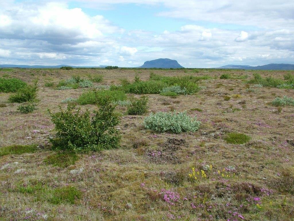
Planting trees to establish local seed banks [أيسلندا]
- تاريخ الإنشاء:
- تحديث:
- جامع المعلومات: Thorunn Petursdottir
- المحرر: –
- المراجعون: Fabian Ottiger, Alexandra Gavilano
technologies_1672 - أيسلندا
عرض الأقسام
توسيع الكل طي الكل1. معلومات عامة
1.2 تفاصيل الاتصال بالأشخاص الرئيسيين لمصدر المعلومات والمؤسسات المشاركة في تقييم وتوثيق التقنية
اسم المشروع الذي سهّل توثيق/تقييم التقنية (إذا كان ذلك على صلة)
Preventing and Remediating degradation of soils in Europe through Land Care (EU-RECARE )اسم المؤسسة (المؤسسات) التي سهلت توثيق/تقييم التقنية (إذا كان ذلك على صلة)
Soil Conservation Service of Iceland (Soil Conservation Service of Iceland) - أيسلندا1.3 الشروط المتعلقة باستخدام البيانات الموثقة من خلال WOCAT
يوافق جامع المعلومات والشخص (لاشخاص) الرئيسي لمصدر المعلومات على الشروط المتعلقة باستخدام البيانات الموثقة من خلال WOCAT:
نعم
2. وصف تقنيةالإدارة المستدامي للأراضي
2.1 وصف مختصر للتقنية
تعريف التقنية:
The technology is supposed to increase afforestation with native species within the area by supporting natural seed dispersal
2.2 وصف تفصيلي للتقنية
الوصف:
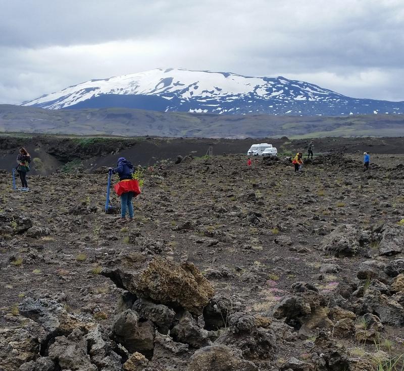
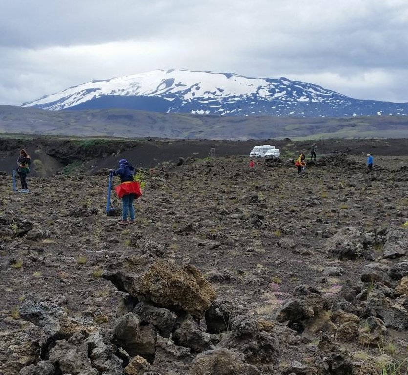
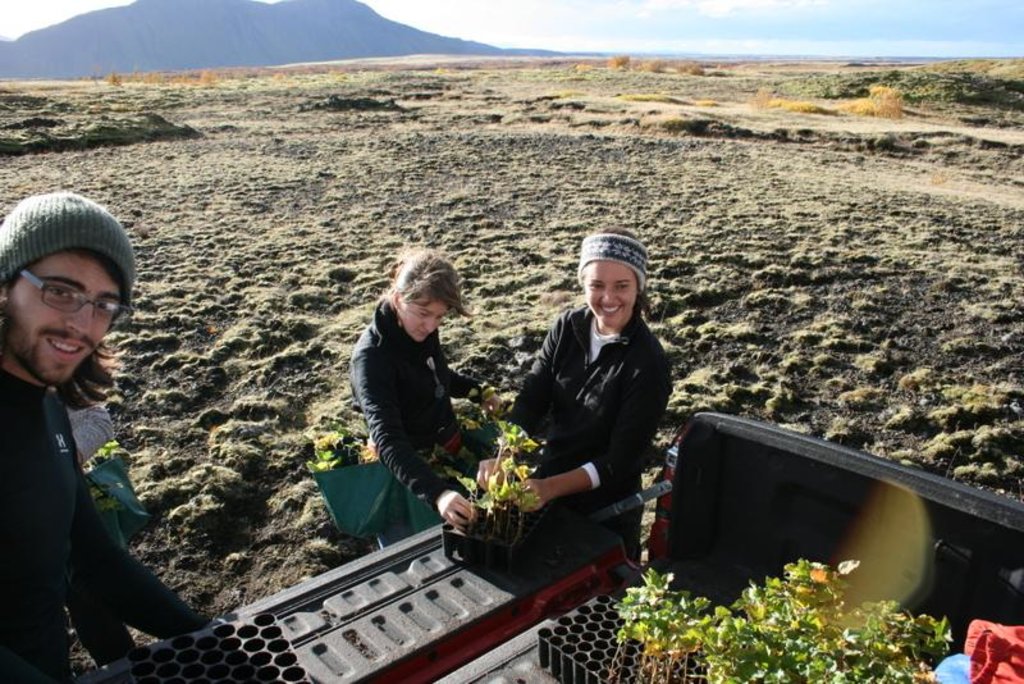
Planting areas are pre-selected based on local condition and optimal rate of potential seed dispersal (prevailing dry-wind direction, distance to remnant seed banks etc.). The areas are partially vegetated or have previously been treated with fertilizer (and seed) to facilitate surface stabilization, improved soil qualities and vegetation succession. Only native species are planted in these seed bank "islands"; mainly birch and a mixture of willow species. The islands/patches are scattered over the restoration area in order to get as much effectiveness out of the technology in the long run.
Purpose of the Technology: The purpose with the technology is to halt further land degradation and facilitate natural succession within the area undergoing restoration. In the long-term, it should substantially reduce wind and water erosion. It should also lead to increased biodiversity, enhanced water availability and accelerated carbon sequestration (in soil and vegetation). The overall restoration task is to increase the resilience of the ecosystems against natural hazards; such as volcanic activities.
Establishment / maintenance activities and inputs: For the first years, the plants in the seed banks islands are yearly treated with a small amount of fertilizer. The nutrient level within the areas is still very low and hardly enough to support sufficient annual plant growth.
Natural / human environment: In the long-term, the technology is expected to substantially increase biomass production, re-build soil qualities, accelerate carbon sequestration and secure water availability within the rangeland and the adjacent ecosystems. Increased tree and diverse vegetation cover will reduce and even halt the sand drift that still creates challenges for inhabitants in adjacent villages, on farmsteads and within the summerhouse clusters, scattered around the area. As the degraded rangeland is in the vicinity of an active volcano (Mt Hekla) the technology is also expected to increase ecosystem resilience against natural hazards like ash and pumice drift and reduce potential offsite damages caused by these materials.
2.3 صور التقنية
2.5 البلد/المنطقة/المواقع التي تم تنفيذ التقنية فيها والتي يغطيها هذا التقييم
البلد:
أيسلندا
المنطقة/الولاية/المحافظة:
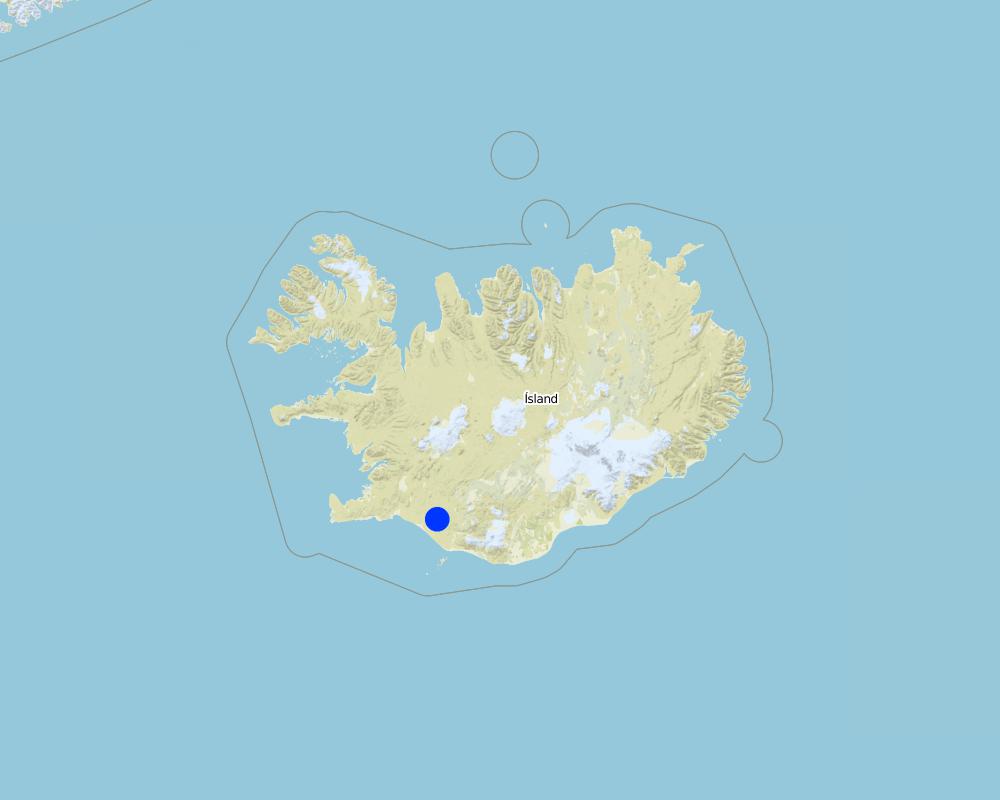
Rangarthing Ytra
مزيد من التفاصيل حول الموقع:
Rangarvellir
التعليقات:
Total area covered by the SLM Technology is 900 km2.
Map
×2.6 تاريخ التنفيذ
في حالة عدم معرفة السنة بالتحديد، يرجى الإشارة إلى التاريخ التقريبي:
- منذ 10-50 سنة
2.7 إدخال التقنية
حدد كيف تم إدخال التقنية:
- أثناء التجارب/الأبحاث
3. تصنيف تقنية الإدارة المستدامي للأراضي
3.1 الغرض الرئيسي ( الأغراض الرئيسية) للتقنية
- الحد من تدهور الأراضي ومنعه وعكسه
- الحفاظ على النظام البيئي
- الحفاظ على/تحسين التنوع البيولوجي
3.2 نوع (أنواع) استخدام الأراضي الحالية حيث يتم تطبيق التقنية

الغابات/ الأراضي الحرجية
منتجات وخدمات:
- حفظ/حماية الطبيعة
- الترفيه / السياحة
- الحماية من المخاطر الطبيعية

أرض غير منتجة
حدد:
Wastelands, deserts, glaciers, swamps, recreation areas, etc
التعليقات:
Major land use problems (compiler’s opinion): Vast parts of the area are heavily degraded due to unsustainable land use through the centuries in combination to harsh climate and frequent volcanic eruptions. The major land use problem are related to the fact that the concerned ecosystems collapsed long time ago and despite all restoration efforts implemented within the area for over 100 years, the systems are still highly dysfunctional. Their carrying capacity is limited and even light livestock grazing can keep further vegetation succession down. Passive restoration might take place where the livestock grazing has been excluded but in most cases some technologies are needed to "kickstart" the ecosystem and break their negative resilience against changes.
Major land use problems (land users’ perception): They are fully aware that the ecosystems are in a poor condition and restoration is needed in order to push improvements forward. They acknowledge that grazing of collapsed ecosystems can maintain the dysfunctional of the systems and hinder ecological improvements. Nevertheless, in many cases they believe the harsh climate and volcanic activities are the main contributors to land degradation - that livestock grazing and the grazing carrying capacity of the rangeland are not fundamental issues in this context.
Future (final) land use (after implementation of SLM Technology): Forests / woodlands: Fn: Natural
Constraints of wastelands / deserts / glaciers / swamps
Number of growing seasons per year: 1
Longest growing period from month to month: June to end August
3.3 هل تغير استخدام الأراضي نتيجة لتنفيذ التقنية؟
هل تغير استخدام الأراضي نتيجة لتنفيذ التقنية؟:
- نعم (يرجى ملء الأسئلة أدناه فيما يتعلق باستخدام الأراضي قبل تنفيذ التقنية)

أرض غير منتجة
حدد:
Wastelands, deserts, glaciers, swamps, recreation areas, etc
3.6 التدابير التقنية في مجال إلادارة المستدامة للأراضي

التدابير النباتية
- V1: غطاء من الأشجار والشجيرات

التدابير الإدارية
- M1: التغيير في نوع استخدام الأراضي
التعليقات:
Main measures: vegetative measures, management measures
Type of vegetative measures: aligned: -against wind, scattered / dispersed
3.7 الأنواع الرئيسية من تدهور الأراضي التي تناولتها التقنية

التدهور البيولوجي
- (Bc): تناقص الغطاء النباتي
- (Bq): انخفاض الكمية/الكتلة الحيوية
- (Bs): انخفاض جودة وتركيبة الأنواع/التنوع

تدهور المياه
- (Hs): التغيير في كمية المياه السطحية
- (Hg): التغير في مستوى المياه الجوفية/الطبقة المائية الجوفية
التعليقات:
Secondary types of degradation addressed: Bc: reduction of vegetation cover, Bq: quantity / biomass decline, Bs: quality and species composition /diversity decline, Hs: change in quantity of surface water, Hg: change in groundwater / aquifer level
Main causes of degradation: deforestation / removal of natural vegetation (incl. forest fires), over-exploitation of vegetation for domestic use, overgrazing, Heavy / extreme rainfall (intensity/amounts), wind storms / dust storms, other natural causes (avalanches, volcanic eruptions, mud flows, highly susceptible natural resources, extreme topography, etc.) specify
Secondary causes of degradation: disturbance of water cycle (infiltration / runoff), change in temperature, floods, land tenure, governance / institutional
3.8 منع أو حد أو عكس تدهور الأراضي
تحديد هدف التقنية فيما يتعلق بتدهور الأراضي:
- الحد من تدهور الأراضي
- اصلاح/إعادة تأهيل الأراضي المتدهورة بشدة
التعليقات:
Main goals: mitigation / reduction of land degradation, rehabilitation / reclamation of denuded land
Secondary goals: prevention of land degradation
4. المواصفات الفنية، وأنشطة التنفيذ، والمدخلات، والتكاليف
4.1 الرسم الفني للتقنية
المواصفات الفنية (المتعلقة بالرسم الفني):
An example showing the development of a local seed bank at a previously eroded area.
Location: South Iceland
Technical knowledge required for field staff / advisors: high
Technical knowledge required for land users: moderate
Main technical functions: improvement of ground cover, increase of surface roughness, improvement of topsoil structure (compaction), increase in organic matter, increase in nutrient availability (supply, recycling,…), increase of infiltration, increase / maintain water stored in soil, increase of groundwater level / recharge of groundwater, water harvesting / increase water supply, water spreading, improvement of water quality, buffering / filtering water, sediment retention / trapping, sediment harvesting, reduction in wind speed, increase of biomass (quantity)
Secondary technical functions: control of raindrop splash, control of dispersed runoff: retain / trap, control of dispersed runoff: impede / retard, control of concentrated runoff: impede / retard, control of concentrated runoff: drain / divert, stabilisation of soil (eg by tree roots against land slides), promotion of vegetation species and varieties (quality, eg palatable fodder), spatial arrangement and diversification of land use
Aligned: -against wind
Vegetative material: T : trees / shrubs
Scattered / dispersed
Vegetative material: T : trees / shrubs
Trees/ shrubs species: birch and several willow species planted to facilitate natural regeneration of native trees and shrubs
Change of land use type: Protected from sheep grazing
المؤلف:
Áskell Þórisson
4.2 معلومات عامة بخصوص حساب المدخلات والتكاليف
عملة أخرى/ عملة وطنية (حدد):
ISK
إذا كان ذا صلة، وضح سعر الصرف من الدولار الأمريكي إلى العملة المحلية (على سبيل المثال، 1 دولار أمريكي = 79.9 ريال برازيلي): 1 دولار أمريكي =:
112,0
4.3 أنشطة التأسيس
| النشاط | التوقيت (الموسم) | |
|---|---|---|
| 1. | Planting seedlings | |
| 2. | Planting |
4.4 التكاليف والمدخلات اللازمة للتأسيس
| تحديد المدخلات | الوحدة | الكمية | التكاليف لكل وحدة | إجمالي التكاليف لكل مدخل | % من التكاليف التي يتحملها مستخدمو الأراضي | |
|---|---|---|---|---|---|---|
| العمالة | Planting | h | 1,0 | 68,0 | 68,0 | |
| المواد النباتية | Seedlings | ha | 1,0 | 3400,0 | 3400,0 | |
| إجمالي تكاليف إنشاء التقنية | 3468,0 | |||||
| إجمالي تكاليف إنشاء التقنية بالدولار الأمريكي | 30,96 | |||||
4.7 أهم العوامل المؤثرة على التكاليف
قدم وصفا لأهم العوامل التي تؤثر على التكاليف:
The most determinate factors affecting the cost are a) the distance from the farmsteads to the eroded areas and b) the time it takes to plant the seedlings; easily accessible areas vs difficult areas
5. البيئة الطبيعية والبشرية
5.1 المناخ
هطول الأمطار السنوي
- < 250 مم
- 251- 500 ملم
- 501 - 750ملم
- 1,000-751 ملم
- 1,500-1,100 ملم
- 2,000-1,500 ملم
- 3,000-2,001 ملم
- 4,000-3,100 ملم
- > 4000 ملم
المنطقة المناخية الزراعية
- شبه رطبة
- شبه قاحلة
Thermal climate class: boreal
Thermal climate class: polar/arctic
5.2 طوبوغرافيا
متوسط الانحدارات:
- مسطح (0-2%)
- بسيط (3-5%)
- معتدل (6-10%)
- متدحرج (11-15%)
- تلال (16-30%)
- شديدة الانحدار(31-60%)
- فائقة الانحدار (>60%)
التضاريس:
- هضاب/سهول
- أثلام مرتفعة
- المنحدرات الجبلية
- منحدرات التلال
- منحدرات في السفوح
- قاع الوادي
المنطقة الارتفاعية:
- 100-0 متر فوق سطح البحر
- 500-101 متر فوق سطح البحر
- 1,000-501 متر فوق سطح البحر
- 1,500-1,001 متر فوق سطح البحر
- 2,000-1,501 متر فوق سطح البحر
- 2,500-2,100 متر فوق سطح البحر
- 3,000-2,501 متر فوق سطح البحر
- 4,000-3,001 متر فوق سطح البحر
- > 4000 متر فوق سطح البحر
5.3 التربة
متوسط عمق التربة:
- ضحل جدًا (0-20 سم)
- ضحلة (21-50 سم)
- متوسطة العمق (51-80 سم)
- عميقة (81-120 سم)
- عميقة جدًا (> 120 سم)
قوام التربة (التربة السطحية):
- خشن / خفيف (رملي)
المواد العضوية في التربة السطحية:
- متوسطة (1-3%)
- منخفضة (<1%)
إذا كان متاحًا، قم بإرفاق وصف كامل للتربة أو تحديد المعلومات المتوفرة، على سبيل المثال نوع التربة، الرقم الهيدروجيني/ درجة حموضة التربة، قدرة التبادل الكاتيوني، النيتروجين، الملوحة وما إلى ذلك.
Soil fertility is very low-low to medium
Soil drainage/infiltration is poor to medium
Soil water sotrage capacity is very low to medium
5.4 توافر المياه ونوعيتها
نوعية المياه (غير المعالجة):
مياه شرب جيدة
5.5 التنوع البيولوجي
تنوع الأنواع:
- منخفض
5.6 خصائص مستخدمي الأراضي الذين يطبقون التقنية
التوجه السوقي لنظام الإنتاج:
- الكفاف (الإمداد الذاتي)
أفراداً أو مجموعات:
- المجموعات/ المجتمع المحلي
الجنس:
- نساء
- رجال
اذكر الخصائص الأخرى ذات الصلة لمستخدمي الأراضي:
Land users applying the Technology are mainly common / average land users
Population density: < 10 persons/km2
5.7 متوسط مساحة الأرض التي يستخدمها مستخدمو الأراضي الذين يطبقون التقنية
- < 0.5 هكتارا
- 0.5 - 1 هكتار
- 1 -2 هكتار
- 2 - 5 هكتار
- 5 - 15 هكتار
- 15 - 50 هكتار
- 50 - 100هكتار
- 500-100 هكتار
- 1,000-500 هكتار
- 10,000-1,000 هكتار
- > 10,000 هكتار
هل يعتبر هذا نطاقًا صغيرًا أو متوسطًا أو واسعا (في إشارة إلى السياق المحلي)؟:
- على نطاق صغير
6. الآثار والتصريحات الختامية
6.1 الآثار التي أظهرتها التقنية في الموقع
الآثار الاجتماعية والاقتصادية
توافر المياه ونوعيتها
توافر مياه الشرب
توافر المياه للماشية
نوعية المياه للماشية
آثار اجتماعية واقتصادية أخرى
Land price/lease
الآثار الاجتماعية والثقافية
الفرص الثقافية
الفرص الترفيهية
المؤسسات المجتمعية
المؤسسات الوطنية
المعرفة بالإدارة المستدامة للأراضي/تدهور الأراضي
الآثار الايكولوجية
دورة المياه / الجريان السطحي
كمية المياه
جودة المياه
حصاد / جمع المياه
الجريان السطحي
تصريف المياه الزائدة
مستوى المياه الجوفية/ الطبقة المائية الجوفية
التبخر
التربة
رطوبة التربة
غطاء التربة
فقدان التربة
دورة المغذيات/إعادة الشحن
المادة العضوية في التربة/تحت الطبقة c
التنوع البيولوجي: الغطاء النباتي، الحيوانات
الكتلة الحيوية/ طبقة الكربون فوق التربة
التنوع النباتي
التنوع الحيواني
تنوع الموائل
الحد من مخاطر المناخ والكوارث
انبعاث الكربون والغازات المسببة للاحتباس الحراري
سرعة الرياح
6.2 الآثار التي أظهرتها التقنية خارج الموقع
توافر المياه
الفيضان في اتجاه مجرى النهر
تراكم الطمي باتجاه مصب النهر
القدرة على التخفيف / الترشيح
الرواسب المنقولة بواسطة الرياح
الأضرار التي لحقت بحقول الجيران
الضرر على البنية التحتية العامة/ الخاصة
6.3 تعرض التقنية وحساسيتها لتغير المناخ التدريجي والظواهر المتطرفة/الكوارث المرتبطة بالمناخ (كما يراها مستخدمو الأراضي)
تغير مناخ تدريجي
تغير مناخ تدريجي
| الموسم | زيادة أو نقصان | كيف تتعامل التقنية مع ذلك؟ | |
|---|---|---|---|
| درجة الحرارة السنوية | زيادة | جيدا |
الظواهر المتطرفة / الكوارث المرتبطة بالمناخ
الكوارث الجوية
| كيف تتعامل التقنية مع ذلك؟ | |
|---|---|
| عاصفة هوائية محلية | جيدا |
الكوارث المناخية
| كيف تتعامل التقنية مع ذلك؟ | |
|---|---|
| جفاف | ليس جيدا |
الكوارث الهيدرولوجية
| كيف تتعامل التقنية مع ذلك؟ | |
|---|---|
| فيضان عام (نهر) | جيدا |
العواقب الأخرى المتعلقة بالمناخ
العواقب الأخرى المتعلقة بالمناخ
| كيف تتعامل التقنية مع ذلك؟ | |
|---|---|
| انخفاض فترة النمو | جيدا |
6.4 تحليل التكلفة والعائد
كيف يمكن مقارنة العوائد نسبة لتكاليف الإنشاء (من وجهة نظر مستخدمي الأراضي)؟
عوائد قصيرة الأجل:
إيجابي
عوائد طويلة الأجل:
ايجابي جدا
كيف تتم مقارنة العوائدمع كلفة الصيانة/التكاليف المتكررة (من وجهة نظر مستخدمي الأراضي)؟
عوائد قصيرة الأجل:
ايجابي جدا
عوائد طويلة الأجل:
ايجابي جدا
الروابط والوحدات المواضيعية
توسيع الكل طي الكلالروابط
لا يوجد روابط
الوحدات المواضيعية
لا يوجد وحدات مواضيعية


