Dugout Pond [الهند]
- تاريخ الإنشاء:
- تحديث:
- جامع المعلومات: Mulchand Kag
- المحرر: –
- المراجعون: Fabian Ottiger, Alexandra Gavilano
Talawadi
technologies_1472 - الهند
عرض الأقسام
توسيع الكل طي الكل1. معلومات عامة
1.2 تفاصيل الاتصال بالأشخاص الرئيسيين لمصدر المعلومات والمؤسسات المشاركة في تقييم وتوثيق التقنية
1.3 الشروط المتعلقة باستخدام البيانات الموثقة من خلال WOCAT
يوافق جامع المعلومات والشخص (لاشخاص) الرئيسي لمصدر المعلومات على الشروط المتعلقة باستخدام البيانات الموثقة من خلال WOCAT:
نعم
1.5 الإشارة إلى الاستبيان (الاستبيانات) حول مناهج الإدارة المستدامة للأراضي (موثقة باستخدام WOCAT)
Comprehensive watershed development [الهند]
Participatory approach that includes a package of measures leading to empowerment of communities to implement and sustain watershed development.
- جامع المعلومات: David Gandhi
2. وصف تقنيةالإدارة المستدامي للأراضي
2.1 وصف مختصر للتقنية
تعريف التقنية:
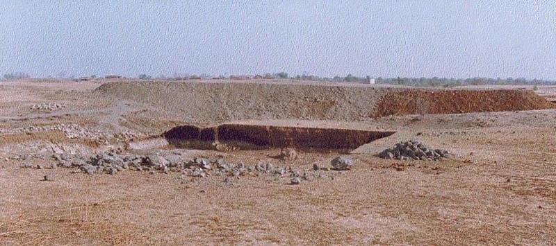
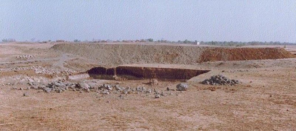
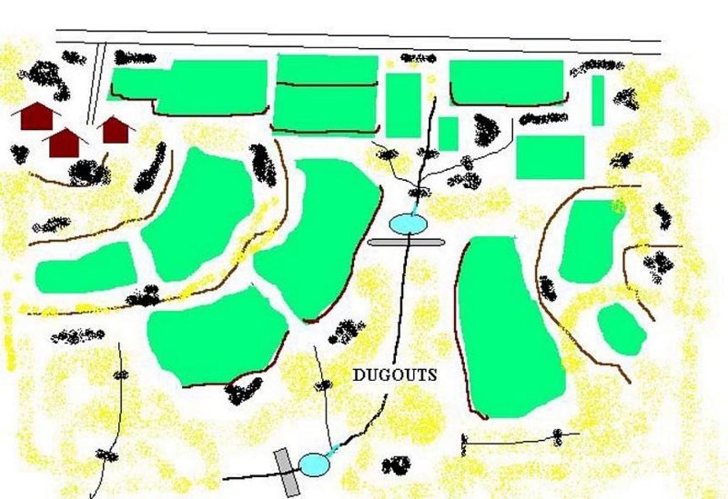
Dugout pond is a sunken water harvesting structure constructed along the rills in upper catchment for the purpose of storage of runoff and recharge of ground water.
2.2 وصف تفصيلي للتقنية
الوصف:
Dugout pond is a rectangular shape subsurface pond with the excavated material forming an embankment down stream. It is constructed in the upper catchment of the watershed, along the rill/shallow gully. The site for the pond should be where there is a depression. The size may vary from small to large depending on the size of catchment, needs of the farmers, availability of finance, bed rock strata.
Purpose of the Technology: 1- Storage of runoff. 2- Increase in water levels of shallow wells 'odees' through increased percolation. 3- Flood control through series of such structures. 4- Low cost, low risk alternative for poor community. 5- Benefits to community living in upper catchment.
Establishment / maintenance activities and inputs: 1- Site selection with community. 2- Design and preparation of estimate by the project staff. 3- Descussion with VWDC and community, identification of users, descussion regarding contribution, agreement, work plan. 4- Layout and construction under VWDC supervision with technical support from the project. 5- Treatment of catchment.
Natural / human environment: Responsibility of user group.
2.3 صور التقنية
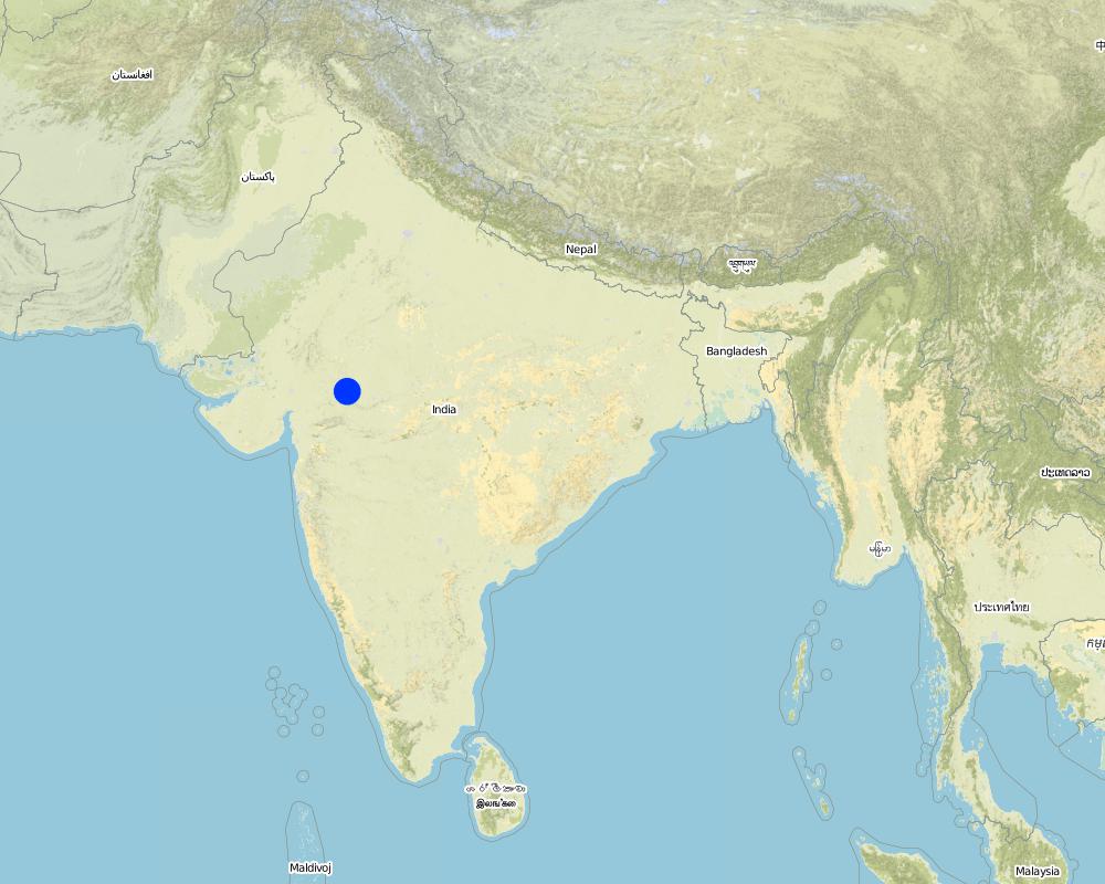
2.5 البلد/المنطقة/المواقع التي تم تنفيذ التقنية فيها والتي يغطيها هذا التقييم
البلد:
الهند
المنطقة/الولاية/المحافظة:
Madhya Pradesh
حدد انتشار التقنية:
- منتشرة بالتساوي على مساحة
إذا كانت التقنيةا موزعة بالتساوي على منطقة ما، حدد المساحة المغطاة (بالكيلومتر المربع):
48,0
إذا كانت المساحة الدقيقة غير معروفة، فيرجى الإشارة إلى المنطقة التقريبية المغطاة:
- 100-10 كم2
التعليقات:
Total area covered by the SLM Technology is 48 km2.
The area comprises 36 villages with 1632 household mainly tribal. Villages comprise a larger settlement along with a number of hamlets. The topography is rolling and gently undulating. The area forms the catchment of the Larki stream, which forms the upper catchment of the river Mahi.
Map
×2.6 تاريخ التنفيذ
في حالة عدم معرفة السنة بالتحديد، يرجى الإشارة إلى التاريخ التقريبي:
- منذ أقل من 10 سنوات (مؤخرًا)
2.7 إدخال التقنية
حدد كيف تم إدخال التقنية:
- من خلال المشاريع/ التدخلات الخارجية
التعليقات (نوع المشروع، الخ):
The technology has been developed by the project as modification/improvement to Dugout pond constructed under NWDPRA (National Watershed Development Program for Rainfed Areas).
3. تصنيف تقنية الإدارة المستدامي للأراضي
3.1 الغرض الرئيسي ( الأغراض الرئيسية) للتقنية
- التكيف مع تغير المناخ/الظواهر المتطرفة وآثارها
3.2 نوع (أنواع) استخدام الأراضي الحالية حيث يتم تطبيق التقنية
استخدامات الأراضي مختلطة ضمن نفس وحدة الأرض:
نعم
حدد استخدام الأراضي المختلطة (المحاصيل / الرعي / الأشجار):
- الرعي الزراعي (بما في ذلك الإدارة المتكاملة للمحاصيل والثروة الحيوانية)

الأراضي الزراعية
- زراعة سنوية
الزراعة السنوية - حدد المحاصيل:
- الحبوب - الذرة
- الحبوب - قمح (شتوي)
- محاصيل الألياف - قطن
- الحبوب البقولية والبقول- الفاصوليا
- الحبوب البقولية والبقول - أخرى
- الحبوب البقولية والبقول -فول الصويا
عدد مواسم الزراعة في السنة:
- 2
حدد:
Longest growing period in days: 150 Longest growing period from month to month: Nov - Mar Second longest growing period in days: 135 Second longest growing period from month to month: Jun - Sep

أراضي الرعي
التعليقات:
Major land use problems (compiler’s opinion): 1. Utilisation of slopy and stony (class VI) land for agriculture. 2. Agriculture practices along the slope, use of erosion permitting crop eg. Cotton, Maize. 3. Excessive grazing of grass land.
Major land use problems (land users’ perception): shallow soils, low soil moisture , low yields , non-availability of grazing land.
Type of cropping system and major crops comments: Monsoon - Cotton + Maize + Blackgram /Soyabean. Winter (with irrigation) - Wheat + Gram (excluding Cotton fields).
3.4 إمدادات المياه
إمدادات المياه للأرض التي يتم تنفيذ التقنية عليها:
- بعلية
التعليقات:
Water supply: Also mixed rainfed - irrigated
3.5 مجموعةالإدارة المستدامة للأراضي التي تنتمي إليها هذه التقنية
- حصاد المياه
- إدارة الري (بما في ذلك إمدادات المياه والصرف الصحي)
- إدارة المياه الجوفية
3.7 الأنواع الرئيسية من تدهور الأراضي التي تناولتها التقنية

تآكل التربة بالمياه
- (Wg):الانجراف الخلجاني/ الخلجان

تدهور المياه
- (Ha): التجفيف
التعليقات:
Main type of degradation addressed: Ha: aridification
Secondary types of degradation addressed: Wg: gully erosion / gullying
Main causes of degradation: other human induced causes (specify) (Social causes - Lack of awareness and mobilisation amongst the communities.), Top down approach (Macro planning rather than micro (village level) planning.)
4. المواصفات الفنية، وأنشطة التنفيذ، والمدخلات، والتكاليف
4.1 الرسم الفني للتقنية
المواصفات الفنية (المتعلقة بالرسم الفني):
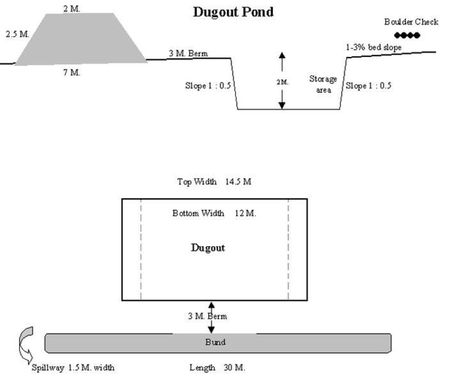
Technical Drawing of Dugout Pond
Technical knowledge required for field staff / advisors: moderate
Technical knowledge required for land users: low
Main technical functions: increase of infiltration
Secondary technical functions: control of dispersed runoff: retain / trap, water harvesting / increase water supply
Construction material (earth): Excavated material used for embankment.
Construction material (stone): Excavated stones used for pitching.
المؤلف:
Rajesh Parihar, India
4.2 معلومات عامة بخصوص حساب المدخلات والتكاليف
عملة أخرى/ عملة وطنية (حدد):
Rupees
إذا كان ذا صلة، وضح سعر الصرف من الدولار الأمريكي إلى العملة المحلية (على سبيل المثال، 1 دولار أمريكي = 79.9 ريال برازيلي): 1 دولار أمريكي =:
48,85
اذكر متوسط تكلفة أجر العمالة المستأجرة في اليوم الواحد:
1.00
4.3 أنشطة التأسيس
| النشاط | التوقيت (الموسم) | |
|---|---|---|
| 1. | Discussion in VWDC meeting | March-April |
| 2. | Site selection | March-April |
| 3. | Identification of beneficiaries, users group formation | March-April |
| 4. | Design & estimate | March-April |
| 5. | Agreement with VWDC | March-April |
| 6. | Treatment of catchment area | April-May |
| 7. | Construction of dugout pond | April-May |
| 8. | Seeding of embankment | June-July |
4.4 التكاليف والمدخلات اللازمة للتأسيس
التعليقات:
Duration of establishment phase: 12 month(s)
4.5 الصيانة/الأنشطة المتكررة
| النشاط | التوقيت/الوتيرة | |
|---|---|---|
| 1. | Monitoring by users group | Year around/Regular |
| 2. | Report of damage, breakage in VWDC | Rainy season/After heavy shower |
| 3. | Decision regarding repair by VWDC/UG | Rainy season/After heavy shower |
| 4. | Necessary repaires carried out | Rainy season/After heavy shower |
| 5. | Desilting | Dry season/annual |
4.6 التكاليف والمدخلات اللازمة للصيانة/للأنشطة المتكررة (سنويًا)
التعليقات:
The size of dugout described in 2.7.1 is :- Excavated area - 13m long X 12m wide X 2.5m Bund - 30m long X2.5m height X 2m top width X 7m bottom width
4.7 أهم العوامل المؤثرة على التكاليف
قدم وصفا لأهم العوامل التي تؤثر على التكاليف:
1- Cost of excavation increases with hardness of strata. 2- Non availability of stones locally for pitching.
5. البيئة الطبيعية والبشرية
5.1 المناخ
هطول الأمطار السنوي
- < 250 مم
- 251- 500 ملم
- 501 - 750ملم
- 1,000-751 ملم
- 1,500-1,100 ملم
- 2,000-1,500 ملم
- 3,000-2,001 ملم
- 4,000-3,100 ملم
- > 4000 ملم
حدد متوسط هطول الأمطار السنوي (إذا كان معروفًا)، بالملليمتر:
800,00
المواصفات/التعليقات على هطول الأمطار:
However for the past 4 years the area has received below average rainfall.
المنطقة المناخية الزراعية
- شبه قاحلة
90 - 120 days LGP - monsoon
5.2 طوبوغرافيا
متوسط الانحدارات:
- مسطح (0-2%)
- بسيط (3-5%)
- معتدل (6-10%)
- متدحرج (11-15%)
- تلال (16-30%)
- شديدة الانحدار(31-60%)
- فائقة الانحدار (>60%)
التضاريس:
- هضاب/سهول
- أثلام مرتفعة
- المنحدرات الجبلية
- منحدرات التلال
- منحدرات في السفوح
- قاع الوادي
المنطقة الارتفاعية:
- 100-0 متر فوق سطح البحر
- 500-101 متر فوق سطح البحر
- 1,000-501 متر فوق سطح البحر
- 1,500-1,001 متر فوق سطح البحر
- 2,000-1,501 متر فوق سطح البحر
- 2,500-2,100 متر فوق سطح البحر
- 3,000-2,501 متر فوق سطح البحر
- 4,000-3,001 متر فوق سطح البحر
- > 4000 متر فوق سطح البحر
التعليقات والمواصفات الإضافية بشأن التضاريس:
Landforms: Ridges (ranked 1, gradually undulating topography) and hill slopes (ranked 2)
Slopes on average: Moderate (ranked 1, fields in upper catchment) and gentle (ranked 2, fields in valley portion)
5.3 التربة
متوسط عمق التربة:
- ضحل جدًا (0-20 سم)
- ضحلة (21-50 سم)
- متوسطة العمق (51-80 سم)
- عميقة (81-120 سم)
- عميقة جدًا (> 120 سم)
قوام التربة (التربة السطحية):
- متوسط ( طميي، سلتي)
المواد العضوية في التربة السطحية:
- منخفضة (<1%)
إذا كان متاحًا، قم بإرفاق وصف كامل للتربة أو تحديد المعلومات المتوفرة، على سبيل المثال نوع التربة، الرقم الهيدروجيني/ درجة حموضة التربة، قدرة التبادل الكاتيوني، النيتروجين، الملوحة وما إلى ذلك.
Soil depth on average: Shallow (ranked 1, fields on ridge/slopes), very shallow (ranked 2, ridge portion) and moderately deep (ranked 3, fields in valley)
Soil fertility: Medium (ranked 1) and low (ranked 2, fields on ridge/slopes, grass land)
Soil drainage/infiltration: Good (ranked 1, sloping land, shallow soils) and medium (ranked 2, fields in valley)
Soil water storage capacity: Low (ranked 1, shallow soils) and medium (ranked 2, deep soils)
5.6 خصائص مستخدمي الأراضي الذين يطبقون التقنية
الدخل من خارج المزرعة:
- 10-50% من جميع الإيرادات
المستوى النسبي للثروة:
- ضعيف
- متوسط
اذكر الخصائص الأخرى ذات الصلة لمستخدمي الأراضي:
Population density: 200-500 persons/km2
Annual population growth: > 4%
33% of the land users are average wealthy and own 33% of the land (Few farmers with wells, fields in valley.).
50% of the land users are poor and own 57% of the land (Majority of farmers.).
17% of the land users are poor and own 10% of the land (Very small holding.).
Off-farm income specification: While main income is from rainfed agriculture, significant income is obtained during migration, which increases during drought periods.
Level of mechanization: Animal traction (ranked 1, land preparation), manual labour (ranked 2, land preparation, weeding, harvesting) and mechanised (ranked 3, threshing)
5.8 ملكية الأراضي، وحقوق استخدام الأراضي، وحقوق استخدام المياه
ملكية الارض:
- مجتمعي/قروي
حقوق استخدام الأراضي:
- وصول مفتوح (غير منظم)
- فردي
6. الآثار والتصريحات الختامية
6.4 تحليل التكلفة والعائد
كيف يمكن مقارنة العوائد نسبة لتكاليف الإنشاء (من وجهة نظر مستخدمي الأراضي)؟
عوائد قصيرة الأجل:
محايد/متوازن
عوائد طويلة الأجل:
إيجابي
كيف تتم مقارنة العوائدمع كلفة الصيانة/التكاليف المتكررة (من وجهة نظر مستخدمي الأراضي)؟
عوائد قصيرة الأجل:
إيجابي
عوائد طويلة الأجل:
إيجابي
6.5 اعتماد التقنية
إذا كان متاحًا، قم بتحديد الكمية (عدد الأسر المعيشية و/أو المساحةالمغطاة):
1672
التعليقات:
100% of land user families have adopted the Technology with external material support
1632 land user families have adopted the Technology with external material support
Comments on acceptance with external material support: estimates
40 land user families have adopted the Technology without any external material support
Comments on spontaneous adoption: survey results
There is a little trend towards spontaneous adoption of the Technology
Comments on adoption trend: The community is very poor and hence requires some financial support to offset loss of wages.
7. المراجع والروابط
7.1 طرق جمع/مصادر المعلومات
الروابط والوحدات المواضيعية
توسيع الكل طي الكلالروابط

Comprehensive watershed development [الهند]
Participatory approach that includes a package of measures leading to empowerment of communities to implement and sustain watershed development.
- جامع المعلومات: David Gandhi
الوحدات المواضيعية
لا يوجد وحدات مواضيعية


