Multi-specific plantation of semiarid woody species on slopes [إسبانيا]
- تاريخ الإنشاء:
- تحديث:
- جامع المعلومات: Susana Bautista
- المحرر: matteo jucker riva
- المراجعون: Fabian Ottiger, Alexandra Gavilano
Plantación pluriespecífica de especies leñosas de ambiente semiárido en laderas
technologies_1618 - إسبانيا
عرض الأقسام
توسيع الكل طي الكل1. معلومات عامة
1.2 تفاصيل الاتصال بالأشخاص الرئيسيين لمصدر المعلومات والمؤسسات المشاركة في تقييم وتوثيق التقنية
متخصص في الإدارة المستدامة للأراضي:
Guixot Lorena
Universidad de Alicante
إسبانيا
متخصص في الإدارة المستدامة للأراضي:
Urgeghe Anna Maria
Universidad de Alicante
إسبانيا
Governement official:
Bartual Miguel
Conselleria de infrastructuras, territorio y medioambiente
إسبانيا
اسم المشروع الذي سهّل توثيق/تقييم التقنية (إذا كان ذلك على صلة)
Catastrophic shifts in drylands (EU-CASCADE)اسم المؤسسة (المؤسسات) التي سهلت توثيق/تقييم التقنية (إذا كان ذلك على صلة)
Universidad de Alicante (Universidad de Alicante) - إسبانيااسم المؤسسة (المؤسسات) التي سهلت توثيق/تقييم التقنية (إذا كان ذلك على صلة)
Conselleria de infrastructuras, territorio y medioambiente - إسبانيا1.3 الشروط المتعلقة باستخدام البيانات الموثقة من خلال WOCAT
يوافق جامع المعلومات والشخص (لاشخاص) الرئيسي لمصدر المعلومات على الشروط المتعلقة باستخدام البيانات الموثقة من خلال WOCAT:
نعم
2. وصف تقنيةالإدارة المستدامي للأراضي
2.1 وصف مختصر للتقنية
تعريف التقنية:
Plantation of native woody species using planting holes on slopes
2.2 وصف تفصيلي للتقنية
الوصف:
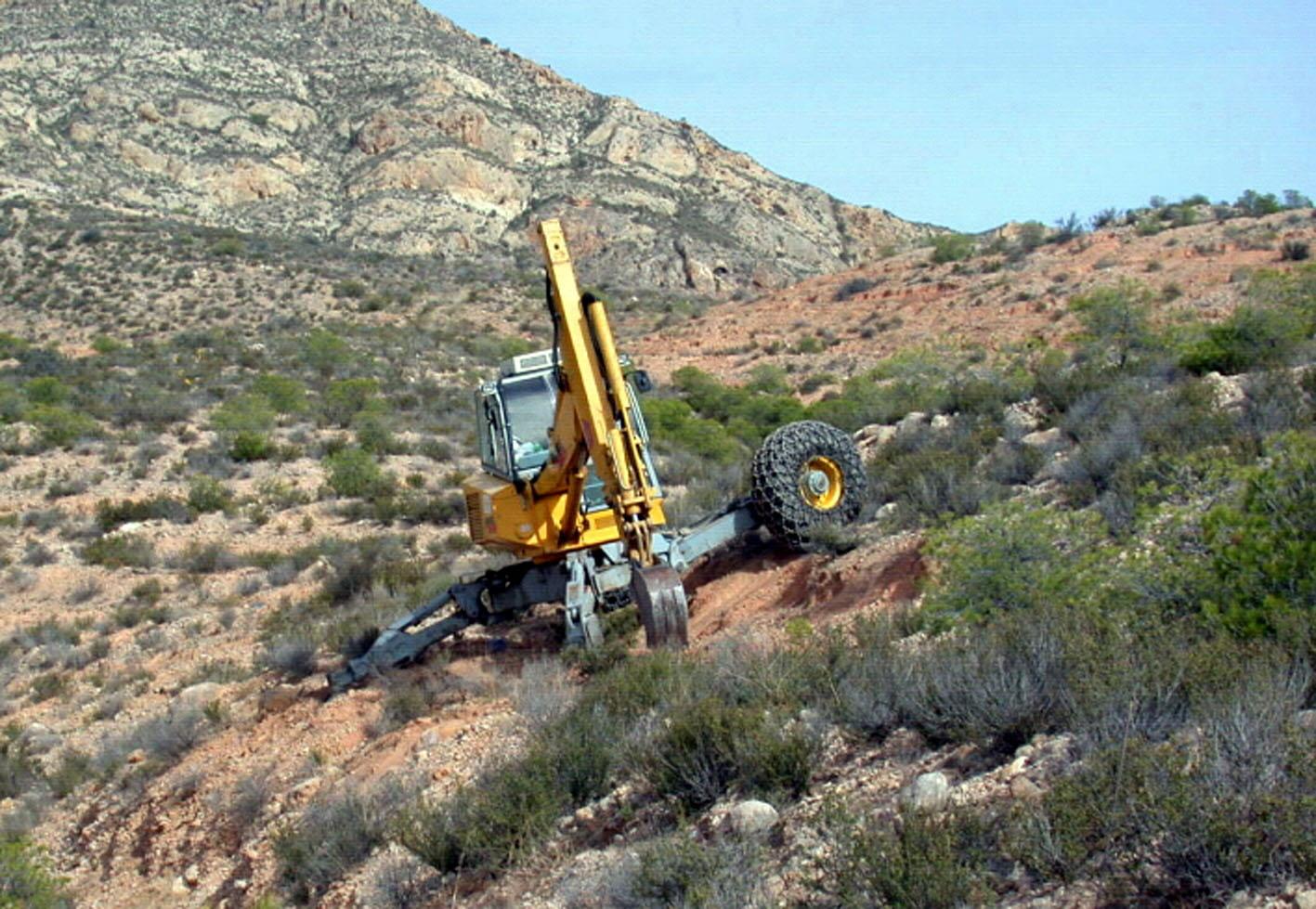
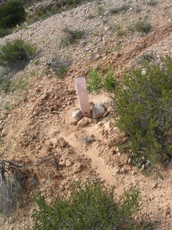
This technology is a restauration technology implemented on degraded south-facing slopes of a semiarid mountain range. The restoration technology consisted of a plantation of seedlings of a variety of native woody species, mostly shrubs, using deep (60cm depth) planting holes. Microcatchments were established upslope the planting hole in suitable areas. Seedlings were protected from extreme radiation and predation by biodegradable seedling shelters. The target area was highly degraded due to long-term overexploitation of resources under harsh environmental conditions. Failed previous reforestation actions on bench terraces led to further degradation in some areas. Degradation resulted in low plant cover, decreased plant biodiversity, lack of riparian vegetation on the ramblas (ravines with intermittent flow), soil erosion, development of gullies, and frequent floods. To address this problem, the Forest Administration implemented a restoration program on the south-facing slopes of the Albatera-Crevillente mountain range. The program was implemented in 2006-07.
Purpose of the Technology: The purpose of the plantation is the restoration of diversity and cover of vegetation on degraded south-facing slopes of a semiarid mountain range, erosion control, and flood prevention.
Natural / human environment: The target area is the south-facing side of a mountain range in a semiarid area of Southeast Spain. Exploitation of resources over centuries, mostly grazing and wood gathering, under harsh environmental conditions, led to very low plant cover, mostly consisting of dwarf shrubs sparsed in a matrix of bare soil, lack of riparian vegetation on the ramblas (ravines with intermittent flow), soil erosion, development of gullies, and frequent floods. The exploitation of the land was drastically reduced during the second half of the 20th century due to the general rural land abandonment trend that started in Spain around the 1950’s driven by critical socio-economic changes such as the use of fossil fuels and the sharp increase in activity in the tourism and services business sectors, mostly in the coast land. However, despite the reduction, or even complete abandonment, of rural activity on the mountain range area, there was no sign of spontaneous recovery from degradation. Soil erosion and floods were of major concern for the resource managers in the area (Public Forest Administration), and a number of reforestation and restoration programs have been implemented in the area, with varying degree of success. In more recent decades, new pressures appeared in the mountain area, such as agricultural expansion into the range area (1970s), mining activities (late 1990’s - early 2000’s), and urbanization (2000s). Rural tourism and recreation are new activities in the mountain range area. For the time being, the intensity of these activities is low to moderate. However there is already some evidence of incipient degradation associated to recreation, and some regulation is being demanded by environmental NGOs.
2.3 صور التقنية
2.5 البلد/المنطقة/المواقع التي تم تنفيذ التقنية فيها والتي يغطيها هذا التقييم
البلد:
إسبانيا
المنطقة/الولاية/المحافظة:
Spain/Alicante
مزيد من التفاصيل حول الموقع:
Albatera
التعليقات:
Comments:
Total area covered by the SLM Technology is 5.7 km2.
The MST was applied on the south-facing side of Albatera-Crevillente mountain range. The area consisted of a sequence of southeast and southwest-facing slopes with small ravines (barrrancos) in between. The MST was specifically applied to the slopes.
2.6 تاريخ التنفيذ
في حالة عدم معرفة السنة بالتحديد، يرجى الإشارة إلى التاريخ التقريبي:
- منذ أقل من 10 سنوات (مؤخرًا)
2.7 إدخال التقنية
حدد كيف تم إدخال التقنية:
- من خلال المشاريع/ التدخلات الخارجية
التعليقات (نوع المشروع، الخ):
The MST was designed by the Forest Administration in the framework of a restoration programme for degraded semiarid lands and incorporated recent scientific findings regarding the technology and species used.
3. تصنيف تقنية الإدارة المستدامي للأراضي
3.1 الغرض الرئيسي ( الأغراض الرئيسية) للتقنية
- الحد من تدهور الأراضي ومنعه وعكسه
- الحد من مخاطر الكوارث
3.2 نوع (أنواع) استخدام الأراضي الحالية حيث يتم تطبيق التقنية

الغابات/ الأراضي الحرجية
- Olea europaea var sylvestris, Ephedra fragilis, Pistacia lentiscus and Pinus halepensis
منتجات وخدمات:
- الترفيه / السياحة
التعليقات:
Major land use problems (compiler’s opinion): Erosion, water scarcity, low productivity, loss of soil functions (water infiltration, nutrient cycling), low biodiversity, loss of landscape structure
Major land use problems (land users’ perception): Low productivity, aridity, erosion
Plantation forestry: Without exploitation
Forest products and services: nature conservation / protection, recreation / tourism
Future (final) land use (after implementation of SLM Technology): Forests / woodlands: Fp: Plantations, afforestations
Number of growing seasons per year:
1
Specify:
Longest growing period in days: 240Longest growing period from month to month: November-June
3.5 مجموعةالإدارة المستدامة للأراضي التي تنتمي إليها هذه التقنية
- تحسين الغطاء الأرضي/النباتي
- التدابير المتقاطعة للمنحدرات
3.6 التدابير التقنية في مجال إلادارة المستدامة للأراضي

التدابير النباتية
- V1: غطاء من الأشجار والشجيرات

التدابير البنيوية
- S1: المصاطب المتدرجة
التعليقات:
Main measures: vegetative measures
3.7 الأنواع الرئيسية من تدهور الأراضي التي تناولتها التقنية

تآكل التربة بالمياه
- الوزن(Wt): فقدان التربة السطحية/تآكل السطح
- (Wo:) تأثيرات التدهور من مواقع أخرى

التدهور البيولوجي
- (Bc): تناقص الغطاء النباتي
- (Bq): انخفاض الكمية/الكتلة الحيوية
- (Bs): انخفاض جودة وتركيبة الأنواع/التنوع

تدهور المياه
- (Ha): التجفيف
التعليقات:
Main type of degradation addressed: Wt: loss of topsoil / surface erosion, Wo: offsite degradation effects, Bc: reduction of vegetation cover, Bq: quantity / biomass decline, Bs: quality and species composition /diversity decline
Secondary types of degradation addressed: Ha: aridification
Main causes of degradation: deforestation / removal of natural vegetation (incl. forest fires) (Agricultural land expansion. Starting in 1965, peaking in late 1970’s), over-exploitation of vegetation for domestic use (Peaking during 1940’s), poverty / wealth (Poverty)
Secondary causes of degradation: overgrazing (Peaking during 1940’s), industrial activities and mining (Late 1990’s - early 2000’s), urbanisation and infrastructure development (Last 10 years), droughts, population pressure (Relative demographic pressure given the low productivity of the land), land tenure (Lack of proper land demarcation until late 1990’s - early 2000’s, leading to misuse and mismanagement of public land)
3.8 منع أو حد أو عكس تدهور الأراضي
التعليقات:
Main goals: rehabilitation / reclamation of denuded land
Secondary goals: prevention of land degradation, mitigation / reduction of land degradation
4. المواصفات الفنية، وأنشطة التنفيذ، والمدخلات، والتكاليف
4.1 الرسم الفني للتقنية
المواصفات الفنية (المتعلقة بالرسم الفني):
Test
Location: Test. Test
Date: Test
Technical knowledge required for field staff / advisors: moderate (Needed for field implementation: soil preparation, planting techniques)
Technical knowledge required for land users: high (Forest Administration staff: High technical knowledge is required for the design of technology implementation)
Main technical functions: control of dispersed runoff: retain / trap, improvement of ground cover, increase in nutrient availability (supply, recycling,…)
Secondary technical functions: control of raindrop splash, control of dispersed runoff: impede / retard, control of concentrated runoff: retain / trap, increase of surface roughness, improvement of surface structure (crusting, sealing), improvement of topsoil structure (compaction), stabilisation of soil (eg by tree roots against land slides), increase in organic matter, increase of infiltration, increase / maintain water stored in soil, sediment retention / trapping, sediment harvesting, increase of biomass (quantity), promotion of vegetation species and varieties (quality, eg palatable fodder), spatial arrangement and diversification of land use
Vegetative measure: Staggered pattern
Vegetative material: T : trees / shrubs
Number of plants per (ha): 610
Spacing between rows / strips / blocks (m): 5
Vertical interval within rows / strips / blocks (m): 5
Vegetative measure: Vegetative material: T : trees / shrubs
Vegetative measure: Vegetative material: T : trees / shrubs
Vegetative measure: Vegetative material: T : trees / shrubs
Trees/ shrubs species: Olea europaea var sylvestris, Ephedra fragilis, Pistacia lentiscus and Pinus halepensis
المؤلف:
Test, Test
4.2 معلومات عامة بخصوص حساب المدخلات والتكاليف
عملة أخرى/ عملة وطنية (حدد):
Euro
إذا كان ذا صلة، وضح سعر الصرف من الدولار الأمريكي إلى العملة المحلية (على سبيل المثال، 1 دولار أمريكي = 79.9 ريال برازيلي): 1 دولار أمريكي =:
0,78
4.3 أنشطة التأسيس
| النشاط | التوقيت (الموسم) | |
|---|---|---|
| 1. | Soil preparation and planting holes | during winter |
| 2. | Soil and microcatchment preparation | during winter |
| 3. | Fertilization plantation (holes) | Winter |
| 4. | Fertilization microcatchment | Winter |
| 5. | Plantation | during winter |
| 6. | Plantation (microcatchments) | during winter |
| 7. | Tree shelter placement | late winter |
| 8. | tree shelter placement (Microcatchments) | late winter |
4.4 التكاليف والمدخلات اللازمة للتأسيس
| تحديد المدخلات | الوحدة | الكمية | التكاليف لكل وحدة | إجمالي التكاليف لكل مدخل | % من التكاليف التي يتحملها مستخدمو الأراضي | |
|---|---|---|---|---|---|---|
| العمالة | Labour | ha | 1,0 | 1343,0 | 1343,0 | 100,0 |
| معدات | Machine use | ha | 1,0 | 853,0 | 853,0 | 100,0 |
| المواد النباتية | Seedlings | ha | 1,0 | 252,0 | 252,0 | 100,0 |
| الأسمدة والمبيدات الحيوية | Biocides | ha | 1,0 | 154,0 | 154,0 | 100,0 |
| غير ذلك | Tree shelters | ha | 1,0 | 424,0 | 424,0 | 100,0 |
| إجمالي تكاليف إنشاء التقنية | 3026,0 | |||||
| إجمالي تكاليف إنشاء التقنية بالدولار الأمريكي | 3879,49 | |||||
التعليقات:
Duration of establishment phase: 5 month(s)
4.6 التكاليف والمدخلات اللازمة للصيانة/للأنشطة المتكررة (سنويًا)
التعليقات:
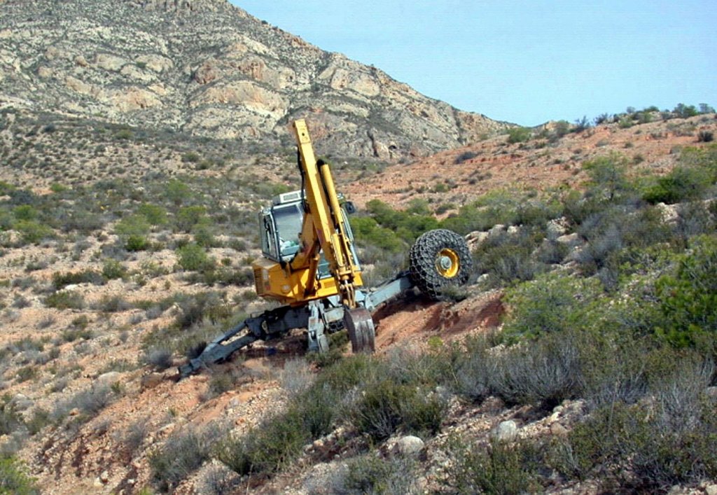
Machinery/ tools: Walking Excavator
5. البيئة الطبيعية والبشرية
5.1 المناخ
هطول الأمطار السنوي
- < 250 مم
- 251- 500 ملم
- 501 - 750ملم
- 1,000-751 ملم
- 1,500-1,100 ملم
- 2,000-1,500 ملم
- 3,000-2,001 ملم
- 4,000-3,100 ملم
- > 4000 ملم
المواصفات/التعليقات على هطول الأمطار:
280 mm (mean 1958 – 2007) Rainy seasons: spring and autumn
المنطقة المناخية الزراعية
- شبه قاحلة
Thermal climate class: subtropics
5.2 طوبوغرافيا
متوسط الانحدارات:
- مسطح (0-2%)
- بسيط (3-5%)
- معتدل (6-10%)
- متدحرج (11-15%)
- تلال (16-30%)
- شديدة الانحدار(31-60%)
- فائقة الانحدار (>60%)
التضاريس:
- هضاب/سهول
- أثلام مرتفعة
- المنحدرات الجبلية
- منحدرات التلال
- منحدرات في السفوح
- قاع الوادي
المنطقة الارتفاعية:
- 100-0 متر فوق سطح البحر
- 500-101 متر فوق سطح البحر
- 1,000-501 متر فوق سطح البحر
- 1,500-1,001 متر فوق سطح البحر
- 2,000-1,501 متر فوق سطح البحر
- 2,500-2,100 متر فوق سطح البحر
- 3,000-2,501 متر فوق سطح البحر
- 4,000-3,001 متر فوق سطح البحر
- > 4000 متر فوق سطح البحر
وضح ما إذا كانت التقنية مطبقة على وجه التحديد في:
- غير ذات صلة
5.3 التربة
متوسط عمق التربة:
- ضحل جدًا (0-20 سم)
- ضحلة (21-50 سم)
- متوسطة العمق (51-80 سم)
- عميقة (81-120 سم)
- عميقة جدًا (> 120 سم)
قوام التربة (التربة السطحية):
- خشن / خفيف (رملي)
- متوسط ( طميي، سلتي)
المواد العضوية في التربة السطحية:
- متوسطة (1-3%)
إذا كان متاحًا، قم بإرفاق وصف كامل للتربة أو تحديد المعلومات المتوفرة، على سبيل المثال نوع التربة، الرقم الهيدروجيني/ درجة حموضة التربة، قدرة التبادل الكاتيوني، النيتروجين، الملوحة وما إلى ذلك.
Soil texture is medium (Sandy- loam (dominant))
Soil fertility is low
Soil drainage/infiltration is good
Soil water storage capacity is medium
5.4 توافر المياه ونوعيتها
منسوب المياه الجوفية:
> 50 م
توافر المياه السطحية:
ضعيف/ غير متوافر
نوعية المياه (غير المعالجة):
للاستخدام الزراعي فقط (الري)
تعليقات ومواصفات أخرى بشأن نوعية المياه وكميتها:
Water quality (untreated): For agricultural use only (irrigation)(groundwater)
5.5 التنوع البيولوجي
تنوع الأنواع:
- متوسط
5.6 خصائص مستخدمي الأراضي الذين يطبقون التقنية
الدخل من خارج المزرعة:
- >50% من إجمالي الدخل
أفراداً أو مجموعات:
- موظف (شركة، حكومة)
الجنس:
- نساء
- رجال
اذكر الخصائص الأخرى ذات الصلة لمستخدمي الأراضي:
Land users applying the Technology are mainly Leaders / privileged
Population density: 100-200 persons/km2
Annual population growth: 2% - 3%
Market orientation of production system: No forestry production
5.7 متوسط مساحة الأرض التي يستخدمها مستخدمو الأراضي الذين يطبقون التقنية
- < 0.5 هكتارا
- 0.5 - 1 هكتار
- 1 -2 هكتار
- 2 - 5 هكتار
- 5 - 15 هكتار
- 15 - 50 هكتار
- 50 - 100هكتار
- 500-100 هكتار
- 1,000-500 هكتار
- 10,000-1,000 هكتار
- > 10,000 هكتار
هل يعتبر هذا نطاقًا صغيرًا أو متوسطًا أو واسعا (في إشارة إلى السياق المحلي)؟:
- على نطاق واسع
التعليقات:
Public land
5.8 ملكية الأراضي، وحقوق استخدام الأراضي، وحقوق استخدام المياه
ملكية الارض:
- دولة
حقوق استخدام الأراضي:
- وصول مفتوح (غير منظم)
5.9 الوصول إلى الخدمات والبنية التحتية
الصحة:
- ضعيف
- معتدل
- جيد
التعليم:
- ضعيف
- معتدل
- جيد
المساعدة التقنية:
- ضعيف
- معتدل
- جيد
العمل (على سبيل المثال خارج المزرعة):
- ضعيف
- معتدل
- جيد
الأسواق:
- ضعيف
- معتدل
- جيد
الطاقة:
- ضعيف
- معتدل
- جيد
الطرق والنقل:
- ضعيف
- معتدل
- جيد
مياه الشرب وخدمات الصرف الصحي:
- ضعيف
- معتدل
- جيد
الخدمات المالية:
- ضعيف
- معتدل
- جيد
6. الآثار والتصريحات الختامية
6.1 الآثار التي أظهرتها التقنية في الموقع
الآثار الاجتماعية والثقافية
الفرص الترفيهية
المعرفة بالإدارة المستدامة للأراضي/تدهور الأراضي
Improved livelihoods and human well-being
التعليقات/ حدد:
Recreational use
الآثار الايكولوجية
دورة المياه / الجريان السطحي
حصاد / جمع المياه
الجريان السطحي
التبخر
التربة
رطوبة التربة
غطاء التربة
فقدان التربة
دورة المغذيات/إعادة الشحن
المادة العضوية في التربة/تحت الطبقة c
التنوع البيولوجي: الغطاء النباتي، الحيوانات
الكتلة الحيوية/ طبقة الكربون فوق التربة
التنوع النباتي
التنوع الحيواني
الأنواع المفيدة
تنوع الموائل
6.2 الآثار التي أظهرتها التقنية خارج الموقع
الفيضان في اتجاه مجرى النهر
6.3 تعرض التقنية وحساسيتها لتغير المناخ التدريجي والظواهر المتطرفة/الكوارث المرتبطة بالمناخ (كما يراها مستخدمو الأراضي)
تغير مناخ تدريجي
تغير مناخ تدريجي
| الموسم | زيادة أو نقصان | كيف تتعامل التقنية مع ذلك؟ | |
|---|---|---|---|
| درجة الحرارة السنوية | زيادة | جيدا |
الظواهر المتطرفة / الكوارث المرتبطة بالمناخ
الكوارث الجوية
| كيف تتعامل التقنية مع ذلك؟ | |
|---|---|
| عاصفة ممطرة محلية | ليس جيدا |
| عاصفة هوائية محلية | غير معروف |
الكوارث المناخية
| كيف تتعامل التقنية مع ذلك؟ | |
|---|---|
| جفاف | ليس جيدا |
الكوارث الهيدرولوجية
| كيف تتعامل التقنية مع ذلك؟ | |
|---|---|
| فيضان عام (نهر) | غير معروف |
العواقب الأخرى المتعلقة بالمناخ
العواقب الأخرى المتعلقة بالمناخ
| كيف تتعامل التقنية مع ذلك؟ | |
|---|---|
| انخفاض فترة النمو | جيدا |
6.4 تحليل التكلفة والعائد
كيف يمكن مقارنة العوائد نسبة لتكاليف الإنشاء (من وجهة نظر مستخدمي الأراضي)؟
عوائد قصيرة الأجل:
سلبي قليلا
عوائد طويلة الأجل:
إيجابي
7. المراجع والروابط
7.1 طرق جمع/مصادر المعلومات
الروابط والوحدات المواضيعية
توسيع الكل طي الكلالروابط
لا يوجد روابط
الوحدات المواضيعية
لا يوجد وحدات مواضيعية


