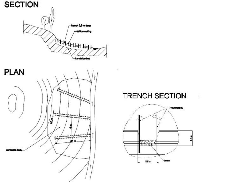
Landslide prevention using drainage trenches lined with fast growing trees. [طاجيكستان]
- تاريخ الإنشاء:
- تحديث:
- جامع المعلومات: Giuseppe Bonati
- المحرر: –
- المراجعون: David Streiff, Alexandra Gavilano
technologies_1457 - طاجيكستان
- Landslide prevention using drainage trenches lined with fast growing trees.: 16 مارس، 2017 (inactive)
- Landslide prevention using drainage trenches lined with fast growing trees.: 21 يوليو، 2017 (inactive)
- Landslide prevention using drainage trenches lined with fast growing trees.: 19 أغسطس، 2019 (inactive)
- Landslide prevention using drainage trenches lined with fast growing trees.: 2 نوفمبر، 2021 (public)
عرض الأقسام
توسيع الكل طي الكل1. معلومات عامة
1.2 تفاصيل الاتصال بالأشخاص الرئيسيين لمصدر المعلومات والمؤسسات المشاركة في تقييم وتوثيق التقنية
متخصص في الإدارة المستدامة للأراضي:
اسم المؤسسة (المؤسسات) التي سهلت توثيق/تقييم التقنية (إذا كان ذلك على صلة)
CESVI (CESVI) - طاجيكستان1.3 الشروط المتعلقة باستخدام البيانات الموثقة من خلال WOCAT
يوافق جامع المعلومات والشخص (لاشخاص) الرئيسي لمصدر المعلومات على الشروط المتعلقة باستخدام البيانات الموثقة من خلال WOCAT:
نعم
2. وصف تقنيةالإدارة المستدامي للأراضي
2.1 وصف مختصر للتقنية
تعريف التقنية:
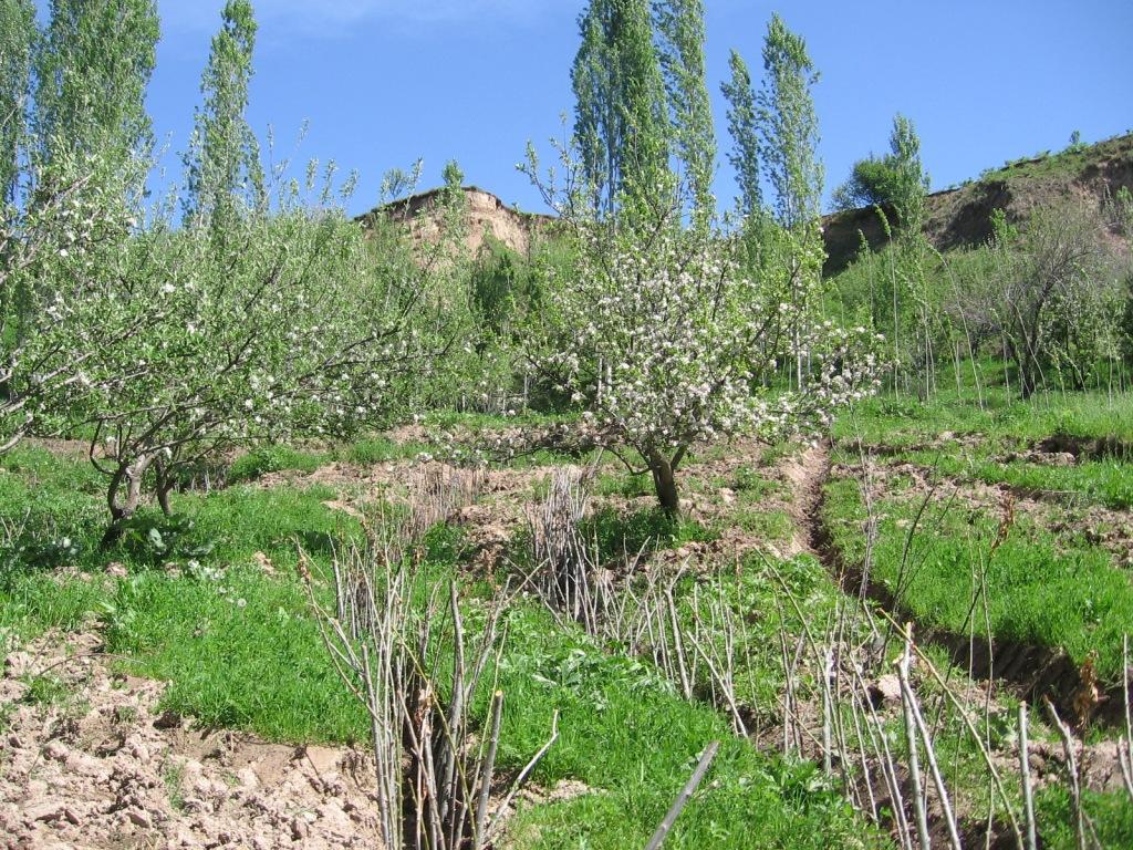
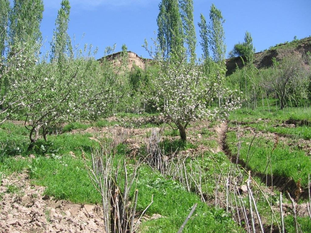
The construction of linear gravel bed ditches lined with local tree species, at angles across a hill slope to channel the surface water.
2.2 وصف تفصيلي للتقنية
الوصف:
A series of 80m long ditches are constructed at angles of approximately 30 degrees, across a hill slope at the base of the watershed. This land is prone to waterlogging, therefore several ditches approximately 0.5m deep, with a gravel bed to prevent erosion, drain the excess surface water away to the main tributary of the watershed. The edge of the ditches are further lined with fast growing tree species such as willow and poplar for stabilisation and afforestation purposes.
Purpose of the Technology: The purpose of the ditches is two fold, firstly to channel the surface water to prevent waterlogging that had previously led to landslides and small mud flows. Secondly, to enable cultivation on land that was previously unusable.
Establishment / maintenance activities and inputs: The technology is very simple and cost effective. Initially there needs to be an assessment of the amount of surface water that runs over the slope, this will determine the number of ditches required. The ditches are marked out, running at approximately 30 degrees perpendicular to the slope. The ditches are dug to a depth of 0.5m (or deeper) and filled with a base layer of stone to prevent the bed of the ditch from being eroded. Once the ditch is established, preferably in the spring time, fast growing and naturally available cuttings from trees such as poplars and willows are planted alongside the edge of the ditch at 0.2m intervals. These will stabilise the ditch bank and as the trees become established some thinning out will be required due to their close proximity to each other.
Natural / human environment: The area used is a hillside slope, subject to substantial amounts of surface water run off due to its location at the base of the watershed. The region suffers from a lack of accessible irrigation water, especially during the hot summer months. This technology allows land to be brought into cultivation that has natural access to water and is able to sustain vegetation during the dry months.
2.3 صور التقنية
2.5 البلد/المنطقة/المواقع التي تم تنفيذ التقنية فيها والتي يغطيها هذا التقييم
البلد:
طاجيكستان
المنطقة/الولاية/المحافظة:
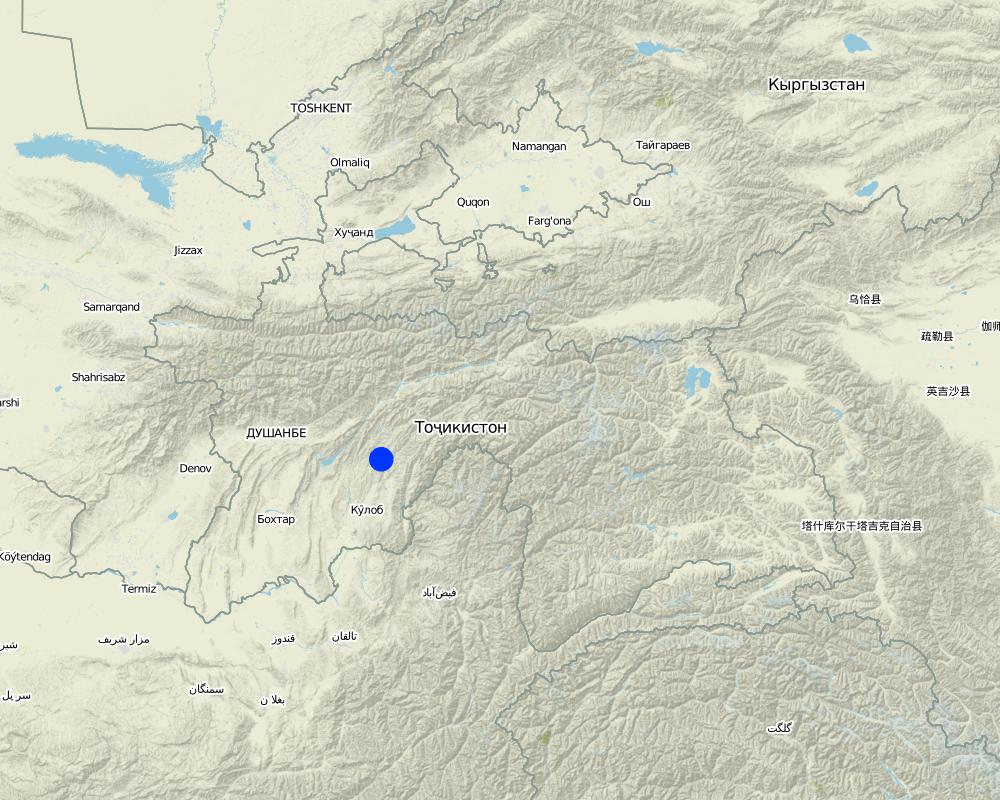
Khatlon
مزيد من التفاصيل حول الموقع:
Khovaling
حدد انتشار التقنية:
- منتشرة بالتساوي على مساحة
إذا كانت المساحة الدقيقة غير معروفة، فيرجى الإشارة إلى المنطقة التقريبية المغطاة:
- 0.1-1 كم2
التعليقات:
Total area covered by the SLM Technology is 0,1 km2.
Map
×2.6 تاريخ التنفيذ
في حالة عدم معرفة السنة بالتحديد، يرجى الإشارة إلى التاريخ التقريبي:
- منذ أقل من 10 سنوات (مؤخرًا)
2.7 إدخال التقنية
حدد كيف تم إدخال التقنية:
- من خلال ابتكار مستخدمي الأراضي
3. تصنيف تقنية الإدارة المستدامي للأراضي
3.1 الغرض الرئيسي ( الأغراض الرئيسية) للتقنية
- الحد من تدهور الأراضي ومنعه وعكسه
3.2 نوع (أنواع) استخدام الأراضي الحالية حيث يتم تطبيق التقنية

الغابات/ الأراضي الحرجية
- الغابات/الأراضي الحرجية (شبه) الطبيعية
الغابات/الأراضي الحرجية (شبه) الطبيعية: حدد نوع الإدارة:
- قطع الأشجار الانتقائي
- willows, bed, poplar
منتجات وخدمات:
- الخشب
- حطب الوقود
- الفواكه والمكسرات
التعليقات:
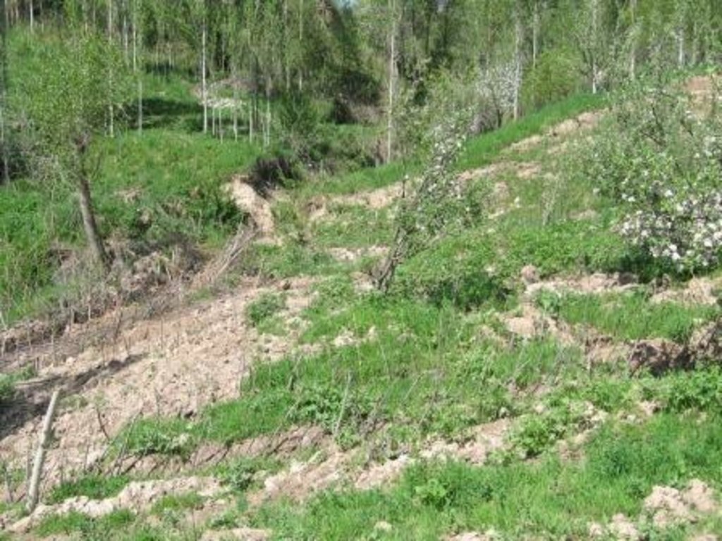
Major land use problems (compiler’s opinion): Due to a lack of drainage in the existing soil, surface flow collects and becomes concentrated leading to top soil washing and gulleying. Animal paths across the slope exacerbate the erosion process.
Major land use problems (land users’ perception): In Soviet times the land was not used due to waterlogging, but the land had good potential to plant trees and produce an income.
Selective felling of (semi-) natural forests: Yes
Problems / comments regarding forest use: Collection of fruit; apple, pear and other trees that can be used for construction purposes. These can be cut after 15yrs to provide income.
Forest products and services: timber, fuelwood, fruits and nuts
Future (final) land use (after implementation of SLM Technology): Cropland: Ct: Tree and shrub cropping
3.3 هل تغير استخدام الأراضي نتيجة لتنفيذ التقنية؟
هل تغير استخدام الأراضي نتيجة لتنفيذ التقنية؟:
- نعم (يرجى ملء الأسئلة أدناه فيما يتعلق باستخدام الأراضي قبل تنفيذ التقنية)

الأراضي الزراعية
- زراعة الأشجار والشجيرات

الغابات/ الأراضي الحرجية
- الغابات/الأراضي الحرجية (شبه) الطبيعية
3.5 مجموعةالإدارة المستدامة للأراضي التي تنتمي إليها هذه التقنية
- التدابير المتقاطعة للمنحدرات
- تحويل المياه والصرف
3.6 التدابير التقنية في مجال إلادارة المستدامة للأراضي

التدابير الزراعية
- A1: الغطاء النباتي/التربة

التدابير النباتية
- V1: غطاء من الأشجار والشجيرات

التدابير البنيوية
- S3: الخنادق المتدرجة ،والقنوات، والممرات المائية

التدابير الإدارية
- M7: أخرى
التعليقات:
Main measures: structural measures
Secondary measures: vegetative measures
Type of vegetative measures: aligned: -contour
3.7 الأنواع الرئيسية من تدهور الأراضي التي تناولتها التقنية

تآكل التربة بالمياه
- الوزن(Wt): فقدان التربة السطحية/تآكل السطح
- (Wm): مجموعة كبيرة من الحركات الأرضية/انزلاقات أرضية
التعليقات:
Main type of degradation addressed: Wt: loss of topsoil / surface erosion, Wm: mass movements / landslides
Main causes of degradation: overgrazing (The land is used for grazing and livestock migration.), Heavy / extreme rainfall (intensity/amounts) (Heavy rainfall events add to the degradation process.), other natural causes (avalanches, volcanic eruptions, mud flows, highly susceptible natural resources, extreme topography, etc.) specify (Topological situation at the base of the watershed means it is susceptible to mud flows and other natural disasters)
Secondary causes of degradation: inputs and infrastructure: (roads, markets, distribution of water points, other, …) (access to animal water points and pastures.)
3.8 منع أو حد أو عكس تدهور الأراضي
تحديد هدف التقنية فيما يتعلق بتدهور الأراضي:
- الحد من تدهور الأراضي
التعليقات:
Secondary goals: prevention of land degradation, rehabilitation / reclamation of denuded land
4. المواصفات الفنية، وأنشطة التنفيذ، والمدخلات، والتكاليف
4.1 الرسم الفني للتقنية
المواصفات الفنية (المتعلقة بالرسم الفني):
The drawing shows the layout of the trench and the lining with fast growing native trees.
Location: JONBKHAT. KHOVALING TAJIKISTAN
Date: 2011-04-30
Technical knowledge required for field staff / advisors: low (Simple technology.)
Technical knowledge required for land users: low
Main technical functions: control of concentrated runoff: drain / divert, stabilisation of soil (eg by tree roots against land slides)
Secondary technical functions: control of dispersed runoff: impede / retard, control of concentrated runoff: impede / retard, water spreading, improvement of water quality, buffering / filtering water, promotion of vegetation species and varieties (quality, eg palatable fodder)
Aligned: -contour
Vegetative material: T : trees / shrubs
Vertical interval within rows / strips / blocks (m): 0.2
Trees/ shrubs species: willows, bed, poplar are planted in 0.2m intervals along the ditch.
Diversion ditch/ drainage
Spacing between structures (m): 20
Depth of ditches/pits/dams (m): 0.6
Width of ditches/pits/dams (m): 0.5
Length of ditches/pits/dams (m): 80
Construction material (stone): stones were used to line the bed of the drainage ditch to reduce scouring.
Slope (which determines the spacing indicated above): 20%
If the original slope has changed as a result of the Technology, the slope today is: 18%
Vegetation is used for stabilisation of structures.
المؤلف:
BONATI GIUSEPPE, C7O CESVI TAJIKISTAN
4.2 معلومات عامة بخصوص حساب المدخلات والتكاليف
عملة أخرى/ عملة وطنية (حدد):
Tajik Somoni
إذا كان ذا صلة، وضح سعر الصرف من الدولار الأمريكي إلى العملة المحلية (على سبيل المثال، 1 دولار أمريكي = 79.9 ريال برازيلي): 1 دولار أمريكي =:
4,5
اذكر متوسط تكلفة أجر العمالة المستأجرة في اليوم الواحد:
5.50
4.3 أنشطة التأسيس
| النشاط | التوقيت (الموسم) | |
|---|---|---|
| 1. | Tree planting | Spring |
| 2. | Construction of the drainage ditches | spring |
4.4 التكاليف والمدخلات اللازمة للتأسيس
| تحديد المدخلات | الوحدة | الكمية | التكاليف لكل وحدة | إجمالي التكاليف لكل مدخل | % من التكاليف التي يتحملها مستخدمو الأراضي | |
|---|---|---|---|---|---|---|
| العمالة | Planting trees | Persons/day | 3,0 | 25,0 | 75,0 | 100,0 |
| العمالة | Building drainage ditches | Persons/day | 3,0 | 25,0 | 75,0 | 100,0 |
| معدات | Tools | Pieces | 1,0 | 20,0 | 20,0 | 100,0 |
| المواد النباتية | Tree seedlings | pieces | 800,0 | 1,0 | 800,0 | 100,0 |
| مواد البناء | Stone | cub m | 3,0 | 100,0 | 300,0 | 100,0 |
| إجمالي تكاليف إنشاء التقنية | 1270,0 | |||||
| إجمالي تكاليف إنشاء التقنية بالدولار الأمريكي | 282,22 | |||||
التعليقات:
Duration of establishment phase: 1 month(s)
4.5 الصيانة/الأنشطة المتكررة
| النشاط | التوقيت/الوتيرة | |
|---|---|---|
| 1. | tree maintenance | spring |
| 2. | clearance of ditches | annual |
4.6 التكاليف والمدخلات اللازمة للصيانة/للأنشطة المتكررة (سنويًا)
| تحديد المدخلات | الوحدة | الكمية | التكاليف لكل وحدة | إجمالي التكاليف لكل مدخل | % من التكاليف التي يتحملها مستخدمو الأراضي | |
|---|---|---|---|---|---|---|
| العمالة | Tree maintenance | Persons/day | 2,0 | 25,0 | 50,0 | 100,0 |
| العمالة | Clearing ditches | Persons/day | 1,0 | 25,0 | 25,0 | 100,0 |
| إجمالي تكاليف صيانة التقنية | 75,0 | |||||
| إجمالي تكاليف صيانة التقنية بالدولار الأمريكي | 16,67 | |||||
التعليقات:
Machinery/ tools: Shovel
The costs are calculated for an 80m trench based on 2010 prices in rural Tajikistan.
4.7 أهم العوامل المؤثرة على التكاليف
قدم وصفا لأهم العوامل التي تؤثر على التكاليف:
The cost of an 80m ditch is mainly determined by labour and seedlings. Labour can be provided by the land owner and seedlings for willows and poplars can be found locally and therefore are of no cost. The stone may occur naturally but there may be transport costs.
5. البيئة الطبيعية والبشرية
5.1 المناخ
هطول الأمطار السنوي
- < 250 مم
- 251- 500 ملم
- 501 - 750ملم
- 1,000-751 ملم
- 1,500-1,100 ملم
- 2,000-1,500 ملم
- 3,000-2,001 ملم
- 4,000-3,100 ملم
- > 4000 ملم
المواصفات/التعليقات على هطول الأمطار:
heavy rainfall in spring.
المنطقة المناخية الزراعية
- شبه قاحلة
Thermal climate class: temperate
5.2 طوبوغرافيا
متوسط الانحدارات:
- مسطح (0-2%)
- بسيط (3-5%)
- معتدل (6-10%)
- متدحرج (11-15%)
- تلال (16-30%)
- شديدة الانحدار(31-60%)
- فائقة الانحدار (>60%)
التضاريس:
- هضاب/سهول
- أثلام مرتفعة
- المنحدرات الجبلية
- منحدرات التلال
- منحدرات في السفوح
- قاع الوادي
المنطقة الارتفاعية:
- 100-0 متر فوق سطح البحر
- 500-101 متر فوق سطح البحر
- 1,000-501 متر فوق سطح البحر
- 1,500-1,001 متر فوق سطح البحر
- 2,000-1,501 متر فوق سطح البحر
- 2,500-2,100 متر فوق سطح البحر
- 3,000-2,501 متر فوق سطح البحر
- 4,000-3,001 متر فوق سطح البحر
- > 4000 متر فوق سطح البحر
التعليقات والمواصفات الإضافية بشأن التضاريس:
Altitudinal zone: Just at the foot of the hill slopes.
5.3 التربة
متوسط عمق التربة:
- ضحل جدًا (0-20 سم)
- ضحلة (21-50 سم)
- متوسطة العمق (51-80 سم)
- عميقة (81-120 سم)
- عميقة جدًا (> 120 سم)
قوام التربة (التربة السطحية):
- متوسط ( طميي، سلتي)
المواد العضوية في التربة السطحية:
- متوسطة (1-3%)
إذا كان متاحًا، قم بإرفاق وصف كامل للتربة أو تحديد المعلومات المتوفرة، على سبيل المثال نوع التربة، الرقم الهيدروجيني/ درجة حموضة التربة، قدرة التبادل الكاتيوني، النيتروجين، الملوحة وما إلى ذلك.
Soil fertility is high because of loess soils
Soil drainage / infiltration is poor
Soil water storage capacity is low
5.4 توافر المياه ونوعيتها
منسوب المياه الجوفية:
< 5 م
توافر المياه السطحية:
جيد
نوعية المياه (غير المعالجة):
مياه الشرب سيئة (تتطلب معالجة)
تعليقات ومواصفات أخرى بشأن نوعية المياه وكميتها:
Availability of surface water: Also medium
5.5 التنوع البيولوجي
تنوع الأنواع:
- متوسط
5.6 خصائص مستخدمي الأراضي الذين يطبقون التقنية
التوجه السوقي لنظام الإنتاج:
- الكفاف (الإمداد الذاتي)
الدخل من خارج المزرعة:
- أقل من % 10من كامل الدخل
أفراداً أو مجموعات:
- المجموعات/ المجتمع المحلي
الجنس:
- رجال
اذكر الخصائص الأخرى ذات الصلة لمستخدمي الأراضي:
Land users applying the Technology are mainly common / average land users
Population density: 10-50 persons/km2
Annual population growth: 1% - 2%
90% of the land users are poor (low income rural families).
10% of the land users are poor.
5.7 متوسط مساحة الأرض التي يستخدمها مستخدمو الأراضي الذين يطبقون التقنية
- < 0.5 هكتارا
- 0.5 - 1 هكتار
- 1 -2 هكتار
- 2 - 5 هكتار
- 5 - 15 هكتار
- 15 - 50 هكتار
- 50 - 100هكتار
- 500-100 هكتار
- 1,000-500 هكتار
- 10,000-1,000 هكتار
- > 10,000 هكتار
هل يعتبر هذا نطاقًا صغيرًا أو متوسطًا أو واسعا (في إشارة إلى السياق المحلي)؟:
- على نطاق صغير
5.8 ملكية الأراضي، وحقوق استخدام الأراضي، وحقوق استخدام المياه
ملكية الارض:
- دولة
حقوق استخدام الأراضي:
- مجتمعي (منظم)
حقوق استخدام المياه:
- وصول مفتوح (غير منظم)
التعليقات:
Water user right refer to the water running over the land
5.9 الوصول إلى الخدمات والبنية التحتية
الصحة:
- ضعيف
- معتدل
- جيد
التعليم:
- ضعيف
- معتدل
- جيد
المساعدة التقنية:
- ضعيف
- معتدل
- جيد
العمل (على سبيل المثال خارج المزرعة):
- ضعيف
- معتدل
- جيد
الأسواق:
- ضعيف
- معتدل
- جيد
الطاقة:
- ضعيف
- معتدل
- جيد
الطرق والنقل:
- ضعيف
- معتدل
- جيد
مياه الشرب وخدمات الصرف الصحي:
- ضعيف
- معتدل
- جيد
الخدمات المالية:
- ضعيف
- معتدل
- جيد
6. الآثار والتصريحات الختامية
6.1 الآثار التي أظهرتها التقنية في الموقع
الآثار الاجتماعية والاقتصادية
الإنتاج
إنتاج المحاصيل
التعليقات/ حدد:
Fruit tree yields
إنتاج الخشب
التعليقات/ حدد:
Fire wood and construction materials
منطقة الإنتاج
توليد الطاقة
التعليقات/ حدد:
Generation of the wood for fuel
الدخل والتكاليف
دخل المزرعة
تنوع مصادر الدخل
الآثار الاجتماعية والثقافية
المعرفة بالإدارة المستدامة للأراضي/تدهور الأراضي
التعليقات/ حدد:
Better understanding of how to control erosion
الآثار الايكولوجية
دورة المياه / الجريان السطحي
حصاد / جمع المياه
الجريان السطحي
تصريف المياه الزائدة
مستوى المياه الجوفية/ الطبقة المائية الجوفية
التربة
غطاء التربة
فقدان التربة
الحد من مخاطر المناخ والكوارث
انزلاقات أرضية / تدفقات الحطام
6.2 الآثار التي أظهرتها التقنية خارج الموقع
القدرة على التخفيف / الترشيح
الأضرار التي لحقت بحقول الجيران
6.3 تعرض التقنية وحساسيتها لتغير المناخ التدريجي والظواهر المتطرفة/الكوارث المرتبطة بالمناخ (كما يراها مستخدمو الأراضي)
تغير مناخ تدريجي
تغير مناخ تدريجي
| الموسم | زيادة أو نقصان | كيف تتعامل التقنية مع ذلك؟ | |
|---|---|---|---|
| درجة الحرارة السنوية | زيادة | جيدا |
الظواهر المتطرفة / الكوارث المرتبطة بالمناخ
الكوارث الجوية
| كيف تتعامل التقنية مع ذلك؟ | |
|---|---|
| عاصفة ممطرة محلية | ليس جيدا |
الكوارث المناخية
| كيف تتعامل التقنية مع ذلك؟ | |
|---|---|
| جفاف | ليس جيدا |
الكوارث الهيدرولوجية
| كيف تتعامل التقنية مع ذلك؟ | |
|---|---|
| فيضان عام (نهر) | ليس جيدا |
6.4 تحليل التكلفة والعائد
كيف يمكن مقارنة العوائد نسبة لتكاليف الإنشاء (من وجهة نظر مستخدمي الأراضي)؟
عوائد قصيرة الأجل:
إيجابي قليلا
عوائد طويلة الأجل:
ايجابي جدا
كيف تتم مقارنة العوائدمع كلفة الصيانة/التكاليف المتكررة (من وجهة نظر مستخدمي الأراضي)؟
عوائد قصيرة الأجل:
إيجابي
عوائد طويلة الأجل:
ايجابي جدا
6.5 اعتماد التقنية
- حالات فردية/تجريبية
إذا كان متاحًا، قم بتحديد الكمية (عدد الأسر المعيشية و/أو المساحةالمغطاة):
1 household
من بين جميع الذين تبنوا التقنية، كم عدد الذين فعلوا ذلك بشكل تلقائي، أي دون تلقي أي حوافز مادية/مدفوعات؟:
- 91-100%
التعليقات:
There is no trend towards spontaneous adoption of the Technology
6.7 نقاط القوة / المزايا / الفرص التي توفرها التقنية
| نقاط القوة/ المزايا/ الفرص من وجهة نظر مستخدمي الأراضي |
|---|
| It is easy to build and cheap. |
| نقاط القوة/ المزايا/ الفرص من وجهة نظر جامع المعلومات أو غيره من الاشخاص الرئيسيين لمصدر المعلومات |
|---|
|
It is a basic and easy technology that could be easily replicated, over larger areas. How can they be sustained / enhanced? Further training on the correct angles to build channels and dimensions |
|
The technogy is low cost and potentially quick to build. How can they be sustained / enhanced? It can be built on many different slopes types, angles and heights. |
|
It allows the land to be used for growing fruit trees and timber. There is the opportunity to sell the products. How can they be sustained / enhanced? Training could be provided on tree cultivation. |
6.8 نقاط ضعف / مساوىء / مخاطر التقنية وسبل التغلب عليها
| نقاط الضعف/ المساوىء/ المخاطر من وجهة نظر جامع المعلومات أو غيره من الاشخاص الرئيسيين لمصدر المعلومات | كيف يمكن التغلب عليها؟ |
|---|---|
| The trench may be inefffective if there is a heavy deluge of surface water, and may in fact concentrate the surface water run off. | The trenches could be filled with gravel and rocks, and intertwined in a grid network, this is a common practice for railway embankements in Europe. The slope has to be shallow enough to prevent the gravel material being washed away. |
7. المراجع والروابط
7.1 طرق جمع/مصادر المعلومات
الروابط والوحدات المواضيعية
توسيع الكل طي الكلالروابط
لا يوجد روابط
الوحدات المواضيعية
لا يوجد وحدات مواضيعية


