Gully erosion management [أثيوبيا]
- تاريخ الإنشاء:
- تحديث:
- جامع المعلومات: Gizaw Desta Gessesse
- المحرر: –
- المراجعون: Deborah Niggli, Alexandra Gavilano
Borebore lemat (Amharic)
technologies_1597 - أثيوبيا
عرض الأقسام
توسيع الكل طي الكل1. معلومات عامة
1.2 تفاصيل الاتصال بالأشخاص الرئيسيين لمصدر المعلومات والمؤسسات المشاركة في تقييم وتوثيق التقنية
متخصص في الإدارة المستدامة للأراضي:
Bekure Melese
WLRC
اسم المشروع الذي سهّل توثيق/تقييم التقنية (إذا كان ذلك على صلة)
Water and Land Resource Centre Project (WLRC)1.3 الشروط المتعلقة باستخدام البيانات الموثقة من خلال WOCAT
يوافق جامع المعلومات والشخص (لاشخاص) الرئيسي لمصدر المعلومات على الشروط المتعلقة باستخدام البيانات الموثقة من خلال WOCAT:
نعم
1.4 إعلان بشأن استدامة التقنية الموصوفة
هل التقنية الموصوفة هنا تمثل مشكلة فيما يتعلق بتدهور الأراضي، بحيث لا يمكن إعلانها تقنية مستدامة لإدارة الأراضي؟:
كلا
1.5 الإشارة إلى الاستبيان (الاستبيانات) حول مناهج الإدارة المستدامة للأراضي (موثقة باستخدام WOCAT)
Community Organizations and Mobilization for Soil and Water … [أثيوبيا]
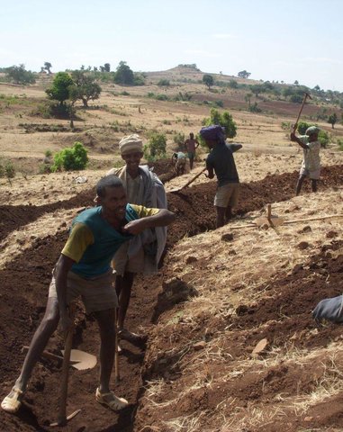
Community mobilization for soil and water conservation work in a watershed planning unit is an approach for collective action by organizing all active labor forces living in the kebele/peasant association into development group of 20-30 members and further divide into 1:5 work force to implement construction of soil and water …
- جامع المعلومات: Gizaw Desta Gessesse
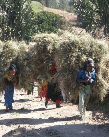
'Cut and Carry' Grazing system or 'Zero Grazing' … [أثيوبيا]
Cut and carry grazing system (alternatively called zero grazing) is an approach where the community is consulted to identify and agree on areas to be closed and protected from free grazing; establish user groups are established to share the fodder biomass harvested from communal closed areas equitably; they utilize tree/shrub …
- جامع المعلومات: Gizaw Desta Gessesse
2. وصف تقنيةالإدارة المستدامي للأراضي
2.1 وصف مختصر للتقنية
تعريف التقنية:
Gully erosion management is the application of combination of practices to control excess or concentrated runoff generation in the gully upstream catchment area, divert excess runoff upstream of gully heads and control further development of gully using appropriate structural and vegetative measures in the head, bed and sides of the gully and eventually convert into productive land through the consultation and involvement of local community.
2.2 وصف تفصيلي للتقنية
الوصف:
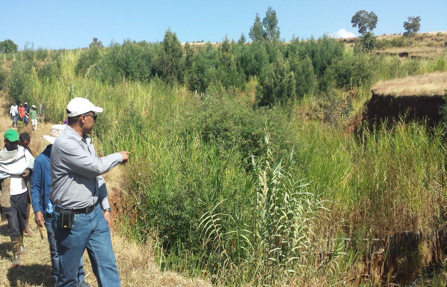
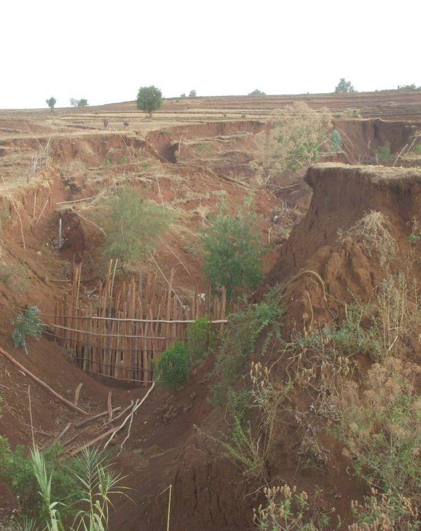
Gully erosion occurs on cultivated and grazing/pasture lands. Gully erosion management is a practice aimed to rehabilitate and protect further development of gullies and change into productive land. It involves both runoff management and erosion control activities. Gully management and treatment is different at upstream catchment area, gully head and gully section. Proper land management practices and slope treatment measures such as terraces, infiltration ditches and grass or shrub hedgerows are taking place on upstream catchment of the gully in order to reduce the rate of surface runoff. The excess runoff above the gully head is safely drained using cutoff drains into natural or properly vegetated waterways in order to reduce the surface water entering into the gully and protect the constructed physical and biological measures being washed away. Before treating gully sections, for the purpose of stability of structures and quick healing, the gully should be reshaped and planted with grass sod. Gully wall reshaping is cutting off steep slopes of active gully flanks in to gentle slope of minimum at 45% slope, up to two-third of the total depth of the gully and constructing small trenches along contours for re-vegetating slanted part of the gully walls and beds. If the gully is wide and has meandering nature with huge accumulation of runoff flowing down, it requires constructing of retaining walls, to protect displaced (not yet stabilized) soils and soil materials and the sidewalls of the reshaped gully. Stabilization of gully sections involves the use of structural and vegetative measures in the head, floor and side of the gully. The construction of physical structures inside the gully section is followed by establishment of biological measures.
Purposes of gully erosion management are: 1) rehabilitate the land damaged due to gully erosion, 2) prevent further expansion and development of gully erosion, and 3) convert the land lost by gully erosion to productive land.
Gully erosion management begins with assessment and mapping of gully erosion that helps to have an overview of erosion, to document extent of damage, to identify the nature and causes of gully formation, and gives relevant information to design appropriate measures. At establishment stage, gully management requires: catchment treatment using different land treatment measures; runoff diversion by cutoff drain; and stabilization of gully sections by physical structures and vegetative measures. Stones for the construction of terraces, cutoff drains and waterways are required. Depending on the nature of gully and available material for construction, either stones, sand bags, brush woods, bamboo mat, gabion or concrete (sand, gravel and cement) are needed for constructing check-dams in a gully section. Different tree/shrub seedlings, grass cuttings, and seedlings of fruit trees are required to reinforce and stabilize the gully sections. The respective labor requirement for stone collection, construction of retaining wall, and gully reshaping is 0.5m3/person day, 5m/person day, and 1m3/person day. Approximately 0.25, 0.50, 0.50, 0.50 , and 1.0 m3/person day is required to construct gabion, loose stone, arc weir, sand bag, and bamboo mat check-dams respectively. About 3.0 m/person day is needed to construct brushwood check dams. The treated gullies should be checked regularly. The maintenance requirement is closely monitored and immediate repair is essential to avoid further damage and eventual collapse of structures. The inputs important for maintenance include stones or other materials for check dams, seedlings to replant areas covered with non-survived seedlings.
Gully erosion is prevalent in areas where excess runoff occurs in high rainfall areas associated with moderate to high erodible soils. It occurs in range of wet highland to moist Kolla areas where annual rainfall exceeds 900mm. Its occurrence is more frequent in heavy clay soils (Vertisols) characterized by low infiltration and in clay soils (like Nitosols) characterized by low organic matter. Often, gully formation occurs on overgrazed pasture lands and inappropriately managed crop lands. Gully erosion control requires mobilization of high input or materials and labor. Larger gullies need to be rehabilitated and treated through community labor mobilization. Subsequent maintenance activities, monitoring and benefit sharing should be made by the user groups who are entitled to utilize the benefits.
The living condition depends on subsistence crop-livestock mixed farming. On average households have 5-6 family size. Crop production is meant for home consumption with small surplus for local market. The services related to water supply, energy supply, and infrastructure are low. Besides it is an asset, animals often used to cope shocks during drought periods.
2.3 صور التقنية
2.5 البلد/المنطقة/المواقع التي تم تنفيذ التقنية فيها والتي يغطيها هذا التقييم
البلد:
أثيوبيا
المنطقة/الولاية/المحافظة:
Amhara National Regional State (ANRS)
مزيد من التفاصيل حول الموقع:
Dembecha/Mecha/Yilmana Densa
حدد انتشار التقنية:
- منتشرة بالتساوي على مساحة
إذا كانت المساحة الدقيقة غير معروفة، فيرجى الإشارة إلى المنطقة التقريبية المغطاة:
- 100-10 كم2
2.6 تاريخ التنفيذ
في حالة عدم معرفة السنة بالتحديد، يرجى الإشارة إلى التاريخ التقريبي:
- منذ أقل من 10 سنوات (مؤخرًا)
2.7 إدخال التقنية
حدد كيف تم إدخال التقنية:
- أثناء التجارب/الأبحاث
- من خلال المشاريع/ التدخلات الخارجية
التعليقات (نوع المشروع، الخ):
Since gully erosion management requires combination of practices, many actors mainly research, local development actors, community, and project are involved in the development of the technology
3. تصنيف تقنية الإدارة المستدامي للأراضي
3.1 الغرض الرئيسي ( الأغراض الرئيسية) للتقنية
- الحد من تدهور الأراضي ومنعه وعكسه
3.2 نوع (أنواع) استخدام الأراضي الحالية حيث يتم تطبيق التقنية

الأراضي الزراعية
- زراعة سنوية
- زراعة معمرة (غير خشبية)
- Elphant grass, Sudan grass
عدد مواسم الزراعة في السنة:
- 1
حدد:
Longest growing period in days: 220, Longest growing period from month to month: May to December; Second longest growing period in days: 180, Second longest growing period from month to month: June to November

أراضي الرعي
الرعي الواسع النطاق:
- رعي شبه مرتحل
الرعي المكثف/ إنتاج الأعلاف:
- قطع وحمل / صفر مرعى
- free grazing

الغابات/ الأراضي الحرجية
- Susbania sesban, Acacia decurrence, treelucern, Acacia saligna
منتجات وخدمات:
- الخشب
- حطب الوقود
التعليقات:
Livestock density (if relevant):
> 100 LU /km2
Major land use problems (compiler’s opinion): Land degradation due to different forms of soil erosion and nutrient depletion, overgrazing, shortage of pasture lands and its low productivity, excessive and inappropriate construction of traditional ditches, and increased pressure on trees for the purpose of fuel wood and timber.
Major land use problems (land users’ perception): Soil erosion and soil nutrient depletion, shortage of cultivated land, shortage of grazing land and wood for fuel wood
The type of grazing is often free grazing on communal grazing lands/pasture, supplemented with crop residues and zero grazing combined with improved forages
3.4 إمدادات المياه
إمدادات المياه للأرض التي يتم تنفيذ التقنية عليها:
- بعلية
3.5 مجموعةالإدارة المستدامة للأراضي التي تنتمي إليها هذه التقنية
- إغلاق المنطقة (إيقاف الاستخدام، دعم الاصلاح)
3.6 التدابير التقنية في مجال إلادارة المستدامة للأراضي

التدابير النباتية
- V1: غطاء من الأشجار والشجيرات
- V2: الأعشاب والنباتات العشبية المعمرة

التدابير البنيوية
- الحواجز والضفاف
- S3: الخنادق المتدرجة ،والقنوات، والممرات المائية
- S4: تسوية الخنادق والحفر
- S6: الجدران والحواجز وسياجات القش، والسياجات
- S11: غير ذلك
التعليقات:
Type of vegetative measures: aligned: -contour, aligned: -along boundary
3.7 الأنواع الرئيسية من تدهور الأراضي التي تناولتها التقنية

تآكل التربة بالمياه
- (Wg):الانجراف الخلجاني/ الخلجان
- (Wo:) تأثيرات التدهور من مواقع أخرى

التدهور البيولوجي
- (Bc): تناقص الغطاء النباتي
التعليقات:
Main causes of degradation: deforestation / removal of natural vegetation (incl. forest fires), over-exploitation of vegetation for domestic use, overgrazing, Heavy / extreme rainfall (intensity/amounts), population pressure
Secondary causes of degradation: soil management, crop management (annual, perennial, tree/shrub), urbanisation and infrastructure development (Urbanization and infrastructure development induced excessive compaction, unprotected drainage systems and lead to gully formation), floods, land tenure (Land under undefined or communal use of grazing lands are subject to mismanagement that result in gully formation), poverty / wealth
3.8 منع أو حد أو عكس تدهور الأراضي
تحديد هدف التقنية فيما يتعلق بتدهور الأراضي:
- الحد من تدهور الأراضي
- اصلاح/إعادة تأهيل الأراضي المتدهورة بشدة
4. المواصفات الفنية، وأنشطة التنفيذ، والمدخلات، والتكاليف
4.1 الرسم الفني للتقنية
المواصفات الفنية (المتعلقة بالرسم الفني):
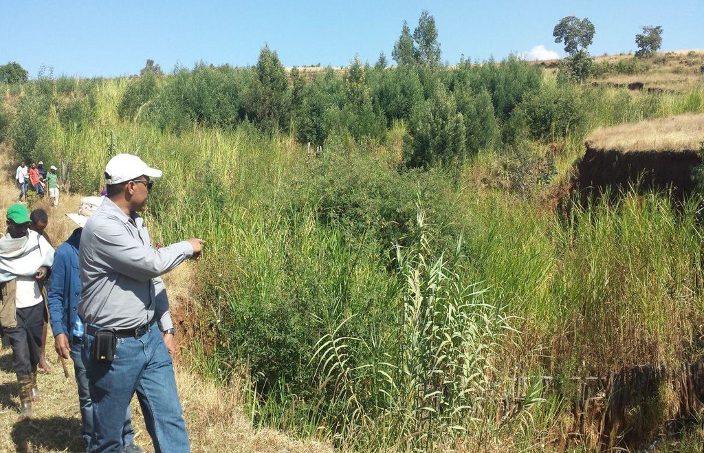
A reshaped gully section treated with an integrated gully control measures including check dams made of loose stone and wooden and vegetative tree/shrub and grass hedgerows planted on the sides of gullies.
Location: Debre Mewi Learning Watershed. Yilmana Densa/West Gojam/Amhara Region
Date: 6/27/2016
Technical knowledge required for field staff / advisors: high (It requires knowledge of peak runoff and runoff management and skills to integrate different measures)
Technical knowledge required for land users: high (It needs skills to construct physical measures, and regular monitoring and maintenance of practices. The users must know and understand the growth nature and harvesting stage tree/shrub, grass species)
Main technical functions: control of concentrated runoff: impede / retard, control of concentrated runoff: drain / divert, reduction of slope angle
Secondary technical functions: reduction of slope length, improvement of ground cover, stabilisation of soil (eg by tree roots against land slides), increase of infiltration
Aligned: -contour
Vegetative material: T : trees / shrubs, G : grass
Number of plants per (ha): 2600
Spacing between rows / strips / blocks (m): 2-3
Vertical interval within rows / strips / blocks (m): 0.5-1.0
Width within rows / strips / blocks (m): 0.5
Aligned: -graded strips
Vegetative material: T : trees / shrubs
Aligned: -along boundary
Number of plants per (ha): 200
Vertical interval within rows / strips / blocks (m): 1
Width within rows / strips / blocks (m): 1
In blocks
Vegetative material: T : trees / shrubs
Vegetative measure: Alinged along side wall of gully
Vegetative material: T : trees / shrubs
Number of plants per (ha): 6800
Spacing between rows / strips / blocks (m): 2-3.0
Vertical interval within rows / strips / blocks (m): 0.5-1.0
Width within rows / strips / blocks (m): 0.5
Vegetative measure: Aligned along side wall of gully
Vegetative material: T : trees / shrubs
Number of plants per (ha): 4800
Spacing between rows / strips / blocks (m): 2-3.0
Vertical interval within rows / strips / blocks (m): 0.5
Width within rows / strips / blocks (m): 0.5
Vegetative measure: Vegetative material: T : trees / shrubs
Trees/ shrubs species: Susbania sesban, Acacia decurrence, treelucern, Acacia saligna
Grass species: Elphant grass, Sudan grass
Slope (which determines the spacing indicated above): 20-30%%
If the original slope has changed as a result of the Technology, the slope today is (see figure below): 18-25%%
Gradient along the rows / strips: 0.5%
Diversion ditch/ drainage
Depth of ditches/pits/dams (m): 0.3-0.7
Width of ditches/pits/dams (m): 1.2-2.8
Length of ditches/pits/dams (m): 100-250
Waterway
Depth of ditches/pits/dams (m): 0.3
Width of ditches/pits/dams (m): 1.5-2.0
Structural measure: Check dams
Vertical interval between structures (m): 1
Spacing between structures (m): 10-15
Height of bunds/banks/others (m): 1-1.5
Width of bunds/banks/others (m): 1.5-3.5
Construction material (earth): Excavated soil
Construction material (stone): Loose stones for check dam
Construction material (wood): Brush wood for check dam
Slope (which determines the spacing indicated above): 10-18%
If the original slope has changed as a result of the Technology, the slope today is: 8-12%
Vegetation is used for stabilisation of structures.
المؤلف:
MOA, 2005, Water and Land Resource Center
4.2 معلومات عامة بخصوص حساب المدخلات والتكاليف
عملة أخرى/ عملة وطنية (حدد):
ETB
إذا كان ذا صلة، وضح سعر الصرف من الدولار الأمريكي إلى العملة المحلية (على سبيل المثال، 1 دولار أمريكي = 79.9 ريال برازيلي): 1 دولار أمريكي =:
20,0
اذكر متوسط تكلفة أجر العمالة المستأجرة في اليوم الواحد:
2.50
4.3 أنشطة التأسيس
| النشاط | التوقيت (الموسم) | |
|---|---|---|
| 1. | Seedling preparation | January-June |
| 2. | Seedling Transportation | June-July |
| 3. | Grass split transportation | June -July |
| 4. | Plantation of biological measures inside the gully | July |
| 5. | Surveying | Dry season |
| 6. | Reshaping of gully | Dry season |
| 7. | Construction of cutoff drains | Dry season |
| 8. | Construction of waterways | Dry season |
| 9. | Construction of stone check dams | Dry season |
4.4 التكاليف والمدخلات اللازمة للتأسيس
| تحديد المدخلات | الوحدة | الكمية | التكاليف لكل وحدة | إجمالي التكاليف لكل مدخل | % من التكاليف التي يتحملها مستخدمو الأراضي | |
|---|---|---|---|---|---|---|
| العمالة | labour | ha | 1,0 | 8319,0 | 8319,0 | 99,0 |
| معدات | animal traction | ha | 1,0 | 9,0 | 9,0 | 100,0 |
| معدات | tools | ha | 1,0 | 901,8 | 901,8 | 50,0 |
| المواد النباتية | grass | ha | 1,0 | 20,0 | 20,0 | |
| المواد النباتية | seeds | ha | 1,0 | 24,0 | 24,0 | |
| المواد النباتية | seedlings | ha | 1,0 | 63,45 | 63,45 | |
| الأسمدة والمبيدات الحيوية | compost/manure | ha | 1,0 | 15,86 | 15,86 | |
| مواد البناء | stone | ha | 1,0 | 1405,0 | 1405,0 | 91,0 |
| مواد البناء | wood | ha | 1,0 | 27,6 | 27,6 | |
| مواد البناء | earth | ha | 1,0 | 91,2 | 91,2 | |
| إجمالي تكاليف إنشاء التقنية | 10876,91 | |||||
| إجمالي تكاليف إنشاء التقنية بالدولار الأمريكي | 543,85 | |||||
التعليقات:
Duration of establishment phase: 15 month(s)
4.5 الصيانة/الأنشطة المتكررة
| النشاط | التوقيت/الوتيرة | |
|---|---|---|
| 1. | Seedling preparation | January-June |
| 2. | Seedling and grass split transportation | July |
| 3. | Replanting seedlings and grass splits | July |
| 4. | Maintenance of cutoff drains/waterways | Dry season (Jan-Apr) |
| 5. | Maintenance of check dams | Dry season (Jan-Apr) |
4.6 التكاليف والمدخلات اللازمة للصيانة/للأنشطة المتكررة (سنويًا)
| تحديد المدخلات | الوحدة | الكمية | التكاليف لكل وحدة | إجمالي التكاليف لكل مدخل | % من التكاليف التي يتحملها مستخدمو الأراضي | |
|---|---|---|---|---|---|---|
| العمالة | labour | ha | 1,0 | 902,0 | 902,0 | 67,0 |
| معدات | animal traction | ha | 1,0 | 4,5 | 4,5 | |
| المواد النباتية | grass | ha | 1,0 | 10,3 | 10,3 | |
| المواد النباتية | seedlings | ha | 1,0 | 33,0 | 33,0 | |
| الأسمدة والمبيدات الحيوية | compost/manure | ha | 1,0 | 8,5 | 8,5 | |
| مواد البناء | stone | ha | 1,0 | 50,0 | 50,0 | 41,0 |
| مواد البناء | wood | ha | 1,0 | 14,4 | 14,4 | |
| مواد البناء | earth | ha | 1,0 | 45,6 | 45,6 | |
| إجمالي تكاليف صيانة التقنية | 1068,3 | |||||
| إجمالي تكاليف صيانة التقنية بالدولار الأمريكي | 53,41 | |||||
التعليقات:
The costs are calculated on hectare basis
4.7 أهم العوامل المؤثرة على التكاليف
قدم وصفا لأهم العوامل التي تؤثر على التكاليف:
The costs for gully erosion management is dependent upon labor, material and transport costs, workability of the soil and maintenance costs.
5. البيئة الطبيعية والبشرية
5.1 المناخ
هطول الأمطار السنوي
- < 250 مم
- 251- 500 ملم
- 501 - 750ملم
- 1,000-751 ملم
- 1,500-1,100 ملم
- 2,000-1,500 ملم
- 3,000-2,001 ملم
- 4,000-3,100 ملم
- > 4000 ملم
المواصفات/التعليقات على هطول الأمطار:
Monsoon, 5-6 months rain and 6-7 dry months
المنطقة المناخية الزراعية
- شبه رطبة
Thermal climate class: subtropics. The lowest temperature is above 5°C but below 18°C between November to January
5.2 طوبوغرافيا
متوسط الانحدارات:
- مسطح (0-2%)
- بسيط (3-5%)
- معتدل (6-10%)
- متدحرج (11-15%)
- تلال (16-30%)
- شديدة الانحدار(31-60%)
- فائقة الانحدار (>60%)
التضاريس:
- هضاب/سهول
- أثلام مرتفعة
- المنحدرات الجبلية
- منحدرات التلال
- منحدرات في السفوح
- قاع الوادي
المنطقة الارتفاعية:
- 100-0 متر فوق سطح البحر
- 500-101 متر فوق سطح البحر
- 1,000-501 متر فوق سطح البحر
- 1,500-1,001 متر فوق سطح البحر
- 2,000-1,501 متر فوق سطح البحر
- 2,500-2,100 متر فوق سطح البحر
- 3,000-2,501 متر فوق سطح البحر
- 4,000-3,001 متر فوق سطح البحر
- > 4000 متر فوق سطح البحر
5.3 التربة
متوسط عمق التربة:
- ضحل جدًا (0-20 سم)
- ضحلة (21-50 سم)
- متوسطة العمق (51-80 سم)
- عميقة (81-120 سم)
- عميقة جدًا (> 120 سم)
قوام التربة (التربة السطحية):
- متوسط ( طميي، سلتي)
- ناعم/ثقيل (طيني)
المواد العضوية في التربة السطحية:
- متوسطة (1-3%)
- منخفضة (<1%)
5.4 توافر المياه ونوعيتها
منسوب المياه الجوفية:
50-5 م
توافر المياه السطحية:
متوسط
نوعية المياه (غير المعالجة):
مياه الشرب سيئة (تتطلب معالجة)
5.5 التنوع البيولوجي
تنوع الأنواع:
- منخفض
5.6 خصائص مستخدمي الأراضي الذين يطبقون التقنية
التوجه السوقي لنظام الإنتاج:
- الكفاف (الإمداد الذاتي)
الدخل من خارج المزرعة:
- أقل من % 10من كامل الدخل
المستوى النسبي للثروة:
- متوسط
أفراداً أو مجموعات:
- المجموعات/ المجتمع المحلي
مستوى المكننة:
- عمل يدوي
- الجر الحيواني
الجنس:
- نساء
- رجال
اذكر الخصائص الأخرى ذات الصلة لمستخدمي الأراضي:
Land users applying the Technology are mainly common / average land users
Difference in the involvement of women and men: Women are involved in collecting stones and assisting men on heavy works
Population density: 200-500 persons/km2
Annual population growth: 2% - 3%
80% of the land users are average wealthy.
20% of the land users are poor.
Some land users involve in seasonal labor in towns and sell charcoal
5.7 متوسط مساحة الأرض التي يستخدمها مستخدمو الأراضي الذين يطبقون التقنية
- < 0.5 هكتارا
- 0.5 - 1 هكتار
- 1 -2 هكتار
- 2 - 5 هكتار
- 5 - 15 هكتار
- 15 - 50 هكتار
- 50 - 100هكتار
- 500-100 هكتار
- 1,000-500 هكتار
- 10,000-1,000 هكتار
- > 10,000 هكتار
هل يعتبر هذا نطاقًا صغيرًا أو متوسطًا أو واسعا (في إشارة إلى السياق المحلي)؟:
- على نطاق صغير
5.8 ملكية الأراضي، وحقوق استخدام الأراضي، وحقوق استخدام المياه
ملكية الارض:
- دولة
حقوق استخدام المياه:
- وصول مفتوح (غير منظم)
- مجتمعي (منظم)
التعليقات:
Land use rights on crop land is individual while on grazing lands it is communal either unorganized or organized in some cases. Water is open accessible in most cases except organized communal utilization for some developed drinking water sources.
5.9 الوصول إلى الخدمات والبنية التحتية
الصحة:
- ضعيف
- معتدل
- جيد
التعليم:
- ضعيف
- معتدل
- جيد
المساعدة التقنية:
- ضعيف
- معتدل
- جيد
العمل (على سبيل المثال خارج المزرعة):
- ضعيف
- معتدل
- جيد
الأسواق:
- ضعيف
- معتدل
- جيد
الطاقة:
- ضعيف
- معتدل
- جيد
الطرق والنقل:
- ضعيف
- معتدل
- جيد
مياه الشرب وخدمات الصرف الصحي:
- ضعيف
- معتدل
- جيد
الخدمات المالية:
- ضعيف
- معتدل
- جيد
6. الآثار والتصريحات الختامية
6.1 الآثار التي أظهرتها التقنية في الموقع
الآثار الاجتماعية والاقتصادية
الإنتاج
إنتاج الأعلاف
التعليقات/ حدد:
Gullies are treated for purpose of improved grass and legume fodder production like napier, susbania, local grasses
تنوع المنتج
التعليقات/ حدد:
Honey, fruits can be diversified under intensive gully development
الدخل والتكاليف
تنوع مصادر الدخل
التعليقات/ حدد:
High fodder biomass provide an opportunity to do fattening; sometimes used to grow fruits;
عبء العمل
التعليقات/ حدد:
Under low productive soil where recovery rate is slow, establishment and maintenance cost of labor is high
الآثار الاجتماعية والثقافية
المؤسسات المجتمعية
التعليقات/ حدد:
Watershed committee and user groups are established
المعرفة بالإدارة المستدامة للأراضي/تدهور الأراضي
التعليقات/ حدد:
Awareness of the community on gully management increased
التخفيف من حدة الصراع
التعليقات/ حدد:
Gullies are stabilized and no more conflict
contribution to human well-being
التعليقات/ حدد:
Land users are organized into user groups and harvest the biomass (grass and fodder) for livestock feed which result in increased livestock productivity. Some land users attempt to fatten cattle and gain benefit.
الآثار الايكولوجية
دورة المياه / الجريان السطحي
الجريان السطحي
التعليقات/ حدد:
Significant reduction of damage due to runoff
تصريف المياه الزائدة
التعليقات/ حدد:
Cutoff drains used to drain excess runoff upstream
مستوى المياه الجوفية/ الطبقة المائية الجوفية
التربة
غطاء التربة
التعليقات/ حدد:
Plantation of gullies increase cover and biomass production
فقدان التربة
التعليقات/ حدد:
Check dams significantly reduce the soil loss from gullies
التنوع البيولوجي: الغطاء النباتي، الحيوانات
الكتلة الحيوية/ طبقة الكربون فوق التربة
6.2 الآثار التي أظهرتها التقنية خارج الموقع
تدفقات مائية موثوقة ومستقرة في موسم الجفاف
التعليقات/ حدد:
Stream size and duration has improved
تراكم الطمي باتجاه مصب النهر
الضرر على البنية التحتية العامة/ الخاصة
التعليقات/ حدد:
Reduction of damage on houses
6.3 تعرض التقنية وحساسيتها لتغير المناخ التدريجي والظواهر المتطرفة/الكوارث المرتبطة بالمناخ (كما يراها مستخدمو الأراضي)
الظواهر المتطرفة / الكوارث المرتبطة بالمناخ
الكوارث الجوية
| كيف تتعامل التقنية مع ذلك؟ | |
|---|---|
| عاصفة ممطرة محلية | ليس جيدا |
الكوارث المناخية
| كيف تتعامل التقنية مع ذلك؟ | |
|---|---|
| جفاف | جيدا |
الكوارث الهيدرولوجية
| كيف تتعامل التقنية مع ذلك؟ | |
|---|---|
| فيضان عام (نهر) | ليس جيدا |
التعليقات:
Gully erosion management involves combination of biological and physical measures. Strong structural measures and upstream runoff management practices should be applied to tolerate flooding.
6.4 تحليل التكلفة والعائد
كيف يمكن مقارنة العوائد نسبة لتكاليف الإنشاء (من وجهة نظر مستخدمي الأراضي)؟
عوائد قصيرة الأجل:
إيجابي قليلا
عوائد طويلة الأجل:
إيجابي
كيف تتم مقارنة العوائدمع كلفة الصيانة/التكاليف المتكررة (من وجهة نظر مستخدمي الأراضي)؟
عوائد قصيرة الأجل:
إيجابي
عوائد طويلة الأجل:
ايجابي جدا
التعليقات:
The short term economic benefits of management of gully erosion include grass and fodder production for livestock feed. While the long term benefits may include product diversification like fruit, fodder, and grass production.
6.5 اعتماد التقنية
التعليقات:
About 3-5% of the total area of watersheds are treated with gully management. Gullies formed on crop lands and communal grazing lands are management collectively by the community labor with external material support such as gabion and seedlings
Gully management is beyond the capacity of land users. So, they are often supported with seedlings and gabions for large gullies
There is a little trend towards spontaneous adoption of the Technology
Land users show interest and motivation by delineating gully damage areas and control free grazing. They also do fencing with external support for nails and seedlings.
6.7 نقاط القوة / المزايا / الفرص التي توفرها التقنية
| نقاط القوة/ المزايا/ الفرص من وجهة نظر مستخدمي الأراضي |
|---|
| It increases fodder production |
| It protects further expansion and damage of settlement areas and infrastructures |
| It increases the flow of streams |
| نقاط القوة/ المزايا/ الفرص من وجهة نظر جامع المعلومات أو غيره من الاشخاص الرئيسيين لمصدر المعلومات |
|---|
| Gully erosion management provides an immediate fodder for cut-and-carry grazing system and encourages zero grazing |
| It controls erosion and sediment transport as well it increases stream flows to downstream and subsequently changed to productive area |
| It reduces conflict among adjacent land holders due to formation of gullies |
| It does not only reduce degradation but also stabilize the soil, water and vegetation system in the area |
| It increases the awareness level of farmers about land degradation and its causes |
6.8 نقاط ضعف / مساوىء / مخاطر التقنية وسبل التغلب عليها
| نقاط الضعف/ المساوىء/ المخاطر من وجهة نظر مستخدم الأراضي | كيف يمكن التغلب عليها؟ |
|---|---|
| It is labor intensive and sometimes harbor rodents and pests | Apply traditional collective action mechanisms |
| نقاط الضعف/ المساوىء/ المخاطر من وجهة نظر جامع المعلومات أو غيره من الاشخاص الرئيسيين لمصدر المعلومات | كيف يمكن التغلب عليها؟ |
|---|---|
| It requires high labor for regular monitoring and maintenance of structures and protect from damage by excessive runoff | Establish by laws and procedures for collective actions among the user groups |
7. المراجع والروابط
7.1 طرق جمع/مصادر المعلومات
- زيارات ميدانية، مسوحات ميدانية
- مقابلات مع مستخدمي الأراضي
7.2 المراجع للمنشورات المتاحة
العنوان، المؤلف، السنة، النظام القياسي الدولي لترقيم الكتب ISBN:
Gully Rehabilitation: What Does it Costs to Heal Gullies and Make Productive? WLRC Brief No. 3. June 2015
متاح من أين؟كم التكلفة؟:
www.wlrc-eth.org
الروابط والوحدات المواضيعية
توسيع الكل طي الكلالروابط

Community Organizations and Mobilization for Soil and Water … [أثيوبيا]
Community mobilization for soil and water conservation work in a watershed planning unit is an approach for collective action by organizing all active labor forces living in the kebele/peasant association into development group of 20-30 members and further divide into 1:5 work force to implement construction of soil and water …
- جامع المعلومات: Gizaw Desta Gessesse

'Cut and Carry' Grazing system or 'Zero Grazing' … [أثيوبيا]
Cut and carry grazing system (alternatively called zero grazing) is an approach where the community is consulted to identify and agree on areas to be closed and protected from free grazing; establish user groups are established to share the fodder biomass harvested from communal closed areas equitably; they utilize tree/shrub …
- جامع المعلومات: Gizaw Desta Gessesse
الوحدات المواضيعية
لا يوجد وحدات مواضيعية


