Community Land Use Planning in Arkhiloskalo [جورجيا]
- تاريخ الإنشاء:
- تحديث:
- جامع المعلومات: Hanns Kirchmeir
- المحرر: Kety Tsereteli
- المُراجع: Rima Mekdaschi Studer
technologies_5762 - جورجيا
عرض الأقسام
توسيع الكل طي الكل1. معلومات عامة
1.2 تفاصيل الاتصال بالأشخاص الرئيسيين لمصدر المعلومات والمؤسسات المشاركة في تقييم وتوثيق التقنية
متخصص في الإدارة المستدامة للأراضي:
اسم المشروع الذي سهّل توثيق/تقييم التقنية (إذا كان ذلك على صلة)
Applying Landscape and Sustainable Land Management (L-SLM) for mitigating land degradation and contributing to poverty reduction in rural area (L-SLM Project)اسم المؤسسة (المؤسسات) التي سهلت توثيق/تقييم التقنية (إذا كان ذلك على صلة)
Regional Environmental Centre for the Caucasus (REC Caucasus) - جورجيا1.3 الشروط المتعلقة باستخدام البيانات الموثقة من خلال WOCAT
يوافق جامع المعلومات والشخص (لاشخاص) الرئيسي لمصدر المعلومات على الشروط المتعلقة باستخدام البيانات الموثقة من خلال WOCAT:
نعم
1.4 إعلان بشأن استدامة التقنية الموصوفة
هل التقنية الموصوفة هنا تمثل مشكلة فيما يتعلق بتدهور الأراضي، بحيث لا يمكن إعلانها تقنية مستدامة لإدارة الأراضي؟:
كلا
1.5 الإشارة إلى الاستبيان (الاستبيانات) حول مناهج الإدارة المستدامة للأراضي (موثقة باستخدام WOCAT)
Land Degradation Neutrality Transformative Projects and Programmes (LDN-TPP) … [جورجيا]
In the framework of the project ‘Generating Economic and Environmental Benefits from Sustainable Land Management for Vulnerable Rural Communities of Georgia’, Land Degradation Neutrality Transformative Projects and Programmes (LDN-TPP) were developed to implement the LDN targets at municipal level. The approach defines the process to break down global and international …
- جامع المعلومات: Daniel Zollner
2. وصف تقنيةالإدارة المستدامي للأراضي
2.1 وصف مختصر للتقنية
تعريف التقنية:
Unsustainable land use practices, such as deforestation, overgrazing and improper agricultural management systems are triggering the loss and degradation of valuable land resources in Georgia. Land use planning is one of the measures among others to contribute to support the integration of good Landscape and Sustainable Land Management (L-SLM) principles and practices into national policy and institutional framework to ensure the adoption of economically viable practices by rural communities. This technology is demonstrated in an application in Arkhiloskalo community in Eastern Georgia.
2.2 وصف تفصيلي للتقنية
الوصف:
The globally ongoing degradation of land resources is threatening our food security and functioning ecosystem services. Therefore, restoration of degraded land as defined by the Sustainable Development Goal (SDG 15.3) has become a strategic objective of the UNCCD. To achieve Land Degradation Neutrality (LDN), action on the national level is needed. Georgia is one of the 113 countries (as of Sept. 2017) willing to take part in the Target Setting Program (TSP).
One of the major problems which Georgia is facing today is an absence of a comprehensive and integrated approach in the land management sector. In addition, an irrelevant legal framework sometimes leads to additional “conflicts” with the evolved national strategy and policy packages.
The land-use planning in the village of Arkhiloskalo, Dedoplistskaro Municipality is one of the pilot activities linked to LDN (Land Degradation Neutrality). The project financed by Global Environment Facility (GEF) / UN Environment Programm (UNEP) was implemented by local partner REC Caucasus (The Regional Environmental Centre for the Caucasus) through E.C.O. Institute of Ecology (Austria).
The land-use plan documents the status quo of the current land use. It is a baseline that can be used to steer and monitor future developments. The land-use plan is based on field assessments made in summer 2019 and builds a baseline for future assessments/monitoring. The land-use plan on the village level helps to break down national LDN targets to the local level. The plan and the development of land-use scenarios help to anticipate the future gains and losses of land resources and reflect the national LDN-target on the local level. Local stakeholders can identify areas of degradation risk and areas which can be rehabilitated. The Arkhiloskalo land-use plan contributes to sustainable land use by recognizing the current situation of land use and its spatial distribution as well as identifying the strength and weaknesses of the current situation.
Methodology:
Mapping for Arkhiloskalo land use plan: The mapping result is a detailed documentation of size and spatial distribution of land cover categories. Change in land cover is an important indicator to monitor the loss and gains of land resources according to the LDN monitoring concept.
For the mapping of the settlements, arable land and gardens, maps from Google Earth and digital cadastre of parcels were used. In the field maps, each polygon has an assigned Map-ID number, which is unique for each village. Polygons with the same land use category and land-use intensity can have the same Map-ID. Next to the drawing of the polygon on the map, in a field form each polygon is described by:
- Map-ID;
- Current Land use category;
- Current Land-use intensity;
- Remark (a specification of the polygon if needed).
Classifications of land use categories: The land-use classification is based on the CLC - Corine Land Classification System (The CORINE Land Cover is a vector map with a scale of 1:10 000, a minimum cartographic unit (MCU) of 100 m². It maps homogeneous landscape patterns). The Corine Land Classification system classifies urban fabric, mine, dump and construction sites, arable land, permanent crops, pastures, forests, shrubs and herbaceous vegetation associations, Open spaces with little or no vegetation, inland wetlands and waters.
The pastureland was differentiated into different productivity classes. In the field three classes of vegetation cover and species composition: low, medium, and high productivity were assessed.
For the mapping in Arkhiloskalo the following land use categories were selected: Settlements and human infrastructure (Code from the Corine Land Classification system – e.g. SHR, name – e.g. Houses); Forests and shrub-land; Agricultural managed land; Natural and semi-natural habitats.
2.3 صور التقنية
2.5 البلد/المنطقة/المواقع التي تم تنفيذ التقنية فيها والتي يغطيها هذا التقييم
البلد:
جورجيا
المنطقة/الولاية/المحافظة:
Kakheti
مزيد من التفاصيل حول الموقع:
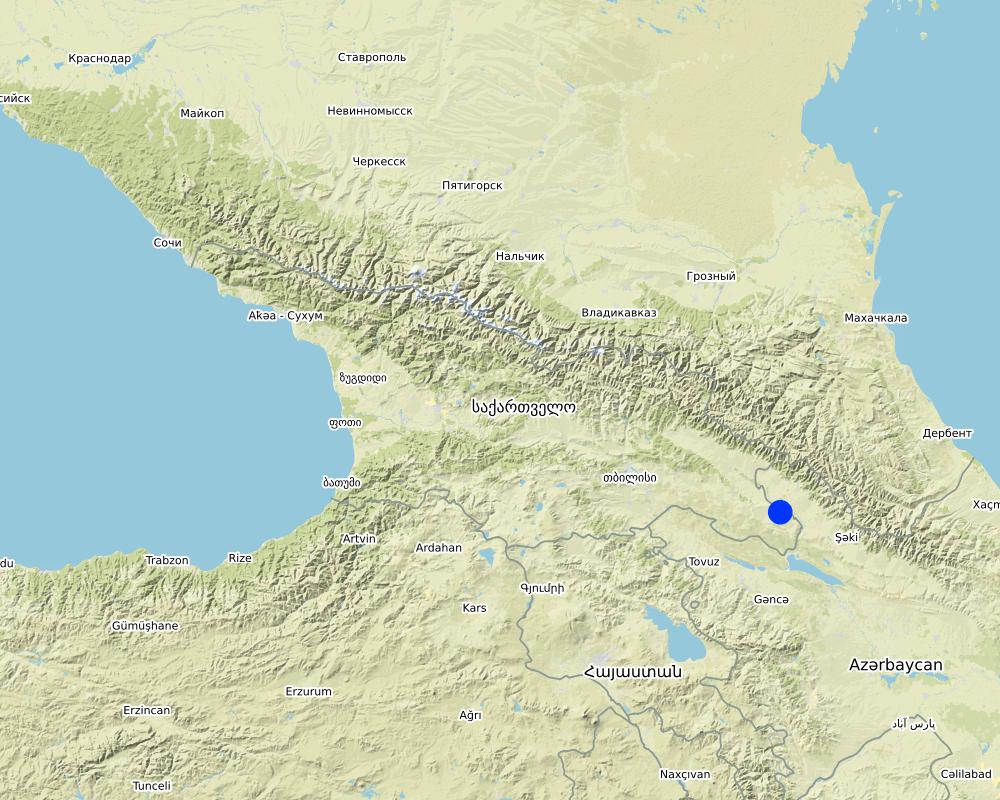
The Village of Arkhiloskalo is locted in the Municipality of Dedoplitskaro.
حدد انتشار التقنية:
- منتشرة بالتساوي على مساحة
إذا كانت التقنيةا موزعة بالتساوي على منطقة ما، حدد المساحة المغطاة (بالكيلومتر المربع):
49,7
إذا كانت المساحة الدقيقة غير معروفة، فيرجى الإشارة إلى المنطقة التقريبية المغطاة:
- 100-10 كم2
التعليقات:
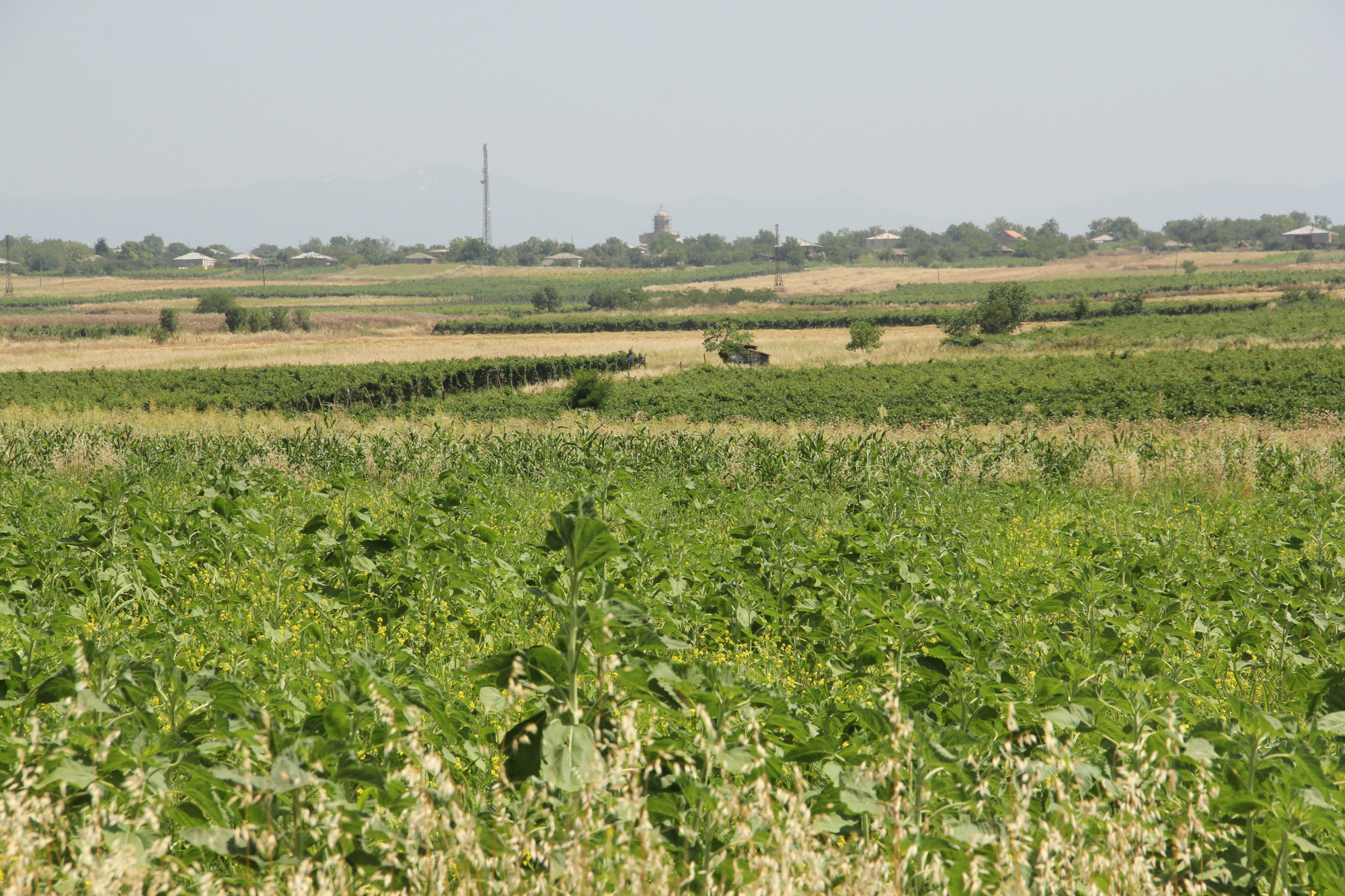
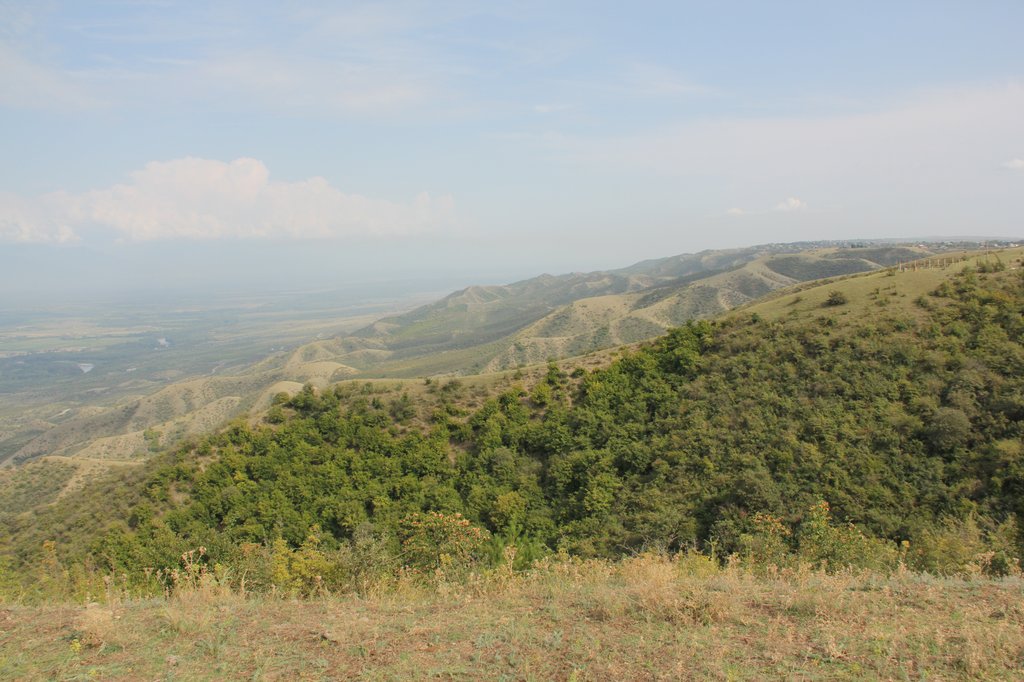
The village Arkhiloskalo covers an area of 4,970 ha. The area ranges from the lower section in the North 250 m (Alasani river valley) up to 730 m at the ridge and then falls again to the South in the Shiraki Valley to 600 m.
Map
×2.6 تاريخ التنفيذ
اذكر سنة التنفيذ:
2018
2.7 إدخال التقنية
حدد كيف تم إدخال التقنية:
- من خلال المشاريع/ التدخلات الخارجية
التعليقات (نوع المشروع، الخ):
The land-use plan approach is one of the measures among others to contribute to support the integration of good Landscape and Sustainable Land Management (L-SLM) principles and practices into national policy and institutional framework to ensure the adoption of economically viable practices by rural communities. This was a GEF-funded project.
3. تصنيف تقنية الإدارة المستدامي للأراضي
3.1 الغرض الرئيسي ( الأغراض الرئيسية) للتقنية
- تحسين الإنتاج
- الحد من تدهور الأراضي ومنعه وعكسه
- الحفاظ على/تحسين التنوع البيولوجي
- التكيف مع تغير المناخ/الظواهر المتطرفة وآثارها
- خلق أثر اقتصادي مفيد
3.2 نوع (أنواع) استخدام الأراضي الحالية حيث يتم تطبيق التقنية
استخدامات الأراضي مختلطة ضمن نفس وحدة الأرض:
نعم
حدد استخدام الأراضي المختلطة (المحاصيل / الرعي / الأشجار):
- الحراجة الزراعية

الأراضي الزراعية
- زراعة سنوية
- زراعة الأشجار والشجيرات
الزراعة السنوية - حدد المحاصيل:
- الحبوب - قمح (ربيعي)
- الحبوب - قمح (شتوي)
- المحاصيل الزيتية - عباد الشمس، بذور اللفت، وغيرها
زراعة الأشجار والشجيرات -حدد المحاصيل:
- فواكه أخرى
- العنب
عدد مواسم الزراعة في السنة:
- 1
حدد:
summer
هل يتم ممارسة الزراعة البينية؟:
كلا
هل تتم ممارسة تناوب المحاصيل؟:
كلا

أراضي الرعي
الرعي الواسع النطاق:
- مربى ماشية محدد
الرعي المكثف/ إنتاج الأعلاف:
- قطع وحمل / صفر مرعى
- مراعي محسنة
نوع الحيوان:
- الماشية - لإنتاج الألبان واللحوم (على سبيل المثال الزيبو)
هل يتم تطبيق الإدارة المتكاملة للمحاصيل والثروة الحيوانية؟:
كلا
الصنف:
الماشية - لإنتاج الألبان واللحوم (على سبيل المثال الزيبو)
العدد:
982

المستوطنات والبنية التحتية
- المستوطنات والمباني
- حركة المرور: الطرق والسكك الحديدية
التعليقات:
All form of land cover and land use forms have been mapped.
3.3 هل تغير استخدام الأراضي نتيجة لتنفيذ التقنية؟
هل تغير استخدام الأراضي نتيجة لتنفيذ التقنية؟:
- لا (تابع مع السؤال 3.4)
3.4 إمدادات المياه
إمدادات المياه للأرض التي يتم تنفيذ التقنية عليها:
- بعلية
3.5 مجموعةالإدارة المستدامة للأراضي التي تنتمي إليها هذه التقنية
- مصد الريح/حزام حماية
- أنظمة التناوب (تعاقب المحاصيل، البور، الزراعة المتنقلة)
- إدارة النفايات / إدارة مياه الصرف الصحي
- Land use planning
3.6 التدابير التقنية في مجال إلادارة المستدامة للأراضي

التدابير الإدارية
- M2: تغيير في مستوى الإدارة/الكثافة
- M7: أخرى
التعليقات:
The land use planning started with mapping of current land use and included stakeholders input on strength and weaknesses. Based on this, development scenarios have been developed to change current land use approaches to a more sustainable way (e.g. restoration of windbreaks, crop rotation etc.)
3.7 الأنواع الرئيسية من تدهور الأراضي التي تناولتها التقنية

تآكل التربة الناتج عن الرياح
- (Et): فقدان التربة السطحية
التعليقات:
The loss of windbreaks caused an increased exposure of topsoil to wind erosion on fields with annual crops. The land use plan helps to quantify the current state of the windbreaks and underlines their functional importance.
3.8 منع أو حد أو عكس تدهور الأراضي
تحديد هدف التقنية فيما يتعلق بتدهور الأراضي:
- منع تدهور الأراضي
4. المواصفات الفنية، وأنشطة التنفيذ، والمدخلات، والتكاليف
4.1 الرسم الفني للتقنية
المواصفات الفنية (المتعلقة بالرسم الفني):
Key stages of implementation:
The land-use planning in the village of Arkhiloskalo, Dedoplistskaro Municipality is one of the pilot activities linked to LDN.
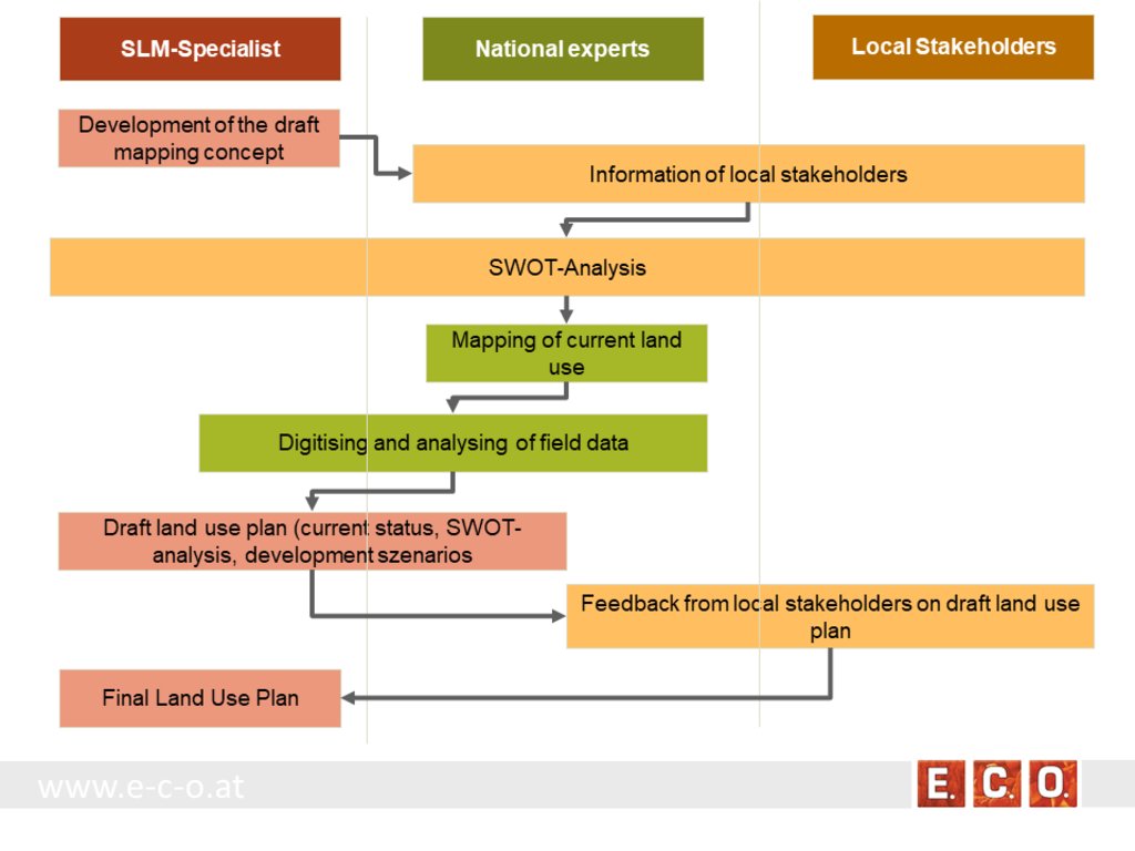
Together with the local stakeholders, a land-use plan has been worked out. The procedure of defining a spatial development plan for a municipality goes along three stages:
• Stage 1: Gather background information & implement pre-design studies and development of a mapping concept
• Stage 2: Information of local stakeholders on this activity and implementation of an SWOT analysis (Strength, Weaknesses, Opportunities, Threats) related to the land use of the village
• Stage 3: Mapping and analyzing the current land use
• Stage 4: Preparation of a draft land use plan
• Stage 5: Reflection of the draft land use plan with local stakeholders
• Stage 6: Preparation of the final land use plan
المؤلف:
Hanns Kirchmeir
التاريخ:
16/01/2020
المواصفات الفنية (المتعلقة بالرسم الفني):
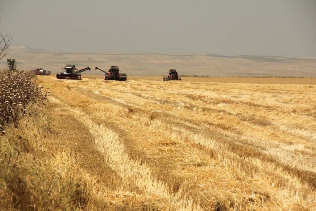
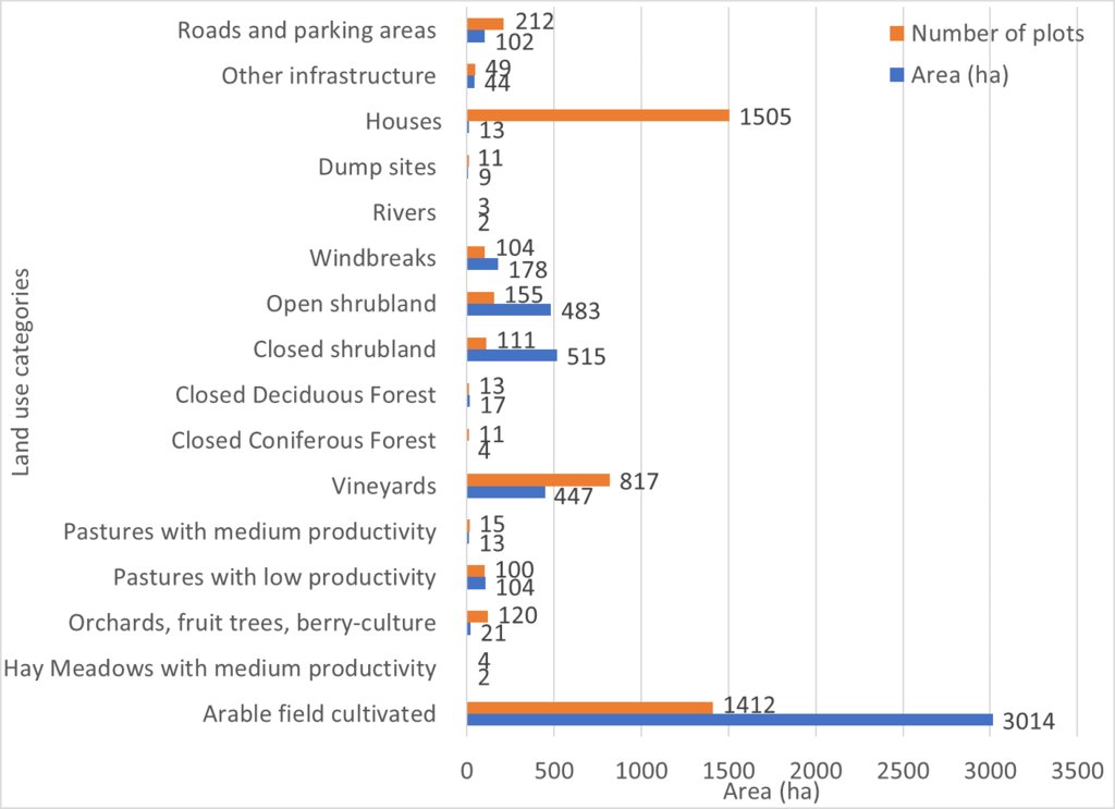
Absolute area sizes. The largest land use category is arable land (3,014 ha) followed by closed and open shrubland (515 ha and 483 ha, respectively). Vineyards cover a total of 447 ha whereas windbreaks cover 178 ha. Pastures with low productivity (104 ha) and roads and parking areas (102 ha) use almost the same amount of land. Other infrastructure covers 44 ha of land. Orchards, fruit trees and berry-culture use 21 ha of land. Closed deciduous forest (17 ha) covers only a few more hectares than pastures (13 ha). Houses are the most common plot category in Arkhiloskalo but use only around 13 ha of land which puts them on the same land-use level as pastures. Dumpsites (9 ha) use more than twice the area of closed coniferous forest (4 ha). Hay meadows and rivers cover around 2 ha of the area.
المؤلف:
Hanns Kirchmeir
التاريخ:
20/11/2019
المواصفات الفنية (المتعلقة بالرسم الفني):
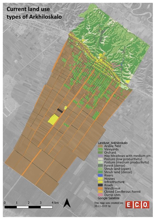
Map of current land-use categories in Arkhiloskalo. The land-use classification in this approach is based on the Corine Land Classification System. It was split into sub-categories where needed to meet the needs of local land use practices.
المؤلف:
Hanns Kirchmeir
التاريخ:
13/11/2019
المواصفات الفنية (المتعلقة بالرسم الفني):
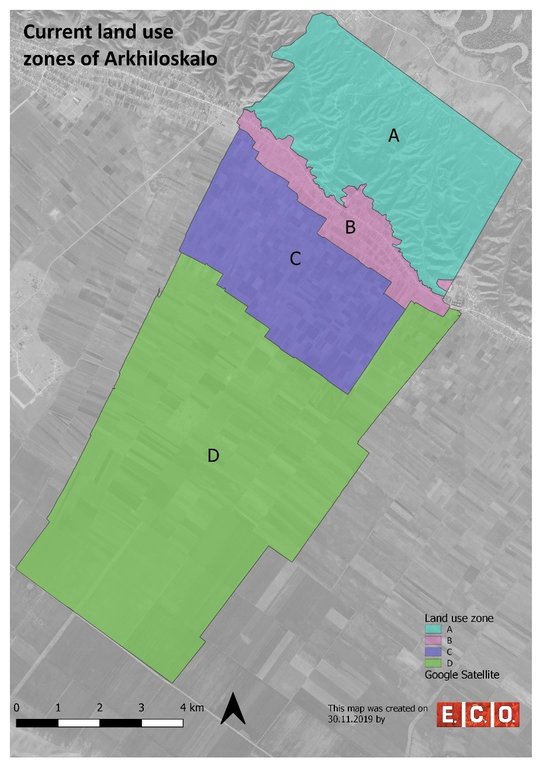
Based on the different land use, 4 different zones have been separated:
•Zone A: Steep North Slope
•Zone B. Settlement Area
•Zone C: Zone of perennial Crops
•Zone D: Zone of annual Crops
المؤلف:
Hanns Kirchmeir
4.2 معلومات عامة بخصوص حساب المدخلات والتكاليف
حدد كيفية احتساب التكاليف والمدخلات:
- حسب مساحة تنفيذ التقنية
الإشارة إلى حجم ووحدة المساحة:
50 km²
حدد العملة المستخدمة لحساب التكاليف:
- دولار أمريكي USD
اذكر متوسط تكلفة أجر العمالة المستأجرة في اليوم الواحد:
national expert 100 USD
4.3 أنشطة التأسيس
| النشاط | التوقيت (الموسم) | |
|---|---|---|
| 1. | Gather background information & implement pre-design studies and development of a mapping concept | Winter/spring |
| 2. | Information of local stakeholders on this activity and implementation of an SWOT analysis (Strength, Weaknesses, Opportunities, Threats) related to the land use of the village | Spring |
| 3. | Mapping and analyzing the current land use | Summer |
| 4. | Preparation of a draft land use plan | Autumn/Winter |
| 5. | Reflection of the draft land use plan with local stakeholders | Autumn/Winter |
| 6. | Preparation of the final land use plan | Autumn/Winter |
4.4 التكاليف والمدخلات اللازمة للتأسيس
إذا لم تتمكن من تفصيل التكاليف في الجدول أعلاه، قم بتقديم تقدير للتكاليف الإجمالية لإنشاء التقنية:
15000,0
إذا تحمل مستخدم الأرض أقل من 100% من التكاليف، حدد من قام بتغطية التكاليف المتبقية:
REC-Caucasus, GEF-funded Project
التعليقات:
The budget is $ 15 000 / per year. This amount includes the salaries of following expert, such as: National expert on SLM, National expert on LUP, International expert on SLM, International expert on LUP, Botanist, GIS expert. Also the above budget includes travels and missions in three municipalities, workshops in Akhmeta and Dedoplistskaro municipalities, workshops and public hearings in selected local communities (Arkhiloskalo and Shenako),
4.7 أهم العوامل المؤثرة على التكاليف
قدم وصفا لأهم العوامل التي تؤثر على التكاليف:
The field work of mapping and analysis of results took a lot of time as well as the stakeholder meetings.
5. البيئة الطبيعية والبشرية
5.1 المناخ
هطول الأمطار السنوي
- < 250 مم
- 251- 500 ملم
- 501 - 750ملم
- 1,000-751 ملم
- 1,500-1,100 ملم
- 2,000-1,500 ملم
- 3,000-2,001 ملم
- 4,000-3,100 ملم
- > 4000 ملم
المواصفات/التعليقات على هطول الأمطار:
The driest month is January, with 25 mm of rainfall. The greatest amount of precipitation occurs in June, with an average of 108 mm. The difference in precipitation between the driest month and the wettest month is 83 mm.
الإشارة إلى اسم محطة الأرصاد الجوية المرجعية المعنية:
Dedoplistskaro Met. Station
المنطقة المناخية الزراعية
- شبه قاحلة
The climate is warm and temperate in Dedoplistskaro. The average annual temperature in Dedoplistskaro is 11.3 °C. The warmest month of the year is July, with an average temperature of 22.7 °C. The lowest average temperatures in the year occur in January, when it is around 0.1 °C.
5.2 طوبوغرافيا
متوسط الانحدارات:
- مسطح (0-2%)
- بسيط (3-5%)
- معتدل (6-10%)
- متدحرج (11-15%)
- تلال (16-30%)
- شديدة الانحدار(31-60%)
- فائقة الانحدار (>60%)
التضاريس:
- هضاب/سهول
- أثلام مرتفعة
- المنحدرات الجبلية
- منحدرات التلال
- منحدرات في السفوح
- قاع الوادي
المنطقة الارتفاعية:
- 100-0 متر فوق سطح البحر
- 500-101 متر فوق سطح البحر
- 1,000-501 متر فوق سطح البحر
- 1,500-1,001 متر فوق سطح البحر
- 2,000-1,501 متر فوق سطح البحر
- 2,500-2,100 متر فوق سطح البحر
- 3,000-2,501 متر فوق سطح البحر
- 4,000-3,001 متر فوق سطح البحر
- > 4000 متر فوق سطح البحر
وضح ما إذا كانت التقنية مطبقة على وجه التحديد في:
- غير ذات صلة
التعليقات والمواصفات الإضافية بشأن التضاريس:
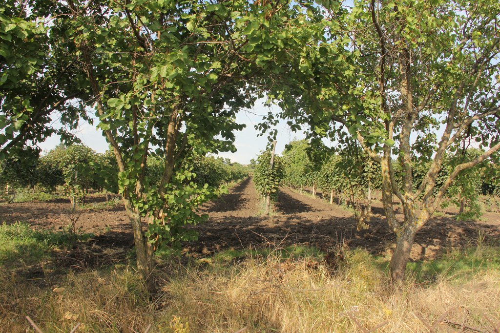
The pastures are located on steep hill slope to the north, while the village and arable lands are located on the gently south facing terrace.
5.3 التربة
متوسط عمق التربة:
- ضحل جدًا (0-20 سم)
- ضحلة (21-50 سم)
- متوسطة العمق (51-80 سم)
- عميقة (81-120 سم)
- عميقة جدًا (> 120 سم)
قوام التربة (التربة السطحية):
- متوسط ( طميي، سلتي)
قوام التربة (> 20 سم تحت السطح):
- متوسط ( طميي، سلتي)
المواد العضوية في التربة السطحية:
- عالية (>3%)
5.4 توافر المياه ونوعيتها
منسوب المياه الجوفية:
50-5 م
توافر المياه السطحية:
ضعيف/ غير متوافر
نوعية المياه (غير المعالجة):
مياه الشرب سيئة (تتطلب معالجة)
تشير جودة المياه إلى:
المياه الجوفية
هل تعتبر ملوحة الماء مشكلة؟:
كلا
هل تحدث فيضانات في المنطقة؟:
كلا
5.5 التنوع البيولوجي
تنوع الأنواع:
- مرتفع
تنوع الموائل:
- مرتفع
التعليقات والمواصفات الإضافية بشأن التنوع البيولوجي:
Especially the semi-natural landscapes of the slopes to the north are of high habitat and species diversity.
5.6 خصائص مستخدمي الأراضي الذين يطبقون التقنية
مستقر أو مرتحل:
- غير المترحل
التوجه السوقي لنظام الإنتاج:
- مختلط (كفاف/ تجاري)
الدخل من خارج المزرعة:
- أقل من % 10من كامل الدخل
المستوى النسبي للثروة:
- ضعيف
أفراداً أو مجموعات:
- فرد/أسرة معيشية
مستوى المكننة:
- ميكانيكية/ مزودة بمحرك
الجنس:
- رجال
عمر مستخدمي الأرضي:
- متوسط العمر
اذكر الخصائص الأخرى ذات الصلة لمستخدمي الأراضي:
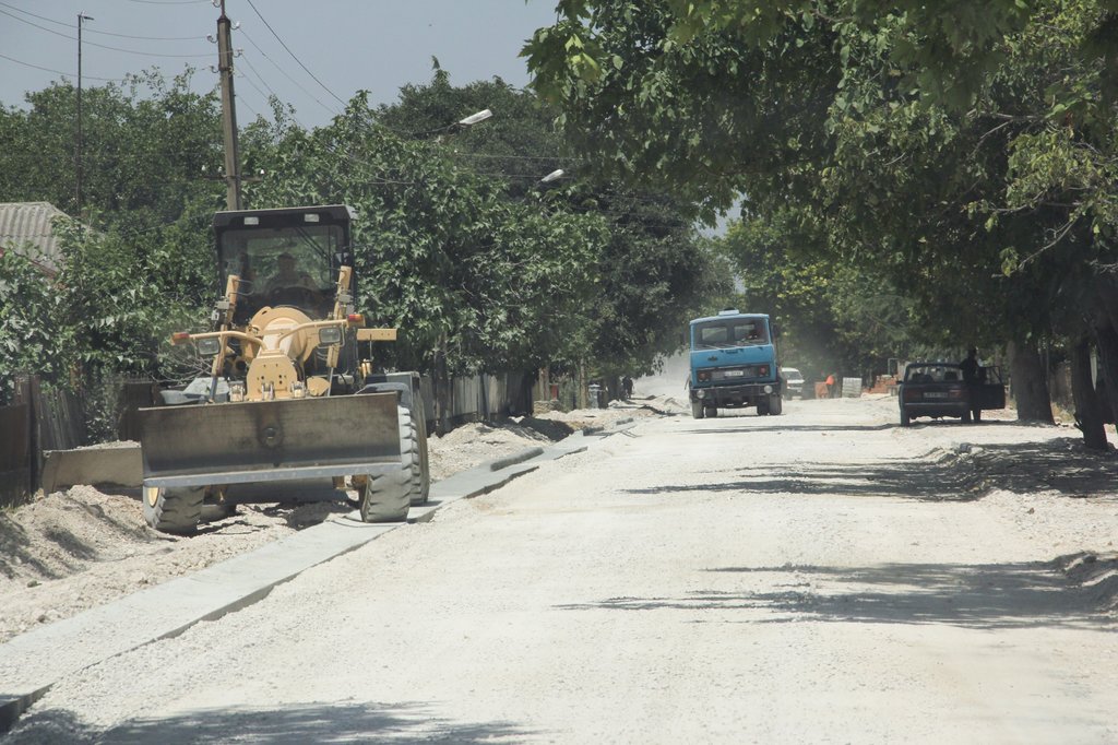
The village is very remote. Driving distance to the municipality is about 1h on bad roads.
5.7 متوسط مساحة الأرض التي يستخدمها مستخدمو الأراضي الذين يطبقون التقنية
- < 0.5 هكتارا
- 0.5 - 1 هكتار
- 1 -2 هكتار
- 2 - 5 هكتار
- 5 - 15 هكتار
- 15 - 50 هكتار
- 50 - 100هكتار
- 500-100 هكتار
- 1,000-500 هكتار
- 10,000-1,000 هكتار
- > 10,000 هكتار
هل يعتبر هذا نطاقًا صغيرًا أو متوسطًا أو واسعا (في إشارة إلى السياق المحلي)؟:
- على نطاق متوسط
5.8 ملكية الأراضي، وحقوق استخدام الأراضي، وحقوق استخدام المياه
ملكية الارض:
- مجتمعي/قروي
- فردية، يوجد سند ملكية
حقوق استخدام الأراضي:
- وصول مفتوح (غير منظم)
- فردي
حقوق استخدام المياه:
- مجتمعي (منظم)
هل تعتمد حقوق استخدام الأراضي على نظام قانوني تقليدي؟:
نعم
5.9 الوصول إلى الخدمات والبنية التحتية
الصحة:
- ضعيف
- معتدل
- جيد
التعليم:
- ضعيف
- معتدل
- جيد
المساعدة التقنية:
- ضعيف
- معتدل
- جيد
الأسواق:
- ضعيف
- معتدل
- جيد
الطاقة:
- ضعيف
- معتدل
- جيد
الطرق والنقل:
- ضعيف
- معتدل
- جيد
مياه الشرب وخدمات الصرف الصحي:
- ضعيف
- معتدل
- جيد
الخدمات المالية:
- ضعيف
- معتدل
- جيد
6. الآثار والتصريحات الختامية
6.1 الآثار التي أظهرتها التقنية في الموقع
الآثار الاجتماعية والاقتصادية
الإنتاج
إنتاج المحاصيل
التعليقات/ حدد:
Effects will be visible based on the implementation of selected development scenario provided by Land use plan.
تنوع المنتج
التعليقات/ حدد:
Effects will be visible based on the implementation of selected development scenario provided by Land use plan.
الدخل والتكاليف
تنوع مصادر الدخل
التعليقات/ حدد:
Effects will be visible based on the implementation of selected development scenario provided by Land use plan.
الآثار الاجتماعية والثقافية
المعرفة بالإدارة المستدامة للأراضي/تدهور الأراضي
التعليقات/ حدد:
Improvements by training and workshops, awareness raising.
الآثار الايكولوجية
التنوع البيولوجي: الغطاء النباتي، الحيوانات
الغطاء النباتي
التعليقات/ حدد:
Reduced grazing in zone A (north slope) will increase the vegetation cover. Effects will be visible based on the implementation of selected development scenario provided by Land use plan.
الكتلة الحيوية/ طبقة الكربون فوق التربة
التعليقات/ حدد:
Reduced grazing in zone A (north slope) will increase the cover of shrubs and trees which will lead to increase of biomass. Effects will be visible based on the implementation of selected development scenario provided by Land use plan.
التنوع الحيواني
التعليقات/ حدد:
Effects will be visible based on the implementation of selected development scenario provided by Land use plan.
تنوع الموائل
التعليقات/ حدد:
Diversification of land use and restoration of windbreaks will increase habitat diversity. Effects will be visible based on the implementation of selected development scenario provided by Land use plan.
الحد من مخاطر المناخ والكوارث
سرعة الرياح
التعليقات/ حدد:
Improvement of windbreaks will reduce wind speed and topoil erosion. Effects will be visible based on the implementation of selected development scenario provided by Land use plan.
6.2 الآثار التي أظهرتها التقنية خارج الموقع
تلوث المياه الجوفية/الأنهار
التعليقات/ حدد:
Removal of uncontrolled dump sites will reduce groundwater and river pollution especially in the Alasani floodplain north of the community.
الرواسب المنقولة بواسطة الرياح
التعليقات/ حدد:
The rehabilitation of windbreaks will have a positive impact on neighboring fields.
6.3 تعرض التقنية وحساسيتها لتغير المناخ التدريجي والظواهر المتطرفة/الكوارث المرتبطة بالمناخ (كما يراها مستخدمو الأراضي)
التعليقات:
The technology of land use planning is not sensitive to climate change but is an appropriate technology to adapt land use to future anticipated climate changes.
6.4 تحليل التكلفة والعائد
كيف يمكن مقارنة العوائد نسبة لتكاليف الإنشاء (من وجهة نظر مستخدمي الأراضي)؟
عوائد قصيرة الأجل:
سلبي
عوائد طويلة الأجل:
إيجابي
كيف تتم مقارنة العوائدمع كلفة الصيانة/التكاليف المتكررة (من وجهة نظر مستخدمي الأراضي)؟
عوائد قصيرة الأجل:
محايد/متوازن
عوائد طويلة الأجل:
محايد/متوازن
التعليقات:
The land use planning process is an investment in future developments. Return of investment can be expected in oncoming years. The mapping result is a detailed documentation of size and spatial distribution land cover categories. Change in land cover is an important indicator to monitor the loss and gains according to the LDN monitoring concept. The land-use plan is based on field assessments made in summer 2019 and built a baseline for future change assessments as it includes data on land-use intensity which will enable to consider change in time dynamics and to monitor changes on the ground.
6.5 اعتماد التقنية
- حالات فردية/تجريبية
إذا كان متاحًا، قم بتحديد الكمية (عدد الأسر المعيشية و/أو المساحةالمغطاة):
It was implemented as show case for one community
من بين جميع الذين تبنوا التقنية، كم عدد الذين فعلوا ذلك بشكل تلقائي، أي دون تلقي أي حوافز مادية/مدفوعات؟:
- 10-0%
6.6 التكيف
هل تم تعديل التقنية مؤخرًا لتتكيف مع الظروف المتغيرة؟:
كلا
6.7 نقاط القوة / المزايا / الفرص التي توفرها التقنية
| نقاط القوة/ المزايا/ الفرص من وجهة نظر مستخدمي الأراضي |
|---|
| The majority of the land users in village Arkhiloskalo have been using the same land and natural resources through decades and have good understanding of the natural conditions and climate change perspectives of the target area. The land use plan, the scenario development and the knowledge exchange in the workshops are have been considered as advantage for awareness raising, joint decision making and to start a positive change in short-term period. |
| The successful land-use system with improved environment conditions and benefit to the local farmers can lead to be a perfect example for the whole municipality of Dedoplistskaro as most part of its territory is agricultural land in semi-arid environment facing some rapid and significant challenges caused by climate change. |
| نقاط القوة/ المزايا/ الفرص من وجهة نظر جامع المعلومات أو غيره من الاشخاص الرئيسيين لمصدر المعلومات |
|---|
| The land use plan will help to optimize the management and to eliminate present challenges in the 4 separate zones and promote improved sustainable land- use, land-management practices like crop rotation and re-establishment of windbreaks. |
| The land-use plan helps to identify the strength, opportunities, weaknesses and threats and contribute to sustainable land-use and its management. E.g.: in the Zone A, Steep North Slope there is a high risk, that the waste in the dumpsites will be washed down in an uncontrolled manner into the natural and semi-natural habitats of the slope. The waste is partly burned and the wash out of toxic solute can harm nature and ground water. |
| Application of the technology helps to optimize management measures, which will reduce costs and labour forces, e.g., by increasing productivity of land and productivity of vineyards in the Zone C: zone of perennial crops. |
| The land-use map integrates climate mitigation. E.g. it helps to plan the re-establishment of the windbreaks, which significantly contributes to the reduction of wind erosion in the Zone D: Zone of annual crops. |
| The terrestrial evaluation of the current land use can also serve to evaluate remote sensing technologies for semi-automatic classification of land cover categories. |
6.8 نقاط ضعف / مساوىء / مخاطر التقنية وسبل التغلب عليها
| نقاط الضعف/ المساوىء/ المخاطر من وجهة نظر مستخدم الأراضي | كيف يمكن التغلب عليها؟ |
|---|---|
| Lack of dialogue and trust could be one of the risks to succeed with the introduction of advanced methods of sustainable land management. | The proposed sustainable land-use practices and pilot activities should be planned in a way to have results on the ground in a short-term period to keep local farmers motivated. |
| نقاط الضعف/ المساوىء/ المخاطر من وجهة نظر جامع المعلومات أو غيره من الاشخاص الرئيسيين لمصدر المعلومات | كيف يمكن التغلب عليها؟ |
|---|---|
| Risks: Land use plan Interest of farmers, guesthouse providers and local residents are conflicting. | This can be limited by good facilitation of focus group discussions between different stakeholder groups. |
| Local actors (farmers, guest house providers ...) are not interested in participating in the joint land-use planning process. | It will need a well-coordinated communication design to include all the local stakeholders in the process of practical and theoretical introduction to the principles of sustainable land-use. The communication should emphasize potential economic benefits to the local households together with advantages of the sustainability. This can be a key factor to get most of the local stakeholders engaged with the proposed sustainable land-use practices. |
7. المراجع والروابط
7.1 طرق جمع/مصادر المعلومات
- زيارات ميدانية، مسوحات ميدانية
2 days of joint field visit of the project team, 2 weeks of field-mapping of the national expert.
- مقابلات مع مستخدمي الأراضي
About 44 participants in workshops and 12 people interviewed.
- مقابلات مع المتخصصين/الخبراء في الإدارة المستدامة للأراضي
2 specialists
- التجميع من التقارير والوثائق الأخرى الموجودة
1 international expert and 3 national experts have been conducted for the feedback on the report.
متى تم تجميع البيانات (ميدانيا)؟:
12/08/2018
7.2 المراجع للمنشورات المتاحة
العنوان، المؤلف، السنة، النظام القياسي الدولي لترقيم الكتب ISBN:
Pilot project on land degradation neutrality in Georgia: Final Report.2017.Huber, M., Joseph, A., Kirchmeir, H., Ghambashidze, G.
متاح من أين؟كم التكلفة؟:
https://e-c-o.at/files/publications/downloads/D00813_ECO_policy_brief_LDN_Georgia_171025.pdf
العنوان، المؤلف، السنة، النظام القياسي الدولي لترقيم الكتب ISBN:
Applying Landscape and Sustainable Land Management (L-SLM) for mitigating land degradation and contributing to poverty reduction in rural areas: Final report. 2017. Kirchmeir, H., Joseph, A., Huber, M.
متاح من أين؟كم التكلفة؟:
Request at RECC Caucasus
العنوان، المؤلف، السنة، النظام القياسي الدولي لترقيم الكتب ISBN:
limatologies at high resolution for the earth’s land surface areas. Sci. Data 4:170122 doi: 10.1038/sdata.2017. Karger, D. N. Conrad, O., Böhner, J., Kawohl, T., Kreft, H., Soria-Auza, R.W., Zimmermann, N.E., Linder H.P. & Kessler M.
متاح من أين؟كم التكلفة؟:
https://www.nature.com/articles/sdata2017122
7.4 تعليقات عامة
It was not easy to consider the land use planning either to be a technology or an approach. Finally, we submitted as an approach.
الروابط والوحدات المواضيعية
توسيع الكل طي الكلالروابط

Land Degradation Neutrality Transformative Projects and Programmes (LDN-TPP) … [جورجيا]
In the framework of the project ‘Generating Economic and Environmental Benefits from Sustainable Land Management for Vulnerable Rural Communities of Georgia’, Land Degradation Neutrality Transformative Projects and Programmes (LDN-TPP) were developed to implement the LDN targets at municipal level. The approach defines the process to break down global and international …
- جامع المعلومات: Daniel Zollner
الوحدات المواضيعية
لا يوجد وحدات مواضيعية


