Marab - Water Harvesting Based Floodplain Agriculture [الأردن]
- تاريخ الإنشاء:
- تحديث:
- جامع المعلومات: Joren Verbist
- المحررون: Mira Haddad, Enrico Bonaiuti
- المُراجع: Rima Mekdaschi Studer
Marab in Arabic “المرب”
technologies_5770 - الأردن
عرض الأقسام
توسيع الكل طي الكل1. معلومات عامة
1.2 تفاصيل الاتصال بالأشخاص الرئيسيين لمصدر المعلومات والمؤسسات المشاركة في تقييم وتوثيق التقنية
الشخص (الأشخاص) الرئيسي لمصدر المعلومات
متخصص في الإدارة المستدامة للأراضي:
Strohmeier Stefan
International Center of Agriculture Research in the Dry Areas (ICARDA)
الأردن
متخصص في الإدارة المستدامة للأراضي:
متخصص في الإدارة المستدامة للأراضي:
Natural Resources Economist Social, Economy & Policy Research:
Dhehibi Boubaker
International Center of Agriculture Research in the Dry Areas (ICARDA)
الأردن
اسم المشروع الذي سهّل توثيق/تقييم التقنية (إذا كان ذلك على صلة)
ICARDA Institutional Knowledge Management Initiativeاسم المؤسسة (المؤسسات) التي سهلت توثيق/تقييم التقنية (إذا كان ذلك على صلة)
International Center for Agricultural Research in the Dry Areas (ICARDA) - لبنان1.3 الشروط المتعلقة باستخدام البيانات الموثقة من خلال WOCAT
يوافق جامع المعلومات والشخص (لاشخاص) الرئيسي لمصدر المعلومات على الشروط المتعلقة باستخدام البيانات الموثقة من خلال WOCAT:
نعم
1.4 إعلان بشأن استدامة التقنية الموصوفة
هل التقنية الموصوفة هنا تمثل مشكلة فيما يتعلق بتدهور الأراضي، بحيث لا يمكن إعلانها تقنية مستدامة لإدارة الأراضي؟:
كلا
التعليقات:
This technology conserves soil and water; it reduces surface water and sediment losses from dryland watersheds. The technology is located in downstream/lowland floodplains, and ideally, it is implemented in an integrated watershed approach. In the present case study, the ‘Marab’ is linked with two main upstream measures: Upland micro-water harvesting (Vallerani system) and gully/channel measures (gully plugs)
2. وصف تقنيةالإدارة المستدامي للأراضي
2.1 وصف مختصر للتقنية
تعريف التقنية:
The Marab is a local downstream water harvesting measure in an integrated watershed context, where up/midstream users and applied land management practices affect the Marab.
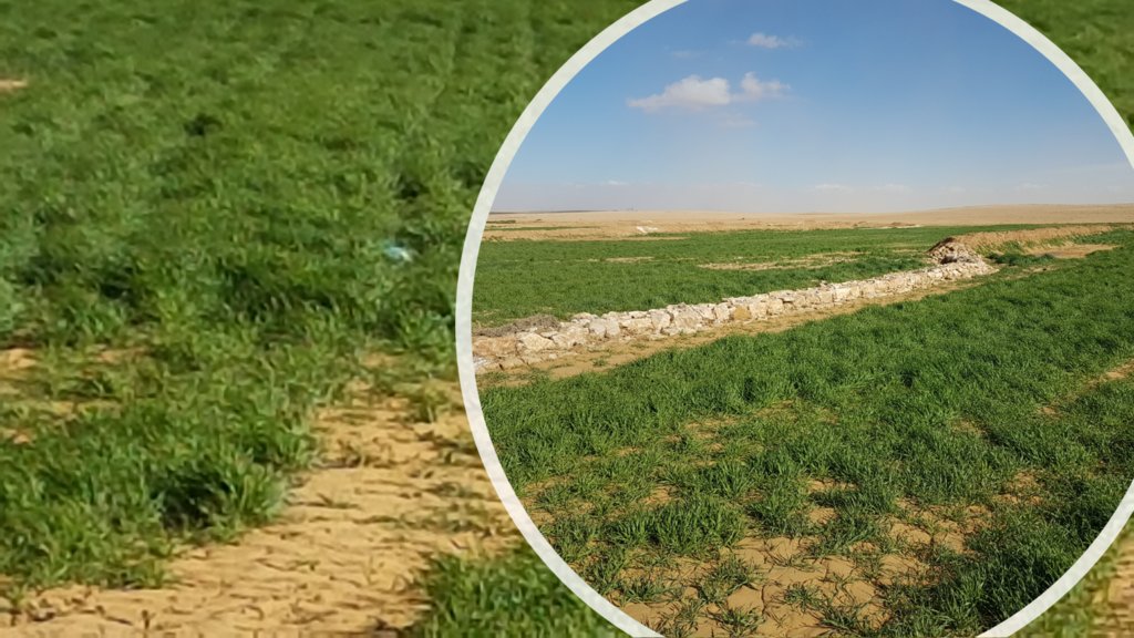
The technology diverts and spreads excess runoff over deep-soil flood plains. The technology comprises local gully-filling, grading/leveling of seed bed, and construction of a bund-and-spillway system creating several compartments for flood-irrigated agriculture.
2.2 وصف تفصيلي للتقنية
الوصف:
Arid drylands of Jordan receive less than 200mm average annual rainfall. The specific site is located close by Al Majeddyeh village, around 30km south-east of Amman. The average annual rainfall at the site is around 130mm. The average temperature is above 18 degrees Celsius. The human environment is characterized by agro-pastoralists. These are farmers that live in permanent houses but transport their livestock to graze. As consequence of the natural environment and mis-management (e.g. overgrazing) desertification has been an increasingly problem, not only from an environmental perspective (e.g. carbon stocking; lack of water), but also from an socio-economic perspective, because desertification leads to reduced productive lands, consequently resulting in less income for the rural population.
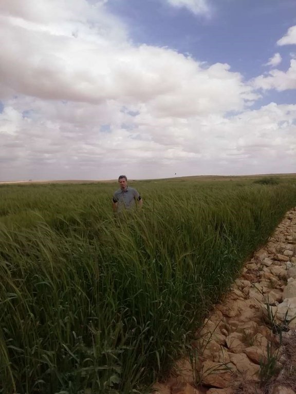
Therefore, the aim of the technology is to achieve high-yield agriculture through flood/macro-catchment water harvesting in arid environments commonly unsuitable for field crop agriculture, creating beneficial impact for local land users. The high yield barley is fed to the livestock (goats and sheeps) of the local agro-pastoralists. Applied in an integrated watershed approach, it meets agricultural demands and motivates sustainable dryland ecosystem management in the uplands. The Marab-technology has a buffering effect on extreme runoff through water retention, for further use in downstream areas, including the trapping of relative fertile sediments from upstream. As the Marab increases yields, it also improves the livelihood of the local population.
The Marab-technology is a macro-catchment water harvesting technology. The Marab is located in the natural depression of the watershed (10 square kilometres), therefore most of the water from the watershed is captured here, instead of being spilled away. Combining this natural depression with the construction of bunds and specific soil leveling, leads to decreased run-off, thus highly increased water infiltration and soil moisture. Thereby, the biomass-production increased as well.
The watershed is characterized by degraded lands upstream (720 ha), where low yield and subsidized barley cultivation is practiced, and by gullies. In a limited part (12 ha) of the upstream area, Vallerani micro-catchments are implemented as a pilot-plot. This might seem contradicting since upstream micro-catchment water harvesting decreases the water in the Marab downstream. However, the Vallerani micro-catchments also have beneficial impacts on the watershed and the Marab, such as flattening peak water flows, reducing erosion and providing fodder. The reduction in water run-off for the Marab as consequence of the Vallerani structures is not significant, due to the small size of the pilot area. But the relations between upstream and downstream should be taken into account.
Upstream watershed measures to buffer and/or avoid extreme runoff events (extreme downstream flooding) in the Marab such as micro-catchment water harvesting structures (Vallerani tractor plow system) and the out-planting of native shrub seedlings, as well as the stabilization of erosive gully systems through gully plugging and revegetation of side banks are advised to be taken before implementing the Marab technology downstream, as they safeguard and protect the Marab. But they are not further into account in this documentation.
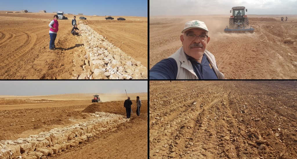
Establishment of the downstream Marab system includes:
•Local filling of downstream gull(system) with deep soil
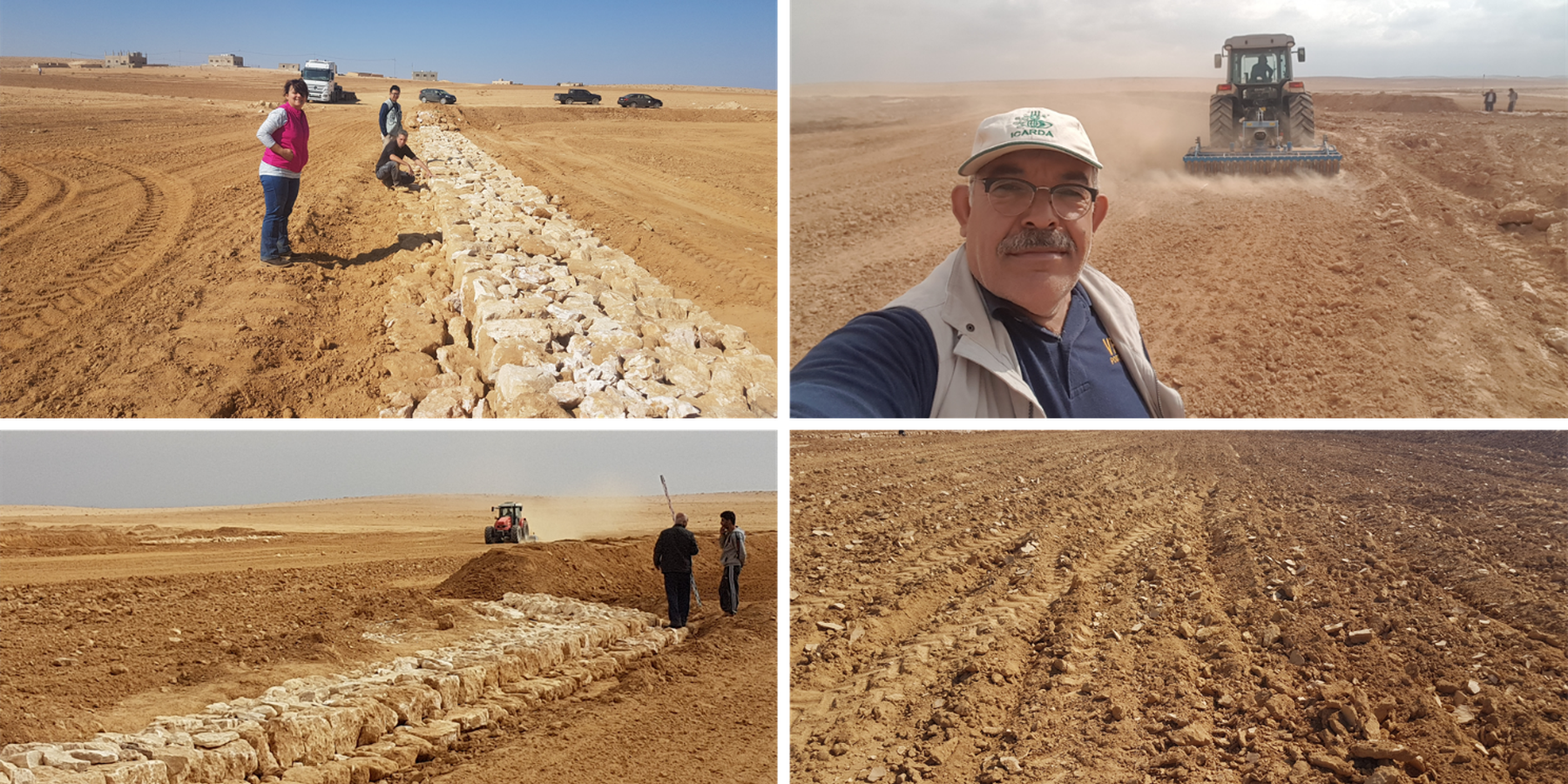
•Leveling/grading of flood plains
•Construction of earth bunds
•Construction of the spillways (stone made)
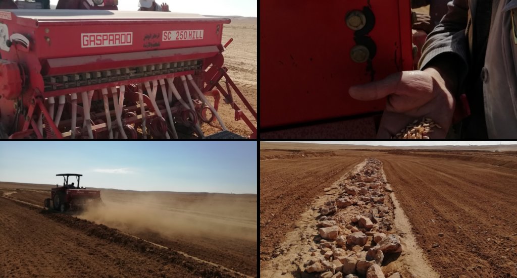
• Seedbed preparation for planting annual crop such as barley
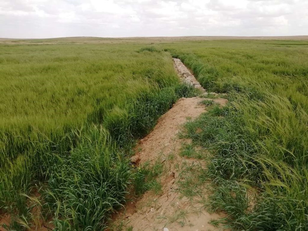
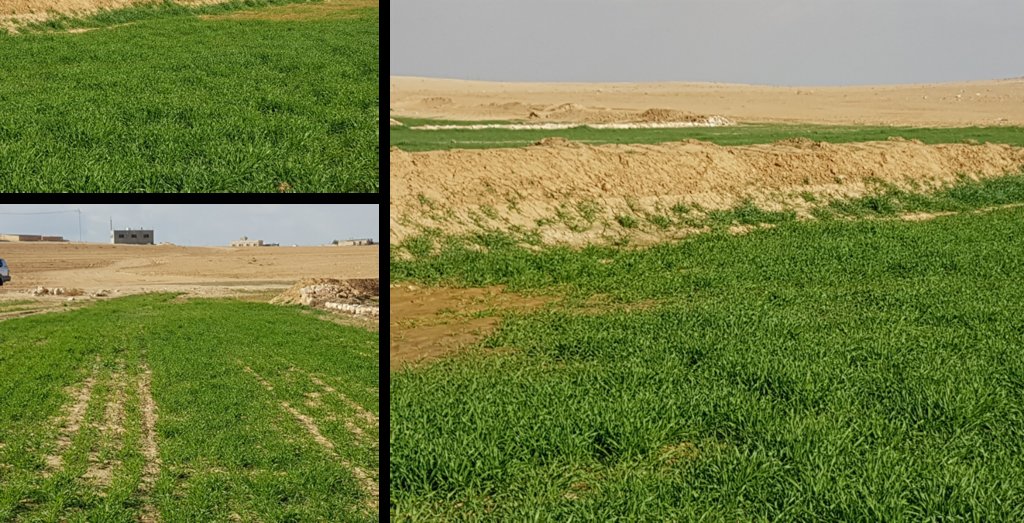
Marab agricultural production is high and stable. It can reach around 5-6 t ha-1 of barley, compared with the low and strongly varying yields of around 0.05-0.30 t ha-1 in traditionally, without macro water harvesting, cultivated barley. Marab barley produces grains (for fodder and reseeding purposes) and requires local inputs, such as fertilizer. The Marab mitigates downstream flooding and loss of sediments from the watershed. Local farmers applying the Marab technology are very satisfied, because of the extremely increased yield as consequence of the technology. However, as water is captured in the watershed, tensions may arise between the downstream (Marab) users and the upstream users.
2.3 صور التقنية
2.5 البلد/المنطقة/المواقع التي تم تنفيذ التقنية فيها والتي يغطيها هذا التقييم
البلد:
الأردن
المنطقة/الولاية/المحافظة:
Al Jiza District
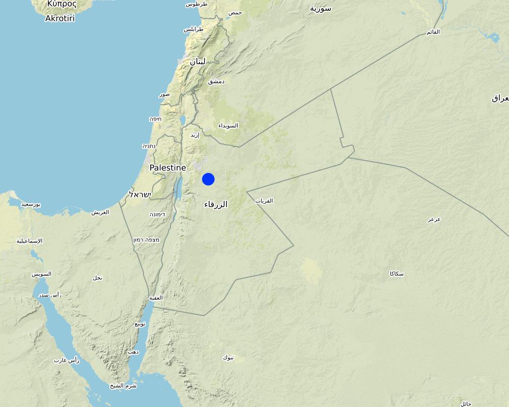
مزيد من التفاصيل حول الموقع:
Al Majeddyeh Village
حدد انتشار التقنية:
- يتم تطبيقها في نقاط محددة/ تتركز على مساحة صغيرة
هل يقع موقع/مواقع التقنية في منطقة محمية بشكل دائم؟:
كلا
Map
×2.6 تاريخ التنفيذ
اذكر سنة التنفيذ:
2017
2.7 إدخال التقنية
حدد كيف تم إدخال التقنية:
- أثناء التجارب/الأبحاث
- من خلال المشاريع/ التدخلات الخارجية
3. تصنيف تقنية الإدارة المستدامي للأراضي
3.1 الغرض الرئيسي ( الأغراض الرئيسية) للتقنية
- تحسين الإنتاج
- الحد من تدهور الأراضي ومنعه وعكسه
- الحد من مخاطر الكوارث
- التكيف مع تغير المناخ/الظواهر المتطرفة وآثارها
- خلق أثر اقتصادي مفيد
3.2 نوع (أنواع) استخدام الأراضي الحالية حيث يتم تطبيق التقنية
استخدامات الأراضي مختلطة ضمن نفس وحدة الأرض:
نعم
حدد استخدام الأراضي المختلطة (المحاصيل / الرعي / الأشجار):
- الرعي الزراعي (بما في ذلك الإدارة المتكاملة للمحاصيل والثروة الحيوانية)

الأراضي الزراعية
- زراعة سنوية
الزراعة السنوية - حدد المحاصيل:
- الحبوب - الشعير
عدد مواسم الزراعة في السنة:
- 1
هل يتم ممارسة الزراعة البينية؟:
كلا
هل تتم ممارسة تناوب المحاصيل؟:
كلا

أراضي الرعي
الرعي الواسع النطاق:
- رعي شبه مرتحل
الرعي المكثف/ إنتاج الأعلاف:
- قطع وحمل / صفر مرعى
نوع الحيوان:
- الماعز
- الأغنام
هل يتم تطبيق الإدارة المتكاملة للمحاصيل والثروة الحيوانية؟:
كلا
3.3 هل تغير استخدام الأراضي نتيجة لتنفيذ التقنية؟
هل تغير استخدام الأراضي نتيجة لتنفيذ التقنية؟:
- لا (تابع مع السؤال 3.4)
3.4 إمدادات المياه
إمدادات المياه للأرض التي يتم تنفيذ التقنية عليها:
- بعلية
التعليقات:
The Marab facilitates uniform distribution of excess rainwater obtained from the upland (partly Vallerani micro-catchments) and the water is conveyed through rehabilitated gullies to the Marab. (Some) Micro catchments and rehabilitated gullies are essential to avoid damaging water peaks, harming the Marab-structures. The Marab is rainfed and naturally flood irrigated.
3.5 مجموعةالإدارة المستدامة للأراضي التي تنتمي إليها هذه التقنية
- تحسين الغطاء الأرضي/النباتي
- حصاد المياه
- تحويل المياه والصرف
3.6 التدابير التقنية في مجال إلادارة المستدامة للأراضي

التدابير الزراعية
- A3: معالجة سطح التربة
- A4: المعالجة تحت السطحية

التدابير البنيوية
- الحواجز والضفاف
- S3: الخنادق المتدرجة ،والقنوات، والممرات المائية
3.7 الأنواع الرئيسية من تدهور الأراضي التي تناولتها التقنية

تآكل التربة بالمياه
- الوزن(Wt): فقدان التربة السطحية/تآكل السطح
- (Wg):الانجراف الخلجاني/ الخلجان
- (Wo:) تأثيرات التدهور من مواقع أخرى

التدهور المادي أو الفيزيائي للتربة
- (Pk)ظهور وتكون قشرة سطحية

التدهور البيولوجي
- (Bc): تناقص الغطاء النباتي
- (Bq): انخفاض الكمية/الكتلة الحيوية

تدهور المياه
- (Ha): التجفيف
3.8 منع أو حد أو عكس تدهور الأراضي
تحديد هدف التقنية فيما يتعلق بتدهور الأراضي:
- الحد من تدهور الأراضي
التعليقات:
Retaining surface runoff and locally infiltrating water through bunds increase soil moisture hence agricultural yield increases (e.g. biomass, vegetation cover) , soil crusting decreases (in some selected ponding areas it might increase) - and because of trapping top-soil sediments and residues from the uplands, soil fertility increases likewise.
4. المواصفات الفنية، وأنشطة التنفيذ، والمدخلات، والتكاليف
4.1 الرسم الفني للتقنية
المواصفات الفنية (المتعلقة بالرسم الفني):
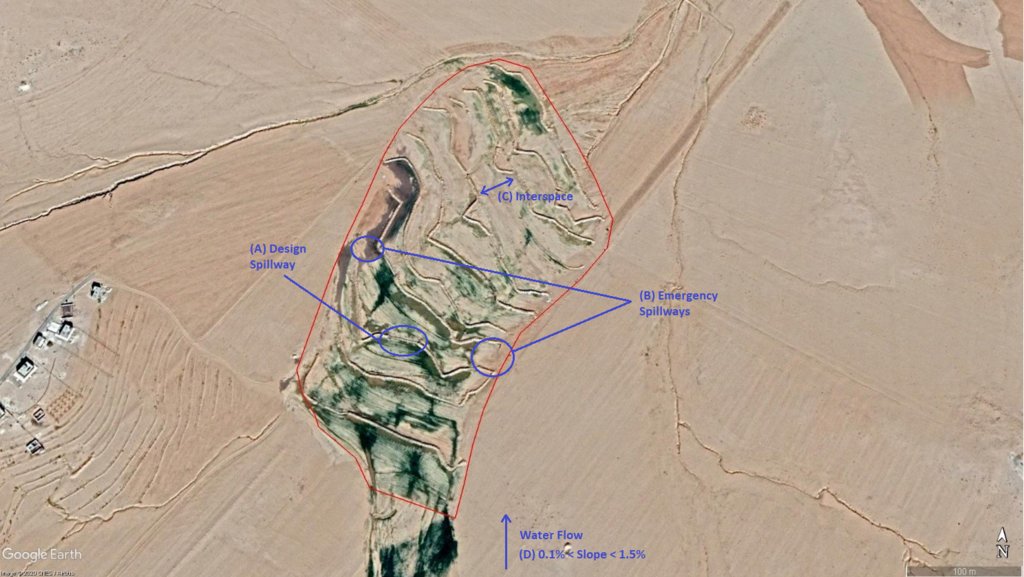
The overall Marab (reshaped flood plain) area is 10 hectares. The natural flood plain was leveled up to the sides; the natural slope in flow direction ranges between 0.1 and 1.5% (D). The later stone bund construction (soil relocation) and siltation/erosion processes over time develop a slight step-terraced bund compartment system, with the single compartments having much smaller slope than the overall Marab. At the sides, the levelled area slightly increases towards the natural terrain (natural terrain at the sides is around 0.1 to 0.3m higher compared with the leveled Marab). This avoids side outflow of water during design storms (*). Bund structures, along the contour, are built with a loader up to around 0.7 to 1.0m height and around 2.0 – 3.0m bottom width. The bunds are built with compaction through the loader. Interspace between the bunds is between 10-50 meters (C), depending on the local slope in the flow direction, having around 0.1 to 0.3m soil surface elevation difference between the bunds. Stone made design-spillways (A) are being constructed around the middle of each bund, with certain position change between the bund in downstream direction. Thus, spillways do not perfectly align with respect to the bund, but create a meandering flow around the center. The stone-protected design-spillways are designed to safely route at least the expected 2-5 year return period flood event. The Marab plain is not perfectly even, especially at the sides, to avoid water flowing around the bunds during design storms. However, the Marab-technology is also designed to cope with more extreme events, a storm of 5-10 return period, without significant damages. Therefore, there are emergency-spillways (**) implemented at the sides of each bund (B). These emergency-spillways allow excess water to flow out sideways rather than flow over the bund which would damage the structures. Note:
Based on above considerations and calculations bund spillway lengths reach 50-60m in the specific watershed.
* A design storm is a rainfall event that results in a flood event as water accumulates throughout the watershed. The Marab is designed to harvest the water optimally by (design) spill ways that keep the water in the Marab. A design storm relates to a certain return period. In general a longer return period (i.e. less frequent) accounts for a more intense event hence a more severe flooding event.
** An emergency spill way is a structure that is designed to discharge excess water coming from storms more extreme than the design storm (i.e. with less frequent storms). In practice this means that the Marab is protected from excess water.
المؤلف:
Joren Verbist (Extracted from Google Earth Pro on Jan 7th 2019)
التاريخ:
19/12/2020
المواصفات الفنية (المتعلقة بالرسم الفني):
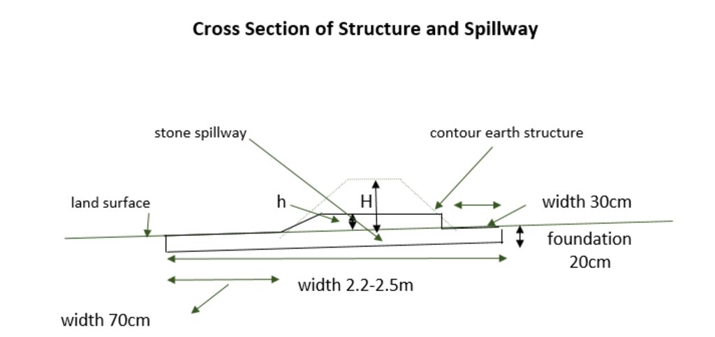
The cross-section shows the dimensions. Downstream of a bund the width is 70 centimeter. The foundation is 20 centimeter high. The upstream width is 30 centimeter. The total width of the bund varies between 2.2 meter and 2.5 meter.
المؤلف:
Stefan Strohmeier
التاريخ:
01/07/2020
4.2 معلومات عامة بخصوص حساب المدخلات والتكاليف
حدد كيفية احتساب التكاليف والمدخلات:
- حسب مساحة تنفيذ التقنية
الإشارة إلى حجم ووحدة المساحة:
10 ha
حدد العملة المستخدمة لحساب التكاليف:
- دولار أمريكي USD
اذكر متوسط تكلفة أجر العمالة المستأجرة في اليوم الواحد:
35
4.3 أنشطة التأسيس
| النشاط | التوقيت (الموسم) | |
|---|---|---|
| 1. | Implement upstream watershed rehabilitation measure (e.g. Upstream Vallerani micro water harvesting) | Prior of Marab-Technology construction |
| 2. | Implement gully rehabilitation measure (e.g. Midstream gully rehabilitation) | Prior of Marab-Technology construction |
| 3. | Marab site selection (flood plain): topographic assessment (slope, soil depth, etc.) and consideration of watershed hydrology (e.g. for bund and spillway design) | Before the rainy season |
| 4. | Grading/levelling of natural flood plain incl. gully fill (with soil material) | season (Aug. – Nov.) |
| 5. | Implement bund structures (based on step 4) | season (Aug. – Nov.) |
| 6. | Construct stone made design and emergence spillways (based on step 5) | season (Aug. – Nov.) |
| 7. | Preparation of compartmentalized agricultural fields (bund interspaces) for field crop agriculture | season (Aug. – Nov.) |
التعليقات:
The upstream measures as the Vallerani System and gully rehabilitation are strongly recommended but are not taken into account as costs in this documentation. Because this documentation focuses specifically on the Marab-technology.
4.4 التكاليف والمدخلات اللازمة للتأسيس
| تحديد المدخلات | الوحدة | الكمية | التكاليف لكل وحدة | إجمالي التكاليف لكل مدخل | % من التكاليف التي يتحملها مستخدمو الأراضي | |
|---|---|---|---|---|---|---|
| العمالة | Local Workers | person-days | 50,0 | 35,0 | 1750,0 | |
| العمالة | Land Survey | person-days | 6,0 | 35,0 | 210,0 | |
| العمالة | Engineer (+assistance) | person-days | 15,0 | 50,0 | 750,0 | |
| العمالة | Drivers of heavy machinery | person-days | 12,0 | 35,0 | 420,0 | |
| معدات | Grader | machine-days | 3,0 | 250,0 | 750,0 | |
| معدات | Loader | machine-days | 10,0 | 250,0 | 2500,0 | |
| معدات | Deep Plow | machine-days | 3,0 | 200,0 | 600,0 | |
| معدات | Tractor (to pull the shallow and deep plow) | machine-days | 5,0 | 200,0 | 1000,0 | |
| معدات | Shallow Plow | machine-days | 2,0 | 200,0 | 400,0 | |
| معدات | Water Tank Truck | Tank | 1,0 | 50,0 | 50,0 | |
| معدات | Small Equipment (Shovel, pickaxe, buckets) | Equipment | 1,0 | 200,0 | 200,0 | |
| مواد البناء | Stones | Kubic Metre | 200,0 | 10,0 | 2000,0 | |
| غير ذلك | Transportation of heavy machinery | 1,0 | 2000,0 | 2000,0 | ||
| غير ذلك | Security | 1,0 | 300,0 | 300,0 | ||
| إجمالي تكاليف إنشاء التقنية | 12930,0 | |||||
| إجمالي تكاليف إنشاء التقنية بالدولار الأمريكي | 12930,0 | |||||
إذا تحمل مستخدم الأرض أقل من 100% من التكاليف، حدد من قام بتغطية التكاليف المتبقية:
ICARDA and National Agricultural Research Centre (NARC)
التعليقات:
These costs are for establishment (so one-time) and are for the total Marab-technology i.e. 10 ha.
4.5 الصيانة/الأنشطة المتكررة
| النشاط | التوقيت/الوتيرة | |
|---|---|---|
| 1. | Maintaining the structures based on observations and possible damages after the rainy season, so no clear maintenance plans | Before the rainy season (Oct. – Nov.)/upon observation |
التعليقات:
Excludes annual farming costs (e.g. seedbed preparation)
4.6 التكاليف والمدخلات اللازمة للصيانة/للأنشطة المتكررة (سنويًا)
| تحديد المدخلات | الوحدة | الكمية | التكاليف لكل وحدة | إجمالي التكاليف لكل مدخل | % من التكاليف التي يتحملها مستخدمو الأراضي | |
|---|---|---|---|---|---|---|
| العمالة | Engineer | person days per year | 2,0 | 50,0 | 100,0 | 100,0 |
| العمالة | Worker | person days per year | 6,0 | 35,0 | 210,0 | 100,0 |
| معدات | Loader | machine days per year | 1,0 | 250,0 | 250,0 | 100,0 |
| مواد البناء | Stones | Kubic Metre | 10,0 | 10,0 | 100,0 | 100,0 |
| إجمالي تكاليف صيانة التقنية | 660,0 | |||||
| إجمالي تكاليف صيانة التقنية بالدولار الأمريكي | 660,0 | |||||
التعليقات:
The costs of practicing agriculture (e.g. cost of seeds and fertilizer) are not taken into account, since these costs were also made before the implementation of this technology.
4.7 أهم العوامل المؤثرة على التكاليف
قدم وصفا لأهم العوامل التي تؤثر على التكاليف:
The special and heavy machinery affect the cost significantly, since these were not available in the area. The implementation of the technology is labour intensive, therefore labour costs are significant as well. However, these costs are initially, so these specific costs are almost zero after establishment. In addition, all the maintenance is payed for by the land users. So, only the establishment was payed for by external parties.
5. البيئة الطبيعية والبشرية
5.1 المناخ
هطول الأمطار السنوي
- < 250 مم
- 251- 500 ملم
- 501 - 750ملم
- 1,000-751 ملم
- 1,500-1,100 ملم
- 2,000-1,500 ملم
- 3,000-2,001 ملم
- 4,000-3,100 ملم
- > 4000 ملم
حدد متوسط هطول الأمطار السنوي (إذا كان معروفًا)، بالملليمتر:
130,00
المواصفات/التعليقات على هطول الأمطار:
In the specific site/dry areas of Jordan rainy season usually ranges from November until April
Queen Alia International Airport long-time avergae annual rainfall is around 150 mm (around 10km west of the site)
At the site a rainfall tipping bucket has been installed in 2016.
الإشارة إلى اسم محطة الأرصاد الجوية المرجعية المعنية:
Queen Alia International Airport
المنطقة المناخية الزراعية
- قاحلة
The maximum temperature usually occurres in August.
The average daily maximum temperature is 25.01 °C.
The average daily minimum temperature is 8.5 °C
5.2 طوبوغرافيا
متوسط الانحدارات:
- مسطح (0-2%)
- بسيط (3-5%)
- معتدل (6-10%)
- متدحرج (11-15%)
- تلال (16-30%)
- شديدة الانحدار(31-60%)
- فائقة الانحدار (>60%)
التضاريس:
- هضاب/سهول
- أثلام مرتفعة
- المنحدرات الجبلية
- منحدرات التلال
- منحدرات في السفوح
- قاع الوادي
المنطقة الارتفاعية:
- 100-0 متر فوق سطح البحر
- 500-101 متر فوق سطح البحر
- 1,000-501 متر فوق سطح البحر
- 1,500-1,001 متر فوق سطح البحر
- 2,000-1,501 متر فوق سطح البحر
- 2,500-2,100 متر فوق سطح البحر
- 3,000-2,501 متر فوق سطح البحر
- 4,000-3,001 متر فوق سطح البحر
- > 4000 متر فوق سطح البحر
وضح ما إذا كانت التقنية مطبقة على وجه التحديد في:
- حالات محدبة أو نتؤات
التعليقات والمواصفات الإضافية بشأن التضاريس:
The Marab itself is rather concave (depression shape) / natural depression. However, the bund structures are convex, spreading water over the field.
5.3 التربة
متوسط عمق التربة:
- ضحل جدًا (0-20 سم)
- ضحلة (21-50 سم)
- متوسطة العمق (51-80 سم)
- عميقة (81-120 سم)
- عميقة جدًا (> 120 سم)
قوام التربة (التربة السطحية):
- متوسط ( طميي، سلتي)
- ناعم/ثقيل (طيني)
قوام التربة (> 20 سم تحت السطح):
- متوسط ( طميي، سلتي)
المواد العضوية في التربة السطحية:
- منخفضة (<1%)
5.4 توافر المياه ونوعيتها
منسوب المياه الجوفية:
> 50 م
توافر المياه السطحية:
ضعيف/ غير متوافر
نوعية المياه (غير المعالجة):
غير صالحة للإستعمال
تشير جودة المياه إلى:
المياه السطحية
هل تعتبر ملوحة الماء مشكلة؟:
كلا
هل تحدث فيضانات في المنطقة؟:
نعم
الإنتظام:
مرارًا
5.5 التنوع البيولوجي
تنوع الأنواع:
- منخفض
تنوع الموائل:
- منخفض
5.6 خصائص مستخدمي الأراضي الذين يطبقون التقنية
مستقر أو مرتحل:
- شبه مرتحل
التوجه السوقي لنظام الإنتاج:
- مختلط (كفاف/ تجاري)
الدخل من خارج المزرعة:
- أقل من % 10من كامل الدخل
المستوى النسبي للثروة:
- ضعيف
- متوسط
أفراداً أو مجموعات:
- فرد/أسرة معيشية
مستوى المكننة:
- ميكانيكية/ مزودة بمحرك
الجنس:
- رجال
عمر مستخدمي الأرضي:
- شباب
- متوسط العمر
اذكر الخصائص الأخرى ذات الصلة لمستخدمي الأراضي:
The actual land users are often poor Jordanians or Syrian refugees. However, the owners of the livestock are relatively rich. The landowners are responsible for the maintenance of the intervention.
5.7 متوسط مساحة الأرض التي يستخدمها مستخدمو الأراضي الذين يطبقون التقنية
- < 0.5 هكتارا
- 0.5 - 1 هكتار
- 1 -2 هكتار
- 2 - 5 هكتار
- 5 - 15 هكتار
- 15 - 50 هكتار
- 50 - 100هكتار
- 500-100 هكتار
- 1,000-500 هكتار
- 10,000-1,000 هكتار
- > 10,000 هكتار
هل يعتبر هذا نطاقًا صغيرًا أو متوسطًا أو واسعا (في إشارة إلى السياق المحلي)؟:
- على نطاق متوسط
التعليقات:
10ha
5.8 ملكية الأراضي، وحقوق استخدام الأراضي، وحقوق استخدام المياه
ملكية الارض:
- فردية، يوجد سند ملكية
حقوق استخدام الأراضي:
- مؤجر
- فردي
- NA
هل تعتمد حقوق استخدام الأراضي على نظام قانوني تقليدي؟:
نعم
5.9 الوصول إلى الخدمات والبنية التحتية
الصحة:
- ضعيف
- معتدل
- جيد
التعليم:
- ضعيف
- معتدل
- جيد
المساعدة التقنية:
- ضعيف
- معتدل
- جيد
العمل (على سبيل المثال خارج المزرعة):
- ضعيف
- معتدل
- جيد
الأسواق:
- ضعيف
- معتدل
- جيد
الطاقة:
- ضعيف
- معتدل
- جيد
الطرق والنقل:
- ضعيف
- معتدل
- جيد
مياه الشرب وخدمات الصرف الصحي:
- ضعيف
- معتدل
- جيد
الخدمات المالية:
- ضعيف
- معتدل
- جيد
6. الآثار والتصريحات الختامية
6.1 الآثار التي أظهرتها التقنية في الموقع
الآثار الاجتماعية والاقتصادية
الإنتاج
إنتاج المحاصيل
التعليقات/ حدد:
The crops produced are used as fodder
إنتاج الأعلاف
الكمية قبل الإدارة المستدامة للأراضي:
0.05ton/ha
الكمية بعد الإدارة المستدامة للأراضي:
5ton/ha
التعليقات/ حدد:
The production of the fodder is increased as the barley yield is mostly used to feed animals and also the stubble is grazed.
جودة العلف
التعليقات/ حدد:
The barley is fed to the livestock
منطقة الإنتاج
التعليقات/ حدد:
Due to the bunds (but very limited and inevitable)
إدارة الأراضي
الدخل والتكاليف
النفقات على المدخلات الزراعية
التعليقات/ حدد:
Expenses are slightly increased due to possible maintenance of the Marab. However, the increased yield justifies this.
دخل المزرعة
عبء العمل
التعليقات/ حدد:
Due to possible maintenance
الآثار الاجتماعية والثقافية
الأمن الغذائي / الاكتفاء الذاتي
المعرفة بالإدارة المستدامة للأراضي/تدهور الأراضي
التعليقات/ حدد:
During the construction, local community were hired as workers, this has significantly boosted their knowlegde about SLM.
الآثار الايكولوجية
دورة المياه / الجريان السطحي
حصاد / جمع المياه
الجريان السطحي
تصريف المياه الزائدة
مستوى المياه الجوفية/ الطبقة المائية الجوفية
التربة
رطوبة التربة
غطاء التربة
فقدان التربة
تراكم التربة
تكون قشرة التربة السطحية/انسداد مسام التربة
المادة العضوية في التربة/تحت الطبقة c
التنوع البيولوجي: الغطاء النباتي، الحيوانات
الغطاء النباتي
الكتلة الحيوية/ طبقة الكربون فوق التربة
الحد من مخاطر المناخ والكوارث
آثار الفيضانات
آثار الجفاف
6.2 الآثار التي أظهرتها التقنية خارج الموقع
الفيضان في اتجاه مجرى النهر
التعليقات/ حدد:
Reduced downstream flooding is desired
تراكم الطمي باتجاه مصب النهر
التعليقات/ حدد:
Reduced downstream siltation is desired
6.3 تعرض التقنية وحساسيتها لتغير المناخ التدريجي والظواهر المتطرفة/الكوارث المرتبطة بالمناخ (كما يراها مستخدمو الأراضي)
تغير مناخ تدريجي
تغير مناخ تدريجي
| الموسم | زيادة أو نقصان | كيف تتعامل التقنية مع ذلك؟ | |
|---|---|---|---|
| هطول الأمطار السنوي | انخفاض | جيدا |
الظواهر المتطرفة / الكوارث المرتبطة بالمناخ
الكوارث الجوية
| كيف تتعامل التقنية مع ذلك؟ | |
|---|---|
| عاصفة ممطرة محلية | جيدة جدا |
الكوارث الهيدرولوجية
| كيف تتعامل التقنية مع ذلك؟ | |
|---|---|
| فيضان مفاجئ | جيدة جدا |
6.4 تحليل التكلفة والعائد
كيف يمكن مقارنة العوائد نسبة لتكاليف الإنشاء (من وجهة نظر مستخدمي الأراضي)؟
عوائد قصيرة الأجل:
سلبي قليلا
عوائد طويلة الأجل:
إيجابي
كيف تتم مقارنة العوائدمع كلفة الصيانة/التكاليف المتكررة (من وجهة نظر مستخدمي الأراضي)؟
عوائد قصيرة الأجل:
إيجابي
عوائد طويلة الأجل:
ايجابي جدا
التعليقات:
The initial investment is quite large. Therefore, the short term returns is classified as slightly negative. After some seasons with good (stable) crop yield the return of investment is positive. Long term benefits are classified positively.
6.5 اعتماد التقنية
- 1-10%
إذا كان متاحًا، قم بتحديد الكمية (عدد الأسر المعيشية و/أو المساحةالمغطاة):
These are some farmers that live near the Marab. They try to copy the Marab in their fields.
من بين جميع الذين تبنوا التقنية، كم عدد الذين فعلوا ذلك بشكل تلقائي، أي دون تلقي أي حوافز مادية/مدفوعات؟:
- 91-100%
التعليقات:
The local farmers like the technology and acknowledge its positive impacts. They would like to have a Marab themselves (even if their locally owned lands are not suitable in many cases). Local agro-pastoralists copy and apply parts of the technology (especially the bund
system). However, it strongly recommended that implementing a Marab-technology is done as a community-based project/intervention; the Marab technology should be part of an integrated watershed management plan, located at the most suitable location for the entire community.
6.6 التكيف
هل تم تعديل التقنية مؤخرًا لتتكيف مع الظروف المتغيرة؟:
نعم
إذا كانت الإجابة بنعم، وضح الظروف المتغيرة التي تم تكييفها معها:
- تغير المناخ / التطرف
حدد تكيف التقنية(التصميم، المواد/الأنواع، الخ.):
The spillway design can be adapted to variable surface runoff occurrence (affected by climate change).
6.7 نقاط القوة / المزايا / الفرص التي توفرها التقنية
| نقاط القوة/ المزايا/ الفرص من وجهة نظر مستخدمي الأراضي |
|---|
| The farmers highly appreciate the improved economic situation as consequence of the increased yield. |
| A strength of the Marab technology is that water is harvested and minimally spilled away, preventing top-soil erosion and accumulating soil organic matter consequently preserving soil fertility. |
| The crop produces grains: can be (partially) used for re-seeding in the coming seasons; economic gain + increase resilience. |
| نقاط القوة/ المزايا/ الفرص من وجهة نظر جامع المعلومات أو غيره من الاشخاص الرئيسيين لمصدر المعلومات |
|---|
| Economic improvement through targeted agricultural interventions in the most suitable location(s) of a watershed. This aims at decreasing the pressure on the fragile dry land ecosystem. The locally increased yield raises awareness on non-sufficient field crop agriculture in uplands (commonly achieved) and might increase the willingness for more nature-based sustainable land management measures in the less fertile and runoff generating (more vulnerable uplands) parts of the watershed. Therefore, the Marab technology could be a starting point for a watershed rehabilitation initiative. |
| The Marab technology creates an opportunity for multiple crop introduction (due to natural flood irrigation) – aside from barley monoculture (agro-diversity). |
| Increased water infiltration conserves water and might lead to deep percolation (groundwater recharge). |
6.8 نقاط ضعف / مساوىء / مخاطر التقنية وسبل التغلب عليها
| نقاط الضعف/ المساوىء/ المخاطر من وجهة نظر مستخدم الأراضي | كيف يمكن التغلب عليها؟ |
|---|---|
| The Marab depends on upstream water users; can lead to increased tensions | Agreement among the community - conducting contacts/contracts among upstream and downstream farmers. Joint watershed management and benefit share could be mediate these tension. And might even lead to watershed rehabilitation. |
| High initial investment and partially high maintenance costs (including machinery) | Once the implementation is linked with larger environmental benefits – communities might receive funds from the government or international donors. |
| Loss of cultivation area where the bunds are placed | Unavoidable. However, the gain of interspaces exceeds these losses several times. |
| نقاط الضعف/ المساوىء/ المخاطر من وجهة نظر جامع المعلومات أو غيره من الاشخاص الرئيسيين لمصدر المعلومات | كيف يمكن التغلب عليها؟ |
|---|---|
| Tensions among multiple actors in the watershed (selection of Marab area) | Develop institutions that could avoid these tensions by establishing agreements, contracts, rules, or regulations. |
| Heavy machinery in a vulnerable ecosystems – can induce other requests/use by locals (improper use) | Targeted policies in place & enforcements |
| Increasing wealth inequality between farmers and/or communities. | Creation of institutions, which assure fair distribution. This would benefit the whole watershed. |
7. المراجع والروابط
7.1 طرق جمع/مصادر المعلومات
- زيارات ميدانية، مسوحات ميدانية
- مقابلات مع مستخدمي الأراضي
- مقابلات مع المتخصصين/الخبراء في الإدارة المستدامة للأراضي
- التجميع من التقارير والوثائق الأخرى الموجودة
متى تم تجميع البيانات (ميدانيا)؟:
15/04/2020
7.2 المراجع للمنشورات المتاحة
العنوان، المؤلف، السنة، النظام القياسي الدولي لترقيم الكتب ISBN:
Strohmeier, S. (2017). Dimensioning of Marab in Majidyya.
العنوان، المؤلف، السنة، النظام القياسي الدولي لترقيم الكتب ISBN:
Strohmeier, S. (2017). Watershed Restoration in Baia Areas of Jordan Technology Packages for Controlling and Monitoring Gully Erosion.
متاح من أين؟كم التكلفة؟:
https://mel.cgiar.org/projects/jordan-watershed-restoration-project
العنوان، المؤلف، السنة، النظام القياسي الدولي لترقيم الكتب ISBN:
Mira Haddad, Stefan Strohmeier. (12/12/2017). Treated upland areas map. Jordan: International Center for Agricultural Research in the Dry Areas (ICARDA).
متاح من أين؟كم التكلفة؟:
https://hdl.handle.net/20.500.11766/9108
العنوان، المؤلف، السنة، النظام القياسي الدولي لترقيم الكتب ISBN:
Stefan Strohmeier, Mira Haddad, Ismail Shukri. (8/11/2018). Marab - water harvesting based agriculture.
متاح من أين؟كم التكلفة؟:
https://hdl.handle.net/20.500.11766/9069
العنوان، المؤلف، السنة، النظام القياسي الدولي لترقيم الكتب ISBN:
Boubaker Dhehibi, Mira Haddad, Stefan Strohmeier, Masnat El-Hiary. (24/7/2020). Enhancing a Traditional Water Harvesting Technique in Jordan’s Agro-pastoral Farming System. Lebanon: International Center for Agricultural Research in the Dry Areas (ICARDA).
متاح من أين؟كم التكلفة؟:
https://hdl.handle.net/20.500.11766/11506
7.3 روابط للمعلومات ذات الصلة على الإنترنت
العنوان/الوصف:
WATER HARVESTING FOR RESTORING RANGELANDS IN JORDAN
عنوان الرابط URL:
https://www.icarda.org/media/drywire/water-harvesting-restoring-rangelands-jordan
الروابط والوحدات المواضيعية
توسيع الكل طي الكلالروابط
لا يوجد روابط
الوحدات المواضيعية
لا يوجد وحدات مواضيعية


