Contour Stone Bunds [بوتان]
- تاريخ الإنشاء:
- تحديث:
- جامع المعلومات: Nima Dolma Tamang
- المحرر: Kuenzang Nima
- المراجعون: William Critchley, Rima Mekdaschi Studer, Joana Eichenberger
Dhoyi Gaytshig (རྡོའི་གད་ཚིགས།)
technologies_6891 - بوتان
عرض الأقسام
توسيع الكل طي الكل1. معلومات عامة
1.2 تفاصيل الاتصال بالأشخاص الرئيسيين لمصدر المعلومات والمؤسسات المشاركة في تقييم وتوثيق التقنية
الشخص (الأشخاص) الرئيسي لمصدر المعلومات
مستخدم الأرض:
Yangzom Pema
NA
بوتان
اسم المشروع الذي سهّل توثيق/تقييم التقنية (إذا كان ذلك على صلة)
Strengthening national-level institutional and professional capacities of country Parties towards enhanced UNCCD monitoring and reporting – GEF 7 EA Umbrella II (GEF 7 UNCCD Enabling Activities_Umbrella II)اسم المؤسسة (المؤسسات) التي سهلت توثيق/تقييم التقنية (إذا كان ذلك على صلة)
National Soil Services Centre, Department of Agriculture, Ministry of Agriculture & Livestock (NSSC) - بوتان1.3 الشروط المتعلقة باستخدام البيانات الموثقة من خلال WOCAT
يوافق جامع المعلومات والشخص (لاشخاص) الرئيسي لمصدر المعلومات على الشروط المتعلقة باستخدام البيانات الموثقة من خلال WOCAT:
نعم
1.4 إعلان بشأن استدامة التقنية الموصوفة
هل التقنية الموصوفة هنا تمثل مشكلة فيما يتعلق بتدهور الأراضي، بحيث لا يمكن إعلانها تقنية مستدامة لإدارة الأراضي؟:
كلا
التعليقات:
The technology reduces soil erosion and conserves soil moisture
1.5 الإشارة إلى الاستبيان (الاستبيانات) حول مناهج الإدارة المستدامة للأراضي (موثقة باستخدام WOCAT)
Community Mobilization for SLM Interventions [بوتان]
Community mobilization in implementing sustainable land management technologies is indispensable in engaging the community to identify their priorities, resources, needs and solutions. It ultimately promotes bottom-up participation and fosters accountability.
- جامع المعلومات: Nima Dolma Tamang
2. وصف تقنيةالإدارة المستدامي للأراضي
2.1 وصف مختصر للتقنية
تعريف التقنية:
Contour stone bunding on sloping agricultural lands reduces soil erosion and conserves soil moisture in order to retain soil productivity. It is promoted /recommended on slopes where there is adequate surface stone.
2.2 وصف تفصيلي للتقنية
الوصف:
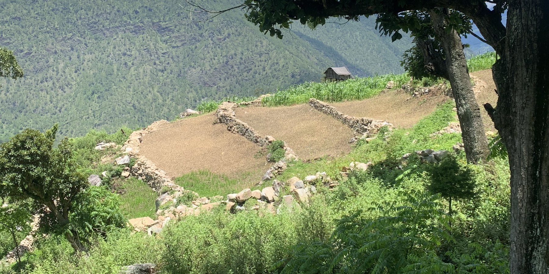
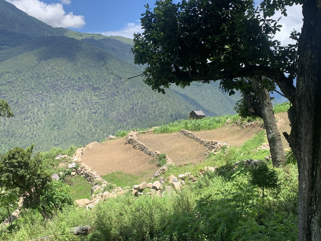
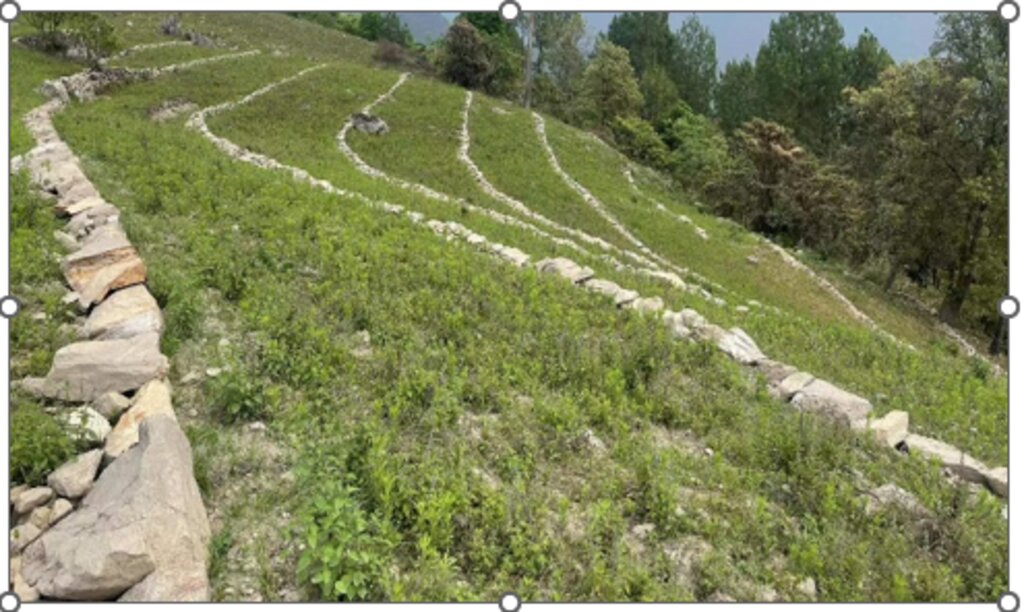
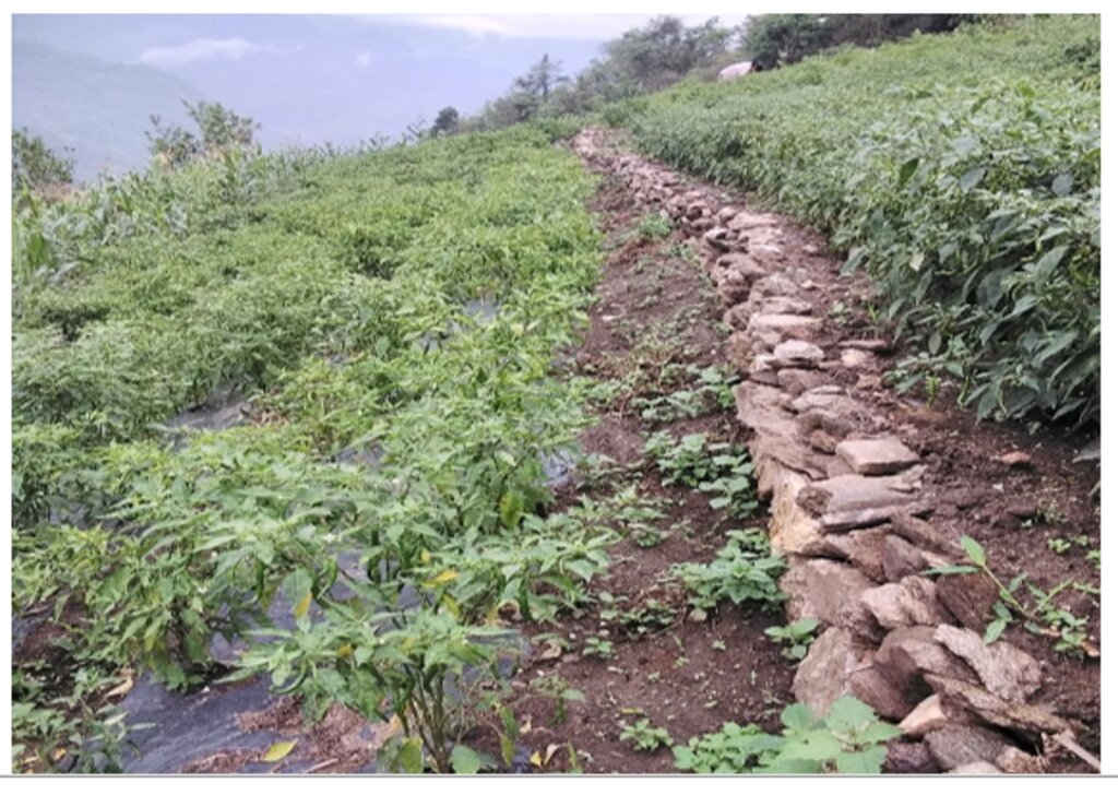
Contour stone bunds are small walls of stone that are laid out along the contour line to help reduce soil erosion, conserve soil moisture, increase soil fertility, to ease workability, increase cropping area, and ultimately ensure sustainable use of lands for enhanced food and nutrition security. This practice is recommended in fields that have plenty of surface stones (> 20%). Construction of contour stone bunds not only helps to get rid of the excess surface stones and gravel but also reduces the slope gradient through formation of partial terraces over a few years.
The stone bund is not new to Bhutan, being a mountainous country, forefathers used the technique to remove stones from the field and stabilise the land for agricultural purposes. Therefore, there were some traditional stone lines constructed in the study area.
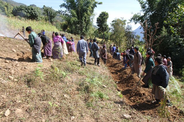
Constructing stone bund is labour intensive, therefore land users resort to a labour sharing approach where all the land users from the community come together and work on a rotational basis until every household in the community has established stone bunds.
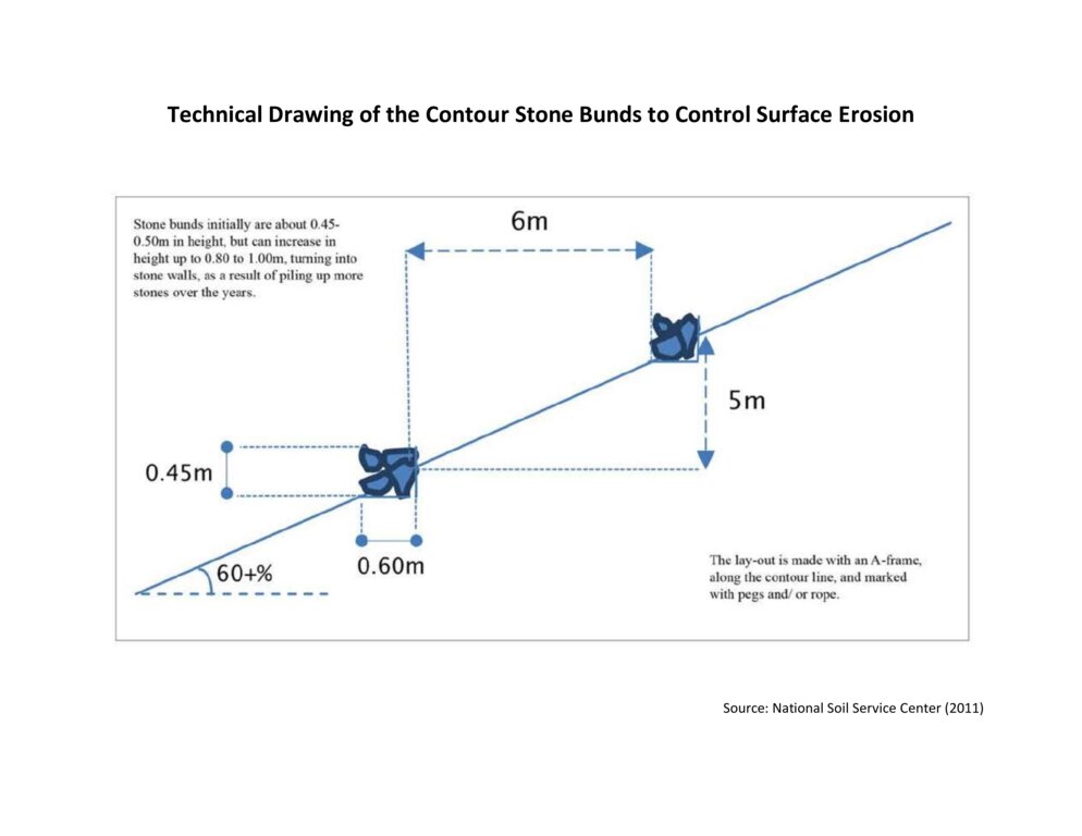
The major activities and inputs required to establish the contour stone bund includes sensitization of beneficiaries, followed by SLM action planning, and hands-on-training. Field implementation follows this sequence: (a) determination of intervals between stone bunds, (b) demarcation of contour lines using an ‘A’ frame, (c) digging a trench of 0.1 - 0.2 m deep and 0.5 m wide to establish a foundation along the contour lines, and (d) constructing stone lines along the trenches with the larger stones at the base to set a sound foundation. A typical stone wall is 0.3 m high (1 ft) and 0.3 - 0.5 m wide, but this depends on the slope and availability of stones in the field. Contour stone bunds are commonly spaced 6 metres apart on slopes of 60%. In some cases, the fodder grass slips are also planted at the base of the stone bund for better stabilization of the bunds and fodder availability.
The major drawbacks of this SLM technology according to respondents are (a) labour demanding, (b) no immediate return, and (c) the space between piled stones harbours rodents leading to crop damage.
2.3 صور التقنية
2.5 البلد/المنطقة/المواقع التي تم تنفيذ التقنية فيها والتي يغطيها هذا التقييم
البلد:
بوتان
المنطقة/الولاية/المحافظة:
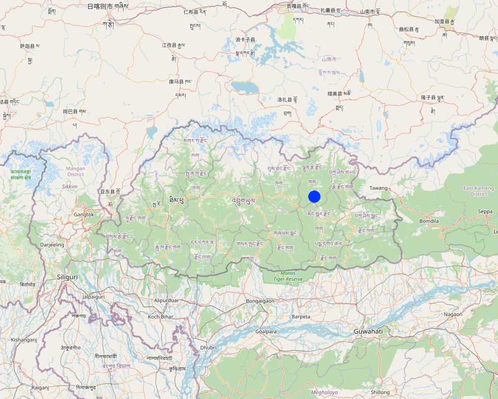
Lhuentse Dzongkhag
مزيد من التفاصيل حول الموقع:
Zangkhar Village, Yabi-Zangkhar Chiwog, Jaray Gewog
حدد انتشار التقنية:
- منتشرة بالتساوي على مساحة
إذا كانت المساحة الدقيقة غير معروفة، فيرجى الإشارة إلى المنطقة التقريبية المغطاة:
- 0.1-1 كم2
هل يقع موقع/مواقع التقنية في منطقة محمية بشكل دائم؟:
نعم
إذا كانت الإجابة بنعم، حدد:
The region where this SLM technology was implemented falls under Phrumsengla National Temperate Park. Phrumsengla National Park is a temperate park with large tracts of old-growth fir forests, its altitudes ranging from 700 metres (2,300 ft) to 4,400 metres (14,400 ft). Phrumsengla has scenic views, including forests ranging with elevations from alpine to sub-tropical. Because the soil of Phrumsengla's biomes is particularly fragile, the land is unsuitable for logging or other development
Map
×2.6 تاريخ التنفيذ
اذكر سنة التنفيذ:
2015
2.7 إدخال التقنية
حدد كيف تم إدخال التقنية:
- من خلال المشاريع/ التدخلات الخارجية
التعليقات (نوع المشروع، الخ):
The National Soil Service Center (NSSC), Semtokha, Thimphu initiated this activity as part of three-year (2015 to 2017) SLM project funded by Bhutan Trust Fund for Environmental Conservation (BTFEC).
3. تصنيف تقنية الإدارة المستدامي للأراضي
3.1 الغرض الرئيسي ( الأغراض الرئيسية) للتقنية
- تحسين الإنتاج
- الحد من تدهور الأراضي ومنعه وعكسه
- الحفاظ على النظام البيئي
- التكيف مع تغير المناخ/الظواهر المتطرفة وآثارها
- خلق أثر اقتصادي مفيد
3.2 نوع (أنواع) استخدام الأراضي الحالية حيث يتم تطبيق التقنية
استخدامات الأراضي مختلطة ضمن نفس وحدة الأرض:
نعم
حدد استخدام الأراضي المختلطة (المحاصيل / الرعي / الأشجار):
- الحراجة الزراعية

الأراضي الزراعية
- زراعة سنوية
- زراعة معمرة (غير خشبية)
الزراعة السنوية - حدد المحاصيل:
- المحاصيل الجذرية/الدرنية - البطاطس
- الخضروات - الخضروات الورقية (السلطات، الملفوف، السبانخ، وغيرها)
- Chili, cauliflower, cabbage, onion, brinjal and garlic.
- Peach, pear, fig, chayote
عدد مواسم الزراعة في السنة:
- 2
حدد:
Maize in summer is followed by cole crops in winter.
هل يتم ممارسة الزراعة البينية؟:
نعم
إذا كانت الإجابة بنعم، حدد المحاصيل التي يتم زراعتها بشكل بيني:
Brinjal, beans, onion and chayote.
هل تتم ممارسة تناوب المحاصيل؟:
نعم
إذا كانت الإجابة بنعم، حدد:
Maize cultivation followed by vegetables (cabbage)

المستوطنات والبنية التحتية
- المستوطنات والمباني
- حركة المرور: الطرق والسكك الحديدية
- الطاقة: خطوط الأنابيب وخطوط الكهرباء
3.3 هل تغير استخدام الأراضي نتيجة لتنفيذ التقنية؟
هل تغير استخدام الأراضي نتيجة لتنفيذ التقنية؟:
- لا (تابع مع السؤال 3.4)
3.4 إمدادات المياه
إمدادات المياه للأرض التي يتم تنفيذ التقنية عليها:
- مختلط بعلي-مروي
3.5 مجموعةالإدارة المستدامة للأراضي التي تنتمي إليها هذه التقنية
- التدابير المتقاطعة للمنحدرات
3.6 التدابير التقنية في مجال إلادارة المستدامة للأراضي

التدابير النباتية
- V2: الأعشاب والنباتات العشبية المعمرة

التدابير البنيوية
- الحواجز والضفاف
التعليقات:
The technology also incudes vegetative measures where some land users plant fodder grass slips at the base of the stone bunds for better stabilization and fodder availability.
3.7 الأنواع الرئيسية من تدهور الأراضي التي تناولتها التقنية

تآكل التربة بالمياه
- الوزن(Wt): فقدان التربة السطحية/تآكل السطح
- (Wg):الانجراف الخلجاني/ الخلجان
- (Wo:) تأثيرات التدهور من مواقع أخرى

التدهور البيولوجي
- (Bc): تناقص الغطاء النباتي
- (Bq): انخفاض الكمية/الكتلة الحيوية
- (Bs): انخفاض جودة وتركيبة الأنواع/التنوع
- (Bp): زيادة الآفات/الأمراض، وفقدان الحيوانات المفترسة

تدهور المياه
- (Ha): التجفيف
3.8 منع أو حد أو عكس تدهور الأراضي
تحديد هدف التقنية فيما يتعلق بتدهور الأراضي:
- الحد من تدهور الأراضي
- التكيف مع تدهور الأراضي
4. المواصفات الفنية، وأنشطة التنفيذ، والمدخلات، والتكاليف
4.1 الرسم الفني للتقنية
المواصفات الفنية (المتعلقة بالرسم الفني):
The specifications provided in the technical drawing (NSSC, 2011) may vary based on the field situation and slope of the land. Variations may be in the width of the terrace (3 m to 6 m), the height of the stone bund (0.45 m to 1m), and minimal variations are observed in the width of the stone bund (0.6 m).
المؤلف:
National Soil Service Centre
التاريخ:
2011
4.2 معلومات عامة بخصوص حساب المدخلات والتكاليف
حدد كيفية احتساب التكاليف والمدخلات:
- حسب مساحة تنفيذ التقنية
الإشارة إلى حجم ووحدة المساحة:
3 acres
عملة أخرى/ عملة وطنية (حدد):
Nu
إذا كان ذا صلة، وضح سعر الصرف من الدولار الأمريكي إلى العملة المحلية (على سبيل المثال، 1 دولار أمريكي = 79.9 ريال برازيلي): 1 دولار أمريكي =:
80,0
اذكر متوسط تكلفة أجر العمالة المستأجرة في اليوم الواحد:
400
4.3 أنشطة التأسيس
| النشاط | التوقيت (الموسم) | |
|---|---|---|
| 1. | Traditional stone bund construction | 50 years earlier |
| 2. | Sensitization, SLM action planning, and Hands-on-training | 2015 |
| 3. | Field implementation of the activity | 2015 |
| 4. | Provision of incentives (Nu. 3000 per acre) | 2015 |
| 5. | Project phase-off | 2017 |
| 6. | Scaling up of this technology through GEF-LDCF | 2022 |
التعليقات:
Traditionally stone bunds were constructed by forefathers during land preparation on the slopes. The stones were piled at the contour lines to make the soil workable and improve the gradient of the land.
4.4 التكاليف والمدخلات اللازمة للتأسيس
| تحديد المدخلات | الوحدة | الكمية | التكاليف لكل وحدة | إجمالي التكاليف لكل مدخل | % من التكاليف التي يتحملها مستخدمو الأراضي | |
|---|---|---|---|---|---|---|
| العمالة | Labour | Person/day | 49,0 | 400,0 | 19600,0 | 100,0 |
| غير ذلك | Project incentive | Per hectare | 1,0 | 6420,0 | 6420,0 | |
| إجمالي تكاليف إنشاء التقنية | 26020,0 | |||||
| إجمالي تكاليف إنشاء التقنية بالدولار الأمريكي | 325,25 | |||||
التعليقات:
The costs and inputs needed for stone bund establishment are calculated for 1 hectare of land.
4.7 أهم العوامل المؤثرة على التكاليف
قدم وصفا لأهم العوامل التي تؤثر على التكاليف:
The most important factor affecting the cost is labor.
5. البيئة الطبيعية والبشرية
5.1 المناخ
هطول الأمطار السنوي
- < 250 مم
- 251- 500 ملم
- 501 - 750ملم
- 1,000-751 ملم
- 1,500-1,100 ملم
- 2,000-1,500 ملم
- 3,000-2,001 ملم
- 4,000-3,100 ملم
- > 4000 ملم
حدد متوسط هطول الأمطار السنوي (إذا كان معروفًا)، بالملليمتر:
1250,00
المواصفات/التعليقات على هطول الأمطار:
The rainfall received in the region may vary from 1000 to 1500 mm.
The rainfall data of the Gewog is not available. The area shares a border with the Medtsho Gewog and has similar agroecological zones. The data provided is for Medtsho Gewog.
الإشارة إلى اسم محطة الأرصاد الجوية المرجعية المعنية:
Website, Lhuentse Dzongkhag Administration
المنطقة المناخية الزراعية
- شبه رطبة
The Gewog falls under dry sub-tropical to warm temperate region (1500 to 2400 meters above sea level) from the six agroecological zones of Bhutan. It is characterized by extreme cold in winter and moderate in summer, humid and foggy.
5.2 طوبوغرافيا
متوسط الانحدارات:
- مسطح (0-2%)
- بسيط (3-5%)
- معتدل (6-10%)
- متدحرج (11-15%)
- تلال (16-30%)
- شديدة الانحدار(31-60%)
- فائقة الانحدار (>60%)
التضاريس:
- هضاب/سهول
- أثلام مرتفعة
- المنحدرات الجبلية
- منحدرات التلال
- منحدرات في السفوح
- قاع الوادي
المنطقة الارتفاعية:
- 100-0 متر فوق سطح البحر
- 500-101 متر فوق سطح البحر
- 1,000-501 متر فوق سطح البحر
- 1,500-1,001 متر فوق سطح البحر
- 2,000-1,501 متر فوق سطح البحر
- 2,500-2,100 متر فوق سطح البحر
- 3,000-2,501 متر فوق سطح البحر
- 4,000-3,001 متر فوق سطح البحر
- > 4000 متر فوق سطح البحر
وضح ما إذا كانت التقنية مطبقة على وجه التحديد في:
- حالات محدبة أو نتؤات
5.3 التربة
متوسط عمق التربة:
- ضحل جدًا (0-20 سم)
- ضحلة (21-50 سم)
- متوسطة العمق (51-80 سم)
- عميقة (81-120 سم)
- عميقة جدًا (> 120 سم)
قوام التربة (التربة السطحية):
- خشن / خفيف (رملي)
قوام التربة (> 20 سم تحت السطح):
- خشن / خفيف (رملي)
المواد العضوية في التربة السطحية:
- منخفضة (<1%)
إذا كان متاحًا، قم بإرفاق وصف كامل للتربة أو تحديد المعلومات المتوفرة، على سبيل المثال نوع التربة، الرقم الهيدروجيني/ درجة حموضة التربة، قدرة التبادل الكاتيوني، النيتروجين، الملوحة وما إلى ذلك.
Moisture content 3.10%, organic matter 7.15%, Organic carbon 4.15%, pH 6.79, electrical conductivity 209.20 µs/cm, nitrogen 0.21%, phosphorus 1.00 ppm, Potassium 121.40 mg/100ml, texture loamy sand.
The soil analysis was conducted at the Science Laboratory of College of Natural Resources, Royal University of Bhutan, Lobesa, Punakha.
5.4 توافر المياه ونوعيتها
توافر المياه السطحية:
متوسط
نوعية المياه (غير المعالجة):
مياه شرب جيدة
تشير جودة المياه إلى:
المياه الجوفية
هل تعتبر ملوحة الماء مشكلة؟:
كلا
هل تحدث فيضانات في المنطقة؟:
كلا
5.5 التنوع البيولوجي
تنوع الأنواع:
- مرتفع
تنوع الموائل:
- مرتفع
التعليقات والمواصفات الإضافية بشأن التنوع البيولوجي:
The area is rich in species diversity as it has pockets of microclimate ensuring habitat diversity.
5.6 خصائص مستخدمي الأراضي الذين يطبقون التقنية
مستقر أو مرتحل:
- غير المترحل
التوجه السوقي لنظام الإنتاج:
- مختلط (كفاف/ تجاري)
الدخل من خارج المزرعة:
- أقل من % 10من كامل الدخل
المستوى النسبي للثروة:
- متوسط
أفراداً أو مجموعات:
- فرد/أسرة معيشية
مستوى المكننة:
- عمل يدوي
- ميكانيكية/ مزودة بمحرك
الجنس:
- نساء
عمر مستخدمي الأرضي:
- متوسط العمر
اذكر الخصائص الأخرى ذات الصلة لمستخدمي الأراضي:
There are 11 Household members of which only the land user and her mother (86 years old) stay at home. Nine household members have migrated to the city for better opportunities.
5.7 متوسط مساحة الأرض التي يستخدمها مستخدمو الأراضي الذين يطبقون التقنية
- < 0.5 هكتارا
- 0.5 - 1 هكتار
- 1 -2 هكتار
- 2 - 5 هكتار
- 5 - 15 هكتار
- 15 - 50 هكتار
- 50 - 100هكتار
- 500-100 هكتار
- 1,000-500 هكتار
- 10,000-1,000 هكتار
- > 10,000 هكتار
هل يعتبر هذا نطاقًا صغيرًا أو متوسطًا أو واسعا (في إشارة إلى السياق المحلي)؟:
- على نطاق واسع
التعليقات:
The land user has 4 acres of land of which the technology is applied in 3 acres. The average land holding in Bhutan is 3.4 acres per household in 2021. Therefore, more than 3.4 acres are characterized as large-scale in the Bhutanese context.
5.8 ملكية الأراضي، وحقوق استخدام الأراضي، وحقوق استخدام المياه
- Family
حقوق استخدام الأراضي:
- فردي
حقوق استخدام المياه:
- وصول مفتوح (غير منظم)
هل تعتمد حقوق استخدام الأراضي على نظام قانوني تقليدي؟:
نعم
5.9 الوصول إلى الخدمات والبنية التحتية
الصحة:
- ضعيف
- معتدل
- جيد
التعليم:
- ضعيف
- معتدل
- جيد
المساعدة التقنية:
- ضعيف
- معتدل
- جيد
العمل (على سبيل المثال خارج المزرعة):
- ضعيف
- معتدل
- جيد
الأسواق:
- ضعيف
- معتدل
- جيد
الطاقة:
- ضعيف
- معتدل
- جيد
الطرق والنقل:
- ضعيف
- معتدل
- جيد
مياه الشرب وخدمات الصرف الصحي:
- ضعيف
- معتدل
- جيد
الخدمات المالية:
- ضعيف
- معتدل
- جيد
6. الآثار والتصريحات الختامية
6.1 الآثار التي أظهرتها التقنية في الموقع
الآثار الاجتماعية والاقتصادية
الإنتاج
إنتاج المحاصيل
التعليقات/ حدد:
The cultivation of potatoes increased due to an increase in the cultivable area as the stones are removed.
جودة المحاصيل
التعليقات/ حدد:
Crops appear greener and healthier due prevention of soil erosion as the topsoil is retained. Maize leaves were dark green and potatoes were bigger.
خطر فشل الإنتاج
التعليقات/ حدد:
Due to the removal of stones from the soil, it is suitable for diverse crop growth (deep-rooted and shallow). Therefore, the land user can cultivate diverse crops throughout the year. Crop diversity and increased growing season will ensure land user with stable household income even if one crop fails.
تنوع المنتج
التعليقات/ حدد:
The technology reduces workload (mechanization) and increases cultivable area leading to the cultivation of diverse crops for market purposes.
منطقة الإنتاج
التعليقات/ حدد:
Increased due to the removal of stones from the land.
الدخل والتكاليف
النفقات على المدخلات الزراعية
التعليقات/ حدد:
Expenses on agriculture input are reduced. For example, with the use of a power tiller which costs Nu. 1500 per day, it takes 2 days to complete ploughing. If it is done by oxen then it takes 8 days and Nu. 400 is paid as a labour charge per day. The total amount required using the power tiller is Nu. 3000 and using oxen is Nu. 3200 with an additional cost of food for the labourers.
دخل المزرعة
التعليقات/ حدد:
Previously the land user was not able to meet the demand for maize as a feed for the cattle. With the introduction of stone bunding and increased production, the land user can meet her domestic demand for maize and additionally sell processed maize alcohol as a source of farm income.
تنوع مصادر الدخل
التعليقات/ حدد:
There is an increased diversity of income sources as the land user can grow different crops throughout the year and also sell some processed products.
عبء العمل
التعليقات/ حدد:
Reduced work load due to farm mechanization. The removal of stone from field had eased workability, lesser wear and tear of farm tools.
الآثار الاجتماعية والثقافية
الأمن الغذائي / الاكتفاء الذاتي
التعليقات/ حدد:
With the increase in cultivable areas, technology has ensured food self-sufficiency and generated income to meet other household demands for food.
الفرص الترفيهية
التعليقات/ حدد:
Reduced workload is directly related to an increase in the available time for recreational opportunities.
المؤسسات الوطنية
التعليقات/ حدد:
Support provided by the NSSC and land users' active participation in the implementation of the technology enabled the national agency to have a better understanding of the land users. Labour sharing enabled the community to work together to achieve a common goal which improved collaboration among the community members.
المعرفة بالإدارة المستدامة للأراضي/تدهور الأراضي
التعليقات/ حدد:
Awareness was created during the introduction of the technology by SLM specialists. Further, the field observation on the neighbours' fields who have already established stone bunds has led to 90% of the population knowing about the stone bunding in the locality.
التخفيف من حدة الصراع
التعليقات/ حدد:
Human-wildlife conflict was reduced as wild boars were not able to climb the stone bund. Although other wild animal such as procupine continued to cause harm to the crop.
وضع الفئات المحرومة اجتماعيا واقتصاديا
التعليقات/ حدد:
The technology improved soil quality leading to improved production and increased household income.
الآثار الايكولوجية
التربة
رطوبة التربة
التعليقات/ حدد:
The stone bund holds irrigation water preventing surface runoff. Further, the gradual labelling of the land increases soil moisture retention capacity.
غطاء التربة
التعليقات/ حدد:
Increased due to crop diversification and year-round cultivation.
فقدان التربة
التعليقات/ حدد:
Soil erosion and surface runoff is reduced leading to decreased soil loss.
تراكم التربة
التعليقات/ حدد:
Eroded soil is accumulated at bunds.
المادة العضوية في التربة/تحت الطبقة c
التعليقات/ حدد:
Soil organic matter is decreased at the upper part of the terrace and increased at the lower part of the terrace due to runoff from the slopes.
التنوع البيولوجي: الغطاء النباتي، الحيوانات
الغطاء النباتي
التعليقات/ حدد:
Increased with the practice of year-round cultivation.
التنوع النباتي
التعليقات/ حدد:
The technology increased suitability of the soil for diverse crops increasing plant diversity.
مكافحة الآفات/الأمراض
التعليقات/ حدد:
The better crop stand resists pest and diseases attacks on crops. To some extend, the stone bunds keep the wild boars away.
الحد من مخاطر المناخ والكوارث
انزلاقات أرضية / تدفقات الحطام
التعليقات/ حدد:
Reduced surface runoff leads to decreased landslides or debris flow.
حدد تقييم الآثار في الموقع (القياسات):
The impact percentage given in this section is a mixture of farmer and professional estimates.
6.2 الآثار التي أظهرتها التقنية خارج الموقع
قيّم الآثار خارج الموقع (القياسات):
No off-site impact of the technology is expected or measurable on this small scattered scale.
6.3 تعرض التقنية وحساسيتها لتغير المناخ التدريجي والظواهر المتطرفة/الكوارث المرتبطة بالمناخ (كما يراها مستخدمو الأراضي)
تغير مناخ تدريجي
تغير مناخ تدريجي
| الموسم | زيادة أو نقصان | كيف تتعامل التقنية مع ذلك؟ | |
|---|---|---|---|
| هطول الأمطار السنوي | زيادة | ليس جيدا |
التعليقات:
The technology does not cope well with increased annual rainfall as it loosens the foundation soil on which the stone wall is built leading to the collapsing of the stone wall.
6.4 تحليل التكلفة والعائد
كيف يمكن مقارنة العوائد نسبة لتكاليف الإنشاء (من وجهة نظر مستخدمي الأراضي)؟
عوائد قصيرة الأجل:
إيجابي
عوائد طويلة الأجل:
إيجابي
كيف تتم مقارنة العوائدمع كلفة الصيانة/التكاليف المتكررة (من وجهة نظر مستخدمي الأراضي)؟
عوائد قصيرة الأجل:
ايجابي جدا
عوائد طويلة الأجل:
ايجابي جدا
التعليقات:
The benefits compared with the establishment costs for the short term are positive due to the subsidy provided.
6.5 اعتماد التقنية
- > 50%
إذا كان متاحًا، قم بتحديد الكمية (عدد الأسر المعيشية و/أو المساحةالمغطاة):
Total of 33 households adopted stone bunds technology.
من بين جميع الذين تبنوا التقنية، كم عدد الذين فعلوا ذلك بشكل تلقائي، أي دون تلقي أي حوافز مادية/مدفوعات؟:
- 10-0%
التعليقات:
All the households received incentive in the form of cash and machinery.
6.6 التكيف
هل تم تعديل التقنية مؤخرًا لتتكيف مع الظروف المتغيرة؟:
كلا
6.7 نقاط القوة / المزايا / الفرص التي توفرها التقنية
| نقاط القوة/ المزايا/ الفرص من وجهة نظر مستخدمي الأراضي |
|---|
| Sloping land is challenged by soil erosion and it has a poor ability to retain water. This challenge was alleviated by stone bunding as it significantly reduced soil degradation. |
| The land user shared that there is an increased cultivable area after the implementation of the technology. Bigger stones were excavated and piled as stone bunds increasing the total area for cultivation. |
| The technology eased farming, as agronomic practices such as tilling became efficient due to the use of power tillers. Soil depth was increased leading to ease in weeding, bed making and other management practices. |
| Stone walls prevented wild boar from entering the field reducing crop loss. Therefore, the farmers need not guard the field from wild boar. |
| Increased cultivable area and easy working conditions of the soil lead to increased production, and improved livelihood of the farm household. |
| نقاط القوة/ المزايا/ الفرص من وجهة نظر جامع المعلومات أو غيره من الاشخاص الرئيسيين لمصدر المعلومات |
|---|
| The technology contributed to reducing rural-urban migration and generated employment. Stone bunding indirectly helped the farming community to engage in agricultural activities and stay back in the village rather than going out to the city in search of employment. |
| Prevent natural disasters. The Gewog is located in the steep slopes and there is a risk of landslides leading to loss of agricultural land, property, and life. Stone bunding prevents surface runoff which could aggravate and lead to land slides. |
| Once the stone and boulders are removed and piled along contour line, it improves workability on the farm. |
6.8 نقاط ضعف / مساوىء / مخاطر التقنية وسبل التغلب عليها
| نقاط الضعف/ المساوىء/ المخاطر من وجهة نظر مستخدم الأراضي | كيف يمكن التغلب عليها؟ |
|---|---|
| Construction of stone bunds is a laboursome and has no direct benefit to the land users. | Practice labour sharing working modality. |
| If stone bunds were not constructed properly, it could be easily damaged by cattle, washed or collapsed by heavy rainfall. | Proper piling of stones during the stone bund construction. |
| نقاط الضعف/ المساوىء/ المخاطر من وجهة نظر جامع المعلومات أو غيره من الاشخاص الرئيسيين لمصدر المعلومات | كيف يمكن التغلب عليها؟ |
|---|---|
| Some sort of incentives is required to scale out the adoption of technology as its requires huge labour and time with no immediate benefits. | Incentive of Nu 3000 tied with construction of 1 ac of stone bunds |
7. المراجع والروابط
7.1 طرق جمع/مصادر المعلومات
- زيارات ميدانية، مسوحات ميدانية
Three field visits was conducted
- مقابلات مع مستخدمي الأراضي
Randomly picked land user from the community for documentation. One land user was interviewed.
متى تم تجميع البيانات (ميدانيا)؟:
22/07/2023
7.2 المراجع للمنشورات المتاحة
العنوان، المؤلف، السنة، النظام القياسي الدولي لترقيم الكتب ISBN:
NSSC. (2011). Bhutan catalogue of soil and water conservation approaches and technologies. National Soil Service Center (NSSC), Department of Agriculture, Ministry of Agriculture and Forests, Royal Government of Bhutan, Thimphu
متاح من أين؟كم التكلفة؟:
Book and soft copy from https://www.wocat.net/documents/140/Bhutan_catalogue_of_SLM_Technologies_and_Approaches.pdf
7.3 روابط للمعلومات ذات الصلة على الإنترنت
العنوان/الوصف:
Sustainable Land Management for improved land productivity & community livelihood in Thangrong
عنوان الرابط URL:
https://www.youtube.com/watch?v=-XS-qFv2dYQ
الروابط والوحدات المواضيعية
توسيع الكل طي الكلالروابط

Community Mobilization for SLM Interventions [بوتان]
Community mobilization in implementing sustainable land management technologies is indispensable in engaging the community to identify their priorities, resources, needs and solutions. It ultimately promotes bottom-up participation and fosters accountability.
- جامع المعلومات: Nima Dolma Tamang
الوحدات المواضيعية
لا يوجد وحدات مواضيعية


