Contour Grass Hedgerows on Steep Slopes [بوتان]
- تاريخ الإنشاء:
- تحديث:
- جامع المعلومات: ONGPO LEPCHA
- المحرر: Kuenzang Nima
- المراجعون: William Critchley, Rima Mekdaschi Studer, Joana Eichenberger
Tsayi Gaytshig (ཙྭའི་རྒད་ཚིག།)
technologies_6854 - بوتان
عرض الأقسام
توسيع الكل طي الكل1. معلومات عامة
1.2 تفاصيل الاتصال بالأشخاص الرئيسيين لمصدر المعلومات والمؤسسات المشاركة في تقييم وتوثيق التقنية
الشخص (الأشخاص) الرئيسي لمصدر المعلومات
مستخدم الأرض:
Daza Khemo
Boucholing village
بوتان
مستخدم الأرض:
Dorji Ugyen
Boucholing village
بوتان
اسم المشروع الذي سهّل توثيق/تقييم التقنية (إذا كان ذلك على صلة)
Strengthening national-level institutional and professional capacities of country Parties towards enhanced UNCCD monitoring and reporting – GEF 7 EA Umbrella II (GEF 7 UNCCD Enabling Activities_Umbrella II)اسم المؤسسة (المؤسسات) التي سهلت توثيق/تقييم التقنية (إذا كان ذلك على صلة)
National Soil Services Centre, Department of Agriculture, Ministry of Agriculture & Livestock (NSSC) - بوتان1.3 الشروط المتعلقة باستخدام البيانات الموثقة من خلال WOCAT
يوافق جامع المعلومات والشخص (لاشخاص) الرئيسي لمصدر المعلومات على الشروط المتعلقة باستخدام البيانات الموثقة من خلال WOCAT:
نعم
1.4 إعلان بشأن استدامة التقنية الموصوفة
هل التقنية الموصوفة هنا تمثل مشكلة فيما يتعلق بتدهور الأراضي، بحيث لا يمكن إعلانها تقنية مستدامة لإدارة الأراضي؟:
كلا
التعليقات:
The technology described is not problematic with regard to land degradation.
2. وصف تقنيةالإدارة المستدامي للأراضي
2.1 وصف مختصر للتقنية
تعريف التقنية:
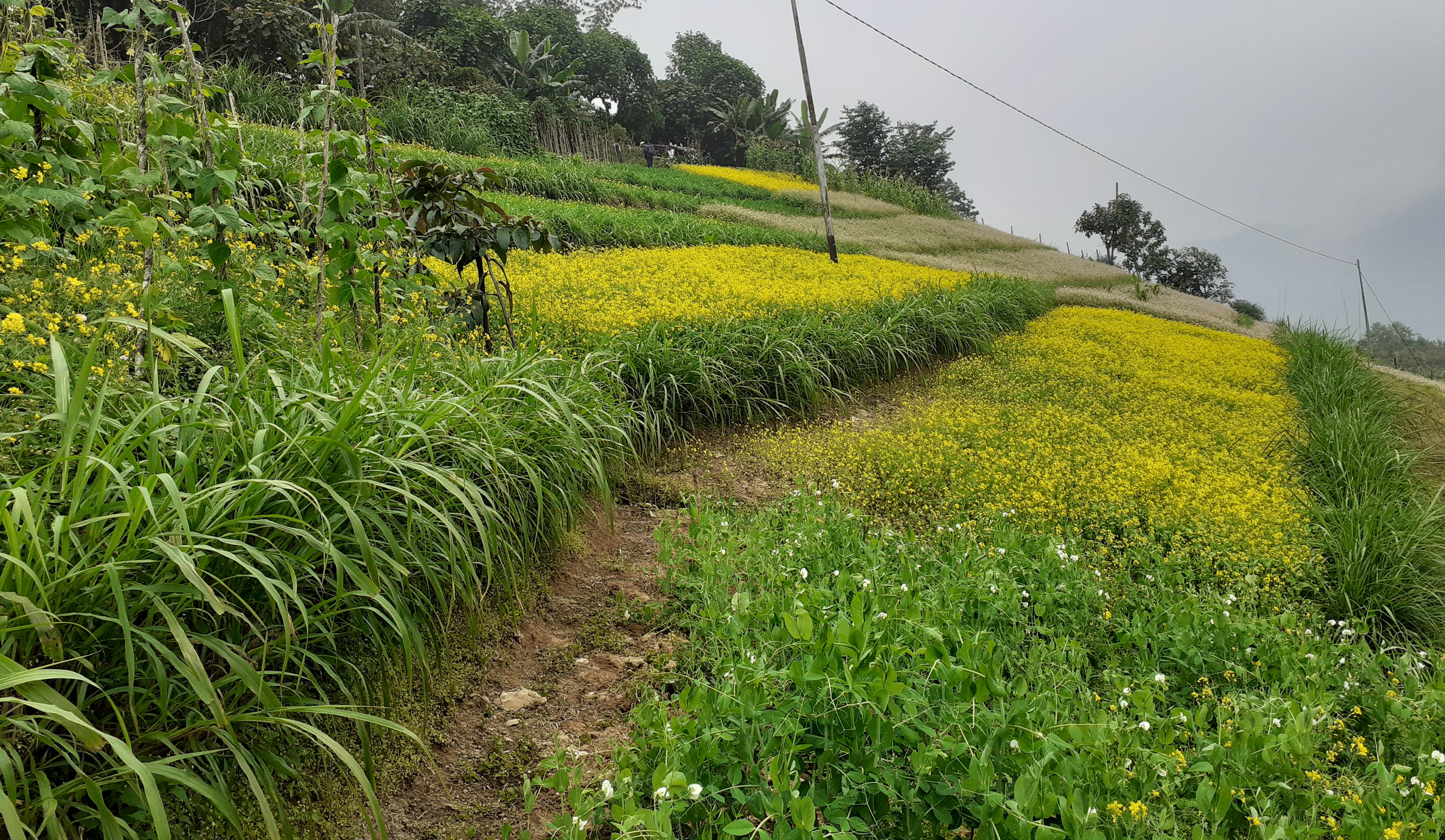
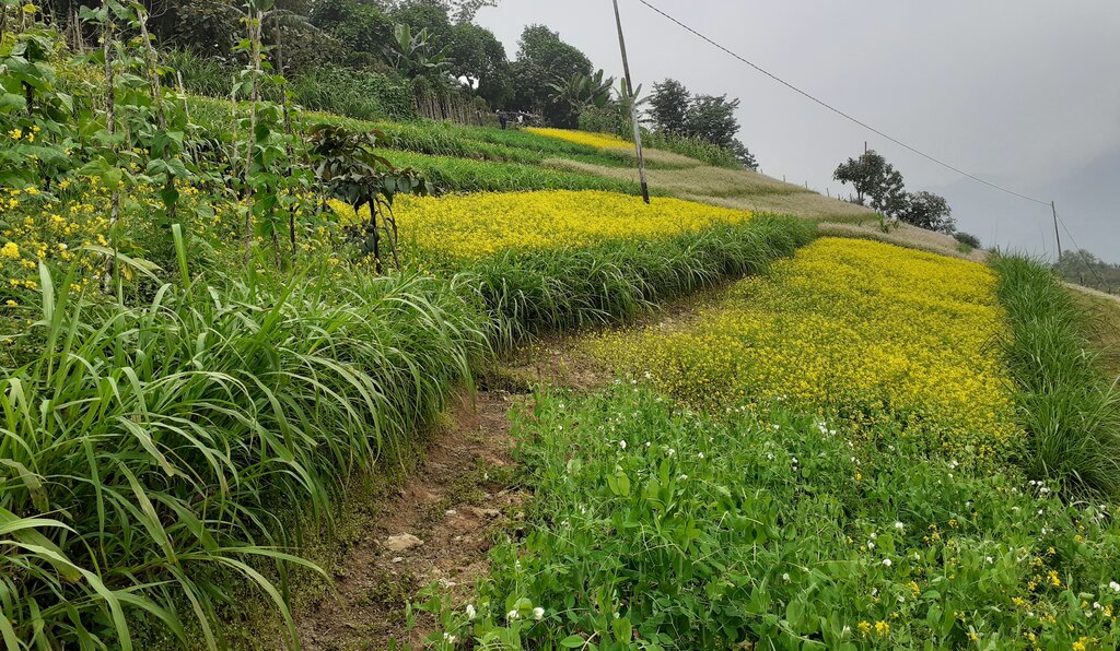
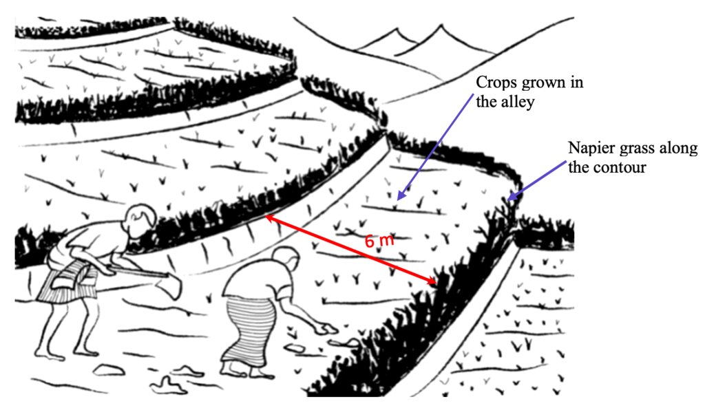
Contour hedgerows are a soil and water conservation technology that involve planting of Napier grass cuttings along contour lines on the slope at a horizontal distance of 6 m. The area between the contour hedgerows is used for crop cultivation.
2.2 وصف تفصيلي للتقنية
الوصف:
Contour hedgerows are a soil and water conservation technology that involves planting Napier stem cuttings along contour lines on slopes. They are planted at a horizontal distance of 6 meters between rows and 15-20 centimeters between cuttings within lines. On average it requires 3500-4000 Napier slips to cover one acre (0.4 ha). Hedgerows form living barriers that trap sediment and reduce surface runoff. With time, as the sediment builds up behind the hedges, the area between the hedgerows develops into flat alleys or “terrace beds”. This technology is effective in reducing soil erosion and conserving water. The hedgerows also boost crop productivity. The contour hedgerow system is widely used in hilly terrain in Bhutan and elsewhere.
The main purposes of the technology are to 1) serve as a barrier to check the movement of soil and water down the slope, 2) effectively utilize sloping areas for agricultural purposes, and 3) increase crop and fodder production.
The major activities/ inputs needed to establish/ maintain contour hedgerows are: 1) surveying of the area by an SLM specialist (planning and site assessment), 2) selecting suitable hedgerow planting materials, 3) registration of interested farmers, 4) training of farmers, 5) layout of contour lines using A-frames, 6) distribution of planting materials and establishment of hedgerows in farmland, 7) monitoring and evaluation of hedgerows, and 8) maintenance of hedgerows. Maintenance includes replacement of cuttings in gaps - either damaged by cattle or natural mortality and trimming of grass back to 15 centimeters after reaching 1 meter. Inputs required include: 1) planting materials (Napier grass), 2) A-Frame for contour lines, 3) spades, pickaxes, shovels, crowbars, etc., and 4) human resource input by SLM specialists.
Contour hedgerows have many benefits/ impacts on the livelihood of the land users including 1) soil and water conservation, 2) use of the sloping areas for crop or fodder production, 3) effective conservation through using local materials with a 90% survival rate, 4) habitat for natural predators, pollinators, insect-eating birds, and rodent predators, 5) groundwater recharge, and 6) they beautify the overall agricultural landscape. Another important benefit of the hedgerows is the availability of fodder grass for livestock, which otherwise would have to be collected from the forest. The disadvantages include the need for regular maintenance and gapping up. At times, conflicts arise within the community due to grazing of hedges by neighbors’ cattle.
2.3 صور التقنية
2.5 البلد/المنطقة/المواقع التي تم تنفيذ التقنية فيها والتي يغطيها هذا التقييم
البلد:
بوتان
المنطقة/الولاية/المحافظة:
Mongar
مزيد من التفاصيل حول الموقع:
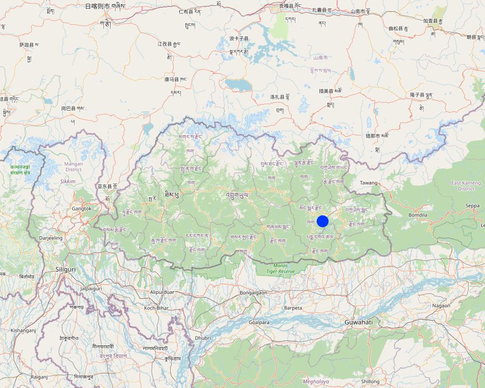
Boucholing village, Thangrong gewog (block), Mongar Dzongkhag (district)
حدد انتشار التقنية:
- منتشرة بالتساوي على مساحة
إذا كانت المساحة الدقيقة غير معروفة، فيرجى الإشارة إلى المنطقة التقريبية المغطاة:
- 100-10 كم2
هل يقع موقع/مواقع التقنية في منطقة محمية بشكل دائم؟:
كلا
Map
×2.6 تاريخ التنفيذ
اذكر سنة التنفيذ:
2014
2.7 إدخال التقنية
حدد كيف تم إدخال التقنية:
- من خلال المشاريع/ التدخلات الخارجية
التعليقات (نوع المشروع، الخ):
The project was funded by UNDP and technical support was provided by the SLM Specialists from the National Soil Service Center and the agriculture extension agent of Thangrong gewog.
3. تصنيف تقنية الإدارة المستدامي للأراضي
3.1 الغرض الرئيسي ( الأغراض الرئيسية) للتقنية
- تحسين الإنتاج
- الحد من تدهور الأراضي ومنعه وعكسه
- الحد من مخاطر الكوارث
- التكيف مع تغير المناخ/الظواهر المتطرفة وآثارها
- خلق أثر اقتصادي مفيد
3.2 نوع (أنواع) استخدام الأراضي الحالية حيث يتم تطبيق التقنية
استخدامات الأراضي مختلطة ضمن نفس وحدة الأرض:
كلا

الأراضي الزراعية
- زراعة سنوية
الزراعة السنوية - حدد المحاصيل:
- الحبوب - الذرة
- المحاصيل الجذرية/الدرنية - البطاطا الحلوة، واليام، والقلقاس/الكوكويام، وغيرها
- الخضروات - الخضروات الورقية (السلطات، الملفوف، السبانخ، وغيرها)
- chilli
عدد مواسم الزراعة في السنة:
- 2
حدد:
Vegetables are grown for two times in a year but the cereal crops are grown for only one time.
هل يتم ممارسة الزراعة البينية؟:
نعم
إذا كانت الإجابة بنعم، حدد المحاصيل التي يتم زراعتها بشكل بيني:
Maize and legumes
هل تتم ممارسة تناوب المحاصيل؟:
نعم
إذا كانت الإجابة بنعم، حدد:
Maize followed by vegetables
3.3 هل تغير استخدام الأراضي نتيجة لتنفيذ التقنية؟
هل تغير استخدام الأراضي نتيجة لتنفيذ التقنية؟:
- لا (تابع مع السؤال 3.4)
استخدامات الأراضي مختلطة ضمن نفس وحدة الأرض:
كلا
3.4 إمدادات المياه
إمدادات المياه للأرض التي يتم تنفيذ التقنية عليها:
- بعلية
التعليقات:
Water is a major constraint and land users mostly depend on rain for irrigation.
3.5 مجموعةالإدارة المستدامة للأراضي التي تنتمي إليها هذه التقنية
- التدابير المتقاطعة للمنحدرات
3.6 التدابير التقنية في مجال إلادارة المستدامة للأراضي

التدابير النباتية
- V2: الأعشاب والنباتات العشبية المعمرة
التعليقات:
Napier grass were planted on the bunds if the already constructed terrace.
3.7 الأنواع الرئيسية من تدهور الأراضي التي تناولتها التقنية

تآكل التربة بالمياه
- الوزن(Wt): فقدان التربة السطحية/تآكل السطح
- (Wg):الانجراف الخلجاني/ الخلجان
التعليقات:
The technology addresses the issue of soil erosion through rain and prevented the degradation the top soil.
3.8 منع أو حد أو عكس تدهور الأراضي
تحديد هدف التقنية فيما يتعلق بتدهور الأراضي:
- منع تدهور الأراضي
- الحد من تدهور الأراضي
التعليقات:
The main goal of the technology is to combat farm land degradation and prevent soil erosion.
4. المواصفات الفنية، وأنشطة التنفيذ، والمدخلات، والتكاليف
4.1 الرسم الفني للتقنية
المواصفات الفنية (المتعلقة بالرسم الفني):
Technical drawing as per the specification given in the SLM Guidelines 2021. See steps for the establishment of hedgerows below:
a)Determine the hedgerow interval for each landform based on the gradient (but based on farmers feedback, the interval is generally set at 6 meters) and then lay out the contour lines. Along the contours, prepare a strip of land with a width of about 40-50cm wide to plant the grass slips or broadcast fodder grass seeds. Napier (Pennisetum spp.) and Pakchong grass spp. is recommended as hedgerow plants for areas that are below 1600 m. However, for areas above 1600 m, temperate grass mixture should be considered;
b)A row of fodder grass slips or seedlings should be planted with a spacing of 15-20 cm. If grass slips are used, at least two nodes should be inserted into the soil for proper establishment/rooting. On the other hand, if grass seeds are used, the seed rate should be 25g per square metre;
c)Mulching should be done right after the grass slip planting or grass seeding to reduce surface erosion, conserve soil moisture, and aid proper germination;
d)Gap filling and trimming of hedgerows should be done as and when required. The trimmed materials can either be used as fodder or mulching materials; and
e)If desired, improved fruit trees suitable at the proposed site can be planted along the hedges at 5 x 5 m spacing. Fruit trees in two adjacent hedgerows should be planted in staggered position to avoid competition for sunlight, water, and soil nutrients.
المؤلف:
NSSC
التاريخ:
10/09/2021
4.2 معلومات عامة بخصوص حساب المدخلات والتكاليف
حدد كيفية احتساب التكاليف والمدخلات:
- حسب مساحة تنفيذ التقنية
الإشارة إلى حجم ووحدة المساحة:
Ha
في حالة استخدام وحدة مساحة محلية، قم بالإشارة إلى عامل التحويل إلى هكتار واحد (على سبيل المثال، 1 هكتار = 2.47 فدان): 1 هكتار =:
0.4
عملة أخرى/ عملة وطنية (حدد):
Ngultrum
إذا كان ذا صلة، وضح سعر الصرف من الدولار الأمريكي إلى العملة المحلية (على سبيل المثال، 1 دولار أمريكي = 79.9 ريال برازيلي): 1 دولار أمريكي =:
82,08
اذكر متوسط تكلفة أجر العمالة المستأجرة في اليوم الواحد:
250
4.3 أنشطة التأسيس
| النشاط | التوقيت (الموسم) | |
|---|---|---|
| 1. | Planning | done between the stakeholders several times |
| 2. | Community meeting and member agreement | twice |
| 3. | Training and workshop | for almost a week |
| 4. | Demonstration | once |
| 5. | Implementation (Planting of napier in the field in groups) | based on the land users convenience and season of plantation |
4.4 التكاليف والمدخلات اللازمة للتأسيس
| تحديد المدخلات | الوحدة | الكمية | التكاليف لكل وحدة | إجمالي التكاليف لكل مدخل | % من التكاليف التي يتحملها مستخدمو الأراضي | |
|---|---|---|---|---|---|---|
| العمالة | Labours | person-days | 4,0 | 250,0 | 1000,0 | 100,0 |
| المواد النباتية | Napier | bundle | 35,0 | 200,0 | 7000,0 | |
| غير ذلك | Payment for resource persons | No of days | 5,0 | 1500,0 | 7500,0 | |
| إجمالي تكاليف إنشاء التقنية | 15500,0 | |||||
| إجمالي تكاليف إنشاء التقنية بالدولار الأمريكي | 188,84 | |||||
إذا تحمل مستخدم الأرض أقل من 100% من التكاليف، حدد من قام بتغطية التكاليف المتبقية:
The funding was provided by UNDP, with technical support from the National Soil Services Center and the Dzongkhag.
التعليقات:
The cost breakdown of the technology establishment was for one acre of land.
The total grant amount was Nu. 2,834,416, however, the total budget for Boucholing specifically was not available.
4.5 الصيانة/الأنشطة المتكررة
| النشاط | التوقيت/الوتيرة | |
|---|---|---|
| 1. | Harvesting, cutting of napier and maintaining the height of the plant | when the napier reaches a height of one meter |
| 2. | Replacing of missing and damaged hills | whenever possible |
4.6 التكاليف والمدخلات اللازمة للصيانة/للأنشطة المتكررة (سنويًا)
| تحديد المدخلات | الوحدة | الكمية | التكاليف لكل وحدة | إجمالي التكاليف لكل مدخل | % من التكاليف التي يتحملها مستخدمو الأراضي | |
|---|---|---|---|---|---|---|
| العمالة | labour | person-days | 2,0 | 250,0 | 500,0 | 100,0 |
| المواد النباتية | Napier slips | Bundle | 10,0 | 200,0 | 2000,0 | |
| إجمالي تكاليف صيانة التقنية | 2500,0 | |||||
| إجمالي تكاليف صيانة التقنية بالدولار الأمريكي | 30,46 | |||||
التعليقات:
Minimal cost go into the maintenance of the hedgerows.
4.7 أهم العوامل المؤثرة على التكاليف
قدم وصفا لأهم العوامل التي تؤثر على التكاليف:
Labour cost and cost of the planting materials.
5. البيئة الطبيعية والبشرية
5.1 المناخ
هطول الأمطار السنوي
- < 250 مم
- 251- 500 ملم
- 501 - 750ملم
- 1,000-751 ملم
- 1,500-1,100 ملم
- 2,000-1,500 ملم
- 3,000-2,001 ملم
- 4,000-3,100 ملم
- > 4000 ملم
المواصفات/التعليقات على هطول الأمطار:
The data used was from the nearest weather station of the National Center for Hydrology and Meteorology (NCHM).
الإشارة إلى اسم محطة الأرصاد الجوية المرجعية المعنية:
https://www.nchm.gov.bt/home/pageMenu/906
المنطقة المناخية الزراعية
- شبه رطبة
Dry subtropical zone
5.2 طوبوغرافيا
متوسط الانحدارات:
- مسطح (0-2%)
- بسيط (3-5%)
- معتدل (6-10%)
- متدحرج (11-15%)
- تلال (16-30%)
- شديدة الانحدار(31-60%)
- فائقة الانحدار (>60%)
التضاريس:
- هضاب/سهول
- أثلام مرتفعة
- المنحدرات الجبلية
- منحدرات التلال
- منحدرات في السفوح
- قاع الوادي
المنطقة الارتفاعية:
- 100-0 متر فوق سطح البحر
- 500-101 متر فوق سطح البحر
- 1,000-501 متر فوق سطح البحر
- 1,500-1,001 متر فوق سطح البحر
- 2,000-1,501 متر فوق سطح البحر
- 2,500-2,100 متر فوق سطح البحر
- 3,000-2,501 متر فوق سطح البحر
- 4,000-3,001 متر فوق سطح البحر
- > 4000 متر فوق سطح البحر
وضح ما إذا كانت التقنية مطبقة على وجه التحديد في:
- غير ذات صلة
التعليقات والمواصفات الإضافية بشأن التضاريس:
Contour hedgerows can be applied in both concave and convex situations, so not relevant
5.3 التربة
متوسط عمق التربة:
- ضحل جدًا (0-20 سم)
- ضحلة (21-50 سم)
- متوسطة العمق (51-80 سم)
- عميقة (81-120 سم)
- عميقة جدًا (> 120 سم)
قوام التربة (التربة السطحية):
- خشن / خفيف (رملي)
قوام التربة (> 20 سم تحت السطح):
- متوسط ( طميي، سلتي)
المواد العضوية في التربة السطحية:
- متوسطة (1-3%)
5.4 توافر المياه ونوعيتها
توافر المياه السطحية:
متوسط
نوعية المياه (غير المعالجة):
للاستخدام الزراعي فقط (الري)
تشير جودة المياه إلى:
المياه السطحية
هل تعتبر ملوحة الماء مشكلة؟:
كلا
هل تحدث فيضانات في المنطقة؟:
نعم
الإنتظام:
بشكل عرضي
تعليقات ومواصفات أخرى بشأن نوعية المياه وكميتها:
The flooding of the area occurs mostly due to heavy rainfall and some surface water.
5.5 التنوع البيولوجي
تنوع الأنواع:
- مرتفع
تنوع الموائل:
- مرتفع
التعليقات والمواصفات الإضافية بشأن التنوع البيولوجي:
Higher diversity because Napier grass adds to diversity to already existing crops.
5.6 خصائص مستخدمي الأراضي الذين يطبقون التقنية
مستقر أو مرتحل:
- غير المترحل
التوجه السوقي لنظام الإنتاج:
- مختلط (كفاف/ تجاري)
الدخل من خارج المزرعة:
- 10-50% من جميع الإيرادات
المستوى النسبي للثروة:
- متوسط
أفراداً أو مجموعات:
- فرد/أسرة معيشية
مستوى المكننة:
- ميكانيكية/ مزودة بمحرك
الجنس:
- رجال
عمر مستخدمي الأرضي:
- متوسط العمر
5.7 متوسط مساحة الأرض التي يستخدمها مستخدمو الأراضي الذين يطبقون التقنية
- < 0.5 هكتارا
- 0.5 - 1 هكتار
- 1 -2 هكتار
- 2 - 5 هكتار
- 5 - 15 هكتار
- 15 - 50 هكتار
- 50 - 100هكتار
- 500-100 هكتار
- 1,000-500 هكتار
- 10,000-1,000 هكتار
- > 10,000 هكتار
هل يعتبر هذا نطاقًا صغيرًا أو متوسطًا أو واسعا (في إشارة إلى السياق المحلي)؟:
- على نطاق صغير
التعليقات:
There are a total of 130 acres of land with an average area of around 2.3 acres for each household.
5.8 ملكية الأراضي، وحقوق استخدام الأراضي، وحقوق استخدام المياه
ملكية الارض:
- فردية، يوجد سند ملكية
حقوق استخدام الأراضي:
- فردي
حقوق استخدام المياه:
- وصول مفتوح (غير منظم)
هل تعتمد حقوق استخدام الأراضي على نظام قانوني تقليدي؟:
نعم
حدد:
The traditional legal system in our country is as per the land act and rules and regulations which dictate the land use in the country.
5.9 الوصول إلى الخدمات والبنية التحتية
الصحة:
- ضعيف
- معتدل
- جيد
التعليم:
- ضعيف
- معتدل
- جيد
المساعدة التقنية:
- ضعيف
- معتدل
- جيد
العمل (على سبيل المثال خارج المزرعة):
- ضعيف
- معتدل
- جيد
الأسواق:
- ضعيف
- معتدل
- جيد
الطاقة:
- ضعيف
- معتدل
- جيد
الطرق والنقل:
- ضعيف
- معتدل
- جيد
مياه الشرب وخدمات الصرف الصحي:
- ضعيف
- معتدل
- جيد
الخدمات المالية:
- ضعيف
- معتدل
- جيد
6. الآثار والتصريحات الختامية
6.1 الآثار التي أظهرتها التقنية في الموقع
الآثار الاجتماعية والاقتصادية
الإنتاج
إنتاج المحاصيل
التعليقات/ حدد:
Crop production is higher than in the past since the contour hedgerows have helped control soil erosion and allowed for proper land utilization. The land user reported about a 25% increase compared to the past.
جودة المحاصيل
التعليقات/ حدد:
The crop quality is also relatively better now compared to the past when the technology was not applied. The land users reported that crops near the hedgerows were found more greener.
إنتاج الأعلاف
الكمية قبل الإدارة المستدامة للأراضي:
No fodder was produced
الكمية بعد الإدارة المستدامة للأراضي:
After napier plantation, napier are harvested as fodder for cattle.
التعليقات/ حدد:
Napier grass was not planted in the past. It was introduced by the National Soil Services Center as part of this technology. The Napier grass planted along the contour has helped not only with soil erosion control but also provided fodder grass for the cattle. The land user reported that there was a 100% increase in fodder because unlike in the past now they don't have to send their cow for grazing in the forest.
جودة العلف
التعليقات/ حدد:
Compared to normal grass that the cattle would graze on, napier is nutrient-rich and of better quality than the normal grass.
خطر فشل الإنتاج
التعليقات/ حدد:
The napier plantation has helped prevent soil erosion that would normally occur in the farm lands thereby preventing crop failure due to soil fertility and moisture conservation.
تنوع المنتج
التعليقات/ حدد:
With the help of the project, the land users were able to utilise the sloping land. This enabled land users to grow crops other than maize.
منطقة الإنتاج
التعليقات/ حدد:
The contour hedgerows have allowed for the sloping and degraded lands to be revitalised into usable cultivable lands.
إدارة الأراضي
الكمية قبل الإدارة المستدامة للأراضي:
Hard manual land management
الكمية بعد الإدارة المستدامة للأراضي:
mechanization of the agriculture in the community
التعليقات/ حدد:
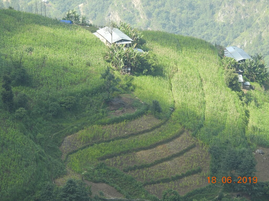
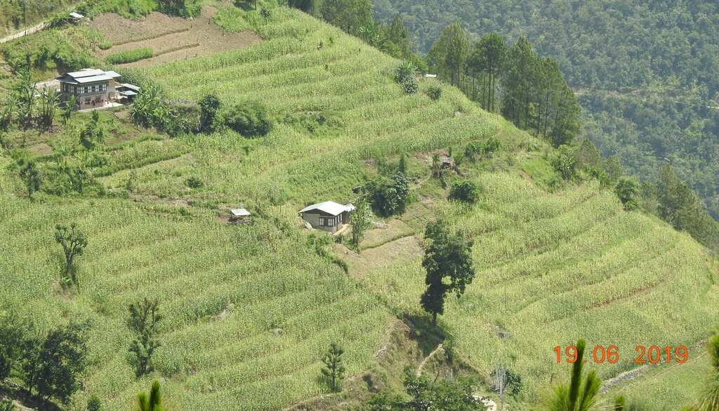
With the help of the project, farm lands in the community were made into terraces and made land management easier compared to the past.
الدخل والتكاليف
النفقات على المدخلات الزراعية
التعليقات/ حدد:
The expenses on agricultural inputs have stayed relatively the same, however, has made working on the farm land easier.
دخل المزرعة
التعليقات/ حدد:
With fodder availability, land users can now focus more on agriculture instead of herding cattle for grazing. The project has also allowed for land users to diversify their products.
عبء العمل
التعليقات/ حدد:
Workload has decreased due to farm mechanization through use of power tillers, which was not possible prior to the SLM intervention.
الآثار الايكولوجية
دورة المياه / الجريان السطحي
الجريان السطحي
التعليقات/ حدد:
Prior to hedgerow establishemt, there was serious surface erosion, which is not the case now.
التنوع البيولوجي: الغطاء النباتي، الحيوانات
التنوع النباتي
الكمية قبل الإدارة المستدامة للأراضي:
primarily maize was cultivated
الكمية بعد الإدارة المستدامة للأراضي:
maize, cole crops, tubers and chilies are cultivated
التعليقات/ حدد:
In the past, the community members would normally cultivate maize and small amounts of vegetables for self consumption, but now a diverse variety of crops are cultivated.
الحد من مخاطر المناخ والكوارث
انزلاقات أرضية / تدفقات الحطام
الكمية قبل الإدارة المستدامة للأراضي:
More prominent in the summer season
الكمية بعد الإدارة المستدامة للأراضي:
occurrence is very minimal
التعليقات/ حدد:
The presence of a terrace and hedgerows in the bunds of the terrace has prevented the erosion of the soil in the farm lands of the farmers.
6.2 الآثار التي أظهرتها التقنية خارج الموقع
الفيضان في اتجاه مجرى النهر
التعليقات/ حدد:
Downstream flooding is relatively less, since the hedgerows has prevented or reduced surface eorsion which would otherwise impact the downstream settlements and water bodies.
6.3 تعرض التقنية وحساسيتها لتغير المناخ التدريجي والظواهر المتطرفة/الكوارث المرتبطة بالمناخ (كما يراها مستخدمو الأراضي)
تغير مناخ تدريجي
تغير مناخ تدريجي
| الموسم | زيادة أو نقصان | كيف تتعامل التقنية مع ذلك؟ | |
|---|---|---|---|
| درجة الحرارة السنوية | زيادة | جيدا | |
| هطول الأمطار السنوي | انخفاض | جيدا |
الظواهر المتطرفة / الكوارث المرتبطة بالمناخ
الكوارث الجوية
| كيف تتعامل التقنية مع ذلك؟ | |
|---|---|
| عاصفة ممطرة محلية | جيدا |
| عاصفة رعدية محلية | جيدة جدا |
| عاصفةبَرَد محلية | جيدا |
| عاصفة هوائية محلية | جيدا |
الكوارث المناخية
| كيف تتعامل التقنية مع ذلك؟ | |
|---|---|
| جفاف | جيدا |
الكوارث الهيدرولوجية
| كيف تتعامل التقنية مع ذلك؟ | |
|---|---|
| الانزلاق الأرضي | جيدا |
6.4 تحليل التكلفة والعائد
كيف يمكن مقارنة العوائد نسبة لتكاليف الإنشاء (من وجهة نظر مستخدمي الأراضي)؟
عوائد قصيرة الأجل:
إيجابي
عوائد طويلة الأجل:
إيجابي
كيف تتم مقارنة العوائدمع كلفة الصيانة/التكاليف المتكررة (من وجهة نظر مستخدمي الأراضي)؟
عوائد قصيرة الأجل:
ايجابي جدا
عوائد طويلة الأجل:
ايجابي جدا
التعليقات:
Since the project was fully funded and minimal cost went into its establishment by the land users, the benefits are higher.
6.5 اعتماد التقنية
- > 50%
إذا كان متاحًا، قم بتحديد الكمية (عدد الأسر المعيشية و/أو المساحةالمغطاة):
40 households
من بين جميع الذين تبنوا التقنية، كم عدد الذين فعلوا ذلك بشكل تلقائي، أي دون تلقي أي حوافز مادية/مدفوعات؟:
- 10-0%
التعليقات:
Since the program was supported by project, the labor were contributed by the land user while the inputs in all sites were provided by the project at every household level.
6.6 التكيف
هل تم تعديل التقنية مؤخرًا لتتكيف مع الظروف المتغيرة؟:
كلا
6.7 نقاط القوة / المزايا / الفرص التي توفرها التقنية
| نقاط القوة/ المزايا/ الفرص من وجهة نظر مستخدمي الأراضي |
|---|
| Hedgerow requires less management |
| Napier are also used as fodder for livestock |
| Prevents the land from erosion due to heavy rain |
| Helps in build up of terraces and facilitates in mechanization of farm |
| نقاط القوة/ المزايا/ الفرص من وجهة نظر جامع المعلومات أو غيره من الاشخاص الرئيسيين لمصدر المعلومات |
|---|
| Additional income opportunities through the production of marketable products from hedgerow vegetation. |
| Improved livelihoods for communities through long-term agricultural productivity. |
| Support for sustainable agricultural practices and resilient farming systems. |
| Preservation of fertile land and protection of agricultural resources. |
6.8 نقاط ضعف / مساوىء / مخاطر التقنية وسبل التغلب عليها
| نقاط الضعف/ المساوىء/ المخاطر من وجهة نظر مستخدم الأراضي | كيف يمكن التغلب عليها؟ |
|---|---|
| Grazing of hedges by free cattle in absence of fences in farm land | Establish community byelaws not to let their cattle free in the fields or install fencing aroung the field. |
| نقاط الضعف/ المساوىء/ المخاطر من وجهة نظر جامع المعلومات أو غيره من الاشخاص الرئيسيين لمصدر المعلومات | كيف يمكن التغلب عليها؟ |
|---|---|
| Shading and potential competition with crops for soil nutrients by hedges | Maintaining height and width of hedges |
| The establishment and maintenance of contour hedgerows require time, effort, and financial resources | The funding for the establishment of technology has already been provided and for maintenance, the expenditure is minimal. |
7. المراجع والروابط
7.1 طرق جمع/مصادر المعلومات
- زيارات ميدانية، مسوحات ميدانية
1 household
- مقابلات مع مستخدمي الأراضي
2 individuals
7.2 المراجع للمنشورات المتاحة
العنوان، المؤلف، السنة، النظام القياسي الدولي لترقيم الكتب ISBN:
ICIMOD. (1999). Manual on Contour Hedgerow Inter-cropping Technology. ICIMOD.
متاح من أين؟كم التكلفة؟:
https://lib.icimod.org/record/31840/files/manual_on_contour_hedgerow_inter-cropping_technology.pdf
العنوان، المؤلف، السنة، النظام القياسي الدولي لترقيم الكتب ISBN:
Pellek, R. (1992). Contour hedgerows and other soil conservation interventions for hilly terrain. Agroforestry Systems, 17, 135-152.
متاح من أين؟كم التكلفة؟:
https://link.springer.com/article/10.1007/BF00053118
العنوان، المؤلف، السنة، النظام القياسي الدولي لترقيم الكتب ISBN:
Kaushal, R., Mandal, D., Panwar, P., Rajkumar, Kumar, P., Tomar, J. M. S. & Mehta, H. (2021). Chapter 20 - Soil and water conservation benefits of agroforestry.
متاح من أين؟كم التكلفة؟:
https://www.sciencedirect.com/science/article/abs/pii/B9780128229316000204
7.3 روابط للمعلومات ذات الصلة على الإنترنت
العنوان/الوصف:
Sustainable Land Management for improved land productivity and community livelihood in Thangrong, Mongar
عنوان الرابط URL:
https://sgp.undp.org/spacial-itemid-projects-landing-page/spacial-itemid-project-search-results/spacial-itemid-project-detailpage.html?view=projectdetail&id=27647
العنوان/الوصف:
Soil erosion control with contour planting
عنوان الرابط URL:
https://apps.worldagroforestry.org/Units/Library/Books/Book%2082/imperata%20grassland/html/4.1_soil.htm?n=20
العنوان/الوصف:
Sustainable Land Management: Guidelines and Best Practices 2021
عنوان الرابط URL:
https://www.nssc.gov.bt
الروابط والوحدات المواضيعية
توسيع الكل طي الكلالروابط
لا يوجد روابط
الوحدات المواضيعية
لا يوجد وحدات مواضيعية


