Microcatchments and ponds [Ethiopia]
- Creation:
- Update:
- Compiler: Unknown User
- Editor: –
- Reviewers: Deborah Niggli, Alexandra Gavilano
Wuha Masebaseb
technologies_1075 - Ethiopia
View sections
Expand all Collapse all1. معلومات عامة
1.2 Contact details of resource persons and institutions involved in the assessment and documentation of the Technology
Key resource person(s)
SLM specialist:
Teshome Melese
Alaba special woreda, SNNPR
Ethiopia
SLM specialist:
Kisum Simeon
Agricultural and Rural Development Office
Ethiopia
Name of the institution(s) which facilitated the documentation/ evaluation of the Technology (if relevant)
SNNPR Bureau of Agriculture - EthiopiaName of the institution(s) which facilitated the documentation/ evaluation of the Technology (if relevant)
Ministry of Agriculture and Rural Development (Ministry of Agriculture and Rural Development) - Ethiopia1.3 Conditions regarding the use of data documented through WOCAT
The compiler and key resource person(s) accept the conditions regarding the use of data documented through WOCAT:
نعم
1.4 Declaration on sustainability of the described Technology
Is the Technology described here problematic with regard to land degradation, so that it cannot be declared a sustainable land management technology?
لا
2. Description of the SLM Technology
2.1 Short description of the Technology
Definition of the Technology:
Microcatchments and ponds are water harvesting measures used to collect stored and spread over an area to increase soil moisture and ground water level.
2.2 Detailed description of the Technology
Description:
Microcatchments for crop fields involve the construction of physical measures which trap rain water and help in increasing infiltration. Soil and stone funds, microbasics, ridges and tied ridges are some of the sWC pracices known as microcatchment. They are designed taking into account the amount of rain received the infiltration capacity of soils and the runoff produced from the field.
Water harvesting techniques described here are the most widely practiced techniques in Alaba woreda, which is characterised by erratic rains, soils having very low water holding capacity and farming systems dominated by seasonal cereal crops such as maize, teff and pepper. Maize is the dominant food and cash crop grown in the wereda. It is a crop requiring more rainfall than teff and sorghum. Water harvesting techniques are more suitable to maize because these structures make more water available to the crop. Bunds are establised by digging channel and embanking the soil either on the upper side or on down ward direction. Wherever stone is abailable it is supported by stone lines at the down slope direction. The purpose is to collect, stone and enhance infiltration of rain water in the soil for increasing survival and productivity of crops planted on the field. The technology is suitable to areas with erratic and low rainfalls, soils with low soil moisture holding capacity and for crops which require more water. The annual rainfall is not small but is not well distributed over the growing period and hence it becomes essential to have structures that could trap and store as much rainfall as possible in the soil.
2.5 Country/ region/ locations where the Technology has been applied and which are covered by this assessment
بلد:
Ethiopia
Region/ State/ Province:
SNNPR
Further specification of location:
Bilate watershed
Comments:
Total area covered by the SLM Technology is 60 km2.
Microcatchments and ponds are practiced in all of the kebeles mentioned above (SWC area)
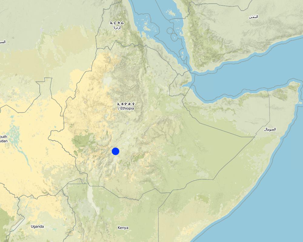
Map
×2.6 Date of implementation
If precise year is not known, indicate approximate date:
- more than 50 years ago (traditional)
2.7 Introduction of the Technology
Specify how the Technology was introduced:
- through projects/ external interventions
Comments (type of project, etc.):
From international expriences.
3. Classification of the SLM Technology
3.1 Main purpose(s) of the Technology
- improve production
- adapt to climate change/ extremes and its impacts
3.2 Current land use type(s) where the Technology is applied

الأراضي الزراعية
- Annual cropping
- Perennial (non-woody) cropping
- Tree and shrub cropping
Annual cropping - Specify crops:
- cereals - maize
- cereals - sorghum
- legumes and pulses - beans
- vegetables - leafy vegetables (salads, cabbage, spinach, other)
- haricot bean
Perennial (non-woody) cropping - Specify crops:
- medicinal, aromatic, pesticidal plants - perennial
- pepper, Teff
- Coffee
Number of growing seasons per year:
- 1

أراضي الرعي
Extensive grazing:
- Semi-nomadic pastoralism
Comments:
Major land use problems (compiler’s opinion): Shortage of rainfall, land degradation, low soil fertility.
Major land use problems (land users’ perception): Moisture stress, poor harvest, unreliable rainfalls.
Grazingland comments: There is serious shortage of fodder in the woreda and to minimize this problem fodder trees are planted and grown using rainwater harvesting structures such as microbasins and trenches on grazing lands which are closed for some time.
Problems / comments regarding forest use: Rainwater should be stored/collected in trenches and soil bunds to support seedling plantation, forage and crop production.
Type of cropping system and major crops comments: maize, haricot bean and cabbage
3.4 Water supply
Water supply for the land on which the Technology is applied:
- rainfed
3.5 SLM group to which the Technology belongs
- water harvesting
- irrigation management (incl. water supply, drainage)
- water diversion and drainage
3.6 SLM measures comprising the Technology

agronomic measures
- A3: Soil surface treatment
Comments:
Type of agronomic measures: contour tillage, contour ridging
3.7 Main types of land degradation addressed by the Technology

soil erosion by water
- Wt: loss of topsoil/ surface erosion

water degradation
- Ha: aridification
3.8 Prevention, reduction, or restoration of land degradation
Specify the goal of the Technology with regard to land degradation:
- prevent land degradation
4. Technical specifications, implementation activities, inputs, and costs
4.1 Technical drawing of the Technology
Technical specifications (related to technical drawing):
Technical knowledge required for field staff / advisors: high
Technical knowledge required for land users: moderate
Main technical functions: increase of infiltration, increase / maintain water stored in soil, water harvesting / increase water supply
Secondary technical functions: control of dispersed runoff: retain / trap, improvement of ground cover
Contour tillage
Remarks: along the contour (0gradient)
Contour ridging
Remarks: along the contour
Slope (which determines the spacing indicated above): 5.00%
If the original slope has changed as a result of the Technology, the slope today is (see figure below): 3.00%
Gradient along the rows / strips: 0.00%
Dam/ pan/ pond
Vertical interval between structures (m): 2-3m
Width of ditches/pits/dams (m): 3m
Length of ditches/pits/dams (m): 5-10m
Retention/infiltration ditch/pit, sediment/sand trap
Vertical interval between structures (m): 1m
Spacing between structures (m): 20-30m
Depth of ditches/pits/dams (m): 0.5
Width of ditches/pits/dams (m): 100m
Length of ditches/pits/dams (m): 100m
Height of bunds/banks/others (m): 0.5m
Width of bunds/banks/others (m): 0.5-0.6m
Structural measure: diversion ditch / cut-off drain
Depth of ditches/pits/dams (m): 0.5m
Width of ditches/pits/dams (m): 2m
Height of bunds/banks/others (m): 0.8m
Width of bunds/banks/others (m): 0.9m
Construction material (earth): soil excavated from the ditches used to construct the embankments.
Construction material (stone): stone is used to reinforce and construct the structures
Slope (which determines the spacing indicated above): 5%
If the original slope has changed as a result of the Technology, the slope today is: 3%
Lateral gradient along the structure: 0%
For water harvesting: the ratio between the area where the harvested water is applied and the total area from which water is collected is: 1:2
4.2 General information regarding the calculation of inputs and costs
other/ national currency (specify):
Birr
If relevant, indicate exchange rate from USD to local currency (e.g. 1 USD = 79.9 Brazilian Real): 1 USD =:
8,6
4.3 Establishment activities
| Activity | Timing (season) | |
|---|---|---|
| 1. | Site selection | |
| 2. | Survey | dry season |
| 3. | Construction | dry season |
4.4 Costs and inputs needed for establishment
| Specify input | Unit | Quantity | Costs per Unit | Total costs per input | % of costs borne by land users | |
|---|---|---|---|---|---|---|
| Labour | Labour | ha | 1,0 | 83,7 | 83,7 | |
| Equipment | Tools | ha | 1,0 | 120,0 | 120,0 | |
| Construction material | Plastic | ha | 1,0 | 232,0 | 232,0 | |
| Total costs for establishment of the Technology | 435,7 | |||||
| Total costs for establishment of the Technology in USD | 50,66 | |||||
4.5 Maintenance/ recurrent activities
| Activity | Timing/ frequency | |
|---|---|---|
| 1. | Surveying | dry season / annual |
| 2. | Rainwater structure construction | dry season / annual |
| 3. | Clearing silt trap | dry season/annual |
| 4. | Stablizing the bunds | rainy season/annual |
4.6 Costs and inputs needed for maintenance/ recurrent activities (per year)
| Specify input | Unit | Quantity | Costs per Unit | Total costs per input | % of costs borne by land users | |
|---|---|---|---|---|---|---|
| Labour | Labour | ha | 1,0 | 6,97 | 6,97 | |
| Equipment | Tools | ha | 1,0 | 120,0 | 120,0 | |
| Total costs for maintenance of the Technology | 126,97 | |||||
| Total costs for maintenance of the Technology in USD | 14,76 | |||||
4.7 Most important factors affecting the costs
Describe the most determinate factors affecting the costs:
Availability of construction materials.
5. Natural and human environment
5.1 Climate
Annual rainfall
- < 250 mm
- 251-500 mm
- 501-750 mm
- 751-1,000 mm
- 1,001-1,500 mm
- 1,501-2,000 mm
- 2,001-3,000 mm
- 3,001-4,000 mm
- > 4,000 mm
Specifications/ comments on rainfall:
850-950 mm
Agro-climatic zone
- sub-humid
- semi-arid
5.2 Topography
Slopes on average:
- flat (0-2%)
- gentle (3-5%)
- moderate (6-10%)
- rolling (11-15%)
- hilly (16-30%)
- steep (31-60%)
- very steep (>60%)
Landforms:
- plateau/plains
- ridges
- mountain slopes
- hill slopes
- footslopes
- valley floors
Altitudinal zone:
- 0-100 m a.s.l.
- 101-500 m a.s.l.
- 501-1,000 m a.s.l.
- 1,001-1,500 m a.s.l.
- 1,501-2,000 m a.s.l.
- 2,001-2,500 m a.s.l.
- 2,501-3,000 m a.s.l.
- 3,001-4,000 m a.s.l.
- > 4,000 m a.s.l.
Comments and further specifications on topography:
Altitudinal zone: 1700-2200 m a.s.l.
5.3 Soils
Soil depth on average:
- very shallow (0-20 cm)
- shallow (21-50 cm)
- moderately deep (51-80 cm)
- deep (81-120 cm)
- very deep (> 120 cm)
Soil texture (topsoil):
- coarse/ light (sandy)
- medium (loamy, silty)
Topsoil organic matter:
- medium (1-3%)
If available, attach full soil description or specify the available information, e.g. soil type, soil PH/ acidity, Cation Exchange Capacity, nitrogen, salinity etc.
Soil fertility is medium (ranked 1) and high (ranked 2)
Soil drainage/infiltration: Good
Soil water storage capacity: very low
5.6 Characteristics of land users applying the Technology
Market orientation of production system:
- subsistence (self-supply)
- mixed (subsistence/ commercial)
Off-farm income:
- 10-50% of all income
Relative level of wealth:
- poor
- average
Level of mechanization:
- manual work
- animal traction
Indicate other relevant characteristics of the land users:
Population density: 200-500 persons/km2
Annual population growth: 3% - 4%
10% of the land users are very rich and own 18% of the land.
20% of the land users are rich and own 25% of the land.
40% of the land users are average wealthy and own 40% of the land.
25% of the land users are poor and own 15% of the land.
5% of the land users are poor and own 2% of the land.
5.7 Average area of land used by land users applying the Technology
- < 0.5 ha
- 0.5-1 ha
- 1-2 ha
- 2-5 ha
- 5-15 ha
- 15-50 ha
- 50-100 ha
- 100-500 ha
- 500-1,000 ha
- 1,000-10,000 ha
- > 10,000 ha
Comments:
Cropland: 1-2 ha
Grazing land: 0.5-1 ha (grazing land is changing into forest land)
5.8 Land ownership, land use rights, and water use rights
Land ownership:
- state
Land use rights:
- individual
6. Impacts and concluding statements
6.1 On-site impacts the Technology has shown
Socio-economic impacts
Production
crop production
fodder production
fodder quality
Income and costs
farm income
Ecological impacts
Water cycle/ runoff
groundwater table/ aquifer
Comments/ specify:
Improved groundwater
Soil
soil moisture
soil loss
Quantity before SLM:
40
Quantity after SLM:
25
6.2 Off-site impacts the Technology has shown
reliable and stable stream flows in dry season
downstream flooding
6.4 Cost-benefit analysis
How do the benefits compare with the establishment costs (from land users’ perspective)?
Short-term returns:
positive
Long-term returns:
very positive
How do the benefits compare with the maintenance/ recurrent costs (from land users' perspective)?
Short-term returns:
positive
Long-term returns:
very positive
6.5 Adoption of the Technology
Comments:
90% of land user families have adopted the Technology with external material support
46800 land user families have adopted the Technology with external material support
Comments on acceptance with external material support: survey results
There is a moderate trend towards spontaneous adoption of the Technology
Comments on adoption trend: The technology is implemented by community participation with out incentive paid.
6.7 Strengths/ advantages/ opportunities of the Technology
| Strengths/ advantages/ opportunities in the land user’s view |
|---|
| Vegetables grown around water harvesting structures. |
| Strengths/ advantages/ opportunities in the compiler’s or other key resource person’s view |
|---|
| Moisture is harvested |
| shortage of water gradually decreased |
7. References and links
7.1 Methods/ sources of information
- field visits, field surveys
- interviews with land users
When were the data compiled (in the field)?
02/06/2011
7.2 References to available publications
Title, author, year, ISBN:
Guideline for watershed development
Links and modules
Expand all Collapse allLinks
No links
Modules
No modules