Unexpected flood risk control in village [النيبال]
- تاريخ الإنشاء:
- تحديث:
- جامع المعلومات: Sabita Aryal
- المحرر: –
- المراجعون: David Streiff, Alexandra Gavilano
Bhelbadi Niyantran
technologies_1590 - النيبال
عرض الأقسام
توسيع الكل طي الكل1. معلومات عامة
1.2 تفاصيل الاتصال بالأشخاص الرئيسيين لمصدر المعلومات والمؤسسات المشاركة في تقييم وتوثيق التقنية
Koirala Pratiksha
النيبال
Gautam Bibhu
النيبال
Mulmi Anjuli
النيبال
اسم المؤسسة (المؤسسات) التي سهلت توثيق/تقييم التقنية (إذا كان ذلك على صلة)
Kathmandu University (KU) - النيبال1.3 الشروط المتعلقة باستخدام البيانات الموثقة من خلال WOCAT
يوافق جامع المعلومات والشخص (لاشخاص) الرئيسي لمصدر المعلومات على الشروط المتعلقة باستخدام البيانات الموثقة من خلال WOCAT:
نعم
2. وصف تقنيةالإدارة المستدامي للأراضي
2.1 وصف مختصر للتقنية
تعريف التقنية:
It is a technology used to control and reduce the effects of downstream flood by physical interventions like construction of spillway, ditch and stone dam on the wall of ditch.
2.2 وصف تفصيلي للتقنية
الوصف:
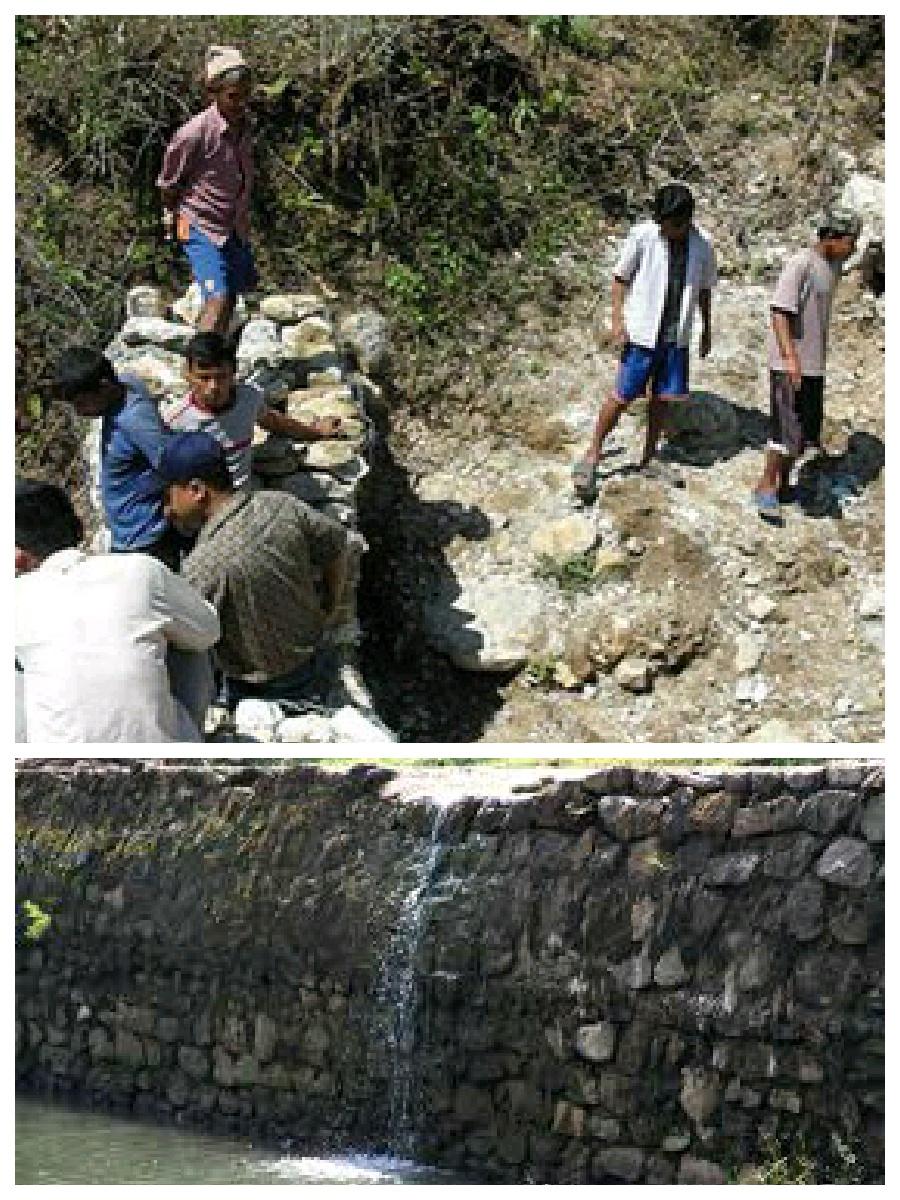
Hilly areas are prone to flash flood that occur with little warning. During rainy season, level of water rises in the stream due to which land mass field of around area was degraded. This technology is used to control the land mass and water flowing from upper region to the lower region of the hill. The natural stream was modified to deep and more sloppy. And surrounding walls were made by piling up stones dams and tighten them by metal wires. These dams decrease the slope gradient and reduce the velocity of water flow and promote the deposition of eroded materials.
Purpose of the Technology: There was no problem of landslide and downstream flood before. But after the road construction, soil became loose resulting in the occurrence of downstream flood. It caused massive destruction of agricultural fields and disturbed settlement areas. Also, stone and gravel during landslide and stream flood used to be deposited and block the flow of the water. So land user invented by this technology to control and reduce the effects of downstream flood.
Establishment / maintenance activities and inputs: Land users and other villagers took the initiative to carry out the technology. Stones were abundantly found in the stream that were utilized to make the dams on lining the stream. Dozer was used to deepen the stream and increase the slope of stream. Stones were piled up and tied by iron wires on the bank of stream by local farmers themselves with their own investment.
Natural / human environment: The area where this technology has been used is a hilly area. Soil fertility in that area is low or medium which differs according to the place. Due to landslide and downstream flood, sand and gravel get deposited in the cropland, so its fertility is very low. No crops can be grown in there. This technology helps to control further degradation of land but could't help to restore natural quality of land.
This area is semi arid area. Due to the proper supply of water the area is prevented from drying. People living in that area are mainly farmers and depend on agriculture for livelihood. Also the area is developing more after the road construction. People are now being more aware about health, education and development.
2.3 صور التقنية
2.5 البلد/المنطقة/المواقع التي تم تنفيذ التقنية فيها والتي يغطيها هذا التقييم
البلد:
النيبال
المنطقة/الولاية/المحافظة:
Nepal
مزيد من التفاصيل حول الموقع:
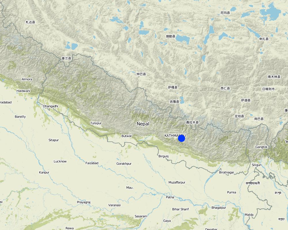
Kavre
حدد انتشار التقنية:
- يتم تطبيقها في نقاط محددة/ تتركز على مساحة صغيرة
التعليقات:
The area occupied by SLM technology is approximately 28 km2. It includes area occupied by conversation measures and the additional area protected by them.
Map
×2.6 تاريخ التنفيذ
في حالة عدم معرفة السنة بالتحديد، يرجى الإشارة إلى التاريخ التقريبي:
- منذ أقل من 10 سنوات (مؤخرًا)
2.7 إدخال التقنية
حدد كيف تم إدخال التقنية:
- من خلال ابتكار مستخدمي الأراضي
التعليقات (نوع المشروع، الخ):
The problem of downstream flood was caused before two years after the construction of road. so technology was also developed before 2 years.
3. تصنيف تقنية الإدارة المستدامي للأراضي
3.1 الغرض الرئيسي ( الأغراض الرئيسية) للتقنية
- الحد من تدهور الأراضي ومنعه وعكسه
- الحد من مخاطر الكوارث
3.2 نوع (أنواع) استخدام الأراضي الحالية حيث يتم تطبيق التقنية

المجاري المائية، المسطحات المائية، الأراضي الرطبة
- Waterway, ditch
التعليقات:
Major land use problems (compiler’s opinion): Cropland destruction
Major land use problems (land users’ perception): Cropland destruction, vegetation destruction, decreased soil fertility.
Constraints of waterway/ditch (Ditch for the flow of water): Big stone which block the water ways.
Number of growing seasons per year: 3
Longest growing period in days: 150; Longest growing period from month to month: june-november; Second longest growing period in days: 90; Second longest growing period from month to month: march-june
3.5 مجموعةالإدارة المستدامة للأراضي التي تنتمي إليها هذه التقنية
- إدارة المياه السطحية (الينابيع، الأنهار، البحيرات، البحار)
3.6 التدابير التقنية في مجال إلادارة المستدامة للأراضي

التدابير البنيوية
- S3: الخنادق المتدرجة ،والقنوات، والممرات المائية
- S6: الجدران والحواجز وسياجات القش، والسياجات
3.7 الأنواع الرئيسية من تدهور الأراضي التي تناولتها التقنية

تآكل التربة بالمياه
- (Wg):الانجراف الخلجاني/ الخلجان
- (Wo:) تأثيرات التدهور من مواقع أخرى
التعليقات:
Main causes of degradation: urbanisation and infrastructure development (Construction of road i.e infrastructure development), floods (Downstream flood during rainy season.), inputs and infrastructure: (roads, markets, distribution of water points, other, …) (Road construction)
Secondary causes of degradation: Heavy / extreme rainfall (intensity/amounts) (Heavy rainfall during rainy season cause downstream flooding.)
3.8 منع أو حد أو عكس تدهور الأراضي
تحديد هدف التقنية فيما يتعلق بتدهور الأراضي:
- منع تدهور الأراضي
التعليقات:
Secondary goals: mitigation / reduction of land degradation, rehabilitation / reclamation of denuded land
4. المواصفات الفنية، وأنشطة التنفيذ، والمدخلات، والتكاليف
4.1 الرسم الفني للتقنية
المواصفات الفنية (المتعلقة بالرسم الفني):
This technical drawing shows the constructed dam and gully which allow proper flow of downstream flood.
Location: Chyamrangbes. Kavre
Technical knowledge required for land users: high
Technical knowledge required for labour: high (Through their experience to construct in a useful way.)
Main technical functions: control of concentrated runoff: drain / divert, reduction of slope angle
Secondary technical functions: control of dispersed runoff: retain / trap, improvement of surface structure (crusting, sealing)
Diversion ditch/ drainage
Vertical interval between structures (m): n'a
Spacing between structures (m): n'a
Depth of ditches/pits/dams (m): 2.13
Width of ditches/pits/dams (m): 3.2
Length of ditches/pits/dams (m): 1000
Height of bunds/banks/others (m): 1.6
Width of bunds/banks/others (m): 0.8
Length of bunds/banks/others (m): 1000
Construction material (earth): Soil excavate from the ditches is used to build bank.
Construction material (stone): the cut off ditch is lined with stones, embankment with stones.
Construction material (other): iron wire was used to bind the stone together.
Slope (which determines the spacing indicated above): 12%
المؤلف:
Bibhu Gautam, KUGH,Kavre
4.2 معلومات عامة بخصوص حساب المدخلات والتكاليف
حدد العملة المستخدمة لحساب التكاليف:
- دولار أمريكي USD
4.3 أنشطة التأسيس
| النشاط | التوقيت (الموسم) | |
|---|---|---|
| 1. | Land user increased the width and slope of existing ditch for easy flow of water. | dry seasonm |
| 2. | Land user embanked the bank with stones on either side. | dry season |
| 3. | Stones are bind together by wires in some places. | dry season |
4.4 التكاليف والمدخلات اللازمة للتأسيس
| تحديد المدخلات | الوحدة | الكمية | التكاليف لكل وحدة | إجمالي التكاليف لكل مدخل | % من التكاليف التي يتحملها مستخدمو الأراضي | |
|---|---|---|---|---|---|---|
| العمالة | Increase the width and slope of ditch | ha | 1,0 | 941,17 | 941,17 | 100,0 |
| إجمالي تكاليف إنشاء التقنية | 941,17 | |||||
| إجمالي تكاليف إنشاء التقنية بالدولار الأمريكي | 941,17 | |||||
التعليقات:
Duration of establishment phase: 2 month(s)
4.6 التكاليف والمدخلات اللازمة للصيانة/للأنشطة المتكررة (سنويًا)
التعليقات:
Machinery/ tools: dozer, Dozer
The above mentioned cost is not given per unit/hectar. It is the total cost used for that technology.
4.7 أهم العوامل المؤثرة على التكاليف
قدم وصفا لأهم العوامل التي تؤثر على التكاليف:
The most determinate factor affecting the cost is land structure. Land contains loamy soil which made it difficult for construction of ditch.
5. البيئة الطبيعية والبشرية
5.1 المناخ
هطول الأمطار السنوي
- < 250 مم
- 251- 500 ملم
- 501 - 750ملم
- 1,000-751 ملم
- 1,500-1,100 ملم
- 2,000-1,500 ملم
- 3,000-2,001 ملم
- 4,000-3,100 ملم
- > 4000 ملم
المواصفات/التعليقات على هطول الأمطار:
monsoon rain, dry winter
المنطقة المناخية الزراعية
- شبه قاحلة
Thermal climate class: subtropics
5.2 طوبوغرافيا
متوسط الانحدارات:
- مسطح (0-2%)
- بسيط (3-5%)
- معتدل (6-10%)
- متدحرج (11-15%)
- تلال (16-30%)
- شديدة الانحدار(31-60%)
- فائقة الانحدار (>60%)
التضاريس:
- هضاب/سهول
- أثلام مرتفعة
- المنحدرات الجبلية
- منحدرات التلال
- منحدرات في السفوح
- قاع الوادي
المنطقة الارتفاعية:
- 100-0 متر فوق سطح البحر
- 500-101 متر فوق سطح البحر
- 1,000-501 متر فوق سطح البحر
- 1,500-1,001 متر فوق سطح البحر
- 2,000-1,501 متر فوق سطح البحر
- 2,500-2,100 متر فوق سطح البحر
- 3,000-2,501 متر فوق سطح البحر
- 4,000-3,001 متر فوق سطح البحر
- > 4000 متر فوق سطح البحر
وضح ما إذا كانت التقنية مطبقة على وجه التحديد في:
- حالات مقعرة
التعليقات والمواصفات الإضافية بشأن التضاريس:
Slopes on average: The average slope is about 15%.
5.3 التربة
متوسط عمق التربة:
- ضحل جدًا (0-20 سم)
- ضحلة (21-50 سم)
- متوسطة العمق (51-80 سم)
- عميقة (81-120 سم)
- عميقة جدًا (> 120 سم)
قوام التربة (التربة السطحية):
- خشن / خفيف (رملي)
المواد العضوية في التربة السطحية:
- منخفضة (<1%)
إذا كان متاحًا، قم بإرفاق وصف كامل للتربة أو تحديد المعلومات المتوفرة، على سبيل المثال نوع التربة، الرقم الهيدروجيني/ درجة حموضة التربة، قدرة التبادل الكاتيوني، النيتروجين، الملوحة وما إلى ذلك.
Soil texture: Sandy and graveled land
Soil fertility is medium - low and varies according to soil texture
Soil drainage / infiltration is poor
Soil water storage capacity is low, soil is sandy and contains gravel. So it cannot store water
5.4 توافر المياه ونوعيتها
منسوب المياه الجوفية:
سطحية
توافر المياه السطحية:
زائدة
نوعية المياه (غير المعالجة):
غير صالحة للإستعمال
تعليقات ومواصفات أخرى بشأن نوعية المياه وكميتها:
Ground water table: Infiltration is very low. Water only flow on surface.
Availability of surface water: During rainy season excess water flow through the steam.
Water quality (untreated): Some portion water is used in agriculture
5.5 التنوع البيولوجي
تنوع الأنواع:
- منخفض
التعليقات والمواصفات الإضافية بشأن التنوع البيولوجي:
Soil is very infertile. So it is poor in biodiversity.
5.6 خصائص مستخدمي الأراضي الذين يطبقون التقنية
الدخل من خارج المزرعة:
- أقل من % 10من كامل الدخل
المستوى النسبي للثروة:
- متوسط
- ثري
أفراداً أو مجموعات:
- المجموعات/ المجتمع المحلي
الجنس:
- نساء
- رجال
اذكر الخصائص الأخرى ذات الصلة لمستخدمي الأراضي:
Land users applying the Technology are mainly common / average land users
Difference in the involvement of women and men: More male because women cannot do such type of heavy labor work.
Population density: 50-100 persons/km2
Annual population growth: 2% - 3%
(living standard is more than average).
(average life standard).
Off-farm income specification: Their land is protected from further degradation
5.7 متوسط مساحة الأرض التي يستخدمها مستخدمو الأراضي الذين يطبقون التقنية
- < 0.5 هكتارا
- 0.5 - 1 هكتار
- 1 -2 هكتار
- 2 - 5 هكتار
- 5 - 15 هكتار
- 15 - 50 هكتار
- 50 - 100هكتار
- 500-100 هكتار
- 1,000-500 هكتار
- 10,000-1,000 هكتار
- > 10,000 هكتار
هل يعتبر هذا نطاقًا صغيرًا أو متوسطًا أو واسعا (في إشارة إلى السياق المحلي)؟:
- على نطاق صغير
5.8 ملكية الأراضي، وحقوق استخدام الأراضي، وحقوق استخدام المياه
ملكية الارض:
- فردية، لا يوجد سند ملكية
حقوق استخدام الأراضي:
- مجتمعي (منظم)
التعليقات:
The land where SLM technology is applied belongs to individual, but it land use right belongs to community.
5.9 الوصول إلى الخدمات والبنية التحتية
الصحة:
- ضعيف
- معتدل
- جيد
التعليم:
- ضعيف
- معتدل
- جيد
المساعدة التقنية:
- ضعيف
- معتدل
- جيد
العمل (على سبيل المثال خارج المزرعة):
- ضعيف
- معتدل
- جيد
الأسواق:
- ضعيف
- معتدل
- جيد
الطاقة:
- ضعيف
- معتدل
- جيد
الطرق والنقل:
- ضعيف
- معتدل
- جيد
مياه الشرب وخدمات الصرف الصحي:
- ضعيف
- معتدل
- جيد
الخدمات المالية:
- ضعيف
- معتدل
- جيد
6. الآثار والتصريحات الختامية
6.1 الآثار التي أظهرتها التقنية في الموقع
الآثار الاجتماعية والاقتصادية
الإنتاج
خطر فشل الإنتاج
الكمية قبل الإدارة المستدامة للأراضي:
n/a
الكمية بعد الإدارة المستدامة للأراضي:
n/a
التعليقات/ حدد:
protected the cropland from flood
الآثار الاجتماعية والثقافية
المعرفة بالإدارة المستدامة للأراضي/تدهور الأراضي
الكمية قبل الإدارة المستدامة للأراضي:
n/a
الكمية بعد الإدارة المستدامة للأراضي:
n/a
التعليقات/ حدد:
active participating people on land conservation.
الآثار الايكولوجية
دورة المياه / الجريان السطحي
الجريان السطحي
التعليقات/ حدد:
water travel in fixed path
تصريف المياه الزائدة
التعليقات/ حدد:
improved water way for passage of excess water
التربة
فقدان التربة
التعليقات/ حدد:
soil loss due to flooding is reduced
6.2 الآثار التي أظهرتها التقنية خارج الموقع
الفيضان في اتجاه مجرى النهر
التعليقات/ حدد:
the main benefits of this technology
6.3 تعرض التقنية وحساسيتها لتغير المناخ التدريجي والظواهر المتطرفة/الكوارث المرتبطة بالمناخ (كما يراها مستخدمو الأراضي)
تغير مناخ تدريجي
تغير مناخ تدريجي
| الموسم | زيادة أو نقصان | كيف تتعامل التقنية مع ذلك؟ | |
|---|---|---|---|
| درجة الحرارة السنوية | زيادة | جيدا |
الظواهر المتطرفة / الكوارث المرتبطة بالمناخ
الكوارث الجوية
| كيف تتعامل التقنية مع ذلك؟ | |
|---|---|
| عاصفة ممطرة محلية | ليس جيدا |
| عاصفة هوائية محلية | غير معروف |
الكوارث المناخية
| كيف تتعامل التقنية مع ذلك؟ | |
|---|---|
| جفاف | جيدا |
الكوارث الهيدرولوجية
| كيف تتعامل التقنية مع ذلك؟ | |
|---|---|
| فيضان عام (نهر) | ليس جيدا |
التعليقات:
Dame can be made more tolerant again flash flood by using wire to tighten the stone walls or making the concrete wall.
6.4 تحليل التكلفة والعائد
كيف يمكن مقارنة العوائد نسبة لتكاليف الإنشاء (من وجهة نظر مستخدمي الأراضي)؟
عوائد قصيرة الأجل:
سلبي
عوائد طويلة الأجل:
سلبي قليلا
التعليقات:
This technology is not a investment purpose. People used their own money to construct it.
6.5 اعتماد التقنية
- حالات فردية/تجريبية
إذا كان متاحًا، قم بتحديد الكمية (عدد الأسر المعيشية و/أو المساحةالمغطاة):
14 households in an area of 10 - 100 sq km (50 - 100 persons per sq km)
من بين جميع الذين تبنوا التقنية، كم عدد الذين فعلوا ذلك بشكل تلقائي، أي دون تلقي أي حوافز مادية/مدفوعات؟:
- 10-0%
التعليقات:
100% of land user families have adopted the Technology with external material support
14 land user families have adopted the Technology with external material support
Comments on acceptance with external material support: Iron wire was provided by Bagmati watershed.
There is a strong trend towards spontaneous adoption of the Technology
Comments on adoption trend: People have well accepted this technology.
6.7 نقاط القوة / المزايا / الفرص التي توفرها التقنية
| نقاط القوة/ المزايا/ الفرص من وجهة نظر مستخدمي الأراضي |
|---|
|
Risk of downstream flood and landslide is reduced. How can they be sustained / enhanced? If they had been more donation from government or any other projects, they would construct concrete or more flood resistance dams. As some parts are still unconstructed they would complete them with some more external support. |
| Agriculture land get protected so they can plant the crop without being at risk. |
| نقاط القوة/ المزايا/ الفرص من وجهة نظر جامع المعلومات أو غيره من الاشخاص الرئيسيين لمصدر المعلومات |
|---|
|
Proper water drainage system and water can get collected in the river following the fix path. How can they be sustained / enhanced? Fodder plant could be grown on the stream banks which is now left and unused. This could be used to feed the animals and would also help to control flood and landslide. |
|
It reduced the risk of further land degradation by downstream flood. How can they be sustained / enhanced? Dams can be made more strong by making concrete walls |
6.8 نقاط ضعف / مساوىء / مخاطر التقنية وسبل التغلب عليها
| نقاط الضعف/ المساوىء/ المخاطر من وجهة نظر مستخدم الأراضي | كيف يمكن التغلب عليها؟ |
|---|---|
| N/A |
| نقاط الضعف/ المساوىء/ المخاطر من وجهة نظر جامع المعلومات أو غيره من الاشخاص الرئيسيين لمصدر المعلومات | كيف يمكن التغلب عليها؟ |
|---|---|
| N/A | N/A |
الروابط والوحدات المواضيعية
توسيع الكل طي الكلالروابط
لا يوجد روابط
الوحدات المواضيعية
لا يوجد وحدات مواضيعية


