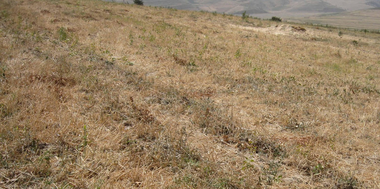
Contour plowed wheat crop after harvest (Malgorzata Conder)

Current wheat crop in rotation with chickpea cultivation (Tajikistan)

Description

Current wheat crop in yearly rotation with chickpea cultivation

The rainfed crop of the farmer sizes around a hectare. He owns the crop since seven years and switches between chickpea and wheat every year. When he started to cultivate, soil properties were good, he did not use fertilizer. Because of the years of ploughing, the soil lost nutrients and moisture. The more rill building and slope instability is severe currently. The plot is over one hectare because it includes a narrow vegetation strip between his and the neighbours crop. The plot, as all the other crops are grazed by livestock, after harvest.

Purpose of the Technology: Chickpea cropping generates a satisfactory yield, whereas wheat production is rather variable and low. Nevertheless the farmer would not change the crop type because the main purpose is to get straw for feeding his cows. The farmer has over three hectares in total. Even though he claims the benefit to be low comparing to the input, he is content as long he can feed his family.

Establishment / maintenance activities and inputs: Ploughing, sowing and then harvesting were part of the establishment phase. The same activities count for maintenance. But as soil is gradually washed away, fertilizing became crucial. The farmer does not control and protect the crop from wild animals and grazing herds.

Natural / human environment: The crop lies on a foot slope not far from the riverbed. Neighbouring cultivations are of the same crop type, chickpea, wheat and food grain. It is less than one kilometre away from the farmers home in Doshmand village. Access to services is rather low, especially in winter, because of the bad condition of the road. Doctor, middle and higher school grades and market are in the village below.

Location

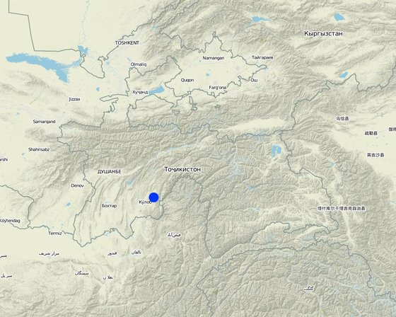
Location: Muminabad, Khatlon, Tajikistan, Tajikistan

No. of Technology sites analysed:

Geo-reference of selected sites
  • 70.01563, 38.01269

Spread of the Technology: evenly spread over an area (approx. < 0.1 km2 (10 ha))

Date of implementation:

Type of introduction
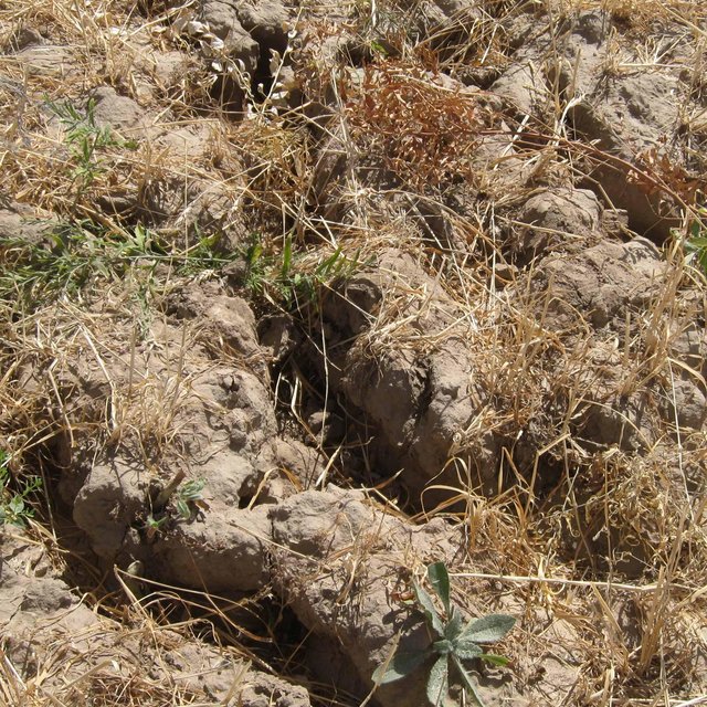
Rill building on the wheat crop (Malgorzata Conder)

Classification of the Technology

Main purpose
  • improve production
  • reduce, prevent, restore land degradation
  • conserve ecosystem
  • protect a watershed/ downstream areas – in combination with other Technologies
  • preserve/ improve biodiversity
  • reduce risk of disasters
  • adapt to climate change/ extremes and its impacts
  • mitigate climate change and its impacts
  • create beneficial economic impact
  • create beneficial social impact
Land use

  • Cropland - Annual cropping
    Main crops (cash and food crops): Major food crop: Wheat chickpea, wheat and food grain
Water supply
  • rainfed
  • mixed rainfed-irrigated
  • full irrigation

Number of growing seasons per year: 1
Land use before implementation of the Technology: n.a.
Livestock density: n.a.
Purpose related to land degradation
  • prevent land degradation
  • reduce land degradation
  • restore/ rehabilitate severely degraded land
  • adapt to land degradation
  • not applicable
Degradation addressed
  • soil erosion by water - Wt: loss of topsoil/ surface erosion, Wg: gully erosion/ gullying
  • chemical soil deterioration - Cn: fertility decline and reduced organic matter content (not caused by erosion)
  • physical soil deterioration - Pk: slaking and crusting
  • water degradation - Hs: change in quantity of surface water
SLM group
  • rotational systems (crop rotation, fallows, shifting cultivation)
SLM measures

Technical drawing

Technical specifications
Contour lined plot, with a vegetation strip of < 1m width, between this and the underneath plot. A lot of rills visible.

Location: Doshmand, Chukurak Watershed. Muminabad, Khatlon, Tajikistan

Main technical functions: control of concentrated runoff: drain / divert, improvement of surface structure (crusting, sealing), stabilisation of soil (eg by tree roots against land slides), increase in organic matter, increase of infiltration

Secondary technical functions: control of concentrated runoff: impede / retard, improvement of ground cover, increase of surface roughness, improvement of topsoil structure (compaction), improvement of subsoil structure (hardpan), increase in nutrient availability (supply, recycling,…), increase / maintain water stored in soil

Establishment and maintenance: activities, inputs and costs

Calculation of inputs and costs
  • Costs are calculated:
  • Currency used for cost calculation: Somoni
  • Exchange rate (to USD): 1 USD = 4.83 Somoni
  • Average wage cost of hired labour per day: 12.40
Most important factors affecting the costs
Establishment and maintenance cost are similar. Agricultural inputs as seeds and fertilizer are the highest expenditures. As soil nutrients are washed out, the fertilizer input rises gradually.
Establishment activities
n.a.
Establishment inputs and costs
Specify input Unit Quantity Costs per Unit (Somoni) Total costs per input (Somoni) % of costs borne by land users
Labour
Sowing Person days 0.25 12.4 3.1 100.0
Applying fertilizer Person days 0.25 12.4 3.1 100.0
Cutting wheat Person days 18.0 12.422 223.6 100.0
Plowing Person days 0.4375 12.4 5.42 100.0
Equipment
Machine use Hours 3.5 5.914 20.7 100.0
Petrol Liters 40.0 1.1375 45.5 100.0
Plant material
Seeds 150.0 0.414 62.1
Fertilizers and biocides
Fertilizer Bucks 2.0 31.05 62.1 100.0
Total costs for establishment of the Technology 425.62
Maintenance activities
  1. Plowing, 3.5 hours, 1 person (Timing/ frequency: every year, spring)
  2. Sowing wheat, 1 hour, 2 persons (Timing/ frequency: every year, spring)
  3. Applying fertilizer (not in the first year), 1 hour, 2 persons (Timing/ frequency: only once a year in spring, more year by year)
  4. Cutting wheat, 6 days (à 8 hours), 3 persons (Timing/ frequency: once a year, around semptember)

Natural environment

Average annual rainfall
  • < 250 mm
  • 251-500 mm
  • 501-750 mm
  • 751-1,000 mm
  • 1,001-1,500 mm
  • 1,501-2,000 mm
  • 2,001-3,000 mm
  • 3,001-4,000 mm
  • > 4,000 mm
Agro-climatic zone
  • humid
  • sub-humid
  • semi-arid
  • arid
Specifications on climate
Totally 800 mm: 700mm in winter-spring, July-Sept dry season
Thermal climate class: temperate, LPG from end of March until September
Slope
  • flat (0-2%)
  • gentle (3-5%)
  • moderate (6-10%)
  • rolling (11-15%)
  • hilly (16-30%)
  • steep (31-60%)
  • very steep (>60%)
Landforms
  • plateau/plains
  • ridges
  • mountain slopes
  • hill slopes
  • footslopes
  • valley floors
Altitude
  • 0-100 m a.s.l.
  • 101-500 m a.s.l.
  • 501-1,000 m a.s.l.
  • 1,001-1,500 m a.s.l.
  • 1,501-2,000 m a.s.l.
  • 2,001-2,500 m a.s.l.
  • 2,501-3,000 m a.s.l.
  • 3,001-4,000 m a.s.l.
  • > 4,000 m a.s.l.
Technology is applied in
  • convex situations
  • concave situations
  • not relevant
Soil depth
  • very shallow (0-20 cm)
  • shallow (21-50 cm)
  • moderately deep (51-80 cm)
  • deep (81-120 cm)
  • very deep (> 120 cm)
Soil texture (topsoil)
  • coarse/ light (sandy)
  • medium (loamy, silty)
  • fine/ heavy (clay)
Soil texture (> 20 cm below surface)
  • coarse/ light (sandy)
  • medium (loamy, silty)
  • fine/ heavy (clay)
Topsoil organic matter content
  • high (>3%)
  • medium (1-3%)
  • low (<1%)
Groundwater table
  • on surface
  • < 5 m
  • 5-50 m
  • > 50 m
Availability of surface water
  • excess
  • good
  • medium
  • poor/ none
Water quality (untreated)
  • good drinking water
  • poor drinking water (treatment required)
  • for agricultural use only (irrigation)
  • unusable
Is salinity a problem?
  • Yes
  • No

Occurrence of flooding
  • Yes
  • No
Species diversity
  • high
  • medium
  • low
Habitat diversity
  • high
  • medium
  • low

Characteristics of land users applying the Technology

Market orientation
  • subsistence (self-supply)
  • mixed (subsistence/ commercial
  • commercial/ market
Off-farm income
  • less than 10% of all income
  • 10-50% of all income
  • > 50% of all income
Relative level of wealth
  • very poor
  • poor
  • average
  • rich
  • very rich
Level of mechanization
  • manual work
  • animal traction
  • mechanized/ motorized
Sedentary or nomadic
  • Sedentary
  • Semi-nomadic
  • Nomadic
Individuals or groups
  • individual/ household
  • groups/ community
  • cooperative
  • employee (company, government)
Gender
  • women
  • men
Age
  • children
  • youth
  • middle-aged
  • elderly
Area used per household
  • < 0.5 ha
  • 0.5-1 ha
  • 1-2 ha
  • 2-5 ha
  • 5-15 ha
  • 15-50 ha
  • 50-100 ha
  • 100-500 ha
  • 500-1,000 ha
  • 1,000-10,000 ha
  • > 10,000 ha
Scale
  • small-scale
  • medium-scale
  • large-scale
Land ownership
  • state
  • company
  • communal/ village
  • group
  • individual, not titled
  • individual, titled
Land use rights
  • open access (unorganized)
  • communal (organized)
  • leased
  • individual
Water use rights
  • open access (unorganized)
  • communal (organized)
  • leased
  • individual
Access to services and infrastructure
health

poor
x
good
education

poor
x
good
technical assistance

poor
x
good
employment (e.g. off-farm)

poor
x
good
markets

poor
x
good
energy

poor
x
good
roads and transport

poor
x
good
drinking water and sanitation

poor
x
good
financial services

poor
x
good

Impacts

Socio-economic impacts
Crop production
decreased
x
increased

risk of production failure
increased
x
decreased

expenses on agricultural inputs
increased
x
decreased


demand on fertilizers is increasing

farm income
decreased
x
increased


gradually increasing

Socio-cultural impacts
food security/ self-sufficiency
reduced
x
improved


Only on long term according to the farmer

Ecological impacts
surface runoff
increased
x
decreased


Many rills

soil moisture
decreased
x
increased

soil cover
reduced
x
improved

soil crusting/ sealing
increased
x
reduced

soil compaction
increased
x
reduced

soil organic matter/ below ground C
decreased
x
increased

wind velocity
increased
x
decreased

Off-site impacts
downstream flooding (undesired)
increased
x
reduced

buffering/ filtering capacity (by soil, vegetation, wetlands)
reduced
x
improved

Cost-benefit analysis

Benefits compared with establishment costs
Benefits compared with maintenance costs
Farmer knows that there is no real benefit when looking at the input. Over the years it got slightly negative because more fertilizer is needed and yield is decreasing.

Climate change

Gradual climate change
annual temperature increase

not well at all
x
very well
Climate-related extremes (disasters)
local rainstorm

not well at all
x
very well
local windstorm

not well at all
very well
Answer: not known
drought

not well at all
x
very well
general (river) flood

not well at all
x
very well
Other climate-related consequences
reduced growing period

not well at all
very well
Answer: not known

Adoption and adaptation

Percentage of land users in the area who have adopted the Technology
  • single cases/ experimental
  • 1-10%
  • 10-50%
  • more than 50%
Of all those who have adopted the Technology, how many have done so without receiving material incentives?
  • 0-10%
  • 10-50%
  • 50-90%
  • 90-100%
Has the Technology been modified recently to adapt to changing conditions?
  • Yes
  • No
To which changing conditions?
  • climatic change/ extremes
  • changing markets
  • labour availability (e.g. due to migration)

Conclusions and lessons learnt

Strengths: land user's view
Strengths: compiler’s or other key resource person’s view
  • Vegetation strip underneath the crop is an idea to develop as it reduces the negative offsite effects.

    How can they be sustained / enhanced? Knowledge transfer about how to reduce offsite effects. Soil cover could rise in that strip, thanks do what soil erosion woul be stopped. Enhance communication between above and below vegetation strip cultivating farmers.
  • Maintain and develop crop rotation.

    How can they be sustained / enhanced? Knowledge transfer and field studies on other plots with crop rotation (e.g. perennial crops).
  • Plowing horizontally.
Weaknesses/ disadvantages/ risks: land user's viewhow to overcome
Weaknesses/ disadvantages/ risks: compiler’s or other key resource person’s viewhow to overcome
  • Too much soil erosion causes rills. Another crop type according to the steepness of the plot. Change plowing deepness or do human-powered tillage.
  • Development of soil crust, sealing and hardpan. Enhance crop rotation and "soft" and horizontal tillage practices.
  • Observed trampling and grazing of the plot. Guarding or fencing of the plot. Guarding could be organized by several farmers in rotation.
  • Poor pecentage of organic matter. Introduce mulching.

References

Compiler
  • Malgorzata Conder
Editors
Reviewer
  • Fabian Ottiger
  • Alexandra Gavilano
Date of documentation: Jan. 17, 2013
Last update: Aug. 4, 2019
Resource persons
Full description in the WOCAT database
Linked SLM data
Documentation was faciliated by
Institution Project
This work is licensed under Creative Commons Attribution-NonCommercial-ShareaAlike 4.0 International