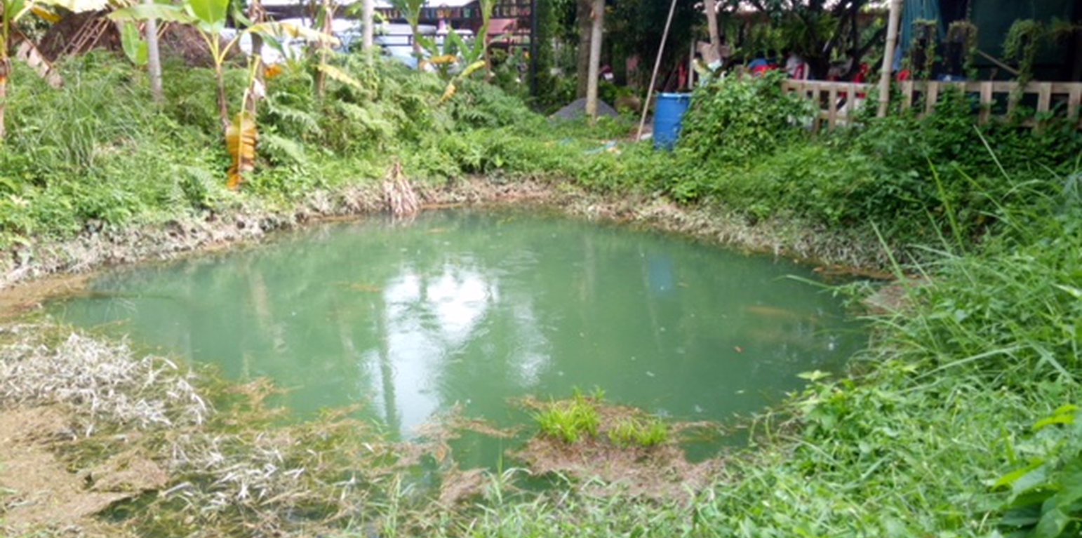
Water storage pond in small-scale agricultural areas (Ms. Munthana Suriyawongpongsa)
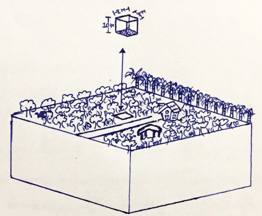
A water storage facility or "Bo Bao Kanomkrok" is a pond excavated as a source of water for agricultural purposes in the dry season. It is dug in a form of rectangle to store water during the rains and thus to prevent water from drying up in the area. It increases agricultural activities in the dry season. Bo Bao Kanomkrok is excavated in a farmer's agricultural land to a dimension of 8 meters wide, 8 meters long and 10 meters deep. It has a capacity of 640 m3 which is appropriate for an agricultural area of about 6 rai. Water in the storage "bank" is available through the dry season. To establish it, the pond is dug vertically with no side-slopes. After the pond is completed, muddy soil is coated around the bottom and sides to prevent water from seeping out. Plants are grown around the edge of the pond to prevent collapse. Therefore, Bo Bao Kanomkrok is an appropriate low cost option for providing stored water to crops on a small-scale. It is a good prototype for extending to other agricultural plots in the community and adjacent communities. In the small-scale agricultural areas there are fruit-bearing trees, perennial crops and vegetables such as sweet yellow marian plums, durians, santols, hairy-leafed apitongs, Barking Deer's Mango, hedge bamboo, Paco fern, bananas, Garcinia cowa, Brazilian Pepper-tree, etc. Bo Bao Kanomkrok must be maintained by the owner so that it will be efficient in storing water throughout the year.
Ban Thung Krapong Learning Center, Nakhon Nayok province is the prototype for communities to learning to solve problems by themselves, by studying from nature and the environment in the community.
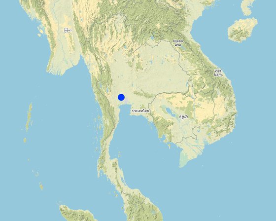
Location: Ban Thung Krapong Learning Center, Nakhon Nayok province, Nakhon Nayok, Thailand
No. of Technology sites analysed: single site
Spread of the Technology: evenly spread over an area (approx. 1-10 km2)
In a permanently protected area?:
Date of implementation: 87; 10-50 years ago
Type of introduction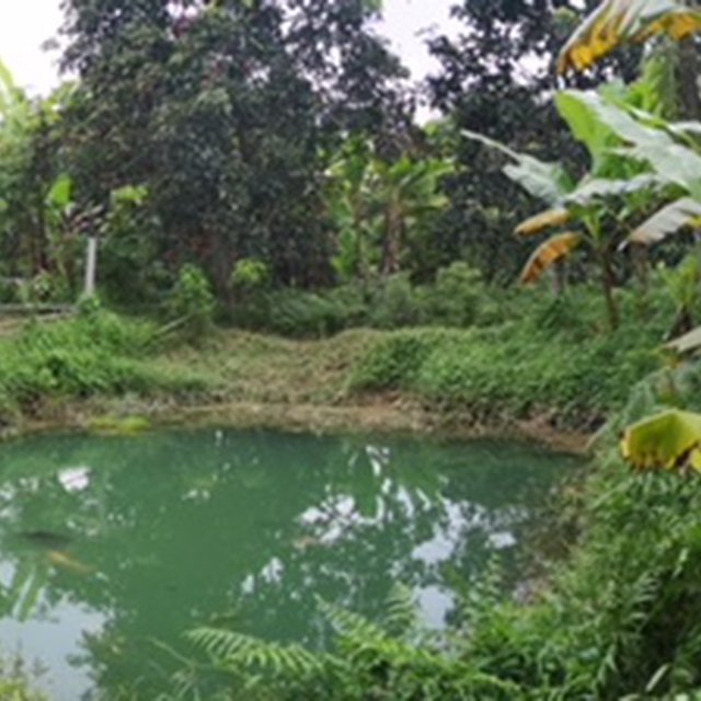


| Specify input | Unit | Quantity | Costs per Unit (n.a.) | Total costs per input (n.a.) | % of costs borne by land users |
| Labour | |||||
| labour cost for digging sediments out from well | head | 4.0 | 300.0 | 1200.0 | 100.0 |
| Labour for driving Backhoe | hours | 3.0 | 1200.0 | 3600.0 | 100.0 |
| Total costs for establishment of the Technology | 4'800.0 | ||||
| Total costs for establishment of the Technology in USD | 150.0 | ||||
| Specify input | Unit | Quantity | Costs per Unit (n.a.) | Total costs per input (n.a.) | % of costs borne by land users |
| Equipment | |||||
| Backhoe | hour | 1.0 | 1200.0 | 1200.0 | 100.0 |
| Total costs for maintenance of the Technology | 1'200.0 | ||||
| Total costs for maintenance of the Technology in USD | 37.5 | ||||
more diversity of plants
area of plants increases
easier soil management


