-

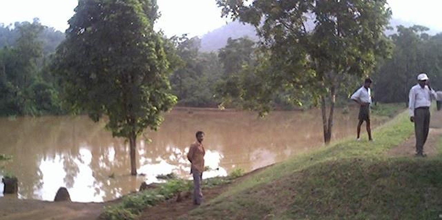
Dug-out sunken pond cum countour bund (India)

Buda Gata with Adibandha

Description

It can be defined as combination of structural & vegetative measures where contour bunds are constructed from the excavated sandy loam soil of cultivated wastelands in semi-arid climatic(?) zone with moderate slope in medium soil depth conditions in order to link with self-subsistance & market oriented production systems from private lands.

The area is located at the foot-slopes & hill slopes area where run-off is at peaks very often at the time of rainy season. Therefore, sand casting came as a first order priorities by the farmers of this patch. At the outset, a livelihood focused micro-plan had been prepared by the villagers stating the details of the base-line data along with problems & alternative solutions. The patch was identified to be the worst affected, concentraton of poor people (defined by villagers), people of this patch ready to contibute at least 20% of the cost. In the mean time project sent the PIA to BAIF, Bangalore to study the linking of farm ponds & its relevance in this context of our situation. As a demonstration, PIA & other technical team facilitated the villagers. One water harvesting structure was constructed by line deptt of soil conservation just at the down hills to harvest rain water & protect the lands below from sand casting. But there were no alternatives for the land users of that patch about the optimum utilisation recharged water. The surrounding area was totally unbunded with sandy loam soil. Therefore, land users are of opinion to go fo field bunding. Earlier the practice was to dig a trench at upper gadient & put a bund below it out of the excavated soil from trench. But the requirement of land users was to get some water in each farmers land to protect the Kharif & some early rabi crop.(june-dec). By which the lands where, farmers take up only minor millets for their subsistance, that too less production & land So the main purpose of this technology was to convert the land into bunded lands along with to fetch some water at the time of dry spell in between the monsoon period. A four days in field training was conducted by the project to community link workers(SWC), particularly on patch treatment, use of levelling instruments like A-frame, proper planning, design, lay-out of different type of structure in a map & ground. After many rounds of discussion with the land users, one of them ( rich farmers with more land) was ready to do it in his own land. But, the SWC specialist did a detail transact along with land users, although results of first round tansact was mentioned in the micro-plan. The main pupose was to looking at problems & demarkating on the map. After that estimate was prepared & lay-out of key contour was done by SWC specialist with the help of community link workers & land users. The work was implemented by by the labourers with the supervision of the respective User's group leade & monitoring was done by the SWC specialist. The prioty ranking by the land users vegetaive measures like vertiver & Sabai (grass plantation on the bund along the side of the bund. For that, the necessary requirement like nursery, seedling collection was done by agriculture specialist. Training was conducted on the probable alternatives of agronomic measures like taking of crop which is of little longer duration, intercrops & cash crops etc. The vegetaive & structructural measures are subsidised by the project & the agronomic measures was taken up on loan basis. The development fund was also generated out of contribution from the land users which was deposited in a separate account for future maintainance cost.
Location

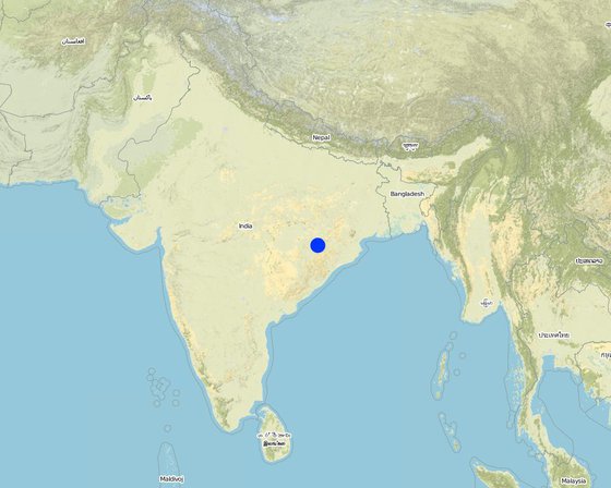
Location: Khaparakhol, Orissa, India

No. of Technology sites analysed:

Geo-reference of selected sites
  • 83.8132, 21.0511

Spread of the Technology: evenly spread over an area (0.7 km²)

In a permanently protected area?:

Date of implementation: less than 10 years ago (recently)

Type of introduction
-
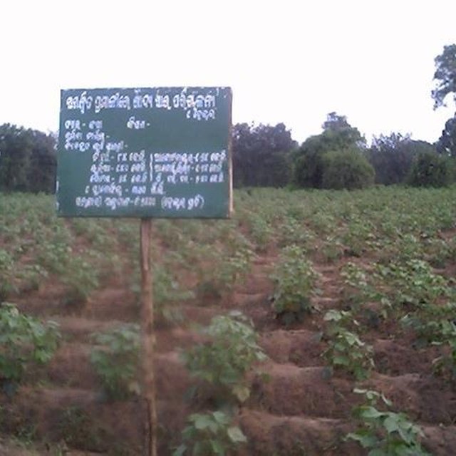
COTTON

Classification of the Technology

Main purpose
  • improve production
  • reduce, prevent, restore land degradation
  • conserve ecosystem
  • protect a watershed/ downstream areas – in combination with other Technologies
  • preserve/ improve biodiversity
  • reduce risk of disasters
  • adapt to climate change/ extremes and its impacts
  • mitigate climate change and its impacts
  • create beneficial economic impact
  • create beneficial social impact
Land use
Land use mixed within the same land unit: Yes - Agro-silvopastoralism

  • Cropland
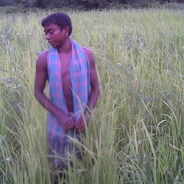
    • Annual cropping: cereals - millet, cereals - rice (upland), fibre crops - cotton, oilseed crops - groundnuts, rice
    • Tree and shrub cropping: mango, mangosteen, guava, pome fruits (apples, pears, quinces, etc.)
    Number of growing seasons per year: 2
  • Grazing land

Water supply
  • rainfed
  • mixed rainfed-irrigated
  • full irrigation

Purpose related to land degradation
  • prevent land degradation
  • reduce land degradation
  • restore/ rehabilitate severely degraded land
  • adapt to land degradation
  • not applicable
Degradation addressed
  • soil erosion by water - Wt: loss of topsoil/ surface erosion, Wg: gully erosion/ gullying, Wm: mass movements/ landslides, Wo: offsite degradation effects
SLM group
  • cross-slope measure
  • water harvesting
SLM measures
  • vegetative measures -
  • structural measures -

Technical drawing

Technical specifications

Establishment and maintenance: activities, inputs and costs

Calculation of inputs and costs
  • Costs are calculated:
  • Currency used for cost calculation: Rupee
  • Exchange rate (to USD): 1 USD = 50.0 Rupee
  • Average wage cost of hired labour per day: n.a
Most important factors affecting the costs
Soil depth is very less, hard soil with slope variation because of undulating lands. The labour was also not sufficiently available at the time of establishment, because the work was implemented at time of main growing season. At that time land users are busy in their own field because of cultivation work.
Establishment activities
  1. Survey & alignment of key Contour & lay-out of tanks (Timing/ frequency: Beginning of rainy season)
  2. Digging of pits for grass, fruit plants & timber (Timing/ frequency: June)
  3. Collection of Vertiver & Sabai grass from external source (Timing/ frequency: july)
  4. Collection of seedling of Trees/Plants (Timing/ frequency: July)
  5. Survey & contour demarkation (Timing/ frequency: April-May)
  6. Demarkation on map (Timing/ frequency: April-May)
  7. Estimate & lay-Out (Timing/ frequency: April-May)
  8. Implementation of work (Timing/ frequency: June)
  9. Survey & Key Contour line demarkation at 75 ft interval (Timing/ frequency: June)
  10. Digging of Sunken ponds (Timing/ frequency: July)
  11. Top level dressing of bund (Timing/ frequency: July)
  12. Water-way with connection Dug-out sunken ponds (Timing/ frequency: August)
Establishment inputs and costs
Specify input Unit Quantity Costs per Unit (Rupee) Total costs per input (Rupee) % of costs borne by land users
Labour
Labour ha 1.0 90.0 90.0 20.0
Equipment
Animal traction ha 1.0 5.0 5.0 20.0
Plant material
Seedlings ha 1.0 25.0 25.0
Total costs for establishment of the Technology 120.0
Total costs for establishment of the Technology in USD 2.4
Maintenance activities
  1. Ploughing (Timing/ frequency: April-May / annual)
  2. Intercultural operation with manure application (Timing/ frequency: June / annual)
  3. Sowing (Timing/ frequency: July & sep for two crops / each cropping season)
  4. weeding & intercultural operation, if required. (Timing/ frequency: July / annual)
  5. Harvesting of paddy or minor millets or ground nut (Timing/ frequency: Aug-sep / annual)
  6. Sowing of pulses as relay crop (Timing/ frequency: Aug-sep / each cropping season)
  7. Harvesting of pulses (Timing/ frequency: Nov-Dec / each cropping season)
  8. Collapsing of bunds may damage th evegetation (Timing/ frequency: Rainy Season /annual)
  9. Checking against free grazing (Timing/ frequency: Jan-June /)
  10. Watering to plants (Timing/ frequency: Dec-May /annual)
  11. Management of surplus water (Timing/ frequency: Rainy Season/Once in Year)
  12. Collapsing of bund (Timing/ frequency: None)
  13. Tanks must be desilted (Timing/ frequency: Dry season/Once in Year)
  14. Control of surplus water-flow (Timing/ frequency: Rainy season / once a year)
  15. Stabilisation of bund at weak points (Timing/ frequency: August / once a year)
  16. Desiltation of ponds (Timing/ frequency: None)
Maintenance inputs and costs
Specify input Unit Quantity Costs per Unit (Rupee) Total costs per input (Rupee) % of costs borne by land users
Labour
Labour ha 1.0 4.0 4.0 100.0
Plant material
Seedlings ha 1.0 3.0 3.0 100.0
Total costs for maintenance of the Technology 7.0
Total costs for maintenance of the Technology in USD 0.14

Natural environment

Average annual rainfall
  • < 250 mm
  • 251-500 mm
  • 501-750 mm
  • 751-1,000 mm
  • 1,001-1,500 mm
  • 1,501-2,000 mm
  • 2,001-3,000 mm
  • 3,001-4,000 mm
  • > 4,000 mm
Agro-climatic zone
  • humid
  • sub-humid
  • semi-arid
  • arid
Specifications on climate
1000-1500 mm: Ranked 1, Avg rainfall from liz kiff report. The study of 20 years of rainfall data shows that, drought comes in every alternative 3 years. The rainfall varies from a minimum of 715.6 mm to maximum of 1863 mm
500-750 mm: Ranked 2
1500-2000 mm: Ranked 3
Slope
  • flat (0-2%)
  • gentle (3-5%)
  • moderate (6-10%)
  • rolling (11-15%)
  • hilly (16-30%)
  • steep (31-60%)
  • very steep (>60%)
Landforms
  • plateau/plains
  • ridges
  • mountain slopes
  • hill slopes
  • footslopes
  • valley floors
Altitude
  • 0-100 m a.s.l.
  • 101-500 m a.s.l.
  • 501-1,000 m a.s.l.
  • 1,001-1,500 m a.s.l.
  • 1,501-2,000 m a.s.l.
  • 2,001-2,500 m a.s.l.
  • 2,501-3,000 m a.s.l.
  • 3,001-4,000 m a.s.l.
  • > 4,000 m a.s.l.
Technology is applied in
  • convex situations
  • concave situations
  • not relevant
Soil depth
  • very shallow (0-20 cm)
  • shallow (21-50 cm)
  • moderately deep (51-80 cm)
  • deep (81-120 cm)
  • very deep (> 120 cm)
Soil texture (topsoil)
  • coarse/ light (sandy)
  • medium (loamy, silty)
  • fine/ heavy (clay)
Soil texture (> 20 cm below surface)
  • coarse/ light (sandy)
  • medium (loamy, silty)
  • fine/ heavy (clay)
Topsoil organic matter content
  • high (>3%)
  • medium (1-3%)
  • low (<1%)
Groundwater table
  • on surface
  • < 5 m
  • 5-50 m
  • > 50 m
Availability of surface water
  • excess
  • good
  • medium
  • poor/ none
Water quality (untreated)
  • good drinking water
  • poor drinking water (treatment required)
  • for agricultural use only (irrigation)
  • unusable
Is salinity a problem?
  • Yes
  • No

Occurrence of flooding
  • Yes
  • No
Species diversity
  • high
  • medium
  • low
Habitat diversity
  • high
  • medium
  • low

Characteristics of land users applying the Technology

Market orientation
  • subsistence (self-supply)
  • mixed (subsistence/ commercial)
  • commercial/ market
Off-farm income
  • less than 10% of all income
  • 10-50% of all income
  • > 50% of all income
Relative level of wealth
  • very poor
  • poor
  • average
  • rich
  • very rich
Level of mechanization
  • manual work
  • animal traction
  • mechanized/ motorized
Sedentary or nomadic
  • Sedentary
  • Semi-nomadic
  • Nomadic
Individuals or groups
  • individual/ household
  • groups/ community
  • cooperative
  • employee (company, government)
Gender
  • women
  • men
Age
  • children
  • youth
  • middle-aged
  • elderly
Area used per household
  • < 0.5 ha
  • 0.5-1 ha
  • 1-2 ha
  • 2-5 ha
  • 5-15 ha
  • 15-50 ha
  • 50-100 ha
  • 100-500 ha
  • 500-1,000 ha
  • 1,000-10,000 ha
  • > 10,000 ha
Scale
  • small-scale
  • medium-scale
  • large-scale
Land ownership
  • state
  • company
  • communal/ village
  • group
  • individual, not titled
  • individual, titled
Land use rights
  • open access (unorganized)
  • communal (organized)
  • leased
  • individual
Water use rights
  • open access (unorganized)
  • communal (organized)
  • leased
  • individual
Access to services and infrastructure

Impacts

Socio-economic impacts
Crop production
decreased
increased


Per hac production/economic cost.

fodder production
decreased
increased


Vertiver as fodder on bund.

fodder quality
decreased
increased


Vertiver as fodder on bund.

wood production
decreased
increased


Teak plants has been planted this year. The yeild is yet to come.

production area (new land under cultivation/ use)
decreased
increased


Land users believe that some land is wastage due the structure.

land management
hindered
simplified


Ploughing operation.

farm income
decreased
increased


Resource rich & resource poor land users accrued double benefit by changing the crop.

diversity of income sources
decreased
increased


Farm employment at lean period. Income through labour

Field Demonstration- living institution
decreased
increased


Alternatives to mitigate drought.

Socio-cultural impacts
community institutions
weakened
strengthened


Contribution labour from land users because of convincing benefit from the technology. The women also contributed in plantation activities.

national institutions
weakened
strengthened


Members from other areas of district also learnt the technology through exposure visit.

SLM/ land degradation knowledge
reduced
improved


Some of the land users of other patch of the village decided to take up similar activity.

situation of socially and economically disadvantaged groups (gender, age, status, ehtnicity etc.)
worsened
improved


Land users having land below 1 hac are getting more benefit out this technology.

Ecological impacts
surface runoff
increased
decreased

Quantity before SLM: 50
Quantity after SLM: 10

excess water drainage
reduced
improved


Earthen hume pipes.

soil moisture
decreased
increased


This condition help the land users to take up second crop.

soil cover
reduced
improved


Particularly top-soil.

soil loss
increased
decreased

Quantity before SLM: 30
Quantity after SLM: 20

plant diversity
decreased
increased

animal diversity
decreased
increased

habitat diversity
decreased
increased

Soil fertility
decreased
increased


Production/ Economic benefit becomes double.

Water availability in dry spell
decreased
increased

Off-site impacts
reliable and stable stream flows in dry season (incl. low flows)
reduced
increased

downstream flooding (undesired)
increased
reduced

downstream siltation
increased
decreased

Cost-benefit analysis

Benefits compared with establishment costs
Short-term returns
very negative
very positive

Long-term returns
very negative
very positive

Benefits compared with maintenance costs
Short-term returns
very negative
very positive

Long-term returns
very negative
very positive

Climate change

-

Adoption and adaptation

Percentage of land users in the area who have adopted the Technology
  • single cases/ experimental
  • 1-10%
  • 11-50%
  • > 50%
Of all those who have adopted the Technology, how many have done so without receiving material incentives?
  • 0-10%
  • 11-50%
  • 51-90%
  • 91-100%
Number of households and/ or area covered
19
Has the Technology been modified recently to adapt to changing conditions?
  • Yes
  • No
To which changing conditions?
  • climatic change/ extremes
  • changing markets
  • labour availability (e.g. due to migration)

Conclusions and lessons learnt

Strengths: land user's view
  • Maintainance is very less

    How can they be sustained / enhanced? Only timely care is needed.
  • Land users can have water in their field other than rain water to be used for different purpose.

    How can they be sustained / enhanced? Some demos agriculture was done in this patch which has to be repeated for the second year for confidence building of the land users.
Strengths: compiler’s or other key resource person’s view
  • Water availability in the dry spell

    How can they be sustained / enhanced? If the land users will desilt the pond timely & care to plants grass on the bund.
  • The land where only one crop is possible, vegetable & pulse crop can be taken up as second crop

    How can they be sustained / enhanced? Some methodology is to be applied to keep water in the pond for longer duration.
Weaknesses/ disadvantages/ risks: land user's viewhow to overcome
  • Ploughing operation will be difficult. This is although difficult but th benefit is more, therefore land users will compromise with this type of difficulty.
  • Water availability in dry period & desiltaion process. This can be overcomed by planting vertiver on the sides of the pond & low cost polythene can be used for prolonging percolation rate of water in sandy loam soil.
Weaknesses/ disadvantages/ risks: compiler’s or other key resource person’s viewhow to overcome
  • The farmers started taking up cotton & paddy in stead of minor millets Improved variety of minor millets is supplied to farmers for better yield in comparison to country variety.
  • Diversion of surplus water The land users have to dig atleast one more feet & earthen pipes will be used for the diversion of surplus water.

References

Compiler
  • Unknown User
Editors
Reviewer
  • Fabian Ottiger
  • Alexandra Gavilano
Date of documentation: June 3, 2011
Last update: April 4, 2019
Resource persons
Full description in the WOCAT database
Linked SLM data
Documentation was faciliated by
Institution Project
This work is licensed under Creative Commons Attribution-NonCommercial-ShareaAlike 4.0 International