Strip tillage wheat production in degraded terraces of High Barind Tract, Rajshahi (Md. Mutasim Billah)

Strip tillage wheat production in degraded terraces of High Barind Tract, Rajshahi (Bangladesh)

Barendra Bhumite sarite gom abad

Description

Strip tillage wheat cultivation is a climate-smart technology to save water and improve soil health

The High Barind Tract (HBT) situated in north-western region of Bangladesh consisting Rajshahi, Chapai Nawabganj and Naogaon Districts where the underlying Madhupur clay soil has been uplifted and cut into by deep valleys. The topsoil of HBT is grey silt loam to silty clay loam, is strongly puddled and has a compact ploughpan at the base. Deep grey terrace soils and grey valley soil are the major components of the general soil types of this area.

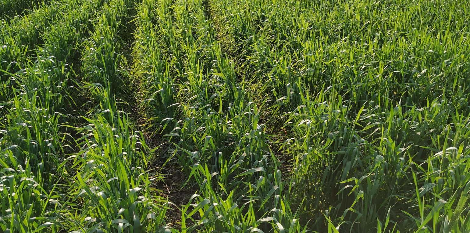
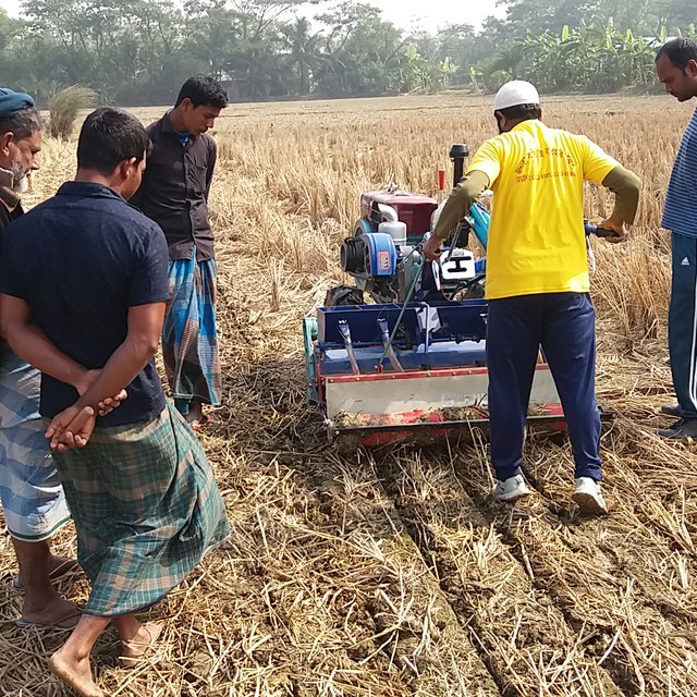
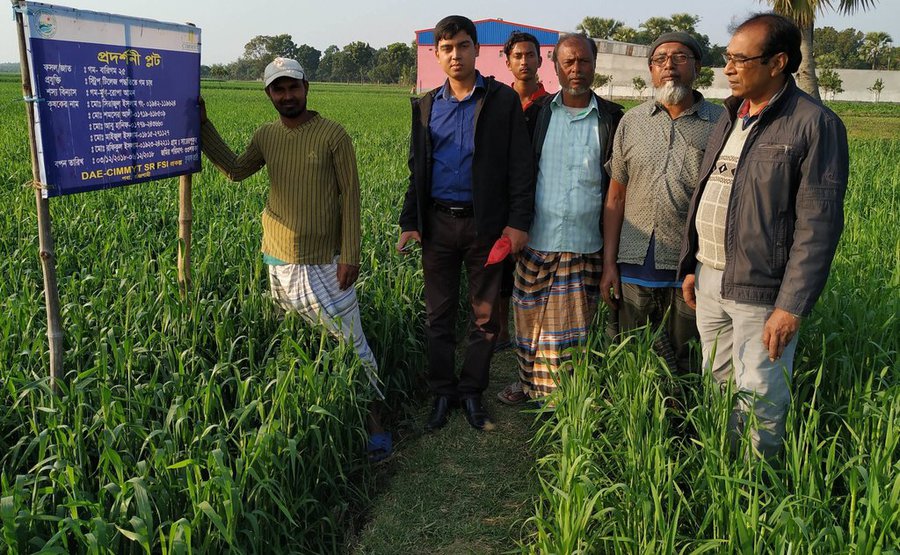
Strip tillage wheat cultivation is being adopted in farmers field on which wheat has been cultivated for decades. Bangladesh Agricultural Research Institute (BARI) developed this technology/innovation, and Department of Agricultural Extension (DAE) and International Maize and Wheat Improvement Center (CIMMYT) disseminated the technology also among farmers of Rajshahi region. In brief, strip tillage wheat is a water saving technology, and requires wheat to be planted in rows. Traditionally, farmers cultivated wheat using the broadcast method, after deep tilling the land 3-4 times and after flood irrigation. In this new method, farmers can use a strip tiller that sows seeds and fertilizer simultaneously immediately after T. Aman rice (Transplanted rice, Aman is the Kharif 2 season from June to November) harvesting. This implies that retained soil moisture can germinate the wheat seeds. Because the wheat seeds are sown in a row, sunlight and air penetrate very well; and weed infestation remains low because of minimum tillage. Farmers report that rodent infestation in strip tillage is lower than conventional broadcast cultivation.

As stated, a strip tiller is needed for this operation, and the machine is a modified version of traditional power tiller developed by BARI. The tiller has thin ploughs in parallel rows (four to a machine), and drops the fertilizer and seed – another wheel-like device presses the seed into the soil. The other parts of land remain unplowed that keep moisture and resist weeds to grow. Retention of rice crop residue increases soil organic matter which in turn increases the soil water retention/holding capacity and loosens the soil (for free drainage).

Overall, this water saving technology has increased livelihood options for tiller machine service providers, decreased on-farm input costs (e.g., irrigation, rodenticide), and increased wheat productivity (by improve weather – storm/wind – resistance of crops and reducing rodent infestation). Moreover, it produces quality wheat, increases the grain weight, and makes wheat easy to harvest. The yield of strip cultivated wheat is reported to be 1.25 times higher than conventional wheat.

Location

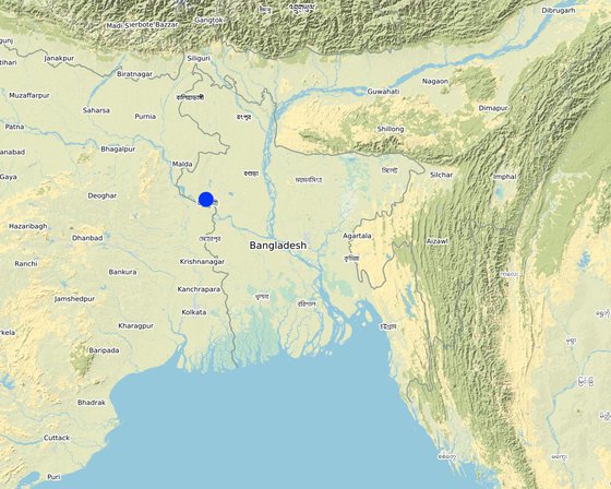
Location: Paba, Rajshahi, Bangladesh

No. of Technology sites analysed: 2-10 sites

Geo-reference of selected sites
  • 88.56359, 24.43141
  • 88.56299, 24.43363
  • 88.56106, 24.43332
  • 88.56346, 24.43258
  • 88.56123, 24.43223
  • 88.56029, 24.43183
  • 88.56261, 24.42961
  • 88.56172, 24.43111
  • 88.56093, 24.4309
  • 88.562, 24.43031
  • 88.56106, 24.43019
  • 88.56398, 24.43043

Spread of the Technology: evenly spread over an area

In a permanently protected area?: No

Date of implementation: 2016; less than 10 years ago (recently)

Type of introduction
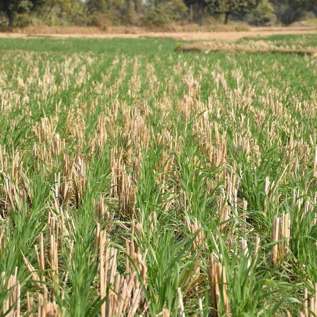
Wheat cultivation with retention of rice straw (Md. Shakhawat Hossain, PhD. Bangladesh Agricultural Research Institute (BARI), Rajshahi)
Machinary for strip tillage wheat cultivation (Md. Shakhawat Hossain, PhD. Bangladesh Agricultural Research Institute (BARI), Rajshahi)

Classification of the Technology

Main purpose
  • improve production
  • reduce, prevent, restore land degradation
  • conserve ecosystem
  • protect a watershed/ downstream areas – in combination with other Technologies
  • preserve/ improve biodiversity
  • reduce risk of disasters
  • adapt to climate change/ extremes and its impacts
  • mitigate climate change and its impacts
  • create beneficial economic impact
  • create beneficial social impact
Land use
Land use mixed within the same land unit: No

  • Cropland
    • Annual cropping: cereals - rice (wetland), cereals - wheat (spring), legumes and pulses - beans, Legume: eg. Mung bean. (T.Aman rice - Wheat - Mung bean)
    Number of growing seasons per year: 3
    Is intercropping practiced? No
    Is crop rotation practiced? Yes
Water supply
  • rainfed
  • mixed rainfed-irrigated
  • full irrigation

Purpose related to land degradation
  • prevent land degradation
  • reduce land degradation
  • restore/ rehabilitate severely degraded land
  • adapt to land degradation
  • not applicable
Degradation addressed
  • soil erosion by water - Wt: loss of topsoil/ surface erosion
  • soil erosion by wind - Et: loss of topsoil
  • chemical soil deterioration - Cn: fertility decline and reduced organic matter content (not caused by erosion)
  • physical soil deterioration - Pc: compaction, Pi: soil sealing, Pw: waterlogging, Ps: subsidence of organic soils, settling of soil
  • biological degradation - Bc: reduction of vegetation cover, Bq: quantity/ biomass decline, Bl: loss of soil life
  • water degradation - Hs: change in quantity of surface water, Hg: change in groundwater/aquifer level, Hp: decline of surface water quality, Hq: decline of groundwater quality
SLM group
  • rotational systems (crop rotation, fallows, shifting cultivation)
  • improved ground/ vegetation cover
  • minimal soil disturbance
SLM measures
  • agronomic measures - A1: Vegetation/ soil cover, A2: Organic matter/ soil fertility, A3: Soil surface treatment (A 3.2: Reduced tillage (> 30% soil cover)), A6: Residue management (A 6.4: retained)
  • structural measures - S1: Terraces
  • management measures - M2: Change of management/ intensity level, M4: Major change in timing of activities

Technical drawing

Technical specifications
Machine and device used: Two wheel drive walking type power tiller and attached strip tiller device
Row to row distance: 20 cm
Plant to plant distance: 5 cm (mainly keep continuous seeding)
Depth of row: 5 cm
Crop residue: paddy straw
Author: Md. Mutasim Billah

Establishment and maintenance: activities, inputs and costs

Calculation of inputs and costs
  • Costs are calculated: per Technology area (size and area unit: Bigha; conversion factor to one hectare: 1 ha = 1 Hectare = 7.48 Bigha)
  • Currency used for cost calculation: USD
  • Exchange rate (to USD): 1 USD = n.a
  • Average wage cost of hired labour per day: USD 4.7
Most important factors affecting the costs
Time of seed sowing: the yield will reduce after 30 November Irrigation: it is critical in tillering and penicle initiation stage, the yield may reduced. The source of irrigation is BMDA deep tubewell and from canal.
Establishment activities
n.a.
Maintenance activities
  1. Herbicide application in field (Timing/ frequency: November - December)
  2. Seed treatment (Timing/ frequency: November - December)
  3. Tillage (Strip) and seed sowing (Timing/ frequency: November - December)
  4. Fertilizer application (Timing/ frequency: November - December)
  5. Irrigation (Timing/ frequency: January - March)
  6. Pesticide application (Timing/ frequency: January - February)
  7. Harvesting (Timing/ frequency: April)
  8. Threshing (Timing/ frequency: April)
Maintenance inputs and costs (per Bigha)
Specify input Unit Quantity Costs per Unit (USD) Total costs per input (USD) % of costs borne by land users
Labour
Herbicide application Person-day 1.0 4.7 4.7 100.0
Harvesting Person-day 5.0 4.7 23.5 100.0
Threshing Person-day 2.0 4.7 9.4 100.0
Equipment
Two wheel strip tiller Rent-Bigha 1.0 5.88 5.88 100.0
Irrigation and its equipment charge Day 3.0 4.11 12.33 100.0
Plant material
Wheat seed Kg 18.0 0.59 10.62 100.0
Fertilizers and biocides
Fertilizer kg 70.0 0.26 18.2 100.0
Herbicide Kg 0.4 4.5 1.8 100.0
Seed treatment chemicals Kg 0.5 4.0 2.0 100.0
Pesticide Kg 3.0 3.26 9.78 100.0
Total costs for maintenance of the Technology 98.21
Total costs for maintenance of the Technology in USD 98.21

Natural environment

Average annual rainfall
  • < 250 mm
  • 251-500 mm
  • 501-750 mm
  • 751-1,000 mm
  • 1,001-1,500 mm
  • 1,501-2,000 mm
  • 2,001-3,000 mm
  • 3,001-4,000 mm
  • > 4,000 mm
Agro-climatic zone
  • humid
  • sub-humid
  • semi-arid
  • arid
Specifications on climate
Average annual rainfall in mm: 1410.0
Average rainfall in High Barind Tract is much lower than other parts of country
Name of the meteorological station: Weather Atlas; {https://www.weather-atlas.com/en/bangladesh/rajshahi-climate#rainfall}
Slope
  • flat (0-2%)
  • gentle (3-5%)
  • moderate (6-10%)
  • rolling (11-15%)
  • hilly (16-30%)
  • steep (31-60%)
  • very steep (>60%)
Landforms
  • plateau/plains
  • ridges
  • mountain slopes
  • hill slopes
  • footslopes
  • valley floors
Altitude
  • 0-100 m a.s.l.
  • 101-500 m a.s.l.
  • 501-1,000 m a.s.l.
  • 1,001-1,500 m a.s.l.
  • 1,501-2,000 m a.s.l.
  • 2,001-2,500 m a.s.l.
  • 2,501-3,000 m a.s.l.
  • 3,001-4,000 m a.s.l.
  • > 4,000 m a.s.l.
Technology is applied in
  • convex situations
  • concave situations
  • not relevant
Soil depth
  • very shallow (0-20 cm)
  • shallow (21-50 cm)
  • moderately deep (51-80 cm)
  • deep (81-120 cm)
  • very deep (> 120 cm)
Soil texture (topsoil)
  • coarse/ light (sandy)
  • medium (loamy, silty)
  • fine/ heavy (clay)
Soil texture (> 20 cm below surface)
  • coarse/ light (sandy)
  • medium (loamy, silty)
  • fine/ heavy (clay)
Topsoil organic matter content
  • high (>3%)
  • medium (1-3%)
  • low (<1%)
Groundwater table
  • on surface
  • < 5 m
  • 5-50 m
  • > 50 m
Availability of surface water
  • excess
  • good
  • medium
  • poor/ none
Water quality (untreated)
  • good drinking water
  • poor drinking water (treatment required)
  • for agricultural use only (irrigation)
  • unusable
Water quality refers to: ground water
Is salinity a problem?
  • Yes
  • No

Occurrence of flooding
  • Yes
  • No
Species diversity
  • high
  • medium
  • low
Habitat diversity
  • high
  • medium
  • low

Characteristics of land users applying the Technology

Market orientation
  • subsistence (self-supply)
  • mixed (subsistence/ commercial)
  • commercial/ market
Off-farm income
  • less than 10% of all income
  • 10-50% of all income
  • > 50% of all income
Relative level of wealth
  • very poor
  • poor
  • average
  • rich
  • very rich
Level of mechanization
  • manual work
  • animal traction
  • mechanized/ motorized
Sedentary or nomadic
  • Sedentary
  • Semi-nomadic
  • Nomadic
Individuals or groups
  • individual/ household
  • groups/ community
  • cooperative
  • employee (company, government)
Gender
  • women
  • men
Age
  • children
  • youth
  • middle-aged
  • elderly
Area used per household
  • < 0.5 ha
  • 0.5-1 ha
  • 1-2 ha
  • 2-5 ha
  • 5-15 ha
  • 15-50 ha
  • 50-100 ha
  • 100-500 ha
  • 500-1,000 ha
  • 1,000-10,000 ha
  • > 10,000 ha
Scale
  • small-scale
  • medium-scale
  • large-scale
Land ownership
  • state
  • company
  • communal/ village
  • group
  • individual, not titled
  • individual, titled
Land use rights
  • open access (unorganized)
  • communal (organized)
  • leased
  • individual
Water use rights
  • open access (unorganized)
  • communal (organized)
  • leased
  • individual
Access to services and infrastructure
health

poor
x
good
education

poor
x
good
technical assistance

poor
x
good
employment (e.g. off-farm)

poor
x
good
markets

poor
x
good
energy

poor
x
good
roads and transport

poor
x
good
drinking water and sanitation

poor
x
good
financial services

poor
x
good

Impacts

Socio-economic impacts
Crop production
decreased
x
increased

crop quality
decreased
x
increased

risk of production failure
increased
x
decreased

production area (new land under cultivation/ use)
decreased
x
increased

land management
hindered
x
simplified

irrigation water availability
decreased
x
increased

demand for irrigation water
increased
x
decreased

expenses on agricultural inputs
increased
x
decreased

farm income
decreased
x
increased

diversity of income sources
decreased
x
increased

workload
increased
x
decreased

Socio-cultural impacts
food security/ self-sufficiency
reduced
x
improved

SLM/ land degradation knowledge
reduced
x
improved

Ecological impacts
water quantity
decreased
x
increased

excess water drainage
reduced
x
improved

groundwater table/ aquifer
lowered
x
recharge

evaporation
increased
x
decreased

soil moisture
decreased
x
increased

soil cover
reduced
x
improved

soil loss
increased
x
decreased

soil crusting/ sealing
increased
x
reduced

soil compaction
increased
x
reduced

nutrient cycling/ recharge
decreased
x
increased

soil organic matter/ below ground C
decreased
x
increased

vegetation cover
decreased
x
increased

biomass/ above ground C
decreased
x
increased

pest/ disease control
decreased
x
increased


Rodent infestation decreased

drought impacts
increased
x
decreased

emission of carbon and greenhouse gases
increased
x
decreased

micro-climate
worsened
x
improved

Off-site impacts
water availability (groundwater, springs)
decreased
x
increased

groundwater/ river pollution
increased
x
reduced

impact of greenhouse gases
increased
x
reduced

Cost-benefit analysis

Benefits compared with establishment costs
Short-term returns
very negative
x
very positive

Long-term returns
very negative
x
very positive

Benefits compared with maintenance costs
Short-term returns
very negative
x
very positive

Long-term returns
very negative
x
very positive

Climate change

Gradual climate change
annual temperature increase

not well at all
x
very well
seasonal temperature increase

not well at all
x
very well
Season: summer
annual rainfall decrease

not well at all
x
very well
seasonal rainfall decrease

not well at all
x
very well
Season: summer
Climate-related extremes (disasters)
tropical storm

not well at all
x
very well
tornado

not well at all
very well
Answer: not known
drought

not well at all
x
very well
insect/ worm infestation

not well at all
x
very well

Adoption and adaptation

Percentage of land users in the area who have adopted the Technology
  • single cases/ experimental
  • 1-10%
  • 11-50%
  • > 50%
Of all those who have adopted the Technology, how many have done so without receiving material incentives?
  • 0-10%
  • 11-50%
  • 51-90%
  • 91-100%
Has the Technology been modified recently to adapt to changing conditions?
  • Yes
  • No
To which changing conditions?
  • climatic change/ extremes
  • changing markets
  • labour availability (e.g. due to migration)

Conclusions and lessons learnt

Strengths: land user's view
  • - Low input cost that save plowing cost
    - Low water requirement
  • - No rodent infestation because of line sowing
  • - High yield
Strengths: compiler’s or other key resource person’s view
  • - Low GHG emission
  • - Low input cost
    - Have scope for women engagement, especially in harvesting and threshing purpose
  • - Increase soil health
    - Increase the organic matter through crop residue retention
Weaknesses/ disadvantages/ risks: land user's viewhow to overcome
  • Need machinery for this practice Rent machinery
Weaknesses/ disadvantages/ risks: compiler’s or other key resource person’s viewhow to overcome
  • - Timely seed sowing - Short duration crop cultivation

References

Compiler
  • Mutasim Billah
Editors
  • Matieu Henry
Reviewer
  • Nicole Harari
  • Rima Mekdaschi Studer
  • Ursula Gaemperli
Date of documentation: April 7, 2019
Last update: May 7, 2020
Resource persons
Full description in the WOCAT database
Linked SLM data
Documentation was faciliated by
Institution Project
Key references
  • STATUS OF CONSERVATION AGRICULTURE BASED TILLAGE TECHNOLOGY FOR CROP PRODUCTION IN BANGLADESH; M. ISRAIL HOSSAIN, M. J. U. SARKER AND M. ARSHADUL HAQUE; 2015; ISSN 0258-7122: Internet, free
Links to relevant information which is available online
This work is licensed under Creative Commons Attribution-NonCommercial-ShareaAlike 4.0 International