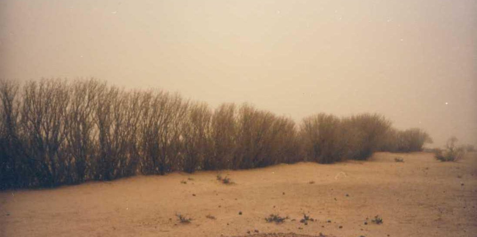
Dune stabilisation using hedges and palisades: Euphorbia balsamifera hedge. (PASP, GIZ)

Sand dune stabilisation (Niger)

Fixation des dunes (French)

Description

Sand dunes are stabilized with vegetation to reduce wind erosion and the amount of sand blown onto cropland, dwellings and other infrastructure.

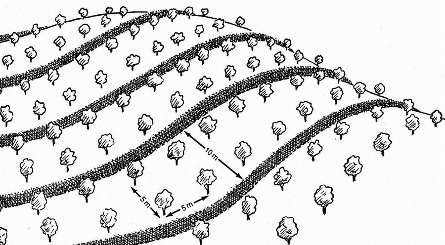
This measure is used to stabilise sand dunes in locations and villages where there is a risk of sand covering cropland or infrastructure (buildings, roads, irrigation systems, etc.). Dune stabilisation is achieved by setting up windbreaks arranged in a checkerboard pattern, with each side measuring between 10 and 15 m. The windbreaks are formed by palisades made from millet stalks or other plant material or by hedges and trees (Leptadenia pyrotechnica, Euphorbia balsamifera, Acacia raddiana, Acacia senegal, Balanites aegyptiaca, Prosopis juliflora, etc.).

Purpose of the Technology: They provide protection from wind erosion and reduce the amount of sand blown onto cropland, dwellings and other infrastructure which can prevent extensive damage. Grass and shrubs are planted in strips in the fenced-off areas to further stabilise the soil. The palisades and vegetation provide shade that lowers soil temperatures and the organic matter and waste improves the soil structure.

Establishment / maintenance activities and inputs: Specific experience is required to assess the degraded area as a whole and choose the most appropriate techniques, the right species to plant and the most suitable locations. Sometimes, the protected area is rehabilitated, particularly when land use pressure is high in neighbouring areas.
The protected dunes must be closely monitored and rigorously maintained for at least three years. It is therefore necessary to ensure good community organisation and take the action required to enforce the rules established and impose fines. Partial use of the area for grazing is sometimes allowed (one day a fortnight). Some projects prefer to fence off the sites with wire fencing to ensure that they are completely protected.
The success of this measure depends to a large extent on climatic conditions. A rainy year after the windbreaks have been erected creates favourable conditions for the species planted to become established.

Natural / human environment: With increasingly stronger winds and the accelerated degradation of the natural vegetation growing on sand dunes, it is very likely that the problems caused by shifting dunes will worsen in the future. Techniques to stabilise shifting sand dunes will therefore become more important.

Location

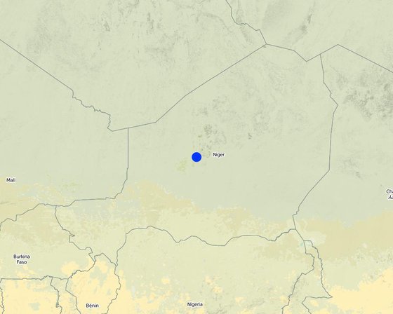
Location: Niger, Niger

No. of Technology sites analysed:

Geo-reference of selected sites
  • 8.08864, 17.61131

Spread of the Technology: evenly spread over an area (1.8 km²)

In a permanently protected area?:

Date of implementation: 10-50 years ago

Type of introduction
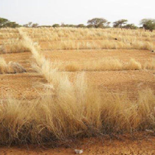
Dune stabilisation using palisades. (CARITAS, GIZ)

Classification of the Technology

Main purpose
  • improve production
  • reduce, prevent, restore land degradation
  • conserve ecosystem
  • protect a watershed/ downstream areas – in combination with other Technologies
  • preserve/ improve biodiversity
  • reduce risk of disasters
  • adapt to climate change/ extremes and its impacts
  • mitigate climate change and its impacts
  • create beneficial economic impact
  • create beneficial social impact
Land use

  • Cropland
    • Annual cropping
    Number of growing seasons per year: 1
  • Grazing land

Water supply
  • rainfed
  • mixed rainfed-irrigated
  • full irrigation

Purpose related to land degradation
  • prevent land degradation
  • reduce land degradation
  • restore/ rehabilitate severely degraded land
  • adapt to land degradation
  • not applicable
Degradation addressed
  • soil erosion by wind - Et: loss of topsoil, Ed: deflation and deposition, Eo: offsite degradation effects
  • chemical soil deterioration - Cn: fertility decline and reduced organic matter content (not caused by erosion)
SLM group
  • windbreak/ shelterbelt
SLM measures
  • vegetative measures - V1: Tree and shrub cover, V2: Grasses and perennial herbaceous plants

Technical drawing

Technical specifications
Dune stabilisation is achieved by setting up windbreaks arranged in a checkerboard pattern, with each side measuring between 10 and 15 m. The windbreaks are formed by palisades made from millet stalks or other plant material or by hedges and trees.

Location: Niger
Technical knowledge required for field staff / advisors: moderate
Technical knowledge required for land users: low

Main technical functions: improvement of ground cover, increase of surface roughness, stabilisation of soil (eg by tree roots against land slides), sediment retention / trapping, sediment harvesting, reduction in wind speed, increase of biomass (quantity), promotion of vegetation species and varieties (quality, eg palatable fodder)

Aligned: -against wind
Vegetative material: T : trees / shrubs, G : grass
Number of plants per (ha): 400
Spacing between rows / strips / blocks (m): 10
Vertical interval within rows / strips / blocks (m): 5

Trees/ shrubs species: Prosopis chilensis, Ziziphus mauritiana, Acacia senegal, Bauhina rufescens, Euphorbia balsamifera.

Establishment and maintenance: activities, inputs and costs

Calculation of inputs and costs
  • Costs are calculated:
  • Currency used for cost calculation: CFA Franc
  • Exchange rate (to USD): 1 USD = 521.18 CFA Franc
  • Average wage cost of hired labour per day: n.a
Most important factors affecting the costs
Labour: 50 man-days per ha • 60 palisade stakes per ha • 400 tree and shrub seedlings per ha • transportation (by lorry) of palisades and seedlings • protection: costly if the site is protected with wire fencing, which might be stolen.
Establishment activities
  1. Establish palisade of millet stalk (Timing/ frequency: None)
  2. Seeding grasses (Timing/ frequency: None)
  3. Planting (Timing/ frequency: None)
  4. Spreading manure (Timing/ frequency: None)
Establishment inputs and costs
Specify input Unit Quantity Costs per Unit (CFA Franc) Total costs per input (CFA Franc) % of costs borne by land users
Labour
Labour ha 1.0 96.45 96.45
Plant material
Seedlings ha 1.0 212.2 212.2
Other
Transport ha 1.0 115.75 115.75
Total costs for establishment of the Technology 424.4
Total costs for establishment of the Technology in USD 0.81
Maintenance activities
n.a.

Natural environment

Average annual rainfall
  • < 250 mm
  • 251-500 mm
  • 501-750 mm
  • 751-1,000 mm
  • 1,001-1,500 mm
  • 1,501-2,000 mm
  • 2,001-3,000 mm
  • 3,001-4,000 mm
  • > 4,000 mm
Agro-climatic zone
  • humid
  • sub-humid
  • semi-arid
  • arid
Specifications on climate
Thermal climate class: subtropics
Slope
  • flat (0-2%)
  • gentle (3-5%)
  • moderate (6-10%)
  • rolling (11-15%)
  • hilly (16-30%)
  • steep (31-60%)
  • very steep (>60%)
Landforms
  • plateau/plains
  • ridges
  • mountain slopes
  • hill slopes
  • footslopes
  • valley floors
Altitude
  • 0-100 m a.s.l.
  • 101-500 m a.s.l.
  • 501-1,000 m a.s.l.
  • 1,001-1,500 m a.s.l.
  • 1,501-2,000 m a.s.l.
  • 2,001-2,500 m a.s.l.
  • 2,501-3,000 m a.s.l.
  • 3,001-4,000 m a.s.l.
  • > 4,000 m a.s.l.
Technology is applied in
  • convex situations
  • concave situations
  • not relevant
Soil depth
  • very shallow (0-20 cm)
  • shallow (21-50 cm)
  • moderately deep (51-80 cm)
  • deep (81-120 cm)
  • very deep (> 120 cm)
Soil texture (topsoil)
  • coarse/ light (sandy)
  • medium (loamy, silty)
  • fine/ heavy (clay)
Soil texture (> 20 cm below surface)
  • coarse/ light (sandy)
  • medium (loamy, silty)
  • fine/ heavy (clay)
Topsoil organic matter content
  • high (>3%)
  • medium (1-3%)
  • low (<1%)
Groundwater table
  • on surface
  • < 5 m
  • 5-50 m
  • > 50 m
Availability of surface water
  • excess
  • good
  • medium
  • poor/ none
Water quality (untreated)
  • good drinking water
  • poor drinking water (treatment required)
  • for agricultural use only (irrigation)
  • unusable
Water quality refers to:
Is salinity a problem?
  • Yes
  • No

Occurrence of flooding
  • Yes
  • No
Species diversity
  • high
  • medium
  • low
Habitat diversity
  • high
  • medium
  • low

Characteristics of land users applying the Technology

Market orientation
  • subsistence (self-supply)
  • mixed (subsistence/ commercial)
  • commercial/ market
Off-farm income
  • less than 10% of all income
  • 10-50% of all income
  • > 50% of all income
Relative level of wealth
  • very poor
  • poor
  • average
  • rich
  • very rich
Level of mechanization
  • manual work
  • animal traction
  • mechanized/ motorized
Sedentary or nomadic
  • Sedentary
  • Semi-nomadic
  • Nomadic
Individuals or groups
  • individual/ household
  • groups/ community
  • cooperative
  • employee (company, government)
Gender
  • women
  • men
Age
  • children
  • youth
  • middle-aged
  • elderly
Area used per household
  • < 0.5 ha
  • 0.5-1 ha
  • 1-2 ha
  • 2-5 ha
  • 5-15 ha
  • 15-50 ha
  • 50-100 ha
  • 100-500 ha
  • 500-1,000 ha
  • 1,000-10,000 ha
  • > 10,000 ha
Scale
  • small-scale
  • medium-scale
  • large-scale
Land ownership
  • state
  • company
  • communal/ village
  • group
  • individual, not titled
  • individual, titled
Land use rights
  • open access (unorganized)
  • communal (organized)
  • leased
  • individual
Water use rights
  • open access (unorganized)
  • communal (organized)
  • leased
  • individual
Access to services and infrastructure
health

poor
good
education

poor
good
technical assistance

poor
good
employment (e.g. off-farm)

poor
good
markets

poor
good
energy

poor
good
roads and transport

poor
good
drinking water and sanitation

poor
good
financial services

poor
good

Impacts

Socio-economic impacts
fodder production
decreased
increased

animal production
decreased
increased


Restrictions for grazing in the first three years

production area (new land under cultivation/ use)
decreased
increased

Socio-cultural impacts
food security/ self-sufficiency
reduced
improved

SLM/ land degradation knowledge
reduced
improved

Improved livelihoods and human well-being
decreased
increased


Sometimes, the protected area is rehabilitated, particularly when land use pressure is high in neighbouring areas. They provide protection from wind erosion and reduce the amount of sand blown onto cropland, dwellings and other infrastructure which can prevent extensive damage.

Ecological impacts
soil cover
reduced
improved

soil loss
increased
decreased

plant diversity
decreased
increased

habitat diversity
decreased
increased

wind velocity
increased
decreased

Off-site impacts
wind transported sediments
increased
reduced

damage on neighbours' fields
increased
reduced

damage on public/ private infrastructure
increased
reduced

Cost-benefit analysis

Benefits compared with establishment costs
Short-term returns
very negative
very positive

Long-term returns
very negative
very positive

Benefits compared with maintenance costs
Short-term returns
very negative
very positive

Long-term returns
very negative
very positive

Climate change

Gradual climate change
annual temperature increase

not well at all
very well
Climate-related extremes (disasters)
local rainstorm

not well at all
very well
local windstorm

not well at all
very well
drought

not well at all
very well
general (river) flood

not well at all
very well
Other climate-related consequences
reduced growing period

not well at all
very well

Adoption and adaptation

Percentage of land users in the area who have adopted the Technology
  • single cases/ experimental
  • 1-10%
  • 11-50%
  • > 50%
Of all those who have adopted the Technology, how many have done so without receiving material incentives?
  • 0-10%
  • 11-50%
  • 51-90%
  • 91-100%
Has the Technology been modified recently to adapt to changing conditions?
  • Yes
  • No
To which changing conditions?
  • climatic change/ extremes
  • changing markets
  • labour availability (e.g. due to migration)

Conclusions and lessons learnt

Strengths: land user's view
Strengths: compiler’s or other key resource person’s view
  • Protection of infrastructure, cropland and rangeland
  • The palisades and vegetation used to stabilise sand dunes contribute to reducing wind erosion, and the shade that they provide lowers soil temperatures. The protection they provide for farmland and infrastructure can prevent extensive damage.
  • Once the surface of the dune has been stabilised with vegetation, the effect is lasting, provided that the area is not overgrazed.
Weaknesses/ disadvantages/ risks: land user's viewhow to overcome
Weaknesses/ disadvantages/ risks: compiler’s or other key resource person’s viewhow to overcome
  • Grazing restrictions may reduce animal production. Some projects fence off the sites with wire fencing to ensure that they are completely protected.

References

Compiler
  • Dieter Nill
Editors
Reviewer
  • Fabian Ottiger
  • Alexandra Gavilano
Date of documentation: Sept. 25, 2014
Last update: June 11, 2019
Resource persons
Full description in the WOCAT database
Linked SLM data
Documentation was faciliated by
Institution Project
Key references
  • Good Practices in Soil and Water Conservation. A contribution to adaptation and farmers´ resilience towards climate change in the Sahel. Published by GIZ in 2012.: http://agriwaterpedia.info/wiki/Main_Page
This work is licensed under Creative Commons Attribution-NonCommercial-ShareaAlike 4.0 International