Mangrove and beach forest program of the Department of Environment and Natural Resources. (Djolly Ma. P. Dinamling)

Mangroves as Buffer against Natural Hazards (Philippines)

"Bakauan"

Description

Mangroves "bakauan" are planted in the island coast to form barriers and as first line of defense during storm surges.

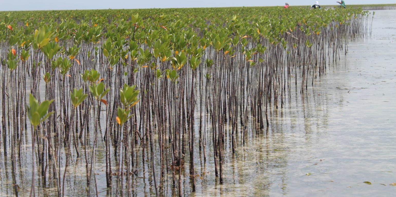
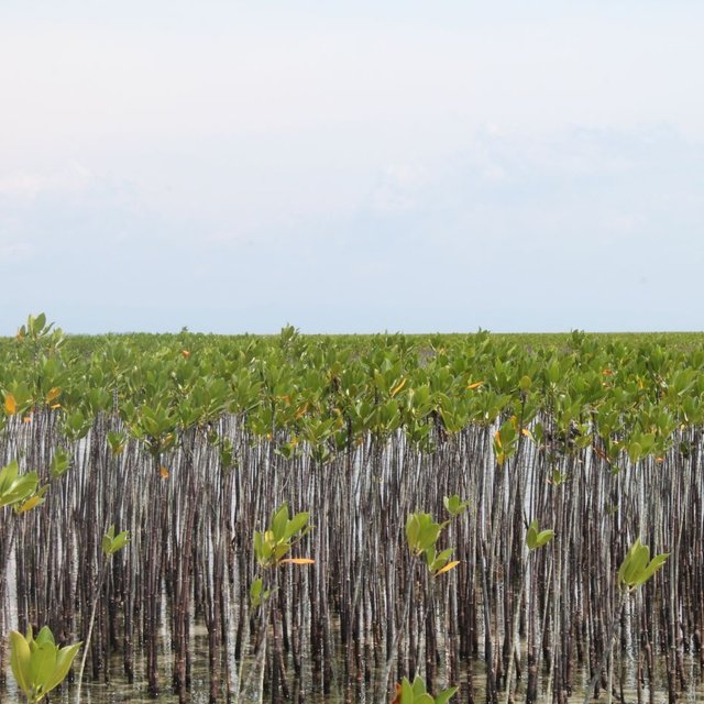
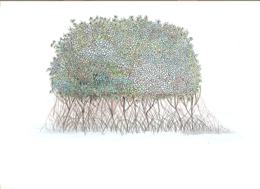
Mangrove plantation in the island of Banacon which is 10.91 kilometers away from the municipality of Getafe, Bohol in Central Visayas started in 1957.The most common specie grown is the “Bakauan” under the Rhizophoracea family.

Mangroves contribute in protecting the coast against natural hazards such as storms, tsunamis and coastal erosion. It weakens the impact of typhoons that bring strong winds, continuous high waves and storm surges. A dense cluster of bakauans obstruct the entry of winds and waves when passing through the mangroves minimizes the force of wind sand waves. According to the residents of the island, they were spared from total destruction of properties during onset of typhoons because of the presence of the bakauans. Mangroves were utilized also by the Banacon residents as source of poles for houses, fishpens and charcoals for cooking. The dense roots of the trees bind the soils thus preventing erosion. The tree roots serve as spawning ground for fishes and other variety of sea species that lead to an increase in harvest of sea foods in the area. The mangrove plantation was also developed into ecotourism site.

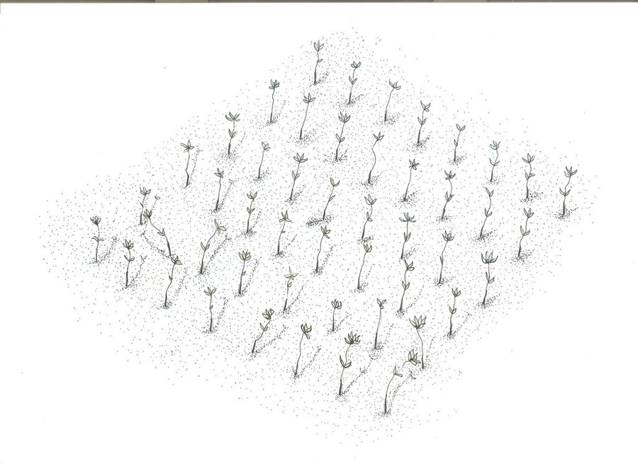
Site evaluation is the pre-requisite in the establishment of mangrove area. An ideal area is with sand dune during low tide. It is followed by site lay out using the planting design that is adopted, and direct planting of propagules in the soil. Planting materials used are the cigar-shaped mature propagules harvested from the Bacauan- Lalake specie of mangroves. The direct seeding planting is the ideal method of planting in establishing a mangroves plantation. Mangrove propagules must be planted after collection. It should not be exposed to direct sunlight to prevent moisture loss.

There are (3) planting designs used in the establishment of the mangroves. First, the high density planting of propagules with no lay out to be followed. This planting design can accommodate 30,000 pcs of propagules per hectare. Second, design has a spacing of 1 meter by 1 meter planted in rows and can hold 10,000 pieces of propagules per hectare. Third is the block/cluster design in which each cluster was planted with 750 pieces of propagules with a distance of 30 centimeters apart per propagules. The spacing between the blocks or cluster is 10 meters and can contain 5,000 pieces of propagules per hectare. Maintenance includes monitoring of the crop status, replanting of missing hills and weeding by removing sea weeds, barnacles and sea debris.

Location

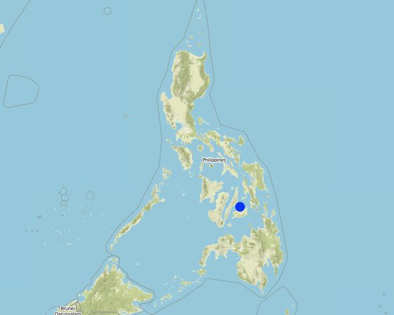
Location: Banacon Island, Getafe, Bohol, Philippines

No. of Technology sites analysed: single site

Geo-reference of selected sites
  • 124.15446, 10.20104

Spread of the Technology: evenly spread over an area (approx. 1-10 km2)

In a permanently protected area?:

Date of implementation: more than 50 years ago (traditional)

Type of introduction
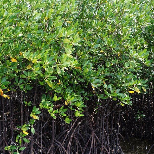
Mature mangroves (Engr. Djolly Ma. P. Dinamling)
Mangroves planted in Banacon island (Ace Wilfred Abarro II)

Classification of the Technology

Main purpose
  • improve production
  • reduce, prevent, restore land degradation
  • conserve ecosystem
  • protect a watershed/ downstream areas – in combination with other Technologies
  • preserve/ improve biodiversity
  • reduce risk of disasters
  • adapt to climate change/ extremes and its impacts
  • mitigate climate change and its impacts
  • create beneficial economic impact
  • create beneficial social impact
Land use

  • Forest/ woodlandsProducts and services: Nature conservation/ protection, Recreation/ tourism, Protection against natural hazards
Water supply
  • rainfed
  • mixed rainfed-irrigated
  • full irrigation

Purpose related to land degradation
  • prevent land degradation
  • reduce land degradation
  • restore/ rehabilitate severely degraded land
  • adapt to land degradation
  • not applicable
Degradation addressed
  • biological degradation - Bc: reduction of vegetation cover, Bh: loss of habitats
SLM group
  • forest plantation management
  • ecosystem-based disaster risk reduction
SLM measures
  • vegetative measures - V1: Tree and shrub cover

Technical drawing

Technical specifications
There are (3) planting designs used in the establishment of the mangroves. First, the high density planting of propagules with no lay out to be followed. This planting design can accommodate 30,000 pcs of propagules per hectare. Second, design has a spacing of 1 meter by 1 meter planted in rows and can hold 10,000 pieces of propagules per hectare. Third is the block/cluster design in which each cluster was planted with 750 pieces of propagules with a distance of 30 centimeters apart per propagules. The spacing between the blocks or cluster is 10 meters and can contain 5,000 pieces of propagules per hectare. Maintenance includes monitoring of the crop status, replanting of missing hills and weeding by removing sea weeds, barnacles and sea debris.
Author: Patricio A. Yambot
None
Author: Patricio A. Yambot

Establishment and maintenance: activities, inputs and costs

Calculation of inputs and costs
  • Costs are calculated: per Technology area (size and area unit: 1 hectare)
  • Currency used for cost calculation: Philippine peso
  • Exchange rate (to USD): 1 USD = 50.0 Philippine peso
  • Average wage cost of hired labour per day: 250
Most important factors affecting the costs
n.a.
Establishment activities
  1. Harvesting of matured propagules (Timing/ frequency: During the month of June)
  2. Direct seeding of propagules (Timing/ frequency: During low tide)
Establishment inputs and costs (per 1 hectare)
Specify input Unit Quantity Costs per Unit (Philippine peso) Total costs per input (Philippine peso) % of costs borne by land users
Labour
Person day/ hectare 10.0 250.0 2500.0
Plant material
mangrove propagules pieces 5000.0 1.0 5000.0
Total costs for establishment of the Technology 7'500.0
Total costs for establishment of the Technology in USD 150.0
Maintenance activities
  1. Replanting of propagules (Timing/ frequency: monthly)
  2. Weeding and cleaning of site (Timing/ frequency: monthly)
Maintenance inputs and costs (per 1 hectare)
Specify input Unit Quantity Costs per Unit (Philippine peso) Total costs per input (Philippine peso) % of costs borne by land users
Labour
labour person day 3.0 250.0 750.0
Plant material
propragules pieces 250.0 1.0 250.0
Total costs for maintenance of the Technology 1'000.0
Total costs for maintenance of the Technology in USD 20.0

Natural environment

Average annual rainfall
  • < 250 mm
  • 251-500 mm
  • 501-750 mm
  • 751-1,000 mm
  • 1,001-1,500 mm
  • 1,501-2,000 mm
  • 2,001-3,000 mm
  • 3,001-4,000 mm
  • > 4,000 mm
Agro-climatic zone
  • humid
  • sub-humid
  • semi-arid
  • arid
Specifications on climate
n.a.
Slope
  • flat (0-2%)
  • gentle (3-5%)
  • moderate (6-10%)
  • rolling (11-15%)
  • hilly (16-30%)
  • steep (31-60%)
  • very steep (>60%)
Landforms
  • plateau/plains
  • ridges
  • mountain slopes
  • hill slopes
  • footslopes
  • valley floors
Altitude
  • 0-100 m a.s.l.
  • 101-500 m a.s.l.
  • 501-1,000 m a.s.l.
  • 1,001-1,500 m a.s.l.
  • 1,501-2,000 m a.s.l.
  • 2,001-2,500 m a.s.l.
  • 2,501-3,000 m a.s.l.
  • 3,001-4,000 m a.s.l.
  • > 4,000 m a.s.l.
Technology is applied in
  • convex situations
  • concave situations
  • not relevant
Soil depth
  • very shallow (0-20 cm)
  • shallow (21-50 cm)
  • moderately deep (51-80 cm)
  • deep (81-120 cm)
  • very deep (> 120 cm)
Soil texture (topsoil)
  • coarse/ light (sandy)
  • medium (loamy, silty)
  • fine/ heavy (clay)
Soil texture (> 20 cm below surface)
  • coarse/ light (sandy)
  • medium (loamy, silty)
  • fine/ heavy (clay)
Topsoil organic matter content
  • high (>3%)
  • medium (1-3%)
  • low (<1%)
Groundwater table
  • on surface
  • < 5 m
  • 5-50 m
  • > 50 m
Availability of surface water
  • excess
  • good
  • medium
  • poor/ none
Water quality (untreated)
  • good drinking water
  • poor drinking water (treatment required)
  • for agricultural use only (irrigation)
  • unusable
Water quality refers to:
Is salinity a problem?
  • Yes
  • No

Occurrence of flooding
  • Yes
  • No
Species diversity
  • high
  • medium
  • low
Habitat diversity
  • high
  • medium
  • low

Characteristics of land users applying the Technology

Market orientation
  • subsistence (self-supply)
  • mixed (subsistence/ commercial)
  • commercial/ market
Off-farm income
  • less than 10% of all income
  • 10-50% of all income
  • > 50% of all income
Relative level of wealth
  • very poor
  • poor
  • average
  • rich
  • very rich
Level of mechanization
  • manual work
  • animal traction
  • mechanized/ motorized
Sedentary or nomadic
  • Sedentary
  • Semi-nomadic
  • Nomadic
Individuals or groups
  • individual/ household
  • groups/ community
  • cooperative
  • employee (company, government)
Gender
  • women
  • men
Age
  • children
  • youth
  • middle-aged
  • elderly
Area used per household
  • < 0.5 ha
  • 0.5-1 ha
  • 1-2 ha
  • 2-5 ha
  • 5-15 ha
  • 15-50 ha
  • 50-100 ha
  • 100-500 ha
  • 500-1,000 ha
  • 1,000-10,000 ha
  • > 10,000 ha
Scale
  • small-scale
  • medium-scale
  • large-scale
Land ownership
  • state
  • company
  • communal/ village
  • group
  • individual, not titled
  • individual, titled
Land use rights
  • open access (unorganized)
  • communal (organized)
  • leased
  • individual
Water use rights
  • open access (unorganized)
  • communal (organized)
  • leased
  • individual
Access to services and infrastructure
health

poor
x
good
education

poor
x
good
technical assistance

poor
x
good
employment (e.g. off-farm)

poor
x
good
markets

poor
x
good
energy

poor
x
good
roads and transport

poor
x
good
drinking water and sanitation

poor
x
good
financial services

poor
x
good

Impacts

Socio-economic impacts
forest/ woodland quality
decreased
x
increased

Socio-cultural impacts
recreational opportunities
reduced
x
improved


Establishment of beach forest

community institutions
weakened
x
strengthened


Formation of Peoples Organization.

Ecological impacts
flood impacts
increased
x
decreased

impacts of cyclones, rain storms
increased
x
decreased

Off-site impacts
damage on neighbours' fields
increased
x
reduced

damage on public/ private infrastructure
increased
x
reduced

Cost-benefit analysis

Benefits compared with establishment costs
Benefits compared with maintenance costs

Climate change

Climate-related extremes (disasters)
storm surge/ coastal flood

not well at all
x
very well

Adoption and adaptation

Percentage of land users in the area who have adopted the Technology
  • single cases/ experimental
  • 1-10%
  • 11-50%
  • > 50%
Of all those who have adopted the Technology, how many have done so without receiving material incentives?
  • 0-10%
  • 11-50%
  • 51-90%
  • 91-100%
Number of households and/ or area covered
Most of the people in the community are involved in the mangrove forest program because of the support of the Department of Environment and Natural Resources.
Has the Technology been modified recently to adapt to changing conditions?
  • Yes
  • No
To which changing conditions?
  • climatic change/ extremes
  • changing markets
  • labour availability (e.g. due to migration)
Planting design was modified through clustering for a technology resilient to climate change

Conclusions and lessons learnt

Strengths: land user's view
  • Innovative planting design using clustering as climate change mitigation measure. Mangroves are planted in cluster to achieve strength. The community and the Peoples' Organization (POs) determine the size of cluster to allow space as passage for boats. Spacing design used is flexible to adjust to local conditions that include depressed grounds, and patches of vegetation.
  • It provides livelihood for the community since it supports fisheries production and aquaculture.
Strengths: compiler’s or other key resource person’s view
  • It provides protection in the coastal communities from storm surges, waves, tides, and currents. Mangrove has buffering capacity to hold back sea waves and reduce wave forces because of its extensive and dense above ground roots.
  • Mangrove plantation has potentials for ecotourism development.
Weaknesses/ disadvantages/ risks: land user's viewhow to overcome
  • Mangrove pests and diseases have caused failure of mangrove forest development.Planted propagules that are submerged most of the time have a low mortality rate. Proper site selection of plantation site
Weaknesses/ disadvantages/ risks: compiler’s or other key resource person’s viewhow to overcome
  • Mangrove sites are threatened by urbanization, conversion to agriculture, cutting/overharvesting of mangrove trees for industrial uses such as timber and charcoal Strict implementation of rules, policies related to the protection and conservation of coastal areas and mangrove forest sites.

References

Compiler
  • Philippine Overview of Conservation Approaches and Technologies
Editors
Reviewer
  • Ursula Gaemperli
  • Alexandra Gavilano
Date of documentation: Sept. 21, 2016
Last update: June 14, 2019
Resource persons
Full description in the WOCAT database
Linked SLM data
Documentation was faciliated by
Institution Project
This work is licensed under Creative Commons Attribution-NonCommercial-ShareaAlike 4.0 International